- San Diego, California
Infobox Settlement

imagesize =
image_caption = San Diego Skyline | March 31, 2007
official_name = City of San Diego
settlement_type =City
nickname = America's Finest City, City in MotionFact|date=September 2008, Silicon BeachFact|date=September 2008
motto = "Semper Vigilans" (Latin : Ever Vigilant)
image_
mapsize = 250x200px
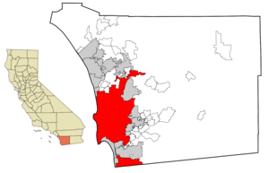
map_caption = Location of San Diego
within San Diego County
mapsize1 =
map_caption1 =
subdivision_type = Country
subdivision_name =United States
subdivision_type1 = State
subdivision_name1 =California
subdivision_type2 = County
subdivision_name2 = San Diego
established_title = Founded
established_date =July 16 1769
established_title2 = Incorporated
established_date2 =March 27 1850
government_type = Mayor-council
leader_title = Mayor
leader_title1 = City Attorney
leader_title2 =City Council
leader_name = Jerry Sanders (R)
leader_name1 = Michael Aguirre
leader_name2 = Scott PetersKevin Faulconer Toni Atkins
Tony YoungBrian Maienschein Donna Frye Jim Madaffer Ben Hueso
area_magnitude = 1 E8
area_total_sq_mi = 372.1
area_total_km2 = 963.6
area_land_sq_mi = 324.3
area_land_km2 = 840.0
area_water_sq_mi = 47.7
area_water_km2 = 123.5
population_as_of = 2007
population_metro = 2941454 Including Tijuana: 4922723
population_total = 1,266,731
population_blank1_title = Ranked
population_blank1 = 8th
population_density_km2 = 1494.7
population_density_sq_mi = 3871.5
population_footnotes =cite web|url=http://www.census.gov/Press-Release/www/2007/cb07-91table1.pdf|title=Population Estimates for the 25 Largest U.S. Cities based on July 1, 2006 Population Estimates|publisher=US Census Bureau|accessdate=2007-06-28|format=PDF]
timezone = PST
utc_offset = -8
timezone_DST = PDT
utc_offset_DST = -7
postal_code_type =ZIP code
postal_code = 92101-92117, 92119-92124, 92126-92140, 92142, 92145, 92147, 92149-92155, 92158-92172, 92174-92177, 92179, 92182, 92184, 92186, 92187, 92190-92199
area_code = 619, 858
demononym = San Dieganlatd = 32 |latm = 42 |lats = 54 |latNS = N
longd = 117 |longm = 09 |longs = 45 |longEW = W
elevation_ft = 72
elevation_m = 22
website = http://www.sandiego.gov/
blank_name = FIPS code
blank_info = 06-66000
blank1_name = GNIS feature ID
blank1_info = 1661377
footnotes =
Other City SymbolsCity Flower:
CarnationCity Urban Tree: Jacaranda City Native Tree: Torrey Pine San Diego (pronounced /ˌsændiˈeɪgoʊ/) is a coastal
Southern California city located in the southwestern corner of thecontinental United States . In2007 , the city's population was estimated to be 1,266,731. It is the second largest city inCalifornia and the eighth largest city in the United States, by population. It is thecounty seat of San Diego County.GR|6 and is the economic center of the nowrap|San Diego–Carlsbad–San Marcos metropolitan area, the 17th-largest in the United States with a population of 3,146,274 as of 2008, and the 21st-largest metropolitan area in theAmericas when includingTijuana (See San Diego-Tijuana Metro.).San Diego County lies just north of the Mexican border—sharing a border with
Tijuana —and lies south of Orange County. It is home to miles of beaches, a mildMediterranean climate and 16 military facilities hosting theUnited States Navy , theUnited States Coast Guard and theUnited States Marine Corps .The presence of the
University of California, San Diego (UCSD) with the affiliatedUCSD Medical Center promotes research in biotechnology.Fact|date=August 2008 San Diego's economy is largely composed of agriculture, biotechnology/biosciences, computer sciences, electronics manufacturing, defense-related manufacturing, financial and business services, ship-repair and construction, software development, telecommunications, and tourism.History
The area has long been inhabited by the
Kumeyaay people. The first European to visit the region was Portuguese-born explorer Juan Rodrigues Cabrillo sailing under the Spanish Flag, (1499 - 1543), who sailed his flagship "San Salvador" from Navidad, New Spain. Cabrillo claimed the bay for theSpanish Empire and named the site "San Miguel". In November of 1602,Sebastián Vizcaíno was sent to map the California coast. Arriving on his flagship "San Diego", Vizcaíno surveyed the harbor and what are nowMission Bay andPoint Loma and named the area for theCatholic Saint Didacus, a Spaniard more commonly known as "San Diego". OnNovember 12 1602 , the first Christian religious service of record inAlta California was conducted by Fray Antonio de la Ascensión, a member of Vizcaíno's expedition, to celebrate the feast day of San Diego.In 1769,
Gaspar de Portolà established thePresidio of San Diego (a military post) overlooking Old Town. Around the same time,Mission San Diego de Alcalá was founded byFranciscan friars under FatherJunípero Serra . By 1797, the mission boasted the largest native population in Alta California, with over 1,400 "neophytes" living in and around the mission proper. After New Spain won its independence from the Spanish Empire in 1823, Mission San Diego de Alcalá's fortunes declined in the 1830s after the decree ofsecularization was enacted, as was the case with all of the missions under the control ofMexico . In 1847 San Diego was a destination of the convert|2000|mi|km|-2|sing=on march of theMormon Battalion which built the city's first courthouse with brick.After the
Battle of San Pasqual , the end of theMexican-American War , and the gold rush of 1848, San Diego was designated the seat of the newly-established San Diego County and was incorporated as a city in 1850. In the years beforeWorld War I , theIndustrial Workers of the World labor union conducted a free speech fight in San Diego, arousing a brutal response (seeSan Diego Free Speech Fight .)Significant U.S. Naval presence began in 1907 with the establishment of the Navy Coaling Station, which gave further impetus to the development of the town. San Diego hosted two World's Fairs, the Panama-California Exposition in 1915, and the California Pacific International Exposition in 1935. Many of the Spanish/Baroque-style buildings in the city's Balboa Park were built for these expositions, particularly the one in 1915. Intended to be temporary structures, most remained in continuous use until they progressively fell into disrepair. All were eventually rebuilt using castings of the original facades to faithfully retain the architectural style.
After
World War II , the military played an increasing role in the local economy, but post-Cold War cutbacks took a heavy toll on the local defense and aerospace industries. The resulting downturn led San Diego leaders to seek to diversify the city's economy, and San Diego has since become a major center of the emergingbiotechnology industry. It is also home to telecommunications giantQualcomm .Downtown San Diego has been undergoing an urban renewal since the early 1980s, beginning with the opening ofHorton Plaza , the revival of the Gaslamp Quarter, and the construction of theSan Diego Convention Center . The Centre City Development Corporation (CCDC), San Diego's downtown redevelopment agency, has transformed what was a largely abandoned downtown into a glittering showcase of waterfrontskyscrapers , expensive live-work loft developments, five-starhotel s, and manycafe s,restaurant s, andboutique s.The North Embarcadero is slated to have parks in addition to a waterfront promenade. And Balboa Park will be linked to downtown with a view corridor. The recent boom in the construction of condos and skyscrapers has brought with it a
gentrification frenzy, and some people are concerned that speculators have played too big a role in the condo market downtown. In the meantime, the city is committed to a "smart growth " development scheme that would increase density along transit corridors in older neighborhoods (the "City of Villages" planning concept.) Some neighborhoods are resisting this planning approach, but "mixed-use development " has had its successes, especially the award-winning Uptown Shopping Center in Hillcrest.The latest accomplishment of CCDC has been the recent inauguration of
PETCO Park . The once-industrial East Village adjacent to the new ballpark is now the new frontier in San Diego's downtown urban renewal.A series of scandals has rocked the city in recent years. With mounting pressure aggravated by underfunding of pensions for city employees that began prior to his administration, Mayor Dick Murphy, in April 2005, announced his intention to resign by mid-July. Two city council members,
Ralph Inzunza and deputy mayorMichael Zucchet — who was to take Murphy's place — were ultimately convicted ofextortion ,wire fraud , and conspiracy to commit wire fraud for taking campaign contributions from a strip club owner and his associates, allegedly in exchange for trying to repeal the city's "no touch" laws at strip clubs. Both subsequently resigned. The judge later set aside (overturned) the conviction in Zucchet's case.On
November 28 2005 , U.S. CongressmanRandy "Duke" Cunningham resigned over abribery scandal. Cunningham represented California's 50th congressional district, which mostly lies outside (north) of the city of San Diego proper. He is currently serving a one-hundred-month prison sentence.Geography
The city of San Diego itself has deep canyons separating its mesas, creating small pockets of natural parkland scattered throughout the city. The same canyons give parts of the city a highly segmented feel, creating literal gaps between otherwise proximal neighborhoods and contributing to a low-density, car-centered built environment.
Downtown San Diego is located onSan Diego Bay . Balboa Park lies on a mesa to the northeast. It is surrounded by several dense urban communities and abruptly ends in Hillcrest to the north. The Coronado andPoint Loma peninsulas separate San Diego Bay from the ocean.Ocean Beach is on the west side of Point Loma. Mission Beach and Pacific Beach lie between the ocean and Mission Bay, a man-made aquatic park.La Jolla , an affluent community, lies north of Pacific Beach.Mount Soledad in La Jolla offers views from northern San Diego County to Mexico. Mountains rise to the east of the city, and beyond the mountains are desert areas.Cleveland National Forest is a half-hour drive from downtown San Diego. Numerous farms are found in the valleys northeast and southeast of the city. San Diego County has one of the highest counts of animal and plant species that appear on theendangered species list among counties in the United States. [ [http://www.signonsandiego.com/news/politics/20070328-9999-1n28esa.html SignOnSanDiego.com > News > Politics - White House seeks limits to species act ] ]Climate
San Diego has a
temperate Mediterranean climate (Koppen climate classification "CSb"). It enjoys mild, Dry-Summer subtropical, sunny weather throughout the year. Average monthly temperatures range from about 57 °Fahrenheit (14°C) in January to 72 °Fahrenheit (22°C) in July, although late summer and early autumn are typically the hottest times of the year. The average annual daily temperature is 62.6° Fahrenheit (17°C). Snow and ice are virtually nonexistent in the wintertime, typically occurring inland from the coast when present. "May gray and June gloom", a local saying, refers to the way in which San Diego sometimes has trouble shaking off the marine layer, a cloudy layer typically higher in the atmosphere than fog, that comes in during those months. Temperatures soar to very high readings on rare occasions, chiefly when easterly winds bring hot, dry air from the inland deserts (these winds are called "Santa Anas"). The record highest temperature at the airport is 111°F (44°C) on September 26, 1963, and the record lowest temperature is 29°F (-2°C) on January 4, 1949. [http://www.ggweather.com Golden Gate Weather Services ] ] The National Weather Service reports that San Diego's all-time lowest temperature was 25°F (-4°C) on January 7, 1913. [ [http://www.wrh.noaa.gov/sgx/document/weatherhistory.pdf Microsoft Word - weatherhistory.doc ] ] The National Climatic Center says that temperatures exceed 90°F (32°C) on an average of 3.5 days annually and 100°F on .2 day annually.The average annual precipitation is less than 12 inches (300 mm), resulting in a borderline arid climate. Rainfall is strongly concentrated in the cooler half of the year, particularly the months December through March, although precipitation is lower than any other part of the U.S. west coast. The summer months are virtually rainless. Rainfall is highly variable from year to year and from month to month, and San Diego is subject to both droughts and floods. Thunderstorms are very rare. National Weather Service research has found documentation of a hurricane which hit San Diego on October 2, 1858, the only hurricane in history to reach California. [ [http://www.publicaffairs.noaa.gov/releases2005/jan05/noaa05-r501.html 1858 Hurricane Struck San Diego, Say Research Meteorologists ] ] There is even greater documentation of a tropical storm which affected much of the southern California coast in September 1939. [ [http://www.weather.gov NOAA's National Weather Service ] ] The greatest 24-hour rainfall at the airport was 2.71 inches on February 6, 1937, and the greatest monthly rainfall was 9.09 inches in January 1993. [http://www.ggweather.com/com] Measurable snowfall has never occurred in downtown San Diego; snow flurries were reported at the airport in January 1949 and January 1979. Light amounts of snow have occurred in higher locations within the city limits, according to the
National Weather Service 's climatological summary.Climate in the San Diego area often varies dramatically over short geographical distances, due to the city's topography (the Bay, and the numerous hills, mountains, and canyons): frequently, particularly during the "May gray / June gloom" period, a thick "marine layer"
cloud cover will keep the air cool and damp within a few miles of the coast, but will yield to bright cloudless sunshine between about 5 and convert|15|mi|km|0 inland—the cities ofEl Cajon and Santee for example, rarely experience the cloud cover. This phenomenon is known asmicroclimate . Infobox Weather
single_line=yes
location=San Diego
Jan_Hi_°F =66 |Jan_REC_Hi_°F =
Feb_Hi_°F =66 |Feb_REC_Hi_°F =
Mar_Hi_°F =66 |Mar_REC_Hi_°F =
Apr_Hi_°F =69 |Apr_REC_Hi_°F =
May_Hi_°F =69 |May_REC_Hi_°F =
Jun_Hi_°F =72 |Jun_REC_Hi_°F =
Jul_Hi_°F =76 |Jul_REC_Hi_°F =
Aug_Hi_°F =78 |Aug_REC_Hi_°F =
Sep_Hi_°F =77 |Sep_REC_Hi_°F =
Oct_Hi_°F =74 |Oct_REC_Hi_°F =
Nov_Hi_°F =70 |Nov_REC_Hi_°F =
Dec_Hi_°F =66 |Dec_REC_Hi_°F =
Year_Hi_°F =71 |Year_REC_Hi_°F =
Jan_Lo_°F =50 |Jan_REC_Lo_°F =
Feb_Lo_°F =52 |Feb_REC_Lo_°F =
Mar_Lo_°F =54 |Mar_REC_Lo_°F =
Apr_Lo_°F =56 |Apr_REC_Lo_°F =
May_Lo_°F =60 |May_REC_Lo_°F =
Jun_Lo_°F =63 |Jun_REC_Lo_°F =
Jul_Lo_°F =66 |Jul_REC_Lo_°F =
Aug_Lo_°F =67 |Aug_REC_Lo_°F =
Sep_Lo_°F =66 |Sep_REC_Lo_°F =
Oct_Lo_°F =61 |Oct_REC_Lo_°F =
Nov_Lo_°F =54 |Nov_REC_Lo_°F =
Dec_Lo_°F =49 |Dec_REC_Lo_°F =
Year_Lo_°F =57 |Year_REC_Lo_°F =
Jan_Precip_inch =2.2
Feb_Precip_inch =1.6
Mar_Precip_inch =1.9
Apr_Precip_inch =0.8
May_Precip_inch =0.2
Jun_Precip_inch =0.1
Jul_Precip_inch =0
Aug_Precip_inch =0.1
Sep_Precip_inch =0.2
Oct_Precip_inch =0.4
Nov_Precip_inch =1.1
Dec_Precip_inch =1.4
Year_Precip_inch =9.9
publisher= |language=Fact|date=August 2008Ecology
Like most of southern California, the majority of San Diego's current area was originally occupied by
chaparral , a plant community made up mostly of drought-resistant shrubs. Theendangered Torrey Pine has the bulk of its population in San Diego in a stretch of protected chapparral along the coast. The steep and varied topography, and proximity to the ocean creates a number of different habitats within the city limits, includingtidal marsh andcanyons . The influence of humans has altered existing habitats and has also created habitats that did not exist prior to human development, by construction of buildings, the introduction of new species, and the use of water for lawns and gardens. A number of species ofparrots , including theRed-masked Parakeet andRed-crowned Amazon have establishedferal populations in urban neighborhoods such as Ocean Beach.San Diego's broad city limits encompass a number of large nature preserves, including
Torrey Pines State Reserve ,Border Field State Park ,Mission Trails Regional Park . Torrey Pines State Preserve and a coastal strip continuing to the north is the only location where the rare species of Torrey Pine, "P. torreyana torreyana", is found. [C.Michael Hogan (2008) "Torrey Pine: Pinus torreyana", Globaltwitcher, ed. Nicklas Stromberg [http://www.globaltwitcher.com/artspec.asp?thingid=62498] ] Due to a combination of the steep topography that prevents or discourages building, and some efforts for preservation, there are also a large number of canyons within the city limits that are nature preserves, including Tecolote Canyon Natural Park, [ [http://www.sandiego.gov/park-and-recreation/parks/teclte.shtml] ] and Marian Bear Memorial Park in the San Clemente Canyon, [ [http://www.sandiego.gov/park-and-recreation/parks/marbear2.shtml] ] as well as a number of small parks and preserves.Communities and neighborhoods
There are around one hundred named areas within the city of San Diego.
Public transportation
Less than three percent of San Diego residents use mass transit.Fact|date=September 2008 San Diego is served by the trolley, bus, Coaster, and
Amtrak . The trolley ( [http://www.sdcommute.com/Rider_Information/trolley/trolleymap.asp system map] ) primarily serves downtown and surrounding urban communities, Mission Valley, east county and coastal south bay. A planned Mid-Coast line will operate from Old Town to University City along the 5 Freeway. There are also plans for a Silver Line to expand trolley service downtown.The Amtrak and Coaster trains currently run along the coastline and connect San Diego with Los Angeles, Orange County, Riverside, San Bernardino, and Ventura via Metrolink. There are three Amtrak stations in San Diego, in Sorrento Valley, Old Town, and Union Station (downtown).
The bus is available along almost all major routes, however a large number of bus stops are concentrated in central San Diego. Typical wait times vary from 15 to 30 minutes, depending on the location and route. Trolleys arrive every 7 to 30 minutes (depending on time of day and which trolley line is used). Ferries are also available every half hour crossing San Diego Bay to Coronado.
Cycling
San Diego's roadway system provides an extensive network of routes for travel by bicycle. The dry and mild climate of San Diego makes cycling a convenient and pleasant year-round option. At the same time, the city's hilly, canyoned terrain and significantly long average trip distances—brought about by strict low-density zoning laws—somewhat restrict cycling for utilitarian purposes. Older and denser neighborhoods around the downtown tend to be friendlier to
utility cycling . This is partly because of the grid street patterns now absent in newer developments farther from the urban core, where suburban style arterial roads are much more common. As a result, a vast majority of cycling related activities are recreational.The city has some
segregated cycle facilities , particularly in newer developments although the majority of road facilities specifically for bicycles are painted on regular roadways.Many San Diego cyclists belong to the
San Diego County Bicycle Coalition which upholds the rights and interests of cyclists throughout the county.In 2006, Bicycling Magazine rated San Diego as the best city for cycling for U.S. cities with a population over 1 million. [ [http://www.bikechattanooga.org/BicyclingMagazineRecognizesChattanoogainTop21Cities.html Bicycling Magazine Recognizes Chattanooga in Top 21 Cities] . Bicycling Magazine (published on [http://www.bikechattanooga.org/ Bike Chattanooga] ).
2006-01-26 . Retrieved on2007-08-10 . ( [http://web.archive.org/web/20070406153520/http://bikechattanooga.org/BicyclingMagazineRecognizesChattanoogainTop21Cities.html archived link] )]Air
San Diego International Airport , also known as Lindbergh International Airport or Lindbergh Field, is the primary commercial airport serving San Diego. It is the busiest single-runway airport in the United States, [cite news| url=http://www.nctimes.com/articles/2006/04/25/news/top_stories/20_02_594_24_06.txt | title=FAA chief says region right to consider bases | work=North County Times | last=Downey | first=Dave | date=2006-04-24 | accessdate=2007-02-22] serving over 17 million passengers every year, and is located on San Diego Bay three miles from downtown. It offered scheduled flights to the rest of the United States, Mexico, Hawaii, and Canada. It serves as a focus city forSouthwest Airlines andExpressJet Airlines . Other airports includeBrown Field Municipal Airport (Brown Field) andMontgomery Field .Aeroméxico provides a shuttle service from San Diego [" [http://www.signonsandiego.com/uniontrib/20061123/news_1b23flight.html Creating a connection] ," "San Diego Union-Tribune "] toGeneral Abelardo L. Rodríguez International Airport inTijuana ,Baja California ,Mexico ." [http://www.aeromexico.com/usa/english/pages/travel/what_new/flights/narita.html Narita (NRT) Service] ," "Aeroméxico "] [" [http://www.aeromexico.com/usa/english/pages/travel/what_new/flights/shanghai.html Shanghai (PVG) Service] ," "Aeroméxico "]There has been debate regarding the placement of a new international airport. While the San Diego Airport Authority has endorsed the current site of the Miramar Marine Corps Air Station, the military said it has no intention of relinquishing that site. A vote on the issue took place on November 7, 2006 against Proposition A, in which voters rejected the proposal to move the airport to Miramar. [cite news| url=http://www.signonsandiego.com/uniontrib/20061119/news_mz1e19craver.html | title=A clear rejection on Miramar, so... | work=
The San Diego Union-Tribune | last=Craver | first=Joe W | date=2006-11-19 | accessdate=2007-02-22] The military has rejected the proposals for a dual-use airport because the area around Miramar has already been set aside as safety corridors for military aircraft accidents. A shared commercial/military airport would force military aircraft to fly outside of those safety corridors.Sea
The
Port of San Diego manages the maritime operations of San Diego harbor. Cruise ships arrive and depart from San Diego's cruise ship terminal at the foot of Broadway downtown.Carnival Cruise Lines ,Royal Caribbean ,Holland America , andCelebrity Cruises have home port cruise ships in San Diego during the Winter season. An additional cruise terminal atEmbarcadero Circle is set to open in 2010. San Diego's port also manages a significant cargo operation which includes imports fromSouth America ; motor vehicle imports fromGermany ,Italy ,Sweden ,Japan , and theUnited Kingdom ; and other trade operations.Fact|date=April 2008San Diego is home to General Dynamics'
National Steel and Shipbuilding Company (NASSCO), the largest shipyard on theWest Coast of the United States . It is capable of building and repairing large ocean-going vessels. The yard constructs commercial cargo ships and auxiliary vessels for the U.S. Navy and Military Sealift Command, which it has served since 1960.Sister cities
San Diego has fifteen sister cities, as designated by
Sister Cities International :cite news |title= Online Directory: California, USA |url=http://www.sister-cities.org/icrc/directory/usa/CA |publisher=Sister Cities International ]*
Jalalabad ,Afghanistan
* Perth,Australia
*Campinas ,Brazil
*Yantai , China
*Tema ,Ghana
*Yokohama ,Japan
* León,Mexico
*Tijuana ,Mexico
*Cavite City ,Philippines
*Warsaw ,Poland
*Vladivostok ,Russia
*Alcalá de Henares ,Spain
*Jeonju ,South Korea
*Taichung City , Taiwan
*Edinburgh ,Scotland Footnotes
References
* [http://www.co.san-diego.ca.us/general/history.html County of San Diego]
* [http://www.citytowninfo.com/places/california/san-diego CityTown Info- San Diego]
* [http://www.sandiego.gov/planning/genplan/pilotvillage/important.shtml City of San Diego City of Villages Program General Outline]
* [http://www.arjis.org/ San Diego Crime Information (ARJIS)]See also
*
1858 San Diego Hurricane
* List of notable San Diegans
*San Diego Harbor Police External links
* [http://www.sandiego.gov/ City of San Diego Official Website]
* [http://quickfacts.census.gov/qfd/states/06/0666000.html Demographic fact sheet] from Census Bureau
* [http://sandiegohistory.org/index.html History of San Diego] from [http://sandiegohistory.org/index.html San Diego Historical Society]
* [http://www.sandiegobusiness.org/ San Diego Regional Economic Development]
* [http://www.sandiegolibrary.org/ San Diego Public Library]
* [http://sandan.org San Diego Association of Nonprofits]
* [http://www.sandiego.org/ San Diego Convention and Visitors Bureau]
*wikitravelpar|San Diego


Wikimedia Foundation. 2010.