- Santee, California
Infobox Settlement
official_name = City of Santee, California
other_name =
native_name =
nickname =
settlement_type =City
motto =
imagesize =
image_caption =
flag_size =
image_
seal_size =
image_shield =
shield_size =
image_blank_emblem =
blank_emblem_size =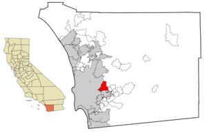
mapsize = 250x200px
map_caption =
mapsize1 =
map_caption1 =
image_dot_
dot_mapsize =
dot_map_caption =
dot_x =
dot_y =
pushpin_
pushpin_label_position =
pushpin_map_caption =
pushpin_mapsize =
subdivision_type = Country
subdivision_name =United States
subdivision_type1 = State
subdivision_name1 =California
subdivision_type2 = County
subdivision_name2 = San Diego
subdivision_type3 =
subdivision_name3 =
subdivision_type4 =
subdivision_name4 =
government_footnotes =
government_type =
leader_title =
leader_name =
leader_title1 =
leader_name1 =
leader_title2 =
leader_name2 =
leader_title3 =
leader_name3 =
leader_title4 =
leader_name4 =
established_title = Incorporated
established_date = December 1, 1980
established_title2 =
established_date2 =
established_title3 =
established_date3 =
area_magnitude =
unit_pref =
area_footnotes =
area_total_km2 = 42.2
area_land_km2 = 41.6
area_water_km2 = 0.6
area_total_sq_mi = 16.56
area_land_sq_mi = 16.1
area_water_sq_mi = 0.2
area_water_percent =
area_urban_km2 =
area_urban_sq_mi =
area_metro_km2 =
area_metro_sq_mi =
population_as_of = State Dept. of Finance 1/1/06
population_footnotes =
population_note =
population_total = 54,709
population_density_km2 = 1273.7
population_density_sq_mi = 3304
population_metro =
population_density_metro_km2 =
population_density_metro_sq_mi =
population_urban =
population_density_urban_km2 =
population_density_urban_sq_mi =
population_blank1_title =
population_blank1 =
population_density_blank1_km2 =
population_density_blank1_sq_mi =
timezone = PST
utc_offset = -8
timezone_DST = PDT
utc_offset_DST = -7
elevation_footnotes =
elevation_m = 107
elevation_ft = 350
postal_code_type =ZIP code s
postal_code = 92071-92072
area_code = 619
blank_name = FIPS code
blank_info = 06-70224
blank1_name = GNIS feature ID
blank1_info = 1656619
website = http://www.ci.santee.ca.us/
footnotes =Santee is a city in San Diego County,
California ,United States . The city is named after Milton Santee, second husband of Jennie Blodgett, whose first husband wasGeorge A. Cowles , a ranching pioneer in the San Diego area. [ [http://www.ci.santee.ca.us/Index.aspx?page=22 City of Santee Official Website: History] ] As of 2006, Santee had a population of 54,709.Demographics
Ethnic Makeup
*Methodology: Percentage breakdowns from SANDAG 1/1/05 estimates (as shown) were applied to 1/1/06 State D.O.F. estimates for population and households.
Politics
In the state legislature Santee is located in the 36th Senate District, represented by Republican
Dennis Hollingsworth , and in the 77th Assembly District, represented by RepublicanJoel Anderson . Federally, Santee is located inCalifornia's 52nd congressional district , which has a Cook PVI of R +9 [cite web | title = Will Gerrymandered Districts Stem the Wave of Voter Unrest? | publisher = Campaign Legal Center Blog | url=http://www.clcblog.org/blog_item-85.html | accessdate = 2008-02-10] and is represented by RepublicanDuncan Hunter .Geography
Regional Parks and Recreation
Santee has two major regional parks,
Santee Lakes andMission Trails Regional Park . Santee Lakes consists of seven public lakes and has a campground and other amenities on site. Santee is also home to a popular Southern Californiarock climbing area.antee Lakes
Santee Boulders
Economic Development
The City of Santee is a growing community comprising 54,700 residents and 17 square miles. Santee’s 2005 median household income of $79,846 represents the highest median income of all East County cities, and the 7th highest among 18 cities in San Diego County. And the 2005 median home price in Santee was $471,000. Single-family units comprise 65% of the city's housing stock, creating a very stable family based community. 71% of homes are owner-occupied--one of the highest percentages of owner-occupied homes in the region. In addition, Santee has one of the lowest crime rates in the County and the city also prides itself on having a stable local economy, well-maintained streets and infrastructure, and family-based neighborhoods. With excellent economic indicators, available land for development, a skilled labor force, transit linkage to SDSU, Mission Valley, and San Diego by trolley, and access to three regional freeways Santee offers unparalleled economic development opportunities. [http://www.ci.santee.ca.us/Index.aspx?page=4 The City of Santee - Economic Development] ]
Schools
In Santee, there are two school districts,
Santee School District andGrossmont Union High School District . Unlike traditional schools districts that operate withelementary school s (k-5) andmiddle school s (6-8), all schools in the Santee School District are kindergarten through eighth grade but separate the campus into "Elementary" (k-6) and "Junior High" (7-8), and also have different schedules. West Hills High School was rated the best high school among the Grossmont Union High School District.* Cajon Park School
* Carlton Hills School
* Carlton Oaks School
* Chet F. Harrit School
* Hill Creek School
* Pepper Drive School
* Prospect Avenue School
* Rio Seco School
* Sycamore Canyon SchoolHigh Schools
There are two highschools in Santee. Both are operated by the Grossmont High School District.
*
Santana High School
*West Hills High School Footnotes
External links
* [http://www.ci.santee.ca.us/ City of Santee Official Website]
* [http://www.mtrp.org/ Mission Trails Regional Park]
* [http://www.santeelakes.com/ Santee Lakes Regional Park]

Wikimedia Foundation. 2010.