- Verdugo Mountains
Geobox| Range
name=Verdugo Mountains
other_name=Verdugos
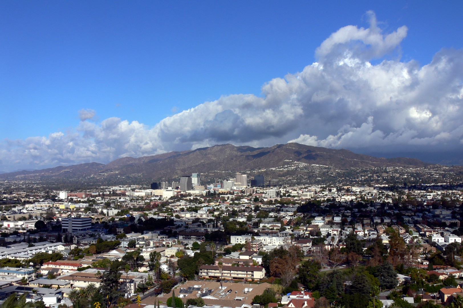
image_caption=Verdugo Mountains, south view
country=United States
state=California
district=Los Angeles County| district_type=County
parent=Transverse Ranges
highest=Verdugo Peak
highest_elevation_imperial=3126
highest_lat_d=
highest_long_d=The Verdugo Mountains are a smallmountain range located just south of the westernSan Gabriel Mountains in Los Angeles County,Southern California , USA. The range is commonly known simply as the Verdugos. It is also sometimes referred to as the Verdugo Hills.History
The Verdugo Mountains were named for the Verdugo family, holders of the "Rancho San Rafael"
land grant which covered the mountains during California's Spanish and Mexican period. OnOctober 20 1784 Pedro Fages , the military governor ofAlta California , granted Jose Maria Verdugo permission to use the rancho Verdugo referred to as "La Zanja". [http://www.laokay.com/halac/RanchoSanRafael.htm "Adobes of Rancho San Rafael"] ] The rancho's boundaries were primarily defined by the Verdugo Mountains,Arroyo Seco , theLos Angeles River , the boundary followed north along the east bank of the river, and wrapping westerly aroundGriffith Park to a point nearTravel Town .Geology
The Verdugo Mountains are a rather rugged offshoot range of the
San Gabriel Mountains located inLos Angeles County ,California , and consist almost entirely of igneous and metamorphic rocks similar to the basement rocks exposed to the north in the San Gabriel Mountains, south of the San Gabriel Fault. These rocks consist ofgneiss , and gneissicdiorite andquartz diorite , intruded by irregular bodies of equigranular granitic rocks, predominantly quartz diorite andgranodiorite , with accompanyingpegmatite andaplite . [Weber, F. Harold, Jr., and others, 1980, Earthquake Hazards Associated with the Verdugo-Eagle Rock and Benedict Canyon Fault Zones, Los Angeles County California. Calif. Div. Mines and Geology Open File Report 80-10] Exposed rocks in the Shadow Hills neighborhood at the extreme northwestern end of the Verdugos are typically marinesedimentary rocks ofMiocene age, predominantlysandstone andshale . A half-inch-thick vein of blade-shapedevaporite crystals can be found in the exposed shale just south of Wentworth Street, between Foothill Boulevard and the Foothill Freeway overpass.Geography
The range runs roughly southeast to northwest between the City of Glendale and the community of Tujunga. The Verdugo Mountains lie within the corporate boundaries of the cities of Glendale, Burbank, and Los Angeles. The Los Angeles neighborhoods of Tujunga, Sunland, Shadow Hills, La Tuna Canyon, and Sun Valley are all adjacent to the range on its north end.
The Verdugos are part of the
Transverse Ranges . They form part of the eastern boundary of theSan Fernando Valley and part of the southern boundary of theCrescenta Valley . North of the range, it is separated from the San Gabriels by an area of connected valleys containing the Sunland and Tujunga neighborhoods of Los Angeles, between the Tujunga Valley at the mouth of Big Tujunga Wash and the northern end of the Crescenta Valley. TheFoothill Freeway (US 210) climbs for a few miles up and over the northern end of the Verdugos after passing through the Crescenta Valley, descending into Sunland to continue along the northeast edge of the San Fernando Valley. Near where the Foothill Freeway begins to climb the Verdugos is another pass across the north end of the range through La Tuna Canyon along La Tuna Canyon Road. On the southeast end of the range, it is separated from theSan Rafael Hills to the east by the "Verdugo Wash". The routing of theGlendale Freeway (SR 2) along these hills north of its junction with theVentura Freeway (SR 134) provides a largely unimpeded view of the eastern slope of the range across the valley. Some say that there are traces of copper and gold. Fact|date=April 2008Peaks
The highest peak in the Verdugos is the informally named
Verdugo Peak (3,126 feet) in Glendale near the northern end of the range. Another peak to the south of "Verdugo Peak" near Brand Park in Glendale was recently namedTongva Peak (2,656 feet) in honor of theTongva (Gabrielino) people, the original inhabitants of much of theLos Angeles Basin ,Santa Monica Mountains , andSan Gabriel Valley areas. Other named peaks areMount La Tuna on the north end of the range andMount Thom on the south end of the range.Maps
*"Angeles Front Country Trail Map".
San Rafael, California : Tom Harrison Maps, 2001. ISBN 1-877689-65-3.
*"Verdugo Mountains trail map". Matt Maxon, 2005 http://pctmap.homeip.net/data/PDF/Verdugo%20Mtns%2001-16-05.pdf
*Burbank, California, 7.5 minute topographic quadrangle map.United States Geological Survey .
*Pasadena, California, 7.5 minute topographic quadrangle map.United States Geological Survey .
*"Mount La Tuna" - coord|34.22327|N|118.33763|W|region:US_type:mountain_scale:50000
*"Verdugo Peak" - coord|34.21518|N|118.28001|W|region:US_type:mountain_scale:50000
*"Tongva Peak" - coord|34.19722|N|118.25833|W|region:US_type:mountain_scale:50000
*"Mount Thom" - coord|34.18717|N|118.25596|W|region:US_type:mountain_scale:50000Flora and fauna
Except for a tenuous link to the
Angeles National Forest through Big Tujunga Wash to the north, the Verdugo Mountains are an urban wildlife island. Native-plant landscapes that may survive and even thrive in many places at the higher elevations include chaparral and oak woodlands. Hazards that the wise hiker will learn to avoid in these landscapes include poison oak ("leaflets three: let them be!"), black widow spiders, gopher holes (ankle sprainers), and rattlesnakes.Mountain lions are present in the Verdugo's. Visitors should take appropriate care.Protected areas
*Verdugo Mountains State Park,
California Department of Parks and Recreation
*Verdugo Mountains Open Space Preserve, jointly operated by theSanta Monica Mountains Conservancy and the City of Glendale*Brand Park, Glendale
*Stough Canyon Nature Center, Burbank
*Wildwood Canyon Park, Burbank
*La Tuna Canyon Park, Los Angeles
*Tujunga Ponds, Los AngelesThe Verdugo Mountains are being considered as part of the proposed
Rim of the Valley Corridor National Park.tate conservation
The purpose of the Verdugo Mountains property, in
Los Angeles County , is to preserve and protect as urban open space a remnant of natural lands located near the city of Glendale in the north portion of the heavily urbanizedLos Angeles basin . The mountains are California state-protected property.Hiking and biking
The Verdugo Mountains have many
hiking trail s. The trails are rather short and intermediate in difficulty.In addition to hikers,
mountain bike riders do theiroff-road sport on the many trails in the Verdugo Mountains. The trail that starts on La Tuna Canyon Road in the northwest end of the mountains is popular with bikers as it is one of the wider and easier trails in the mountains, with one of the easiest grades.The entrance to the Upper Verdugo Park from the Villa Cabrinis in Burbank is a park popular with hikers who walk up the Cabrini hill.
ee also
Nearby mountain ranges
*San Rafael Hills - southeast
*San Gabriel Mountains - east and north
*Santa Monica Mountains - southwest
*Santa Susana Mountains - northwest
*Simi Hills - westources
*" [http://www.geo.oregonstate.edu/people/faculty/yeats_publications/SanGabrielBasin_GSABulletin_2004.pdf Tectonics of the San Gabriel Basin and surroundings, southern California] ". Robert S. Yeats.
Corvallis, Oregon :Oregon State University , Department of Geosciences, 2004.
*" [http://www.laokay.com/halac/ Historic Adobes of Los Angeles County] ", " [http://www.laokay.com/halac/RanchoSanRafael.htm Adobes of Rancho San Rafael] ". John R. Kielbasa. Pittsburg: Dorrance Publishing Company, 1998. ISBN 0-8059-4172-X.
*"Los Angeles River: Its Life, Death, and Possible Rebirth". Blake Gumprecht. Baltimore &London : TheJohns Hopkins University Press, 1999. ISBN 0-8018-6642-1.
*"Afoot & Afield in Los Angeles County", 2nd edition, Area B-5. Jerry Schad.Berkeley, California : Wilderness Press, 2000. ISBN 0-89997-267-5.
*" [http://www.geo.oregonstate.edu/people/faculty/yeats_publications/SanGabrielBasin_GSABulletin_2004.pdf Tectonics of the San Gabriel Basin and surroundings, southern California] ". Robert S. Yeats.Corvallis, Oregon :Oregon State University , Department of Geosciences, 2004.
*"Paleoseismology, active tectonics, and seismic hazards of the Verdugo fault zone, Los Angeles County, California". James F. Dolan. The University, 1997.
*"Segmentation, slip rates and earthquake dimensions in the active fold-thrust belt of northern Los Angeles Basin, California". Robert S. Yeats. Dept. of Geosciences, Oregon State University, 1996.
*"Geology of Earthquakes". Robert S. Yeats, Kerry E. Sieh, and Clarence R. Allen. Oxford University Press, 1997. ISBN 0-19507-827-6.
*"Living with Earthquakes in California: A Survivor's Guide". Robert S. Yeats. Oregon State University Press, 2001. ISBN 0-87071-493-7.
*"The geology of a portion of the western Verdugo mountains". Robert L. Johnston, 1938.
*"Geology Underfoot in Southern California". Allen Glazner. Mountain Press, 1993. ISBN 0-87842-289-7.
*"Assembling California". John McPhee. Farrar, Straus and Giroux, 1993. ISBN 0-37410-645-2.
*"Cycles of Rock and Water: At the Pacific Edge". Kenneth A. Brown. HarperCollins, 1993. ISBN 0-06016-056-X.
*"Birds of Los Angeles: Including Santa Barbara, Ventura and Orange Counties". Chris C. Fisher and Herbert Clarke. Lone Pine Publications, 1997. ISBN 1-55105-104-4.
*"A Flora of Southern California". Philip A. Munz. University of California Press, 1974.
*"Native Trees of Southern California". Victor P. Peterson. University of California Press, 1970.
*"Illustrated Guide to the Oaks of the Southern Californian Floristic Province: The Oaks of Coastal Southern California and Northwestern Baja California". Fred M. Roberts, Jr. F. M. Roberts Publishing, 1995. ISBN 0-96438-470-1.
*"Plant Life in the World's Mediterranean Climates: California, Chile, South Africa, Australia and the Mediterranean Basin". Peter R. Dallman. University of California, 1998. ISBN 0-52020-808-0.
*"Island Called California: An Ecological Introduction to Its Natural Communities". Elna Bakker. Second Edition. University of California Press, 1984. ISBN 0-52004-947-0.
*"Natural History of Vacant Lots (California Natural History Guides)". Matthew F. Vessel and Herbert H. Wong. University of California Press, 1987. ISBN 0-52005-250-1.
*"Growing California Native Plants". Marjorie D. Schmidt. University of California Press, 1981. ISBN 0-52003-762-6.
*"Introduction to California Beetles". Arthur V. Evans and James N. Hogue. University of California Press, 2004. ISBN 0-52024-035-9.
*"Geography and evolution in the pocket gophers of California". Joseph Grinnell. USGPO, 1927.
*"Evolutionary Dynamics of the Pocket Gopher" Thomomys Bottae", With Emphasis on California Populations". James L. Patton and Margaret F. Smith. University of California Press, 1990. ISBN 0-52009-761-0.
*"The Verdugos of Hispanic California". Marie E. Northrop. 1978.References
External links
* [http://outdoorla.org/trails/ Outdoor LA Hiking Trails] - Hiking trails in the area with maps and directions to the trailheads.
* [http://parks.ca.gov/default.asp?page_id=635 Verdugo Mountains State Park] - California State Parks page for the Verdugo Mountains State Park
* [http://www.govtrack.us/congress/bill.xpd?bill=s109-153 Rim of the Valley Corridor Study Act] - GovTrack page for Senate Bill 153, the Rim of the Valley Corridor Study Act
* [http://www.latrails.com/hike/v.html LA Trails - Verdugo Mountains] - a listing of most of the hiking trails in the Verdugo Mountains.
* [http://www.verdugohillshike.org/ Verdugo Hills Community Hike] - an annual communinty hike and trail run in the Verdugos involving the Glendale, Burkbank, and Crescenta Valley communities
* [http://www.lamountains.com/searchresults.asp?regionid=9 Parks in the Verdugo & San Rafael Mountains Region] - Santa Monica Mountains Conservancy page, with an interagency list of parks and other protected areas in the Verdugo Mountains/San Rafael Hills area
Wikimedia Foundation. 2010.