- Pigeon Point Lighthouse
Infobox_Lighthouse
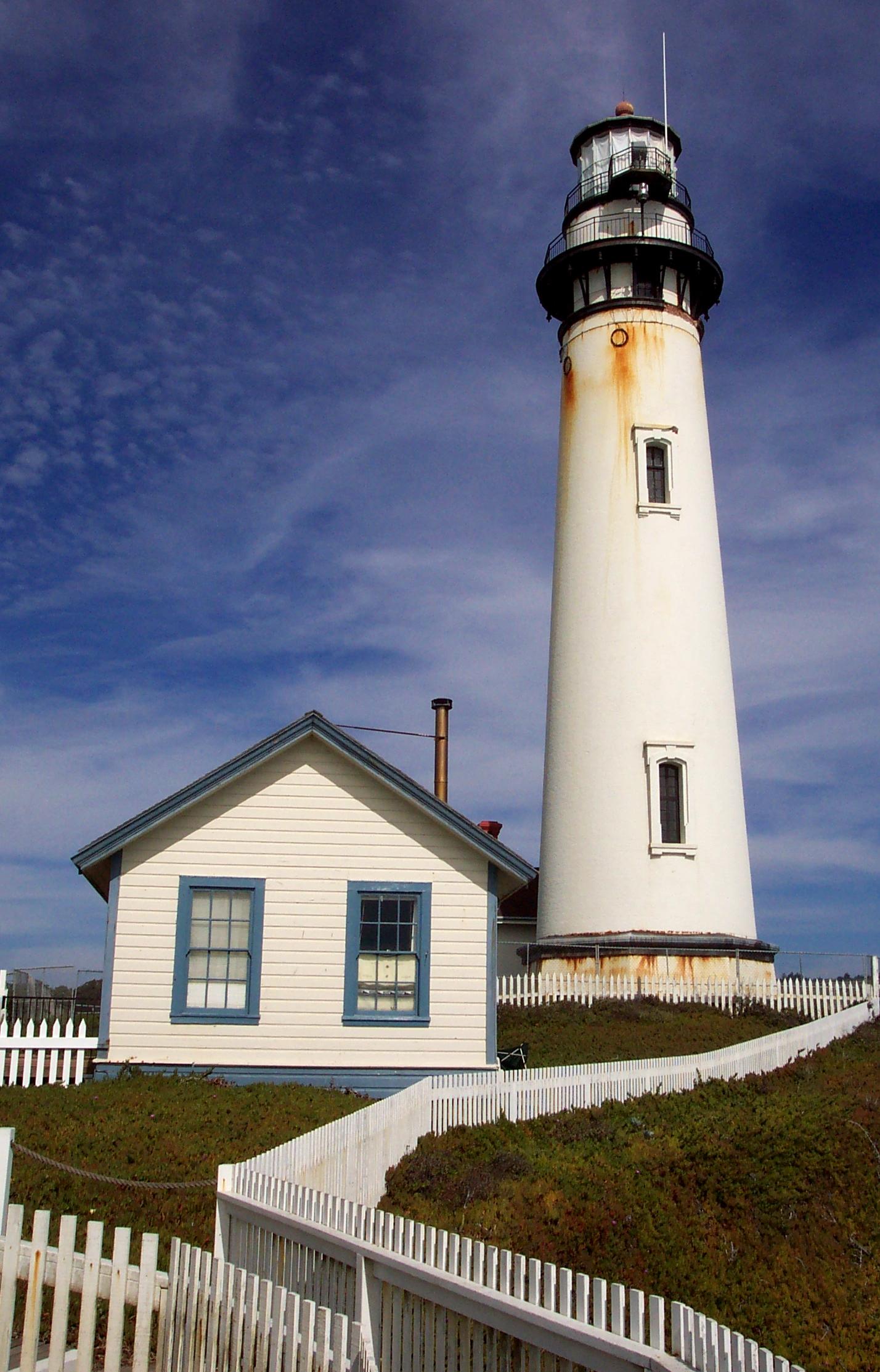
|200px|center
caption = Pigeon Point Lighthouse
location = Southern approach toSan Francisco Bay , California
coordinates = coord|37|10|54|N|122|23|38|W|region:US_type:landmark
yearbuilt = 1871
yearlit = 1872
automated = 1974
yeardeactivated =
foundation = Stone
construction = Brick
shape = Conical attached to workroom
marking = white with black trim
height = convert|115|ft|m|0|abbr=on|lk=on
elevation = convert|148|ft|m|0|abbr=on
lens = First orderFresnel lens 1872
currentlens =
intensity =
range = convert|24|nmi|km|-1|lk=on|abbr=on
characteristic = Flashing white 10s, Emergency light of reduced intensity when main light is extinguished.
admiralty = G4006
ARLHS = USA-499
USCG = 6-0320:"Pigeon Point" redirects here. The name also refers to the Pigeon Point neighborhood in
Delridge, Seattle, Washington .Pigeon Point Light Station or Pigeon Point Lighthouse is a
lighthouse built in 1871 to guide ships on the Pacific coast ofCalifornia . It is one of the tallest lighthouses in theUnited States . It is still an active Coast Guard aid to navigation. Pigeon Point Light Station is located on the coastal highway (State Route 1), convert|5|mi|km|0|lk=on south ofPescadero, California . The convert|115|ft|m|0|adj=on, white masonry tower, resembles the typical New England structure. Because of its location and ready access from the main highway, Pigeon Point entertains a large number of public visitors.The lighthouse and the land around have been preserved as Pigeon Point Light Station State Historic Park, a California
state park . It is between Santa Cruz and San Francisco.History
Pigeon Point Lighthouse is one of the most picturesque lighthouses on the Pacific coast. The tower stands on a rocky promontory and has long been a landmark for ships approaching
San Francisco Bay from the south. This headland, and hence the lighthouse, took its name from the ship "Carrier Pigeon" that wrecked here in 1853.The lantern room of the tower is equipped with the original first-order
Fresnel lens . Illuminated for [http://antwrp.gsfc.nasa.gov/apod/ap071126.html demonstration purposes] only today, the lens has 24 flash panels, is composed of 1008 hand-polished lenses and prisms and is capable of producing over 500,000 candlepower illumination. It was manufactured by the Henry-LePaute company in Paris, France and was first lit at Pigeon Point at sunset onNovember 15 ,1872 .Originally the tower was equipped with a lamp that burned refined lard oil. In 1888, that lamp was replaced with a mineral oil (
kerosene ) lamp. To produce Pigeon Point's assigned characteristic of one white flash of light every ten seconds, the four ton lens rotated one time every four minutes. When observed from a distance, this resulted in the appearance of one white flash of light every ten seconds. The lens rotation was originally powered by a clockworks and weight. In 1926 the lighthouse was provided with electricity. Modern innovations were incorporated and the kerosene IOV lamp was replaced by a 1000 watt bulb, the clockworks by an electric motor and an electrically operated fog signal was eventually installed.In 1972, the
United States Coast Guard mounted a 24-inchaerobeacon on the front of the tower and officially retired the Fresnel lens from regular duty. The Fresnel lens is now lit only to celebrate special occasions, such as the annual lighting of the lens, which usually occurs in mid-November (closest Saturday to Nov. 15) the date of the original first lighting in 1872. The light (outside aerobeacon) is still an active aid to navigation.The tower has been closed to tours since December 2001 because of collapse of brickwork supporting outside access walkways on the top of the structure. The California State Park system has promised repairs, but it is estimated that even if funds were available, it would be seven to ten years before the repairs would be completed.
The restored lighthouse keepers housing also serves as a
hostel for travelers. The hostel is operated by the Golden Gate Council ofHostelling International . The four three-bedroom houses next to the lighthouse have overnight lodging for up to 50 people of all ages. Each house has three male or female bunk rooms. Separate bunk rooms can be reserved for families or couples. Hostel guests share bathrooms, kitchens and living rooms. An outdoor hot tub can be rented in the evenings.External links
* [http://www.parks.ca.gov/default.asp?page_id=533 Pigeon Point Light Station State Historic Park]
* [http://channelislands.nos.noaa.gov/shipwreck/dbase/mbnms/carrierpign_2.html Carrier Pigeon / CINMS Shipwreck Database]
* [http://www.lighthousefriends.com/light.asp?ID=10 Lighthouse Friends / Pigeon Point History]*Geolinks-US-streetscale|37.181667|-122.393889
Wikimedia Foundation. 2010.