- Salton City, California
Infobox Settlement
official_name = Salton City, California
settlement_type = CDP
imagesize =
image_caption =
image_
imagesize =
image_caption =
image_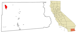
mapsize = 250x200px
map_caption = Location in Imperial County and the state ofCalifornia
mapsize1 =
map_caption1 =
subdivision_type = Country
subdivision_type1 = State
subdivision_type2 = County
subdivision_name =United States
subdivision_name1 =California
subdivision_name2 = Imperial
government_type =
leader_title =
leader_name =
established_date =
area_magnitude =
area_total_km2 = 56
area_total_sq_mi = 21.6
area_land_km2 = 56
area_land_sq_mi = 21.6
area_water_km2 = 0
area_water_sq_mi = 0
elevation_ft = -125
elevation_m = -38
population_as_of = 2000
population_footnotes =
population_total = 978
population_metro =
population_density_km2 = 17.5
population_density_sq_mi = 45.3
timezone = Pacific (PST)
utc_offset = -8
latd = 33 |latm = 17 |lats = 55 |latNS = N
longd = 115 |longm = 57 |longs = 34 |longEW = W
timezone_DST = PDT
utc_offset_DST = -7
postal_code_type =ZIP code
postal_code = 92275
area_code = 760
blank_name = FIPS code
blank_info = 06-64294
blank1_name = GNIS feature ID
blank1_info = 1853413
footnotes =
website =Salton City is a
census-designated place (CDP) in Imperial County,California ,United States . The population was 978 at the 2000 census. It is part of the 'El Centro, California Metropolitan Statistical Area '. Although maps (such as those seen atGoogle Maps [http://maps.google.com/maps?ll=33.298601,-115.959575&spn=0.11,0.18] ) at first glance show Salton City to be a sizable community, in fact very few of the surveyed streets and roads were ever developed. The town was developed in the 1950s as a resort community on theSalton Sea , but as the salinity of the already highly polluted sea rose, very little development took place and much of what was built - including the city'smarina - was abandoned.Geography
Salton City is located at coor dms|33|17|55|N|115|57|34|W|city (33.298601, -115.959575)GR|1.
According to the
United States Census Bureau , the CDP has a total area of 21.6square mile s (56.0km² ), all of it land.Demographics
As of the
census GR|2 of 2000, there were 978 people, 416 households, and 267 families residing in the CDP. Thepopulation density was 45.2 people per square mile (17.5/km²). There were 730 housing units at an average density of 33.8/sq mi (13.0/km²). The racial makeup of the CDP was 73.62% White, 0.82% Black or African American, 1.94% Native American, 0.61% Asian, 0.10% Pacific Islander, 17.38% from other races, and 5.52% from two or more races. 32.52% of the population were Hispanic or Latino of any race.There were 416 households out of which 21.4% had children under the age of 18 living with them, 51.4% were married couples living together, 8.2% had a female householder with no husband present, and 35.8% were non-families. 30.0% of all households were made up of individuals and 19.7% had someone living alone who was 65 years of age or older. The average household size was 2.35 and the average family size was 2.91.
In the CDP the population was spread out with 20.9% under the age of 18, 5.7% from 18 to 24, 18.9% from 25 to 44, 24.1% from 45 to 64, and 30.4% who were 65 years of age or older. The median age was 49 years. For every 100 females there were 91.4 males. For every 100 females age 18 and over, there were 92.5 males.
The median income for a household in the CDP was $21,563, and the median income for a family was $20,208. Males had a median income of $26,458 versus $4,886 for females. The
per capita income for the CDP was $14,106. About 26.3% of families and 29.8% of the population were below thepoverty line , including 71.8% of those under age 18 and 10.0% of those age 65 or over.Currently, Salton City is being developed and several new homes have been built in the area.
A few scenes in the 2007 film Into the Wild were shot in Salton City.
Government
Local
Salton City and its neighboring community of Desert Shores are governed by the Salton Community Services District (SCSD) which is a special district per California Government Code. The legislative body of the SCSD is a five member Board of Directors who are elected by the registered voters in the district every two years.
The SCSD is authorized to provide seven services:1. Collect, treat, or dispose of sewage.2. Collect, transfer, and dispose of solid waste.3. Provide fire protection.4. Acquire, construct recreational facilities.5. Organize, promote community recreation.6. Acquire, construct, and improve street lighting and landscaping.7. Provide emergency medical services.
Aside from acting as the architectural committee for architectural compliance with the Covenants, Conditions, and Restrictions (CC&R’s) of the 80 plus tracts within the district the SCSD has no land use authority under existing law, that responsibility falls on the County of Imperial Board of Supervisors.
tate and Federal
In the state legislature Brawley is located in the 40th Senate District, represented by Democrat
Denise Moreno Ducheny , and in the 80th Assembly District, represented by RepublicanBonnie Garcia . Federally, Brawley is located inCalifornia's 51st congressional district , which has a Cook PVI of D +7 [cite web | title = Will Gerrymandered Districts Stem the Wave of Voter Unrest? | publisher = Campaign Legal Center Blog | url=http://www.clcblog.org/blog_item-85.html | accessdate = 2007-10-20] and is represented by DemocratBob Filner .References
External links
* The 2006
documentary film [http://www.saltonseadoc.com/ "Plagues and Pleasures on the Salton Sea"] (narrated by John Waters) documented the lives of the inhabitants of Salton City, as well as the ecological issues associated with the Sea - www.saltonseadoc.com.
* [http://www.saltonseawest.com/xdocumentlibrary.htm Salton Sea West] is a non-commercial website with a large library of government documents pertaining to Salton City
* [http://www.willpearson.co.uk/virtual_tours/salton_sea/index.php/ Virtual tours of the Salton Sea]
Wikimedia Foundation. 2010.