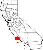
- Santa Barbara County, California
-
County of Santa Barbara — County — 
SealLocation in the state of California California's location in the United States
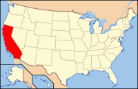
Country  United States
State  California
Region California Central Coast Incorporated 1850 County seat Santa Barbara Largest city Santa Maria Area – Total 9,813.7 km2 (3,789.08 sq mi) – Land 7,088.8 km2 (2,737.01 sq mi) – Water 2,724.8 km2 (1,052.07 sq mi) Population (2010) – Total 423,895 – Density 43.2/km2 (111.9/sq mi) Time zone Pacific Standard Time (UTC-8) – Summer (DST) Pacific Daylight Time (UTC-7) Area code(s) 805 Website www.countyofsb.org Santa Barbara County is a county located in the southern portion of the U.S. state of California, on the Pacific coast. As of 2010 the county had a population of 423,895. The county seat is Santa Barbara and the largest city is Santa Maria.
Contents
History
The Santa Barbara County area, including the Northern Channel Islands, was first settled by Native Americans at least 13,000 years ago. Evidence for a Paleoindian presence has been found in the form of a fluted Clovis-like point found in the 1980s along the western Santa Barbara Coast, as well as the remains of Arlington Springs Man found on Santa Rosa Island in the 1960s. For thousands of years, the area was home to the Chumash tribe of Native Americans, complex hunter-gatherers who lived along the coast and in interior valleys leaving rock art in many locations including Painted Cave.
Europeans first contacted the Chumash in AD 1542, when three Spanish ships under the command of Juan Rodriguez Cabrillo explored the area. The Santa Barbara Channel received its name from Spanish explorer Sebastian Vizcaino when he sailed over the channel waters in 1602; he entered the channel on December 4, the day of the feast of Santa Barbara. Although Spanish ships associated with the Manila Galleon trade probably contacted the Chumash intermittently during this "protohistoric" period, the Spanish first colonized Santa Barbara County in AD 1769, when the DeAnza expedition explored the area and laid plans to establish a series of missions and presidios (forts). Mission Santa Barbara was founded on December 4, 1786 in what is now Santa Barbara. The county derives its name from the mission.
European contacts had devastating effects on the Chumash Indians, including a series of disease epidemics that drastically reduced Chumash population. The Chumash survived, however, and thousands of Chumash descendants still live in the Santa Barbara area or surrounding counties.
Santa Barbara County was one of the 26 original counties of California, formed in 1850 at the time of statehood. Parts of the county's territory were given to Ventura County in 1872.
Politics
In terms of aggregate, the county is strongly left-leaning. However, there is a dramatic difference in gradient between the northern and southern parts of the county.
Santa Barbara County has long been divided between competing political interests. North of the Santa Ynez Mountains, agricultural activities and oil development have long been predominant. Enormous oil fields such as the Orcutt, Lompoc, Santa Maria Valley, and East Cat Canyon fields provided jobs and a steady supply of oil, gas, and asphalt since the first oil discovery in the Solomon Hills in 1901. In recent years, major oil companies have left the area, turning over their oil leases to small independents, and decommissioning some leases areas that were no longer profitable. The northern portion contains a large military base, Vandenberg Air Force Base, and thus military interests are prominent. These influences together create a Republican-leaning northern half.
Santa Barbara County vote
by party in presidential electionsYear GOP DEM Others 2008 37.5% 65,585 60.4% 105,614 2.4% 4,208 2004 45.2% 76,806 53.2% 90,314 1.6% 2,741 2000 46.1% 71,493 47.4% 73,411 6.5% 10,070 1996 42.4% 63,915 46.9% 70,650 10.7% 16,180 1992 35.3% 57,375 42.5% 69,215 22.2% 36,166 1988 54.2% 77,524 44.5% 63,586 1.3% 1,830 1984 62.8% 89,314 36.0% 51,243 1.2% 1,763 1980 54.0% 69,629 31.5% 40,650 14.5% 18,716 1976 50.8% 60,922 45.9% 55,018 3.3% 3,904 1972 55.2% 67,075 41.6% 50,609 3.2% 3,857 1968 53.6% 50,068 40.2% 37,565 6.2% 5,787 1964 44.0% 38,020 55.9% 48,381 0.1% 85 1960 56.7% 38,805 43.0% 29,409 0.3% 188 1956 64.6% 31,294 34.9% 16,925 0.6% 265 1952 67.2% 32,160 32.4% 15,490 0.4% 179 1948 58.1% 19,998 38.0% 13,085 3.8% 1,317 1944 46.3% 13,647 53.4% 15,721 0.3% 89 1940 44.5% 14,107 54.4% 17,237 1.1% 334 1936 37.4% 9,728 61.1% 15,923 1.5% 394 1932 38.1% 8,864 57.4% 13,373 4.5% 1,054 1928 69.4% 11,666 29.5% 4,954 1.1% 179 1924 64.7% 8,615 9.3% 1,242 26.0% 3,461 1920 67.5% 6,970 25.0% 2,586 7.5% 773 On the other hand, the southern portion of Santa Barbara county has had an economy based on tourism, with a significant percentage of people with white-collar jobs, formerly in aerospace but more recently in software and other high-tech pursuits. Additionally, the University of California, Santa Barbara contributes to a liberal populace. The southern portion of the county has a strong history of left-wing activism, with anti-war protests common in Santa Barbara. It is generally believed that the inspiration for Earth Day was the 1969 Santa Barbara oil spill; however, Gaylord Nelson, the senator who proposed the idea, has never directly cited any direct cause for the establishment of the holiday.[1]
Voting patterns in Santa Barbara county indeed reflect a strong split between a "conservative" north and "liberal" south. Coastal Santa Barbara is part of California's California's 23rd congressional district, which is held by Democrat Lois Capps; the inland is part of the 24th district, which is held by Republican Elton Gallegly. In the State Assembly, Santa Barbara is in the 33rd and 35th districts, which are held by Republican Katcho Achadjian and Democrat Pedro Nava, respectively. In the State Senate, Santa Barbara is part of the 15th and 19th districts, which are held by Republicans Sam Blakeslee and Tony Strickland, respectively.
Overall, Santa Barbara is a Democratic-leaning county in Presidential and congressional elections. The last Republican to win a majority in the county was George H. W. Bush in 1988.
On November 4, 2008 Santa Barbara County voted 53.1 % against Proposition 8 which amended the California Constitution to ban same-sex marriages. It was the only county in Southern California to vote against it.
The County is governed by a five member Board of Supervisors that reflects this ideological split. The Board's three vote majority has shifted over the years between the north and south. The Board majority now includes three members from the southern portion of the County.
The Board of Supervisors appoints a County Executive Officer, who serves at the pleasure of the Board, to operate the County governmental organization. The County government includes 4296 employees and a budget of $757 million. The County provides various services ranging from health services to law enforcement.
Proposed county splits
In 1978, some residents of the northern area initiated an effort to create a "Los Padres County" out of the northern area of the county; that effort did not succeed. In 2006, northern county organizations initiated a similar secession proposal, to create a proposed Mission County. Governor Arnold Schwarzenegger appointed a formation commission to research the viability of the proposed northern county, which reached the conclusion, stated in its final report (March 28, 2005) that "the proposed County, upon formation in 2006, would not be economically viable at current levels of service."[2] In June 2006, voters rejected the formation of the new county.
The proposed new Mission County would have included the cities of Santa Maria, Lompoc, Guadalupe, Buellton, and Solvang, as well as the Cuyama Valley and Santa Ynez Valley, including Lake Cachuma. Most of the south coast of Santa Barbara County, along with the Channel Islands, would have remained with that county, with the exception of the stretch from Hollister Ranch to Point Conception. Most of the Los Padres National Forest also would have remained with Santa Barbara County.[3]
Geography
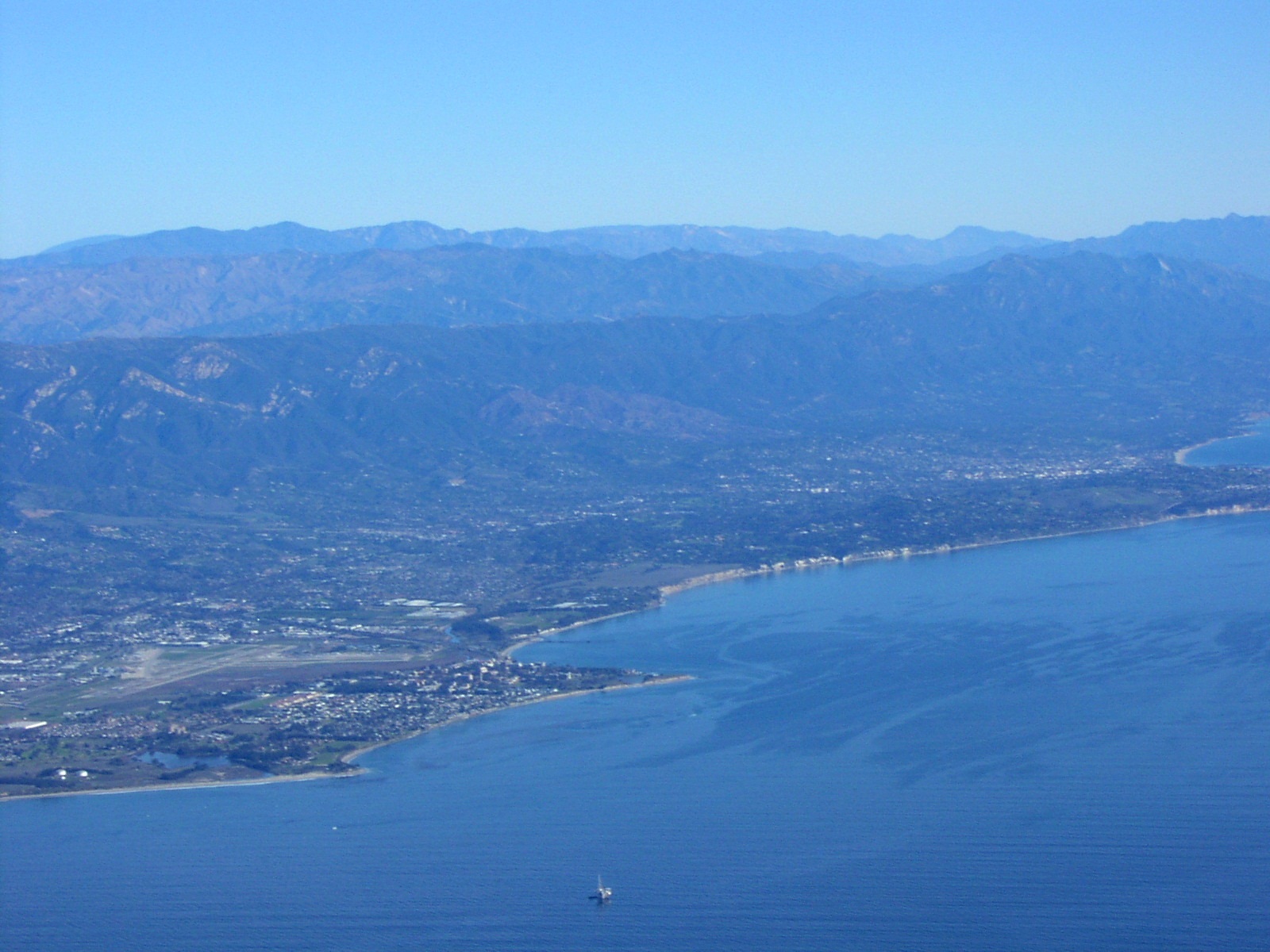
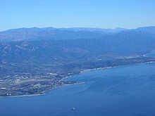 South Coast of Santa Barbara County, view looking northeast, showing, from left to right, Isla Vista, Goleta, Hope Ranch, Santa Barbara. All the mountains except for the most distant in the right rear are in Santa Barbara County.
According to the 2000 census, the county has a total area of 3,789.08 square miles (9,813.7 km2), of which 2,737.01 square miles (7,088.8 km2) (or 72.23%) is land and 1,052.07 square miles (2,724.8 km2) (or 27.77%) is water.[5] Four of the Channel Islands – San Miguel Island, Santa Cruz Island, Santa Rosa Island and Santa Barbara Island – are in Santa Barbara County. They form the largest part of the Channel Islands National Park (which also includes Anacapa Island in Ventura County).
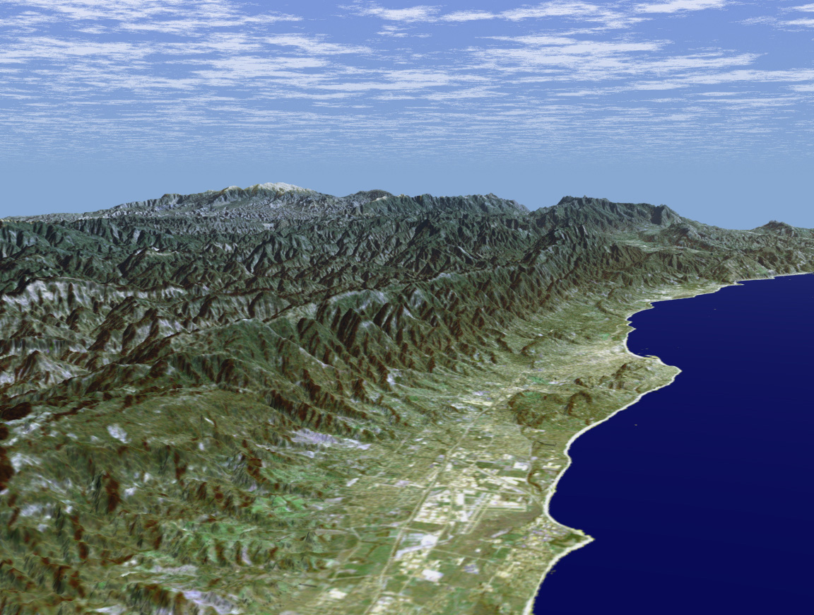
Santa Barbara County has a mountainous interior abutting several coastal plains on the west and south coasts of the county. The largest concentration of population is on the southern coastal plain, referred to as the "south coast" – meaning the part of the county south of the Santa Ynez Mountains. This region includes the cities of Santa Barbara, Goleta, and Carpinteria, as well as the unincorporated areas of Hope Ranch, Summerland, Mission Canyon, Montecito and Isla Vista. North of the mountains are the towns of Santa Ynez, Solvang, Buellton, Lompoc; the unincorporated towns of Los Olivos and Ballard; the unincorporated areas of Mission Hills and Vandenberg Village; and Vandenberg Air Force Base, where the Santa Ynez River flows out to the sea. North of the Santa Ynez Valley are the cities of Santa Maria and Guadalupe, and the unincorporated towns of Orcutt, Los Alamos, Casmalia, Garey, and Sisquoc. In the extreme northeastern portion of the county are the small cities of New Cuyama, Cuyama, and Ventucopa. As of January 1, 2006, Santa Maria has become the largest city in Santa Barbara County.[6]
The principal mountain ranges of the county are the Santa Ynez Mountains in the south, and the San Rafael Mountains and Sierra Madre Mountains in the interior and northeast. Most of the mountainous area is within the Los Padres National Forest, and includes two wilderness areas: the San Rafael Wilderness and the Dick Smith Wilderness. The highest elevation in the county is 6820 feet (2079 m) at Big Pine Mountain in the San Rafaels.
North of the mountains is the arid and sparsely populated Cuyama Valley, portions of which are in San Luis Obispo and Ventura Counties. Oil production, ranching, and agriculture dominate the land use in the privately owned parts of the Cuyama Valley; the Los Padres National Forest is adjacent to the south, and regions to the north and northeast are owned by the Bureau of Land Management and the Nature Conservancy.
Air quality in the county, unlike much of southern California, is generally good because of the prevailing winds off of the Pacific Ocean. The county is in attainment of federal standards for ozone and particulate matter, but exceeds state standards for these pollutants. Sometimes in late summer and early autumn there are days with higher ozone levels; usually this occurs when there is a low inversion layer under a stagnant air mass, which traps pollutants underneath. In these cases a traveler into the mountains encounters a curious paradox: the temperature rises as altitude increases. On these days the visibility from the higher summits may be more than a hundred miles, while the population on the coastal plain experiences haze and smog.
Cities and towns
- Mission Hills
- Montecito
- New Cuyama
- Orcutt
- Painted Cave
- Santa Barbara
- Santa Maria
- Santa Ynez
- Sisquoc
- Solvang
- Summerland
- Toro Canyon
- Vandenberg Air Force Base with spaceport
- Vandenberg Village
- Ventucopa
Adjacent counties
- San Luis Obispo County, California - north
- Kern County, California - northeast
- Ventura County, California - east
National protected areas
- Channel Islands National Park (part)
- Guadalupe-Nipomo Dunes National Wildlife Refuge (part)
- Los Padres National Forest (part)
- Burton Mesa Ecological Reserve
Transportation Infrastructure
Major highways
Public transportation
Santa Barbara County is served by Amtrak trains and Greyhound Lines buses. The southern portion of the county is served by the Santa Barbara Metropolitan Transit District. In the North County, the cities of Lompoc, Santa Maria, and Buellton/Solvang have their own bus services.
Airports
- Santa Barbara Airport, is located near Goleta, west of Santa Barbara.
- Santa Maria Public Airport is located just southwest of Downtown Santa Maria.
- Lompoc Airport is located on the north side of Lompoc.
- Santa Ynez Airport is just southeast of Santa Ynez.
Commercial flights are available at Santa Barbara Airport and Santa Maria Public Airport.
Demographics
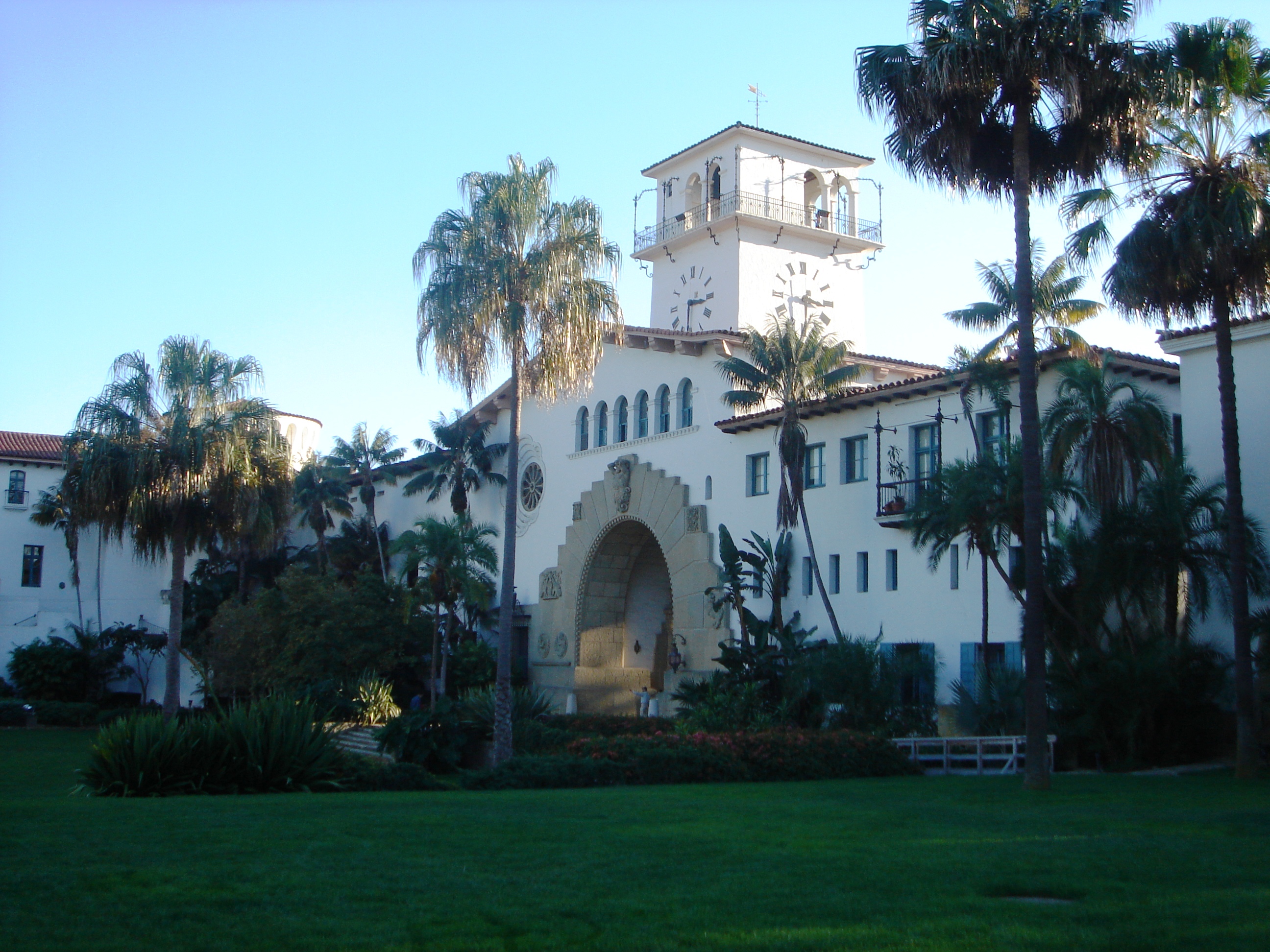
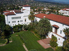 Santa Barbara County Courthouse, constructed in 1929, designed by William Mooser in the Spanish Colonial/Moorish Revival style.
2010
The 2010 United States Census reported that Santa Barbara County had a population of 423,895. The racial makeup of Santa Barbara County was 295,124 (69.6%) White, 8,513 (2.0%) African American, 5,485 (1.3%) Native American, 20,665 (4.9%) Asian (1.6% Filipino, 1.0% Chinese, 0.5% Japanese, 0.5% Korean, 0.3% Vietnamese, 0.4% Indian), 806 (0.2%) Pacific Islander, 73,860 (17.4%) from other races, and 19,442 (4.6%) from two or more races. Hispanic or Latino of any race were 181,687 persons (42.9%); 38.5% of Santa Barbara County is Mexican, 0.4% Salvadoran, 0.4% Guatemalan, and 0.3% Puerto Rican.[7]
Population reported at 2010 United States Census The County Total
PopulationWhite African
AmericanNative
AmericanAsian Pacific
Islanderother
racestwo or
more racesHispanic
or Latino
(of any race)Santa Barbara County 423,895 295,124 8,513 5,485 20,665 806 73,860 19,442 181,687 Incorporated
citiesTotal
PopulationWhite African
AmericanNative
AmericanAsian Pacific
Islanderother
racestwo or
more racesHispanic
or Latino
(of any race)Buellton 4,828 3,912 37 76 137 5 424 237 1,451 Carpinteria 13,040 9,348 109 144 296 15 2,599 529 6,351 Goleta 29,888 20,833 469 283 2,728 26 4,182 1,367 9,824 Guadalupe 7,080 3,395 74 103 279 5 2,783 441 6,103 Lompoc 42,434 25,950 2,432 750 1,615 186 9,020 2,481 21,557 Santa Barbara 88,410 66,411 1,420 892 3,062 116 13,032 3,477 33,591 Santa Maria 99,553 55,983 1,656 1,818 5,054 161 29,841 5,040 70,114 Solvang 5,245 4,326 38 59 72 1 611 138 1,530 Census-designated
placesTotal
PopulationWhite African
AmericanNative
AmericanAsian Pacific
Islanderother
racestwo or
more racesHispanic
or Latino
(of any race)Ballard 467 432 3 1 2 0 12 17 46 Casmalia 138 91 3 0 1 0 30 13 58 Cuyama 57 40 0 2 0 0 14 1 40 Garey 68 53 0 1 0 0 5 9 21 Isla Vista 23,096 14,875 594 104 3,387 45 2,686 1,405 5,265 Los Alamos 1,890 1,667 5 10 32 0 134 42 773 Los Olivos 1,132 1,049 1 4 12 5 40 21 125 Mission Canyon 2,381 2,193 14 17 40 11 35 71 198 Mission Hills 3,576 2,689 91 74 125 9 386 202 1,137 Montecito 8,965 8,267 55 38 218 6 156 225 605 New Cuyama 517 418 3 14 3 0 53 26 234 Orcutt 28,905 23,677 394 347 1,129 59 2,006 1,293 6,870 Santa Ynez 4,418 3,797 12 234 51 4 147 173 639 Sisquoc 183 146 0 5 3 0 9 20 58 Summerland 1,448 1,295 3 7 41 6 51 45 192 Toro Canyon 1,508 1,388 7 7 14 1 73 18 293 Vandenberg AFB 3,338 2,317 307 26 207 24 140 317 616 Vandenberg Village 6,497 5,029 271 60 323 58 432 324 1,216 Unincorporated
communitiesTotal
PopulationWhite African
AmericanNative
AmericanAsian Pacific
Islanderother
racestwo or
more racesHispanic
or Latino
(of any race)All others not CDPs (combined) 44,833 35,543 515 409 1,834 63 4,959 1,510 12,780 2005
Santa Barbara County grew by only 0.2% from 2000–2005, while California on the whole grew over 7%. 54.1% of the population is Non-Hispanic White. The African American percentage remained steady and the percentage of Native Americans rose to 1.6%. 4.6% of the population was Asian. About 2.2% of the population reported belonging to two or more racial groups. In addition, the percentage of residents claiming Hispanic or Latino background, reached 37.3%.
2000
As of the census[8] of 2000, there were 399,347 people, 136,622 households, and 89,487 families residing in the county. The population density was 146 people per square mile (56/km²). There were 142,901 housing units at an average density of 52 per square mile (20/km²). The racial makeup of the county was 72.72% White, 2.30% Black or African American, 1.20% Native American, 4.09% Asian, 0.18% Pacific Islander, 15.20% from other races, and 4.31% from two or more races. 34.22% of the population were Hispanic or Latino of any race. 9.1% were of German, 8.5% English and 6.5% Irish ancestry according to Census 2000. 26.58% of the population reported speaking Spanish at home.[9]
There were 136,622 households out of which 32.4% had children under the age of 18 living with them, 51.4% were married couples living together, 10.0% had a female householder with no husband present, and 34.5% were non-families. 24.3% of all households were made up of individuals and 9.4% had someone living alone who was 65 years of age or older. The average household size was 2.8 and the average family size was 3.33.
In the county the population was spread out with 24.9% under the age of 18, 13.3% from 18 to 24, 29.0% from 25 to 44, 20.1% from 45 to 64, and 12.7% who were 65 years of age or older. The median age was 33 years. For every 100 females there were 100.1 males. For every 100 females age 18 and over, there were 98.1 males.
The median income for a household in the county was $46,677, and the median income for a family was $54,042. Males had a median income of $37,997 versus $29,593 for females. The per capita income for the county was $23,059. About 8.5% of families and 14.3% of the population were below the poverty line, including 16.3% of those under age 18 and 6.2% of those age 65 or over.
The population of the area south of the Santa Ynez Mountain crest—the portion known as "South County"—was 201,161 according to the 2000 census; thus the population is almost exactly split between north and south. Recent years have shown slow or even negative growth for regions in the south county, while areas in the north county have continued to grow at a faster rate.
Education
There are 22 independent school districts in Santa Barbara County, and the Santa Barbara County Education Office[10] serves as an intermediate agency between those districts and the California Department of Education.[11] During the 2006-2007 school year, 67,523 students were enrolled in Santa Barbara County schools, kindergarten through grade 12.
There are also a number of private schools in the county. The Los Angeles Archdiocese operates two Catholic high schools and several elementary schools.
Santa Barbara County Wine Country
The first wine grapes in Santa Barbara County were planted by the missionaries associated with Mission Santa Barbara late in the 18th century. Since commercial viticulture rebounded in the 1960s, Santa Barbara County has become a prominent viticultural region. The 2004 Alexander Payne film, Sideways, set in the area, brought additional attention to the county as a wine region.
Famous for ripe, yet elegant, Chardonnay and Pinot Noir, the County is also gaining a reputation for Rhone varietals including Syrah and Viognier. Santa Barbara wine grapes now command among the highest prices anywhere in the state.
Many of the areas planted with wine grapes are mixed in with the rolling hills, ancient oak trees, oil fields, cattle ranches, and natural areas in the central part of the county. The county now claims more than 115 wineries and 21,000 acres (85 km2) of vine, with the vast majority of the vineyards in the county's Central Coast American Viticultural Areas: Santa Maria Valley AVA, Santa Ynez Valley AVA, Sta. Rita Hills AVA, and Happy Canyon AVA each with its own distinct terroir. The county continues to split into AVAs, with Los Olivos AVA and Ballard Canyon AVA currently going through necessary procedures to become their own official AVAs.
Foxen Canyon Wine Trail
The Foxen Canyon Wine Trail is situated about an hour above Santa Barbara, and several miles above Los Olivos. The South of the trail has mostly Rhone style wines due to the warmer climate. In the North, there are Burgundy styles due to the cooler maritime weather, which is also great for Chardonnay and Pinot noir.[12]
Throughout the year numerous events are held in this area by the Foxen Canyon Wine Trail Association. The trail is home to many wineries including Andrew Murray Vineyards, Fess Parker Winery and Firestone Vineyard.
One of the wineries along the trail, Cambria Estate Winery, was featured in the 3rd episode of The Bachelor, an American reality television series, Season 15, on January 17, 2011.[13]
See also
- List of school districts in Santa Barbara County, California
- List of schools in the Roman Catholic Archdiocese of Los Angeles
- National Register of Historic Places listings in Santa Barbara County, California
- Santa Barbara County Courthouse
- Santa Barbara County Probation Department
References
- ^ Sports.espn.go.com
- ^ Missioncountyformation.org
- ^ Santa Barbara
- ^ "SRTM Perspective View with Landsat Overlay: Santa Barbara, California: Image of the Day". earthobservatory.nasa.gov. http://earthobservatory.nasa.gov/IOTD/view.php?id=1088. Retrieved 2009-10-12.
- ^ "Census 2000 U.S. Gazetteer Files: Counties". United States Census. http://www.census.gov/tiger/tms/gazetteer/county2k.txt. Retrieved 2011-02-13.
- ^ Keyt.com
- ^ "2010 Census P.L. 94-171 Summary File Data". United States Census Bureau. http://www2.census.gov/census_2010/01-Redistricting_File--PL_94-171/California/.
- ^ "American FactFinder". United States Census Bureau. http://factfinder.census.gov. Retrieved 2008-01-31.
- ^ MLA.org/
- ^ SBCEO.org
- ^ CDE.gov
- ^
- Wineries Near Los Alamos, Santa Maria and Los Olivos. "Foxen Canyon Wine Trail". Experience Wine Country. http://www.experience-wine-country.com/foxen-canyon-wine-trail.html.
- Boghossian, Victor. "Foxen Canyon Wine Trail". Foxen Canyon Wine Trail. http://www.foxencanyonwinetrail.com/.
- ^
- Cambria Winery Estate. "Cambria Estate Winery to be Featured on ABC's Hit Romance Reality Series The Bachelor". PR Newswire. http://www.prnewswire.com/news-releases/cambria-estate-winery-to-be-featured-on-abcs-hit-romance-reality-series-the-bachelor-113272429.html.
- Jackson, Katie. "The Bachelor comes to Cambria". Katie's Blog. http://katie.cambriawines.com/?p=692.
External links
- Official Santa Barbara County website
- California Department of Fish and Game - Burton Mesa Ecological Reserve website
- County quick facts
- Official Santa Barbara CITY website
- California State Association of Counties
- Santa Barbara County Education Office
- Travel information on Santa Barbara
- Santa Barbara County travel guide from Wikitravel
- Discover Santa Barbara's Favorite Places
- Santa Barbara County Blog
- Santa Barbara wine tours and tasting

San Luis Obispo County Kern County Pacific Ocean 
Ventura County  Santa Barbara County, California

Pacific Ocean Municipalities and communities of Santa Barbara County, California Cities Buellton | Carpinteria | Goleta | Guadalupe | Lompoc | Santa Barbara | Santa Maria | Solvang
CDPs Ballard | Casmalia | Cuyama | Garey | Isla Vista | Los Alamos | Los Olivos | Mission Canyon | Mission Hills | Montecito | New Cuyama | Orcutt | Santa Ynez | Sisquoc | Summerland | Toro Canyon | Vandenberg AFB | Vandenberg Village
Unincorporated
communitiesGaviota | Hope Ranch | Las Cruces | Painted Cave | Ventucopa
Ghost town Santa Rita
Categories:- California counties
- Santa Barbara County, California
- Metropolitan areas of California


Wikimedia Foundation. 2010.