- Guadalupe, California
Infobox Settlement
official_name = Guadalupe, California
other_name =
native_name =
nickname =
settlement_type = city
motto =
imagesize =
image_caption =
flag_size =
image_
seal_size =
image_shield =
shield_size =
image_blank_emblem =
blank_emblem_type =
blank_emblem_size =
imagesize =
image_caption =
flag_size =
image_
seal_size =
image_shield =
shield_size =
image_blank_emblem =
blank_emblem_type =
blank_emblem_size =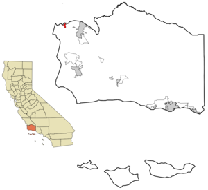
mapsize = 250x200px
map_caption = Location in Santa Barbara County and the state ofCalifornia
mapsize1 =
map_caption1 =
image_dot_
dot_mapsize =
dot_map_caption =
dot_x =
dot_y =
pushpin_
pushpin_label_position =
pushpin_map_caption =
pushpin_mapsize =
subdivision_type = Country
subdivision_name =United States
subdivision_type1 = State
subdivision_name1 =California
subdivision_type2 = County
subdivision_name2 = Santa Barbara
subdivision_type3 =
subdivision_name3 =
subdivision_type4 =
subdivision_name4 =
government_footnotes =
government_type =
leader_title = Mayor
leader_name =
leader_title1 =
leader_title1 = Senate
leader_name1 =Abel Maldonado (R)
leader_title2 = Assembly
leader_name2 =Sam Blakeslee (R)
leader_title3 = U. S. Congress
leader_name3 =Lois Capps (D)
leader_title4 =
leader_name4 =
established_title =
established_date =
established_title2 =
established_date2 =
established_title3 =
established_date3 =
area_magnitude =
unit_pref =
area_footnotes =
area_total_km2 = 3.6
area_land_km2 = 3.6
area_water_km2 = 0
area_total_sq_mi = 1.4
area_land_sq_mi = 1.4
area_water_sq_mi = 0
area_water_percent =
area_urban_km2 =
area_urban_sq_mi =
area_metro_km2 =
area_metro_sq_mi =
area_blank1_title =
area_blank1_km2 =
area_blank1_sq_mi =
population_as_of = 2000
population_footnotes =
population_note =
population_total = 5659
population_density_km2 = 1571.9
population_density_sq_mi = 4042.1
population_metro =
population_density_metro_km2 =
population_density_metro_sq_mi =
population_urban =
population_density_urban_km2 =
population_density_urban_sq_mi =
population_blank1_title =
population_blank1 =
population_density_blank1_km2 =
population_density_blank1_sq_mi =
timezone = PST
utc_offset = -8
timezone_DST = PDT
utc_offset_DST = -7
latd = 34 |latm = 57 |lats = 56 |latNS = N
longd = 120 |longm = 34 |longs = 23 |longEW = W
elevation_footnotes =
elevation_m = 26
elevation_ft = 85
postal_code_type =ZIP code
postal_code = 93434
area_code = 805
blank_name = FIPS code
blank_info = 06-31414
blank1_name = GNIS feature ID
blank1_info = 1652715
website =
footnotes =Guadalupe is a city in Santa Barbara County,
California ,United States . The population was 6,659 estimated in 2007. It was incorporated as a city onMay 19 ,1946 . It is economically and socially tied to Santa Maria.Geography
Guadalupe is located at coor dms|34|57|56|N|120|34|23|W|city (34.965588, -120.573089).GR|1 It is in the northwestern extremity of Santa Barbara County, immediately south of the
Santa Maria River . The landscape in the vicinity of the town is mostly flat, with the predominant land use being agriculture. Hills rise south of the town; on the other side isVandenberg Air Force Base . West of town, both in Santa Barbara County and north in adjacent San Luis Obispo County, is theGuadalupe-Nipomo Dunes , a large region of dune habitat along the Pacific Ocean shore.According to the
United States Census Bureau , the city has a total area of 1.4square mile s (3.6km² ), all of it land.There is a beach on the Pacific Ocean near Guadalupe. A scene from Pirates of the Caribbean III was filmed on the beach.
The railroad stops in Guadalupe. It connects with other cities like Santa Maria and Pismo Beach.
Demographics
As of the
census GR|2 of 2000, there were 5,659 people, 1,414 households, and 1,217 families residing in the city. Thepopulation density was 4,091.6 people per square mile (1,583.3/km²). There were 1,450 housing units at an average density of 1,048.4/sq mi (405.7/km²). The racial makeup of the city was 45.54% White, 0.71% African American, 1.86% Native American, 5.88% Asian, 0.16% Pacific Islander, 38.70% from other races, and 7.16% from two or more races. Hispanic or Latino of any race were 84.48% of the population.There were 1,414 households out of which 53.8% had children under the age of 18 living with them, 62.8% were married couples living together, 16.9% had a female householder with no husband present, and 13.9% were non-families. 11.2% of all households were made up of individuals and 6.2% had someone living alone who was 65 years of age or older. The average household size was 4.00 and the average family size was 4.24.
In the city the population was spread out with 35.6% under the age of 18, 11.7% from 18 to 24, 28.9% from 25 to 44, 15.2% from 45 to 64, and 8.5% who were 65 years of age or older. The median age was 27 years. For every 100 females there were 104.1 males. For every 100 females age 18 and over, there were 101.4 males.
The median income for a household in the city was $31,205, and the median income for a family was $31,042. Males had a median income of $24,250 versus $17,870 for females. The
per capita income for the city was $11,608. About 23.4% of families and 25.0% of the population were below thepoverty line , including 28.9% of those under age 18 and 15.7% of those age 65 or over.External links
Wikimedia Foundation. 2010.