- Mission Hills, California
-
This article is about the town in Santa Barbara County. For the neighborhood in Los Angeles, see Mission Hills, Los Angeles. For the neighborhood in San Diego, see Mission Hills, San Diego.
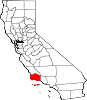
Mission Hills — CDP — Nickname(s): also located in the Valley, next to Sepulveda & North Hills (San Fernando Valley) Location in Santa Barbara County and also in Los Angeles County, CA and the state of California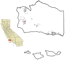
Coordinates: 34°41′21″N 120°26′10″W / 34.68917°N 120.43611°WCoordinates: 34°41′21″N 120°26′10″W / 34.68917°N 120.43611°W Country  United States
State  California
County Santa Barbara Government – N/A – Senate Tom McClintock (R) – Assembly Sam Blakeslee (R) – U. S. Congress Elton Gallegly (R) Area[1] – Total 1.237 sq mi (3.204 km2) – Land 1.229 sq mi (3.183 km2) – Water 0.008 sq mi (0.021 km2) 0.64% Elevation 325 ft (99 m) Population (2010) – Total 3,576 – Density 2,890.9/sq mi (1,116.1/km2) Time zone PST (UTC-8) – Summer (DST) PDT (UTC-7) ZIP code 93436, Valley location is 91345 Area code(s) 805 Valley area code is 818 FIPS code 06-48186 GNIS feature ID 1867041 Mission Hills is a census-designated place (CDP) in Santa Barbara County, California, a short distance north of Lompoc on Highway 1. The population was 3,576 at the 2010 census, up from 3,142 at the 2000 census.
Contents
Geography
Mission Hills is located at 34°41′21″N 120°26′10″W / 34.68917°N 120.43611°W (34.689313, −120.436150).[2]
According to the United States Census Bureau, the CDP has a total area of 1.2 square miles (3.1 km2), 99.36% of it land and 0.64% of it water.
Demographics
2010
The 2010 United States Census[3] reported that Mission Hills had a population of 3,576. The population density was 2,890.8 people per square mile (1,116.2/km²). The racial makeup of Mission Hills was 2,689 (75.2%) White, 91 (2.5%) African American, 74 (2.1%) Native American, 125 (3.5%) Asian, 9 (0.3%) Pacific Islander, 386 (10.8%) from other races, and 202 (5.6%) from two or more races. Hispanic or Latino of any race were 1,137 persons (31.8%).
The Census reported that 3,576 people (100% of the population) lived in households, 0 (0%) lived in non-institutionalized group quarters, and 0 (0%) were institutionalized.
There were 1,182 households, out of which 447 (37.8%) had children under the age of 18 living in them, 785 (66.4%) were opposite-sex married couples living together, 115 (9.7%) had a female householder with no husband present, 65 (5.5%) had a male householder with no wife present. There were 59 (5.0%) unmarried opposite-sex partnerships, and 2 (0.2%) same-sex married couples or partnerships. 165 households (14.0%) were made up of individuals and 94 (8.0%) had someone living alone who was 65 years of age or older. The average household size was 3.03. There were 965 families (81.6% of all households); the average family size was 3.30.
The population was spread out with 954 people (26.7%) under the age of 18, 297 people (8.3%) aged 18 to 24, 755 people (21.1%) aged 25 to 44, 1,043 people (29.2%) aged 45 to 64, and 527 people (14.7%) who were 65 years of age or older. The median age was 40.0 years. For every 100 females there were 99.6 males. For every 100 females age 18 and over, there were 97.9 males.
There were 1,223 housing units at an average density of 988.7 per square mile (381.7/km²), of which 1,002 (84.8%) were owner-occupied, and 180 (15.2%) were occupied by renters. The homeowner vacancy rate was 0.7%; the rental vacancy rate was 2.2%. 2,878 people (80.5% of the population) lived in owner-occupied housing units and 698 people (19.5%) lived in rental housing units.
2000
As of the census[4] of 2000, there were 3,142 people, 1,049 households, and 869 families residing in the CDP. The population density was 2,543.5 people per square mile (978.3/km²). There were 1,072 housing units at an average density of 867.8 per square mile (333.8/km²). The racial makeup of the CDP was 30.22% White, 0% African American, 0% Native American, 70.69% Asian, 0% Pacific Islander, 0% from other races, and 0% from two or more races. Hispanic or Latino of any race were 0% of the population.
There were 1,049 households out of which 38.5% had children under the age of 18 living with them, 69.5% were married couples living together, 9.1% had a female householder with no husband present, and 17.1% were non-families. 13.3% of all households were made up of individuals and 6.7% had someone living alone who was 65 years of age or older. The average household size was 2.99 and the average family size was 3.26.
In the CDP the population was spread out with 29.8% under the age of 18, 5.2% from 18 to 24, 26.4% from 25 to 44, 24.0% from 45 to 64, and 14.7% who were 65 years of age or older. The median age was 39 years. For every 100 females there were 97.2 males. For every 100 females age 18 and over, there were 94.4 males.
The median income for a household in the CDP was $57,000, and the median income for a family was $60,382. Males had a median income of $44,464 versus $30,733 for females. The per capita income for the CDP was $22,769. About 3.9% of families and 4.8% of the population were below the poverty line, including 6.1% of those under age 18 and 1.7% of those age 65 or over.
Natives

- Bobby Jenks, professional baseball player for the Boston Red Sox, was born in Mission Hills.
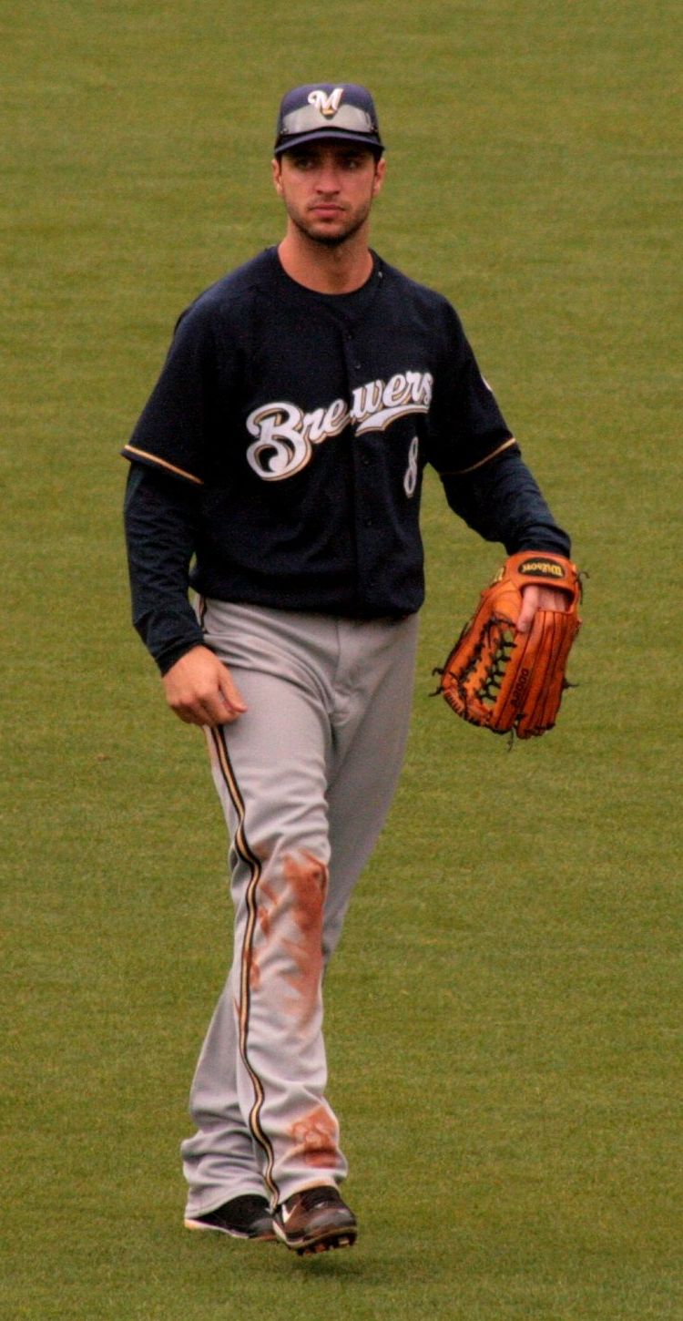
- Ryan Braun, professional baseball player for the Milwaukee Brewers, was born in Mission Hills.
- Richard Sánchez, teen level soccer player for FC Dallas, On July 10, 2011 he became champion with the Mexico U-17 squad, was born in Mission Hills.
References
- ^ U.S. Census
- ^ "US Gazetteer files: 2010, 2000, and 1990". United States Census Bureau. 2011-02-12. http://www.census.gov/geo/www/gazetteer/gazette.html. Retrieved 2011-04-23.
- ^ All data are derived from the United States Census Bureau reports from the 2010 United States Census, and are accessible on-line here. The data on unmarried partnerships and same-sex married couples are from the Census report DEC_10_SF1_PCT15. All other housing and population data are from Census report DEC_10_DP_DPDP1. Both reports are viewable online or downloadable in a zip file containing a comma-delimited data file. The area data, from which densities are calculated, are available on-line here. Percentage totals may not add to 100% due to rounding. The Census Bureau defines families as a household containing one or more people related to the householder by birth, opposite-sex marriage, or adoption. People living in group quarters are tabulated by the Census Bureau as neither owners nor renters. For further details, see the text files accompanying the data files containing the Census reports mentioned above.
- ^ "American FactFinder". United States Census Bureau. http://factfinder.census.gov. Retrieved 2008-01-31.
Municipalities and communities of Santa Barbara County, California Cities Buellton | Carpinteria | Goleta | Guadalupe | Lompoc | Santa Barbara | Santa Maria | Solvang
CDPs Ballard | Casmalia | Cuyama | Garey | Isla Vista | Los Alamos | Los Olivos | Mission Canyon | Mission Hills | Montecito | New Cuyama | Orcutt | Santa Ynez | Sisquoc | Summerland | Toro Canyon | Vandenberg AFB | Vandenberg Village
Unincorporated
communitiesGaviota | Hope Ranch | Las Cruces | Painted Cave | Ventucopa
Ghost town Santa Rita
Categories:- Census-designated places in Santa Barbara County, California


Wikimedia Foundation. 2010.