- Cuyama, California
-
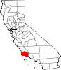
Cuyama — census-designated place — Position in California.
 Cuyama
Coordinates: 34°55′52″N 119°36′54″W / 34.93111°N 119.615°WCoordinates: 34°55′52″N 119°36′54″W / 34.93111°N 119.615°W Country  United States
State  California
County Santa Barbara Area[1] – Total 0.457 sq mi (1.186 km2) – Land 0.453 sq mi (1.174 km2) – Water 0.004 sq mi (0.011 km2) 0.96% Elevation[2] 2,293 ft (699 m) Population (2010) – Total 57 – Density 124.5/sq mi (48.1/km2) Time zone Pacific (PST) (UTC-8) – Summer (DST) PDT (UTC-7) ZIP Code GNIS feature ID 2582989 U.S. Geological Survey Geographic Names Information System: Cuyama, California Cuyama is a census-designated place in Santa Barbara County. California. It is located in the Cuyama Valley, near the Carrizo Plain. The Cuyama River runs adjacent to the town, flowing west towards the Pacific Ocean. Cuyama is surrounded by many apricot, peach, and plum orchards. The ZIP Code is 93254, and the community is inside area code 805. The population was 57 at the 2010 census.
Cuyama is located on California State Route 166 2.5 miles (4 km) east of its much-larger neighbor New Cuyama.
South of the town is the Sierra Madre mountain range, most of which is included in the Los Padres National Forest. Considerable oil and gas development has taken place at the South Cuyama Oil Field in the foothills of the Sierra Madre, just south of Cuyama and adjacent New Cuyama. In July 2005, 52,000 acres (210 km2) in Los Padres National Forest, mostly in the region immediately south of Cuyama, was opened up to further development by the National Forest Service.
Contents
Geography
According to the United States Census Bureau, the CDP covers an area of 0.5 square miles (1.2 km²), 99.04% of it land, and 0.96% of it water.
Demographics
The 2010 United States Census[3] reported that Cuyama had a population of 57. The population density was 124.5 people per square mile (48.1/km²). The racial makeup of Cuyama was 40 (70.2%) White, 0 (0.0%) African American, 2 (3.5%) Native American, 0 (0.0%) Asian, 0 (0.0%) Pacific Islander, 14 (24.6%) from other races, and 1 (1.8%) from two or more races. Hispanic or Latino of any race were 40 persons (70.2%).
The Census reported that 57 people (100% of the population) lived in households, 0 (0%) lived in non-institutionalized group quarters, and 0 (0%) were institutionalized.
There were 20 households, out of which 7 (35.0%) had children under the age of 18 living in them, 9 (45.0%) were opposite-sex married couples living together, 1 (5.0%) had a female householder with no husband present, 2 (10.0%) had a male householder with no wife present. There were 2 (10.0%) unmarried opposite-sex partnerships, and 0 (0%) same-sex married couples or partnerships. 6 households (30.0%) were made up of individuals and 2 (10.0%) had someone living alone who was 65 years of age or older. The average household size was 2.85. There were 12 families (60.0% of all households); the average family size was 3.75.
The population was spread out with 14 people (24.6%) under the age of 18, 8 people (14.0%) aged 18 to 24, 13 people (22.8%) aged 25 to 44, 17 people (29.8%) aged 45 to 64, and 5 people (8.8%) who were 65 years of age or older. The median age was 34.2 years. For every 100 females there were 137.5 males. For every 100 females age 18 and over, there were 152.9 males.
There were 30 housing units at an average density of 65.5 per square mile (25.3/km²), of which 10 (50.0%) were owner-occupied, and 10 (50.0%) were occupied by renters. The homeowner vacancy rate was 0%; the rental vacancy rate was 23.1%. 27 people (47.4% of the population) lived in owner-occupied housing units and 30 people (52.6%) lived in rental housing units.
References
- ^ U.S. Census
- ^ U.S. Geological Survey Geographic Names Information System: Cuyama, California
- ^ All data are derived from the United States Census Bureau reports from the 2010 United States Census, and are accessible on-line here. The data on unmarried partnerships and same-sex married couples are from the Census report DEC_10_SF1_PCT15. All other housing and population data are from Census report DEC_10_DP_DPDP1. Both reports are viewable online or downloadable in a zip file containing a comma-delimited data file. The area data, from which densities are calculated, are available on-line here. Percentage totals may not add to 100% due to rounding. The Census Bureau defines families as a household containing one or more people related to the householder by birth, opposite-sex marriage, or adoption. People living in group quarters are tabulated by the Census Bureau as neither owners nor renters. For further details, see the text files accompanying the data files containing the Census reports mentioned above.
See also
- USS Cuyama (AO-3) — a fleet oiler built in 1916.
Municipalities and communities of Santa Barbara County, California Cities Buellton | Carpinteria | Goleta | Guadalupe | Lompoc | Santa Barbara | Santa Maria | Solvang
CDPs Ballard | Casmalia | Cuyama | Garey | Isla Vista | Los Alamos | Los Olivos | Mission Canyon | Mission Hills | Montecito | New Cuyama | Orcutt | Santa Ynez | Sisquoc | Summerland | Toro Canyon | Vandenberg AFB | Vandenberg Village
Unincorporated
communitiesGaviota | Hope Ranch | Las Cruces | Painted Cave | Ventucopa
Ghost town Santa Rita
Categories:- Census-designated places in Santa Barbara County, California
- Unincorporated communities in California
- Populated places in California with Hispanic majority populations


Wikimedia Foundation. 2010.