- Cuyama Valley
-
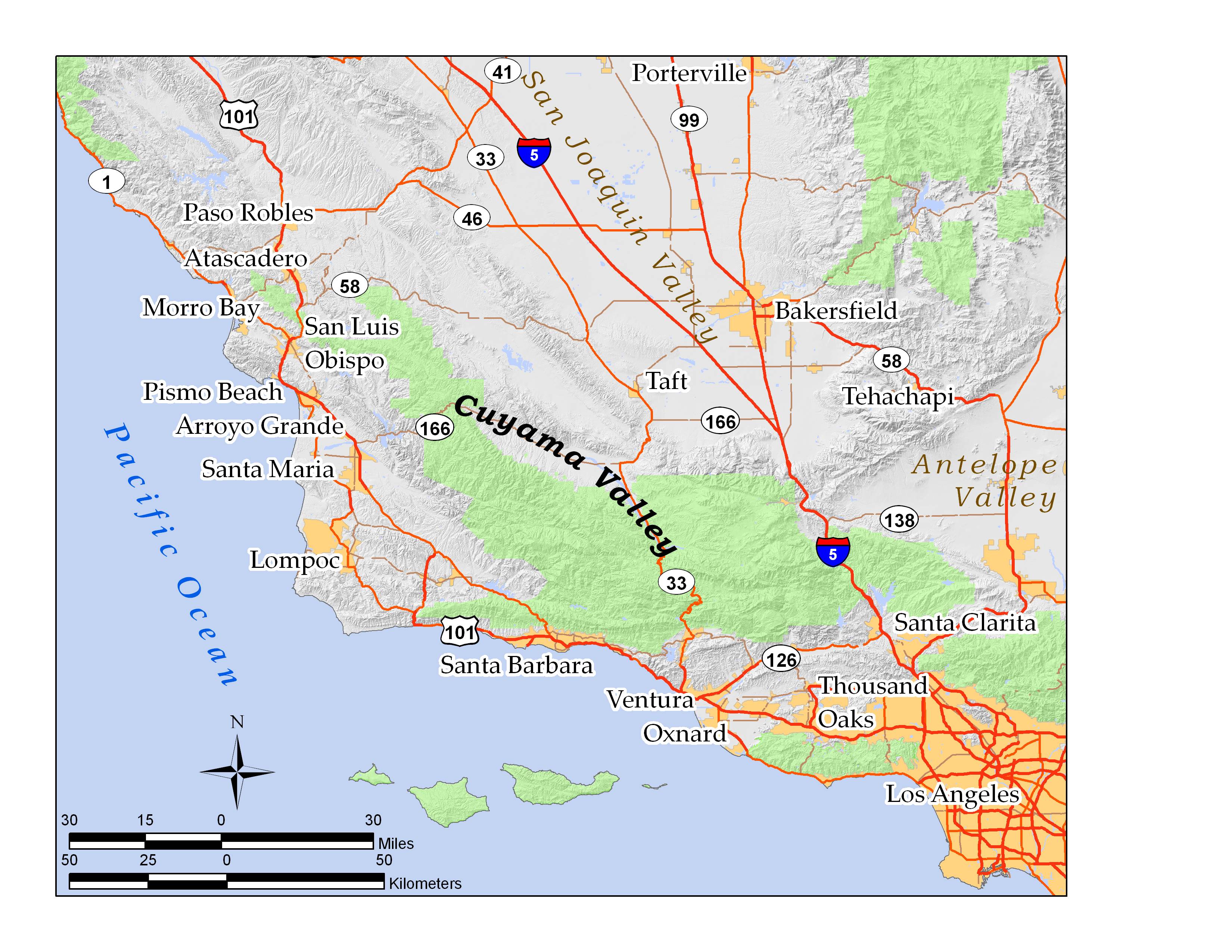
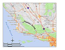 Location of the Cuyama Valley in southern and central California: green areas are national forests and national parks
The Cuyama Valley is a valley along the Cuyama River in central California, in northern Santa Barbara, southern San Luis Obispo, southwestern Kern, and northwestern Ventura counties. It is a sparsely inhabited area containing two significant towns – Cuyama and New Cuyama – and is largely used for ranching, agriculture, and oil and gas production. California State Route 166 runs along most of the length of the valley, connecting the coastal communities of Santa Maria and Arroyo Grande with the San Joaquin Valley near Bakersfield.
Contents
Geography
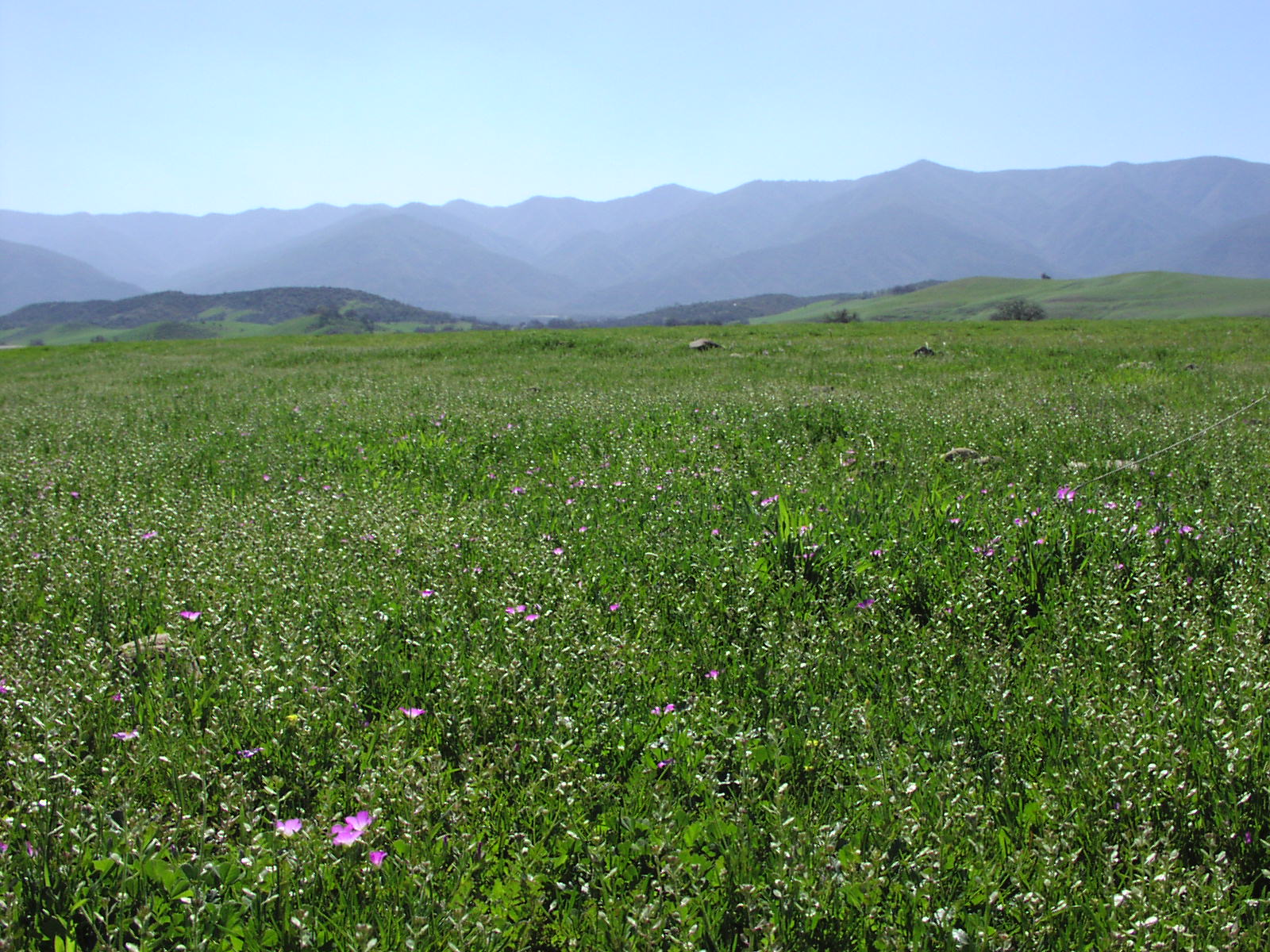
 Rugged terrain surrounding the valley
The valley encompasses an area of approximately 300 square miles (780 km2). It is bounded on all sides by mountains, and the Cuyama River escapes west through a narrow canyon to the Pacific Ocean between the Sierra Madre Mountains on the south and the La Panza Range on the north. The headwaters of the Cuyama River are just north of Pine Mountain Summit on California State Route 33, and the valley widens from there to its maximum width near the junction of Route 166 and 33, near the corner of the four counties, and then it narrows again as the river exits to the ocean between the enclosing mountain ranges. The agricultural portions are in the center, near to the major highway intersection and the two towns, where the alluvium is rich and the valley is a wide floodplain.[1]
North of the major portion of the valley is the mile-high Caliente Range, on the other side of which is the Carrizo Plain. To the east-southeast is the high backcountry of Ventura County, which includes Mount Pinos, the highest summit in the region, and the northeastern extremity of the valley ends at the San Andreas Fault, which forms a low jumble of hills over which passes Route 166; the southern San Joaquin Valley and Bakersfield are on the other side. The Los Padres National Forest is adjacent to the Cuyama Valley on the south, east, and northwest; much of the land to the north, including most of the Caliente Range, is owned by the Bureau of Land Management (BLM).
Geologically, the valley is an alluvium-filled synclinal basin, at an elevation of approximately 2,000 to 2,500 feet (600 to 800 meters). Most of the rocks are sedimentary, and the Miocene-age Monterey Formation outcrops to the south, in the foothills of the Sierra Madre. Pliocene and Pleistocene sedimentary formations occur in the foothills along the south side of the valley as well. The large Morales Thrust Fault separates the abruptly-rising block of the Caliente Range from the valley itself on the north. Scenic badlands occur in the upper reaches of the valley, north and northeast of Pine Mountain Summit; they are reachable from Route 33 via Lockwood Valley Road.[1][2]
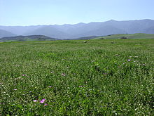
The climate of the valley is semi-arid with hot summers and cool winters. Almost all precipitation occurs in the winter in the form of rain, although snow has fallen on occasion; only five inches of rain falls annually on the valley floor, making it the driest place in coastal Central California.[3] Since the valley is open to the sea, there is occasional marine influence. The principal native vegetation on the valley floor is grassland and scrub, with chaparral and oak woodland in the hills to the south.
History
 Looking south in the Cuyama Valley towards the Sierra Madre Mountains
The native inhabitants of the valley were Chumash Indians.
In the early to middle 19th century, the first European settlers arrived, and near the end of the Mexican period of Alta California the valley was split into two land grants along the Cuyama River, the 22,193-acre (89.81 km2) Rancho Cuyama (Rojo) in 1843 and the 48,827-acre (197.60 km2) Rancho Cuyama (Lataillade) in 1846. The main land use in the 19th century was cattle grazing, although some homesteading took place in the late part of the century, especially in the side canyons, where there was more water. In 1939, the first successful water wells using a pumping system were drilled – groundwater is deep in the Cuyama Valley – and the availability of irrigation transformed the valley into an agricultural area.[1]
Little further economic development took place until the discovery of oil in 1948 at the Russell Ranch Oil Field, and more significantly, in 1949 at the much larger South Cuyama Oil Field. Richfield Oil Company, later part of ARCO, built the town of New Cuyama to house the oil workers and their associated services; they moved the oil pumped from these two fields by pipeline to a refinery near Long Beach. For a brief time in the early 1950s, the Cuyama Valley was the fourth-most productive oil region of California.[1]
As oil production declined – only about two percent of the South Cuyama Field's oil is estimated to remain[4] – the main economic activity in the valley again became agriculture, although with the sharp rise in the price of oil in 2007 and 2008, petroleum exploration has again been of interest. Recently E&B Natural Resources purchased the rights to develop the South Cuyama Oil Field from Hallador Petroleum.
See also
References
- Charles W. Jennings and Rudolph G. Strand. Geologic Map of California, Los Angeles Sheet. State of California, Division of Mines and Geology. 1969.
- Dennis W. Lantis, Rodney Steiner, Arthur E. Karinen: California, Land of Contrast, 3rd edition. Kendall/Hunt Publishing Company, Dubuque Iowa. 1977. ISBN 0-8403-0768-3
Notes
External links
Coordinates: 34°55′46″N 119°35′50″W / 34.9295°N 119.5971°W
Categories:- Landforms of Santa Barbara County, California
- Landforms of Kern County, California
- Landforms of San Luis Obispo County, California
- Landforms of Ventura County, California
- Valleys of California
- Regions of California

Wikimedia Foundation. 2010.