- Santa Ynez, California
Infobox Settlement
official_name = Santa Ynez, California
other_name =
native_name =
nickname =
settlement_type = CDP
motto =
imagesize =
image_caption =
flag_size =
image_
seal_size =
image_shield =
shield_size =
image_blank_emblem =
blank_emblem_type =
blank_emblem_size =
imagesize =
image_caption =
flag_size =
image_
seal_size =
image_shield =
shield_size =
image_blank_emblem =
blank_emblem_type =
blank_emblem_size =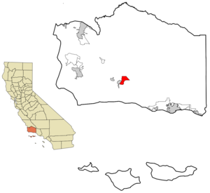
mapsize = 250x200px
map_caption = Location in Santa Barbara County and the state ofCalifornia
mapsize1 =
map_caption1 =
image_dot_
dot_mapsize =
dot_map_caption =
dot_x =
dot_y =
pushpin_
pushpin_label_position =
pushpin_map_caption =
pushpin_mapsize =
subdivision_type = Country
subdivision_name =United States
subdivision_type1 = State
subdivision_name1 =California
subdivision_type2 = County
subdivision_name2 = Santa Barbara
subdivision_type3 =
subdivision_name3 =
subdivision_type4 =
subdivision_name4 =
government_footnotes =
government_type =
leader_title = N/A
leader_name =
leader_title1 =
leader_title1 = Senate
leader_name1 =Tom McClintock (R)
leader_title2 = Assembly
leader_name2 =Pedro Nava (D)
leader_title3 = U. S. Congress
leader_name3 =Elton Gallegly (R)
leader_title4 =
leader_name4 =
established_title =
established_date =
established_title2 =
established_date2 =
established_title3 =
established_date3 =
area_magnitude =
unit_pref =
area_footnotes =
area_total_km2 = 20.2
area_land_km2 = 20.2
area_water_km2 = 0
area_total_sq_mi = 7.8
area_land_sq_mi = 7.8
area_water_sq_mi = 0
area_water_percent =
area_urban_km2 =
area_urban_sq_mi =
area_metro_km2 =
area_metro_sq_mi =
area_blank1_title =
area_blank1_km2 =
area_blank1_sq_mi =
population_as_of = 2000
population_footnotes =
population_note =
population_total = 4584
population_density_km2 = 226.9
population_density_sq_mi = 587.7
population_metro =
population_density_metro_km2 =
population_density_metro_sq_mi =
population_urban =
population_density_urban_km2 =
population_density_urban_sq_mi =
population_blank1_title =
population_blank1 =
population_density_blank1_km2 =
population_density_blank1_sq_mi =
timezone = PST
utc_offset = -8
timezone_DST = PDT
utc_offset_DST = -7
latd = 34 |latm = 36 |lats = 43 |latNS = N
longd = 120 |longm = 5 |longs = 18 |longEW = W
elevation_footnotes =
elevation_m = 185
elevation_ft = 607
postal_code_type =ZIP code
postal_code = 93460
area_code = 805
blank_name = FIPS code
blank_info = 06-70182
blank1_name = GNIS feature ID
blank1_info = 1661407
website =
footnotes =Santa Ynez is a
census-designated place (CDP) in Santa Barbara County,California ,United States . The town of Santa Ynez is one of the communities that make up theSanta Ynez Valley . The population was 4,584 at the 2000 census. It is named afterSaint Ines , Ynez being the formerSpanish language spelling.Geography
Santa Ynez is located at coor dms|34|36|43|N|120|5|18|W|city (34.612080, -120.088262)GR|1.
According to the
United States Census Bureau , the CDP has a total area of 7.8 square miles (20.2 km²); none of it is covered by water.Demographics
As of the
census GR|2 of 2000, there were 4,584 people, 1,627 households, and 1,277 families residing in the CDP. Thepopulation density was 586.7 people per square mile (226.6/km²). There were 1,670 housing units at an average density of 213.7/sq mi (82.6/km²). The racial makeup of the CDP was 91.84% White, 0.17% African American, 1.22% Native American, 1.29% Asian, 0.02% Pacific Islander, 3.08% from other races, and 2.38% from two or more races. Hispanic or Latino of any race were 9.21% of the population.There were 1,627 households out of which 36.3% had children under the age of 18 living with them, 68.0% were married couples living together, 7.4% had a female householder with no husband present, and 21.5% were non-families. 15.5% of all households were made up of individuals and 7.0% had someone living alone who was 65 years of age or older. The average household size was 2.78 and the average family size was 3.09.
In the CDP the population was spread out with 26.2% under the age of 18, 4.7% from 18 to 24, 25.5% from 25 to 44, 28.8% from 45 to 64, and 14.9% who were 65 years of age or older. The median age was 42 years. For every 100 females there were 90.7 males. For every 100 females age 18 and over, there were 88.4 males.
The median income for a household in the CDP was $80,284, and the median income for a family was $84,467. Males had a median income of $56,286 versus $45,688 for females. The
per capita income for the CDP was $33,811. About 3.0% of families and 5.5% of the population were below thepoverty line , including 7.1% of those under age 18 and 2.4% of those age 65 or over.The Santa Ynez Band of Chumash Indians operates the Chumash Casino in Santa Ynez.
Politics
In the state legislature Santa Ynez is located in the 19th Senate District, represented by Republican
Tom McClintock , and in the 35th Assembly District, represented by DemocratPedro Nava . Federally, Santa Ynez is located inCalifornia's 24th congressional district , which has a Cook PVI of R +5 [cite web | title = Will Gerrymandered Districts Stem the Wave of Voter Unrest? | publisher = Campaign Legal Center Blog | url=http://www.clcblog.org/blog_item-85.html | accessdate = 2008-02-10] and is represented by RepublicanElton Gallegly .External links
* [http://www.syvnews.com/ Santa Ynez Valley News]
* [http://www.chumashcasino.com Chumash Casino]
* [http://www.airnav.com/airport/KIZA Santa Ynez Airport]
Wikimedia Foundation. 2010.