- Solano County, California
-
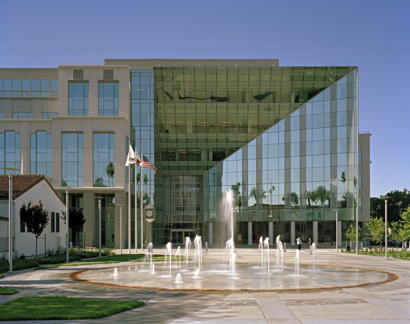
County of Solano — County — The Solano County Government Center in Downtown Fairfield
SealLocation in the state of California California's location in the United States
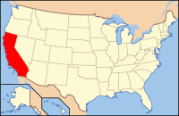
Country  United States
State  California
Region/Metro area San Francisco Bay Area Incorporated 1850 County seat Fairfield Largest city Vallejo Area – Total 2,348.3 km2 (906.67 sq mi) – Land 2,147.6 km2 (829.19 sq mi) – Water 200.7 km2 (77.48 sq mi) Population (2010) – Total 413,344 – Density 176/km2 (455.9/sq mi) Time zone Pacific Standard Time (UTC-8) – Summer (DST) Pacific Daylight Time (UTC-7) Area code(s) 707 Website www.co.solano.ca.us Solano County is a county located in Bay-Delta region of the U.S. state of California, about halfway between San Francisco and Sacramento and is one of the nine San Francisco Bay Area counties. The county's population was reported by the U.S. Census to be 413,344 in 2010. The county seat is Fairfield and the largest city is Vallejo.
Contents
History
Solano County was one of the original counties of California, created in 1850 at the time of statehood. Prior to statehood, it had been referred to as Benicia County.[citation needed]
At the request of General Mariano Vallejo, the county derives its name directly from an Indian Chief, Chief Solano of the Suisunes, a Native American tribe of the region and Vallejo's close ally. Chief Solano at one time led the tribes between the Petaluma River and the Sacramento River. The chief was also called Sem-Yeto, which signifies "brave or fierce hand." The Chief was given the Spanish name Francisco Solano during baptism at the Catholic Mission, and is named after the Spanish Franciscan missionary, Father Francisco Solano. "Solano" is a common surname in the north of Spain, specially in Navarra, Zaragoza and La Rioja.
Travis Air Force Base is located just east of Fairfield.
Geography
According to the 2000 census, the county has a total area of 906.67 square miles (2,348.3 km2), of which 829.19 square miles (2,147.6 km2) (or 91.45%) is land and 77.48 square miles (200.7 km2) (or 8.55%) is water.[1]
A portion of the South Campus at the University of California, Davis is in Solano County.
Cities and towns
Unincorporated communities
- Bahia
- Birds Landing
- Bucktown - within or just outside of NW Vacaville.
- Collinsville
- Cordelia - located within the city limits of Fairfield.
- Elmira
- Green Valley
- Maine Prairie
- Scandia - The name “Scandia” is part of the cultural landscape of Solano County. It means “Little Norway,” and refers to the Scandinavian pioneers who settled the area southeast of present-day Fairfield. In 1852, three Norwegian seafarers – Carl H. Thompson and his brother Dan, and Steve Larsen – purchased a small sailboat in San Francisco and headed up the Sacramento River. Apparently their destination was the gold fields of the Mother Lode region; however, they missed the main channel of the river and found themselves in Montezuma Slough which is located a few miles south of present-day Travis Air Force Base (AFB). They abandoned their boat there and walked inland to Calaveras County. After two years of work, and finding little gold, the three Norwegians returned to Montezuma Slough, built a small house, and raised sheep and cattle. Gradually other Scandinavians took up farming in the area, and ‘Little Norway’ became the accepted name of the area east and south of Denverton.
Adjacent counties
- Contra Costa County, California - south
- Sonoma County, California - west
- Napa County, California - west
- Yolo County, California - north
- Sacramento County, California - east

Yolo County Sonoma County and Napa County 
Sacramento County  Solano County, California

Contra Costa County National protected area
Environment
Endangered species
Solano county has a number of rare and endangered species including the beetle Elaphrus viridis, the wildflower Lasthenia conjugens, commonly known as Contra Costa goldfields and the annual plant Legenere limosa or False Venus' looking glass.
Solano County has several inactive cinnabar mines including the Hastings Mine and St. John's Mine,[2] both of which are subject to ongoing environmental monitoring; these mines were worked in the first half of the twentieth century.
Transportation infrastructure
Major highways
 Interstate 80
 Interstate 505
 Interstate 680
 Interstate 780
 State Route 12
 State Route 29
 State Route 37
 State Route 84
 State Route 113
Public transportation
Solano County is served by several transit agencies:
- SolTrans, formed as a merger between these two existing transit agencies:
- Vallejo Transit, which also operates the Baylink Ferry to San Francisco
- Benicia Breeze
- Fairfield Suisun Transit
- Vacaville City Coach
- Rio Vista Delta Breeze
Each agency interconnects with each other, enabling transit trips throughout the county. Service also connects with BART stations in Contra Costa County. Transit links are provided to Napa, Yolo and Sacramento counties as well.
Greyhound and Amtrak provide long-distance intercity service.
Airports
General aviation airports in Solano County which are open to the public are the Nut Tree Airport and Rio Vista Municipal Airport.
Demographics
Historical populations Census Pop. %± 1850 580 — 1860 7,169 1,136.0% 1870 16,871 135.3% 1880 18,475 9.5% 1890 20,946 13.4% 1900 24,143 15.3% 1910 27,559 14.1% 1920 40,602 47.3% 1930 40,834 0.6% 1940 49,118 20.3% 1950 104,833 113.4% 1960 134,597 28.4% 1970 169,941 26.3% 1980 235,203 38.4% 1990 340,421 44.7% 2000 394,542 15.9% 2010 413,344 4.8% 2010
The 2010 United States Census reported that Solano County had a population of 413,344. The racial makeup of Solano County was 210,751 (51.0%) White, 60,750 (14.7%) African American, 3,212 (0.8%) Native American, 60,473 (14.6%) Asian, 3,564 (0.9%) Pacific Islander, 43,236 (10.5%) from other races, and 31,358 (7.6%) from two or more races. Hispanic or Latino of any race were 99,356 persons (24.0%).[3]
Population reported at 2010 United States Census The County Total
PopulationWhite African
AmericanNative
AmericanAsian Pacific
Islanderother
racestwo or
more racesHispanic
or Latino
(of any race)Solano County 413,344 210,751 60,750 3,212 60,473 3,564 43,236 31,358 99,356 Incorporated
cities and townsTotal
PopulationWhite African
AmericanNative
AmericanAsian Pacific
Islanderother
racestwo or
more racesHispanic
or Latino
(of any race)Benicia 26,997 19,568 1,510 135 2,989 102 895 1,798 3,248 Dixon 18,351 13,023 562 184 671 58 2,838 1,015 7,426 Fairfield 105,321 48,407 16,586 869 15,700 1,149 13,301 9,309 28,789 Rio Vista 7,360 6,003 372 53 359 15 288 270 914 Suisun City 28,111 10,805 5,713 196 5,348 340 2,898 2,811 6,753 Vacaville 92,428 61,301 9,510 846 5,606 532 8,136 6,497 21,121 Vallejo 115,942 38,064 25,572 757 28,895 1,239 12,759 8,656 26,165 Census-designated
placesTotal
PopulationWhite African
AmericanNative
AmericanAsian Pacific
Islanderother
racestwo or
more racesHispanic
or Latino
(of any race)Allendale 1,506 1,239 49 22 42 2 79 73 235 Elmira 188 150 1 10 2 0 17 8 47 Green Valley 1,625 1,412 41 6 82 9 20 55 121 Hartley 2,510 1,956 70 24 70 16 248 126 510 Unincorporated
communitiesTotal
PopulationWhite African
AmericanNative
AmericanAsian Pacific
Islanderother
racestwo or
more racesHispanic
or Latino
(of any race)All others not CDPs (combined) 13,005 8,823 764 110 709 102 1,757 740 4,027 2000
As of the census[4] of 2000, there were 394,542 people, 130,403 households, and 97,411 families residing in the county. The population density was 476 people per square mile (184/km²). There were 134,513 housing units at an average density of 162 per square mile (63/km²). The racial makeup of the county was 56.37% White, 14.91% Black or African American, 0.79% Native American, 12.75% Asian, 0.78% Pacific Islander, 8.01% from other races, and 6.39% from two or more races. 17.64% of the population were Hispanic or Latino of any race. 8.5% were of German, 6.4% Irish and 6.0% English ancestry according to Census 2000. 75.7% spoke English, 12.1% Spanish and 6.6% Tagalog as their first language.
There were 130,403 households out of which 39.90% had children under the age of 18 living with them, 55.70% were married couples living together, 13.80% had a female householder with no husband present, and 25.30% were non-families. 19.60% of all households were made up of individuals and 6.50% had someone living alone who was 65 years of age or older. The average household size was 2.90 and the average family size was 3.33.
In the county the population was spread out with 28.30% under the age of 18, 9.20% from 18 to 24, 31.30% from 25 to 44, 21.70% from 45 to 64, and 9.50% who were 65 years of age or older. The median age was 34 years. For every 100 females there were 101.50 males. For every 100 females age 18 and over, there were 100.20 males.
The median income for a household in the county was $54,099, and the median income for a family was $60,597. Males had a median income of $41,787 versus $31,916 for females. The per capita income for the county was $21,731. About 6.10% of families and 8.30% of the population were below the poverty line, including 10.30% of those under age 18 and 6.30% of those age 65 or over.
Politics
Solano County vote
by party in presidential electionsYear GOP DEM Others 2008 34.9% 56,035 63.5% 102,095 2.1% 3,458 2004 41.9% 62,301 57.2% 85,096 1.0% 1,440 2000 39.2% 51,604 57.0% 75,116 3.8% 5,015 1996 34.7% 40,742 55.1% 64,644 10.1% 11,893 1992 29.4% 38,883 48.7% 64,320 21.9% 28,908 1988 47.4% 50,314 51.2% 54,344 1.4% 1,430 1984 54.5% 51,678 44.3% 41,982 1.2% 1,138 1980 50.7% 40,919 38.4% 30,952 10.9% 8,805 1976 42.4% 26,136 54.6% 33,682 3.0% 1,826 1972 54.0% 31,314 42.7% 24,766 3.3% 1,885 1968 34.7% 17,683 53.5% 27,271 11.8% 5,998 1964 30.4% 15,263 69.5% 34,930 0.1% 47 1960 40.9% 18,751 58.8% 26,977 0.3% 141 1956 41.7% 17,865 58.1% 24,903 0.2% 95 1952 42.4% 19,369 57.2% 26,130 0.5% 216 1948 33.7% 12,345 63.5% 23,257 2.8% 1,022 1944 29.8% 10,361 69.9% 24,335 0.3% 105 1940 28.5% 6,081 70.6% 15,054 0.9% 193 1936 20.9% 3,603 78.1% 13,459 1.1% 182 1932 30.3% 4,382 67.2% 9,712 2.5% 367 1928 52.3% 7,061 46.5% 6,278 1.2% 158 1924 48.0% 4,782 9.6% 957 42.4% 4,223 1920 64.8% 7,102 26.9% 2,954 8.3% 909 Solano is a strongly Democratic county in presidential and congressional elections, though it usually gives somewhat higher vote percentages to Republicans compared to the eight other Bay Area counties. The last Republican to win a majority in the county was Ronald Reagan in 1984.
Solano is part of California's 3rd, 7th, and 10th congressional districts. The 3rd is represented by Republican Dan Lungren and the 7th by Democrat George Miller. The 10th has been vacant since Ellen Tauscher was appointed to be Undersecretary of State, and was filled in a special election on November 3, 2009 by Democrat John Garamendi. In the State Assembly Solano is in the 7th and 8th Assembly districts, which are held by Democrats Michael Allen and Mariko Yamada, respectively. In the California State Senate, Solano is part of the 2nd and 5th Senate districts, which are held by Democrats Noreen Evans and Lois Wolk, respectively.
On Nov. 4, 2008, Solano County voted 55.9% for Proposition 8, which amended the California Constitution to ban same-sex marriages. It was the only Bay Area county to approve the initiative. In the 2008 presidential election that day, Barack Obama carried the county by a 28.5% margin over John McCain, a larger margin than statewide (24%).[5]
Trivia
- In 1985 Humphrey the humpback whale strayed off his migration route and ended up in Shag Slough north of Rio Vista at which point rescuers from The Marine Mammal Center and other volunteers after dismantling a county bridge were able to turn him around in the narrow slough.
See also
- Hiking trails in Solano County
- List of school districts in Solano County, California
- National Register of Historic Places listings in Solano County, California
- Solano County Library
References
- ^ "Census 2000 U.S. Gazetteer Files: Counties". United States Census. http://www.census.gov/tiger/tms/gazetteer/county2k.txt. Retrieved 2011-02-13.
- ^ C.Michael Hogan, Marc Papineau et al., Environmental Assessment of the columbus Parkway Widening between Ascot Parkway and the Northgate Development, Vallejo, Earth Metrics Inc. Report 7853, California State Clearinghouse, Sept, 1989
- ^ "2010 Census P.L. 94-171 Summary File Data". United States Census Bureau. http://www2.census.gov/census_2010/01-Redistricting_File--PL_94-171/California/.
- ^ "American FactFinder". United States Census Bureau. http://factfinder.census.gov. Retrieved 2008-01-31.
- ^ U.S. Election Atlas
External links
- Solano County official website
- J. P. Munro-Fraser, History of Solano County...and histories of its cities, towns...etc., Wood, Alley & Co., East Oakland, 1879. Early History of Solano County
Municipalities and communities of Solano County, California Cities 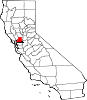
CDPs Allendale | Elmira | Green Valley | Hartley
Unincorporated
communitiesBahia | Batavia | Birds Landing | Bucktown | Collinsville | Montezuma | Rockville | Yolano
 State of California
Topics - Climate
- Delegations
- Deserts
- Districts
- Ecology
- Elections
- Environment
- Geography
- Government
- History
- Protected areas
- Sports
- Symbols
- Transportation
- Visitor attractions
- Index of California-related articles
Society Regions - Antelope Valley
- Big Sur
- Cascade Range
- Central California
- Central Coast
- Central Valley
- Channel Islands
- Coachella Valley
- Conejo Valley
- Cucamonga Valley
- Death Valley
- East Bay (SF)
- East County (SD)
- Eastern California
- Emerald Triangle
- Gold Country
- Great Basin
- Greater Los Angeles
- Greater Sacramento
- Inland Empire
- Lake Tahoe
- Los Angeles Basin
- Lost Coast
- Metropolitan Fresno
- Mojave
- Mountain Empire
- North Bay (SF)
- North Coast
- North County (SD)
- Northern California
- Owens Valley
- Oxnard Plain
- San Francisco Peninsula
- Pomona Valley
- Sacramento Valley
- San Bernardino Valley
- San Diego–Tijuana
- San Fernando Valley
- San Francisco Bay Area
- San Gabriel Valley
- San Joaquin Valley
- Santa Clara Valley
- Santa Clara River Valley
- Santa Clarita Valley
- Shasta Cascade
- Sierra Nevada
- Silicon Valley
- South Bay (LA)
- South Bay (SF)
- South Bay (SD)
- South Coast
- Southern California
- Southern Border Region
- Tri-Valley
- Upstate California
- Victor Valley
- Wine Country
- Yosemite
Metro areas - Bakersfield
- Chico
- El Centro
- Fresno
- Hanford–Corcoran
- Los Angeles–Long Beach–Glendale
- Madera
- Modesto
- Merced
- Napa
- Oakland–Fremont–Hayward
- Oxnard–Thousand Oaks–Ventura
- Redding
- Riverside–San Bernardino–Ontario
- Sacramento–Arden Arcade–Roseville
- Salinas
- San Diego–Carlsbad–San Marcos
- San Francisco–San Mateo–Redwood City
- San Jose–Sunnyvale–Santa Clara
- San Luis Obispo–Paso Robles
- Santa Ana–Anaheim–Irvine
- Santa Barbara–Santa Maria–Goleta
- Santa Cruz–Watsonville
- Santa Rosa–Petaluma
- Stockton
- Vallejo–Fairfield
- Visalia–Porterville
- Yuba City
Micro areas Counties - Alameda
- Alpine
- Amador
- Butte
- Calaveras
- Colusa
- Contra Costa
- Del Norte
- El Dorado
- Fresno
- Glenn
- Humboldt
- Imperial
- Inyo
- Kern
- Kings
- Lake
- Lassen
- Los Angeles
- Madera
- Marin
- Mariposa
- Mendocino
- Merced
- Modoc
- Mono
- Monterey
- Napa
- Nevada
- Orange
- Placer
- Plumas
- Riverside
- Sacramento
- San Benito
- San Bernardino
- San Diego
- San Francisco
- San Joaquin
- San Luis Obispo
- San Mateo
- Santa Barbara
- Santa Clara
- Santa Cruz
- Shasta
- Sierra
- Siskiyou
- Solano
- Sonoma
- Stanislaus
- Sutter
- Tehama
- Trinity
- Tulare
- Tuolumne
- Ventura
- Yolo
- Yuba
Coordinates: 38°16′N 121°56′W / 38.27°N 121.94°W
Categories:- Solano County, California
- Counties in the San Francisco Bay Area
- Metropolitan areas of California
- California counties


Wikimedia Foundation. 2010.