- Pleasant Hill, California
Infobox Settlement
official_name = Pleasant Hill, California
settlement_type =City 
imagesize =
image_caption = City Hall - Pleasant Hill, CA
image_
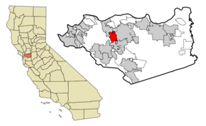
mapsize = 250x200px
map_caption = Location in Contra Costa County and the state ofCalifornia
mapsize1 =
map_caption1 =
subdivision_type = Country
subdivision_type1 = State
subdivision_type2 = County
subdivision_name =United States
subdivision_name1 =California
subdivision_name2 = Contra Costa
government_type =
leader_title = Mayor
leader_name =
leader_title1 = Senate
leader_name1 =Tom Torlakson (D)
leader_title2 = Assembly
leader_name2 =Loni Hancock (D)
leader_title3 = U. S. Congress
leader_name3 =Ellen Tauscher (D)
established_date =
area_magnitude =
area_total_km2 = 18.4
area_total_sq_mi = 7.1
area_land_km2 = 18.4
area_land_sq_mi = 7.1
area_water_km2 = 0
area_water_sq_mi = 0
elevation_ft = 52
elevation_m = 16
population_as_of = 2007
population_footnotes =
population_total = 32689
population_metro =
population_density_km2 = 1784.6
population_density_sq_mi = 4624.9
timezone = PST
utc_offset = -8
latd = 37 |latm = 57 |lats = 6 |latNS = N
longd = 122 |longm = 4 |longs = 20 |longEW = W
timezone_DST = PDT
utc_offset_DST = -7
postal_code_type =ZIP code
postal_code = 94523
area_code = 925
blank_name = FIPS code
blank_info = 06-57764
blank1_name = GNIS feature ID
blank1_info = 1659406
footnotes =
website =Pleasant Hill is a city in Contra Costa County,
California , in the East Bay of theSan Francisco Bay Area . The population was 32,837 at the 2000 census. It was incorporated in1961 . Pleasant Hill is the home of College Park High School,Diablo Valley College ,John F Kennedy University , the central branch of the Contra Costa County Library system, and [http://www.pleasanthillrec.com Pleasant Hill Recreation & Park District.]Geography
According to the
United States Census Bureau , the city has a total area of 18.4km² (7.1 mi²).chools
Elementary schools
*
Christ the King Catholic School
*Gregory Gardens Elementary
*Pleasant Hill Adventist Acdemy
*Pleasant Hill Elementary
*Sequoia Elementary
*Strandwood Elementary
*Valhalla ElementaryMiddle schools
*
Christ the King Catholic School
*Pleasant Hill Adventist Acdemy
*Pleasant Hill
*Sequoia
*Valley ViewHigh schools
*College Park
*Pleasant Hill Adventist AcademyColleges
* [http://www.dvc.edu Diablo Valley College]
* [http://www.jkfu.edu John F. Kennedy University]Demographics
As of the
census GR|2 of 2000, there were 32,837 people, 13,753 households, and 8,403 families residing in the city. Thepopulation density was 1,788.2/km² (4,633.6/mi²). There were 14,034 housing units at an average density of 764.3/km² (1,980.3/mi²). The racial makeup of the city was 81.77% White, 1.53% Black or African American, 0.47% Native American, 9.43% Asian, 0.27% Pacific Islander, 2.32% from other races, and 4.19% from two or more races. 8.43% of the population were Hispanic or Latino of any race.There were 13,753 households out of which 28.0% had children under the age of 18 living with them, 48.4% were married couples living together, 9.1% had a female householder with no husband present, and 38.9% were non-families. 29.1% of all households were made up of individuals and 9.5% had someone living alone who was 65 years of age or older. The average household size was 2.35 and the average family size was 2.95.In the city the population was spread out with 21.3% under the age of 18, 7.2% from 18 to 24, 32.4% from 25 to 44, 25.8% from 45 to 64, and 13.2% who were 65 years of age or older. The median age was 39 years. For every 100 females there were 94.2 males. For every 100 females age 18 and over, there were 90.8 males.
The median income for a household in the city was $67,489, and the median income for a family was $79,001. Males had a median income of $57,278 versus $42,013 for females. The
per capita income for the city was $33,076. About 2.7% of families and 5.0% of the population were below thepoverty line , including 3.2% of those under age 18 and 4.8% of those age 65 or over.Planning and environmental factors
Pleasant Hill utilized a system of
environmental planning at a relatively early stage of its modern growth. Notably the city authorized a study ofhill side development in the 1980s that included detailed mapping ofbiota ,geotechnical hazards, sound levels and other environmental constraints. These studies were used to establish appropriatezoning and development densities for all the principal undeveloped hillside areas within the city.ister cities
*flagicon|Mexico
Chilpancingo ,Mexico
*flagicon|TurkeyMerzifon ,Turkey References
External links
* [http://www.ci.pleasant-hill.ca.us/ City of Pleasant Hill website]
* [http://www.pleasanthillchamber.com/ Pleasant Hill Chamber of Commerce website]
* [http://ph.360village.com/ Pleasant Hill Interactive Community Guide]
Wikimedia Foundation. 2010.