- Port Costa, California
Infobox Settlement
official_name = Port Costa, California
settlement_type = CDP
imagesize = 100px
image_caption = Heritage advertisment for "Port Costa" Flour
image_
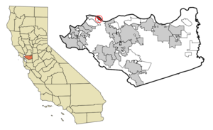
mapsize = 250x200px
map_caption = Location in Contra Costa County and the state ofCalifornia
mapsize1 =
map_caption1 =
subdivision_type = Country
subdivision_type1 = State
subdivision_type2 = County
subdivision_name =United States
subdivision_name1 =California
subdivision_name2 = Contra Costa
government_type =
leader_title = County Board
leader_name = District 1:Gayle Uilkema
leader_title1 = Senate
leader_name1 =Tom Torlakson (D)
leader_title2 = Assembly
leader_name2 = Guy Houston (R)
leader_title3 = U. S. Congress
leader_name3 = George Miller (D)
established_date =
area_magnitude =
area_total_km2 = 1.8
area_total_sq_mi = 0.7
area_land_km2 = 1.8
area_land_sq_mi = 0.7
area_water_km2 = 0
area_water_sq_mi = 0
elevation_ft = 16
elevation_m = 5
population_as_of = 2000
population_footnotes =
population_total = 232
population_metro =
population_density_km2 = 128.9
population_density_sq_mi = 331.4
timezone = PST
utc_offset = -8
latd = 38 |latm = 2 |lats = 46 |latNS = N
longd = 122 |longm = 11 |longs = 7 |longEW = W
timezone_DST = PDT
utc_offset_DST = -7
postal_code_type =ZIP code
postal_code = 94569
area_code = 510
blank_name = FIPS code
blank_info = 06-58226
blank1_name = GNIS feature ID
blank1_info = 0230948
footnotes =
website =Port Costa is a
census-designated place (CDP) in Contra Costa County,California ,United States . The population was 232 at the 2000 census.Geography
According to the
United States Census Bureau , the CDP has a total area of 0.7square mile s (1.8km² ), all of it land.History
Port Costa was founded in 1879 as a landing for the railroad
ferry "Solano", owned and operated by theCentral Pacific .Images of America: Richmond, by Donald Bastin, Arcadia Publishing (SC), November 2003] This put Port Costa on the main route of thetranscontinental railroad . The "Solano", later joined by the "Contra Costa", carried entire trains across theCarquinez Strait fromBenicia to Port Costa, from whence they continued on to theOakland Pier . For a time, it was also the United States' busiest wheat-shipping port and had a reputation as a colorful, sometimes violent community.After
California 's wheat output dropped in the early 20th Century and especially, after the Southern Pacific (which took over the operations of the Central Pacific) constructed a railroad bridge atMartinez in 1930 to replace the ferry crossing, Port Costa lost population and importance. Since the late 1960s, it has mainly been a small shopping venue for antique hunters.Demographics
As of the
census GR|2 of 2000, there were 232 people, 108 households, and 60 families residing in the CDP. Thepopulation density was 342.1 people per square mile (131.7/km²). There were 115 housing units at an average density of 169.6/sq mi (65.3/km²). The racial makeup of the CDP was 90.95% White, 0% Black,1.29% Native American, 1.29% Asian, 1.72% from other races, and 4.74% from two or more races. 6.90% of the population were Hispanic or Latino of any race.There were 108 households out of which 20.4% had children under the age of 18 living with them, 46.3% were married couples living together, 3.7% had a female householder with no husband present, and 44.4% were non-families. 34.3% of all households were made up of individuals and 8.3% had someone living alone who was 65 years of age or older. The average household size was 2.15 and the average family size was 2.80.
In the CDP the population was spread out with 15.5% under the age of 18, 4.7% from 18 to 24, 28.0% from 25 to 44, 37.5% from 45 to 64, and 14.2% who were 65 years of age or older. The median age was 46 years. For every 100 females there were 121.0 males. For every 100 females age 18 and over, there were 110.8 males.
The median income for a household in the CDP was $61,429, as was the median income for a family. Males had a median income of $40,769 versus $58,000 for females. The
per capita income for the CDP was $33,563. About 9.7% of families and 10.7% of the population were below thepoverty line , including 27.9% of those under the age of eighteen and none of those sixty five or over.100% of the residents speak English. [http://www.mla.org/map_data_results&state_id=6&county_id=&mode=place&zip=&place_id=58226&cty_id=&ll=&a=&ea=&order=r MLA Data Center] , 10-21-07]
Notes
External links
* [http://www.portcosta.com/ PortCosta.com]
Wikimedia Foundation. 2010.