- Pittsburg, California
-
- For the former settlement in Nevada County, see Pittsburg, Nevada County, California; for other uses, see Pittsburg (disambiguation).
City of Pittsburg — City — Location in Contra Costa County and the state of California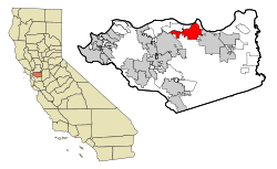
Coordinates: 38°01′41″N 121°53′05″W / 38.02806°N 121.88472°WCoordinates: 38°01′41″N 121°53′05″W / 38.02806°N 121.88472°W Country  United States
State  California
County Contra Costa Incorporated June 25, 1903 Government - Type General Law City - Senate Mark DeSaulnier (D) - Assembly Susan Bonilla (D) - U. S. Congress George Miller (D) Area[1] - Total 19.154 sq mi (49.610 km2) - Land 17.218 sq mi (44.595 km2) - Water 1.936 sq mi (5.015 km2) 10.11% Elevation[2] 26 ft (8 m) Population (2010) - Total 63,264 - Density 3,302.9/sq mi (1,275.3/km2) Time zone PST (UTC-8) - Summer (DST) PDT (UTC-7) ZIP code 94565 Area code(s) 925 FIPS code 06-57456 GNIS feature ID 1659783 Website http://www.ci.pittsburg.ca.us/ Pittsburg (formerly Black Diamond and New York of the Pacific)[3] is a city located in eastern Contra Costa County, California, the outer portion of the East Bay region of the San Francisco Bay Area. The population was 63,264 at the 2010 census.
The city has access to one BART station, the Pittsburg/Bay Point Station located in Pittsburg near Bay Point. Service will be extended further into the city via DMU train with a Railroad Avenue station that is currently under construction.[4] The current zip code is 94565 for both Pittsburg and Bay Point, and the area code is 925.
Contents
History
In 1849, Colonel Jonathan D. Stevenson (from New York) bought the Rancho Los Medanos land grant, and laid out a town he called New York of the Pacific.[5] By 1850, this venture failed.[5] With the discovery of coal in the nearby town of Nortonville, California, the place became a port for coaling, and adopted the name Black Diamond, after the mining firm[5] that built the Black Diamond Coal Mining Railroad from there to Nortonville.[6] Due to the industrial potential of the site, a name change to Pittsburg was proposed in 1909.[5]
Pittsburg, originally settled in 1839, was called first "New York Landing", then "Black Diamond", before citizens voted on "Pittsburg" on February 11, 1911. The name "Pittsburg" has at least two origins. First, it was the name of a coal mining company that built a railroad in 1865 on the eastern edge of what is now the city.[7] Second, some citizens wanted to honor Pittsburgh, Pennsylvania, (with the "H" dropped), due to the city's relations with the steel building industry, which was first established by the Columbia Geneva Steel Company.[8] The original town site fronts on the Sacramento River Delta, reflecting its origins as a deep water channel river port. (As of January 1, 2007, new state legislation will enable the city to manage its own riverfront for commercial development and subsequent port operations).[citation needed]
Since the early 1900s, the city has grown inland to the south, then spread east and west along State Route 4, now a freeway carrying resident commuters to jobs in the San Francisco Bay-Oakland Region. In the process, the former town of Cornwall, California was absorbed. The city has enjoyed continued residential redevelopment growth near its northern boundary, as well as ongoing construction of major subdivisions in the southwest hills.[citation needed] As of the 2000 census, the city had a total population of 56,769.[9]
Camp Stoneman, located in the area, was a major staging area for the United States Army during World War II and the Korean War.
The post office first opened in 1868 as Black Diamond, and changed its name with the town's in 1911.[5]
Economy
The city has an extensive history of coal mining and industrial development since the late 1800s, with USS-POSCO Industries (a joint venture between US Steel and POSCO of South Korea) and Dow Chemical Company maintaining substantial plants in Pittsburg.[citation needed] Ramar International manufactures Magnolia Dairy Ice Cream, a Philippine specialty brand, in Pittsburg.
Top employers
According to the City's 2009 Comprehensive Annual Financial Report,[10] the top employers in the city are:
# Employer # of Employees 1 Pittsburg Unified School District 965 2 USS-POSCO Industries 900 3 Los Medanos College 640 4 Dow Chemical Company 400 5 City of Pittsburg 268 6 Mi Pueblo Foods 250 7 Angelica 220 7 Ramar Foods 220 7 Wal-Mart 220 10 WinCo Foods 200 Geography
Climate
Pittsburg experiences a warm Mediterranean climate (Köppen climate classification Csa).
Climate data for Pittsburg Month Jan Feb Mar Apr May Jun Jul Aug Sep Oct Nov Dec Year Average high °C (°F) 11.7
(53.1)15.6
(60.1)21.7
(71.1)26.1
(79.0)30.0
(86.0)32.8
(91.0)32.2
(90.0)30.0
(86.0)25.6
(78.1)18.3
(64.9)17.8
(64.0)12.2
(54.0)22.8 Average low °C (°F) 3.3
(37.9)5.0
(41.0)8.3
(46.9)11.1
(52.0)13.9
(57.0)14.4
(57.9)14.4
(57.9)13.3
(55.9)10.6
(51.1)6.7
(44.1)6.7
(44.1)2.2
(36.0)9.2 Precipitation mm (inches) 69.1
(2.72)63.8
(2.51)54.9
(2.16)18.5
(0.73)11.9
(0.47)2.3
(0.09)0.8
(0.03)0.8
(0.03)6.1
(0.24)19.3
(0.76)45
(1.77)48
(1.89)338.6
(13.33)Source: [11] Education
Pittsburg is home to Los Medanos College,[12] a two-year community college that is part of the Contra Costa Community College District. The college's name is derived from that of the Rancho Los Medanos, one of the land grants made by the Mexican Government during its sovereignty over California from 1821 to 1846; Los Medanos, loosely translated from Spanish, means The Sand Dunes. Construction on Los Medanos College was completed in early 1974 and the campus opened its doors in the spring semester of 1974.[citation needed]
Pittsburg has two public high schools, one a continuation school:[13]
- Pittsburg High School
- Riverside Continuation High School
The public Junior high schools in Pittsburg are
- former (Central Junior High School)
- Hillview Junior High School
- Rancho Medanos Junior High School
The public elementary schools in Pittsburg are:
- Bel Air Elementary School (part of Mt. Diablo Unified School District)
- Delta View Elementary School (part of Mt. Diablo Unified School District)
- Foothill Elementary School
- Heights Elementary School
- Highlands Elementary School
- Los Medanos Elementary School
- Marina Vista Elementary School
- Parkside Elementary School
- Stoneman Elementary School
- Willow Cove Elementary School
Private schools in Pittsburg include the Christian Center and School of Saint Peter Martyr.
Public libraries
The Pittsburg Library of the Contra Costa County Library is located in Pittsburg.[14]
Redevelopment projects
- The city is currently in the process of redeveloping the older downtown. In November 2010 The Railroad Book Depot opened. The bookstore is owned and operated by the non-profit Pittsburg Arts & Community Foundation.[citation needed]
- A new Marina Master Plan is under development along Pittsburg's waterfront which will include a pedestrian promenade with subsequent commercial and hotel construction and development planned in 2008.[citation needed]
- An extension of the existing Bay Area Rapid Transit District (BART) rapid transit system, which includes a Pittsburg BART station at Railroad Avenue, designed for construction by 2010.[citation needed]
- A Civic Center Master Plan by the city will promote transit-oriented and mixed-use development to coincide with the construction of the new BART station adjacent to the current Civic Center.[citation needed]
- The Black Diamond Project will provide services to residents on the north side.
Recreation
The Pittsburg Delta View Golf Course has a back nine designed by Alister MacKenzie, the architect who designed the course at the Augusta National Golf Club, home of The Masters.[citation needed]
Demographics
Historical populations Census Pop. %± 1890 300 — 1900 603 101.0% 1910 2,372 293.4% 1920 4,715 98.8% 1930 9,610 103.8% 1940 9,520 −0.9% 1950 12,763 34.1% 1960 19,062 49.4% 1970 21,423 12.4% 1980 33,034 54.2% 1990 47,564 44.0% 2000 56,769 19.4% 2010 63,264 11.4% source:[15][16] 2010
The 2010 United States Census[17] reported that Pittsburg had a population of 63,264. The population density was 3,302.8 people per square mile (1,275.2/km²). The racial makeup of Pittsburg was 23,106 (36.5%) White, 11,187 (17.7%) African American, 517 (0.8%) Native American, 9,891 (15.6%) Asian (9.9% Filipino, 2.0% Indian, 1.2% Chinese, 1.1% Vietnamese, 0.2% Korean, 0.2% Japanese, 1.1% Other), 645 (1.0%) Pacific Islander, 13,270 (21.0%) from other races, and 4,648 (7.3%) from two or more races. Hispanic or Latino of any race were 26,841 persons (42.4%).
The Census reported that 62,973 people (99.5% of the population) lived in households, 153 (0.2%) lived in non-institutionalized group quarters, and 138 (0.2%) were institutionalized.
There were 19,527 households, out of which 8,837 (45.3%) had children under the age of 18 living in them, 9,833 (50.4%) were opposite-sex married couples living together, 3,583 (18.3%) had a female householder with no husband present, 1,420 (7.3%) had a male householder with no wife present. There were 1,432 (7.3%) unmarried opposite-sex partnerships, and 194 (1.0%) same-sex married couples or partnerships. 3,446 households (17.6%) were made up of individuals and 1,067 (5.5%) had someone living alone who was 65 years of age or older. The average household size was 3.22. There were 14,836 families (76.0% of all households); the average family size was 3.64.
The population was spread out with 17,385 people (27.5%) under the age of 18, 6,823 people (10.8%) aged 18 to 24, 18,319 people (29.0%) aged 25 to 44, 15,298 people (24.2%) aged 45 to 64, and 5,439 people (8.6%) who were 65 years of age or older. The median age was 32.5 years. For every 100 females there were 94.9 males. For every 100 females age 18 and over, there were 92.4 males.
There were 21,126 housing units at an average density of 1,102.9 per square mile (425.8/km²), of which 11,490 (58.8%) were owner-occupied, and 8,037 (41.2%) were occupied by renters. The homeowner vacancy rate was 3.8%; the rental vacancy rate was 6.8%. 37,078 people (58.6% of the population) lived in owner-occupied housing units and 25,895 people (40.9%) lived in rental housing units.
2000
As of the census[18] of 2000, there were 56,769 people, 17,741 households, and 13,483 families residing in the city. The population density was 3,639.0/mi² (1,405.0/km²). There were 18,300 housing units at an average density of 1,173.1/mi² (452.9/km²). The racial makeup of the city was 36.53% White, 25.89% Black or African American, 0.75% Native American, 12.65% Asian, 0.86% Pacific Islander, 16.11% from other races, and 7.22% from two or more races. 32.21% of the population were Hispanic or Latino of any race.
There were 17,741 households out of which 42.2% had children under the age of 18 living with them, 52.5% were married couples living together, 17.2% had a female householder with no husband present, and 24.0% were non-families. 18.0% of all households were made up of individuals and 5.8% had someone living alone who was 65 years of age or older. The average household size was 3.17 and the average family size was 3.59.
In the city the population was spread out with 30.8% under the age of 18, 10.4% from 18 to 24, 31.2% from 25 to 44, 19.4% from 45 to 64, and 8.2% who were 65 years of age or older. The median age was 31 years. For every 100 females there were 96.6 males. For every 100 females age 18 and over, there were 94.1 males.
The median income for a household in the city was $50,557, and the median income for a family was $54,472. Males had a median income of $39,111 versus $31,396 for females. The per capita income for the city was $18,241. About 8.7% of families and 11.5% of the population were below the poverty line, including 14.1% of those under age 18 and 7.6% of those age 65 or over.
Sister cities
 Isola delle Femmine, Italy
 Shimonoseki, Japan
 Pohang, South Korea
 Yahualica, Mexico
 Wenzhou, China (Friendship City)
- Shenyang, China (Friendship City)
References
- ^ U.S. Census
- ^ U.S. Geological Survey Geographic Names Information System: Pittsburg Post Office
- ^ U.S. Geological Survey Geographic Names Information System: Pittsburg, California
- ^ "Pittsburg/Bay Point Station overview". http://bart.gov/stations/stationguide/localareamap_baypt.asp?ct=1. Retrieved 2007-12-03.
- ^ a b c d e Durham, David L. (1998). California's Geographic Names: A Gazetteer of Historic and Modern Names of the State. Quill Driver Books. p. 681. ISBN 9781884995149.
- ^ Third Annual Report of the Board of Railroad Commissioners of the State of California for the Years ending December 31, 1880-81-82, pages 345-348.
- ^ Traci Parent and Karen Terhune, Black Diamond Mines Regional Preserve, Arcadia Publishing, 2009, pages 15, 46 and 50.
- ^ "History of Our City". Archived from the original on October 17, 2007. http://web.archive.org/web/20071017135629/http://ci.pittsburg.ca.us/Pittsburg/About+Pittsburg/Our+History/history.htm. Retrieved 2007-12-03.
- ^ "Pittsburg city, California profile". http://censtats.census.gov/data/CA/1600657456.pdf. Retrieved 2007-12-03.
- ^ City of Pittsburg CAFR
- ^ "Pittsburg historic weather averages". Intellicast. http://www.intellicast.com/local/history.aspx?location=USCA0873. Retrieved 10 February 2010.
- ^ "Los Medanos Community College". http://www.losmedanos.edu/. Retrieved 2007-12-03.
- ^ "City of Pittsburg". Archived from the original on April 16, 2008. http://web.archive.org/web/20080416143605/http://www.ci.pittsburg.ca.us/Pittsburg/Government/Departments/City+Manager/edu-high-sch.htm. Retrieved 2008-05-05.
- ^ "Pittsburg Library." Contra Costa County Library. Retrieved on April 1, 2010.
- ^ Moffatt, Riley. Population History of Western U.S. Cities & Towns, 1850-1990. Lanham: Scarecrow, 1996, 50.
- ^ "Subcounty population estimates: California 2000-2007" (CSV). United States Census Bureau, Population Division. 2009-03-18. http://www.census.gov/popest/cities/files/SUB-EST2007-6.csv. Retrieved 2009-05-10.
- ^ All data are derived from the United States Census Bureau reports from the 2010 United States Census, and are accessible on-line here. The data on unmarried partnerships and same-sex married couples are from the Census report DEC_10_SF1_PCT15. All other housing and population data are from Census report DEC_10_DP_DPDP1. Both reports are viewable online or downloadable in a zip file containing a comma-delimited data file. The area data, from which densities are calculated, are available on-line here. Percentage totals may not add to 100% due to rounding. The Census Bureau defines families as a household containing one or more people related to the householder by birth, opposite-sex marriage, or adoption. People living in group quarters are tabulated by the Census Bureau as neither owners nor renters. For further details, see the text files accompanying the data files containing the Census reports mentioned above.
- ^ "American FactFinder". United States Census Bureau. http://factfinder.census.gov. Retrieved 2008-01-31.
External links
- City of Pittsburg official website
- Pittsburg Library's official website
- Pittsburg Events Spotlight
- Pittsburg Chamber of Commerce
Municipalities and communities of Contra Costa County, California Cities and towns 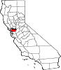
CDPs Acalanes Ridge | Alamo | Alhambra Valley | Bay Point | Bayview | Bethel Island | Blackhawk | Byron | Camino Tassajara | Castle Hill | Clyde | Contra Costa Centre | Crockett | Diablo | Discovery Bay | East Richmond Heights | El Sobrante | Kensington | Knightsen | Montalvin Manor | Mountain View | Norris Canyon | North Gate | North Richmond | Pacheco | Port Costa | Reliez Valley | Rodeo | Rollingwood | San Miguel | Saranap | Shell Ridge | Tara Hills | Vine Hill
Unincorporated
communitiesAlamo Oaks | Arbor | Avon | Bancroft | Bayo Vista | Bayview-Montalvin | Bixler | Blackhawk-Camino Tassajara | Bridgehead | Canyon | Christie | Cornwall | Crolona Heights | Diamond | Eastport | Four Corners | Franklin Canyon | Gateley | Glen Frazer | Hasford Heights | Herpoco | Hookston | Las Juntas | Los Medanos | Luzon | Maltby | Marsh Creek Springs | McAvoy | Meinert | Monsanto | Muir | Neroly | Newlove | Nichols | Oleum | Orinda Village | Orwood | Ozol | Rheem | Rock City | Selby | Shore Acres | Sobrante | Sparkle | Stege | Tassajara | Tormey | Valle Vista | Valona | Waldon | Walnut Heights | Werner
Ghost towns Acelanus | Ambrose | Atchison | Eckley | Empire | Hooper | Horse Haven | Judsonville | Junction | Nortonville | Ohmer | Point of Timber | Port Chicago | Schmidtville | Somersville | Stewartville | Tammukan | West Hartley | Winehaven

Bay Point 
Antioch  Pittsburg

Concord Clayton Categories:- Cities in Contra Costa County, California
- Cities in the San Francisco Bay Area
- Pittsburg, California
- Populated places established in 1849
- Incorporated cities and towns in California
- Populated places in the United States with Hispanic plurality populations


Wikimedia Foundation. 2010.