- Novato, California
-
City of Novato — City — Location in Marin County and the state of California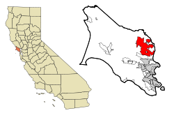
Coordinates: 38°06′27″N 122°34′11″W / 38.1075°N 122.56972°WCoordinates: 38°06′27″N 122°34′11″W / 38.1075°N 122.56972°W[1] Country  United States
State  California
County Marin Incorporated 1960[2] Government – Mayor Madeline Kellner[3] – County Board Districts 5 & 4
Judy Arnold
Steve Kinsey– Senate Mark Leno (D) – Assembly Jared Huffman (D) – U. S. Congress Lynn Woolsey (D) Area[4] – Total 27.957 sq mi (72.407 km2) – Land 27.440 sq mi (71.068 km2) – Water 0.517 sq mi (1.339 km2) 1.85% Elevation[1] 30 ft (9 m) Population (2010) – Total 51,904 – Density 1,856.6/sq mi (716.8/km2) Time zone PST (UTC-8) – Summer (DST) PDT (UTC-7) ZIP codes 94945, 94947-94949, 94998 Area code(s) 415 FIPS code 06-52582 GNIS feature ID 0277612 Website www.ci.novato.ca.us Novato (
 /nəˈvɑːtoʊ/ nə-vah-toh) is a city located in the North Bay region of the San Francisco Bay Area, in northern Marin County. Novato is located about 10 miles (16 km) north-northwest of San Rafael,[5] at an elevation of 30 feet above sea level (nine meters).[1] The 2010 U.S. Census estimated the city population to be about 51,904. Novato is about 30 miles (48 km) north of San Francisco on U.S. 101.
Contents
History
What is now Novato was originally the site of several Coast Miwok villages: Chokeche, near downtown Novato, Puyuku, near Ignacio, and Olompali, at the present Olompali State Historic Park.[6]
In 1839 the Mexican government granted the 8,876-acre (35.92 km2) Rancho Novato to Fernando Feliz. The rancho was named after a local Miwok leader who had probably been given the name of Saint Novatus at his baptism.[7] Subsequently four additional land grants were made in the area; Rancho Corte Madera de Novato to John Martin in 1839, Rancho San Jose to Ignacio Pacheco in 1840, Rancho Olompali awarded in 1843 to Camilo Ynitia, son of a Coast Miwok chief, and Rancho Nicasio, by far the largest at 56,621 acres (229.1 km2), awarded to Pablo de la Guerra and John B.R. Cooper in 1844.[8] Novato, along with the rest of California, became part of the United States on February 2, 1848. Early pioneers included Joseph Sweetser and Francis De Long who bought 15,000 acres (61 km2) in the mid-1850s and planted orchards and vineyards.
The first post office at Novato opened in 1856; it closed in 1860, and a new post office opened in 1891.[5]
The first school was built in 1859 at the corner of Grant Avenue at what is today Redwood Boulevard.
The original town was located around Novato Creek at what is now South Novato Boulevard. A railroad was built in 1879, connecting Novato to Sonoma County and San Rafael. The area around the train depot became known as New Town, and forms the edge of what today is Old Town Novato. The current depot was built in 1917, but closed in 1959 and is largely derelict. The depot consisted of two buildings, a warehouse and a station. The warehouse burned twice in the intervening years and was torn down in late 2007 to make way for a Whole Foods development, while the station is still standing.
A Presbyterian church, still a landmark in Novato today, was built in 1896. Until 2006 it housed a number of City offices, but was vacated that year due to safety concerns and condemned. The church has since been renovated.
The Great Depression of the 1930s had a marked effect on the area as many farmers lost their land. After World War II, Novato grew quickly with the construction of tract homes and a freeway. As the area was unincorporated much of the growth was unplanned and uncontrolled. Novato was finally incorporated as a city in 1960.[2] One of the most important venues of the time (1960 to 1965) was "Western Weekend". Beard growing contests sponsored by Bob's Barber Shop and many other odd activities helped to bring this community together.
A program titled A Century of Gentle Seasons, The History of Novato, was released on DVD in 2009 and tells the varied stories of Novato's vibrant community.
Geography
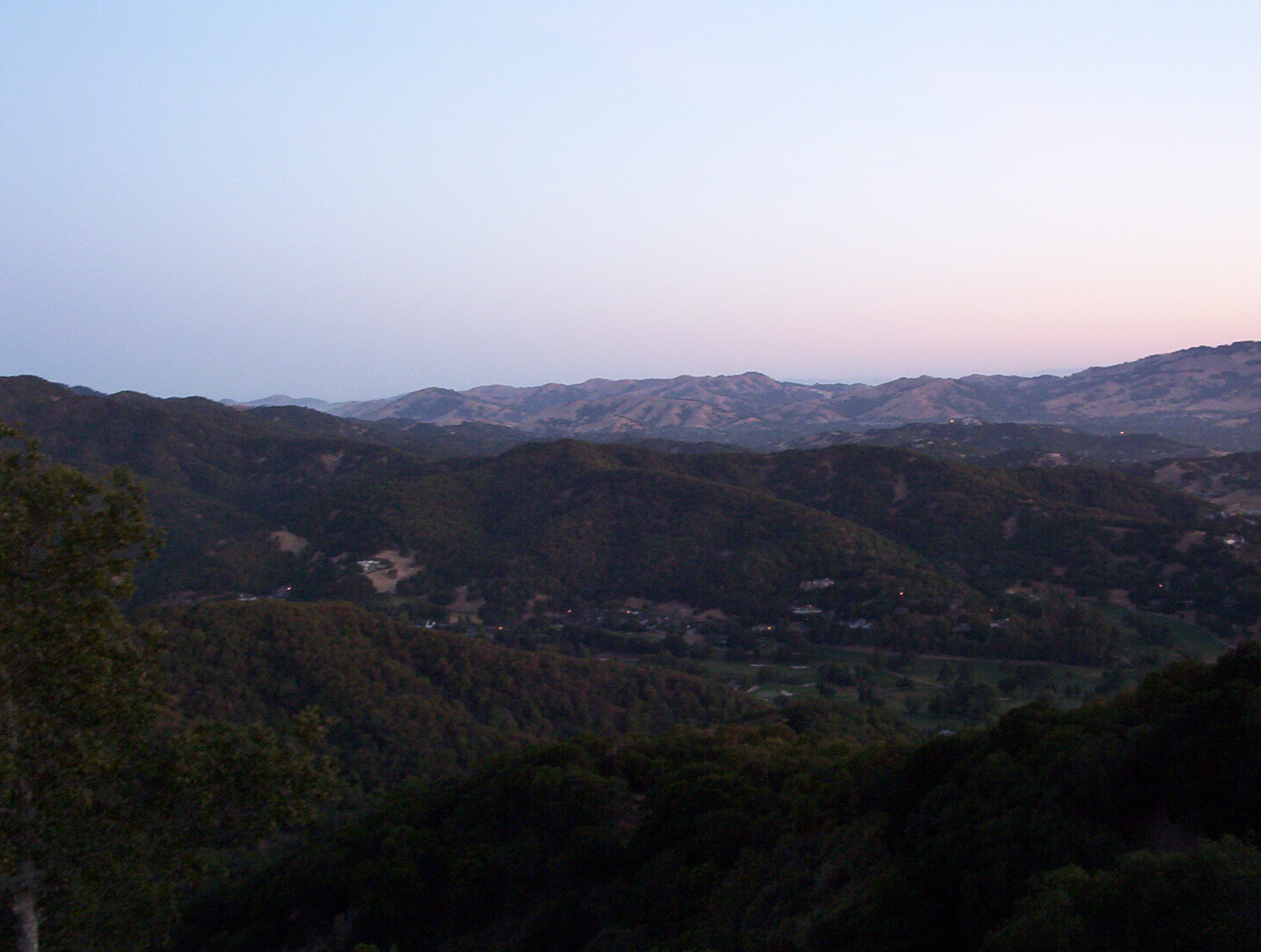
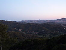 An early morning view from Big Rock Ridge trail.
According to the United States Census Bureau, the city has a total area of 28.0 square miles (73 km2). 27.4 square miles (71 km2) of it is land and 0.5 square miles (1.3 km2) of it (1.85%) is water.
Major geographical features nearby include Mount Burdell to the north and Big Rock Ridge to the southwest. Stafford Lake to the west is a secondary water supply for Novato, with the Russian River in Sonoma County to the north supplying most of the city's water. Novato includes ten of Marin County's open space preserves: Mount Burdell, Rush Creek, Little Mountain, Verissimo Hills, Indian Tree, Deer Island, Indian Valley, Ignacio Valley, Loma Verde and Pacheco Valley.
Climate
Novato has warm, mostly dry summers and cool, wet winters.
Official weather observations were taken at Hamilton Air Force Base through 1964. Average January temperatures were a maximum of 53.6 °F (12.0 °C) and a minimum of 38.7 °F (3.7 °C). Average July temperatures were a maximum of 79.9 °F (26.6 °C) and a minimum of 52.0 °F (11.1 °C). There were an average of 12.4 days with highs of 90 °F (32 °C) or higher and an average of 12.5 days with lows of 32 °F (0 °C) or lower. The record high temperature was 107 °F (42 °C) on September 9, 1944. The record low temperature was 23 °F (−5 °C) on January 13, 1963. Average annual precipitation was 25.49 inches (64.7 cm). The wettest year was 1940 with 46.63 inches (118.4 cm) and the driest year was 1939 with 9.44 inches (24.0 cm). The most rainfall in one month was 18.87 inches (47.9 cm) in December 1955. The most rainfall in 24 hours was 3.89 inches (9.9 cm) on October 12, 1962.[9]
Today, the nearest National Weather Service cooperative weather station is in San Rafael, where records date back to 1894. Compared to records from Hamilton Air Force Base, San Rafael is generally several degrees warmer than Novato and has an average of about 10 inches (25 cm) more rainfall. The record high temperature in San Rafael was 110 °F (43 °C) on September 7, 1904, and June 14, 1961. The record low temperature was 20 °F (−7 °C) on December 26, 1967.[10]
Demographics
2010
The 2010 United States Census[11] reported that Novato had a population of 51,904. The population density was 1,856.6 people per square mile (716.8/km²). The racial makeup of Novato was 39,443 (76.0%) White, 1,419 (2.7%) African American, 286 (0.6%) Native American, 3,428 (6.6%) Asian, 117 (0.2%) Pacific Islander, 4,693 (9.0%) from other races, and 2,518 (4.9%) from two or more races. Hispanic or Latino of any race were 11,046 persons (21.3%).
The Census reported that 51,278 people (98.8% of the population) lived in households, 449 (0.9%) lived in non-institutionalized group quarters, and 177 (0.3%) were institutionalized.
There were 20,279 households, out of which 6,679 (32.9%) had children under the age of 18 living in them, 10,393 (51.3%) were opposite-sex married couples living together, 2,237 (11.0%) had a female householder with no husband present, 854 (4.2%) had a male householder with no wife present. There were 1,010 (5.0%) unmarried opposite-sex partnerships, and 195 (1.0%) same-sex married couples or partnerships. 5,358 households (26.4%) were made up of individuals and 2,415 (11.9%) had someone living alone who was 65 years of age or older. The average household size was 2.53. There were 13,484 families (66.5% of all households); the average family size was 3.04.
The population was spread out with 11,769 people (22.7%) under the age of 18, 3,355 people (6.5%) aged 18 to 24, 12,743 people (24.6%) aged 25 to 44, 15,914 people (30.7%) aged 45 to 64, and 8,123 people (15.7%) who were 65 years of age or older. The median age was 42.6 years. For every 100 females there were 93.6 males. For every 100 females age 18 and over, there were 90.1 males.
There were 21,158 housing units at an average density of 756.8 per square mile (292.2/km²), of which 13,591 (67.0%) were owner-occupied, and 6,688 (33.0%) were occupied by renters. The homeowner vacancy rate was 1.0%; the rental vacancy rate was 4.7%. 33,252 people (64.1% of the population) lived in owner-occupied housing units and 18,026 people (34.7%) lived in rental housing units.
2000
As of the census[12] of 2000, there were 47,630 people, 18,524 households, and 12,411 families residing in the city. The population density was 1,719.2 inhabitants per square mile (663.9/km²). There were 18,994 housing units at an average density of 685.6 per square mile (264.8/km²). The racial makeup of the city in 2010 was 65.8% non-Hispanic White American, 2.5% non-Hispanic Black American, 0.2% Native American, 6.5% Asian, 0.2% Pacific Islander, 0.3% from other races, and 3.2% from two or more races. Hispanic or Latino of any race were 21.3% of the population. NOTE: The forgoing contains errors, for example the number of Hispanics and Latinos in 2000 was not 21.3%, more like 13.1% (6229 persons). For accurate facts google "Bay Area Census" and choose "Cities: and then "Novato", where you can compare 2000 and 2010 Census figures for Novato side by side.
There were 18,524 households out of which 32.1% had children under the age of 18 living with them, 52.7% were married couples living together, 10.3% had a female householder with no husband present, and 33.0% were non-families. 25.2% of all households were made up of individuals and 9.3% had someone living alone who was 65 years of age or older. The average household size was 2.52 and the average family size was 3.01.
In the city the population was spread out with 23.1% under the age of 18, 6.4% from 18 to 24, 29.9% from 25 to 44, 27.5% from 45 to 64, and 13.0% who were 65 years of age or older. The median age was 40 years. For every 100 females there were 93.6 males. For every 100 females age 18 and over, there were 90.3 males.
The median income for a household in the city was $63,453, and the median income for a family was $74,434 (these figures had risen to $78,895 and $91,890 respectively as of a 2007 estimate[13]). Males had a median income of $55,822 versus $40,287 for females. The per capita income for the city was $32,402. About 3.1% of families and 5.6% of the population were below the poverty line, including 6.1% of those under age 18 and 4.0% of those age 65 or over.
Economy
The city is home to the Fireman's Fund Insurance Company, and several small biotech firms, such as Buck Institute for Age Research, Biosearch Technologies and BioMarin Pharmaceutical. Several small technology companies are also based in Novato, such as 2K Marin, Radiant Logic, Imagemovers Digital, Toys For Bob, Enwisen, and Sonic Solutions.
The former Hamilton Air Force Base is also located in Novato, but was decommissioned in 1974 and designated a Historic District in 1998. After lying stagnant for many years, major renovations were pushed through by then-mayor Michael DiGiorgio. As of 2008 the base has largely been redeveloped into single family homes. The former hangar buildings were gutted and redeveloped into two story office buildings. Hangar tenants include ImageMovers Digital, 2K Sports, Sony Imageworks, Visual Concepts Entertainment, Smith & Hawken, The Republic of Tea, and Birkenstock Distribution USA.
Schools
- Novato High School
- San Marin High School
- Marin Oaks High School
- Hill Middle School
- Sinaloa Middle School
- San Jose Middle School
- Pleasant Valley Elementary School
- Loma Verde Elementary School
- Lu Sutton Elementary School
- Lynwood Elementary School
- Olive Elementary School
- Hamilton Elementary School
- Rancho Elementary School
- San Ramon Elementary School
- Our Lady of Loretto School (private school)
- Nova Education Center
- Samuel Hazelton School of the Arts
- Novato Charter School (charter school)
- Good Shepherd Lutheran School (Novato) (private school)
- Buck Institute for Age Research
References
- ^ a b c U.S. Geological Survey Geographic Names Information System: Novato, California
- ^ a b "Early Novato Area History". http://www.cityofnovato.org/prcs/museum.cfm. Retrieved 2007-12-06.
- ^ "City of Novato: Council Members". http://www.ci.novato.ca.us/Index.aspx?page=289. Retrieved April 17, 2011.
- ^ U.S. Census
- ^ a b Durham, David L. (1998). California's Geographic Names: A Gazetteer of Historic and Modern Names of the State. Quill Driver Books. p. 673. ISBN 9781884995149.
- ^ Peterson, Bonnie J. (1976). Dawn of the World: Coast Miwok Myths. ISBN 0-912908-04-1
- ^ Bright, William (1998). 1500 California Place Names. University of California Press. ISBN 978-0-520-21271-8.
- ^ Marin County Ranchos
- ^ http://www.wrcc.dri.edu/cgi-bin/cliMAIN.pl?ca3734
- ^ http://www.wrcc.dri.edu/cgi-bin/cliMAIN.pl?ca7880
- ^ All data are derived from the United States Census Bureau reports from the 2010 United States Census, and are accessible on-line here. The data on unmarried partnerships and same-sex married couples are from the Census report DEC_10_SF1_PCT15. All other housing and population data are from Census report DEC_10_DP_DPDP1. Both reports are viewable online or downloadable in a zip file containing a comma-delimited data file. The area data, from which densities are calculated, are available on-line here. Percentage totals may not add to 100% due to rounding. The Census Bureau defines families as a household containing one or more people related to the householder by birth, opposite-sex marriage, or adoption. People living in group quarters are tabulated by the Census Bureau as neither owners nor renters. For further details, see the text files accompanying the data files containing the Census reports mentioned above.
- ^ "American FactFinder". United States Census Bureau. http://factfinder.census.gov. Retrieved 2008-01-31.
- ^ http://factfinder.census.gov/servlet/ACSSAFFFacts?_event=Search&geo_id=16000US0646114&_geoContext=01000US%7C04000US06%7C16000US0646114&_street=&_county=novato&_cityTown=novato&_state=04000US06&_zip=&_lang=en&_sse=on&ActiveGeoDiv=geoSelect&_useEV=&pctxt=fph&pgsl=160&_submenuId=factsheet_1&ds_name=ACS_2007_3YR_SAFF&_ci_nbr=null&qr_name=null®=null%3Anull&_keyword=&_industry=
External links
Municipalities and communities of Marin County, California Cities and towns Belvedere | Corte Madera | Fairfax | Larkspur | Mill Valley | Novato | Ross | San Anselmo | San Rafael | Sausalito | Tiburon
CDPs Alto | Black Point-Green Point | Bolinas | Dillon Beach | Inverness | Kentfield | Lagunitas-Forest Knolls | Lucas Valley-Marinwood | Marin City | Muir Beach | Nicasio | Point Reyes Station | San Geronimo | Santa Venetia | Sleepy Hollow | Stinson Beach | Strawberry | Tamalpais-Homestead Valley | Tomales | Woodacre
Unincorporated
communitiesAlmonte | Bel Marin Keys | Belvedere Island | Bivalve | Black Point | Blakes Landing | Burdell | California Park | Cerro | Chapman | Cypress Grove | Dewitt | Dogtown | El Campo | Fallon | Five Brooks | Forest Knolls | Gallinas | Greenbrae | Hamlet | Harbor Point | Homestead Valley | Ignacio | Inverness Park | Jewell | Kent Woodlands | Lagunitas | Lairds Landing | Las Gallinas | Los Ranchitos | Lucas Valley | Manzanita | Marconi | Marinwood | Marshall | McDonald | McNears Beach | Meadowsweet | Millerton | Murray Park | Nicks Cove | Ocean Roar | Old Town | Olema | Paradise Cay | Reed | Reynolds | Sacramento Landing | Saint Vincent | San Antonio | San Quentin | Seahaven | Shafter | Strawberry Manor | Tamalpais Valley | Tamalpais Valley Junction | Tocaloma | Vincent Landing | Waldo
Ghost towns Categories:- Cities in Marin County, California
- Cities in the San Francisco Bay Area
- Incorporated cities and towns in California


Wikimedia Foundation. 2010.