- Dillon Beach, California
-
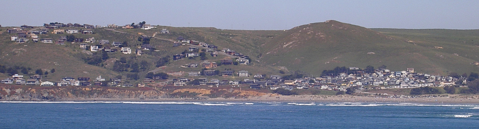
Dillon Beach — census-designated place — Dillon Beach as seen from Tomales Point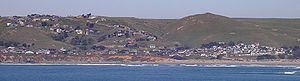 Location in Marin County and the state of California
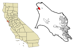
Coordinates: 38°15′03″N 122°57′55″W / 38.25083°N 122.96528°WCoordinates: 38°15′03″N 122°57′55″W / 38.25083°N 122.96528°W Country  United States
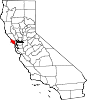
State  California
County Marin Government – County Board District 4
Steve Kinsey– State Senate Mark Leno (D) – Assembly Jared Huffman (D) – U. S. Congress Lynn Woolsey (D) Area[1] – Total 2.984 sq mi (7.728 km2) – Land 2.984 sq mi (7.728 km2) – Water 0 sq mi (0 km2) 0% Elevation[2] 89 ft (27 m) Population (2010) – Total 283 – Density 94.8/sq mi (36.6/km2) Time zone PST (UTC-8) – Summer (DST) PDT (UTC-7) ZIP code 94929 Area code(s) 707 FIPS code 06-19262 GNIS feature ID 1658420 Dillon Beach is a census-designated place (CDP) in Marin County, California, United States. Dillon Beach is located 3.25 miles (5.2 km) west of Tomales,[3] at an elevation of 89 feet (27 m).[2] The population was 283 at the 2010 census. Dillon Beach was named after the founder, George Dillon, who settled there in 1858.[3]
Contents
Geography
Dillon Beach is located near the mouth of Tomales Bay, at 38°15′03″N 122°57′55″W / 38.25083°N 122.96528°W.[2]
According to the United States Census Bureau, the CDP has a total area of 2.98 sq mi (7.7 km2), all land.
History
The first post office at Dillon Beach opened in 1922.[3]
Demographics
2010
The 2010 United States Census[4] reported that Dillon Beach had a population of 283. The population density was 94.8 people per square mile (36.6/km²). The racial makeup of Dillon Beach was 266 (94.0%) White, 3 (1.1%) Native American, 4 (1.4%) Asian, and 10 (3.5%) from two or more races. Hispanic or Latino of any race were 9 persons (3.2%).
The Census reported that 100% of the population lived in households.
There were 147 households, out of which 20 (13.6%) had children under the age of 18 living in them, 79 (53.7%) were opposite-sex married couples living together, 6 (4.1%) had a female householder with no husband present, 2 (1.4%) had a male householder with no wife present. There were 6 (4.1%) unmarried opposite-sex partnerships, and 3 (2.0%) same-sex married couples or partnerships. 48 households (32.7%) were made up of individuals and 26 (17.7%) had someone living alone who was 65 years of age or older. The average household size was 1.93. There were 87 families (59.2% of all households); the average family size was 2.37.
The population was spread out with 28 people (9.9%) under the age of 18, 7 people (2.5%) aged 18 to 24, 44 people (15.5%) aged 25 to 44, 127 people (44.9%) aged 45 to 64, and 77 people (27.2%) who were 65 years of age or older. The median age was 57.4 years. For every 100 females there were 95.2 males. For every 100 females age 18 and over, there were 94.7 males.
There were 440 housing units at an average density of 147.5 per square mile (56.9/km²), of which 125 (85.0%) were owner-occupied, and 22 (15.0%) were occupied by renters. The homeowner vacancy rate was 5.3%; the rental vacancy rate was 59.3%. 84.5% of the population lived in owner-occupied housing units and 15.5% lived in rental housing units.
2000
As of the census[5] of 2000, there were 319 people, 155 households, and 103 families residing in the CDP. The population density was 107/sq mi (41.5/km²). There were 415 housing units at an average density of 140/sq mi (54/km²). The racial makeup of the CDP in 2010 was 90.8% non-Hispanic White, 1.1% Native American, 1.4% Asian, and 3.5% from two or more races. 3.2% of the population were Hispanic or Latino of any race.
There were 155 households out of which 17.4% had children under the age of 18 living with them, 59.4% were married couples living together, 4.5% had a female householder with no husband present, and 33.5% were non-families. 27.7% of all households were made up of individuals and 10.3% had someone living alone who was 65 years of age or older. The average household size was 2.06 and the average family size was 2.47.
In the CDP the population was spread out with 14.4% under the age of 18, 1.3% from 18 to 24, 18.8% from 25 to 44, 43.6% from 45 to 64, and 21.9% who were 65 years of age or older. The median age was 52 years. For every 100 females there were 95.7 males. For every 100 females age 18 and over, there were 95.0 males.
The median income for a household in the CDP was $47,679, and the median income for a family was $52,000. Males had a median income of $40,714 versus $37,083 for females. The per capita income for the CDP was $39,475. None of the families and 1.3% of the population were living below the poverty line, including no under eighteens and none of those over 64.
References
- ^ U.S. Census
- ^ a b c U.S. Geological Survey Geographic Names Information System: Dillon Beach, California
- ^ a b c Durham, David L. (1998). California's Geographic Names: A Gazetteer of Historic and Modern Names of the State. Quill Driver Books. p. 624. ISBN 9781884995149.
- ^ All data are derived from the United States Census Bureau reports from the 2010 United States Census, and are accessible on-line here. The data on unmarried partnerships and same-sex married couples are from the Census report DEC_10_SF1_PCT15. All other housing and population data are from Census report DEC_10_DP_DPDP1. Both reports are viewable online or downloadable in a zip file containing a comma-delimited data file. The area data, from which densities are calculated, are available on-line here. Percentage totals may not add to 100% due to rounding. The Census Bureau defines families as a household containing one or more people related to the householder by birth, opposite-sex marriage, or adoption. People living in group quarters are tabulated by the Census Bureau as neither owners nor renters. For further details, see the text files accompanying the data files containing the Census reports mentioned above.
- ^ "American FactFinder". United States Census Bureau. http://factfinder.census.gov. Retrieved 2008-01-31.
West Marin Villages Bolinas • Dillon Beach • Dogtown • Inverness • Inverness Park • Lagunitas • Marshall • Millerton • Muir Beach • Nicasio • Olema • Pt. Reyes Station • Stinson Beach • TomalesGeography Audubon Canyon • Bolinas Lagoon • Bolinas Ridge • Bonita Channel • Centissima Reef • Copper Mine Gulch • Drakes Bay • Drakes Estero • Gull Rock • Pirates Cove • Point Reyes • Kent Island • Nicasio Creek • Nicasio Reservoir • Olema Valley • Rancho Punta de los Reyes Sobrante • Rodeo Lagoon • Rodeo Cove • Tennessee Cove • Tomales Bay • Sears RockParks and transportation Municipalities and communities of Marin County, California Cities and towns Belvedere | Corte Madera | Fairfax | Larkspur | Mill Valley | Novato | Ross | San Anselmo | San Rafael | Sausalito | Tiburon
CDPs Alto | Black Point-Green Point | Bolinas | Dillon Beach | Inverness | Kentfield | Lagunitas-Forest Knolls | Lucas Valley-Marinwood | Marin City | Muir Beach | Nicasio | Point Reyes Station | San Geronimo | Santa Venetia | Sleepy Hollow | Stinson Beach | Strawberry | Tamalpais-Homestead Valley | Tomales | Woodacre
Unincorporated
communitiesAlmonte | Bel Marin Keys | Belvedere Island | Bivalve | Black Point | Blakes Landing | Burdell | California Park | Cerro | Chapman | Cypress Grove | Dewitt | Dogtown | El Campo | Fallon | Five Brooks | Forest Knolls | Gallinas | Greenbrae | Hamlet | Harbor Point | Homestead Valley | Ignacio | Inverness Park | Jewell | Kent Woodlands | Lagunitas | Lairds Landing | Las Gallinas | Los Ranchitos | Lucas Valley | Manzanita | Marconi | Marinwood | Marshall | McDonald | McNears Beach | Meadowsweet | Millerton | Murray Park | Nicks Cove | Ocean Roar | Old Town | Olema | Paradise Cay | Reed | Reynolds | Sacramento Landing | Saint Vincent | San Antonio | San Quentin | Seahaven | Shafter | Strawberry Manor | Tamalpais Valley | Tamalpais Valley Junction | Tocaloma | Vincent Landing | Waldo
Ghost towns Categories:- West Marin
- Populated coastal places in California
- Census-designated places in Marin County, California


Wikimedia Foundation. 2010.