- Woodacre, California
Infobox Settlement
official_name = Woodacre, California
settlement_type = CDP
imagesize =
image_caption =
image_
imagesize =
image_caption =
image_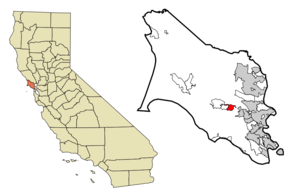
mapsize = 250x200px
map_caption = Location in Marin County and the state ofCalifornia
mapsize1 =
map_caption1 =
subdivision_type = Country
subdivision_type1 = State
subdivision_type2 = County
subdivision_name =United States
subdivision_name1 =California
subdivision_name2 = Marin
government_type =
leader_title = N/A
leader_name =
leader_title = County Board
leader_name = District 4Steve Kinsey
leader_title1 = Senate
leader_name1 =Carole Migden (D)
leader_title2 = Assembly
leader_name2 =Jared Huffman (D)
leader_title3 = U. S. Congress
leader_name3 =Lynn Woolsey (D)
established_date =
area_magnitude =
area_total_km2 = 4.7
area_total_sq_mi = 1.8
area_land_km2 = 4.7
area_land_sq_mi = 1.8
area_water_km2 = 0
area_water_sq_mi = 0
elevation_ft = 364
elevation_m = 111
population_as_of = 2000
population_footnotes =
population_total = 1393
population_metro =
population_density_km2 = 296.4
population_density_sq_mi = 773.9
timezone = PST
utc_offset = -8
latd = 38 |latm = 0 |lats = 24 |latNS = N
longd = 122 |longm = 38 |longs = 15 |longEW = W
timezone_DST = PDT
utc_offset_DST = -7
postal_code_type =ZIP code
postal_code = 94973
area_code = 415
blank_name = FIPS code
blank_info = 06-86216
blank1_name = GNIS feature ID
blank1_info = 1652657
footnotes =
website =Woodacre is an unincorporated town and
census-designated place (CDP) located in theSan Geronimo Valley inMarin County, California . The population was 1,393 at the 2000 census.Geography
Woodacre is located at coor dms|38|0|24|N|122|38|15|W|city (38.006755, -122.637592)GR|1.
According to the
United States Census Bureau , the CDP has a total area of 1.8square mile s (4.7km² ), all of it land.Demographics
As of the
census GR|2 of 2000, there were 1,393 people, 548 households, and 381 families residing in the CDP. Thepopulation density was 763.6 people per square mile (295.5/km²). There were 570 housing units at an average density of 312.5/sq mi (120.9/km²). The racial makeup of the CDP was 94.40% White, 0.43% African American, 0.36% Native American, 0.93% Asian, 1.72% from other races, and 2.15% from two or more races. Hispanic or Latino of any race were 4.31% of the population.There were 548 households out of which 34.3% had children under the age of 18 living with them, 55.3% were married couples living together, 11.3% had a female householder with no husband present, and 30.3% were non-families. 19.5% of all households were made up of individuals and 4.4% had someone living alone who was 65 years of age or older. The average household size was 2.54 and the average family size was 2.90.
In the CDP the population was spread out with 23.0% under the age of 18, 3.7% from 18 to 24, 25.8% from 25 to 44, 38.8% from 45 to 64, and 8.7% who were 65 years of age or older. The median age was 44 years. For every 100 females there were 92.1 males. For every 100 females age 18 and over, there were 88.2 males.
The median income for a household in the CDP was $62,917, and the median income for a family was $71,250. Males had a median income of $50,109 versus $40,167 for females. The
per capita income for the CDP was $31,996. About 3.9% of families and 6.6% of the population were below thepoverty line , including 8.4% of those under age 18 and none of those age 65 or over.References
External links
Wikimedia Foundation. 2010.