- Mill Valley, California
-
For the former settlement of this name, see Mill Valley, Calaveras County, California.
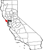
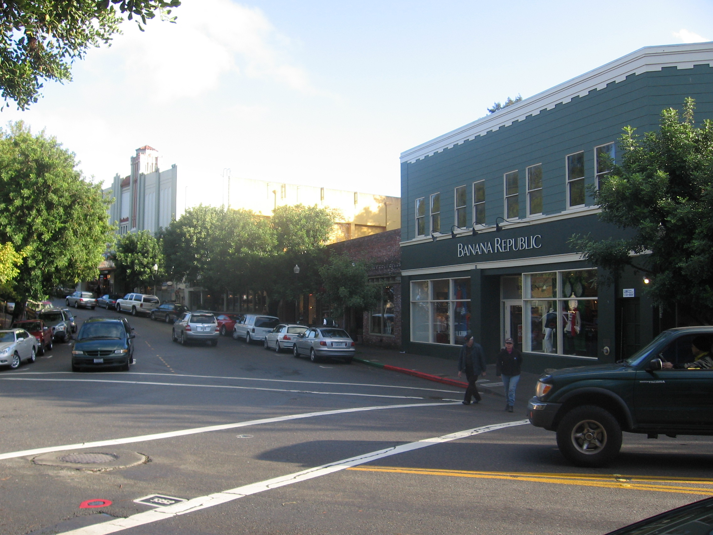
City of Mill Valley — City — Throckmorton Ave. in downtown Mill Valley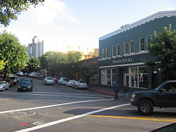 Location in Marin County and the state of California
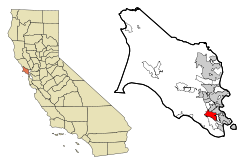
Coordinates: 37°54′22″N 122°32′42″W / 37.90611°N 122.545°WCoordinates: 37°54′22″N 122°32′42″W / 37.90611°N 122.545°W Country  United States
State  California
County Marin Government - Mayor Kenneth R. Wachtel[1] - Senate Mark Leno (D) - Assembly Jared Huffman (D) - Congress Lynn Woolsey (D) - County Board District 3
Kate SearsArea[2] - Total 4.847 sq mi (12.555 km2) - Land 4.763 sq mi (12.336 km2) - Water 0.084 sq mi (0.219 km2) 1.74% Elevation[3] 79 ft (24 m) Population (2010) - Total 13,903 - Density 2,868.4/sq mi (1,107.5/km2) Time zone PST (UTC-8) - Summer (DST) PDT (UTC-7) ZIP codes 94941-94942 Area code(s) 415 FIPS code 06-47710 GNIS feature ID 1659128 Website cityofmillvalley.org Mill Valley is a city in Marin County, California, United States located about 4 miles (6.4 km) north of San Francisco via the Golden Gate Bridge. The population was 13,903 at the 2010 census.
Mill Valley is located on the western and northern shores of Richardson Bay. Beyond the flat coastal area and marshlands, it occupies narrow wooded canyons, mostly of second-growth redwoods, on the southern slopes of Mount Tamalpais. The Mill Valley 94941 ZIP code also includes the following adjacent unincorporated communities: Almonte, Alto, Homestead Valley, Strawberry and Tamalpais Valley. The Muir Woods National Monument is also located just outside the city limits.
Contents
History
Coast Miwok
The first people known to inhabit Marin County, the Coast Miwok, arrived approximately 6,000 years ago. The territory of the Coast Miwok included all of Marin County, north to Bodega Bay and southern Sonoma County. More than 600 village sites have been identified,including 14 sites in the Mill Valley area. Nearby archaeological discoveries include the rock carvings and grinding sites on Ring Mountain.[4] The pre-Missionization population of the Coast Miwok is estimated to be between 1,500 (Alfred L. Kroeber's estimate for the year 1770 A.D.[5] to 2,000 (Sherburne F. Cook's estimate for the same year[6]). The pre-Missionization population of the Coast Miwok may have been as high as 5000. Cook speculated that by 1848 their population had decreased to 300, and down to 60 by 1880. As of 2011 there are over 1,000 registered members of the Federated Indians of Graton Rancheria which includes both the Coast Miwok and the Southern Pomo, all of whom can date their ancestry back to the 14 survivors original tribal ancestors.[7] The Lucretia Hanson Little History Room in the Mill Valley Public Library has some oral histories recorded from some Coast Miwok descendants[8]
In Mill Valley, on Locust Avenue between Sycamore and Walnut Avenues, there is now a metal plaque set in the sidewalk in the area believed to be the birthplace of Chief Marin nearly 230 years ago; the plaque was dedicated on 8 May 2009.[9] The village site was first identified by Nels Nelson in 1907 and his excavation revealed tools, burials and food debris just beyond the driveway of 44 Locust Ave. At that time, the moud was 20 feet high. Another famous Mill Valley site was in the Manzanita area underneath the Fireside Inn (previously known as the Manzanita Roadhouse, Manzanita Hotel, Emil Plasberg's Top Rail, and Top Rail Tavern, most of which were notorious Prohibition-era gin joints and brothels) located near the intersection of U.S. Route 101 and California State Route 1. Built in 1916, the "blind pig" roadhouse was outside the dry limits of the city itself. Shell mounds have been discovered in areas by streams and along Richardson Bay, including in the Strawberry and Almonte neighborhoods.
Beginning with the foundation of Mission San Francisco de Asís, commonly known as Mission Dolores, in 1776, the Coast Miwok of southern Marin began to slowly enter the mission, first those from Sausalito followed by those from areas we now know as Mill Valley, Belvedere, Tiburon and Bolinas. They called themselves the "Huimen" people. At the mission they were taught the Catholic religion, lost their freedom, and three quarters died as a result of exposure to European diseases. As a result of the high death rate at Mission Dolores it was decided to build a new Mission San Rafael, built in 1817. Over 200 surviving Coast Miwok were taken there from Mission Dolores and Mission San Jose,including the 17 survivors of the Huimen Coast Miwok of the Richardson Bay Area. California Missions.[10]
Early settlers
 John Joseph Reed House c. 1884. Courtesy of the Mill Valley Public Library, Lucretia Little History Room
By 1834 the Mission era had ended and California was under the control of the Mexican government. They took Miwok ancestral lands, divided them and gave them to Mexican soldiers or relatives who had connections with the Mexican governor. The huge tracts of land, called ranchos by the Mexican settlers, or Californios, soon covered the area. The Miwoks who had not died or fled were often employed under a state of indentured servitude to the California land grant owners. In 1834, the governor of Alta California José Figueroa awarded to John T. Reed the first land grant in Marin, Rancho Corte Madera del Presidio. Just west of that, Rancho Saucelito was transferred to William A. Richardson in 1838 after being originally awarded to Nicolas Galindo in 1835. John Reed married Hilarita Sanchez, the daughter of a commandante in the San Francisco Presidio. William Richardson also married a well-connected woman; both he and Reed were originally from Europe. Richardson's name was later applied to Richardson Bay, an arm of the San Francisco Bay that brushes up against the eastern edge of Mill Valley. The latter rancho contained everything south and west of the Corte Madera and Larkspur areas with the Pacific Ocean, San Francisco Bay, and Richardson Bay as the other three borders. The former encompassed what is now southern Corte Madera, the Tiburon Peninsula, and Strawberry Point.[11]
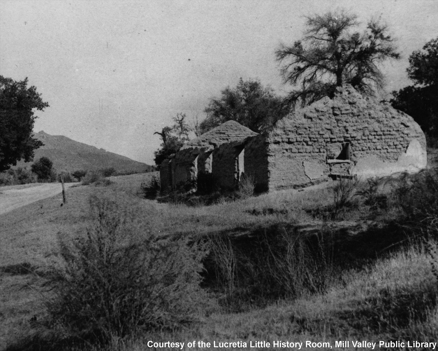
 Reed's adobe house c. 1890 after being destroyed by fire. Courtesy of the Mill Valley Public Library, Lucretia Little History Room
In 1836, Reed married Hilaria Sanchez, the daughter of the commandant of the local presidio. He built the first sawmill in the county on the Cascade Creek (now Old Mill Park) in the mid-1830s on Richardson's rancho and settled near what is now Locke Lane and LaGoma Avenue.[12] The mill cut wood for the San Francisco Presidio. He also raised cattle and horses and had a brickyard and stone quarry. Reed also did brisk businesses in hunting, skins, tallow, and other products until his death in 1843 at 38 years of age.[13] Richardson sold butter, milk and beef to San Francisco during the Gold Rush. Shortly thereafter, he made several poor investments and wound up massively in debt to many creditors. On top of losing his Mendocino County rancho he was forced to deed 640 acres (2.6 km2) of Rancho Saucelito to his wife, Maria Antonia Martinez, daughter of the commandant of the Presidio, in order to protect her. The rest of the rancho, including the part of what is now Mill Valley that did not already belong to Reed's heirs, was given to his administrator Samuel Reading Throckmorton. At his death in 1856 at 61 years old, Richardson was almost entirely destitute.[14]
Throckmorton came to San Francisco in 1850 as an agent for an eastern mining business before working for Richardson. As payment of a debt, Throckmorton acquired a large portion of Rancho Saucelito in 1853-4 and built his own rancho "The Homestead" on what is now Linden Lane and Montford Avenue. The descendants of ranch superintendent Jacob Gardner continue to be active in Marin. Some of the rest of his land was leased out for dairy farming to Portuguese settlers.[12] A majority of the immigrants came from the Azores Islands. Those who were unsuccessful at gold mining came north to the Marin Headlands and later brought their families. In Mill Valley, Ranch "B" is one of the few remaining dairy farm buildings and is located near the parking lot at the Tennessee Valley trailhead.[15] Throckmorton also suffered devastating financial problems before his death in 1887. His surname would later be applied to one of the major thoroughfares in Mill Valley.
Richardson and Reed had never formalized the boundary lines separating their ranchos. Richardson's heirs successfully sued Reed's heirs in 1860 claiming the mill was built on their property. The border was officially marked as running along the Arroyo Corte Madera del Presidio along present day Miller Avenue. Everything to the east of the creek was Reed property, and everything to the west was Richardson land. It was Richardson's territory that would soon become part of Mill Valley when Throckmorton's daughter Suzanna was forced to relinquish several thousand acres to the San Francisco Savings & Union Bank to satisfy a debt of $100,000 against the estate in 1889.[16]
 Blithedale Hotel c. 1880-1890s. Courtesy of the Mill Valley Public Library, Lucretia Little History Room
In 1873, San Francisco physician Dr. John Cushing discovered 320 "lost" acres between the Reed and Richardson boundaries between present day Corte Madera Avenue, across the creek, and into West Blithedale Canyon. Using the Homestead Act he petitioned the government and managed to acquire the land. Before his death in 1879 he had built a sanitarium in the peaceful canyon.[12] In Sausalito the North Pacific Coast Railroad had laid down tracks to a station near present day Highway 101 at Strawberry. Seeing the financial advantages of a railroad his descendants then turned the hospital into the Blithedale Hotel after the land title was finally granted in 1884. The sanitarium was enlarged, cottages were built up along the property, and horse-drawn carriages were purchased to pick up guests at the Alto station. Within a few years, several other summer resort hotels had cropped up in the canyon including the Abbey, the Eastland, and the Redwood Lodge.[17] Fishing, hunting, hiking, swimming, horseback riding, and other activities increased in popularity as people came to the area as vacationers or moved in and commuted to San Francisco for work. Meanwhile, Reed's mill deforested much of the surrounding redwoods meaning most of the redwoods growing today are second or third growth.
The King family (King Street) also owned property near the Cushing land. One of its buildings was a small adobe house which, according to oral histories available at the Lucretia Hanson Little History Room in the Mill Valley Public Library, is believed to have predated the King farm.[8] The Blithedale Hotel used it as a milk house. The adobe structure is still standing and connected to a house on West Blithedale Avenue; it is the oldest structure in Mill Valley.
The San Francisco Savings & Union Bank organized the Tamalpais Land & Water Company in 1889 as an agency for disposing of the Richardson land gained from the Throckmorton debt. The Board of Directors was President Joseph Eastland, Secretary Louis L. Janes (Janes Street), Thomas Magee (Magee Avenue), Albert Miller (Miller Avenue), and Lovell White (Lovell Avenue).[18] Eastland, who had been president of the North Pacific Coast Railroad in 1877 and retained an interest, pushed to extend the railroad into the area in 1889. Though Reed, Richardson, and the Cushings were crucial to bringing people to the Mill Valley area, it was Eastland who really propelled the area and set the foundation for the city today. He had founded power companies all around the San Francisco Bay area, was on the board of several banks, and had control of several commercial companies.[12] The Tamalpais Land & Water Co. hired Michael M. O'Shaughnessy, already a noted engineer (later on he would become chief engineer for the Hetch Hetchy Reservoir and O'Shaughnessy Dam and planned many San Francisco streets) to lay out roads, pedestrian paths, and step-systems for what the developers hoped would become a new city. He also built the Cascade Dam & Reservoir for water supply, and set aside land plots for churches, schools, and parks.
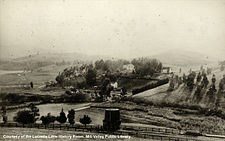
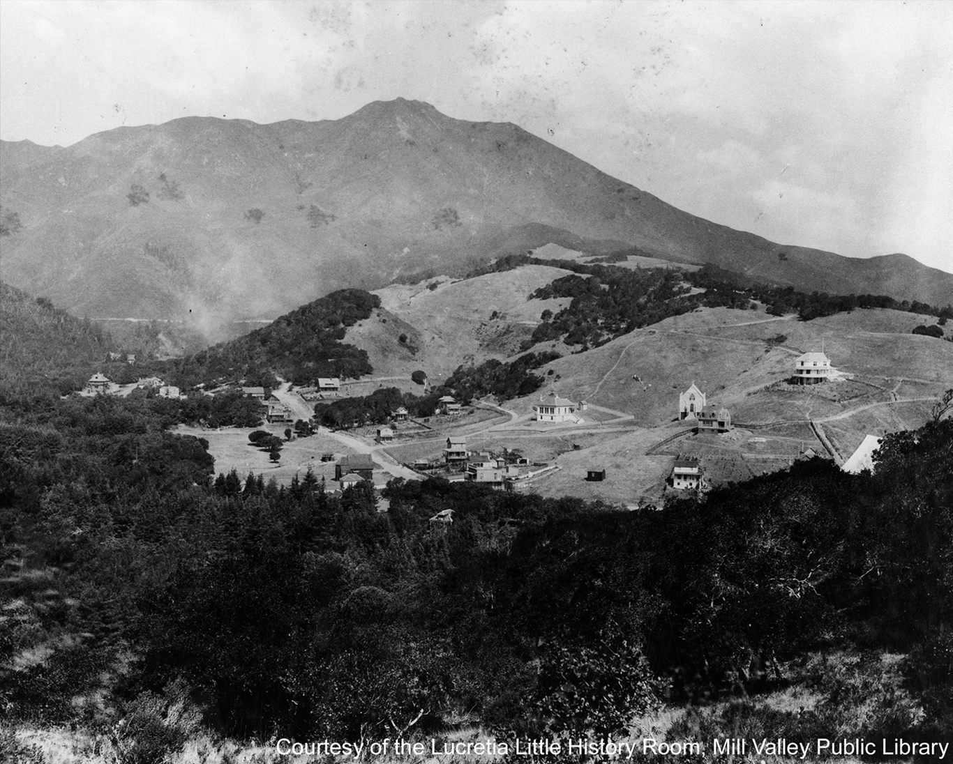
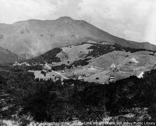 Mill Valley pre-1900. Courtesy of the Mill Valley Public Library, Lucretia Little History Room
 Gravity car no. 21 on the Mt. Tam and Muir Woods Scenic Rwy c. 1915. Courtesy of the Mill Valley Public Library, Lucretia Little History Room
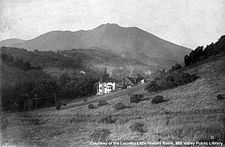
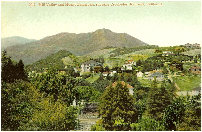
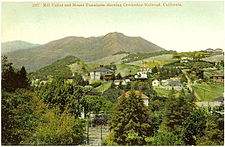 Similar view of Mill Valley, circa 1910, as pictured on a souvenir postcard with the caption 'Mill Valley and Mount Tamalpais, Showing Crookedest Railroad, California'."
On 31 May 1890, nearly 3,000 people attended The Tamalpais Land & Water Co. land auction near the now-crumbling sawmill. More than 200 acres (0.81 km2) were sold that day in the areas of present day Throckmorton, Cascade, Lovell, Summit, and Miller Avenues and extending to the west side of Corte Madera Avenue. By 1892, there were two schools in the area and a few churches.[12] The auction also brought into Mill Valley architects, builders, and craftsmen. Harvey A. Klyce was one of the most prominent of the architects and designed many private homes and public buildings in the area, including the Masonic Lodge in 1904.[19] Before his death in 1894, Eastland built a large summer home, "Burlwood", constructed on Throckmorton Avenue in 1892 that still stands though much of the original land has been parceled off. Burlwood was the first home in the town to have electricity, and when telephones were installed only he and Mrs. Cushing, the owner of the Blithedale Hotel had service.[18] After the land auctions the area was known as both "Eastland" and "Mill Valley".[20]
Janes, by then the resident director of Tamalpais Land & Water Co. (and eventually the city's first town clerk), and Sidney B. Cushing, president of the San Rafael Gas & Electric Co. set out to bring the railroads to Mt. Tamalpais. The Mt. Tamalpais Scenic Railway opened in 1896 (with Cushing as President) and ran from the town center (present day Lytton Square) all the way to the summit. After Muir Woods became a national monument in 1908 the railroad expanded and became the Mt. Tamalpais & Muir Woods Scenic Railway. "The Crookedest Railroad in the World" and its accompanying Gravity Cars[21] brought thousands of tourists to the Tavern of Tamalpais on the mountain summit (built in 1896, rebuilt after the 1929 fire, and razed in the 1950s after a windstorm),[22] the West Point Inn (built in 1904, abandoned in the 1930s, reopened in 1943),[23] and the Muir Woods Inn (burned in 1907, rebuilt in 1914, now closed).[24] The tracks were removed in 1930 after the 1929 fire, the drop in tourism due to the Great Depression, and the increase in automobile traffic with the construction of the Panoramic Highway and other roads caused a drastic drop in ridership. Train service also became a reliable and relatively cheap form of commuting and tracks crisscrossed Mill Valley and connected it with neighboring cities and San Francisco.
Incorporation through WWII
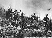 Volunteer firemen in action during the July 4th-6th 1929 fire on Mt. Tamalpais. Courtesy of the Mill Valley Public Library, Lucretia Little History Room
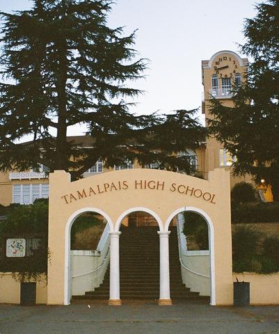
By 1900, the population was nearing 900 and the locals pushed out the Tamalpais Land & Water Co. in favor of incorporation. Organizations and clubs cropped up including the Outdoor Art Club (1902)[25] and the Dipsea Race (1905), the latter marking its 100th anniversary in 2010.[26] The second big population boom came after the 1906 Great Earthquake. While much of San Francisco and Marin County was devastated, many fled to Mill Valley and most never left. In that year alone the population grew to over 1,000 permanent residents.[27] Creeks were bridged over or dammed, more roads laid down and oiled, and cement sidewalks poured. Tamalpais High School opened in 1908, the first city hall was erected in 1908, and Andrew Carnegie's library in 1910. The Post Office opened under the name "Eastland", however after many objections it was changed to "Mill Valley" in 1904.[12] The very first Mountain Play was performed at the Mountain Theater on Mt. Tam in 1913.[28] By the 1920s, most roads were paved over, mail delivery was in full swing, and the population was at its highest at more than 2,500 citizens. Mill Valley Italian settlers made wine during Prohibition, while some local bar owners made bootleg whiskey under the dense foliage around the local creeks.[29] January 1922 saw the first of several years of snow in Marin County, coating Mt. Tam white. Two years later the Sulphur Springs, a natural hot spring where locals could revive their lagging spirits, was covered over and turned in the playground of the Old Mill Elementary School.
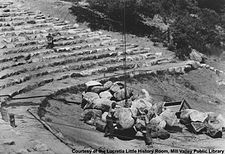 The Mountain Theater under construction by the CCC c. 1937-1940. Courtesy of the Mill Valley Public Library, Lucretia Little History Room
1929 was a year of great change for Mill Valley. The Great Fire raged for several days in early July and nearly destroyed the fledgling city. It ravaged much of Mt. Tam (including the Tavern and 117 homes) and the city itself was spared only by a change in wind direction.[12] In October of that year, the Mt. Tamalpais and Muir Woods Scenic Railway ran for the last time. The fire caused great devastation to tourism and tourist destinations, but the railroads were also crushed by the car. Panoramic Highway, a section of Highway 1 running between Mill Valley and Stinson Beach was built in 1929-1930. The stock market crash of 1929 and the ensuing Great Depression crippled what little railroad tourism there was to the point where the tracks were eventually taken up in 1931.
During the Great Depression, many famous local landmarks were constructed with the help of the Works Progress Administration and the Civilian Conservation Corps, including the Mead Theater at Tam High(named after school board Trustee Ernest Mead), the Mountain Theater rock seating, and the Golden Gate Bridge in 1934-1937;[29] the latter event ended railroad commuting between Marin and the city and helped increase the Marin population. With the demise of the railroads came the introduction of local bus service. Greyhound moved into the former train depot in Lytton Square in October 1940. In Sausalito, Marinship brought over 75,000 people to Marin, many of whom moved to Mill Valley permanently. At the height of the War, nearly 400 locals were fighting, including many volunteer firemen and government officials. By 1950, 1 in 10 Mill Valleyans were living in a "Goheen Home". George C. Goheen built the so-called "defense homes" for defense workers throughout the 1940s and 1950s in the Alto neighborhood.[29]
1950s to present
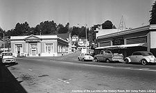 The corner of Throckmorton Ave. and Corte Madera Ave. c. 1970. Courtesy of the Mill Valley Public Library, Lucretia Little History Room
With a population just over 7,000 by 1950,[29] Mill Valley was still relatively rural. Men commuted to San Francisco on the Greyhound bus when the streets were not flooding in heavy rain, and there still were not any traffic lights. The military built the Mill Valley Air Force Station to protect the area during the Korean War. In 1956, a group of Beat poets and writers lived briefly in the Perry house, most notably Jack Kerouac and San Francisco Renaissance Beat poet Gary Snyder. The house and its land is now owned by the Marin County Open Space District. By the beginning of the 1960s, however, the population swelled. The Mill Valley Fall Arts Festival became a permanent annual event and the old Carnegie library was replaced with an award-winning library at 375 Throckmorton Ave. Designed by architect Donn Emmons, the new library was formally dedicated on September 18, 1966.[30] The 1970s saw a change in attitude and population. Mill Valley became an area associated with great wealth, with many people making their millions in San Francisco and moving north. New schools and neighborhoods cropped up, though the city maintained its defense of redwoods and protected open space.
 Miller Ave. toward Mt. Tamalpais in the 1990s. Courtesy of the Mill Valley Public Library, Lucretia Little History Room
Cascade Dam, built in 1893, was closed in 1972 and drained four years later in an attempt to curb the "hordes" of young people using the reservoir for nude sunbathing and swimming. Youth subculture would come under attack again in 1974 when the City Council banned live music, first at the Sweetwater and later at the Old Mill Tavern, both now defunct.[29] In 1977, the Lucretia Hanson Little History Room in the library opened and became the base of operations for the Mill Valley Historical Society. Marin County was hit with one of the worst droughts on record beginning in 1976 and peaking in 1977, brought on by a combination of several seasons of low rainfall and a refusal to import water from the Russian River, instead relying solely on rain water from Mt. Tam and the West Marin watersheds to fill the then-six reservoirs. By June 1977, the County managed to pipe in water from the Sacramento River Delta, staving off disaster. The rainfall during the winter of 1977-78 was one of the heaviest on record.[31] The Mill Valley Film Festival, now part of the California Film Institute, began in 1978 at the Sequoia Theatre.
The 1980s and 1990s saw the decline of small businesses in Mill Valley. Local establishments like Lockwood's Pharmacy closed in 1981 after running almost continuously for 86 years. Old Mill Tavern, O'Leary's, and the Unknown Museum shut their doors, as did Red Cart Market and Tamalpais Hardware. In their places came boutiques, upscale clothing stores, coffee shops, art galleries, and gourmet grocery stores. Downtown Plaza and Lytton Square were remodled to fit the new attitude. The population in the city alone swelled over 13,000 and many of the old, narrow, winding streets grew clogged with traffic congestion.[29] The Public Library expanded with a new Children's Room, a downstairs Fiction Room, and Internet computers.[32] It also joined MARINet, a consortium of all the public libraries in Marin, to allow patrons greater access to information. MARINet now has an online catalogue of all the materials, both physical and electronic, in the Marin public libraries, which patrons can order, pick up, and drop off materials at any of the participating libraries.[33] The Old Mill also got a face lift; it was rebuilt to the same specifications of the original in 1991. The 1990s also saw another influx of affluence. Many new homeowners gutted homes built in the 19th and early 20th centuries, or tore them down all together.
The dawn of the new millennium brought reflection on the past, as the city celebrated 100 years of incorporation. Soon after Mill Valley got its brand new Community Center at 180 Camino Alto,[34] adjacent to Mill Valley Middle School. On January 31, 2008, Mill Valley's sewage treatment plant spilled 2.45 million gallons of sewage into the San Francisco Bay.[35] This marked the second such spill in Mill Valley within a week (the previous one spilled 2.7 million gallons), and the most recent of several that occurred in Marin County in early 2008.[36] Mill Valley's treatment plant attributed the spills to "human error".[36] The spills caused distress in Mill Valley's administrative government, which remains outspoken about "dedicating itself to the protection of air quality, waste reduction, water and energy conservation, and the protection of wildlife and habitat" in Mill Valley.[37]
Geography
According to the United States Census Bureau the city has a total area of 4.8 square miles (12 km2), of which 4.7 square miles (12 km2) is land and 0.1 square miles (0.26 km2) of (1.74%) water.[citation needed]
The Mill Valley 94941 area lies between Mt. Tamalpais on the west, the city of Tiburon on the east,the City of Corte Madera on the north, and the Golden Gate National Recreational Area (GGNRA) on the south. Two streams flow from the slopes of Mt. Tamalpais through Mill Valley to the bay: the Arroyo Corte Madera del Presidio; and Cascade Creek. Mill Valley is surrounded by hundreds of acres (hectares) of state, federal, and county park lands. In addition, there are many municipally maintained open-space reserves, parks, and coastal habitats which, when taken together, ensconce Mill Valley in a natural wilderness. This close and constant proximity to nature has left generations of Mill Valley residents with a strong sense of conservancy toward much of this natural environment. This unique cultural attitude, along with the many natural public spaces preserved within (see below) and around its borders, combine to form one of the main cultural cornerstones that has always defined Mill Valley.[clarification needed][citation needed]
Mill Valley has a number of scenic and natural features which provides significant habitat for fishes, marine mammals, and other biota. Notable areas of public access to experience these aquatic preserves can be found at:[citation needed]
Mill Valley and the Homestead Valley Land Trust maintains many minimally disturbed wildland areas and preserves which are open to the public from sunrise to dusk everyday. Several nature trails allow access as well as providing gateway access to neighboring state and federal park lands, and the Mt. Tamalpais Watershed[38] wildland on the broad eastern face of Mt. Tamalpais that overlooks Mill Valley. These are undeveloped natural areas and contain many species of wild animals, including some large predators like the coyote, the bobcat, and the cougar. As in all wildland areas, observe daytime access hours, keep dogs on leashes, and keep younger children from wandering about unattended. One may also want to familiarize themselves with how to live and recreate among cougars, coyotes, and bobcats prior to visiting these wildland areas.[citation needed]
- Cascade Falls Park—A natural forested park that spans an area between the western stretches of Cascade Drive and Lovell Ave.
- Blithedale Summit Open Space Preserve—located up West Blithdale Ave.
- Tennessee Valley—located in Tamalpais Valley, off Shoreline Highway
- Alto Bowl Open Space Preserve—located 1.2 miles (1.9 km) up Camino Alto
- Camino Alto Open Space Preserve—located 1/2 mile (800 m) up Camino Alto, up Overhill Rd.
Climate
 Old Railroad Depot
Mill Valley has a mild Mediterranean climate which results in relatively wet winters and very dry summers. Winter lows rarely drop below freezing and summer highs rarely peak 90 °F (32 °C) with 90% of the annual rain falling in November through March. Wind speeds average lower than national averages in winter months and higher in summer, and often become quite gusty in the canyon regions of town. California coastal fog often affects Mill Valley, making relative humidity highly variable. The wetter winter months tend to make for a more consistent daily relative humidity around 70-90% (slightly higher than US averages). During the summer months, however, while the morning fog often keeps morning humidity normal, in a typical 70-80% range, by afternoon after the fog burns off, the humidity regularly plummets to around 30% as one would expect in this dry seasonal climate.[39]
Climate data for Mill Valley, California Month Jan Feb Mar Apr May Jun Jul Aug Sep Oct Nov Dec Year Record high °F (°C) 79
(26)79
(26)87
(31)96
(36)102
(39)110
(43)111
(44)106
(41)106
(41)101
(38)87
(31)77
(25)111
(44)Average high °F (°C) 56
(13)61
(16)65
(18)71
(22)76
(24)82
(28)85
(29)84
(29)82
(28)75
(24)63
(17)56
(13)71 Average low °F (°C) 41
(5)43
(6)44
(7)46
(8)49
(9)52
(11)53
(12)54
(12)53
(12)50
(10)45
(7)41
(5)48 Record low °F (°C) 20
(−7)21
(−6)27
(−3)31
(−1)23
(−5)39
(4)41
(5)40
(4)37
(3)30
(−1)26
(−3)18
(−8)18
(−8)Rainfall inches (mm) 9.60
(243.8)9.10
(231.1)7.05
(179.1)2.56
(65)1.20
(30.5)0.24
(6.1)0.01
(0.3)0.12
(3)0.50
(12.7)2.33
(59.2)7.47
(189.7)7.29
(185.2)47.47
(1,205.7)Source: http://www.weather.com/weather/wxclimatology/monthly/graph/94941 Mill Valley is also affected by microclimate conditions in the several box canyons with steep north-facing slopes and dense forests which span the southern and western city limits, which, along with the coastal fog, all conspire to make many of the dense forested regions of Mill Valley noticeably cooler and moister, on average, than other regions of town. This microclimate is what makes for the favorable ecology required by the Coastal Redwood forests which still cover much of the town and surrounding area, and have played such a pivotal role throughout the history of Mill Valley.[citation needed]
Demographics
2010
The 2010 United States Census[40] reported that Mill Valley had a population of 13,903. The population density was 2,868.2 people per square mile (1,107.4/km²). The racial makeup of Mill Valley was 12,341 (88.8%) White, 118 (0.8%) African American, 23 (0.2%) Native American, 755 (5.4%) Asian, 14 (0.1%) Pacific Islander, 152 (1.1%) from other races, and 500 (3.6%) from two or more races. Hispanic or Latino of any race were 622 persons (4.5%).
The Census reported that 99.5% of the population lived in households and 0.5% were institutionalized.
There were 6,084 households, out of which 1,887 (31.0%) had children under the age of 18 living in them, 2,984 (49.0%) were opposite-sex married couples living together, 465 (7.6%) had a female householder with no husband present, 178 (2.9%) had a male householder with no wife present. There were 306 (5.0%) unmarried opposite-sex partnerships, and 55 (0.9%) same-sex married couples or partnerships. 2,016 households (33.1%) were made up of individuals and 888 (14.6%) had someone living alone who was 65 years of age or older. The average household size was 2.27. There were 3,627 families (59.6% of all households); the average family size was 2.94.
The population was spread out with 3,291 people (23.7%) under the age of 18, 459 people (3.3%) aged 18 to 24, 2,816 people (20.3%) aged 25 to 44, 4,714 people (33.9%) aged 45 to 64, and 2,623 people (18.9%) who were 65 years of age or older. The median age was 46.6 years. For every 100 females there were 85.3 males. For every 100 females age 18 and over, there were 80.8 males.
There were 6,534 housing units at an average density of 1,348.0 per square mile (520.4/km²), of which 3,974 (65.3%) were owner-occupied, and 2,110 (34.7%) were occupied by renters. The homeowner vacancy rate was 1.2%; the rental vacancy rate was 4.5%. 9,861 people (70.9% of the population) lived in owner-occupied housing units and 3,966 people (28.5%) lived in rental housing units.
2000
At the 2000 census,[41] there were 13,600 people, 6,147 households and 3,417 families residing in the city, not including those living in unincorporated territories. The population density was 2,883.1 inhabitants per square mile (1,112.5/km²). There were 6,286 housing units at an average density of 1,332.6 per square mile (514.2/km²). The racial makeup of the city in 2010 was 85.8% non-Hispanic White, 0.8% non-Hispanic African American, 0.1% Native American, 5.3% Asian, 0.1% Pacific Islander, 0.3% from other races, and 3.1% from two or more races. Hispanic or Latino of any race were 4.5% of the population.
There were 6,147 households of which 27.1% had children under the age of 18 living with them, 45.2% were married couples living together, 7.6% had a female householder with no husband present, and 44.4% were non-families. 34.1% of all households were made up of individuals and 12.4% had someone living alone who was 65 years of age or older. The average household size was 2.20 and the average family size was 2.85.
21.2% of the population was under the age of 18, 2.9% from 18 to 24, 28.1% from 25 to 44, 32.5% from 45 to 64, and 15.4% who were 65 years of age or older. The median age was 44 years. For every 100 females there were 86.5 males. For every 100 females age 18 and over, there were 82.5 males.
The median household income was $90,794, and the median family income was $119,669. Males had a median income of $94,800 versus $52,088 for females. The per capita income for the city was $64,179. About 2.7% of families and 4.5% of the population were below the poverty line, including 3.6% of those under age 18 and 5.7% of those age 65 or over. The median single-family home price in the city was $1,500,000 in January 2005.[citation needed]
Cityscape
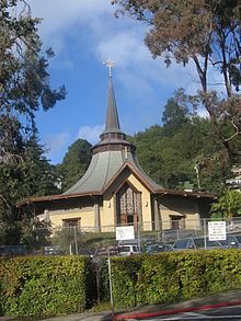 Mount Carmel Catholic Church
The combination of Mill Valley's idyllic location nestled beneath Mount Tamalpais coupled with its ease of access to nearby San Francisco has made it a popular home for many high-income commuters. Over the last 20 years, following a trend that is endemic throughout the Bay Area, home prices have climbed in Mill Valley (the median price for a single-family home is in excess of $1.5 million as of 2005), which has had the effect of pushing out some earlier residents who can no longer afford to live in the area. This trend has also transformed Mill Valley's commercial activity, e.g. Village Music (see below) was replaced in 2008 by more luxury-oriented commercial establishments: a cupcake shop and a dog salon.
In July 2005, CNN/Money and Money magazine ranked Mill Valley tenth on its list of the 100 Best Places to Live in the United States.[42] In 2007, MSN and Forbes magazine ranked Mill Valley seventy-third on its "Most expensive zip codes in America" list.[43]
While Mill Valley has retained elements of its earlier artistic culture through galleries, festivals, and performances, its stock of affordable housing has diminished,[44] forcing some residents to leave the area. This trend has also affected some of the city's well-known cultural centers like Village Music.[45] and the Sweetwater Saloon. As of April 2007, only one affordable housing project was underway: an initiative to raze and rebuild an abandoned motel called the Fireside.[46]
Neighborhoods and unincorporated CDPs
Strawberry is an unincorporated Census-designated Place to the east of the City of Mill Valley. Other CDPs with Mill Valley mailing addresses include Tamalpais-Homestead Valley and Muir Beach. Smaller unincorporated areas include Alto and Almonte.
Neighborhoods in Mill Valley:
Almonte "Alto" Sutton Manor Blithedale Canyon Boyle Park Cascade Canyon Country Club Downtown East Blithedale Corridor Edgewood Cypress Enchanted Knolls Eucalyptus Knolls Homestead Valley Kite Hill Land of Peter Pan Marin Terrace Marin View Middle Ridge Mill Valley Heights Mill Valley Meadows Miller Avenue Molino Edgewood Muir Woods Old Mill Panoramic Highway Scott Highlands Scott Valley Sequoia Valley Shelter Bay Shelter Ridge Strawberry Sycamore Sycamore Park Tam Junction Tamalpais Valley Tamalpais Park Tennessee Valley Vernal Heights Warner Canyon City recreational parks
Mill Valley maintains many recreational parks which often contain playgrounds and other designated areas specifically designed for playing various sports. Dogs are required to be on leashes in all but one of these parks, which is specifically designated a dog park to allow the option of off-leash exercise[47].
Mill Valley has a costly but popular "steps, lanes, and paths program" that provides improved pedestrian access between many of the winding and twisting residential roads that cover the hillsides. Blue stencils on the roadway mark certain paths as potential emergency escape routes from the fire prone hills. A picture book, although not entirely accurately, shows the paths, "Steps, Lanes and Paths of Mill Valley"[48]. In 2009 resident Matt Connelly threatened litigation alleging that some of the proposed paths represent a seizure of private property (even though some antique maps suggest that certain potential easements could be thought of as the justification for future steps, lanes, or paths).[49]. The very limited amount of usage of some of the newer paths suggests that the over $1,000,000 spent on these paths could be argued to be excessive.
For those who prefer to enjoy nature from the comfort of a chair, the city's public library[50] is nestled in a serene and scenic location at the edge of Old Mill Park[51] where visitors may relax indoors near the wood-burning fireplace and view the redwood forest through the library's multi-storied windows, or from the outside deck which overlooks the park and Cascade Creek.
Nature trails
 Blithedale Canyon
- Tenderfoot Trail (1.5 miles) -- Lower trail head is on Cascade Drive between Cascade Falls park and the lower trail head of the Zigzag trail. The upper trail head is at Edgewood Ave., near Mountain Home Inn. This upper trail head provides access to the Edgewood trail, and also provides gateway access to the upper region of Muir Woods, Tamalpais State Park near the Alice Eastwood Campsite access road, and the main southern access point Mt. Tamalpais Watershed (near the Throckmorton Ridge Fire Station).
- Zigzag Trail (1/2 mile, steep climb) -- This is a very steep trail which has an upper trail head near the Throckmorton Ridge Fire Station and the Mountain Home Inn with gateway access to the upper region of Muir Woods, Tamalpais State Park near the Alice Eastwood Campsite access road, and the main southern access point Mt. Tamalpais Watershed (near the Throckmorton Ridge Fire Station). The lower trail head is near the western end of Cascade Drive, west of Cascade Falls Park and the lower Tenderfoot Trail head.
- Cypress Trail (1 mile) -- runs between the end of Cypress Ave. and the middle of the Tenderfoot Trail. Cypress Avenue leads to Edgewood Blvd. Going down Edgewood leads to the top of Dipsea trail stairs and Cowboy Rock Trail head, and uphill on Edgewood lead to the Edgewood Trail.
- Edgewood Trail (1/2 mile)(aka Pipeline trail) -- runs between the two parts of Edgewood Ave. and provides access to the upper Tenderfoot trail head or, if one follows Edgewood Ave. out to the Mountain Home Inn, leads to a gateway access to the upper region of Muir Woods, Tamalpais State Park near the Alice Eastwood Campsite access road, and the main southern access point Mt. Tamalpais Watershed (near the Throckmorton Ridge Fire Station)
- Cowboy Rock Trail (1/4 mile) -- part of the Homestead Valley Land Trust, the upper trail head is at Edgewood and Sequoia Valley Road intersection, across the street from where the Dipsea trail stairs from downtown end. This path leads to the Homestead Trail and to the path/stairs down to Stolte Grove and the western tip of Homestead Valley.
- Pixie Trail (1/2 mile) -- part of the Homestead Valley Land Trust, this trail has several trail heads. On the upper end the trail head is at Marion Ave, (upper portion) Ridgewood Ave., and Edgewood Ave. intersect. The Pixie Trail also has a mid-access point, where the Pixie Trail becomes paved and developed. The street runs down hill to Stolte Grove. The trail continues on and connects to any of three other trail heads. The first head is at the five way intersection of Molino Ave, Edgewood Ave, Cape Ct, and Mirabel Ave. The second head leads to the end of Seymour lane which is a short road off of Edgewood Ave. Crossing Edgewood, the path continues down a set of stairs to Ethel Ave and the Una Way staircase down to Miller Ave. The third and final head ends at Janes Street, down the way from Molino Avenue Park.
- Homestead Trail (1 mile) -- part of the Homestead Valley Land trust, this longer winding trail traverses the western slope of Homestead Valley itself. It is not well delineated or maintained in parts. It has several other trail heads that leads up into Tamalpais State Park near the "four-corners" intersection, as well as down into the valley via (lower portion) Ridgeview Ave. and Ferndale Ave.
- Dipsea Trail (7.1 miles) The most famous hike in Marin County is the Dipsea Trail, a challenging route beginning with three long, steep stairways leading up from Old Mill Park and ending at Stinson Beach 7.1 miles (11.4 km) later. The annual Dipsea Race is in June, although the trail can be run or hiked any time. The West Marin Stagecoach is a bus that runs from Stinson Beach back to Mill Valley, stopping approximately one mile from downtown.[1] The Dipsea Trail is not well marked, so first timers should consider carrying a guidebook.
- Muir Woods to Bootjack Trail (6.3 miles) This trail is a loop that will take around 3.5 hours and popular among tourists due to the first hour among the redwood trees. Bootjack is accessible from here, transitioning to meadows with bridges and streams. Bootjack itself is 2.2 miles (3.5 km) long, moderate uphill and great for the average hiker.
Education
Public schools
Public schools are managed by the Mill Valley School District. There are five elementary schools and one middle school, Mill Valley Middle School, a four-time winner of the California Distinguished School Award.[52] The public high school, Tamalpais High School, is part of the Tamalpais Union High School District, whose five campuses serve central and southern Marin County. Marin Horizon School is an independent school serving students in grades PK-8. Founded in 1977, the school enrolls approximately 285 students.
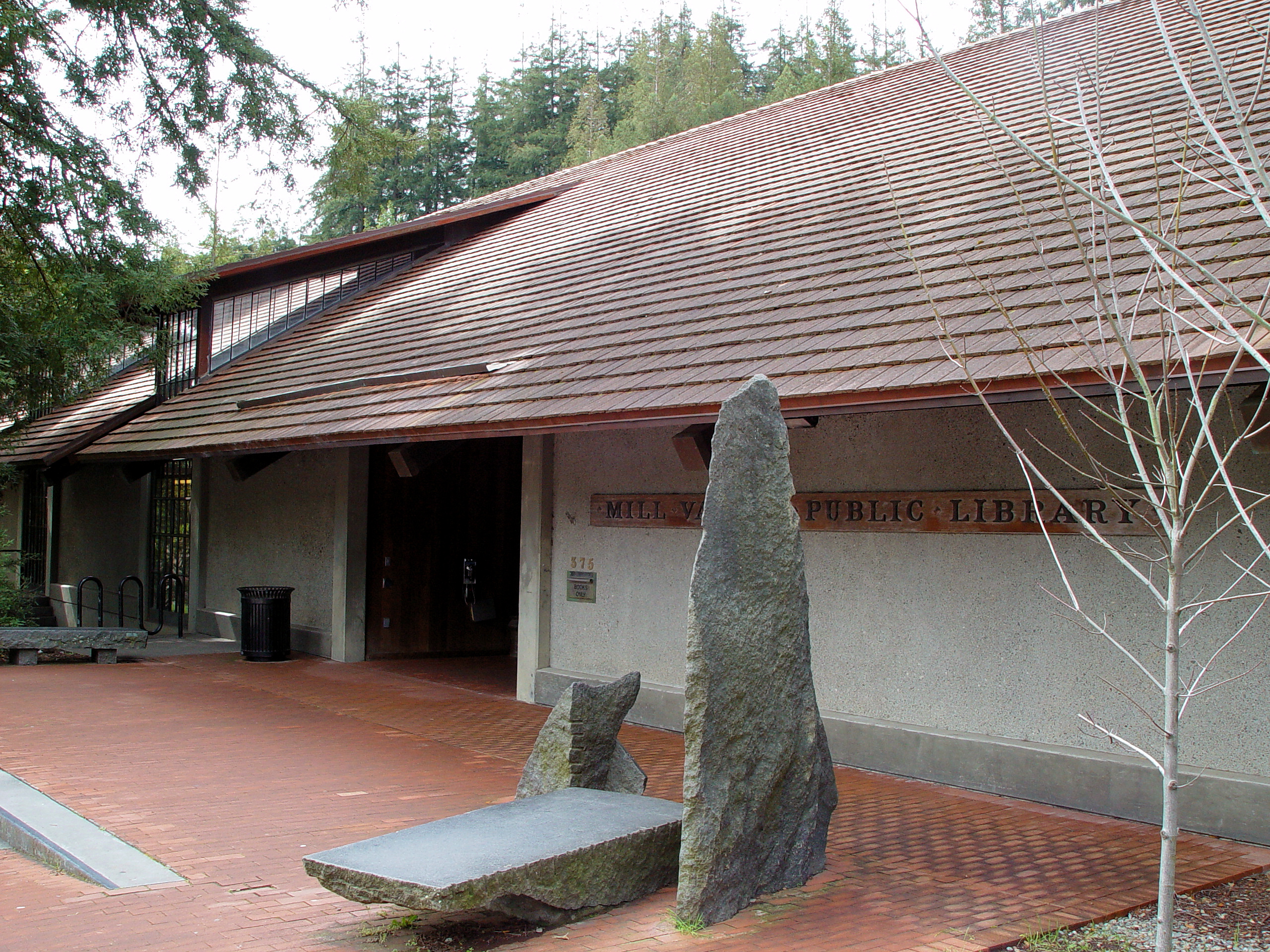
Mill Valley Public Library
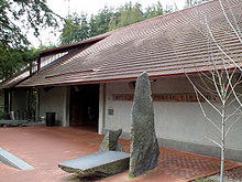 The Mill Valley Public Library.
The municipal library overlooks Old Mill Park and provides many picturesque reading locations, as well as free computer and Internet access. Recently they have begun offering Museum Passes to 94941 residents for free entry to Bay Area museums.[53] As part of the City of Mill Valley's decision to "go Green", the library has a Sustainability Collection with books and DVDs with information about how to become more environmentally friendly.[54]
The Mill Valley Public Library is also home to the Lucretia Hanson Little History Room. It has thousands of books, photographs, newspapers, pamphlets, artifacts, and oral histories on the history of California, Marin County, and Mill Valley.[55] It is staffed almost entirely by volunteers.[56] As of 2009, the History Room is in the midst of a digitization project wherein all documents are being scanned and digitized. Eventually the History Room will have all of their documents and artifacts available for public perusal on an online database. It also has a Twitter account, @MVHistoryRoom where updates, historical information, and new acquisitions are posted.
Annual events
Mill Valley is the home of several annual events, many of which attract national and international followings:
- Dipsea Race[57]
- The Mountain Play[58]
- Mill Valley Film Festival[59]
- Mill Valley Fall Arts Festival[60]
- Mill Valley Shakespeare in Old Mill Park Amphitheater[61]
Arts and crafts in Mill Valley
Mill Valley is known for being a village with a strong artistic heritage. A visitor to downtown Mill Valley will discover many art galleries, open-air coffee shops, and other hallmarks of a thriving artistic community. In addition, the town has sponsored the Mill Valley Fall Arts Festival for over fifty years and also the Mill Valley Film Festival, which is part of the California Film Institute, for over thirty years. In addition, Mill Valley's Chamber of Commerce has sponsored the annual Gourmet Food and Wine Tasting in Lytton Square for many years.
Theater arts also have a huge following in Mill Valley. In addition to supporting the local 142 Throckmorton Theatre, which hosts theater of all levels, Mill Valley is also home for the Marin Theatre Company, and the Mountain Play Association which hosts annual musical productions in the Sidney B. Cushing Amphitheater located in Mill Valley's neighboring Mount Tamalpais State Park. For several years the Curtain Theatre Group has also been performing annual free Shakespeare plays among the redwoods on the Old Mill Park Amphitheatre behind the Mill Valley Library.
Music, novels, television and movies
Mill Valley has also been home to many musicians, authors, actors, and TV personalities. Jerry Garcia — who recorded music in a Mill Valley recording studio — also once called Mill Valley home. John Lennon and Yoko Ono summered in a Mill Valley home on Lovell Ave. near the library in the early 1970s, having left some of his own graffiti on the wall of the residence "The Maya the Merrier". Other rock stars such as Michael Bloomfield, Huey Lewis, Bob Weir, Lee Michaels, Sammy Hagar, Bonnie Raitt, Pete Sears, Clarence Clemons, John and Mario Cipollina, and Janis Joplin have also called this small town home. The composer John Anthony Lennon was raised in Mill Valley. Authors such as Wright Morris and Jack London have also lived here, as does Joyce Maynard. Actors Peter Coyote, Dana Carvey, Jill Eikenberry, Kathleen Quinlan, Michael Tucker, and it was the place of birth for actors Eve Arden, Mariel Hemingway and Jonah Hill. Celebrity chef Tyler Florence, Pixar Animation Studios' Andrew Stanton and former women's basketball star Jennifer Azzi also call Mill Valley home. Former naval aviator Dieter Dengler built a home on Mount Tamalpais near the Mountain Home Inn and lived there until his death in 2001; parts of the biographical documentary about him, Little Dieter Needs to Fly were filmed there. Author John Gray who writes the Men are from Mars, Women are from Venus books is a long time Mill Valley resident. Preventive medicine physician, John Travis, founded the first wellness center in the US at 42 Miller Avenue in 1975.
In fiction, character B.J. Hunnicutt from the TV show M*A*S*H called Mill Valley home, and fictional character Charley Furuseth in Jack London's 1904 novel The Sea-Wolf, apparently had a summer cottage here. In the Star Trek universe, it is home to the 602 Club. It is also the setting for resident author Jack Finney's 1954 novel The Body Snatchers, although the 1956 film, Invasion of the Body Snatchers, and subsequent movie versions of the book have been set elsewhere. Fictional character Doris Martin from the TV show The Doris Day Show called Mill Valley home as well. In the syndicated version of Too Close For Comfort, Henry and Muriel Rush got their jobs at the Marin Bugler newspaper in Mill Valley.
Writer Jack Kerouac and beat poet Gary Snyder shared a Mill Valley cabin in 1955-56[62] around 370 Montford Ave. in Homestead Valley. The cabin's coincidental location in Marin County and its adjacent location to a meadow where horses grazed, combined with Snyder's expertise in Asian languages and cultures, lead to Snyder naming the cabin "Marin-An", which is Japanese for "Horse Grove Hermitage".[62] It was during this stay in Mill Valley that Kerouac's recent budding interest in Zen Buddhism was greatly expanded by Snyder's expertise in the subject. Kerouac's 1958 novel, The Dharma Bums, was consequently composed while living here and contains many semi-fictionalized accounts of the lives of Kerouac and Snyder while living at Marin-An.[63]
American writer Cyra McFadden, while living in Mill Valley in the 1970s, wrote a column for the Pacific Sun newspaper entitled, "The Serial", which satirized the trendy lifestyles of the affluent residents of Marin County.[64] In 1977, she turned her column ideas into a novel called The Serial: A Year in the Life of Marin County which focused on the fictional exploits of a Mill Valley couple, Kate and Harvey Holroyd, who never quite fit in to the Marin 'Scene.' The highly successful book was later made into a 1980 comedy called Serial, starring Tuesday Weld and Martin Mull.
The song "Mill Valley", recorded in 1970 and released on the album Miss Abrams and the Strawberry Point 4th Grade Class,[65] reached #90 on the Billboard Hot 100.[66] While the school is in the Mill Valley School District, it is not within the city limits.
Richard Laymon, the American horror author, set his novel The Lake primarily in Mill Valley. Other Laymon novels are also either set in or mention Mill Valley.
The Tamalpais High School Marching Band appeared in the 1969 Woody Allen film Take The Money and Run. In the 1973 George Lucas film American Graffiti, the 'sock hop' dance scenes were filmed in the high school's boys gymnasium.
The television show Quantum Leap filmed episode 406 in Mill Valley in 1991.
A now defunct band named Abi Yoyos resided in Mill Valley, and named one of their albums after the town.[67]
In March 2009, the pilot for NBC's Parenthood filmed a few scenes at Boyle Park.
Mill Valley in the news
1974: Jenny Fulle first girl to play Little League
Little League Baseball specifically banned girls from participating in 1951 and had successfully defended this gender discrimination many times in court. In 1972, President Nixon signed Title IX into law, which prohibited gender discrimination in any area of education. Since Little League depended upon public school facilities for practice and games, Title IX made the boys-only policy illegal. Jenny Fulle of Mill Valley was first banned from playing Little League upon registration in 1973, but after her was written about in the Mill Valley Record, it quickly attracted national attention and the support of National Organization for Women and the American Civil Liberties Union. In 1974, Jenny Fulle won a superior court ruling under Title IX which allowed her to become the first girl in the nation to play Little League. In 1975, the year after she played her first season, Little League permanently changed its national policy, allowing girls to participate.[68][69]
Points of interest
- Muir Woods[70]
- Mount Tamalpais[71]
- Edgewood Botanic Garden
- Richardson Bay
- Golden Gate Baptist Theological Seminary
- Sweetwater Saloon - Evicted from its 30 year home in September 2007
- Mill Valley School District
- Tamalpais High School
- Old Mill School
- 142 Throckmorton Theatre
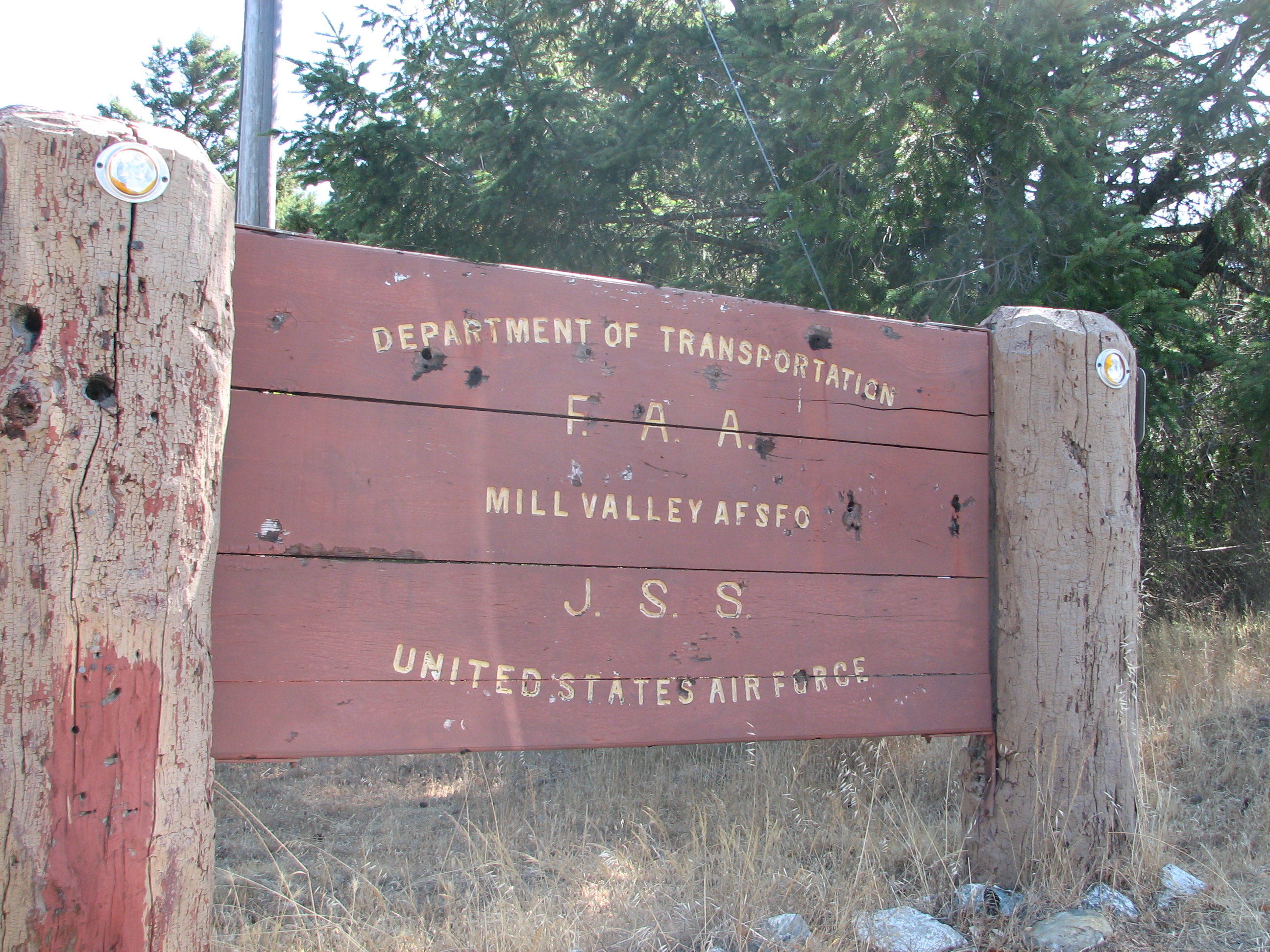
- Mill Valley Air Force Station
- Mill Valley Masonic Events Center
- Mill Valley Islamic Center
See also
References
- ^ "City Council". http://www.cityofmillvalley.org/Index.aspx?page=40. Retrieved 2010-12-06.
- ^ U.S. Census
- ^ U.S. Geological Survey Geographic Names Information System: Mill Valley, California
- ^ C. Michael Hogan. 2008. Ring Mountain, The Megalithic Portal, ed. A. Burnham
- ^ Kroeber, Alfred L. 1925. Handbook of the Indians of California. Washington, D.C: Bureau of American Ethnology Bulletin No. 78. (Chapter 30, The Miwok); available at Yosemite Online Library
- ^ Cook, Sherburne. 1976. The Conflict Between the California Indian and White Civilization. Berkeley and Los Angeles, CA: University of California Press. ISBN 0-520-03143-1.
- ^ http://www.gratonrancheria.com/ourpeople.htm
- ^ a b http://www.millvalleylibrary.org/Index.aspx?page=532
- ^ http://www.marinij.com/millvalley/ci_12329056
- ^ Goerke, Betty. 2007. Chief Marin, Leader, Rebel, and Legend: A History of Marin County's Namesake and his People. Berkeley, CA: Heyday Books. ISBN 13:978-1-59714-053-9
- ^ http://www.co.marin.ca.us/depts/lb/main/crm/maps/MarinRanchosMap.swf
- ^ a b c d e f g http://www.millvalleylibrary.org/Index.aspx?page=989
- ^ http://www.co.marin.ca.us/depts/lb/main/crm/maps/presidio.html
- ^ http://www.co.marin.ca.us/depts/lb/main/crm/maps/sausalito.html
- ^ http://www.nps.gov/goga/historyculture/portuguese-dairy-farmers.htm
- ^ http://www.millvalleyhistoricalsociety.org/history-of-early-mill-valley.html
- ^ http://www.pacificsun.com/story.php?story_id=853
- ^ a b http://mill-valley.freemasonry.biz/history/mill-valley-town.htm
- ^ http://mill-valley.freemasonry.biz/history/biographies.htm
- ^ Durham, David L. (1998). California's Geographic Names: A Gazetteer of Historic and Modern Names of the State. Quill Driver Books. p. 664. ISBN 9781884995149.
- ^ http://www.mttam.net/Default.aspx?tabid=828
- ^ http://www.co.marin.ca.us/depts/lb/main/crm/photoalbums/railroadalbum/railroad1.html
- ^ http://www.westpointinn.com/about.htm
- ^ http://www.co.marin.ca.us/depts/lb/main/crm/photoalbums/railroadalbum/muirinn.html
- ^ http://www.theoutdoorartclub.org/
- ^ http://www.dipsea.org/
- ^ http://www.sfgenealogy.com/marin/ourtowns/ot_mv.htm
- ^ http://www.mountainplay.org/about.html
- ^ a b c d e f Mill Valley Historical Society Spring 2000 Review
- ^ http://www.millvalleylibrary.org/Index.aspx?page=624
- ^ http://www.marinmagazine.com/Marin-Magazine/March-2007/When-Marin-Went-Dry/
- ^ http://www.millvalleylibrary.org/Index.aspx?page=627
- ^ http://marinet.lib.ca.us/
- ^ http://www.cityofmillvalley.org/Index.aspx?page=69
- ^ http://www.marinij.com/marin/ci_8182853
- ^ a b http://www.marinij.com/ci_8364890?source=most_viewed
- ^ http://www.cityofmillvalley.org/Index.aspx?page=675
- ^ http://www.marinwater.org/controller?action=menuclick&id=242
- ^ http://www.city-data.com/city/Mill-Valley-California.html See "Average climate in Mill Valley, California" graphs.
- ^ All data are derived from the United States Census Bureau reports from the 2010 United States Census, and are accessible on-line here. The data on unmarried partnerships and same-sex married couples are from the Census report DEC_10_SF1_PCT15. All other housing and population data are from Census report DEC_10_DP_DPDP1. Both reports are viewable online or downloadable in a zip file containing a comma-delimited data file. The area data, from which densities are calculated, are available on-line here. Percentage totals may not add to 100% due to rounding. The Census Bureau defines families as a household containing one or more people related to the householder by birth, opposite-sex marriage, or adoption. People living in group quarters are tabulated by the Census Bureau as neither owners nor renters. For further details, see the text files accompanying the data files containing the Census reports mentioned above.
- ^ "American FactFinder". United States Census Bureau. http://factfinder.census.gov. Retrieved 2008-01-31.
- ^ "MONEY Magazine: Best places to live 2005". CNN. http://money.cnn.com/magazines/moneymag/bplive/2005/. Retrieved 2010-05-12.
- ^ http://moneycentral.msn.com/content/invest/forbes/P62020.asp/
- ^ http://www.marinij.com/fastsearchresults/ci_4355908
- ^ http://www.marinij.com/fastsearchresults/ci_4910289
- ^ http://www.marinij.com/fastsearchresults//ci_3981677
- ^ http://www.cityofmillvalley.org/Index.aspx?page=416
- ^ Sandberg, Robert Skip (2010). Steps, Lanes and Paths of Mill Valley. Mill Valley, CA USA: Self. pp. 120. ISBN 978-0-9830494-0-1. http://www.robertsandbergphoto.com/steps-lanes-paths-mill-valley.asp.
- ^ http://www.cityofmillvalley.org/Modules/ShowDocument.aspx?documentid=3770
- ^ http://www.millvalleylibrary.org/
- ^ http://justplaygrounds.com/play/millValley/oldMill/index.htm
- ^ California School Recognition Program distinguished school honorees, accessed January 26, 2008[dead link]
- ^ http://www.millvalleylibrary.org/Index.aspx?page=867
- ^ http://marinet.lib.ca.us/search~S3?/dSustainability+Collection+--+Mill+Valley/dsustainability+collection+mill+valley/-3%2C-1%2C0%2CB/exact&FF=dsustainability+collection+mill+valley&1%2C80%2C
- ^ http://www.millvalleylibrary.org/Index.aspx?page=712
- ^ http://www.millvalleylibrary.org/Index.aspx?page=516
- ^ http://www.dipsea.org
- ^ http://www.mountainplay.org
- ^ http://www.mvff.com
- ^ http://www.mvfaf.org
- ^ http://curtaintheatre.org/
- ^ a b http://content.cdlib.org/view?docId=tf1489n5dm&chunk.id=bioghist-1.8.3&brand=oac
- ^ http://www.millvalleyhistoricalsociety.org/history-of-homestead-valley-2002.html
- ^ http://www.pacificsun.com/morguepdf/2007/2007_06_29.pac.section1.pdf p.9
- ^ http://www.amazon.com/exec/obidos/tg/detail/-/B00004SGY5
- ^ "Mill Valley" Chart History, Billboard.com.
- ^ http://www.scenepointblank.com/reviews/1056
- ^ http://licensetothrive.org/leader/detail/id/45
- ^ http://www.thefreelibrary.com/A+hero%27s+journey:+Jenny+Fulle+has+led+a+charmed+life+of+her+own...-a0159593365 A Hero's Journey: Jenny Fulle...
- ^ http://www.nps.gov/muwo/
- ^ http://www.parks.ca.gov/pages/471/files/mounttamalpais.pdf
External links
- Mill Valley Public Library
- Lucretia Hanson Little History Room
- City of Mill Valley
- Mill Valley Historical Society
- Mill Valley Masonic Lodge
- Mill Valley Fall Arts Festival
- California Film Institute (CFI)
- Mill Valley Film Festival
- Marin Theatre Company
- Mountain Play Association
- Curtain Theatre Shakespeare in the Park
- Mill Valley Chamber of Commerce
- The Dipsea Race
- Tamalpais Community Services District (T.C.S.D.)
- Tamalpais Valley Community Center (T.C.C.)
- Homestead Valley Community Association (H.V.C.A.)
Municipalities and communities of Marin County, California Cities and towns Belvedere | Corte Madera | Fairfax | Larkspur | Mill Valley | Novato | Ross | San Anselmo | San Rafael | Sausalito | Tiburon
CDPs Alto | Black Point-Green Point | Bolinas | Dillon Beach | Inverness | Kentfield | Lagunitas-Forest Knolls | Lucas Valley-Marinwood | Marin City | Muir Beach | Nicasio | Point Reyes Station | San Geronimo | Santa Venetia | Sleepy Hollow | Stinson Beach | Strawberry | Tamalpais-Homestead Valley | Tomales | Woodacre
Unincorporated
communitiesAlmonte | Bel Marin Keys | Belvedere Island | Bivalve | Black Point | Blakes Landing | Burdell | California Park | Cerro | Chapman | Cypress Grove | Dewitt | Dogtown | El Campo | Fallon | Five Brooks | Forest Knolls | Gallinas | Greenbrae | Hamlet | Harbor Point | Homestead Valley | Ignacio | Inverness Park | Jewell | Kent Woodlands | Lagunitas | Lairds Landing | Las Gallinas | Los Ranchitos | Lucas Valley | Manzanita | Marconi | Marinwood | Marshall | McDonald | McNears Beach | Meadowsweet | Millerton | Murray Park | Nicks Cove | Ocean Roar | Old Town | Olema | Paradise Cay | Reed | Reynolds | Sacramento Landing | Saint Vincent | San Antonio | San Quentin | Seahaven | Shafter | Strawberry Manor | Tamalpais Valley | Tamalpais Valley Junction | Tocaloma | Vincent Landing | Waldo
Ghost towns Categories:- Cities in Marin County, California
- Cities in the San Francisco Bay Area
- Incorporated cities and towns in California


Wikimedia Foundation. 2010.