- Kentfield, California
Infobox Settlement
official_name = Kentfield, California
settlement_type = CDP
imagesize =
image_caption =
image_
imagesize =
image_caption =
image_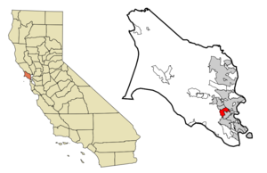
mapsize = 250x200px
map_caption = Location in Marin County and the state ofCalifornia
mapsize1 =
map_caption1 =
subdivision_type = Country
subdivision_type1 = State
subdivision_type2 = County
subdivision_name =United States
subdivision_name1 =California
subdivision_name2 = Marin
government_type =
leader_title = N/A
leader_name =
leader_title = County Board
leader_name = District 2Harold Brown
leader_title1 = Senate
leader_name1 =Carole Migden (D)
leader_title2 = Assembly
leader_name2 =Jared Huffman (D)
leader_title3 = U. S. Congress
leader_name3 =Lynn Woolsey (D)
established_date =
area_magnitude =
area_total_km2 = 7.8
area_total_sq_mi = 3
area_land_km2 = 7.8
area_land_sq_mi = 3
area_water_km2 = 0
area_water_sq_mi = 0
elevation_ft = 115
elevation_m = 35
population_as_of = 2000
population_footnotes =
population_total = 6351
population_metro =
population_density_km2 = 814.2
population_density_sq_mi = 2117
timezone = PST
utc_offset = -8
latd = 37 |latm = 57 |lats = 5 |latNS = N
longd = 122 |longm = 32 |longs = 50 |longEW = W
timezone_DST = PDT
utc_offset_DST = -7
postal_code_type =ZIP code s
postal_code = 94904, 94914
area_code = 415
blank_name = FIPS code
blank_info = 06-38114
blank1_name = GNIS feature ID
blank1_info = 1658892
footnotes =
website =Kentfield is a
census-designated place (CDP) in Marin County,California ,United States , just north of San Francisco. The population was 6,351 at the 2000 census. The ZIP code is 94904, and is shared with the neighboring community ofGreenbrae .Geography
Kentfield is located at coor dms|37|57|5|N|122|32|50|W|city (37.951491, -122.547148)GR|1.
According to the
United States Census Bureau , the CDP has a total area of 3.0square mile s (7.8km² ), of which, 3.0 square miles (7.8 km²) of it is land and 0.33% is water.Climate
The
National Weather Service reports that Kentfield's warmest month is July with an average high of 85.0°F (29.4°C) and an average low of 53.4°F (11.8°C). January is the coolest month with an average high of 56.2°F (13.4°C) and an average low of 40.7°F (4.8°C). The highest temperature on record was 111°F (43.9°C) on July 14, 1972. The lowest temperature recorded was 18°F (-7.8°C) on December 22, 1990. Annually, there are an average of 28.4 days with highs of 90°F (32°C) or higher and 3.5 days with highs of 100°F (38°C) or more. Freezing temperatures (32°F (0°C) or below) occur an average of 6.0 days each year.Kentfield has one of the highest average rainfalls of any community in the San Francisco Bay Area; normally 47.47 inches (120.6 cm) of rain falls each year on an average of 66.0 days. The most rainfall in a month was 26.95 inches (68.45 cm) in February 1986 and the most in 24 hours was 11.56 inches (27.74 cm) on January 21, 1967. Although heavy snow sometimes falls on nearby
Mount Tamalpais , snow is rare in Kentfield; however, traces were reported on January 28 and December 13, 1972.Demographics
As of the
census GR|2 of 2000, there were 6,351 people, 2,506 households, and 1,806 families residing in the CDP. Thepopulation density was 2,119.5 people per square mile (817.4/km²). There were 2,565 housing units at an average density of 856.0/sq mi (330.1/km²). The racial makeup of the CDP was 94.54% White, 0.35% Black or African American, 0.17% Native American, 2.14% Asian, 0.11% Pacific Islander, 0.46% from other races, and 2.24% from two or more races. 2.22% of the population were Hispanic or Latino of any race.There were 2,506 households out of which 34.2% had children under the age of 18 living with them, 62.3% were married couples living together, 7.6% had a female householder with no husband present, and 27.9% were non-families. 21.5% of all households were made up of individuals and 8.4% had someone living alone who was 65 years of age or older. The average household size was 2.52 and the average family size was 2.94.
In the CDP the population was spread out with 25.0% under the age of 18, 3.4% from 18 to 24, 22.0% from 25 to 44, 32.9% from 45 to 64, and 16.7% who were 65 years of age or older. The median age was 45 years. For every 100 females there were 93.7 males. For every 100 females age 18 and over, there were 88.9 males.
The median income for a household in the CDP was $117,457, and the median income for a family was $154,673. Males had a median income of $88,000 versus $59,286 for females. The
per capita income for the CDP was $79,459. About 2.8% of families and 3.7% of the population were below thepoverty line , including 4.7% of those under age 18 and 1.9% of those age 65 or over.Educational institutions
Adeline E. Kent Middle School
Adeline E. Kent Middle School is a California Distinguished School that hosts grades 5-8. As of 2003 it enrolled 509
student s. The school is racially homogeneous, with over 90% white. The next largest ethnicity is Asian, at 3 %. The school consists of 38 classrooms, as well as a multipurpose room, a gym, and a library. As of 2003, there were 32 teachers. Kent has anAcademic Performance Index of about 890 out of 1000, putting it within the top ten percent in the state ofCalifornia .Marin Catholic High School
Marin Catholic High School , aRoman Catholic college preparatory , serves young boys and girls in the Catholic tradition. The student population currently numbers around 725. The school is owned by the Archdiocese of San Francisco.College of Marin
The main campus for the
College of Marin is in Kentfield, and is across the street from Kent Middle School. College of Marin is well known for its theatre department, with the highest transfer acceptance toJuilliard of any junior college in the state.References
External links
Wikimedia Foundation. 2010.