- Inverness, California
Infobox Settlement
official_name = Inverness, California
settlement_type = CDP
imagesize =
image_caption =
image_
imagesize =
image_caption =
image_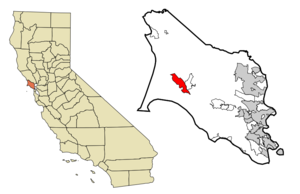
mapsize = 250x200px
map_caption = Location in Marin County and the state ofCalifornia
mapsize1 =
map_caption1 =
subdivision_type = Country
subdivision_type1 = State
subdivision_type2 = County
subdivision_name =United States
subdivision_name1 =California
subdivision_name2 = Marin
government_type =
leader_title = N/A
leader_name =
leader_title = County Board
leader_name = District 4
Steve Kinsey
leader_title1 = Senate
leader_name1 =Carole Migden (D)
leader_title2 = Assembly
leader_name2 =Jared Huffman (D)
leader_title3 = U. S. Congress
leader_name3 =Lynn Woolsey (D)
established_date =
area_magnitude =
area_total_km2 = 16.6
area_total_sq_mi = 6.4
area_land_km2 = 15.5
area_land_sq_mi = 6
area_water_km2 = 1.1
area_water_sq_mi = 0.4
elevation_ft = 43
elevation_m = 13
population_as_of = 2000
population_footnotes =
population_total = 1421
population_metro =
population_density_km2 = 85.6
population_density_sq_mi = 222
timezone = PST
utc_offset = -8
latd = 38 |latm = 5 |lats = 35 |latNS = N
longd = 122 |longm = 50 |longs = 54 |longEW = W
timezone_DST = PDT
utc_offset_DST = -7
postal_code_type =ZIP code
postal_code = 94937
area_code = 415
blank_name = FIPS code
blank_info = 06-36616
blank1_name = GNIS feature ID
blank1_info = 1658827
footnotes =
website =Inverness is an unincorporated community and
census-designated place (CDP) located in westernMarin County, California . In the2000 census, the population was 1,421. The community is named afterInverness inScotland by a Scots landowner.Inverness is north of San Francisco, on a bay of the
Pacific Ocean .Community
Inverness is located on the west shore of Tomales Bay, which runs southeast along the line of the San Andreas Fault. Surrounded by Point Reyes National Seashore, it is primarily a residential community, with little industry other than tourism. It has a small downtown area with a general store, post office, library, two restaurants and two gift shops. A third restaurant is located a short way north of downtown. There are also a number of hotels and inns spread throughout the town.
One aspect of the town is a concentration of recreational (and some commercial) boating. There is a small public marina, a few private piers, and the Inverness Yacht Club.
Portions of the John Carpenter film "
The Fog " as well as most of his film "Village of the Damned" were shot in and around Inverness.History
The town is a 15 miles or so from
Drake's Bay on the Pacific Ocean , named afterSir Francis Drake , who explored the coast in the 17th Century. Although Drake's official log was lost, the ship's doctor's log described landing in an area that reminded him of the White Cliffs of Dover. Drake's Bay is backed by similar-looking cliffs, leading many to believe this is where the ship landed.The region became the property of James Shafter, who began to develop the property in the 1890s. It became a summer resort where people from San Francisco and Oakland came to camp, hike and swim in Tomales Bay. Many built small summer cabins that still exist today. Small steamboats took day trippers down the bay to secluded beaches. They left from Brock Schreiber's boathouse, which has been preserved and is a prominent local landmark with its prominent sign "Launch for Hire."
In 1995, Inverness Ridge was the site of the Mt. Vision Fire, which burned a large area of
Point Reyes National Seashore and a number of homes built on the ridge. The town itself was threatened but was saved by helicopters dipping water from Tomales Bay to drop on the Bishop pine forest between the town and the burning ridgetop.Geography
Inverness is located at coor dms|38|5|35|N|122|50|54|W|city (38.092984, -122.848432)GR|1. According to the
United States Census Bureau , the CDP has a total area of 6.4 square miles (16.6 km²), of which, 6.0 square miles (15.5 km²) of it is land and 0.4 square miles (1.1 km²) of it (6.86%) is water.The town is adjacent to the
San Andreas Fault .Inverness is spread out along approximately convert|2|mi|km of the western shore and valleys of
Tomales Bay on thePoint Reyes Peninsula , it provides services to visitors to the Point Reyes National Seashore andTomales Bay State Park .Other nearby towns include Point Reyes Station, Inverness Park, Olema, and Marshall.
Demographics
As of the
census GR|2 of 2000, there were 1,421 people, 707 households, and 364 families residing in the CDP. Thepopulation density was 237.9 people per square mile (91.9/km²). There were 999 housing units at an average density of 167.3/sq mi (64.6/km²). The racial makeup of the CDP was 94.58% White, 0.42% Black or African American, 0.42% Native American, 1.13% Asian, 1.20% from other races, and 2.25% from two or more races. 5.70% of the population were Hispanic or Latino of any race.There were 707 households out of which 16.0% had children under the age of 18 living with them, 41.9% were married couples living together, 5.5% had a female householder with no husband present, and 48.4% were non-families. 37.2% of all households were made up of individuals and 10.0% had someone living alone who was 65 years of age or older. The average household size was 1.98 and the average family size was 2.56.
In the CDP the population was spread out with 14.5% under the age of 18, 2.7% from 18 to 24, 20.3% from 25 to 44, 41.8% from 45 to 64, and 20.8% who were 65 years of age or older. The median age was 51 years. For every 100 females there were 90.5 males. For every 100 females age 18 and over, there were 86.9 males.
The median income for a household in the CDP was $47,500, and the median income for a family was $78,398. Males had a median income of $42,448 versus $37,321 for females. The
per capita income for the CDP was $37,340. About 5.5% of families and 10.6% of the population were below thepoverty line , including 20.7% of those under age 18 and 3.6% of those age 65 or over.References
External links
* [http://www.co.marin.ca.us/depts/lb/main/wmarin/invindex.cfm Inverness Library]
*Wikitravel|Point Reyes National Seashore
* [http://www.pointreyes.org/inverness.html Inverness info at pointreyes.org]
Wikimedia Foundation. 2010.