- Tomales, California
Infobox Settlement
official_name = Tomales, California
settlement_type = CDP
imagesize =
image_caption =
image_
imagesize =
image_caption =
image_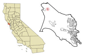
mapsize = 250x200px
map_caption = Location in Marin County and the state ofCalifornia
mapsize1 =
map_caption1 =
subdivision_type = Country
subdivision_type1 = State
subdivision_type2 = County
subdivision_name =United States
subdivision_name1 =California
subdivision_name2 = Marin
government_type =
leader_title = N/A
leader_name =
leader_title = County Board
leader_name = District 4Steve Kinsey
leader_title1 = Senate
leader_name1 =Carole Migden (D)
leader_title2 = Assembly
leader_name2 =Jared Huffman (D)
leader_title3 = U. S. Congress
leader_name3 =Lynn Woolsey (D)
established_date =
area_footnotes = GR|2
area_magnitude =
area_total_sq_mi = 0.31
area_land_sq_mi = 0.31
area_water_sq_mi = 0
area_water_percent = 0
elevation_footnotes = [gnis|236439|Tomales]
elevation_ft = 89
elevation_m = 27
population_as_of = 2000
population_footnotes = GR|2
population_total = 210
population_density_sq_mi = 670
timezone = PST
utc_offset = -8
latd = 38 |latm = 14 |lats = 45 |latNS = N
longd = 122 |longm = 54 |longs = 19 |longEW = W
timezone_DST = PDT
utc_offset_DST = -7
postal_code_type =ZIP code
postal_code = 94971
area_code = 707
blank_name = FIPS code
blank_info = 06-78890
blank1_name = GNIS feature ID
blank1_info = 236439
footnotes =
website = http://www.tomales.com/Tomales is a
census-designated place (CDP) on State Route 1 in Marin County,California ,United States . The population was 210 at the 2000 census.GR|2 The largest employer in Tomales isTomales High School , which has a student body of approximately 250.Geography
Tomales is located at coor dms|38|14|45|N|122|54|19|W|city (38.245809, -122.905377)GR|1, above Keys Creek, about convert|3|mi|km|0|lk=on|abbr=on northeast of
Tomales Bay . The nearest city is Petaluma, about 24 minutes away by automobile, and the nearest large city isSan Francisco , about 75 minutes to the south. [cite web|url=http://maps.google.com/maps|title=Google Maps|accessdate=2007-12-01]The CDP has a total area of convert|0.31|sqmi|km2|1|lk=on|abbr=on, all land.GR|2
History
When Europeans first reached Tomales Bay, it was home to
Coast Miwok people. Numerous authenticated Miwok villages are known from this area, including one (named "Utumia") sited near the present-day town of Tomales.cite web|url=http://www.accessgenealogy.com/native/california/miwokindianhist.htm|publisher=Access Genealogy|title=Miwok Indian Tribe|accessdate=2007-12-02]Starting in the 1870s, Tomales was a stop on the
North Pacific Coast Railroad connecting Cazadero to the Sausalito ferry.Built near the
San Andreas Fault , Tomales was affected by the1906 San Francisco earthquake . One of the town's two cemeteries predates the earthquake, and the damage to the pre-1906 plots show just how widespread the quake's effects were.Much of the 2001 movie "
Bandits " was filmed in and around Tomales, [cite web|url=http://www.imdb.com/title/tt0219965/locations|title=Filming locations for Bandits (2001)|publisher=The Internet Movie Database|accessdate=2007-12-02] as were the opening shots of "Mumford" (1999), [ [http://www.filminamerica.com/PacificNorthwest/NCA/MarinCounty/Tomales/ filminamerica.com] ] and parts of "Scream" (1996), [cite web|url=http://www.imdb.com/title/tt0117571/locations|title=Filming locations for Scream (1996/I)|publisher=The Internet Movie Database|accessdate=2007-12-02] and "Village of the Damned" (1995). [ [http://www.theofficialjohncarpenter.com/pages/themovies/vd/vdpronotes.html John Carpenter website] ]Demographics
As of the
census GR|2 of 2000, there were 210 people, 73 households, and 41 families residing in the CDP. Thepopulation density was 670/sq mi (262/km²). There were 85 housing units at an average density of 271/sq mi (106/km²). The racial makeup of the CDP was 96.67% White, 0.48% African American, 0.95% Native American, 1.43% Asian, and 0.48% from two or more races. Hispanic or Latino of any race were 2.38% of the population.There were 73 households out of which 28.8% had children under the age of 18 living with them, 37.0% were married couples living together, 13.7% had a female householder with no husband present, and 43.8% were non-families. 28.8% of all households were made up of individuals and 6.8% had someone living alone who was 65 years of age or older. The average household size was 2.41 and the average family size was 3.10.
In the CDP the population was spread out with 22.4% under the age of 18, 3.8% from 18 to 24, 21.4% from 25 to 44, 41.9% from 45 to 64, and 10.5% who were 65 years of age or older. The median age was 46 years. For every 100 females there were 90.9 males. For every 100 females age 18 and over, there were 87.4 males.
The median income for a household in the CDP was $51,953, and the median income for a family was $52,708. Males had a median income of $41,607 versus $46,389 for females. The
per capita income for the CDP was $26,609. None of the families and 14.3% of the population were living below thepoverty line , including no under eighteens and 14.3% of those over 64.Many new shopping areas are being built. Some are making local residence unhappy.fact|date=July 2008
References
External links
* [http://www.tomales.com/ Tomales website]
Wikimedia Foundation. 2010.