- Tiburon, California
Infobox Settlement
official_name = Tiburon, California
settlement_type =Town 
imagesize = 250px
image_caption = View of Downtown Tiburon, near the Ferry Docks.
image_
mapsize = 250x200px
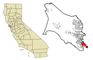
map_caption = Location in Marin County and the state ofCalifornia
mapsize1 =
map_caption1 =
subdivision_type = Country
subdivision_type1 = State
subdivision_type2 = County
subdivision_name =United States
subdivision_name1 =California
subdivision_name2 = Marin
government_type =
leader_title = Mayor
leader_name =
leader_title = County Board
leader_name = District 3Charles McGlashan
leader_title1 = Senate
leader_name1 =Carole Migden (D)
leader_title2 = Assembly
leader_name2 =Jared Huffman (D)
leader_title3 = U. S. Congress
leader_name3 =Lynn Woolsey (D)
established_date =
area_magnitude =
area_total_km2 = 34.2
area_total_sq_mi = 13.2
area_land_km2 = 11.7
area_land_sq_mi = 4.5
area_water_km2 = 22.5
area_water_sq_mi = 8.7
elevation_ft = 13
elevation_m = 4
population_as_of = 2000
population_footnotes =
population_total = 8666
population_metro =
population_density_km2 = 253.4
population_density_sq_mi = 656.5
timezone = PST
utc_offset = -8
latd = 37 |latm = 53 |lats = 24 |latNS = N
longd = 122 |longm = 27 |longs = 59 |longEW = W
timezone_DST = PDT
utc_offset_DST = -7
postal_code_type =ZIP code
postal_code = 94920
area_code = 415
blank_name = FIPS code
blank_info = 06-78666
blank1_name = GNIS feature ID
blank1_info = 1659998
footnotes =
website =Tiburon is an affluent incorporated town in
Marin County, California . It occupies most of the Tiburon Peninsula, which reaches south into theSan Francisco Bay . The smaller city of Belvedere (formerly a separate island) occupies the south-east part of the peninsula and is contiguous with Tiburon. Tiburon is bordered by Corte Madera to the north and Mill Valley to the west, but is otherwise surrounded by the Bay.The city's name comes from the Spanish word "tiburón", which means "
shark ." Tiburon was formerly the southern terminus of theNorthwestern Pacific Railroad . This railroad carried freight, mostly lumber, to the town for transfer tobarge s for shipping to cities around San Francisco Bay. It is now a commuter and tourist town, linked byfast ferry services toSan Francisco and with a concentration of restaurants and clothes shops. It is the nearest mainland point to Angel Island and a regular ferry service connects to the island.The former railroad right of way now forms part of the
San Francisco Bay Trail , used byhiker s and cyclists. Within the Tiburon town limits, therail trail passes through the Richardson Bay Park and next to theAudubon Society 'sRichardson Bay Sanctuary. These provide excellent opportunities for observingwildlife .Geography and environment
Tiburon is located at coor dms|37|53|24|N|122|27|59|W|city (37.889880, -122.466421)GR|1.
According to the
United States Census Bureau , the town has a total area of 34.2km2 (13.2 mi2). 4.5 square miles (11.7 km²) of it is land and 8.7 square miles (22.5 km²) of it (65.71%) is water, much in the form of Richardson Bay.There are a number of rare and
endangered species in Tiburon including theTiburon Indian paintbrush and theTiburon Jewelflower , "Streptanthus niger", the latter of which is a tiburon endemic.Demographics
As of the year 2000
census GR|2, there were 8,666 people, 3,712 households, and 2,409 families residing in the town. Thepopulation density was 1,914.9 people per square mile (738.6/km²). There were 3,893 housing units at an average density of 860.2/sq mi (331.8/km²). The racial makeup of the town was 90.92% White, 0.87% African American, 0.22% Native American, 4.42% Asian, 0.12% Pacific Islander, 0.75% from other races, and 2.71% from two or more races. Hispanic or Latino of any race were 3.66% of the population.There were 3,712 households out of which 27.7% had children under the age of 18 living with them, 55.3% were married couples living together, 7.2% had a female householder with no husband present, and 35.1% were non-families. 27.6% of all households were made up of individuals and 9.5% had someone living alone who was 65 years of age or older. The average household size was 2.31 and the average family size was 2.82.
In the town the population was spread out with 21.9% under the age of 18, 2.8% from 18 to 24, 24.4% from 25 to 44, 34.3% from 45 to 64, and 16.5% who were 65 years of age or older. The median age was 45 years. For every 100 females there were 88.3 males. For every 100 females age 18 and over, there were 84.1 males.
The median
income for a household in the town was $106,611, and the median income for a family was $149,041. Males had a median income of $100,000+ versus $60,773 for females. Theper capita income for the town was $85,966. About 1.6% of families and 3.3% of the population were below thepoverty line , including 3.0% of those under age 18 and 1.5% of those age 65 or over.Belvedere/Tiburon was ranked by "Forbes" magazine as among the 20 most expensive real-estate markets in the US. [http://www.forbes.com/lists/2006/7/Rank_1.html]
Economy
Tiburon features numerous small boutiques and restaurants, catering both to local residents and to tourists. Most of the town's restaurants are located on or near Main Street, near the ferry landing. In 2004 Tiburon became the first city in the world to eliminate "trans" fats from all its restaurants. [http://www.bantransfats.com/projecttiburon.html]
One of the oldest Tiburon restaurants is Sam's Anchor Cafe, founded in 1920. [http://www.samscafe.com/] Sam's is especially popular on sunny days for the outdoor dining on its harbor-front deck. It is one of the only restaurants in the San Francisco Bay with a public dock for pleasure boats (under 40 feet). Other restaurants to include upscale dining with expansive Bay views are The Caprice, Guaymas, The Dynasty and Servino Ristorante. [http://www.thecaprice.com/] [http://www.guaymasrestaurant.com] [http://www.servino.com/]
Tiburon has two hotels: Water's Edge, a
boutique hotel on Main Street, and the recently refurbished The Lodge at Tiburon. [http://www.marinhotels.com/waters.html] [http://www.thelodgeattiburon.com/]One weekly newspaper is published in the town, The Ark, which extensively covers local news and events. [http://www.thearknewspaper.com/]
On Friday evenings in the spring and summer, the town's Main Street is closed to vehicles and transformed into a large
al fresco dining area for "Friday Nights on Main". [http://www.tiburonchamber.org] . Local restaurants and bars provide outdoor dining and drinks, with music and lively crowds helping create a festive atmosphere. There is also a small shopping center named The Cove in the Bel Aire neighborhood.History
Tiburon has a Town Historian, Branwell Fanning. Much of the material below is drawn from his "Brief History of Tiburon", published in the Town of Tiburon's General Plan. [http://www.ci.tiburon.ca.us/GeneralPlan/generalplan.htm]
1775–1882
"Tiburón" means "shark" in Spanish. Whether Lt. Juan Manuel de Ayala saw a number of sharks near where he anchored the San Carlos in August
1775 , off what is nowAngel Island , or whether the tree-covered Tiburon Peninsula looked like a shark we may never know. He named the land Punta del Tiburon, or Shark Point. TheCoast Miwok Indians had lived here for thousands of years, but there is no clear concept of what they called thepeninsula .John Reed, from Dublin, received a provisional grant for much of Southern Marin, including the Tiburon Peninsula, from the Mexican authorities in 1831, and was formally granted the Rancho Corte de Madera del Presidio in 1834. Reed married Hilaria Sanchez, daughter of the "commandante" of the San Francisco Presidio in 1836. The Reed name is preserved on streets, subdivisions, and the local school district. Various forms of Hilaria's name, and that of her granddaughter Hilarita Reed, are found on streets, a housing development, and the Catholic Church.
Hilarita married Dr.
Benjamin Lyford , who became the first land developer with his Lyford's Hygeia, now Old Tiburon. Their house, formerly located on theirdairy farm on Strawberry Point, is now a feature of the Audubon Society's Western Headquarters and Sanctuary on Greenwood Beach Road.Tiburon's industrial era
Life changed little in the 40 years between the death of John Reed in 1842 and the arrival of Peter Donahue in 1882. Donahue brought with him the North Pacific Railroad (later the
Northwestern Pacific Railroad ). He made a deal with the Reed family for a right-of-way, blasted out the rock at Point Tiburon, and built a railroad yard andferry terminal. The passenger ferries took commuters and automobiles to San Francisco and Sausalito, whilebarge s carried loaded freight cars to San Francisco and Richmond.The last railroad operated passenger
ferry left Tiburon in 1941, but the passenger and freight trains ran until 1967. Passenger ferry service was resumed in the 1960s when Harbor Carriers utilized sightseeing boats in the early morning and evening hours. In the 1970s the railroad tore up the tracks, plugged the tunnels, removed the trestle over Trestle Glen, and demolished the railroad ferry pier. The railroad right-of-way was purchased by the City of Tiburon and is now the waterfront Multi-Use Path. After years of hearings and studies, the former railroad yards became the Point Tiburon housing and commercial project.During its heyday the railroad-ferry service brought many other industries to Tiburon. Codfish canneries sprouted along the bay shore to can fish brought down from Alaska. Ship dismantlers broke up many obsolete ocean-going vessels, and the Navy established a huge coaling station on the east shore of the peninsula. Brick kilns were built and several powder plants opened, and oyster beds developed in the shallow waters of the bay. The rail yards were fully equipped to not only repair and service trains but to build passenger and freight cars and locomotives.
Several of the largest
San Francisco Bay ferries were built in the Tiburon yards. The Navy coaling station has played a prominent part in the history of both Tiburon and Bay Area at large.Theodore Roosevelt 'sGreat White Fleet was refueled there on its famous round-the-world cruise. Coaling service ended in 1931 and theCalifornia Maritime Academy moved in to train officers for the merchant fleet. Because the large cranes left over from the coaling operations were still operational, the company spinning the cables for theGolden Gate Bridge set up shop.World War II
As
World War II loomed, the site was converted to the manufacture and service of hugeanti-submarine net s, which guarded the Golden Gate and other harbors across the Pacific, and to train the sailors to handle them. Later, theU.S. Bureau of Mines and theU.S. Bureau of Fisheries established research facilities on the site and the Coast Guard's icebreakers made this their summer home. It is now theRomberg Tiburon Center for Environmental Studies [ [http://rtc.sfsu.edu/ Romberg Tiburon Center for Environmental Studies] ] operated bySan Francisco State University .With all the seamen, sailors, railroad workers, cannery employees, and local dairymen in Tiburon, the taverns and other attractions of Main Street were very popular on Saturday night. Prohibition did not interrupt Main Street activities as the railroad workers were able to signal the Tiburon depot as soon as any revenuers boarded a train or ferry headed for town. By the time they got to Tiburon, prayer meetings were being held in the taverns. The volunteer fire department organized highly spirited baseball games, and the Corinthian Yacht Club was in full swing, so Main Street was not the only activity center.
World War II brought more people to Tiburon as the Navy built housing for NetDepot workers on the site of the present Hilarita Housing, for sailors from submarines at an annex to the Net Depot (now Paradise Beach County Park). Real estate development did not get under way in any meaningful form until after the end of the war. The descendants of the Reed family still controlled most of the land that was used for cattle ranching. Small areas of filled land were sold off to create the Bel Aire and Belveron Gardens subdivisions. The Little Reed Ranch was sold and Hawthorne Terrace, Del Mar and Reed Heights subdivisions were well under way by the time the County finally began preparing a Master Plan for the Tiburon Peninsula.After several years of public hearings and discussions with the primary landowners a Master Plan was finally completed in 1956. It had something for everyone: freeways on both sides of the peninsula, a four lane "ridge route" down the center of the peninsula (with a high-level bridge over Trestle Glen Blvd.), a shopping center on the crest of Ring Mountain, and a bridge to
San Francisco (viaAngel Island andAlcatraz ) off the end. A land-use density of two homes to the acre, plus areas zoned for apartments and duplexes, would have permitted 50,000 to 60,000 people to live in Tiburon.City incorporation and growth
There had been numerous attempts to incorporate a City of Tiburon over the years, but they had all failed to come to a vote due to the opposition of the large land owners. The only semblance of local land use input came from the Tiburon Peninsula Coordinating Council (TPCC). This was made up of representatives of each of the home owners associations; the school, fire and sanitary districts; and the City of Belvedere. In 1963, after a number of adverse rulings by County planners regarding development on the Tiburon Peninsula, the leaders of the TPCC decided that another attempt to incorporate was justified. A separate incorporation committee was established and work began. The main issues were: revision of the 1956 Master Plan, improved police services, the bridge to San Francisco, preserving open space, and getting some form of effective local government.
One of the first challenges to be decided was just what properties were to be included in the incorporated area. The mapping committee started with the Tiburon Fire Protection District map as a base. The properties of large land owners who had been able to frustrate previous attempts were eliminated from the map. Certain areas, such as the Reedlands and part of Belveron Gardens, which were outside the Tiburon Fire District, but which wanted to be in the new city, were added. Angel Island, also outside the fire district boundary, was more controversial. Most did not see any value to having it within the city limits, as it was a state park. The counter argument was that it was "there", and we wanted a say in whatever future development might be planned. The County Boundary Commission (later [http://lafco.marin.org LAFCO] ), at the time made up of the members of the Board of Supervisors wanted it out of the new city because of potential sales tax revenues.
They finally yielded to arguments put forth by the incorporation committee, and let it remain within the new city limits. In March 1964 an election was held to create the City of Tiburon, and on
June 23 ,1964 , the incorporation was final and a City Council seated, and mayor elected.A city manager was hired and a contract for police services was made with the county sheriff. A Planning Commission was established and commissioners appointed. Offices at 80 Main Street were rented. To help plan for the future the Tiburon Advisory Committee was appointed, consisting of citizens who had been active in community affairs. Their report, issued in 1965, outlined goals in land use, recreation, traffic, and "image".
In 1966, at the first election after incorporation, three of the incumbents were replaced. Over the next several years, the new City Council strengthened the Planning Commission and divided it further into Boards of Design Review and Adjustments. They completed a new Master Plan and General Plan for the peninsula and new zoning ordinances to implement the plans. They also created a parks and recreation commission. Special ordinances to protect trees and to protect views were created. Property values were rising faster than funds could be accumulated, so bonds were issued and several hundred acres of open space were acquired. Several hundred additional acres were purchased by the Nature Conservancy to permanently protect the ridgelines, and the City purchased additional land from the Navy. The railroad right-of-way, almost convert|2.5|mi|km of frontage on Richardson Bay, was acquired for a bicycle path.
One of the most difficult decisions involved
traffic planning . After numerous public hearings it was finally decided that Tiburon Boulevard would remain a two-lane road east of Trestle Glen Blvd. Stop lights and turnouts were scheduled east of that point and eventually built. The four-lane bypass section from Highway 101 to Blackie's Pasture (the old Tiburon Blvd. became Greenwood Beach Road) was completed in 1966. TheCalifornia Department of Transportation (Caltrans) had anticipated extending the four lanes downtown, so the fill created during this project was placed in the Bay east of Blackie's Pasture, and after the City did some land swapping with Caltrans, became McKegney Green and the park South of Knoll Park. Blackie's Pasture property was also acquired and became part of the series of waterfront parks and paths known as the Richardson Bay Lineal Park.LAFCO determined that Tiburon's sphere of influence would extend to Highway 101. Annexation of the rest of the peninsula was attempted but never successful due to opposition in Strawberry. Eventually, those areas that wished to be within the city limits were annexed, and the city grew westward to include the Reedland Woods, Bel Aire, Tiburon Crest and Cypress Hollow subdivisions.
After 1997
The completion of the Point Tiburon development in the former railroad yards signaled a change in the population mix and needs of the area. The Town acquired the waterfront land as part of the Point Tiburon development and created the Ferry Landing and Plaza. In 1997 a new Town Hall was opened with a new
Belvedere-Tiburon Library next door. A new police station followed in 2000.Following a large and successful Millennium Party the Town has pursued a policy to revitalize Main Street and the rest of downtown Tiburon. Main Street was reconstructed for both aesthetics and to make it and the shops and restaurants handicapped accessible. The Allan Thompson Walkway along the water side of Main Street was completely rebuilt. A waterfront park from the ferry landing to Elephant Rock Fishing Pier included the Donahue Building, last survivor of the railroad presence. In the summer of 2004 a series of "Friday Nights on Main Street" community parties was inaugurated. Main Street was closed to automobile traffic and the restaurants created special menus for the occasion. Tables in the street in front of each restaurant added to the festivities.
In November, 2006, a commissioned fountain with a nautically-themed sculpture titled "Coming About" was unveiled at the entrance to Main Street. About half of the $500,000 cost of the sculpture was donated by the Zelinsky family, longtime owners of many commercial properties in Tiburon. The sculpture was designed by Jeffery Reed and Jennifer Madden.
Development
Controversies surrounding development are a significant public policy issues facing the Town; this condition has endured for at least three decades.Fact|date=September 2008
At the lowest level, any new construction or exterior renovation, commercial or residential, must be approved by the Design Review Board, which often applies stringent criteria to avoid "eyesores" and preserve neighbors' views. [http://www.ci.tiburon.ca.us/government/design%20review%20board/index.asp]
More significantly, there remain several large tracts of undeveloped land, virtually all of which have owners who desire to build multiple residences on these properties. Many of these properties, while located on the Tiburon Peninsula, are outside of town boundaries. However, under a LAFCO policy, any urbanization of these lands would result in their being annexed by the Town, since it is the Town that would provide needed services. Hence it is the town planning commission and ultimately the Town Council that determines the extent that these lands can be developed. [http://www.ci.tiburon.ca.us/government/planning%20commission/index.asp] [http://www.ci.tiburon.ca.us/government/town%20council/index.asp] Major tracts of land currently in various stages of planning or permitting include the Martha Property, Easton Point and Tiburon Glen. The permitting processes in all cases are lengthy and contentious, pitting developers against active and organized residents seeking to preserve the open space and quasi-rural character of the area and avoid the kind of traffic seen by other Bay Area communities. Particularly active in opposing development is the Tiburon Last Chance Committee. No development has yet begun on any of these open tracts.
The Martha Property and Easton Point, the largest of the undeveloped lands, are particularly contested issues, with court battles dating back to 1975.Fact|date=September 2008 Historically the
Ring Mountain property was an area of contest, especially due to the highbiodiversity and presence of rare andendangered species .In 2002 residents in a referendum narrowly defeated a proposed rule that would have prohibited much of the development on open tracts of land by, among other things, banning development near ridgelines. [http://www.smartvoter.org/2002/11/05/ca/mrn/meas/I/] Among the arguments against this proposal were that it would subject the town to costly lawsuits by developers claiming their economic rights had been unjustly impaired.
A 2006 controversy concerned the expansion plans of the Kol Shofar Synagogue. These were opposed by a number of neighbors, principally over the size of a new multi-purpose room and the traffic and noise impact of a proposed 27 additional events with up to 250 persons. The Tiburon Planning Commission in the summer of 2006 rejected the expansion plans, claiming that Kol Shofar refused to engage in compromise discussions. This brought the issue to the Tiburon Town Council. In October 2006, the dispute took on broader significance when Kol Shofar proponents raised issues of religious freedom. Specifically, they claimed that the federal
Religious Land Use and Institutionalized Persons Act (RLUIPA), which prohibits "substantial burdens" on the exercise of religion by government regulations, would be violated if the Town prohibited their expansion plans. The synagogue retainedThe Becket Fund for Religious Liberty which threatened litigation depending on the outcome. The Tiburon City Council attempted to resolve the issue late in the 2006 by permitting a somewhat reduced expansion with restrictions on event sizes and hours and provisions to mitigate the parking, noise and traffic impacts. However a group of neighbors sued both the town and the synagogue in March, 2007, alleging environmental and land-use violations.Schools
Tiburon, Belvedere, and a part of Corte Madera are in the
Reed Union School District . The District has three schools, all located in Tiburon: Reed Elementary (grades K-2); Bel Aire Elementary (grades 3-5); and Del Mar Middle School (grades 6-8). [ [http://www.reedschools.org/index.html Reed Union School District] Accessed2007-02-17 ] All three have been recognized as "California Distinguished Schools" by the state Department of Education. St. Hilary School, a Catholic primary school for children grades K-8, is also located in Tiburon. [ [http://sainthilary-school.org/index.html St. Hilary School] Accessed2007-02-17 ]All three of Tiburon's public schools have gone or are undergoing substantial renovation and expansion. Reed completed reconstruction in 2004, and both Bel Aire and Del Mar completed reconstruction in 2006.
Tiburon is in the
Tamalpais Union High School District and the Marin Community College District. Tiburon graduates attendedTamalpais High School in Mill Valley from 1908, when Tam opened, until 1958, when Redwood High School opened in Larkspur, with Reed Union School District in its attendance area.Natural Hazards
In
2006 , Tiburon launched the Get Ready 94920 program, which seeks to be the first city in the nation to train 100% of its citizens in disaster preparedness. [http://www.getready94920.org]See also
References
External links
* [http://www.bayareacensus.ca.gov/cities/Tiburon.pdf Tiburon demographic information]
* [http://www.thelibrary.info Belvedere-Tiburon Library]
* [http://www.tiburonheritageandarts.org Tiburon Heritage & Arts Commission]
* [http://www.landmarks-society.org Belvedere-Tiburon Landmarks Society]
* [http://www.reedschools.org/ Reed Union School District]
* [http://www.tiburonchamber.org Tiburon Belvedere Chamber of Commerce]
* [http://www.tibtv.com TibTV: Live from Tiburon, California]
Wikimedia Foundation. 2010.