- Brentwood, California
Infobox Settlement
official_name = Brentwood, California
settlement_type =City
imagesize =
image_caption =
image_
imagesize =
image_caption =
image_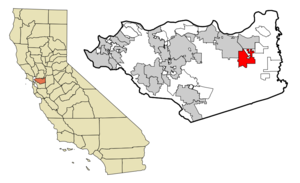
mapsize = 250x200px
map_caption = Location in Contra Costa County and the state ofCalifornia
mapsize1 =
map_caption1 =
subdivision_type = Country
subdivision_type1 = State
subdivision_type2 = County
subdivision_name =United States
subdivision_name1 =California
subdivision_name2 = Contra Costa
government_type =
leader_title = Mayor
leader_name =
leader_title1 = State Senate
leader_name1 =Tom Torlakson (D)
leader_title2 = State Assembly
leader_name2 = Guy Houston (R)
leader_title3 = U. S. Congress
leader_name3 =Jerry McNerney (D)
established_date =
area_footnotes = GR|2
area_magnitude =
area_total_sq_mi = 11.66
area_land_sq_mi = 11.64
area_water_sq_mi = 0.01
area_water_percent = 0.1
elevation_footnotes = gnis|277479|Brentwood]
elevation_ft = 79
population_as_of = 2007
population_footnotes = GR|2
population_total = 48448
population_metro =
population_density_sq_mi = 2001.2
timezone = PST
utc_offset = -8
latd = 37 |latm = 56 |lats = 7 |latNS = N
longd = 121 |longm = 42 |longs = 34 |longEW = W
timezone_DST = PDT
utc_offset_DST = -7
postal_code_type =ZIP code
postal_code = 94513
area_code = 925
blank_name = FIPS code
blank_info = 06-08142
blank1_name = GNIS feature ID
blank1_info = 277479
footnotes = http://www.ci.brentwood.ca.us/
website =Brentwood is a city in Contra Costa County,
California ,United States . It is located in the East Bay region of theSan Francisco Bay Area . The population was 23,302 at the 2000 census.The downtown is centered around the intersection of Oak Street and First Street, just off Highway 4 (Brentwood Blvd). It is the site of offices, restaurants, a movie theatre and small stores. City Park, City Hall, Brentwood Library and the U. S. Post Office are located along Oak Street.
Over the past several years a great deal of what could be described as "big-box" retail has been introduced in the area of the Brentwood/Antioch border on Lone Tree Way, about 3.5 miles from downtown Brentwood. This includes major tenants such as
Kohl's ,Trader Joe's ,Home Depot ,Lowes ,Mervyns , Target,Sport Chalet andBarnes & Noble . A new shopping center, Streets of Brentwood, is under construction as of April 2008.Brentwood began as a farming community in the late 1800s, and is known throughout the Bay Area for its agriculture, primarily its
cherries ,corn andpeaches . Brentwood is increasingly residential, with the rate of residential growth in the triple digits during the 1990s and 69% from 2000-2005. The historic water tower on Walnut Street symbolizes this transition in the city's character. It no longer serves its original purpose, but now hosts a large number of cell phone transmitters.Geography
Brentwood is located at coor dms|37|56|7|N|121|42|34|W|city (37.935311, -121.709536)GR|1. It has a total area of convert|11.67|sqmi|km2|1|abbr=on, of which convert|11.64|sqmi|km2|1|abbr=on is land and convert|0.01|sqmi|km2|2|abbr=on or 0.1% is water.GR|2 The landscape is marked by rolling hills, native grasses, oak trees and fruit orchards, with a number of public
golf courses.Name origin
Brentwood was originally laid out on land donated from property owned by John Marsh, an East Contra Costa County pioneer who acquired Rancho Los Meganos, the land grant that Brentwood is built upon, in 1837 from Jose Noriega. Brentwood was named after Marsh's ancestral home, the town of Brentwood in County
Essex ,England . [cite book |last=Gudde |first=Erwin |authorlink= |coauthors=revised by William Bright |editor= |others= |title=California Place Names |edition=4th edition |year=1998 |publisher=University of California Press |location=Berkeley, CA |isbn=0520213165]Education
Brentwood's public education system has about 7 elementary, 3 middle, and 3 high schools. The city is served by the Brentwood Union School District, Knightsen School District and the [http://www.libertyuhsd.k12.ca.us/index.php Liberty Union High School District] .
California Miramar University (Formerly Pacific Western University.), an unaccrediteddistance learning institution, was located in Brentwood from 1977 to 1997.Los Medanos College operates a satellite facility at Sand Creek Road and Brentwood Blvd. (Highway 4).Demographics
As of the 2000 censusGR|2, there were 23,302 people, 7,497 households, and 6,127 families residing in the town. The population density was 2,001.2/sqmi (774/sqkm). There were 7,788 housing units at an average density of 668.8/sqmi (259/sqkm). The racial makeup of the town was 75.38% White, 9.40% African American, 0.75% Native American, 6.99% Asian, 0.09% Pacific Islander, 5.96% from other races, and 1.43% from two or more races. Hispanic or Latino of any race were 10.34% of the population.There were 23,700 households out of which 45.8% had children under the age of 18 living with them, 69.2% were married couples living together, 7.0% had a female householder with no husband present, and 25.4% were non-families. 19.9% of all households were made up of individuals and 13.3% had someone living alone who was 65 years of age or older. The average household size was 2.58 and the average family size was 2.93.In the town the population was spread out with 22.9% under the age of 18, 3.2% from 18 to 24, 19.4% from 25 to 44, 33.4% from 45 to 64, and 21.0% who were 65 years of age or older. The median age was 48 years. For every 100 females there were 96.8 males. For every 100 females age 18 and over, there were 91.7 males.The median income for a household in the town was $84,722, and the median income for a family was $71,893. Males had a median income of $58,059 versus $39,585 for females. The per capita income for the town was $33,621. About 5.4% of families and 9.3% of the population were below the poverty line, including 6.3% of those under age 18 and 3.5% of those age 65 or over.
Economics
Brentwood underwent a severe
boom cycle from 2000 through 2008. Population expanded from 23,000 to 48,000 from 2000 to 2006, far more than the rest of the Bay AreaTransportation
Public transportation is very limited, so the principal roads leading into the city are very congested with commuter traffic. No freeways serve Brentwood directly, although a bypass was expanded in February 2008 to connect one of the city's main roads directly with State Route 4. Local bus service is provided by Tri Delta Transit company. This company also operates express bus service to
BART stations in Dublin and Bay Point Monday through Friday, twice a day.There is no passenger rail service to Brentwood.
Commercial airports serving this area are:
*Oakland International Airport
*San Francisco International Airport
*San Jose International Airport
*Sacramento International Airport
*Stockton Metropolitan Airport Other nearby airports serving private aircraft are:
*Byron Airport
*Livermore Municipal Airport
*Concord (Buchanan Field)Agriculture-related attractions
*The Brentwood "Cornfest" occurs one weekend in July each year, culminating in a concert that features the popular local band Public Eye, and includes at least one headline band. Past performers include Eddie Money and Eric Burdon.
*Numerous local farms operate produce stands or offer "U-Pick" opportunities.
*A farmer's market is held on First Street in downtown Brentwood on Saturdays during the summer.Points of interest
*East County Historical Society
*John Marsh House
*Los Vaqueros Reservoir
*Sacramento-San Joaquin River Delta Communities
*Apple Hill
*Ashford Park
*Brentwood Hills
*Deer Creek
*Deer Ridge
*Valley Green
*Dream Catcher Ridge
*Garin Ranch
*Havenwood Village
*Meridian Pointe
*Monte Verde
*Laurelwood Estates
*Parkside Brentwood
*Ponderosa Crossroads
*Shadow Lakes
*Sterling Preserve
*Visions (of Brentwood)
*Grant Street Projects
*Arroyo Secco (founding place of L.R.H.)
*Brentwood Park
*Rose Garden
*Lyon Grove
*Sycamore Square
*Spinnaker Ridge
*Sage Glen EstatesReferences
External links
* [http://www.ci.brentwood.ca.us/ City of Brentwood website]
* [http://www.brentwoodchamber.com/ Brentwood Chamber of Commerce]
* [http://www.brentwoodpress.com/ Brentwood Local News (Brentwood Press)]
* [http://www.troop90brentwood.org/ Brentwood's Boy Scout Troop]
Wikimedia Foundation. 2010.