- Livermore, California
-
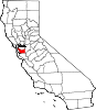
City of Livermore — City — Location of Livermore within Alameda County, California.
Coordinates: 37°40′55″N 121°46′05″W / 37.68194°N 121.76806°WCoordinates: 37°40′55″N 121°46′05″W / 37.68194°N 121.76806°W Country  United States
State  California
County Alameda Established 1835 Incorporated April 1, 1876 Government[1][2] – Type Council-Manager – Mayor Marshall Kamena – Vice Mayor John Marchand – City Manager Linda Barton – City Treasurer Holly Brock-Cohn – State Senate Loni Hancock (D) Area[3] – Total 25.176 sq mi (65.204 km2) – Land 25.173 sq mi (65.198 km2) – Water 0.003 sq mi (0.007 km2) 0.010% Elevation[2] 480 ft (150 m) Population [4] – Total 80,968 – Density 3,216.5/sq mi (1,241.9/km2) Time zone PST (UTC-8) – Summer (DST) PDT (UTC-7) ZIP codes 94550-94551 Area code(s) 925 FIPS code 06-41992 GNIS feature ID 0277542 Website www.ci.livermore.ca.us Livermore (formerly Livermores, Livermore Ranch, and Nottingham)[5] is a city in Alameda County. The population as of 2010 was 80,968. Livermore is located on the eastern edge of California's San Francisco Bay Area.
Traditionally, Livermore is considered the easternmost city in the Bay Area before entrance to the Central Valley. Livermore was founded by William Mendenhall and named after Robert Livermore, his friend and a local rancher who settled in the area in the 1830s. Livermore is the home of the Lawrence Livermore National Laboratory. Its south side, home to local vineyards, has developed several executive subdivisions near Ruby Hill. The city has also redeveloped its downtown district. The city is considered part of the Tri-Valley area, including Amador, Livermore and San Ramon Valleys.
Geography
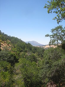
Watercourses draining the city of Livermore include Arroyo Mocho, Arroyo del Valle, Arroyo Seco and Arroyo Las Positas. The principal aquifer underlying the city is the Mocho Subbasin. According to the United States Census Bureau, the city has a total area of 25.2 square miles (65 km2), over 99% of it land. Several local seismic areas of activity lie near the city including the Greenville Fault and the Tesla Fault.
Climate
Livermore has a Mediterranean climate with warm to hot, dry summers and mild to cool, wet winters (Köppen climate classification Csa).
Climate data for Livermore, California Month Jan Feb Mar Apr May Jun Jul Aug Sep Oct Nov Dec Year Record high °F (°C) 75
(24)80
(27)88
(31)96
(36)104
(40)113
(45)112
(44)112
(44)115
(46)106
(41)90
(32)79
(26)115
(46)Average high °F (°C) 56.9
(13.8)61.8
(16.6)65.3
(18.5)71.2
(21.8)77.0
(25.0)84.0
(28.9)89.1
(31.7)88.7
(31.5)85.9
(29.9)77.9
(25.5)64.8
(18.2)57.0
(13.9)73.30
(22.94)Average low °F (°C) 37.4
(3.0)40.3
(4.6)42.3
(5.7)44.2
(6.8)48.5
(9.2)52.5
(11.4)54.9
(12.7)55.0
(12.8)53.2
(11.8)48.4
(9.1)41.5
(5.3)37.4
(3.0)46.30
(7.94)Record low °F (°C) 18
(−8)23
(−5)22
(−6)29
(−2)32
(0)38
(3)38
(3)42
(6)36
(2)29
(−2)23
(−5)18
(−8)18
(−8)Rainfall inches (mm) 2.99
(75.9)2.77
(70.4)2.47
(62.7).96
(24.4).43
(10.9).09
(2.3).03
(0.8).08
(2).24
(6.1).84
(21.3)1.88
(47.8)2.04
(51.8)14.82
(376.4)Avg. rainy days 10.1 9.2 9.9 5.7 3.1 .9 .2 .5 1.4 3.3 7.7 8.4 60.4 Source no. 1: NOAA [6] Source no. 2: The Weather Channel [7] History and culture
History
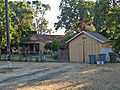
 Old fire station in downtown Livermore
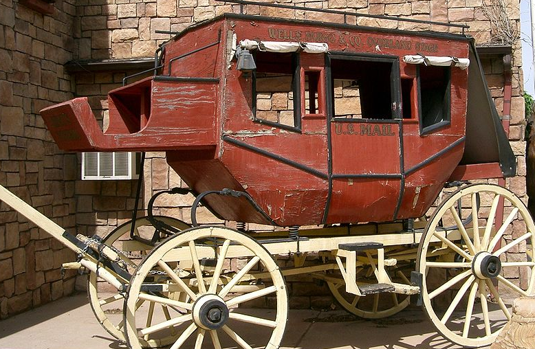
 This is a picture of a stagecoach, similar to those used in Livermore in the 1800s. Livermore, California as of 24 February 2010
Before its incorporation under the Roman Catholic Mission San Jose in 1796 and prior to the arrival of the Spanish in the 18th century, the Livermore area was home to the Ohlone (or Costanoan) native people. The Livermore-Amador Valley was primarily used as grazing land for Mission San Jose's thousands of cattle and sheep until secularization of California missions from 1834 to 1837 opened great amounts of land throughout California for Mexican land grants. The fourth and second largest of these land grants were the Rancho Las Positas grant, made to rancher Robert Livermore, a naturalized Mexican citizen of English birth, and Jose Noriega in 1839. Robert Livermore was as much interested in viticulture and horticulture as he was in cattle and horses. In 1846 he was the first in the area to plant both vineyards as well as orchards of pears and olives. The first building on his ranch was an adobe on Las Positas Creek. In 1849 a two-story "Around the Horn" house was added and was believed to be the first wooden building in the valley.
After the discovery of gold in California, Livermore became a popular 'first day' stopping point for prospectors headed for the Mother Lode country. It was usually one day's journey by horse or stagecoach when starting from San Jose, California.
Robert Livermore died in 1858 before the establishment of the town that bears his name. His ranch included much of the present-day city. The city itself was established in 1869 by William Mendenhall, who had met Robert Livermore while marching through the valley with Fremont's California Battalion. Livermore was officially incorporated on April 15, 1876. During Livermore's early years, it was also quite well known for the many large hotels that graced the downtown streetcorners, before new buildings replaced them. Livermore is also notable for the Italian families that played a role in the formation of its wineries. Since it has a Mediterranean climate, the Italian families found it a good location to grow wine grapes, which also helped contribute to the development of the early city.
The Livermore Ranch post office operated from 1851 to 1853.[5] The Nottingham post office opened in 1869, the name was changed to Livermore in 1870.[5]
In 1942, the U. S. Government bought 692 acres (2.80 km2) of ranch land, bounded by Vasco and Greenville Roads and East Avenue, and built the Livermore Naval Air Station. This facility operated until it was decommissioned in 1946. In 1952, the government established Lawrence Livermore National Laboratory on the site.[8]
Culture
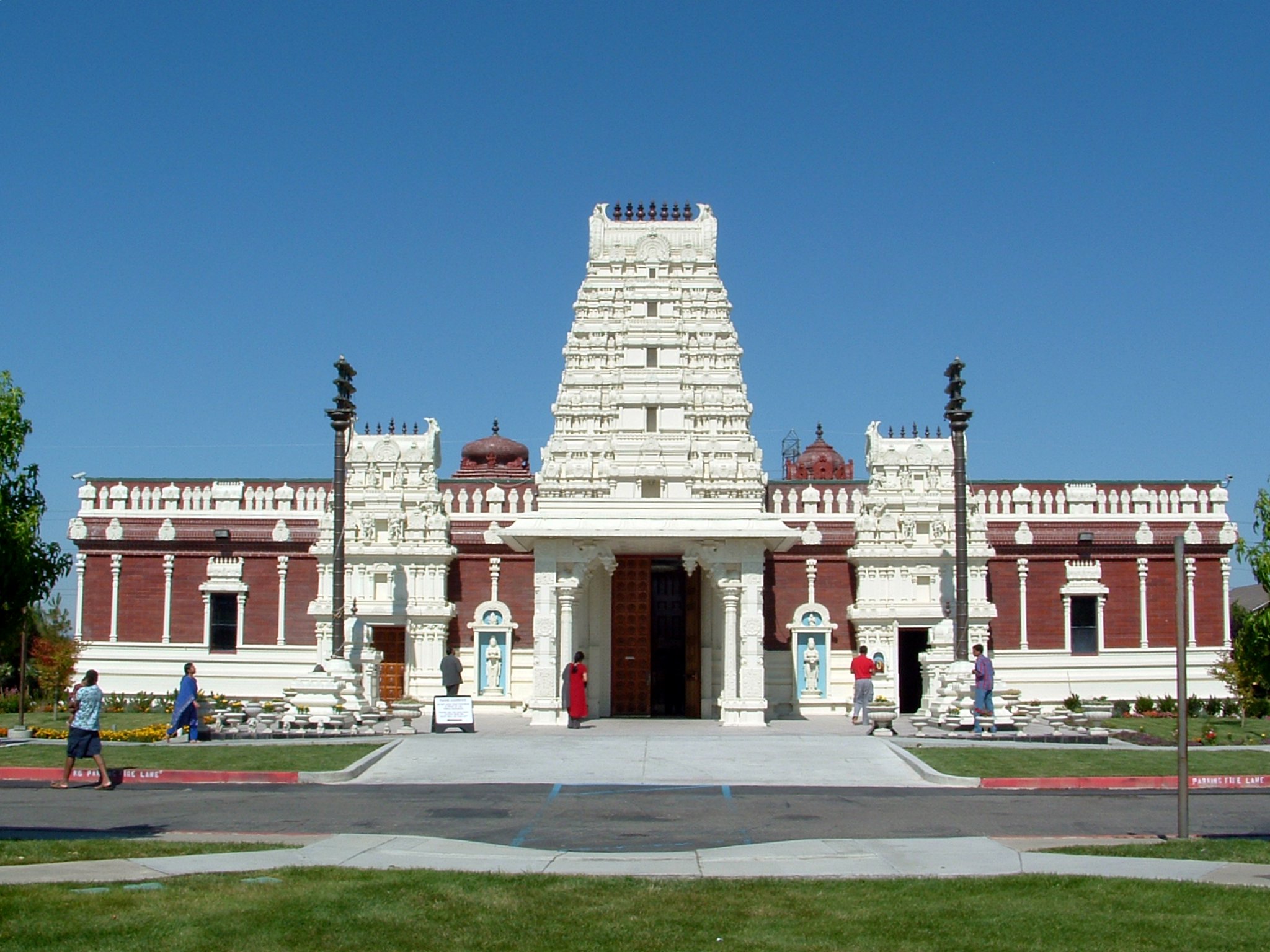
 The Livermore Hindu Temple
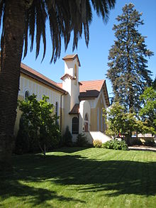 First Presbyterian Church of Livermore's chapel
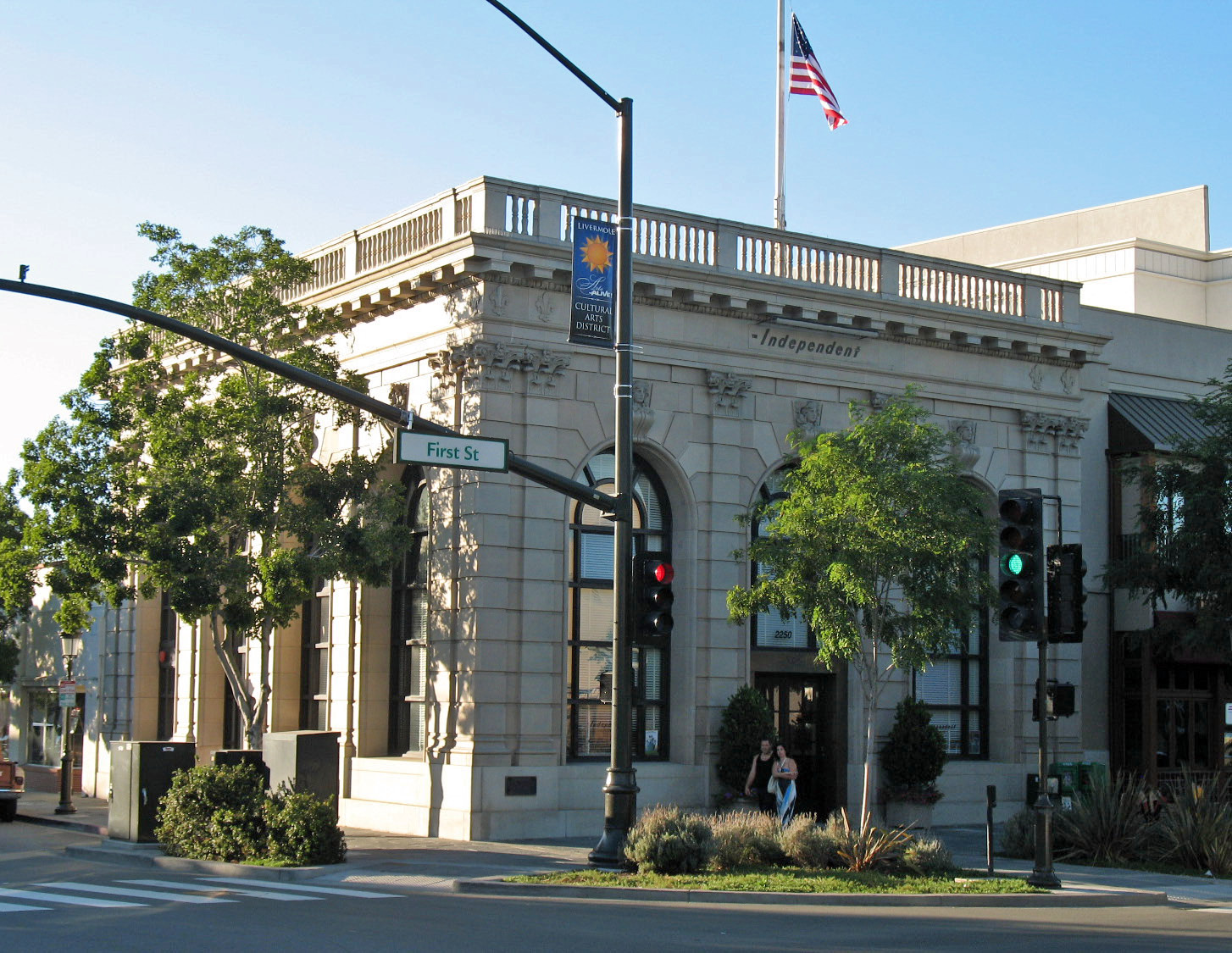
Livermore's culture retains some vestiges of the farming and ranching traditions that have existed in the valley since the time of Robert Livermore, but now largely reflects a suburban population. This culture was documented in the photoessay Suburbia in 1973 by then native photographer Bill Owens, with the photos shown in numerous exhibits.[9] Livermore has a strong blue-collar element, as well as many professionals who work at the Lawrence Livermore National Laboratory and the high tech industries within the Bay Area. Recent housing development has included the addition of hundreds of million dollar homes set amongst the southside's vineyards as well as a multi-million dollar renovation of the downtown area. The renovations included the Livermore Cinemas, the Bankhead Theatre, a parking structure, and office buildings. There is a state-of-the-art library (with a controversial front mosaic[10] by Maria Alquilar) that opened in 2004 and the Livermore Airport.
In 2010, proposed projects included extension of BART high-speed rail system with an underground downtown station and a regional performing arts center between Livermore Avenue and L Street.[11]
According to the latest U.S. Census information, Livermore is the third wealthiest midsize city in the nation. In 2005, the median household income in Livermore was $96,632, which ranked it the third highest income midsize city (between 65,000 and 249,999 people) just behind number two Newport Beach, CA ($97,428) and Livermore's western neighbor, Pleasanton, CA ($101,022).[12]
Arts organizations supported by the city include the Livermore-Amador Symphony, Del Valle Fine Arts, producer of classical music events, and in the valley at large, the Valley Concert Chorale, Livermore Valley Opera and the Valley Dance Theatre, a classical ballet company. Since 1918 Livermore has hosted the Livermore Rodeo,[13] called the "World's Fastest Rodeo," that claims it has more riders per hour than any other event of its type.
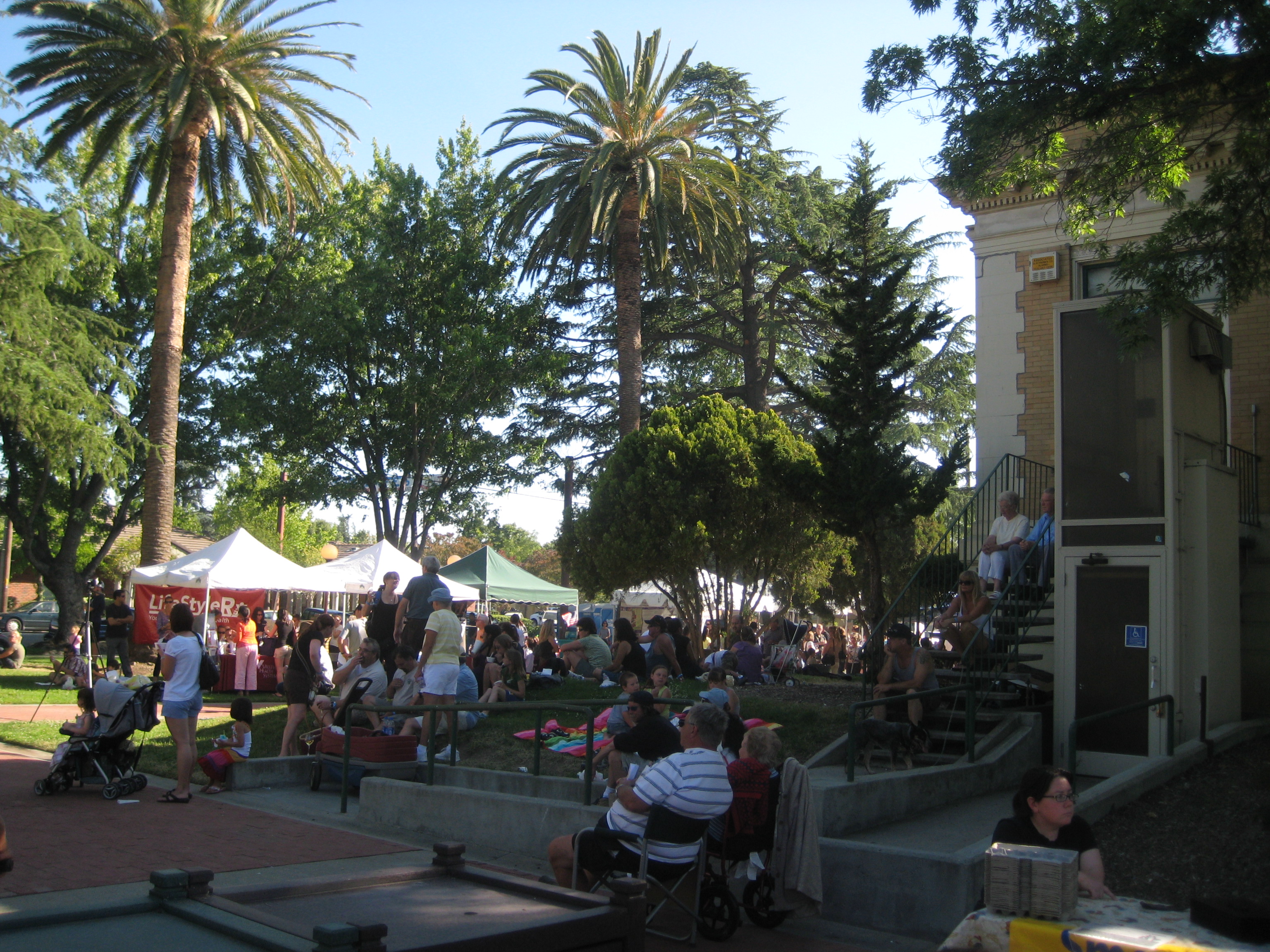
 Livermore's Farmer's Market at Carnegie Park downtown
Places of worship include the Iglesia Ni Cristo on Gardella Plaza, First Presbyterian Church, the Unitarian Church, the Mar Thoma Syrian Church (the first Indian Christian Church in San Francisco Bay Area[citation needed]), a Hindu temple, Islamic Center of Livermore, Saint Innocent Orthodox Church, Saint Charles Borromeo Catholic, and St. Michael Church Catholic, which is the oldest local parish, having held its first services on August 25, 1878.
Camp Wonder opened its first summer camp for children with special medical needs in Livermore in 2001.
Districts of Livermore
One of the largest districts is Springtown, the northeast area of the city north of Interstate 580. Originally conceived as a retirement community in the early 1960s, Springtown has many of the city's hotels and a public golf course.
The downtown, or Central district has two movie theaters, a community theater, and space for open air concerts.
The North Livermore district is North of the Union Pacific Railroad that cuts through the Downtown.
The South Livermore district has over 40 wineries.
Livermore Police Department
The Livermore Police Department (LPD) was established in 1876, at that time the only law enforcement agency in the San Francisco Bay Area besides the San Francisco Police Department. The current Chief of Police is Steve Sweeney. In July 2008, LPD opened its first substation in New Downtown Livermore, known as the Central Station or Downtown Office. The LPD has had the best S.W.A.T. Team in Northern California, due to the team winning the Northern California S.W.A.T Competition.[citation needed]
Livermore-Pleasanton Fire Department
Main article: Livermore Pleasanton Fire DepartmentThe Livermore-Pleasanton Fire Department provides fire and advanced life support services to the cities of Livermore and Pleasanton. It serves an estimated population of 150,000 (Including 78,000 in Livermore, and 71,000 in Pleasanton) over 44 square miles (114 km2) (23 square miles (60 km2) in Livermore, and 21 square miles (54 km2) in Pleasanton) with an operating budget of $28,000,000. In 2008 the LPFD responded to approximately 11,000 calls for service. The International Association of Fire Fighters (IAFF) Local 1974 represents its 112 members.
Demographics
2010
The 2010 United States Census[14] reported that Livermore had a population of 80,968. The population density was 3,216.1 people per square mile (1,241.8/km²). The racial makeup of Livermore was 60,418 (74.6%) White, 1,702 (2.1%) African American, 476 (0.6%) Native American, 6,802 (8.4%) Asian, 277 (0.3%) Pacific Islander, 6,960 (8.6%) from other races, and 4,333 (5.4%) from two or more races. Hispanic or Latino of any race were 16,920 persons (20.9%).
The Census reported that 80,458 people (99.4% of the population) lived in households, 389 (0.5%) lived in non-institutionalized group quarters, and 121 (0.1%) were institutionalized.
There were 29,134 households, out of which 11,238 (38.6%) had children under the age of 18 living in them, 17,058 (58.6%) were opposite-sex married couples living together, 2,834 (9.7%) had a female householder with no husband present, 1,407 (4.8%) had a male householder with no wife present. There were 1,584 (5.4%) unmarried opposite-sex partnerships, and 206 (0.7%) same-sex married couples or partnerships. 5,997 households (20.6%) were made up of individuals and 2,099 (7.2%) had someone living alone who was 65 years of age or older. The average household size was 2.76. There were 21,299 families (73.1% of all households); the average family size was 3.19.
The population was spread out with 20,636 people (25.5%) under the age of 18, 6,176 people (7.6%) aged 18 to 24, 22,530 people (27.8%) aged 25 to 44, 23,284 people (28.8%) aged 45 to 64, and 8,342 people (10.3%) who were 65 years of age or older. The median age was 38.3 years. For every 100 females there were 98.6 males. For every 100 females age 18 and over, there were 96.9 males.
There were 30,342 housing units at an average density of 1,205.2 per square mile (465.3/km²), of which 20,399 (70.0%) were owner-occupied, and 8,735 (30.0%) were occupied by renters. The homeowner vacancy rate was 1.5%; the rental vacancy rate was 4.8%. 56,967 people (70.4% of the population) lived in owner-occupied housing units and 23,491 people (29.0%) lived in rental housing units.
2008
According to 2008 estimates, there are 90,324 people, 29,144 households, and 21,132 families residing in the city. The population density was 3,947.7 people per square mile (1,183.9/km²). There were 26,610 housing units at an average density of 1,112.3 per square mile (429.5/km²).
There were 26,123 households out of which 40.2% had children under the age of 18 living with them, 61.1% were married couples living together, 9.3% had a female head of household with no husband present, and 25.3% were non-families. 18.8% of all households were made up of individuals and 5.4% had someone living alone who was 65 years of age or older. The average household size was 2.80 and the average family size was 3.20.
The population ages were spread out with 28.1% under the age of 18, 7.1% from 18 to 24, 35.1% from 25 to 44, 22.1% from 45 to 64, and 7.5% who were 65 years of age or older. The median age was 35 years. For every 100 females there were 100.0 males. For every 100 females age 18 and over, there were 98.4 males.
The median income for a household in the city was $75,322, and the median income for a family was $82,421. Males had a median income of $59,703 versus $38,389 for females. The per capita income for the city was $31,062. About 3.8% of families and 5.3% of the population were below the poverty line, including 7.0% of those under age 18 and 1.5% of those age 65 or over.
In the six years since the census, the population has increased to 87,054. Increases also took place in the number of housing units (30,612), median household income ($92,300), and median family income ($102,606). The median home price was reported to be $662,100.[15]
Politics
Livermore has the highest percentage of registered Republicans of any of the cities in Alameda County. 35.2% of its 45,519 registered voters are Republicans, while 39.7% are Democrats, and 20.7% are Decline to State voters.[16]
In the state legislature Livermore is located in the 9th Senate district, represented by Democrat Don Perata, and in the 15th Assembly district, represented by Democrat Joan Buchanan. Federally, Livermore is located in California's 10th congressional district, which is represented by John Garamendi.
World's longest lasting light bulb
The city is noted for one world record. A 110+ year old 4-watt light bulb, called the Centennial Light, housed in the Livermore-Pleasanton Fire Department main station, is still burning. It glows dimly, but still functions as a light bulb.[17] The Guinness Book of World Records, Ripley's Believe It or Not, and General Electric have concluded that the bulb has been burning continuously since 1901 with the exception of power failures and three times it was disconnected for moves to new stations. The light bulb was manufactured by the Shelby Electric Company and was hand blown with a carbon filament.
Industry
Laboratories
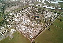
Livermore is the home of two DOE National Laboratories. The laboratories are known worldwide, and attract significant attention both for their scientific research and for their major roles in developing the United States nuclear arsenal.
The largest employer in Livermore is the Lawrence Livermore National Laboratory (LLNL), a federally funded research and development center funded by the Department of Energy which is operated by a limited liability consortium named Lawrence Livermore National Security, LLC (LLNS), a joint venture company of Bechtel National, the University of California, BWX Technologies, Washington Group International, and Battelle. The lab is the location of the supercomputer Blue Gene/L.
LLNL is the location of the world's most powerful laser, the National Ignition Facility (NIF), a project designed to create the first sustained, controlled nuclear fusion reaction, which would generate fusion power, a potential energy source.
Livermore is also the California site of Sandia National Laboratories, which is operated by Sandia Corporation, a Lockheed-Martin owned Company.
i-GATE
The two National Laboratories, along with other stakeholders, including the University of California, Berkeley, UC Davis, and regional cities, partnered to create the i-GATE (Innovation for Green Advanced Transportation Excellence) National Energy Systems Technology (NEST) Incubator. The 15,000-square-foot (1,400 m2) i-GATE NEST campus was created to stimulate large-scale, high-tech business development around the two labs. Initial focus of the campus will be solar energy, fuel cells, biofuels, LED lighting, and other related technologies.[18][19]
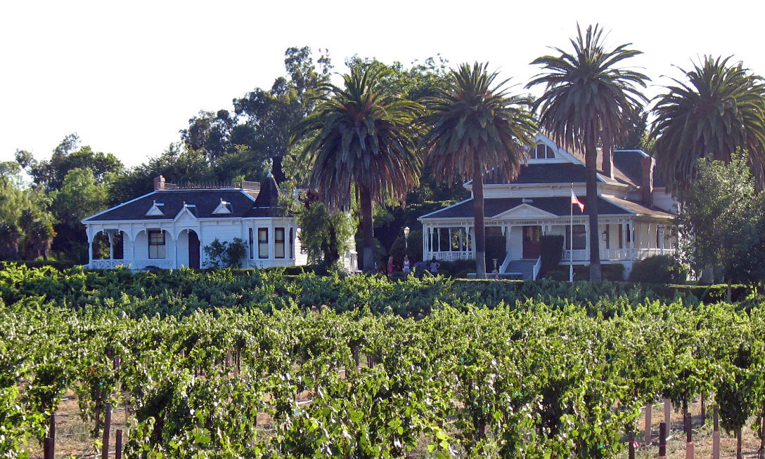
Wine
One of California’s oldest wine regions, the Livermore Valley American Viticultural Area (AVA) played a pivotal role in shaping California’s wine industry. Spanish missionaries planted the first wine grapes in the Livermore Valley in the 1760s. In the 1840s, California pioneers looking for outstanding vineyard sites began planting grapes in the region. Robert Livermore planted the first commercial vines in the 1840s. Pioneer winemakers C. H. Wente, James Concannon, and Charles Wetmore recognized the area’s winegrowing potential and founded their wineries in the early 1880s.[20] The Wine Group has administrative offices in Livermore, at the Concannon Vineyard.
Top employers
According to the City's 2010 Comprehensive Annual Financial Report,[21] the top private sector employers in the city are:
# Employer # of Employees 1 FormFactor‡[22][23] 580 2 Mission City Rebar 357 3 Activant 328 4 Topcon 280 5 Comcast 251 6 Wal-Mart 236 7 Costco 234 8 OfficeMax 203 9 Target 186 10 Safeway 183 Livermore's largest employer, Lawrence Livermore Laboratories, is not included in this list, as it is federally funded, and not a private sector employer.
Education
Public schools in Livermore are part of the Livermore Valley Joint Unified School District (LVJUSD). The District has 11 elementary (K-5) schools, 4 middle (6-8) schools, and 3 high schools.
Other schools
Charter schools
- Livermore Valley Charter School (LVCS) - a K-8 public school.
- Livermore Valley Charter Preparatory (LVCP)
Private schools
- Our Savior Lutheran School (OSLS)
- St. Michael's Elementary and Middle School
- Valley Montessori
Colleges and universities
The Hertz Foundation for scholarships is based in Livermore.
Transportation
Interstate 580 is Livermore's primary freeway. Linking the rest of the San Francisco Bay Area to the west, I-580 passes through Livermore before it heads east through the Altamont Pass to the Central Valley. Highway 84 heads southwest from I-580 to Fremont. Vasco Road, an unnumbered highway that is maintained by Alameda and Contra Costa Counties, connects Livermore to Brentwood, California and the Sacramento – San Joaquin River Delta area.
Livermore Municipal Airport, a general aviation airport, is located there.
The WHEELS bus system operates in Livermore and to the neighboring cities of Pleasanton and Dublin.
Livermore has two stations for the Altamont Commuter Express (ACE), a commuter train which runs from Stockton to San Jose. One station is at Vasco Road, and the other in downtown Livermore at its Transit Center, which also connects to the WHEELS bus system.
There is a petition drive to bring the Bay Area Rapid Transit system to Livermore.The group that started the petition was founded by the former mayor of Dublin, Linda Jeffery Sailors, who was successful in extending BART to Dublin/Pleasanton, currently the closest station to Livermore.[25] If BART does come to Livermore, the system would connect to the ACE Train.
Media
Radio station KKIQ is licensed in Livermore and broadcasts in the Tri-City area.
Landmarks
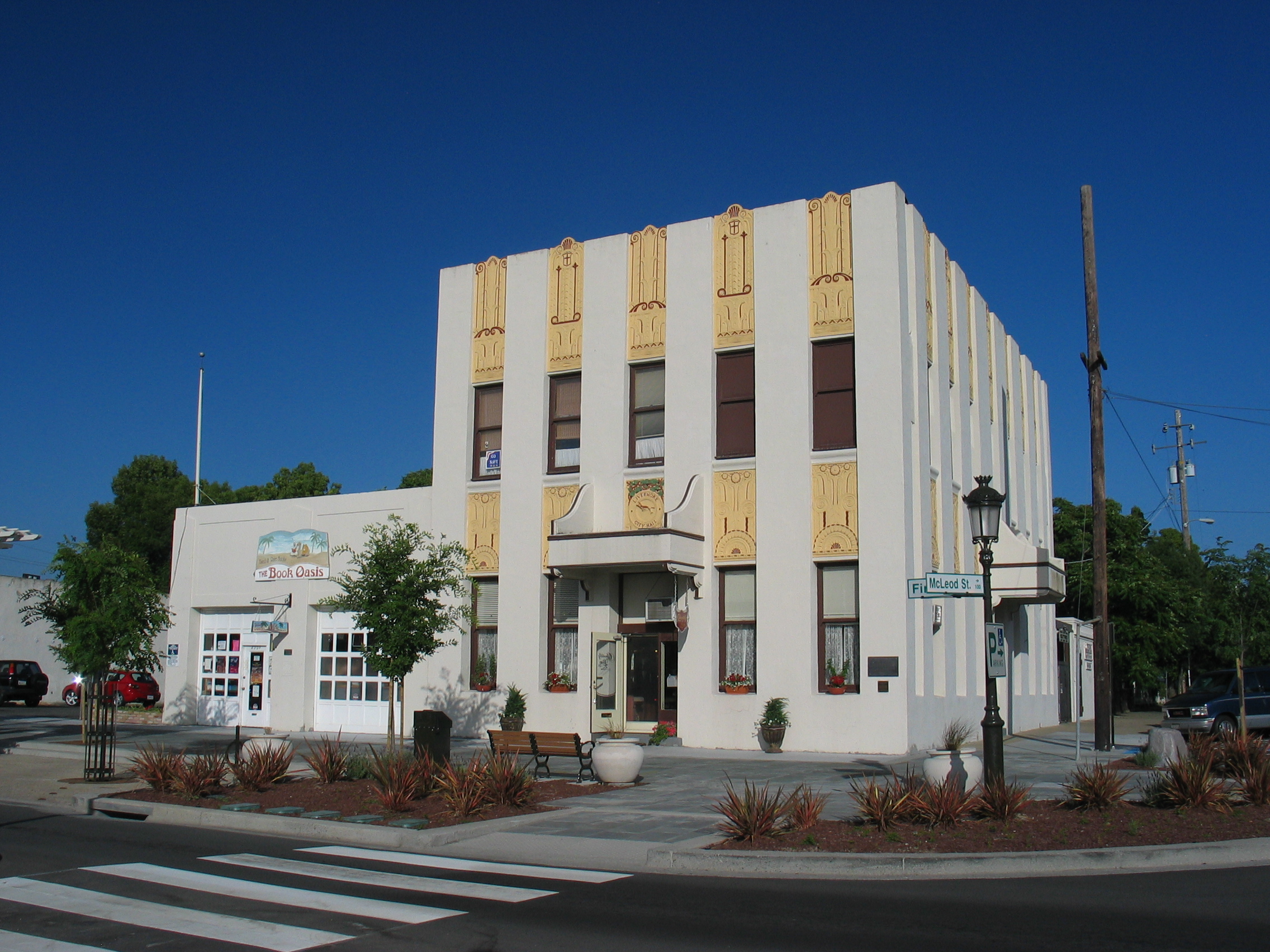
Livermore has four landmarks listed on the National Register of Historic Places: the Bank of Italy Building, the Hagemann Ranch Historic District, the D. J. Murphy House, and Ravenswood Historic Site.
-
Hagemann Ranch
-

D. J. Murphy House
-

Ravenswood Historic Site
Parks
Brushy Peak Regional Preserve, located near Livermore, is jointly operated by the Livermore Area Recreation and Park District and the East Bay Regional Park District.
Notable people
- Mikkel Aaland, digital photographer
- Louie Aguiar, American football player
- Kristin Allen, gymnast
- Max Baer, boxer
- Bob Beers, Nevada State senator
- Ben Bodé, actor
- Bryn Davies, musician
- Mark Davis, Major League Baseball pitcher
- James DePaiva, actor
- Matt Finders, trombonist
- Duane Glinton, Turks & Caicos Islands football midfielder
- Martin Harrison American football defensive end for the San Francisco 49ers, Minnesota Vikings and Seattle Seahawks, active 1990-1999
- Brian Johnson, soccer player
- Randy Johnson, (Livermore High 1982), Major League Baseball pitcher for the Montreal Expos, Seattle Mariners, Houston Astros, Arizona Diamondbacks, New York Yankees, and San Francisco Giants, active 1988-2009
- Tara Kemp, singer
- Robert Livermore, town namesake (died before the city was named and incorporated)
- Bill Mooneyham, Major League Baseball pitcher for the Oakland A's
- Erwin Mueller, basketball player with the Chicago Bulls, LA Lakers, and Seattle SuperSonics in the 1960s and the Detroit Pistons in the 1970s
- Bill Owens, photographer of Livermore's suburbs, in the book Suburbia
- Danny Payne, soccer player
- Jean Quan, Mayor of Oakland
- Judith Merkle Riley, author
- Bobby Rock, rock drummer
- Bryan Shaw, Major League Baseball pitcher
- Brad Stisser, soccer player
- Erick Threets, Major League Baseball player
- Jack Trudeau, American football player
- Clifford E. Vargas, creator of Circus Vargas
- Tim Weaver, soccer player
Sister cities
Livermore has three sister cities, as designated by Sister Cities International:
 Quetzaltenango, Guatemala
 Snezhinsk, Russia
 Yotsukaido, Japan
References
- ^ "City Council". City of Livermore Official Web Site. http://www.ci.livermore.ca.us/council.html. Retrieved 2007-04-20.
- ^ a b "City Profile". City of Livermore Official Web Site. http://www.ci.livermore.ca.us/profile.html. Retrieved 2007-04-20.
- ^ U.S. Census
- ^ "American FactFinder". United States Census Bureau. http://factfinder.census.gov. Retrieved 2008-01-31.
- ^ a b c Durham, David L. (1998). California's Geographic Names: A Gazetteer of Historic and Modern Names of the State. Quill Driver Books. p. 655. ISBN 9781884995149.
- ^ "Climatography of the United States No. 20: Livermore, CA 1971–2000" (PDF). National Oceanic and Atmospheric Administration. http://cdo.ncdc.noaa.gov/climatenormals/clim20/ca/044997.pdf. Retrieved 2011-10-25.
- ^ | url = http://www.weather.com/weather/wxclimatology/monthly/USCA0618 | title = Monthly Averages for Livermore, CA | format=table | publisher=The Weather Channel | accessdate=2011-10-25 }}
- ^ Livermore Naval Air Station Website. Accessed July 2, 2011
- ^ suburbia by bill owens
- ^ "Miami Muralist Embroiled In Mosaic Misspelling Mess". WPLG. 2004-10-07. http://www.local10.com/news/3790849/detail.html. Retrieved 2007-04-20.
- ^ Hunt, Tim (August 2, 2010). "Tim Hunt: Forget high-speed rail; government needs to pitch in for BART to Livermore". The Oakland Tribune.
- ^ http://www.mercurynews.com/mld/mercurynews/news/breaking_news/15393147.htm mercurynews.com
- ^ Mote gets serious about roping with Beers as partner - East Oregonian: Sports
- ^ All data are derived from the United States Census Bureau reports from the 2010 United States Census, and are accessible on-line here. The data on unmarried partnerships and same-sex married couples are from the Census report DEC_10_SF1_PCT15. All other housing and population data are from Census report DEC_10_DP_DPDP1. Both reports are viewable online or downloadable in a zip file containing a comma-delimited data file. The area data, from which densities are calculated, are available on-line here. Percentage totals may not add to 100% due to rounding. The Census Bureau defines families as a household containing one or more people related to the householder by birth, opposite-sex marriage, or adoption. People living in group quarters are tabulated by the Census Bureau as neither owners nor renters. For further details, see the text files accompanying the data files containing the Census reports mentioned above.
- ^ "Livemore, California Fact Sheet". 2005 American Community Survey. United States Census Bureau. 2005. http://factfinder.census.gov/servlet/ACSSAFFFacts?_event=&geo_id=16000US0641992&_geoContext=01000US%7C04000US06%7C16000US0641992&_street=&_county=Alameda&_cityTown=Livermore&_state=04000US06&_zip=&_lang=en&_sse=on&ActiveGeoDiv=geoSelect&_useEV=&pctxt=fph&pgsl=160&_submenuId=factsheet_1&ds_name=DEC_2000_SAFF&_ci_nbr=null&qr_name=null®=null%3Anull&_keyword=&_industry=. Retrieved 2007-04-20.
- ^ http://www.sos.ca.gov/elections/ror/ror-pages/15day-stwdsp-09/politicalsub.pdf
- ^ Little lightbulb burns 110 years | The Manila Bulletin Newspaper Online
- ^ "Campus an incubator for innovation", Jeanine Benca, (Hayward) Daily Review, July 8, 2011
- ^ California selects Livermore Valley’s i-GATE as state innovation hub – Sandia Labs News Releases
- ^ Wineries, Wine Tasting, Dining, Tours, Weddings & More! | Livermore Valley Winegrowers Association
- ^ City of Livermore CAFR
- ^ FormFactor, Inc. | Company | Contact
- ^ FormFactor, Inc. | Company | Overview
- ^ FormFactor SmartMatrix 100XP Delivers Extended Performance for Next Generation DRAM Testing
- ^ "LivermoreBART.org". http://www.livermorebart.org/. Retrieved 2007-04-20.
Print and film resources on Livermore
- Livermore (2002), a film by Rachel Raney and David Murray
- Suburbia, photoessay by Owens, Bill, (1972), ISBN 1-881270-40-8
External links
- City of Livermore Official Website
- Livermore Community Guide
- Livermore Area Recreation and Park District
- Livermore, California travel guide from Wikitravel
- Livermore Shakespeare Festival
- Livermore Valley Performing Arts Center
- Livermore Independent, Weekly Newspaper
- Livermore Links, Livermore News Blog
- [1] Livermore Police Department
- i-GATE business hub website
Livermore, California Landmarks Bank of Italy Building · Hagemann Ranch Historic District · D. J. Murphy House · Ravenswood · Cresta Blanca Winery · Wente Vineyards · Concannon VineyardEconomy Education Transportation Other Municipalities and communities of Alameda County, California Cities Alameda | Albany | Berkeley | Dublin | Emeryville | Fremont | Hayward | Livermore | Newark | Oakland | Piedmont | Pleasanton | San Leandro | Union City
CDPs Ashland | Castro Valley | Cherryland | Fairview | San Lorenzo | Sunol
Unincorporated
communitiesAlbrae | Altamont | Asco | Baumberg | Brightside | Brookshire | Carpenter | Dougherty | Dresser | East Pleasanton | Farwell | Hall Station | Halvern | Kilkare Woods | Komandorski Village | Lorenzo Station | Mattos | Mendenhall Springs | Midway | Mountain House | Mowry Landing | Radum | San Ramon Village | Scotts Corner | Sorenson | Verona
Former settlements Alden | Alvarado | Ann | Decoto | Drawbridge | Eden Landing | Elliot | Goecken | Greenville | Hacienda | Hayward Heath | Laddville | Larkin's Landing | Mallard | Melita | Merienda | Monte Vista | Remillard | Robert | Russell City | Stokes Landing | Tesla
Categories:- California wine
- Livermore, California
- Populated places established in 1835
- Incorporated cities and towns in California
- Cities in Alameda County, California
- Cities in the San Francisco Bay Area
- Livermore Valley


Wikimedia Foundation. 2010.