- Clayton, California
-
For the community in Placer County, see Clayton, Placer County, California. For the former town in Los Angeles County, see Clayton, Los Angeles County, California.
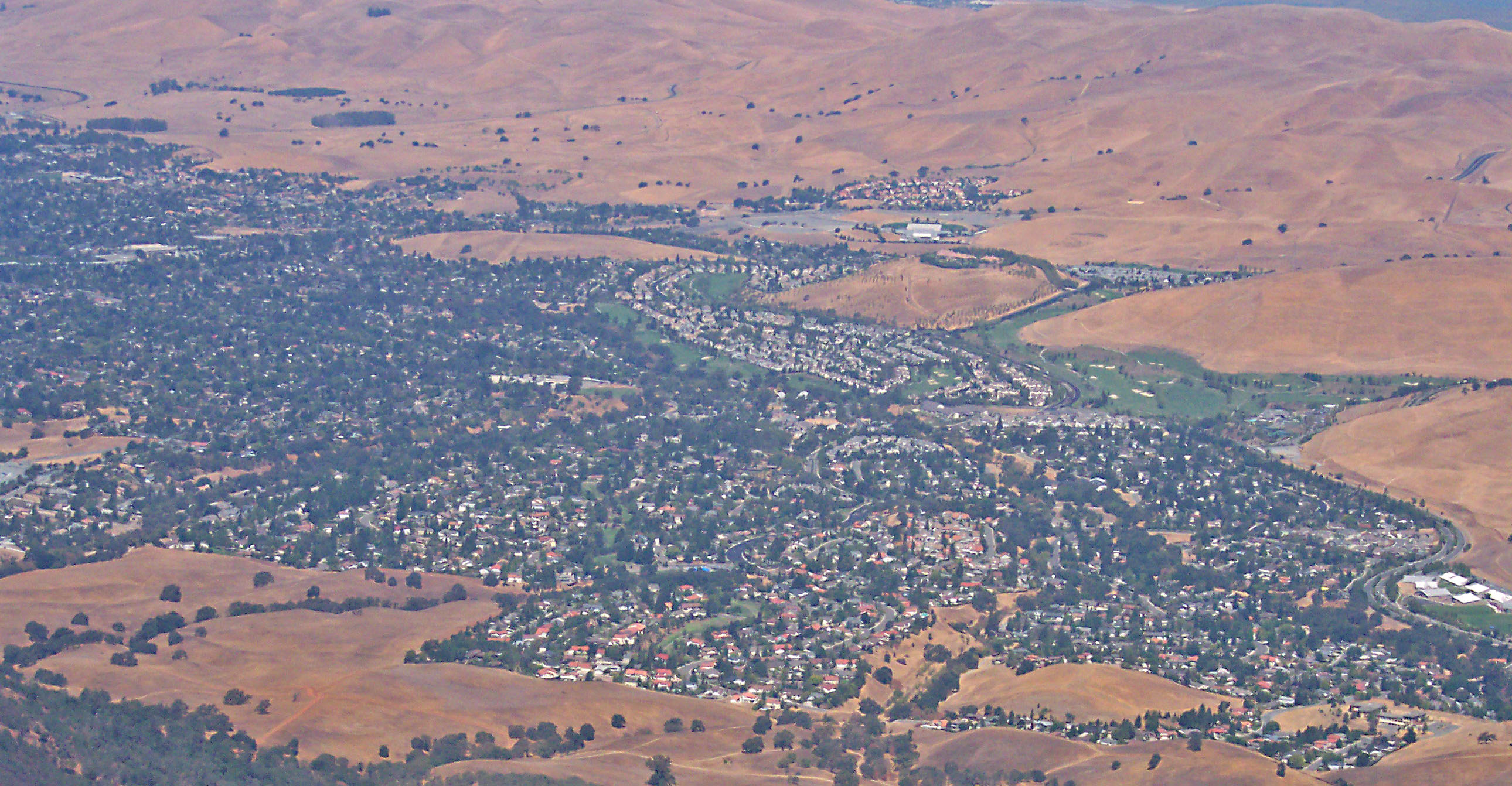
City of Clayton — City — Parts of Clayton as seen from Mt. Diablo in Summer 2005 Location in Contra Costa County and the state of California
Coordinates: 37°56′28″N 121°56′09″W / 37.94111°N 121.93583°WCoordinates: 37°56′28″N 121°56′09″W / 37.94111°N 121.93583°W Country  United States
State  California
County Contra Costa Government – Mayor Dave Shuey – Senate Mark DeSaulnier (D) – Assembly Susan Bonilla (D) – U. S. Congress George Miller (D) Area[1] – Total 3.836 sq mi (9.935 km2) – Land 3.836 sq mi (9.935 km2) – Water 0 sq mi (0 km2) 0% Elevation 394 ft (120 m) Population (2010) – Total 10,897 – Density 2,840.7/sq mi (1,096.8/km2) Time zone PST (UTC-8) – Summer (DST) PDT (UTC-7) ZIP code 94517 Area code(s) 925 FIPS code 06-13882 GNIS feature ID 0277488 Website ci.clayton.ca.us Clayton (formerly, Clayton's and Claytonville)[2] is a city in Contra Costa County, California, United States. The population was 10,897 as of the 2010 census.
Contents
Geography
According to the United States Census Bureau, the city has a total area of 3.8 square miles (9.8 km2), all land.
Clayton is located at the foot of Mt. Diablo State Park.
History
In 1857, the town of Clayton was laid out and founded by Joel Henry Clayton (1812–1872) and his two younger brothers. Clayton was born in Bugsworth, now Buxworth, in the United Kingdom, and emigrated to the United States in 1837. After years in other states he settled down with his wife Margaret (1820–1908) at his town at the foot of Mt. Diablo, where he and his family prospered. Clayton was named after Joel Henry Clayton, although only by the flip of a coin. Joel Clayton and Charles Rhine cofounded the town, and each wanted to name it after himself. If Charles had won it would have become Rhinesville, but Joel Clayton won. Joel and his wife Margaret both died in Clayton, and were buried in Live Oak Cemetery in what is now Concord, CA[3].
Clayton prospered during the coal mining boom in eastern Contra Costa County. The post office opened in 1861.[4] Clayton incorporated in 1964.[4]
December 7, 2009 it snowed in Clayton and nearby Concord for the first time since the 1970s.[5]
Education
The public schools of which the minors of Clayton attend include: Mt.Diablo Elementary School, Highlands Elementary School, Diablo View Middle School, Pine Hollow Middle School, and Clayton Valley High School.
Public libraries
The Clayton branch of the Contra Costa County Library system is located in Clayton.[6]
Demographics
2010
The 2010 United States Census[7] reported that Clayton had a population of 10,897. The population density was 2,840.7 people per square mile (1,096.8/km²). The racial makeup of Clayton was 9,273 (85.1%) White, 146 (1.3%) African American, 34 (0.3%) Native American, 717 (6.6%) Asian, 16 (0.1%) Pacific Islander, 234 (2.1%) from other races, and 477 (4.4%) from two or more races. Hispanic or Latino of any race were 982 persons (9.0%).
The Census reported that 10,887 people (99.9% of the population) lived in households, 10 (0.1%) lived in non-institutionalized group quarters, and 0 (0%) were institutionalized.
There were 4,006 households, out of which 1,455 (36.3%) had children under the age of 18 living in them, 2,795 (69.8%) were opposite-sex married couples living together, 301 (7.5%) had a female householder with no husband present, 112 (2.8%) had a male householder with no wife present. There were 136 (3.4%) unmarried opposite-sex partnerships, and 36 (0.9%) same-sex married couples or partnerships. 647 households (16.2%) were made up of individuals and 310 (7.7%) had someone living alone who was 65 years of age or older. The average household size was 2.72. There were 3,208 families (80.1% of all households); the average family size was 3.04.
The population was spread out with 2,662 people (24.4%) under the age of 18, 602 people (5.5%) aged 18 to 24, 2,185 people (20.1%) aged 25 to 44, 3,846 people (35.3%) aged 45 to 64, and 1,602 people (14.7%) who were 65 years of age or older. The median age was 45.0 years. For every 100 females there were 93.4 males. For every 100 females age 18 and over, there were 90.3 males.
There were 4,086 housing units at an average density of 1,065.2 per square mile (411.3/km²), of which 3,621 (90.4%) were owner-occupied, and 385 (9.6%) were occupied by renters. The homeowner vacancy rate was 0.7%; the rental vacancy rate was 3.8%. 9,936 people (91.2% of the population) lived in owner-occupied housing units and 951 people (8.7%) lived in rental housing units.
2000
As of the census[8] of 2000, there were 10,762 people, 3,883 households, and 3,207 families residing in the city. The population density was 1,054.6/km² (2,729.3/mi²). There were 3,924 housing units at an average density of 384.5/km² (995.1/mi²). The racial makeup of the city was 87.95% White, 1.12% Black or African American, 0.19% Native American, 5.38% Asian, 0.10% Pacific Islander, 1.54% from other races, and 3.73% from two or more races. 6.33% of the population were Hispanic or Latino of any race.
There were 3,883 households out of which 39.2% had children under the age of 18 living with them, 74.6% were married couples living together, 5.5% had a female householder with no husband present, and 17.4% were non-families. 13.0% of all households were made up of individuals and 3.9% had someone living alone who was 65 years of age or older. The average household size was 2.76 and the average family size was 3.04.
In the city the population was spread out with 26.5% under the age of 18, 4.5% from 18 to 24, 28.5% from 25 to 44, 31.5% from 45 to 64, and 9.1% who were 65 years of age or older. The median age was 40 years. For every 100 females there were 96.0 males. For every 100 females age 18 and over, there were 94.6 males.
The median income for a household in the city was $101,652, and the median income for a family was $107,448. Males had a median income of $77,535 versus $50,279 for females. The per capita income for the city was $42,048. About 1.2% of families and 2.6% of the population were below the poverty line, including 3.6% of those under age 18 and 1.9% of those age 65 or over.
References
- ^ U.S. Census
- ^ U.S. Geological Survey Geographic Names Information System: Clayton, California
- ^ "Joel Clayton" from the Clayton Historical Society
- ^ a b Durham, David L. (1998). California's Geographic Names: A Gazetteer of Historic and Modern Names of the State. Quill Driver Books. p. 617. ISBN 9781884995149.
- ^ Photo from local newstation KTVU Channel 2
- ^ Clayton Library. Contra Costa County Library. Retrieved on April 1, 2010.
- ^ All data are derived from the United States Census Bureau reports from the 2010 United States Census, and are accessible on-line here. The data on unmarried partnerships and same-sex married couples are from the Census report DEC_10_SF1_PCT15. All other housing and population data are from Census report DEC_10_DP_DPDP1. Both reports are viewable online or downloadable in a zip file containing a comma-delimited data file. The area data, from which densities are calculated, are available on-line here. Percentage totals may not add to 100% due to rounding. The Census Bureau defines families as a household containing one or more people related to the householder by birth, opposite-sex marriage, or adoption. People living in group quarters are tabulated by the Census Bureau as neither owners nor renters. For further details, see the text files accompanying the data files containing the Census reports mentioned above.
- ^ "American FactFinder". United States Census Bureau. http://factfinder.census.gov. Retrieved 2008-01-31.
External links
Municipalities and communities of Contra Costa County, California Cities and towns 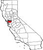
CDPs Acalanes Ridge | Alamo | Alhambra Valley | Bay Point | Bayview | Bethel Island | Blackhawk | Byron | Camino Tassajara | Castle Hill | Clyde | Contra Costa Centre | Crockett | Diablo | Discovery Bay | East Richmond Heights | El Sobrante | Kensington | Knightsen | Montalvin Manor | Mountain View | Norris Canyon | North Gate | North Richmond | Pacheco | Port Costa | Reliez Valley | Rodeo | Rollingwood | San Miguel | Saranap | Shell Ridge | Tara Hills | Vine Hill
Unincorporated
communitiesAlamo Oaks | Arbor | Avon | Bancroft | Bayo Vista | Bayview-Montalvin | Bixler | Blackhawk-Camino Tassajara | Bridgehead | Canyon | Christie | Cornwall | Crolona Heights | Diamond | Eastport | Four Corners | Franklin Canyon | Gateley | Glen Frazer | Hasford Heights | Herpoco | Hookston | Las Juntas | Los Medanos | Luzon | Maltby | Marsh Creek Springs | McAvoy | Meinert | Monsanto | Muir | Neroly | Newlove | Nichols | Oleum | Orinda Village | Orwood | Ozol | Rheem | Rock City | Selby | Shore Acres | Sobrante | Sparkle | Stege | Tassajara | Tormey | Valle Vista | Valona | Waldon | Walnut Heights | Werner
Ghost towns Acelanus | Ambrose | Atchison | Eckley | Empire | Hooper | Horse Haven | Judsonville | Junction | Nortonville | Ohmer | Point of Timber | Port Chicago | Schmidtville | Somersville | Stewartville | Tammukan | West Hartley | Winehaven
Categories:- Cities in Contra Costa County, California
- Cities in the San Francisco Bay Area
- Populated places established in 1857
- Incorporated cities and towns in California


Wikimedia Foundation. 2010.