- North Fair Oaks, California
-
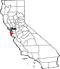
North Fair Oaks — census-designated place — Location in San Mateo County and the state of California
Coordinates: 37°28′31″N 122°12′13″W / 37.47528°N 122.20361°WCoordinates: 37°28′31″N 122°12′13″W / 37.47528°N 122.20361°W Country  United States
State  California
County San Mateo Area[1] - Total 1.200 sq mi (3.109 km2) - Land 1.200 sq mi (3.109 km2) - Water 0 sq mi (0 km2) 0% Elevation 26 ft (8 m) Population (2010) - Total 14,687 - Density 12,239.2/sq mi (4,724/km2) Time zone PST (UTC-8) - Summer (DST) PDT (UTC-7) ZIP code 94025 Area code(s) 650 FIPS code 06-51840 GNIS feature ID 1786241 North Fair Oaks is a census-designated place and district for the purposes of the United States census in an unincorporated area of San Mateo County adjacent to Redwood City, Atherton, and Menlo Park. As of the 2010 census the area had a total population of 14,687. Because of the large number of residents from one Mexican state the area is also known as Little Michoacan. The larger area including North Fair Oaks and adjacent parts of Redwood City has a large Latino population and is known locally as Little Mexico. It is one of the most distinctive cities on the entire Peninsula, as it is one out of only three cities (the others being East Palo Alto and Pescadero) that have a substantial Hispanic population (the parts of Redwood City adjoining North Fair Oaks have more in common with North Fair Oaks than the rest of Redwood City).
Contents
History
Fair Oaks was a residential area to the north of Menlo Park. Menlo Park attempted to incorporate the area Atherton incorporated first, leaving North Fair Oaks unincorporated. See Atherton for details and history.
One of the two Hetch Hetchy Aqueduct utility corridors on the San Francisco Peninsula was installed going through the area at an angle diagonal to the street grid which was already in place.
Geography and climate
North Fair Oaks is located at 37°28′31″N 122°12′13″W / 37.47528°N 122.20361°W (37.475170, -122.203506)[2].
According to the United States Census Bureau, the area has a total area of 1.2 square miles (3.1 km2), all of it land.
Proximity to mountains by the Pacific coast and the San Francisco Bay creates a microclimate that makes the area frequently sunny and warm with temperatures moderated by ocean and bay breezes. Similar conditions are found on the Canary Islands and the Mediterranean Coast of North Africa. This local microclimate is centered on nearby Redwood City which claims the slogan "climate best by government test".
Law and government
Essential services are provided through San Mateo County by the Board of Supervisors using input from the North Fair Oaks Community Council.
Children attend elementary school in the Redwood City Elementary School District [1] but then attend Menlo-Atherton High School within the Sequoia Union School District [2].
Demographics
The 2010 United States Census[3] reported that North Fair Oaks had a population of 14,687. The population density was 12,236.5 people per square mile (4,724.5/km²). The racial makeup of North Fair Oaks was 7,060 (48.1%) White, 235 (1.6%) African American, 143 (1.0%) Native American, 548 (3.7%) Asian, 219 (1.5%) Pacific Islander, 5,728 (39.0%) from other races, and 754 (5.1%) from two or more races. Hispanic or Latino of any race were 10,731 persons (73.1%).
The Census reported that 14,367 people (97.8% of the population) lived in households, 314 (2.1%) lived in non-institutionalized group quarters, and 6 (0%) were institutionalized.
There were 3,919 households, out of which 1,928 (49.2%) had children under the age of 18 living in them, 2,033 (51.9%) were opposite-sex married couples living together, 548 (14.0%) had a female householder with no husband present, 350 (8.9%) had a male householder with no wife present. There were 324 (8.3%) unmarried opposite-sex partnerships, and 45 (1.1%) same-sex married couples or partnerships. 629 households (16.1%) were made up of individuals and 175 (4.5%) had someone living alone who was 65 years of age or older. The average household size was 3.67. There were 2,931 families (74.8% of all households); the average family size was 3.93.
The population was spread out with 4,075 people (27.7%) under the age of 18, 1,557 people (10.6%) aged 18 to 24, 4,990 people (34.0%) aged 25 to 44, 3,097 people (21.1%) aged 45 to 64, and 968 people (6.6%) who were 65 years of age or older. The median age was 31.0 years. For every 100 females there were 113.0 males. For every 100 females age 18 and over, there were 115.0 males.
There were 4,107 housing units at an average density of 3,421.7 per square mile (1,321.1/km²), of which 1,838 (46.9%) were owner-occupied, and 2,081 (53.1%) were occupied by renters. The homeowner vacancy rate was 1.0%; the rental vacancy rate was 5.1%. 5,997 people (40.8% of the population) lived in owner-occupied housing units and 8,370 people (57.0%) lived in rental housing units.
Politics
In the state legislature North Fair Oaks is located in the 11th Senate district, represented by Democrat Joe Simitian, and in the 21st Assembly district, represented by Democrat Rich Gordon. Federally, North Fair Oaks is located in California's 14th congressional district, which has a Cook PVI of D +18[4] and is represented by Democrat Anna Eshoo. The city is mostly Democratic, with 58% registered Democrats and 19% registered Republicans as of 02/2002.[5]
Community
The Fair Oaks Beautification Association is an active element of the North Fair Oaks community. FOBA is a not-for-profit 501c3 organization that has raised funds to plant trees and install traffic-calming devices throughout the neighborhood. Its primary activity is to maintain the neighborhood park at Edison Way and Fair Oaks Avenue. This park is built over the Hetch Hetchy Aqueduct and was installed with permission of the SFPUC. Construction and maintenance are made possible by grants and community contributions, with substantial volunteer effort provided by members of the community.
Every summer, North Fair Oaks Festival is held in the town.
References
- ^ U.S. Census
- ^ "US Gazetteer files: 2010, 2000, and 1990". United States Census Bureau. 2011-02-12. http://www.census.gov/geo/www/gazetteer/gazette.html. Retrieved 2011-04-23.
- ^ All data are derived from the United States Census Bureau reports from the 2010 United States Census, and are accessible on-line here. The data on unmarried partnerships and same-sex married couples are from the Census report DEC_10_SF1_PCT15. All other housing and population data are from Census report DEC_10_DP_DPDP1. Both reports are viewable online or downloadable in a zip file containing a comma-delimited data file. The area data, from which densities are calculated, are available on-line here. Percentage totals may not add to 100% due to rounding. The Census Bureau defines families as a household containing one or more people related to the householder by birth, opposite-sex marriage, or adoption. People living in group quarters are tabulated by the Census Bureau as neither owners nor renters. For further details, see the text files accompanying the data files containing the Census reports mentioned above.
- ^ "Will Gerrymandered Districts Stem the Wave of Voter Unrest?". Campaign Legal Center Blog. http://www.clcblog.org/blog_item-85.html. Retrieved 2008-02-10.
- ^ "SD11 partisan registration". http://www.sen.ca.gov/ftp/SEN/senplan/SD11.HTM. Retrieved 2010-03-20.
Municipalities and communities of San Mateo County, California County seat: Redwood City Cities and towns Atherton | Belmont | Brisbane | Burlingame | Colma | Daly City | East Palo Alto | Foster City | Half Moon Bay | Hillsborough | Menlo Park | Millbrae | Pacifica | Portola Valley | Redwood City | San Bruno | San Carlos | San Mateo | South San Francisco | Woodside
CDPs Broadmoor | El Granada | Emerald Lake Hills | Highlands-Baywood Park | Ladera | La Honda | Loma Mar | Montara | Moss Beach | North Fair Oaks | Pescadero | West Menlo Park
Unincorporated
communitiesGhost towns  State of California
Sacramento (capital) Topics Climate · Delegations · Deserts · Districts · Ecology · Elections · Environment · Geography · Government · History · Protected areas · Sports · Symbols · Transportation · Visitor attractions · Index of California-related articles
Society Californians · Culture · Crime · Demographics · Economy · Education · Politics
Regions Antelope Valley · Big Sur · Cascade Range · Central California · Central Coast · Central Valley · Channel Islands · Coachella Valley · Conejo Valley · Cucamonga Valley · Death Valley · East Bay (SF) · East County (SD) · Eastern California · Emerald Triangle · Gold Country · Great Basin · Greater Los Angeles · Greater Sacramento · Inland Empire · Lake Tahoe · Los Angeles Basin · Lost Coast · Metropolitan Fresno · Mojave · Mountain Empire · North Bay (SF) · North Coast · North County (SD) · Northern California · Owens Valley · Oxnard Plain · San Francisco Peninsula · Pomona Valley · Sacramento Valley · San Bernardino Valley · San Diego–Tijuana · San Fernando Valley · San Francisco Bay Area · San Gabriel Valley · San Joaquin Valley · Santa Clara Valley · Santa Clara River Valley · Santa Clarita Valley · Shasta Cascade · Sierra Nevada · Silicon Valley · South Bay (LA) · South Bay (SF) · South Bay (SD) · South Coast · Southern California · Southern Border Region · Tri-Valley · Upstate California · Victor Valley · Wine Country · Yosemite
Metro areas Bakersfield · Chico · El Centro · Fresno · Hanford–Corcoran · Los Angeles–Long Beach–Glendale · Madera · Modesto · Merced · Napa · Oakland–Fremont–Hayward · Oxnard–Thousand Oaks–Ventura · Redding · Riverside–San Bernardino–Ontario · Sacramento–Arden Arcade–Roseville · Salinas · San Diego–Carlsbad–San Marcos · San Francisco–San Mateo–Redwood City · San Jose–Sunnyvale–Santa Clara · San Luis Obispo–Paso Robles · Santa Ana–Anaheim–Irvine · Santa Barbara–Santa Maria–Goleta · Santa Cruz–Watsonville · Santa Rosa–Petaluma · Stockton · Vallejo–Fairfield · Visalia–Porterville · Yuba City
Micro areas Counties Alameda · Alpine · Amador · Butte · Calaveras · Colusa · Contra Costa · Del Norte · El Dorado · Fresno · Glenn · Humboldt · Imperial · Inyo · Kern · Kings · Lake · Lassen · Los Angeles · Madera · Marin · Mariposa · Mendocino · Merced · Modoc · Mono · Monterey · Napa · Nevada · Orange · Placer · Plumas · Riverside · Sacramento · San Benito · San Bernardino · San Diego · San Francisco · San Joaquin · San Luis Obispo · San Mateo · Santa Barbara · Santa Clara · Santa Cruz · Shasta · Sierra · Siskiyou · Solano · Sonoma · Stanislaus · Sutter · Tehama · Trinity · Tulare · Tuolumne · Ventura · Yolo · Yuba
Categories:- Populated places in California with Hispanic majority populations
- Census-designated places in San Mateo County, California


Wikimedia Foundation. 2010.