- Ventura, California
-
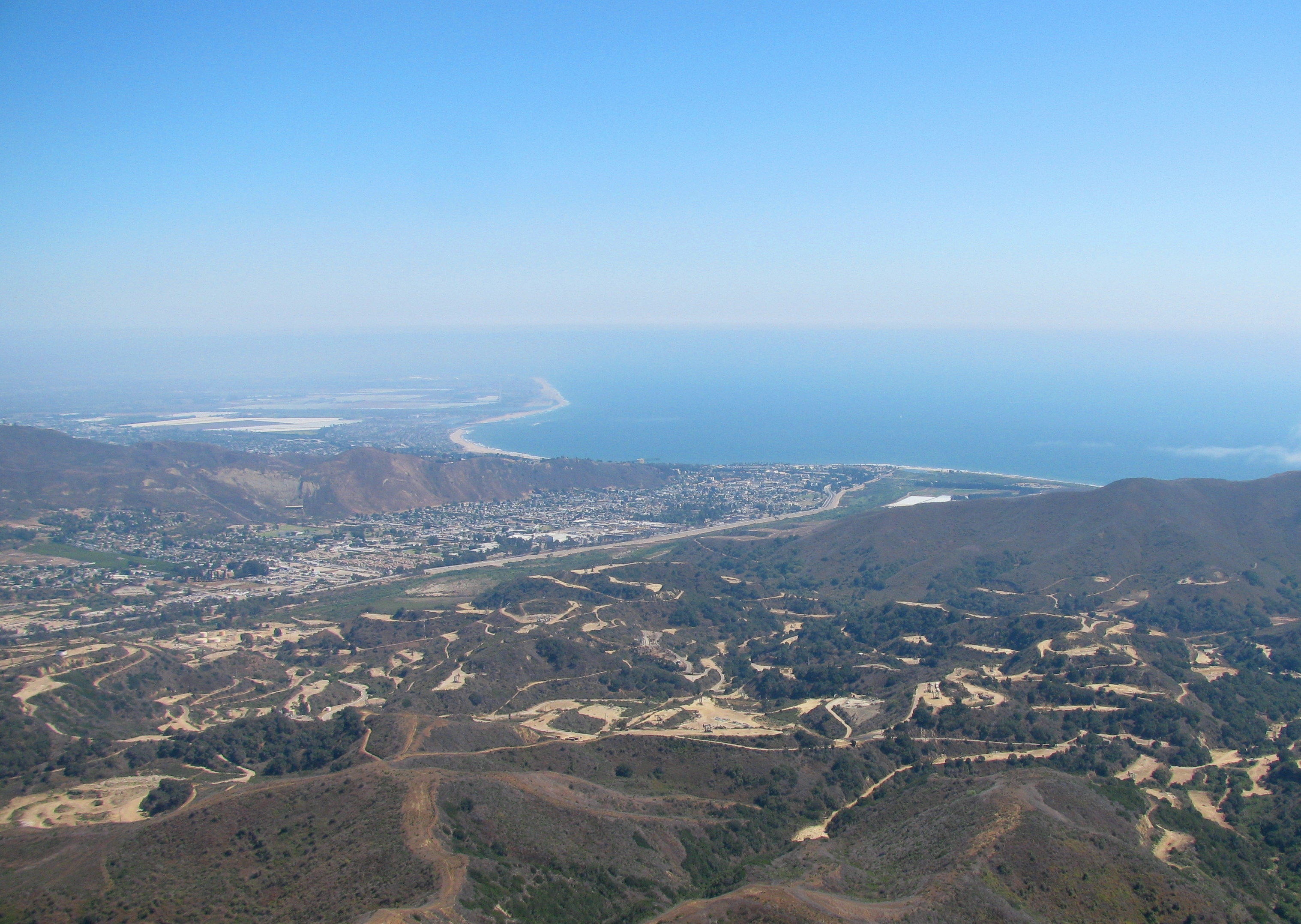
Ventura — City — City of San Buenaventura Ventura, California, viewed from the northwest (Oil fields in foreground)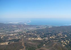
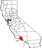
SealLocation within Ventura County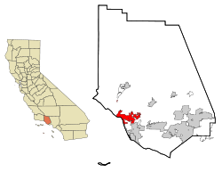 Location within California
 Ventura
Coordinates: 34°16′30″N 119°13′40″W / 34.275°N 119.22778°WCoordinates: 34°16′30″N 119°13′40″W / 34.275°N 119.22778°W Country  United States
State  California
County Ventura Government - Mayor William (Bill) Fulton - Senate Tony Strickland (R) - Assembly Das Williams (D) - U. S. Congress CA-23: Lois Capps (D)
CA-24: Elton Gallegly (R)Area[1] - Total 32.095 sq mi (83.124 km2) - Land 21.655 sq mi (56.085 km2) - Water 10.440 sq mi (27.039 km2) 32.53% Population (2010) - Total 106,433 - Rank 4th in Ventura County
56th in California
250th in the United States- Density 3,316.3/sq mi (1,280.4/km2) Time zone PST (UTC-8) - Summer (DST) PDT (UTC-7) ZIP code 93001-93007, 93009 Area code(s) 805 Website cityofventura.net Ventura (officially the City of San Buenaventura; commonly called San Buenaventura before 1891[2]) is the county seat of Ventura County, California, United States, incorporated in 1866. The population was 106,433 at the 2010 census, up from 100,916 at the 2000 census. Ventura is accessible via U.S. Route 101, State Route 33, and State Route 126.
Contents
History
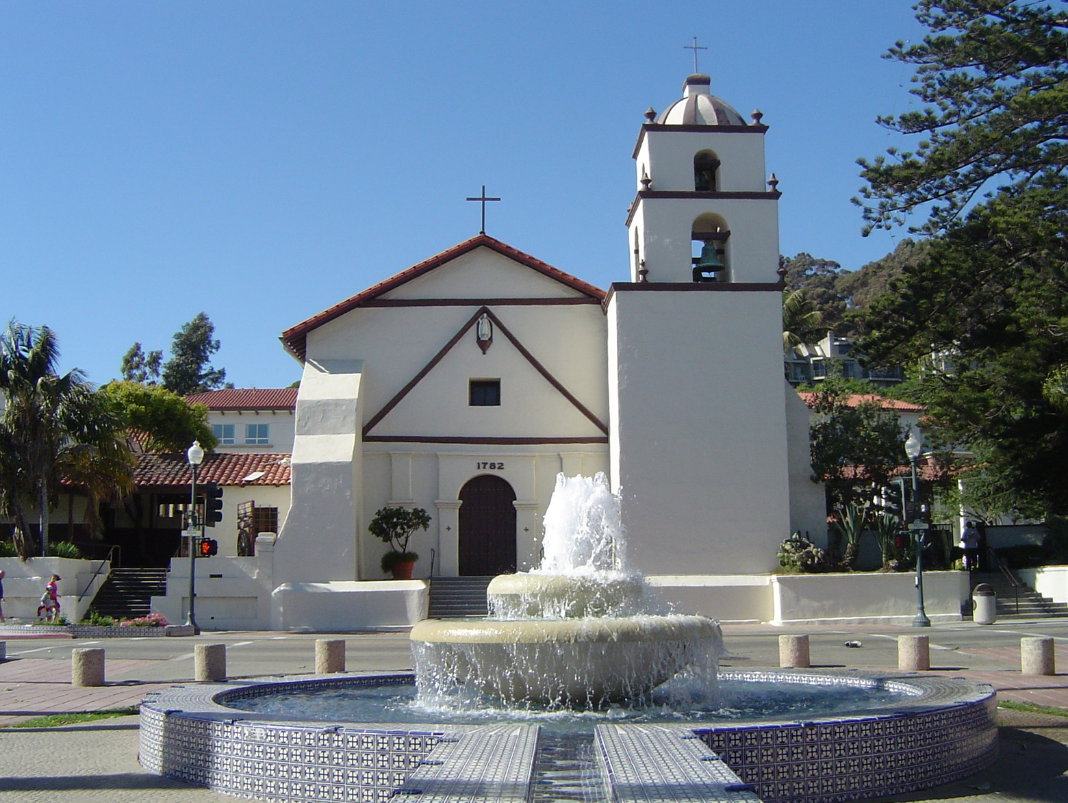
Father Junípero Serra founded Mission San Buenaventura in 1782,[3] forming the basis of what would become the city. The mission was named for St. Bonaventure, a Thirteenth Century Franciscan saint and a Doctor of the Church. On July 6, 1841, Governor Juan Bautista Alvarado granted Rancho San Miguel to Felipe Lorenzana and Raymundo Olivas,[4] whose Olivas Adobe on the banks of the Santa Clara River was the most magnificent hacienda south of Monterey.
After the American Civil War, settlers came to the area, buying land from the Mexicans, or simply as squatters. Vast holdings were later acquired by Easterners, including the railroad magnate, Thomas Scott. He was impressed by one of the young employees, Thomas R. Bard, who had been in charge of train supplies to Union troops, and Bard was sent west to handle Scott's property.
Not easily accessible, Ventura was not a target of immigrants, and as such, remained quiet and rural. For most of the century which followed the incorporation of Ventura in 1866, it remained isolated from the rest of the state.
Bard is often regarded as the Father of Ventura and his descendants have been prominently identified with the growth of Ventura County. The Union Oil Company was organized with Bard as President in 1890, and has offices in Santa Paula. The large Ventura Oil Field was first drilled in 1919 and at its peak produced 90,000 barrels per day (14,000 m3/d). The city is located between the Ventura River and the Santa Clara River, leading to soil so fertile that citrus grew better here than anywhere else in the state. The citrus farmers formed Sunkist Growers, Incorporated, the world's largest organization of citrus production.
On March 12, 1928, the St. Francis Dam, 54 miles (87 km) inland, failed catastrophically, taking over 600 lives. The resulting flood reached Montalvo about 5:30 a.m., almost two miles (3 km) wide and traveling at a speed of 5 miles (8 km) per hour.
From the south, travel by auto was slow and hazardous, until the completion of a four-lane freeway (US Highway 101) over the Conejo Grade in 1959. This route, now further widened and improved by 1969, is known as the Ventura Freeway, which directly links Ventura with the Los Angeles metropolitan area. Another route, US Highway 101 ALT (now the Pacific Coast Highway) traveled along the coast from Santa Monica via Oxnard, but was not heavily used.
From the north, entrance was by way of a single road along the beach and stagecoach passengers either had to wait until low tide when the horses could cross on the exposed wet sand, or go up the Ventura River Valley and then cross over the mountains to Santa Barbara via Casitas Pass, a long and difficult trip.
Inland, Ventura was hemmed in by (what is now) the Los Padres National Forest, composed of mountainous country and deep canyons. This route became passable with the completion of the Maricopa Highway (Hwy 33) in the 1930s.
Since then, Ventura has grown steadily. In 1920 there were 4,156 people. In 1930 the population had increased to 11,603, by 1950 the population reached 16,643, by 1970 the population was 57,964, and in 1980 the population had increased to 73,774. In the last three decades it has increased to approximately 107,000.
Points of interest
 Geographer Restored Mission San Buenaventura on a sunny day.
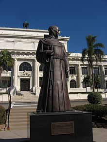
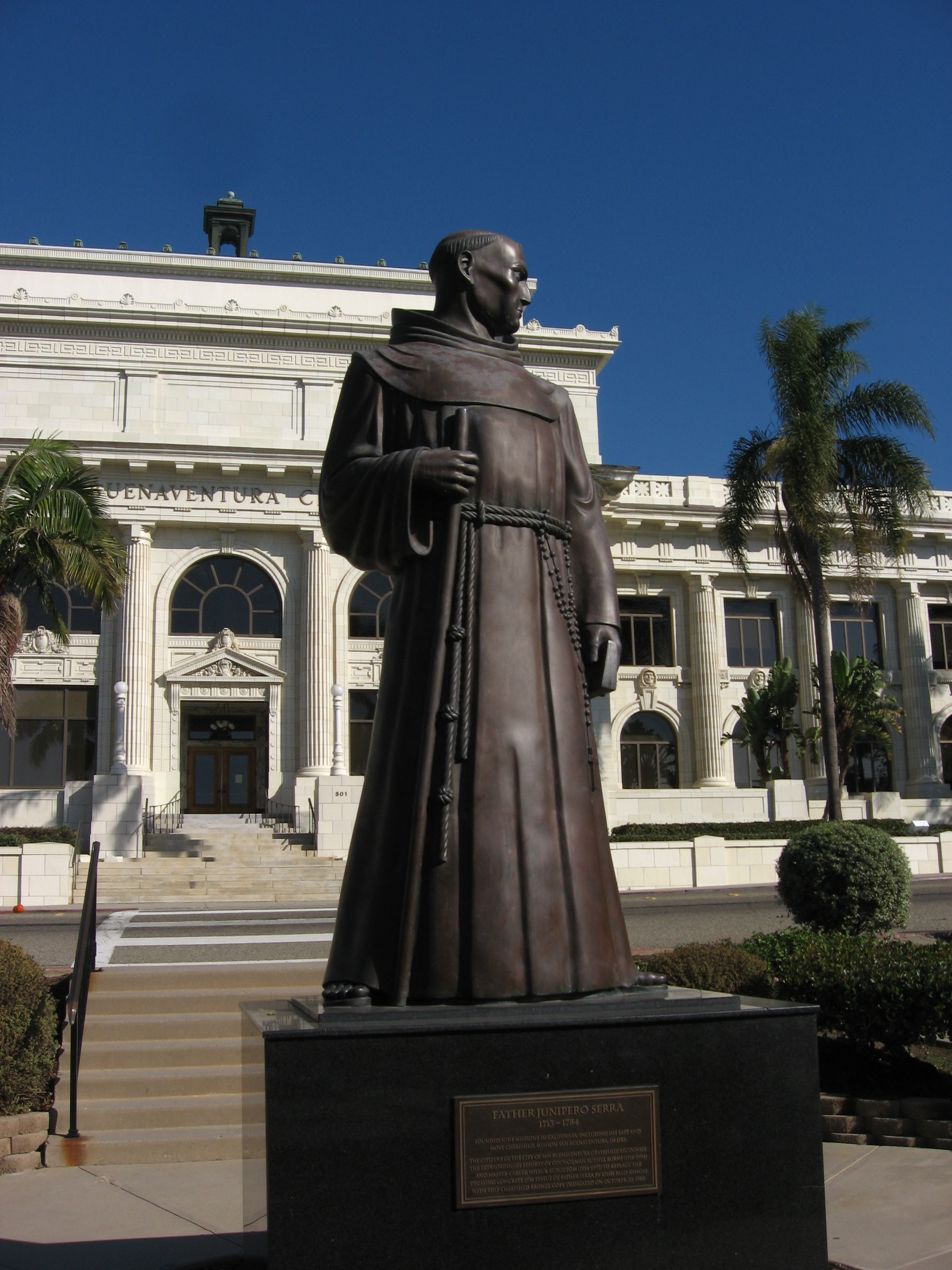
Ventura has some of the best surfing in Southern California, especially Surfer's Point at Ventura County Fairgrounds. Downtown Ventura is home to the Mission San Buenaventura, museums, galleries, dining, and shopping. Primary areas of activity include California Street and Main Street between Ventura Avenue and Fir Street. Located in downtown is the historic Ortega Adobe, once home to the Ortega family, now famous for their chili products. Numerous thrift stores contrast with high-end shops and restaurants. Downtown Ventura is home to Ventura's ornate city hall with its statue of Junipero Serra. Downtown now features numerous restaurants, winebars and the internationally acclaimed Rubicon Theatre Company.
A 4,300-square-foot (400 m2) Ventura Visitors Center is located at 101 S. California Street, in downtown and features exhibits on the Heritage Valley, Channel Islands National park, local arts scene and maps and guide books on the area.
One of the most recognizable landmarks in Ventura is called two trees. These are two lone trees on a hill, visible from most of Ventura.
In Plaza Park (Chestnut and Santa Clara Streets, downtown) one of the nation's largest Moreton Bay Fig Trees is marked with a plaque. Across the street is the main post office with WPA murals on interior walls.
The Ventura Harbor is home to fishing industry, seafood restaurants and a shopping village at Ventura Harbor Village. The Channel Islands National Park Headquarters is also located in this harbor, and boats to the Channel Islands depart from there daily.
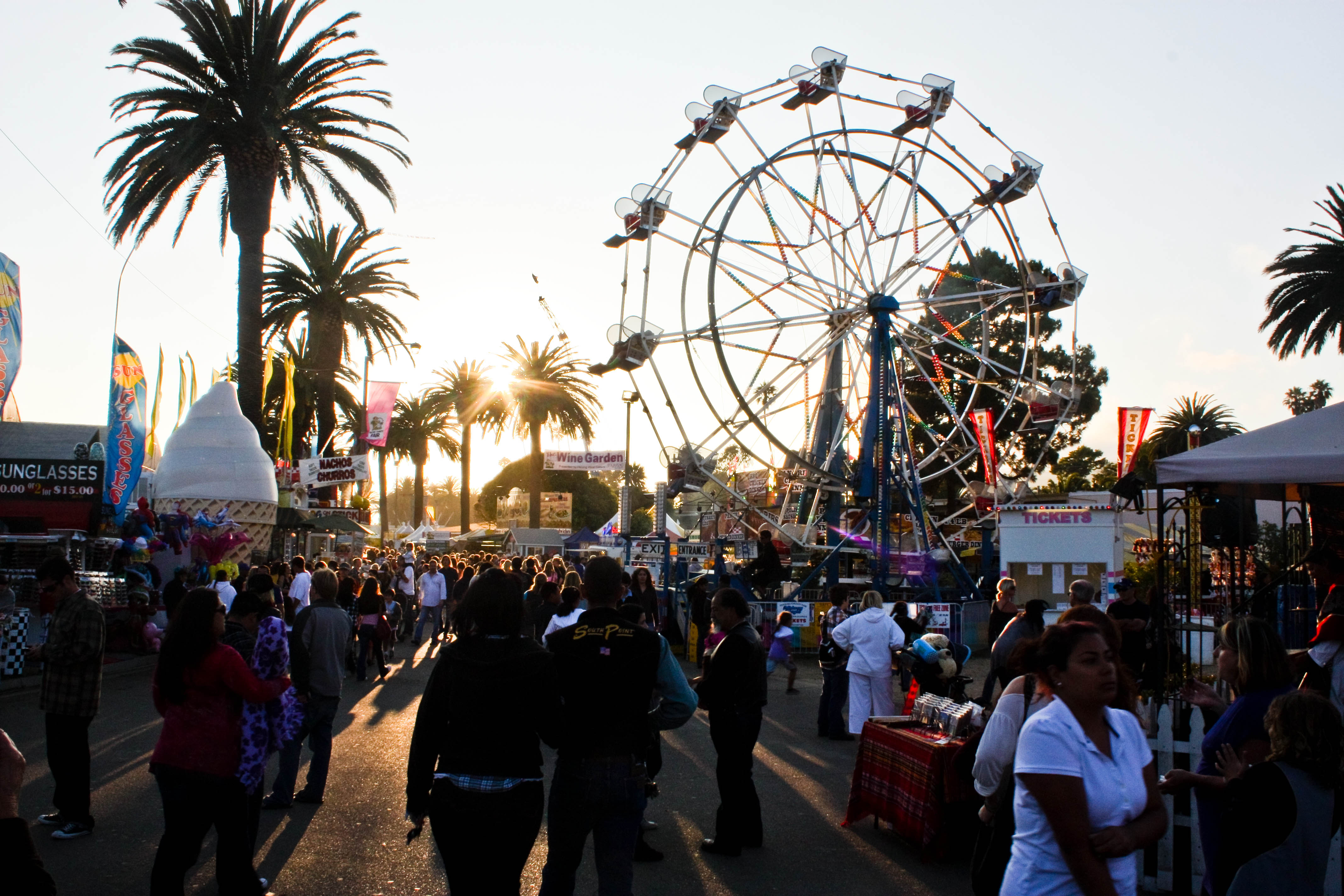
 The Ventura Fairgrounds during the Ventura County Fair.
Pierpont Bay (Pierpont) is the residential neighborhood along the one mile stretch between the Ventura Harbor and San Buenaventura State Beach. Reclaimed marshland was subdivided in 1925 with sluggish sporadic development through years of economic depression, wars, and two coastal floods (in 1937 and 1962). Formerly a hodge-podge of mostly rentals, weekend cottages and vacant lots, each of California's real estate booms brought surges of development and renovation and now Pierpont is mostly owner-occupied with an equal number of large, high-quality homes and older modest beach cottages. A lack of planning has left Pierpont with an apparent identity crisis, with widely varying architectural styles, a poorly implemented commercial area along Seaward Avenue, a noticeable lack of city maintenance, even next to multi-million dollar homes, and continuous conflicts regarding regulation of the neighborhood's public beach areas. Conflicts are likely to increase in the near future, with plans for high-density development along already-crowded streets, and with State officials beginning to exercise authority along beaches that have been mostly self-regulated for the last eighty years.The Ventura County Fairgrounds is the home of the annual Ventura County Fair, and over the years has hosted such acts as Jimi Hendrix, The Grateful Dead, Smokey Robinson, and All American Rejects.
The Derby Club at the Ventura County Fairgrounds offers Horse Racing Live via Satellite, and full service bars and restaurants.
The Ventura County Fairgrounds is also the home of Ventura Raceway, "The best little dirt track in America".[5][6]
The Ventura County Fairgrounds also serves as a Train Station for Amtrak's Pacific Surfliner route
The Vans Warped Tour also stops yearly at the Ventura County Fairgrounds with line ups including bands such as Yellowcard, Pepper and Avenged Sevenfold.
The Olivas Adobe, one of the early California Rancho homes, is operated today as a museum and performing arts venue. Located adjacent to the Olivas Park Golf Course, the home is one of the most visited historic sites on the central coast. Living history reinactments, demonstrations of Rancho life, and wonderful ghost stories abound. A summer music series of performances held in the old home's courtyard feature an eclectic assortment of artists from blues to jazz to country.
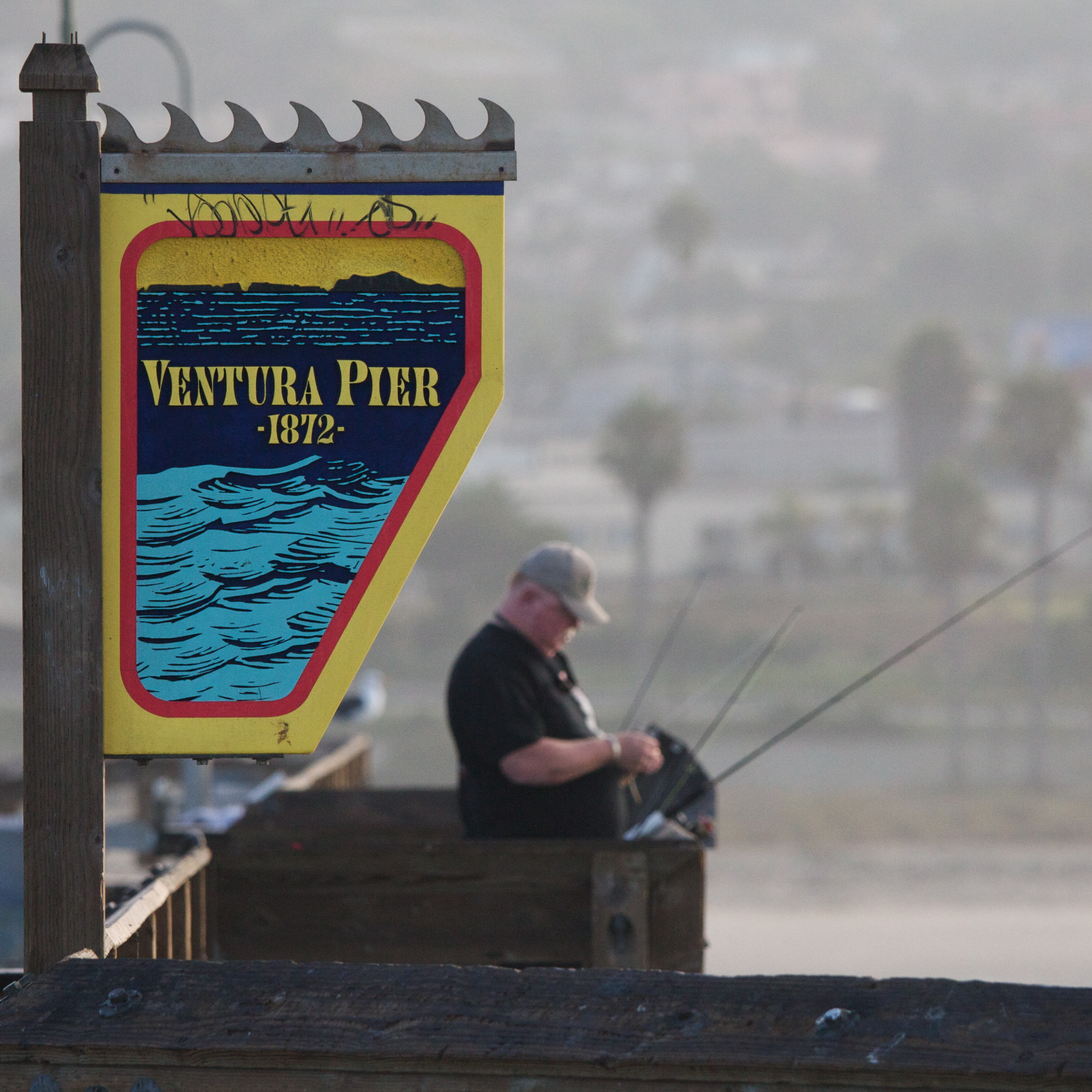
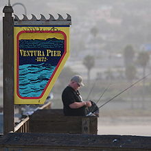 An early-morning fisherman at Ventura Pier, 2008.
Perry Mason creator Erle Stanley Gardner had a law practice and did much of his early writing in Downtown Ventura. The building where his law offices were housed, at California and Main Street bears his name on a historical marker.
The Ventura Film Festival shows over 200 films each year and many films including Swordfish, Little Miss Sunshine, Chinatown, Erin Brockovich, The Aviator, and The Rock were partly filmed in Ventura. The majority of the 2011 release Bellflower was shot in Ventura.[7]
Downtown Ventura also hosts the Majestic Ventura Theater, a beautiful early century theatre, which is situated about two blocks away from city hall. It serves as a venue for concerts. The theater has seen many bands such as Gregg Allman, John Prine, The Doors, Devo, Van Halen, X, Paramore, She Wants Revenge, Pennywise, Red Hot Chili Peppers, Lamb of God, Social Distortion, Bad Religion, Thrice, Avenged Sevenfold, Fugazi, Incubus, Tom Petty, America, They Might Be Giants, Panic! at the Disco, and Modest Mouse, as well as successful local artists such as Army of Freshmen, Big Bad Voodoo Daddy, Gregory Hillman, Bruce Kimmell.
The headquarters for outdoor clothing manufacturer Patagonia is located downtown. There was an organic clothing retailer on Main Street called Korazon Organics (now out of business) and the eco-designer Stewart+Brown has their factory just a few blocks from the ocean. Chic diaper bag manufacturer Petunia Pickle Bottom is headquartered near downtown Ventura. Ventura is a course in Tony Hawk's Pro Skater 2. It was called 'Skatestreet Ventura'.
Geography and climate

Ventura is located northwest of Los Angeles on the California coast and at 34°16′30″N 119°13′40″W / 34.275°N 119.22778°W (34.275242, -119.228048).[8]
According to the United States Census Bureau, Ventura has a total area of 32.1 square miles (83 km2). 21.7 square miles (56 km2) of it is land and 10.4 square miles (27 km2) of it (32.53%) is water.
Ventura River is at its western boundary and the Santa Clara River at its southern edge. [1][9]
Ventura has a Mediterranean climate, typical of most Southern California cities.Climate data for Ventura, California Month Jan Feb Mar Apr May Jun Jul Aug Sep Oct Nov Dec Year Record high °F (°C) 88
(31)91
(33)94
(34)100
(38)98
(37)102
(39)94
(34)97
(36)103
(39)103
(39)98
(37)96
(36)103
(39)Average high °F (°C) 66
(19)66
(19)65
(18)68
(20)68
(20)70
(21)73
(23)74
(23)74
(23)73
(23)70
(21)66
(19)69 Average low °F (°C) 45
(7)47
(8)48
(9)50
(10)53
(12)56
(13)59
(15)60
(16)59
(15)55
(13)49
(9)45
(7)48 Record low °F (°C) 29
(−2)28
(−2)31
(−1)35
(2)39
(4)42
(6)44
(7)46
(8)42
(6)37
(3)33
(1)29
(−2)28
(−2)Rainfall inches (mm) 3.41
(86.6)3.90
(99.1)3.04
(77.2)0.72
(18.3)0.21
(5.3)0.05
(1.3)0.02
(0.5)0.07
(1.8)0.36
(9.1)0.36
(9.1)1.37
(34.8)2.11
(53.6)15.62
(396.7)Source: http://www.weather.com/outlook/travel/businesstraveler/wxclimatology/monthly/graph/USCA1193 Demographics
2010
The 2010 United States Census[10] reported that Ventura had a population of 106,433. The population density was 3,316.2 people per square mile (1,280.4/km²). The racial makeup of Ventura was 76.6% White, 1.6% African American, 1.2% Native American, 3.4% Asian (0.9% Filipino, 0.6% Chinese, 0.4% Indian, 0.4% Korean, 0.4% Japanese, 0.3% Vietnamese, 0.5% Other), 0.2% Pacific Islander, 5.2% from two or more races. Hispanic or Latino of any race were 31.8% of the population.
The Census reported that 103,940 people (97.7% of the population) lived in households, 755 (0.7%) lived in non-institutionalized group quarters, and 1,738 (1.6%) were institutionalized.
There were 40,438 households, out of which 13,014 (32.2%) had children under the age of 18 living in them, 18,907 (46.8%) were opposite-sex married couples living together, 4,936 (12.2%) had a female householder with no husband present, 2,153 (5.3%) had a male householder with no wife present. There were 2,621 (6.5%) unmarried opposite-sex partnerships, and 371 (0.9%) same-sex married couples or partnerships. 10,959 households (27.1%) were made up of individuals and 4,271 (10.6%) had someone living alone who was 65 years of age or older. The average household size was 2.57. There were 25,996 families (64.3% of all households); the average family size was 3.14.
The population was spread out with 23,918 people (22.5%) under the age of 18, 9,581 people (9.0%) aged 18 to 24, 28,814 people (27.1%) aged 25 to 44, 29,957 people (28.1%) aged 45 to 64, and 14,163 people (13.3%) who were 65 years of age or older. The median age was 39.0 years. For every 100 females there were 97.7 males. For every 100 females age 18 and over, there were 95.6 males.
There were 42,827 housing units at an average density of 1,334.4 per square mile (515.2/km²), of which 22,600 (55.9%) were owner-occupied, and 17,838 (44.1%) were occupied by renters. The homeowner vacancy rate was 1.3%; the rental vacancy rate was 5.5%. 59,330 people (55.7% of the population) lived in owner-occupied housing units and 44,610 people (41.9%) lived in rental housing units.
2000
As of the census[11] of 2000, there were 100,916 people, 38,524 households, and 25,233 families residing in the city. The population density was 4,790.6 inhabitants per square mile (1,849.3/km²). There were 39,803 housing units at an average density of 1,889.5 per square mile (729.4/km²). The racial makeup of the city was 78.8% White, 1.4% African American, 1.2% Native American, 3.0% Asian, 0.2% Pacific Islander, 11.1% from other races, and 4.3% from two or more races. Hispanic or Latino of any race were 30.4% of the population.
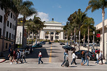 Ventura City Hall
There were 38,524 households out of which 32.1% had children under the age of 18 living with them, 49.2% were married couples living together, 11.7% had a female householder with no husband present, and 34.5% were non-families. 26.5% of all households were made up of individuals and 9.7% had someone living alone who was 65 years of age or older. The average household size was 2.56 and the average family size was 3.12.
In the city the population was spread out with 25.0% under the age of 18, 7.8% from 18 to 24, 31.5% from 25 to 44, 22.8% from 45 to 64, and 12.8% who were 65 years of age or older. The median age was 37 years. For every 100 females there were 96.9 males. For every 100 females age 18 and over, there were 93.8 males.
The median income for a household in the city was $52,297, and the median income for a family was $60,466. Males had a median income of $43,828 versus $31,793 for females. The per capita income for the city was $25,065. About 6.4% of families and 9.0% of the population were below the poverty line, including 12.2% of those under age 18 and 5.3% of those age 65 or over.
Education
Ventura hosts four college campuses, the Brooks Institute of Photography, Ventura College of Law, Southern California Institute of Law and Ventura College. Ventura College is a community college, part of the Ventura County Community College District [2]. The Ventura College of Law is a non-profit law school founded in 1969.
Public school students from kindergarten through 12th grade attend schools in the Ventura Unified School District. The district has two high schools: Ventura High in the midtown area, and Buena High in east Ventura. Students from throughout the district may attend Foothill Technology High School, a magnet school focusing on technology and health careers or El Camino High School (Ventura), an independent study school located on the Ventura College campus. Private schools include St. Bonaventure High School, a Catholic school, Ventura County Christian School, an evangelical Christian school, and Holy Cross School, a Roman Catholic school for grades Pre-K-8. [3]
Economy
Patagonia is based in Ventura.[12]
Top employers
According to the City's 2009 Comprehensive Annual Financial Report,[13] the top employers in the city are:
# Employer # of Employees 1 County of Ventura 8,121 2 Ventura County Health Care Agency 2,430 3 Ventura Unified School District 2,197 4 Community Memorial Hospital 2,000 5 Ventura College 1,974 6 City of San Buenaventura 1,047 Incubator
In 2009 the City of Ventura created Ventura Ventures Technology Center, a business incubator with a high-tech focus. Ventura Ventures Technology Center was created as a economic engine to develop jobs and companies locally, as well as attract entrepreneurs to the area.
Libraries
Public Libraries: Ventura County Library - There are three branches in the City of Ventura: E.P. Foster Library on Main Street, Avenue Library on the Avenue, and Saticoy Library in the unincorporated area of Saticoy. H.P. Wright Library was closed on November 30, 2009 due to lack of funding. All books from the H.P. Wright Library were integrated into the E.P. Foster Library in March 2010.
Academic Library: Ventura College
Other: Ventura County Law Library
Shopping centers
- Borchard Shopping Center
- Figueroa Street Mall Shopping Center
- Gateway Village Shopping Center
- Marina Village Shopping Center
- Pacific View Mall Shopping Center
- Plaza Shopping Center
- Victoria Plaza Shopping Center
- Ventura Harbor Village Shopping Center
- Ventura Harbor Shopping Center
Notable locations
 Surfer rides a wave off of Point Mugu during a Ventura surf contest.
- Avenue Library
- A J Comstock Fire Museum
- Albinger Archeological Museum
- City Hall
- City of Ventura Filtration Plant
- Channel Islands National Park Headquarters and Visitors Center
- Lemon
- Leeward Winery
- Lillian Smolt Memorial Library
- Mission San Buenaventura
- Mobil Pier
- Olivas Park Golf Course
- Old Creek Ranch Winery
- Pierpont Bay Yacht Club
- Southern Pacific Station
- Saticoy Regional Golf Course
- Saticoy Community Center
- Surfing Museum
- The Livery Arts Center
- Ventura Yacht Club
- Ventura Municipal Golf Course
Parks
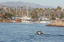 Boat entering Ventura Harbor.
- Arroyo Verde Park
- Arundell Linear Park
- Aurora Linear Park
- Babe Ruth Field
- Barranca Vista Park
- Belaire Linear Park
- Blanche Reynolds Park (Rainbow Bridge)
- Bristol Bay Linear Park
- Brock Linear Park
- Chumash Park
- Camino Real Park
- County Square Linear Park
- Eastwood Park
- Fritz Huntzinger Youth Sports Complex
- Grant Park
- Harry Lyon Park
- Hobart Park
- Juanamaria Park
- Junipero Serra Park
- Kennebec Linear Park
- Marina Park
- Marion Cannon Park
- Memorial Park
- Mission Park
- Montalvo Hill Park
- Northbank Linear Park
- Ocean Avenue Park
- Plaza Park
- Promenade Park
- Ralston Village Linear Park
- Rancho Ventura Linear Park
- Riverview Linear Park
- Seaside Park (and Ventura County Fairgrounds)
- Seaside Wilderness Park
- San Buenaventura State Beach
- Thille Park
- Ventura Community Park
- West Park
- Woodside Linear Park
References
- ^ U.S. Census
- ^ Erwin G. Gudde, California Place Names: The Origin and Etymology of Current Geographical Names, 4th ed., rev. and enlarged by William Bright (University of California Press, 1998), p. 410.
- ^ Murphy, Arnold L. (ed.) (1979). A Comprehensive Story of Ventura County, California. Oxnard, CA: M & N Printing. pp. 8.
- ^ "Spanish and Mexican Land Grants". Ventura County Genealogical Society. http://www.venturacogensoc.org/SpanGrants.htm. Retrieved 2007-03-17.
- ^ http://www.greywolfphotos.com/ Grey Wolf Photos
- ^ http://www.ustream.tv/channel/ventura-raceway-live Ventura Raceway Channel
- ^ http://www.vcstar.com/news/2011/jan/15/can-do-movie-crew/
- ^ "US Gazetteer files: 2010, 2000, and 1990". United States Census Bureau. 2011-02-12. http://www.census.gov/geo/www/gazetteer/gazette.html. Retrieved 2011-04-23.
- ^ Ventura Beach Realty
- ^ All data are derived from the United States Census Bureau reports from the 2010 United States Census, and are accessible on-line here. The data on unmarried partnerships and same-sex married couples are from the Census report DEC_10_SF1_PCT15. All other housing and population data are from Census report DEC_10_DP_DPDP1. Both reports are viewable online or downloadable in a zip file containing a comma-delimited data file. The area data, from which densities are calculated, are available on-line here. Percentage totals may not add to 100% due to rounding. The Census Bureau defines families as a household containing one or more people related to the householder by birth, opposite-sex marriage, or adoption. People living in group quarters are tabulated by the Census Bureau as neither owners nor renters. For further details, see the text files accompanying the data files containing the Census reports mentioned above.
- ^ "American FactFinder". United States Census Bureau. http://factfinder.census.gov. Retrieved 2008-01-31.
- ^ "Patagonia", Accessed 5 July 2011
- ^ City of San Buenaventura CAFR
External links
- Ventura Wiki
- Guide to Ventura, California by locals
- VenturaTalk.com - Blog on Ventura news and opinion
- Ventura Visitor's and Convention Bureau
- Ventura.com
- Ventura @ The Official Conejo Valley Website, a Web site with local history, events, and community information.
- Bell Arts Factory
- Ventura Port District
- Ventura Harbor
- City of Ventura

Carpinteria
Santa Barbara
U.S. 101Ojai
SR 33Santa Paula
Santa Clarita
SR 126Pacific Ocean 
Saticoy
Moorpark and Simi Valley
SR 118 Ventura

Pacific Ocean
Channel IslandsOxnard
Port Hueneme
Malibu
U.S. 101
SR 1Camarillo
Los Angeles
U.S. 101Municipalities and communities of Ventura County, California County seat: Ventura Cities Camarillo | Fillmore | Moorpark | Ojai | Oxnard | Port Hueneme | Santa Paula | Simi Valley | Thousand Oaks | Ventura
CDPs Bell Canyon | Casa Conejo | Channel Islands Beach | El Rio | Lake Sherwood | Meiners Oaks | Mira Monte | Oak Park | Oak View | Piru | Santa Rosa Valley | Santa Susana | Saticoy
Unincorporated
communitiesBardsdale | Buckhorn | Casitas Springs | Dulah | Faria | La Conchita | Newbury Park | Point Mugu | Sea Cliff | Somis | Upper Ojai
California county seats Consolidated city-county Municipalities Alturas | Auburn | Bakersfield | Colusa | Crescent City | El Centro | Eureka | Fairfield | Fresno | Hanford | Hollister | Jackson | Lakeport | Los Angeles | Madera | Martinez | Marysville | Merced | Modesto | Napa | Nevada City | Oakland | Oroville | Placerville | Red Bluff | Redding | Redwood City | Riverside | Sacramento | Salinas | San Bernardino | San Diego | San Jose | San Luis Obispo | San Rafael | Santa Ana | Santa Barbara | Santa Cruz | Santa Rosa | Sonora | Stockton | Susanville | Ukiah | Ventura | Visalia | Willows | Woodland | Yreka | Yuba City
CDPs Bridgeport | Downieville | Independence | Mariposa | Markleeville | Quincy | San Andreas | Weaverville
 State of California
Sacramento (capital) Topics Climate · Delegations · Deserts · Districts · Ecology · Elections · Environment · Geography · Government · History · Protected areas · Sports · Symbols · Transportation · Visitor attractions · Index of California-related articles
Society Californians · Culture · Crime · Demographics · Economy · Education · Politics
Regions Antelope Valley · Big Sur · Cascade Range · Central California · Central Coast · Central Valley · Channel Islands · Coachella Valley · Conejo Valley · Cucamonga Valley · Death Valley · East Bay (SF) · East County (SD) · Eastern California · Emerald Triangle · Gold Country · Great Basin · Greater Los Angeles · Greater Sacramento · Inland Empire · Lake Tahoe · Los Angeles Basin · Lost Coast · Metropolitan Fresno · Mojave · Mountain Empire · North Bay (SF) · North Coast · North County (SD) · Northern California · Owens Valley · Oxnard Plain · San Francisco Peninsula · Pomona Valley · Sacramento Valley · San Bernardino Valley · San Diego–Tijuana · San Fernando Valley · San Francisco Bay Area · San Gabriel Valley · San Joaquin Valley · Santa Clara Valley · Santa Clara River Valley · Santa Clarita Valley · Shasta Cascade · Sierra Nevada · Silicon Valley · South Bay (LA) · South Bay (SF) · South Bay (SD) · South Coast · Southern California · Southern Border Region · Tri-Valley · Upstate California · Victor Valley · Wine Country · Yosemite
Metro areas Bakersfield · Chico · El Centro · Fresno · Hanford–Corcoran · Los Angeles–Long Beach–Glendale · Madera · Modesto · Merced · Napa · Oakland–Fremont–Hayward · Oxnard–Thousand Oaks–Ventura · Redding · Riverside–San Bernardino–Ontario · Sacramento–Arden Arcade–Roseville · Salinas · San Diego–Carlsbad–San Marcos · San Francisco–San Mateo–Redwood City · San Jose–Sunnyvale–Santa Clara · San Luis Obispo–Paso Robles · Santa Ana–Anaheim–Irvine · Santa Barbara–Santa Maria–Goleta · Santa Cruz–Watsonville · Santa Rosa–Petaluma · Stockton · Vallejo–Fairfield · Visalia–Porterville · Yuba City
Micro areas Counties Alameda · Alpine · Amador · Butte · Calaveras · Colusa · Contra Costa · Del Norte · El Dorado · Fresno · Glenn · Humboldt · Imperial · Inyo · Kern · Kings · Lake · Lassen · Los Angeles · Madera · Marin · Mariposa · Mendocino · Merced · Modoc · Mono · Monterey · Napa · Nevada · Orange · Placer · Plumas · Riverside · Sacramento · San Benito · San Bernardino · San Diego · San Francisco · San Joaquin · San Luis Obispo · San Mateo · Santa Barbara · Santa Clara · Santa Cruz · Shasta · Sierra · Siskiyou · Solano · Sonoma · Stanislaus · Sutter · Tehama · Trinity · Tulare · Tuolumne · Ventura · Yolo · Yuba
Mayors of cities with populations exceeding 100,000 in California - Antonio Villaraigosa
(Los Angeles) - Jerry Sanders
(San Diego) - Chuck Reed
(San Jose) - Edwin M. Lee
(San Francisco) - Ashley Swearengin
(Fresno) - Kevin Johnson
(Sacramento) - Bob Foster
(Long Beach) - Jean Quan
(Oakland) - Harvey Hall
(Bakersfield) - Tom Tait
(Anaheim) - Miguel A. Pulido
(Santa Ana)
- Ronald O. Loveridge
(Riverside) - Ann Johnston
(Stockton) - Cheryl Cox
(Chula Vista) - Bob Wasserman
(Fremont) - Sukhee Kang
(Irvine) - Pat Morris
(San Bernardino) - Jim Ridenour
(Modesto) - Thomas E. Holden
(Oxnard) - Acquanetta Warren
(Fontana) - William H. Batey II
(Moreno Valley)^ - John Drayman
(Glendale)
- Cathy Green
(Huntington Beach)^ - Bob Kellar
(Santa Clarita)^ - William Dalton
(Garden Grove) - Susan Gorin
(Santa Rosa)^ - Jim Wood
(Oceanside) - Donald Kurth
(Rancho Cucamonga) - Paul S. Leon
(Ontario) - R. Rex Parris
(Lancaster) - Pat Hume
(Elk Grove) - James C. Ledford Jr.
(Palmdale) - Stan Skipworth
(Corona)^
- Dennis Donohue
(Salinas) - Elliot Rothman
(Pomona) - Frank Scotto
(Torrance) - Michael Sweeney
(Hayward) - Sam Abed
(Escondido) - Tony Spitaleri
(Sunnyvale) - Bill Bogaard
(Pasadena) - Carolyn Cavecche
(Orange) - F. Richard Jones
(Fullerton)^ - Jacqui Irwin
(Thousand Oaks)^ - Jesus Gamboa
(Visalia)
- Paul Miller
(Simi Valley) - William D. Shinn
(Concord)^ - Gina Garbolino
(Roseville) - Jamie L. Matthews
(Santa Clara) - Osby Davis
(Vallejo) - Rudy Cabriales
(Victorville) - Ernest Gutierrez
(El Monte) - Tom Bates
(Berkeley) - Rick Trejo
(Downey)^ - Eric R. Bever
(Costa Mesa)^ - James T. Butts, Jr.
(Inglewood)

^Mayor selected from city council
Other states: AL • AK • AZ • AR • CA • CO • CT • DE • FL • GA • HI • ID • IL • IN • IA • KS • KY • LA • ME • MD • MA • MI • MN • MS • MO • MT • NE • NV • NH • NJ • NM • NY • NC • ND • OH • OK • OR • PA • RI • SC • SD • TN • TX • UT • VT • VA • WA • WV • WI • WYCategories:- Cities in Ventura County, California
- Populated coastal places in California
- County seats in California
- Ventura, California
- Incorporated cities and towns in California


Wikimedia Foundation. 2010.