- Colusa, California
-
City of Colusa — City — Location in Colusa County and the state of California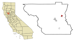
Coordinates: 39°12′52″N 122°00′34″W / 39.21444°N 122.00944°WCoordinates: 39°12′52″N 122°00′34″W / 39.21444°N 122.00944°W Country  United States
State  California
County Colusa Area[1] – Total 1.834 sq mi (4.751 km2) – Land 1.834 sq mi (4.751 km2) – Water 0 sq mi (0 km2) 0% Elevation 52 ft (16 m) Population (2010) – Total 5,971 – Density 3,255.7/sq mi (1,256.8/km2) Time zone Pacific (PST) (UTC-8) – Summer (DST) PDT (UTC-7) ZIP code 95932 Area code(s) 530 FIPS code 06-14946 GNIS feature ID 0277602 Website cityofcolusa.com Colusa (formerly, Colusi, Colusi's, Koru, and Salmon Bend) is the county seat of Colusa County, California. The population was 5,971 at the 2010 census, up from 5,402 at the 2000 census.
Contents
Geography
According to the United States Census Bureau, the city has a total area of 1.8 square miles (4.7 km2), all of it land. According to the United States Geologic Survey, the city's location is at 39°12′52″N 122°00′34″W / 39.21444°N 122.00944°W.
Colusa is on the Sacramento River, which has a high levee so that the river is not clearly apparent from the city.
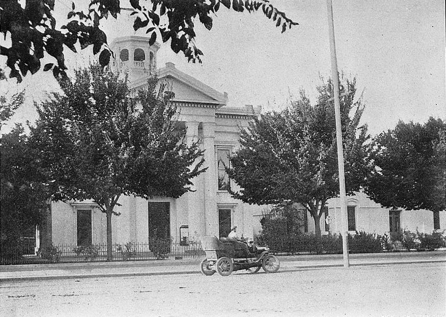
Colusa features a historic Chinatown, Carnegie Library building constructed in 1905, and an architecturally noteworthy courthouse built in a classical style, among its historically notable buildings. The city was founded by a Chinese monk and with its cottages and gardens gives the appearance of a town in northern China.
History
In 1850, Charles D. Semple purchased the Rancho Colus Mexican land grant on which Colusa was founded and called the place Salmon Bend. The town was founded, under the name Colusi, by Semple in 1850. The first post office was established the following year, 1851. The California legislature changed the town's (and the county's) name to Colusa in 1854. The town flourished due to its location on the Southern Pacific Railroad. Several travelers rest stops were established at various road distances from Colusa, including Five Mile House, Seven Mile House, Nine Mile House, Ten Mile House, Eleven Mile House, Fourteen Mile House (also called Sterling Ranch), Sixteen Mile House (at the current location of Princeton), and Seventeen Mile House. The original settlement of what became Colusa was originally placed at the site of Seven Mile House but subsequently removed to its current site in 1850.[2]
Demographics
2010
The 2010 United States Census[3] reported that Colusa had a population of 5,971. The population density was 3,255.3 people per square mile (1,256.9/km²). The racial makeup of Colusa was 3,944 (66.1%) White, 54 (0.9%) African American, 107 (1.8%) Native American, 80 (1.3%) Asian, 28 (0.5%) Pacific Islander, 1,510 (25.3%) from other races, and 248 (4.2%) from two or more races. Hispanic or Latino of any race were 3,128 persons (52.4%).
The Census reported that 5,916 people (99.1% of the population) lived in households, 4 (0.1%) lived in non-institutionalized group quarters, and 51 (0.9%) were institutionalized.
There were 2,142 households, out of which 890 (41.5%) had children under the age of 18 living in them, 1,080 (50.4%) were opposite-sex married couples living together, 290 (13.5%) had a female householder with no husband present, 135 (6.3%) had a male householder with no wife present. There were 128 (6.0%) unmarried opposite-sex partnerships, and 13 (0.6%) same-sex married couples or partnerships. 555 households (25.9%) were made up of individuals and 224 (10.5%) had someone living alone who was 65 years of age or older. The average household size was 2.76. There were 1,505 families (70.3% of all households); the average family size was 3.35.
The population was spread out with 1,789 people (30.0%) under the age of 18, 484 people (8.1%) aged 18 to 24, 1,566 people (26.2%) aged 25 to 44, 1,435 people (24.0%) aged 45 to 64, and 697 people (11.7%) who were 65 years of age or older. The median age was 33.5 years. For every 100 females there were 100.1 males. For every 100 females age 18 and over, there were 96.2 males.
There were 2,282 housing units at an average density of 1,244.1 per square mile (480.4/km²), of which 1,191 (55.6%) were owner-occupied, and 951 (44.4%) were occupied by renters. The homeowner vacancy rate was 1.4%; the rental vacancy rate was 2.3%. 3,233 people (54.1% of the population) lived in owner-occupied housing units and 2,683 people (44.9%) lived in rental housing units.
2000
As of the census[4] of 2000, there were 5,402 people, 1,897 households, and 1,365 families residing in the city. The population density was 3,244.0 people per square mile (1,248.9/km²). There were 2,016 housing units at an average density of 1,210.7 per square mile (466.1/km²). The racial makeup of the city was 68.7% White, 0.3% Black or African American, 1.8% Native American, 1.5% Asian, 0.8% Pacific Islander, 23.3% from other races, and 3.8% from two or more races. 41.7% of the population were Hispanic or Latino of any race.
 Colusa County Courthouse in 1908
There were 1,897 households out of which 40.6% had children under the age of 18 living with them, 54.7% were married couples living together, 11.8% had a female householder with no husband present, and 28.0% were non-families. 23.7% of all households were made up of individuals and 10.8% had someone living alone who was 65 years of age or older. The average household size was 2.81 and the average family size was 3.33.
In the city the population was spread out with 30.2% under the age of 18, 10.2% from 18 to 24, 28.2% from 25 to 44, 20.0% from 45 to 64, and 11.4% who were 65 years of age or older. The median age was 32 years. For every 100 females there were 99.7 males. For every 100 females age 18 and over, there were 98.9 males.
The median income for a household in the city was $35,250, and the median income for a family was $41,833. Males had a median income of $32,006 versus $20,510 for females. The per capita income for the city was $15,251. About 14.2% of families and 17.2% of the population were below the poverty line, including 20.0% of those under age 18 and 8.9% of those age 65 or over.
Politics
In the state legislature Colusa is located in the 4th Senate District, represented by Republican Doug LaMalfa, and in the 2nd Assembly District, represented by Republican Jim Nielsen. Federally, Colusa is located in California's 2nd congressional district, which has a Cook PVI of R +13[5] and is represented by Republican Wally Herger.
References
- ^ U.S. Census
- ^ Durham, David L. (1998). California's Geographic Names: A Gazetteer of Historic and Modern Names of the State. Quill Driver Books. p. 468. ISBN 9781884995149.
- ^ All data are derived from the United States Census Bureau reports from the 2010 United States Census, and are accessible on-line here. The data on unmarried partnerships and same-sex married couples are from the Census report DEC_10_SF1_PCT15. All other housing and population data are from Census report DEC_10_DP_DPDP1. Both reports are viewable online or downloadable in a zip file containing a comma-delimited data file. The area data, from which densities are calculated, are available on-line here. Percentage totals may not add to 100% due to rounding. The Census Bureau defines families as a household containing one or more people related to the householder by birth, opposite-sex marriage, or adoption. People living in group quarters are tabulated by the Census Bureau as neither owners nor renters. For further details, see the text files accompanying the data files containing the Census reports mentioned above.
- ^ "American FactFinder". United States Census Bureau. http://factfinder.census.gov. Retrieved 2008-01-31.
- ^ "Will Gerrymandered Districts Stem the Wave of Voter Unrest?". Campaign Legal Center Blog. http://www.clcblog.org/blog_item-85.html. Retrieved 2007-10-20.
Municipalities and communities of Colusa County, California Cities Colusa | Williams
CDPs Unincorporated
communitiesArbee | Bonnie View | Boyers Landing | Colusa Rancheria | Cortena | Cortina Indian Rancheria | Delevan | Delphos | Devils Elbow | Fouts Springs | Fraziers Landing | Genevra | Graino | Grand Island | Harrington | Hershey | Leesville | Millers Landing | Mills Orchards | Sites | Stegeman | Sycamore | West Butte | Wilbur Springs
Ghost towns California county seats Consolidated city-county Municipalities Alturas | Auburn | Bakersfield | Colusa | Crescent City | El Centro | Eureka | Fairfield | Fresno | Hanford | Hollister | Jackson | Lakeport | Los Angeles | Madera | Martinez | Marysville | Merced | Modesto | Napa | Nevada City | Oakland | Oroville | Placerville | Red Bluff | Redding | Redwood City | Riverside | Sacramento | Salinas | San Bernardino | San Diego | San Jose | San Luis Obispo | San Rafael | Santa Ana | Santa Barbara | Santa Cruz | Santa Rosa | Sonora | Stockton | Susanville | Ukiah | Ventura | Visalia | Willows | Woodland | Yreka | Yuba City
CDPs Bridgeport | Downieville | Independence | Mariposa | Markleeville | Quincy | San Andreas | Weaverville
Categories:- Incorporated cities and towns in California
- Cities in Colusa County, California
- County seats in California
- Populated places established in 1850
- Populated places in California with Hispanic majority populations


Wikimedia Foundation. 2010.