- Delphos, California
-
Coordinates: 39°11′25″N 122°10′12″W / 39.19028°N 122.17°W
Delphos — Unincorporated community — Location in California
 Delphos
Coordinates: 39°11′25″N 122°10′12″W / 39.19028°N 122.17°W Country United States State California County Colusa County Elevation[1] 75 ft (23 m) Delphos is an unincorporated community in Colusa County, California. It lies at an elevation of 75 feet (23 m). The community developed along the Southern Pacific Railroad.[2]
References
- ^ U.S. Geological Survey Geographic Names Information System: Delphos, California
- ^ Durham, David L. (1998). California's Geographic Names: A Gazetteer of Historic and Modern Names of the State. Quill Driver Books. p. 475. ISBN 9781884995149.
Municipalities and communities of Colusa County, California County seat: Colusa Cities 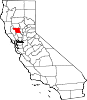
CDPs Unincorporated
communitiesArbee | Bonnie View | Boyers Landing | Colusa Rancheria | Cortena | Cortina Indian Rancheria | Delevan | Delphos | Devils Elbow | Fouts Springs | Fraziers Landing | Genevra | Graino | Grand Island | Harrington | Hershey | Leesville | Millers Landing | Mills Orchards | Sites | Stegeman | Sycamore | West Butte | Wilbur Springs
Ghost towns Categories:- Populated places in Colusa County, California
- Unincorporated communities in California
- Sacramento Valley geography stubs


Wikimedia Foundation. 2010.