- Arbuckle, California
Infobox Settlement
official_name = Arbuckle, California
settlement_type = CDP
imagesize =
image_caption =
image_
imagesize =
image_caption =
image_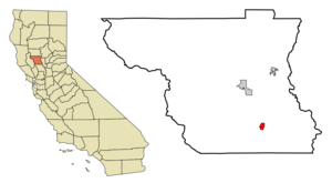
mapsize = 250x200px
map_caption = Location in Colusa County and the state ofCalifornia
mapsize1 =
map_caption1 =
subdivision_type = Country
subdivision_type1 = State
subdivision_type2 = County
subdivision_name =United States
subdivision_name1 =California
subdivision_name2 = Colusa
government_type =
leader_title =
leader_name =
established_date =
area_magnitude =
area_total_km2 = 3.6
area_total_sq_mi = 1.4
area_land_km2 = 3.6
area_land_sq_mi = 1.4
area_water_km2 = 0
area_water_sq_mi = 0
elevation_ft = 141
elevation_m = 43
population_as_of = 2000
population_footnotes =
population_total = 2332
population_metro =
population_density_km2 = 647.8
population_density_sq_mi = 1665.7
timezone = Pacific (PST)
utc_offset = -8
latd = 39 |latm = 1 |lats = 6 |latNS = N
longd = 122 |longm = 3 |longs = 33 |longEW = W
timezone_DST = PDT
utc_offset_DST = -7
postal_code_type =ZIP code
postal_code = 95912
area_code = 530
blank_name = FIPS code
blank_info = 06-02420
blank1_name = GNIS feature ID
blank1_info = 1657943
footnotes =
website =Arbuckle is a
census-designated place (CDP) in Colusa County,California ,United States . The population was 2,332 at the 2000 census. The town entrance sign on I-5 only says 864 people, but it's very old and hasn't been updated. The town of Arbuckle is situated in the southerly portion of Colusa County, approximately convert|20|mi|km southwest of the City of Colusa, the County seat. Arbuckle is characterized by single-family residences, multiple-family units, some mobile homes, and commercial activities. The land surrounding Arbuckle is mostlyagriculture including cultivated annualcrop s, and both active and unmaintainedorchard s (primarilyalmond ). Regional access is provided by the north south running Interstate Highway 5.Geography
According to the
United States Census Bureau , the CDP has a total area of 1.4 square miles (3.6 km²), all of it land. Twostream s drain the area, the Salt andElk Creek s. The Salt Creek flows north in the area, then bends east, and is joined by Elk Creek. Both streams join Sand Creek a half mile northeast of the town, and flow in a northeast direction [Wagner, D.L., and Bortugno, E.J., California Department of Mines and Geology Report, 1982] . Salt Creek is subject to periodic flooding during heavy rainfall. ["Arbuckle Estates Environmental Impact Report", Earth Metrics Inc, City of Arbuckle report, 1990]Demographics
As of the
census GR|2 of 2000, there were 2,332 people, 650 households, and 533 families residing in the CDP. Thepopulation density was 1,695.3 people per square mile (652.5/km²). There were 679 housing units at an average density of 493.6/sq mi (190.0/km²). The racial makeup of the CDP was 50.21% White, 0.17% Black or African American, 2.10% Native American, 0.47% Asian, 0.09% Pacific Islander, 40.44% from other races, and 6.52% from two or more races. 70.75% of the population were Hispanic or Latino of any race.There were 650 households out of which 52.6% had children under the age of 18 living with them, 63.2% were married couples living together, 12.6% had a female householder with no husband present, and 18.0% were non-families. 15.2% of all households were made up of individuals and 8.3% had someone living alone who was 65 years of age or older. The average household size was 3.59 and the average family size was 3.98.
In the CDP the population was spread out with 35.9% under the age of 18, 12.0% from 18 to 24, 27.8% from 25 to 44, 15.7% from 45 to 64, and 8.5% who were 65 years of age or older. The median age was 26 years. For every 100 females there were 105.6 males. For every 100 females age 18 and over, there were 106.5 males.
The median income for a household in the CDP was $35,463, and the median income for a family was $36,573. Males had a median income of $25,875 versus $22,865 for females. The
per capita income for the CDP was $13,225. About 16.3% of families and 17.4% of the population were below thepoverty line , including 22.9% of those under age 18 and 7.1% of those age 65 or over.Politics
In the state legislature Maxwell is located in the 4th Senate District, represented by Republican
Sam Aanestad , and in the 2nd Assembly District, represented by RepublicanDoug LaMalfa . Federally, Maxwell is located inCalifornia's 2nd congressional district , which has a Cook PVI of R +13 [cite web | title = Will Gerrymandered Districts Stem the Wave of Voter Unrest? | publisher = Campaign Legal Center Blog | url=http://www.clcblog.org/blog_item-85.html | accessdate = 2007-10-20] and is represented by RepublicanWally Herger .References
External links
Wikimedia Foundation. 2010.