- Colusa Rancheria, California
-
Coordinates: 39°15′01″N 122°01′33″W / 39.25028°N 122.02583°W
Colusa Rancheria — Unincorporated community — Location in California
 Colusa Rancheria
Coordinates: 39°15′01″N 122°01′33″W / 39.25028°N 122.02583°W Country United States State California County Colusa County Elevation[1] 59 ft (18 m) Colusa Rancheria (also, Cachildehe Rancheria) is an unincorporated community in Colusa County, California. It lies at an elevation of 59 feet (18 m). The inhabitants belong to the Wintun tribe.
References
Municipalities and communities of Colusa County, California County seat: Colusa Cities 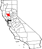
CDPs Unincorporated
communitiesArbee | Bonnie View | Boyers Landing | Colusa Rancheria | Cortena | Cortina Indian Rancheria | Delevan | Delphos | Devils Elbow | Fouts Springs | Fraziers Landing | Genevra | Graino | Grand Island | Harrington | Hershey | Leesville | Millers Landing | Mills Orchards | Sites | Stegeman | Sycamore | West Butte | Wilbur Springs
Ghost towns Categories:- Wintun
- Populated places in Colusa County, California
- Unincorporated communities in California
- Native American populated places
- Sacramento Valley geography stubs


Wikimedia Foundation. 2010.