- San Luis Obispo, California
Infobox Settlement
official_name = City of San Luis Obispo
other_name =
native_name =
nickname =
settlement_type =City
motto =
imagesize =
image_caption = The city of San Luis Obispo looking east from the top of Bishop Peak.
flag_size =
image_ |
|
seal_size =
image_shield =
shield_size =
image_blank_emblem =
blank_emblem_type =
blank_emblem_size =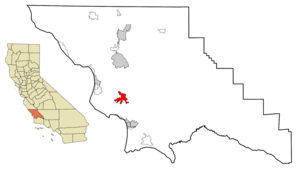
mapsize = 250x200px
map_caption = Location in San Luis Obispo County and the state ofCalifornia
mapsize1 =
map_caption1 =
image_dot_
dot_mapsize =
dot_map_caption =
dot_x =
dot_y =
pushpin_
pushpin_label_position =
pushpin_map_caption =
pushpin_mapsize =
subdivision_type = Country
subdivision_name =United States
subdivision_type1 = State
subdivision_name1 =California
subdivision_type2 = County
subdivision_name2 = San Luis Obispo
subdivision_type3 =
subdivision_name3 =
subdivision_type4 =
subdivision_name4 =
government_footnotes =
government_type =
leader_title =Mayor
leader_name = Dave Romero
leader_title1 = State Senate
leader_name1 =Abel Maldonado (R)
leader_title2 = State Assembly
leader_name2 =Sam Blakeslee (R)
leader_title3 = U. S. Congress
leader_name3 =Lois Capps (D)
leader_title4 =
leader_name4 =
established_title =
established_date =
established_title2 =
established_date2 =
established_title3 =
established_date3 =
area_magnitude =
unit_pref =
area_footnotes =
area_total_km2 = 27.7
area_land_km2 = 27.6
area_water_km2 = 0.5
area_total_sq_mi = 10.8
area_land_sq_mi = 10.7
area_water_sq_mi = 0.2
area_water_percent =
area_urban_km2 =
area_urban_sq_mi =
area_metro_km2 =
area_metro_sq_mi =
area_blank1_title =
area_blank1_km2 =
area_blank1_sq_mi =
population_as_of = 2000 census
population_footnotes =
population_note =
population_total = 44174
population_density_km2 = 1600
population_density_sq_mi = 4144.5
population_metro =
population_density_metro_km2 =
population_density_metro_sq_mi =
population_urban =
population_density_urban_km2 =
population_density_urban_sq_mi =
population_blank1_title =
population_blank1 =
population_density_blank1_km2 =
population_density_blank1_sq_mi =
timezone = PST
utc_offset = -8
timezone_DST = PDT
utc_offset_DST = -7
latd = 35 |latm = 16 |lats = 27 |latNS = N
longd = 120 |longm = 39 |longs = 47 |longEW = W
elevation_footnotes =
elevation_m = 91
elevation_ft = 233
postal_code_type =ZIP code
postal_code = 93401-93410, 93412
area_code = 805
blank_name = FIPS code
blank_info = 06-68154
blank1_name = GNIS feature ID
blank1_info = 1652788
website = http://www.slocity.org/
footnotes =San Luis Obispo (IPAEng|sænˈluːɪs əˈbɪspoʊ; Spanish for "St. Louis, the Bishop") is a city in
California , located roughly midway betweenSan Francisco andLos Angeles , andMonterey Bay and Santa Barbara on the Central Coast. The city, referred to locally as SLO or "San Luis," is thecounty seat ofSan Luis Obispo County and is adjacent toCalifornia Polytechnic State University (Cal Poly). As of the 2000 census, the city population was 44,174.History
Earliest human inhabitants of the local area were the
Chumash peoples, who settled in the vicinity circa 5000 to 10000 yearsBC . One of the earliest villages lies south of San Luis Obispo, and reflects the landscape of the earlyHolocene when estuaries came farther inland and sea levels were higher. These Chumash people exploited marine resources of the inlets and bays along the Central Coast and inhabited a network of villages including sites atLos Osos andMorro Creek . [C.Michael Hogan (2008) "Morro Creek", The Megalithic Portal, ed. by A. Burnham [http://www.megalithic.co.uk/article.php?sid=18502] ]The City of San Luis Obispo serves as the commercial, governmental, and cultural hub of San Luis Obispo County. One of California’s oldest communities, it began with the founding of
Mission San Luis Obispo de Tolosa in 1772 by FatherJunípero Serra , on the site of a Chumash village called Tilhini, as the fifth Spanish mission in California's chain of 21 missions. The mission was named after Saint Louis, a thirteenth centurybishop of Toulouse ,France . It is one of the best preserved examples of Spanish Mission architecture and among the oldest buildings in California.San Luis Obispo once had a burgeoning Chinatown in the vicinity of Palm St. and Chorro St. Laborers were brought from China by
Ah Louis in order to construct thePacific Coast Railway , roads connecting San Luis Obispo to Paso Robles and Paso Robles to Cambria, and also the 1884 to 1894 tunneling through Cuesta Ridge for theSouthern Pacific Railroad . SLO's Chinatown revolved aroundAh Louis Store and other Palm Street businesses owned and run by Chinese business people. Today, Mee Heng Low chop suey shop is all that remains of the culture, although a revitalized Chinatown development is being planned. A display of some of the unearthed relics from this period can be seen on the first floor of the Palm Street parking garage, which was built over the location where Chinatown once stood. The San Luis Obispo Historical Society (adjacent to the Mission) also contains rotating historical exhibits. [ [http://www.nps.gov/history/history/online_books/5views/5views3h2.htm Five Views: An Ethnic History Site Survey] ]San Luis Obispo was also a popular stop on both U.S. Route 101 and
California State Route 1 with the rise of car culture. Due to its popularity as a stop, it was the location of the nation's firstmotel , the Milestone Mo-Tel.Geography
San Luis Obispo is located at 35°16'27" North, 120°39'47" West (35.274305, -120.663192)GR|1.
According to the
United States Census Bureau , the city has a total area of 10.8 square miles (28.1 km²), of which, 10.7 square miles (27.6 km²) of it is land and 0.2 square miles (0.5 km²) of it is water. The total area is 1.66% water.San Luis Obispo is on the
West Coast of the United States and in theCentral Coast of California . ThePacific Ocean is only about convert|12|mi|km west of San Luis Obispo. TheSanta Lucia Mountains lie just east of San Luis Obispo.San Luis Obispo is a seismically active area; there are a number of nearby faults including the
San Andreas Fault . TheNine Sisters are a string of hills that partially run through San Luis Obispo. They aregeologically noteworthy for beingvolcanic plug s. Six of the nine peaks are open to the public for recreation. [cite web |url=http://santalucia.sierraclub.org/ninesis.html |title=The Nine Sisters of San Luis Obispo County |accessdate=2007-02-12 |work=Sierra Club ]Climate
San Luis Obispo has a
Mediterranean climate .Infobox Weather
single_line= yes
location = San Luis Obispo, California
Jan_Hi_°F = 62 |Jan_Hi_°C = 17
Feb_Hi_°F = 63 |Feb_Hi_°C = 17
Mar_Hi_°F = 64 |Mar_Hi_°C = 18
Apr_Hi_°F = 66 |Apr_Hi_°C = 19
May_Hi_°F = 68 |May_Hi_°C = 20
Jun_Hi_°F = 70 |Jun_Hi_°C = 21
Jul_Hi_°F = 72 |Jul_Hi_°C = 22
Aug_Hi_°F = 72 |Aug_Hi_°C = 22
Sep_Hi_°F = 74 |Sep_Hi_°C = 23
Oct_Hi_°F = 73 |Oct_Hi_°C = 23
Nov_Hi_°F = 70 |Nov_Hi_°C = 21
Dec_Hi_°F = 65 |Dec_Hi_°C = 18
Year_Hi_°F = 68 |Year_Hi_°C = 20
Jan_Lo_°F = 38 |Jan_Lo_°C = 3
Feb_Lo_°F = 40 |Feb_Lo_°C = 4
Mar_Lo_°F = 42 |Mar_Lo_°C = 6
Apr_Lo_°F = 44 |Apr_Lo_°C = 7
May_Lo_°F = 47 |May_Lo_°C = 8
Jun_Lo_°F = 49 |Jun_Lo_°C = 9
Jul_Lo_°F = 52 |Jul_Lo_°C = 11
Aug_Lo_°F = 52 |Aug_Lo_°C = 11
Sep_Lo_°F = 51 |Sep_Lo_°C = 11
Oct_Lo_°F = 47 |Oct_Lo_°C = 8
Nov_Lo_°F = 42 |Nov_Lo_°C = 6
Dec_Lo_°F = 40 |Dec_Lo_°C = 4
Year_Lo_°F = 45 |Year_Lo_°C = 7
Jan_Precip_inch = 2.3
|Jan_Precip_cm = |Jan_Precip_mm = 58
Feb_Precip_inch = 2.1
|Feb_Precip_cm = |Feb_Precip_mm = 53
Mar_Precip_inch = 1.9
|Mar_Precip_cm = |Mar_Precip_mm = 48
Apr_Precip_inch = 1.2
|Apr_Precip_cm = |Apr_Precip_mm = 30
May_Precip_inch = 0.2
|May_Precip_cm = |May_Precip_mm = 5
Jun_Precip_inch = 0 |Jun_Precip_cm = |Jun_Precip_mm =
Jul_Precip_inch = 0 |Jul_Precip_cm = |Jul_Precip_mm =
Aug_Precip_inch = 0 |Aug_Precip_cm = |Aug_Precip_mm =
Sep_Precip_inch = 0.1
|Sep_Precip_cm = |Sep_Precip_mm = 3
Oct_Precip_inch = 0.5
|Oct_Precip_cm = |Oct_Precip_mm = 13
Nov_Precip_inch = 1.1
|Nov_Precip_cm = |Nov_Precip_mm = 28
Dec_Precip_inch = 2.0
|Dec_Precip_cm = |Dec_Precip_mm = 51
Year_Precip_inch = 11.3
|Year_Precip_cm = |Year_Precip_mm =287
source =Weatherbasecite web
url =http://www.weatherbase.com/weather/weather.php3?s=001057&refer= |title =Weatherbase: Historical Weather for San Luis Obispo, California, United States of America | accessdate=2007-02-12 ]
accessdate = Feb 2007Demographics
As of the
census GR|2 of2000 , there are 44,174 people, 18,639 households, and 7,697 families residing in the city. Thepopulation density is 4,144.5 people per square mile (1,600.0/km²). There are 19,306 housing units at an average density of 1,811.3/sq mi (699.3/km²). The racial makeup of the city is 84.11% White, 1.46% African American, 0.65% Native American, 5.28% Asian, 0.13% Pacific Islander, 4.82% from other races, and 3.55% from two or more races. 11.65% of the population are Hispanic or Latino of any race.There are 18,639 households out of which 17.7% have children under the age of 18 living with them, 31.3% are married couples living together, 7.2% have a female householder with no husband present, and 58.7% are non-families. 32.7% of all households are made up of individuals and 9.5% have someone living alone who is 65 years of age or older. The average household size is 2.27 and the average family size is 2.86.
In the city the population is spread out with 14.2% under the age of 18, 33.6% from 18 to 24, 23.7% from 25 to 44, 16.5% from 45 to 64, and 12.1% who are 65 years of age or older. The median age is 26 years. For every 100 females there are 105.8 males. For every 100 females age 18 and over, there are 106.3 males.
The median
income for a household in the city is $31,926, and the median income for a family is $56,319. Males have a median income of $41,915 versus $27,407 for females. Theper capita income for the city is $20,386. 26.6% of the population and 7.1% of families are below thepoverty line . Out of the total population, 9.3% of those under the age of 18 and 4.6% of those 65 and older are living below the poverty line.Government
Local
San Luis Obispo is an incorporated city, and it is also the
county seat ofSan Luis Obispo County . The City of San Luis Obispo is governed by amayor who is elected to two year terms and four city council members who are elected to four year terms. [cite web |url=http://www.slocity.org/organization.asp |title=City Government : City Structure |accessdate=2007-02-12 |work=City of San Luis Obispo] The fire department of San Luis Obispo was first organized in 1872 and now has forty-five full-timefirefighters and fourfire stations (as of 2007 ). [cite web |url=http://www.ci.san-luis-obispo.ca.us/fire/about.asp |title=City of San Luis Obispo Fire Department |work=City of San Luis Obispo |accessdate=2007-05-22]Fire Department
The SLO City Fire Stations are staffed with three man ALS engine companies and a four man ALS Truck company. Each apparatus has a at least one Paramedic on duty each day. The department responds to over 4,500 calls each year. The San Luis Obispo City Fire Department also maintains a bike medic program which is used at Farmer's market and other special events throughout the City. Four members of the Fire Department are also on the San Luis Obispo SWAT Team as SWAT Medics. The front-line members of the department are represented by the San Luis Obispo City Firefighters' IAFF Local 3523.
Unusual Ordinances
City ordinance prevents businesses, such as fast-food restaurants, from constructing
drive-through s.tate and Federal
In the state legislature San Luis Obispo is located in the 15th Senate District, represented by Republican
Abel Maldonado , and in the 33rd Assembly District, represented by RepublicanSam Blakeslee . Federally, San Luis Obispo is located inCalifornia's 23rd congressional district , which has a Cook PVI of D +9 [cite web | title = Will Gerrymandered Districts Stem the Wave of Voter Unrest? | publisher = Campaign Legal Center Blog | url=http://www.clcblog.org/blog_item-85.html | accessdate = 2008-02-10] and is represented by DemocratLois Capps .Economy
Downtown San Luis Obispo is centered around the carefully restored
Mission San Luis Obispo de Tolosa . The downtown area also has many eclectic shops and boutiques. New downtown shopping centers have been added in recent years. The Court Street Center and Downtown Center house many stores that belong to nationwide chains.A field station of the
Marine Mammal Center is located in San Luis Obispo to support sea rescue and beach stranding rescue operations for this section of the California coast.One of the primary draws of this area for both students, visitors and residents is the plethora of outside sports. Hiking, kayaking, surfing, windsurfing, diving, sailing and kite boarding.
Education
All public K-12 institutions in San Luis Obispo are operated by
San Luis Coastal Unified School District .Higher Education
California Polytechnic State University is a public university enrolling nearly 20,000 students. Beyond the university, A short driving distance from San Luis Obispo,Cuesta College is acommunity college .High Schools
*
San Luis Obispo High School is San Luis Obispo's only public high school.
* Pacific Beach High School is the community's publiccontinuation high school .
* Mission College Preparatory Catholic High School, commonly known as Mission Prep, is the only private high school, and teaches grades 9-12 in the tradition of the Roman Catholic denomination.Junior High Schools
* Laguna Middle School is San Luis Obispo's only public junior high school.
* San Luis Obispo Junior High School was closed in 1982.Elementary Schools
* Old Mission School, a private Catholic elementary school which serves grades K-8, is located adjacent to Mission College Preparatory Catholic High School.
* The Laureate is a privately owned and operated non-
secular school that hosts from Toddler to Eighth grade.Transportation
The city is home to
San Luis Obispo County Regional Airport which offers private and commercial air service to several major cities.Amtrak provides daily rail transport service here as the terminus of thePacific Surfliner line and a stop on theCoast Starlight line. Greyhound also maintains a bus terminal in San Luis Obispo.Public transit includes the city-wide [http://www.slocity.org/publicworks/download/busmap.pdf SLO Transit] bus lines as well as the county-wide [http://www.slorta.org/ SLO Regional Transit] system. [http://www.rideshare.org/buses.htm Rideshare] encourages the use of the local public transit, as well ascarpooling and cycling.Bicycling is increasing as a mode of transportation. The Bill Roalman (Morro Street) Bicycle Boulevard gives priority to bicycle traffic while a special bicycle traffic signal (one of only a handfull in the United States) allows bicyclists their own phase in traffic flow. The [http://www.slobikelane.org SLO County Bicycle Coalition] offers a free bicycle valet service during the weekly Farmers' Market. In 2007, the city was designated as a Bicycle Friendly Community at the Silver level by the
League of American Bicyclists .The city provides parking in three multistory
parking structures downtown. Street parking downtown is metered. The city's innovative [http://www.ci.san-luis-obispo.ca.us/publicworks/transportation/racks.asp Racks with Plaques] program has increased bike racks in the downtown area and has cut down on parking congestion.Culture
The
Madonna Inn is a famous local landmark. Established byAlex Madonna in 1958, the inn is famously eccentric. TheFremont Theater is a historicArt Deco theater from the 1940s that still plays first run movies on the huge screen. Murals adorn the walls of the main theater where neon swirls light the ceiling. Another destination isBubblegum Alley . Since about 1960, people have been sticking their chewed gum on the walls of this alley. The doctor's office on the corner of Santa Rosa and Pacific streets is one of very few commercial buildings designed byFrank Lloyd Wright . San Luis also has aCarnegie Library which is now home to San Luis Obispo County Historical Museum.Fact|date=August 2008A
Mardi Gras parade used to be held in San Luis Obispo, but it has been canceled recently because of difficulties related to crowd control and alcohol consumption. Cal Poly's open house, Poly Royal, was held every April until a 1990 riot of drunken revelers, many visitors to town, caused damage throughout residential neighborhoods and the business district. The university canceled the event for several years before reintroducing a scaled-down Open House. While Poly Royal welcomed the community, the revamped version is designed for students and parents.Fact|date=August 2008San Luis Obispo has been home of several other events, including a stop on the way of the
Olympic Flame Relay, the Tour of California bicycle race,Cinco de Mayo celebrations, an annualMozart festival, held every July, and a long-standing Christmas Parade. Another attraction is the development of Edna Valley into a well-known wine region. Just south of the city, people can spend an afternoon wine tasting several wineries in the area with a very short drive. The wine region extends north beyondPaso Robles (30 miles north) and south toSanta Ynez (70 miles south).Fact|date=August 2008Since June 2000, the first Thursday of every month is The Bike Happening (also known as Bike Nite) in San Luis Obispo. People gather after the Farmer's Market at the Mission Plaza with their bikes. The bikers then go around on multiple circuits on the main streets of downtown adhering to the traffic laws (for the most part). The ride is considered a fun/social ride meant to encourage people to get back on their bikes and to have fun. Each Bike Happening has a theme and a large portion of the crowd is in some costume adherent to the theme. [ [BikeHappening.org] ]
One of the cultural focal centers of San Luis Obispo is the Christopher Cohen Performing Arts Center built on the Cal Poly Campus, which was constructed utilizing the donations of local businesses and individuals. The Performing Arts Center consists of multiple venues, including the original Spanos Theatre. The largest venue, Harmon Hall, seats 1,300. Many high school and college programs are scheduled. Local artists perform plays, music and dance. The addition of the Performing Arts Center attracts many touring performances which are usually not found in communities of comparable size to San Luis Obispo. The Summer of 2007 was the opening concert of the Forbes Pipe Organ, which was built elevated into a side wall of Harmon Hall and required the donation of a further $3 million for purchase and installation. [ [pacslo.org] ]
In 1990, San Luis Obispo became notable as the first municipality in the world to ban smoking in all public buildings, including bars and restaurants. This statute has been a catalyst worldwide in anti-smoking legislation. [cite web |url=http://www.tobacco.org/News/010129garth.html |title=Letter to Nebraska Senators from San Luis Obispo Chamber of Commerce in favor of Smokefree Legislation |work=Tobacco.org |accessdate=2007-04-07]
Notable residents
Raised in San Luis Obispo
*
Zac Efron , actor in "High School Musical", "High School Musical 2", and "Summerland", was born here onOctober 18 1987 .
*Jordan Hasay , American middle distance runner, attends Mission College Preparatory High School.
*Jenaveve Jolie [ [http://www.mobilepenthouse.com/vm/action.do?action=browset&m1Id=14000&m2Id=14550&pag=20&next=/vm/browse/pge_models_bio.vm&fIds=12000-12100-12200-12300-12330-13020-12300&titleIndex=13 Penthous - Jenaveve Jolie Biography] ] , mexican american female pornstar.
*Chris Pontius and other members of theMTV show "Jackass" are 1992 graduates of San Luis Obispo High School.
*Loren Roberts is an American professional golfer.
*Chris Seitz is a goalkeeper, (Mayland, No. 4 pick in 2007) forReal Salt Lake of MLS, was born and raised in San Luis Obispo, CA.Lived in San Luis Obispo
*
Ernie Ball , creator of "slinky" guitar strings, died and was buried near his home in San Luis Obispo.
*Allen Fox , 1960s tennis player and author, former Wimbledon quarterfinalist
*Mike Krukow , formerstarting pitcher inMajor League Baseball . Current sportscaster for theSan Francisco Giants baseball team.
*Chuck Liddell , FormerUFC Light Heavyweight Champion.
*Ah Louis , banker and storekeep during San Luis Obispo's rail boom.
*Arron Oberholser , professional golfer
*Matt Ward , singer-songwriter. Stage nameM. Ward
*Laci Peterson , murdered by her husband, Scott Peterson
*Scott Peterson , murdered his wife, Laci Peterson and their unborn son. The couple owned a restaurant in San Luis Obispo.Notable bands
*Sherwood, an
Indie rock band
*Watashi Wa , a Christianpop rock band
*Still Time , anIndie rock band
*Scissors For Lefty , former San Luis Obispo BandNotes and references
External links
* [http://www.slolibrary.org/ The San Luis Obispo City-County Public Library]
* [http://www.sanluisobispo.com/ The Tribune, the largest daily newspaper serving all of San Luis Obispo County]
* [http://www.slocity.org/ City of San Luis Obispo]
* [http://www.downtownslo.com Downtown SLO Association] has information about concerts in the plaza and Farmers' Market.
* [http://www.visitslo.com San Luis Obispo Chamber of Commerce] promotes member business and serves as the city's contracted tourism promoter. Also runs the city's Visitors Center, 1039 Chorro St.
* [http://www.sloweather.com/ San Luis Obispo local weather]

Wikimedia Foundation. 2010.