- Cambria, California
Infobox Settlement
official_name = Cambria, California
other_name =
native_name =
nickname =
settlement_type = CDP
motto =
imagesize =
image_caption capital =
flag_size =
image_
seal_size =
image_shield =
shield_size =
image_blank_emblem =
blank_emblem_type =
blank_emblem_size =
imagesize =
image_caption capital =
flag_size =
image_
seal_size =
image_shield =
shield_size =
image_blank_emblem =
blank_emblem_type =
blank_emblem_size =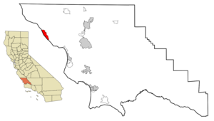
mapsize = 250x200px
map_caption = Location in San Luis Obispo County and the state ofCalifornia
mapsize1 =
map_caption1 =
image_dot_
dot_mapsize =
dot_map_caption =
dot_x =
dot_y =
pushpin_
pushpin_label_position =
pushpin_map_caption =
pushpin_mapsize =
subdivision_type = Country
subdivision_name =United States
subdivision_type1 = State
subdivision_name1 =California
subdivision_type2 = County
subdivision_name2 = San Luis Obispo
subdivision_type3 =
subdivision_name3 =
subdivision_type4 =
subdivision_name4 =
government_footnotes =
government_type =
leader_title =
leader_name =
leader_title1 =
leader_name1 =
leader_title2 =
leader_name2 =
leader_title3 =
leader_name3 =
leader_title4 =
leader_name4 =
established_title =
established_date =
established_title2 =
established_date2 =
established_title3 =
established_date3 =
area_magnitude =
unit_pref =
area_footnotes =
area_total_km2 = 22.2
area_land_km2 = 22.2
area_water_km2 = 0
area_total_sq_mi = 8.6
area_land_sq_mi = 8.6
area_water_sq_mi = 0
area_water_percent =
area_urban_km2 =
area_urban_sq_mi =
area_metro_km2 =
area_metro_sq_mi =
area_blank1_title =
area_blank1_km2 =
area_blank1_sq_mi =
population_as_of = 2000
population_footnotes =
population_note =
population_total = 6232
population_density_km2 = 280.7
population_density_sq_mi = 724.7
population_metro =
population_density_metro_km2 =
population_density_metro_sq_mi =
population_urban =
population_density_urban_km2 =
population_density_urban_sq_mi =
population_blank1_title =
population_blank1 =
population_density_blank1_km2 =
population_density_blank1_sq_mi =
timezone = Pacific (PST)
utc_offset = -8
timezone_DST = PDT
utc_offset_DST = -7
latd = 35 |latm = 33 |lats = 15 |latNS = N
longd = 121 |longm = 5 |longs = 15 |longEW = W
elevation_footnotes =
elevation_m = 13
elevation_ft = 43
postal_code_type =ZIP code
postal_code = 93428
area_code = 805
blank_name = FIPS code
blank_info = 06-10074
blank1_name = GNIS feature ID
blank1_info = 1652683
website =
footnotes =Cambria is a
census-designated place (CDP) in San Luis Obispo County,California ,United States . The population was 6,232 at the2000 census.Geography
Cambria is located at coor dms|35|33|15|N|121|5|15|W|city (35.554030, -121.087394)GR|1. According to the
United States Census Bureau , the CDP has a total area of 8.6square mile s (22.2km² ), all of it land.History
Earliest human settlement of this area is associated with
prehistoric habitation by the Native AmericanChumash peoples, who exploited marine resources along the coastal area, with emphasis upon sites that were streamside in nature. [ [http://www.megalithic.co.uk/article.php?sid=18502 C.Michael Hogan (2008) "Morro Creek", The Megalithic Portal, ed. by A. Burnham] ]Demographics
As of the
census GR|2 of2000 , there were 6,232 people, 2,816 households, and 1,881 families residing in the CDP. Thepopulation density was 727.1 people per square mile (280.8/km²). There were 3,752 housing units at an average density of 437.7/sq mi (169.0/km²). The racial makeup of the CDP was 91.08% White, 0.35% African American, 0.99% Native American, 1.16% Asian, 0.13% Pacific Islander, 4.03% from other races, and 2.26% from two or more races. Hispanic or Latino of any race were 14.02% of the population.There were 2,816 households out of which 18.6% had children under the age of 18 living with them, 57.6% were married couples living together, 7.1% had a female householder with no husband present, and 33.2% were non-families. 26.8% of all households were made up of individuals and 13.2% had someone living alone who was 65 years of age or older. The average household size was 2.21 and the average family size was 2.63.
In the CDP the population was spread out with 16.4% under the age of 18, 5.4% from 18 to 24, 18.0% from 25 to 44, 33.5% from 45 to 64, and 26.6% who were 65 years of age or older. The median age was 51 years. For every 100 females there were 91.4 males. For every 100 females age 18 and over, there were 89.5 males.
The median income for a household in the CDP was $45,000, and the median income for a family was $55,745. Males had a median income of $36,193 versus $24,594 for females. The
per capita income for the CDP was $29,620. About 3.8% of families and 8.2% of the population were below thepoverty line , including 15.6% of those under age 18 and 4.5% of those age 65 or over.Schools
Cambria is home to Coast Unified School District. Coast Unified has one K-5 elementary school, one 6-8 middle school, one traditional 9-12 high school and one alternative high school. There are approximately 810 students enrolled K-12. The District also serves the communities of San Simeon to the north and Cayucos to the south (grades 9-12) as well as surrounding rural areas.
Politics
In the state legislature Cambria is located in the 15th Senate District, represented by Republican
Abel Maldonado , and in the 33rd Assembly District, represented by RepublicanSam Blakeslee . Federally, Cambria is located inCalifornia's 23rd congressional district , which has a Cook PVI of D +9 [cite web | title = Will Gerrymandered Districts Stem the Wave of Voter Unrest? | publisher = Campaign Legal Center Blog | url=http://www.clcblog.org/blog_item-85.html | accessdate = 2008-02-10] and is represented by DemocratLois Capps .Tourism
The primary economic activity of Cambria is tourism. Cambria is located on the coast of the
Pacific Ocean , and has dramatic rocky cliffs and beaches. There are many hotels and bed & breakfasts, especially on Moonstone Beach Drive.Cambria is home to California State Historical Landmark No 939:
Nitt Witt Ridge .Cambria was used as the fictional town of "Canaima" in 1990's "Arachnophobia".
Cambria was recently used as the fictional town of "Arcade Bay" in the pilot for the television program "
Ghost Town ".Cambria is located approximately six miles south of
Hearst Castle and fifteen miles south of theNorthern Elephant Seal rookery at Piedras Blancas [http://www.elephantseal.org] .One of the more interesting places in Cambria is a uniquely personalized cemetery located at 6005 Bridge Street and detailed further here. [http://www.studiogphotos.com/cambriaphotos.html]
Recreation
Cambria offers a variety of recreational activities. The
Fiscalini Ranch offers opportunities forbicycling , dog walking, orhiking . Local beaches offer a venue toboogie board , surf, skimboard or relax. Ocean fishing is conducted off area beaches. Local kayak fishing tours are available.Notable residents
Notable residents of Cambria include:
*Red Holloway , saxophonist [http://www.redholloway.com/index.htm ]
*Catherine Ryan Hyde , author
*Jack Morrow , author, saxaphonist, environmentalist
*Ray Mullikin , cartoonist
*Nehemiah Persoff , actor
*Charlie Shoemake , vibraphonist [http://www.talsanmusic.com/charlie/index.html ]
*Kath Soucie , cartoon voice actress
*Arthur Tress , photographer
*Peter Horton ,actor, producerReferences
External links
* [http://www.aboutcambria.com/ About Cambria - get informed, get involved]
* [http://www.Cambriaranchwalks.com/ Docent walks on Fiscallini Ranch Preserve]
* [http://www.greenspacecambria.org/ Greenspace - The Cambria Land Trust]
* [http://www.rockybutteassociation.org/ Rocky Butte Association]
* [http://www.CambriaPhotography.com/ CambriaPhotography.com]
* [http://www.incambria.com/ InCambria.com]
* [http://www.seecambria.com/ SeeCambria.com]
* [http://www.visitcambriacalifornia.com/ Visit Cambria California]
* [http://www.cambriasbest.com/ Cambria's Best]
* [http://www.cambria-online.com/ Cambria Online]
* [http://www.cambriafiresafe.org/ Cambria Fire Safety Information]
* [http://www.mycambria.com/ myCambria]
* [http://www.cambriachamber.org/ Cambria Chamber of Commerce]
*dmoz|Regional/North_America/United_States/California/Localities/C/Cambria/
Wikimedia Foundation. 2010.