- El Rio, California
Infobox Settlement
official_name = El Rio, California
other_name =
native_name =
nickname =
settlement_type = CDP
motto =
imagesize =
image_caption =
flag_size =
image_
seal_size =
image_shield =
shield_size =
image_blank_emblem =
blank_emblem_type =
blank_emblem_size =
imagesize =
image_caption =
flag_size =
image_
seal_size =
image_shield =
shield_size =
image_blank_emblem =
blank_emblem_type =
blank_emblem_size =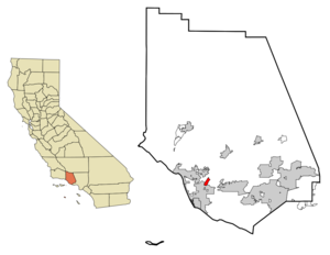
mapsize = 250x200px
map_caption = Location in Ventura County and the state ofCalifornia
mapsize1 =
map_caption1 =
image_dot_
dot_mapsize =
dot_map_caption =
dot_x =
dot_y =
pushpin_
pushpin_label_position =
pushpin_map_caption =
pushpin_mapsize =
subdivision_type = Country
subdivision_name =United States
subdivision_type1 = State
subdivision_name1 =California
subdivision_type2 = County
subdivision_name2 = Ventura
subdivision_type3 =
subdivision_name3 =
subdivision_type4 =
subdivision_name4 =
government_footnotes =
government_type =
leader_title = N/A
leader_name =
leader_title1 =
leader_title1 = Senate
leader_name1 =Tom McClintock (R)
leader_title2 = Assembly
leader_name2 =Pedro Nava (D)
leader_title3 = U. S. Congress
leader_name3 =Lois Capps (D)
leader_title4 =
leader_name4 =
established_title =
established_date =
established_title2 =
established_date2 =
established_title3 =
established_date3 =
area_magnitude =
unit_pref =
area_footnotes =
area_total_km2 = 4
area_land_km2 = 4
area_water_km2 = 0
area_total_sq_mi = 1.6
area_land_sq_mi = 1.6
area_water_sq_mi = 0
area_water_percent =
area_urban_km2 =
area_urban_sq_mi =
area_metro_km2 =
area_metro_sq_mi =
area_blank1_title =
area_blank1_km2 =
area_blank1_sq_mi =
population_as_of = 2000
population_footnotes =
population_note =
population_total = 6193
population_density_km2 = 1548.3
population_density_sq_mi = 3870.6
population_metro =
population_density_metro_km2 =
population_density_metro_sq_mi =
population_urban =
population_density_urban_km2 =
population_density_urban_sq_mi =
population_blank1_title =
population_blank1 =
population_density_blank1_km2 =
population_density_blank1_sq_mi =
timezone = PST
utc_offset = -8
timezone_DST = PDT
utc_offset_DST = -7
latd = 34 |latm = 14 |lats = 21 |latNS = N
longd = 119 |longm = 9 |longs = 32 |longEW = W
elevation_footnotes =
elevation_m = 25
elevation_ft = 82
postal_code_type =ZIP code
postal_code = 93030
area_code = 805
blank_name = FIPS code
blank_info = 06-22370
blank1_name = GNIS feature ID
blank1_info = 1652703
website =
footnotes =El Rio is a
census-designated place (CDP) in Ventura County,California ,United States . The population was 6,193 at the 2000 census.Geography
El Rio is located at coor dms|34|14|21|N|119|9|32|W|city (34.239197, -119.158754)GR|1.
According to the
United States Census Bureau , the CDP has a total area of 1.6square mile s (4.0km² ). 1.6 square miles (4.0 km²) of it is land and none of it is covered bywater .Demographics
As of the
census GR|2 of 2000, there were 6,193 people, 1,467 households, and 1,273 families residing in the CDP. Thepopulation density was 3,961.2 people per square mile (1,532.8/km²). There were 1,491 housing units at an average density of 953.7/sq mi (369.0/km²). The racial makeup of the CDP was 47.60% White, 1.26% African American, 2.52% Native American, 1.39% Asian, 0.34% Pacific Islander, 42.48% from other races, and 4.41% from two or more races. Hispanic or Latino of any race were 77.36% of the population.There were 1,467 households out of which 45.9% had children under the age of 18 living with them, 63.7% were married couples living together, 15.5% had a female householder with no husband present, and 13.2% were non-families. 10.6% of all households were made up of individuals and 6.2% had someone living alone who was 65 years of age or older. The average household size was 4.22 and the average family size was 4.31.
In the CDP the population was spread out with 33.0% under the age of 18, 11.2% from 18 to 24, 28.7% from 25 to 44, 16.6% from 45 to 64, and 10.5% who were 65 years of age or older. The median age was 29 years. For every 100 females there were 105.7 males. For every 100 females age 18 and over, there were 106.7 males.
The median income for a household in the CDP was $50,273, and the median income for a family was $56,339. Males had a median income of $35,041 versus $22,254 for females. The
per capita income for the CDP was $14,898. About 9.4% of families and 13.6% of the population were below thepoverty line , including 19.2% of those under age 18 and 3.9% of those age 65 or over.External links
Wikimedia Foundation. 2010.