- Arroyo Seco (Los Angeles County)
-
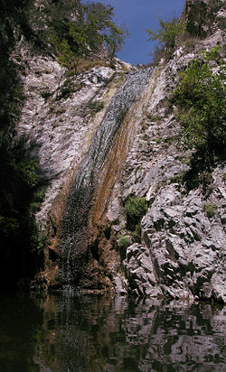
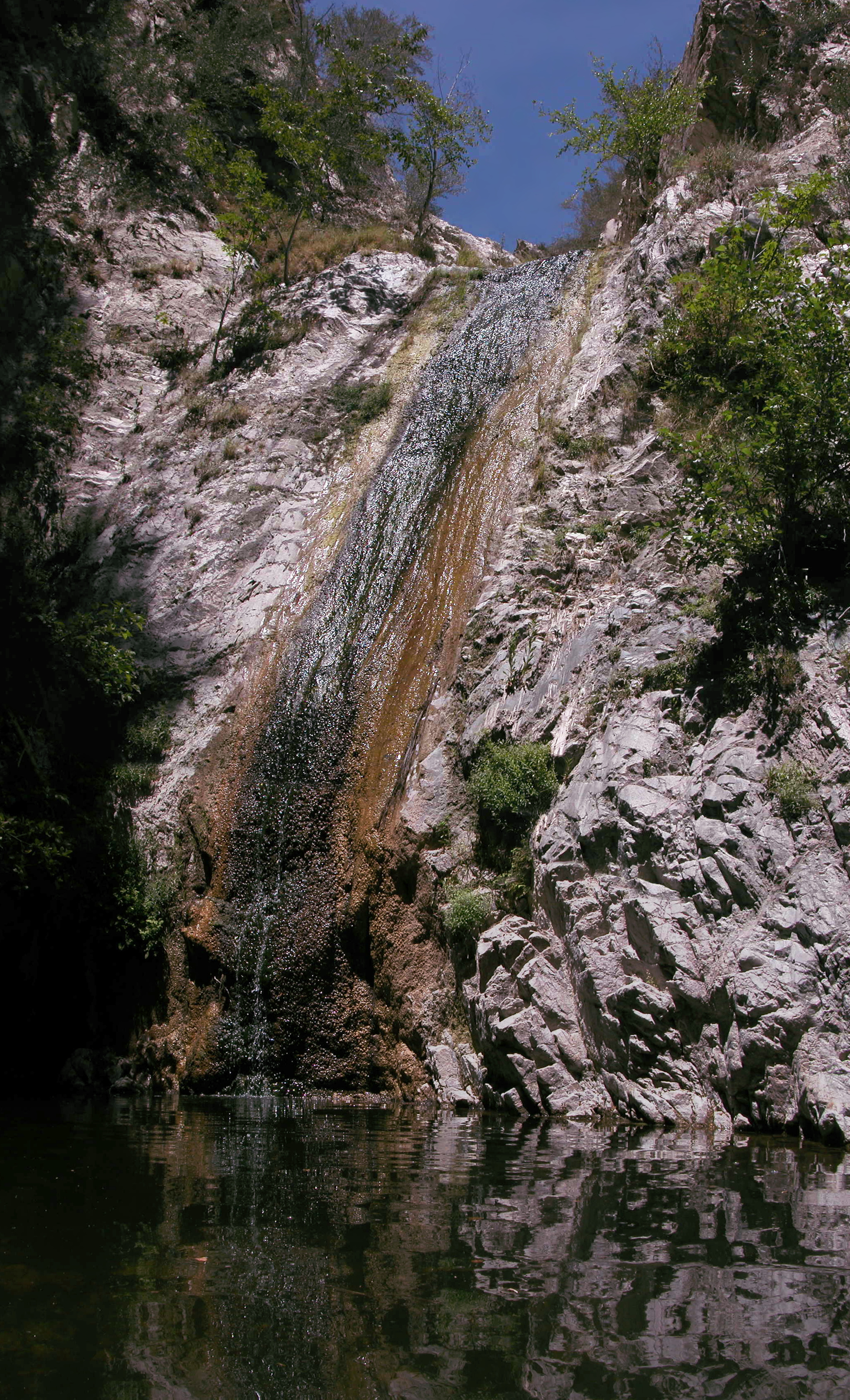
 The 'Arroyo Seco: Devil's Face profile next to Devil's Gate Dam, gunited many decades ago for erosion control
The Arroyo Seco, meaning "dry stream" in Spanish, is a 24.9-mile-long (40.1 km)[1] seasonal river, canyon, watershed, and cultural area in Los Angeles County, California, United States. The Arroyo Seco has been called the most celebrated canyon in Southern California.
Contents
River course
The watershed begins at Red Box Saddle in the Angeles National Forest near Mount Wilson in the San Gabriel Mountains. As it enters the urbanized area of the watershed, the Arroyo Seco stream flows between La Cañada Flintridge on the west and Altadena on the east. Just below Devil's Gate Dam, the stream passes underneath the Foothill Freeway; at the north end of Brookside Golf Course the stream becomes channelized into a flood control channel and proceeds southward through the golf course.
The Arroyo Seco goes through Pasadena, with the notable Rose Bowl and Brookside Park in it.[2] The Arroyo Seco stream, which is fed by a 46.7 square miles (121.0 km2) watershed, helps to replenish the Raymond Basin, an aquifer underlying Pasadena that provides about half the local water supply. This is one of two major streams that capture rainfall and storm water in Pasadena, the other being Eaton Wash on the eastern side of the city, a tributary of the Rio Hondo watershed.[3]
The Arroyo Seco proceeds on, passing under the Ventura (134) Freeway and the Colorado Street Bridge, and crosses the Raymond Fault at the southern boundary of Pasadena at the San Rafael Hills. The channel continues along the western boundary of South Pasadena, then into northeast Los Angeles flowing southeast of the Verdugo Mountains and Mount Washington.
The Arroyo Seco then proceeds through the Los Angeles neighborhoods of Highland Park, Cypress Park, and Montecito Heights. It ends at the confluence with the Los Angeles River near Elysian Park, north of Dodger Stadium and Downtown Los Angeles.[4]
The historic Arroyo Seco Parkway, or Pasadena Freeway, parallels the channelized Arroyo Seco from South Pasadena to the Los Angeles River.
History
 The Devil's Gate at the Arroyo Seco River prior to 1920 damming. Note the "devil's profile" in the rock to the right.
Traditional narrative
Above Devil's Gate, the rapids of the Arroyo Seco are so positioned so that the falls make a beating, laughing sound. In Tongva-Gabrieliño traditional narratives, this is attributed to a wager made between the river and the coyote spirit.
Early settlement
The Arroyo Seco was one of the Los Angeles River tributaries explored by Gaspar de Portola in the late summer and fall of 1770. He named the stream Arroyo Seco, for of all the canyons he had seen, this one had the least water. During this exploration he met the Chief Hahamog-na (Hahamonga) near Millard Canyon, at the settlement later known as Hahamongna - California. This band of the Tongva Indians would end up gathered into the fold of the San Gabriel Mission and with other bands and tribes collectively called "Gabrielenos."
The Arroyo Seco region can be considered by historical accounts as the birthplace of Pasadena. After the 1820s secularization of the Missions, the broad area to the east of the Arroyo was the Mexican land grant of Rancho San Pascual, present-day Pasadena, California. Manuel Garfias was the grantee of the Rancho and its longest early resident. His adobe house was on the east ridge of the Arroyo, in present-day South Pasadena.
With the 1874 establishment of the community of the Indiana Colony, the new residents built their homes along today's Orange Grove Boulevard, the major north-south avenue paralleling the Arroyo on the east. However, the deep and seasonally flooded Arroyo presented a barrier to easy travel and transportation between renamed Pasadena and Los Angeles. Stories of four and five hours just crossing the chasm, whether exaggerated or not, abounded in Pasadena history.[5]
The first recorded American to live in the Upper Arroyo (north of Devil's Gate) was simply known as "Old Man Brunk". Brunk's cabin stood at a large bend in the canyon, roughly where the Forest Service housing is today. It was said he left San Francisco "for that town's good".[6]
Transportation corridor
Dating back to the original Tongva residents of the area, the Arroyo Seco canyon has always served as a major transportation corridor. Today it links downtown Los Angeles with Pasadena, the west San Gabriel Valley and the San Gabriel Mountains.
By 1895 a railroad line had been established from Downtown Los Angeles with a grand wooden trestle that cut a straight line crossing from the west side to the east. Eventually this line would hook up with rail lines built from the east to create the cross-country course of the Santa Fe Railroad. For local commutes, an electric traction trolley was put in and operated by the Pacific Electric Railway, a Henry E. Huntington enterprise, which ran the "Red Cars" from the upper Arroyo and Pasadena through the San Gabriel Valley into Los Angeles and many points beyond.[7] The lower Arroyo Seco was served by the Los Angeles Railway "Yellow Car" lines.
In 1900 Horace Dobbins, Mayor of Pasadena, opened his innovative California Cycleway, an elevated wood structure with a flat planked surface that would allow bicyclers to travel from Pasadena to Los Angeles avoiding the uncertain schedules of the early trains. Dobbins was only able to build a two-mile portion of the cycleway from the Green Hotel to Raymond Hill before competition from the railroads and the growing popularity of the horseless carriage undermined the project. Present day cycling activists are reviving a vision and plan for a dedicated bikeway from Pasadena to Los Angeles.[8]
In 1913 the Colorado Street Bridge was dedicated. This elegant structure curves across the Arroyo accessing Eagle Rock, Glendale, and the San Fernando Valley. During the Stock Market Crash of 1929 and the subsequent Great Depression of the 1930s, the bridge was a jumping off point for many committing suicide, whereby it received the ignoble name of "Suicide bridge." By the 1980s the bridge fell into disrepair as chunks of concrete dropped from its face to the armory parking lot in the Arroyo below. After the San Francisco – Oakland Bay Bridge failure in the 1989 Loma Prieta earthquake, the Colorado Street Bridge was closed as a precautionary measure. Eventually assistance from the Federal Bridge Repair and Replacement Fund and other local governmental agency discretionary funds provided funding for the complete restoration and seismic retrofit of the bridge. The total project budget amounted to $24 million, and the Colorado Street Bridge was reopened on Dec. 13, 1993, on time and on budget.
Arroyo Seco Parkway
The automobile had long become a mainstay of Southern California life. In 1940 the Arroyo Seco Parkway, the first freeway, was built as a parkway alongside the newly constructed flood channel in the Los Angeles portion of the Arroyo. Today, also known as the Pasadena Freeway, it continues on through downtown becoming the Harbor Freeway, and terminates near the harbor in San Pedro.
The Arroyo Seco Corridor Management Plan was completed for the historic "Arroyo Seco Parkway" in 2004. The Plan was created through a partnership with the National Trust for Historic Preservation, the National Scenic Byways Center (Federal Highways), Caltrans (State Highways), the National Park Service, the Santa Monica Mountains Conservancy, and The Center for Preservation Education and Planning (CPEP Inc.).[9]
Floods and controls
Despite its name, the Arroyo Seco generally has a flow of several cubic feet per second,[10] but periodically it is inundated by torrential floods from its steep, erosion-prone mountain watershed. The reputation of Arroyo Seco floods led the Spanish to site the original Pueblo de Los Angeles away from the confluence of the Arroyo Seco and the Los Angeles River. Historically, these floods would race down the stream bed and overflow through adjacent communities all the way to the Los Angeles River. As Los Angeles developed into a city and grew outwards, the damage from these floods was particularly severe in 1914 and 1916.
In 1920 flood engineers from the Los Angeles County Flood Control District built Devil's Gate Dam in the Arroyo Seco, the first flood control dam in Los Angeles County.[11] Named for a rock outcropping which resembles the face of a devil, Devil's Gate gorge, located in Pasadena between La Cañada Flintridge and Altadena, is the narrowest spot in the Arroyo Seco. The construction was by the Bent Brothers Company.
Above the dam is the flood basin which captures the flows of the mountain watershed of the Arroyo Seco. This area is now called "Hahamongna", a phrase meaning "Flowing Waters, Fruitful Valley", a remarkably different designation than the name given the area by the Spanish explorers. Hahamongna also refers to the original Native American tribe of the Tongva Indians who once inhabited the area. Pasadena is developing the Devil's Gate/Hahamongna flood basin into Hahamongna Watershed Park, a 1,400-acre (6 km2) regional park, which emphasizes the unique natural values of the park.[12] By 2011, the flood basin had filled with about 1.5 million cubic yards of mud brought down after the 2009 Station fire, reducing its effectiveness as a flood control measure and leading to public debates on how to restore the basin.[13]
Below the dam, most of the Arroyo Seco stream, with two short exceptions, is contained in a concrete channel that captures stormwater and municipal runoff. This channel and other similar flood control structures throughout the Los Angeles Basin and along the foothills of the San Gabriel Mountains were built following the devastating Los Angeles Flood of 1938.
Restoration programs
For more than one hundred years, the great natural beauty of the Arroyo Seco and its proximity to a large urban population have inspired efforts to protect and preserve it. Charles Lummis founded the Arroyo Seco Foundation in 1905 for that purpose, and residents in Los Angeles and Pasadena contributed generously to efforts to buy up open space in the great canyon to protect for future generations.
In recent years, up and down the Arroyo, citizens, neighborhood groups and governmental agencies are collaborating to better manage the Riparian watershed for nature and for people and to pass on its splendor and riches to future generations.
There has been a series of studies conducted to assess and improve the management of the Arroyo Seco Watershed. These include:
Study or program Year Description Arroyo Seco Watershed Restoration Feasibility Study 2002 A cooperative partnership of North East Trees and the Arroyo Seco Foundation, this report released in May, 2002, provides a blueprint for restoration and better management for the watershed. The study contains a series of valuable technical reports on hydrology, biology, water resources and recreational uses. US Army Corps of Engineers Arroyo Seco Watershed Reconnaissance Study 2002 - Evaluates watershed conditions and determines there is a federal purpose in Arroyo Seco work. Pasadena Arroyo Seco Master Plan & EIR 2003 Identifies a comprehensive series of projects and improvements for the five mile (8 km) stretch of the Arroyo Seco lying within Pasadena Angeles National Forest Master Plan - US Forest Service 2005 Defines the plan for the management of the upper mountain watershed of the Arroyo Seco Arroyo Seco Watershed Coordination Program (Arroyo Seco Foundation) 2004-ongoing Builds the capacity of local groups to cooperate and collaborate in watershed management. In addition to educational programs about California's water issues and local water programs, this program supports the Council of Arroyo Seco Organization, a network of Arroyo improvement groups. Arroyo Seco Parkway Corridor Management Plan 2004 Parkway management plan prepared for Caltrans by the National Scenic Byways Center, Federal Highways, the National Trust for Historic Preservation, and the Center for Preservation Education and Planning (CPEP, Inc.). This plan serves as the basis for signage and other recent improvements on the parkway. USACE Arroyo Seco Watershed Feasibility Study 2005 - ongoing This study, conducted by the US Army Corps of Engineers with the County of Los Angeles and other local partners is evaluating the watershed to determine the best program to improve water resources, habitat and recreational opportunities; the study, which actually began in 2001 continues on a slow pace, but local sponsors hope that it will provide a basis for federal support of local restoration and management efforts. AS Watershed Management and Restoration Study (North East Trees) 2006 Reviews water quality and habitat restoration data and prioritizes projects for water quality improvements Central Arroyo Stream Restoration Program 2007–2008 This program, which has now been completed, has improved stream conditions and water quality in the Arroyo Seco stream by habitat restoration, parking lot and trail improvements and trash capture devices. As a result, the Arroyo chub, a native fish that once thrived in the stream but was wiped out by the flood control measures, has now been reintroduced to the stream.[14] Arroyo Seco Watershed Sustainability Program 2007–2010 A program to improve conservation, watershed management and governance in the watershed Fish Restoration in the Arroyo Seco 2008 This study, conducted by C. Camm Swift, evaluates the potential for fish restoration in the stream and makes recommendations about needed improvements. Arroyo Seco Watershed Assessment 2010 This program provides an assessment of major projects to restore and enhance the Arroyo Seco Watershed and is intended to inform the Corps of Engineers ecosystem study of the Arroyo. The study was prepared by CDM for the Arroyo Seco Foundation. Restoration goals
1. Restore the natural hydrological functioning of the watershed
2. Better manage, optimize, and conserve water resources while improving water quality.
3. Restore, protect, and augment habitat quality, quantity and connectivity.
4. Improve regional park recreational opportunities and enhance nature reserve open space[15]The restoration efforts are being carried out by the County of Los Angeles, the local cities, community based organizations like the Arroyo Seco Foundation and North East Trees, the Council of Arroyo Seco Agencies (CASA), the Council of Arroyo Seco Organization (CASO), and the Arroyo Seco Stream Team, a volunteer band organized the by Arroyo Seco Foundation.
Jet Propulsion Lab - NASA
Early rocket-testing began in the Arroyo Seco in 1936 and led to the establishment of the Jet Propulsion Laboratory -JPL at the mouth of the Arroyo Seco by the California Institute of Technology.[16] In the 1950s the laboratory was heavily involved in rocket testing, and the roars of rocket engines could be heard emanating from the Arroyo Seco area for miles. These rocket projects were terminated at the facility by 1958. By the mid 1960s JPL had become highly instrumental in the development, launching and tracking of a number of unmanned near-space and deep-space spacecrafts. One of their most recent projects is the Mars Rover which has returned a number of panoramic photos of the Martian surface.
JPL has been criticized by regional environmentalists and the community for their water pollution of the local groundwater with toxic chemicals, such as solvents and perchlorate rocket fuel accelerants. A monumental cleanup project has begun, by NASA, which includes a multimillion dollar pumping and water filtration system to treat the groundwater, removing toxins until the aquifer contamination level has been reduced to federally mandated limits. The project is staffed by a NASA project team and monitored by the Environmental Protection Agency. Frequent public meetings are held with public comment, and recorded for the record on the quality and progress of the cleanup.
Crossings
From mouth to source (year built in parentheses):[17]
- Railroad
- North Avenue 19 - twin bridges (1956)
- North San Fernando Road (1913)
- Interstate 5 - Golden State Freeway and ramps (1962)
- West Avenue 26 (1939)
- Southbound State Route 110 ramp to Interstate 5 (1962)
- Interstate 5 ramp to northbound State Route 110 (1962)
- Cypress Avenue [Pedestrian Bridge]
- Railroad - Metro Gold Line
- Pasadena Avenue (1940)
- State Route 110 ramps to East Avenue 43 (1940)
- East Avenue 43 (1939)
- Sycamore Grove Park [Pedestrian Bridge]
- South/East Avenue 52 (1940)
- Via Marisol (1940)
- [Pedestrian Bridge]
- South Avenue 60 (1909)
- State Route 110 ramps to South Avenue 60 (1940)
- Railroad - Metro Gold Line
- Marmion Way (1940) and California 110 Offramp (1940)
- York Boulevard (1912)
- State Route 110 - Pasadena Freeway (1939)
- San Pasqual Avenue (1939)
- Dirt road
- South San Rafael Avenue (1922)
- La Loma Road (1914)
- South Arroyo Park dirt road
- South Arroyo Park [Pedestrian Bridge]
- Colorado Street Bridge carrying West Colorado Boulevard (1913)
- State Route 134 - Ventura Freeway (1953)
- North Arroyo Boulevard (1927)
- West Holly Street (1925)
- Seco Street (1939)
- Rose Bowl Parking Lot [2 Pedestrian Bridges]
- Brookside Golf Course [7 Pedestrian Bridges]
- West Washington Boulevard (1939)
- Brookside Golf Course [Pedestrian Bridge]
- Interstate 210 - Foothill Freeway (1974)
- Oak Grove Drive (1955)
- Devil's Gate Dam
- Explorer Road
- Forest Route 2N70 (2002)
Attractions and landmarks
Upper Arroyo - mountains section
The many great places to visit in or near the Arroyo Seco have made it one of the most popular hiking spots in Southern California. The mountainous part of the Arroyo Seco is located within the Angeles National Forest.[18] Angeles Crest Highway skirts the western edge of the Arroyo Seco Canyon.
The following is a list of Forest Service facilities in the Upper Arroyo, from south to north:[19]
- Forest Service Employee Housing w/ attached public hitching rail and horse trough
- Teddy's Outpost Picnic Area
- Gould Mesa Campground
- Niño Picnic Area
- Paul Little Picnic Area
- Oakwilde Campground
- Commodore Perry Switzer Trail Camp
- Switzer's Picnic Area
- Red Box Station (at the canyon's head)
- Switzer Falls
- Dawn Mine
- Bear Canyon
- Millard Canyon - Millard Canyon Falls
Millard Canyon, located near the mouth of the Arroyo, is a delightful canyon with an impressive waterfall. Sunset Ridge The trail skirts the eastern side of the canyon, the eastern boundary of the Arroyo Seco Watershed. Millard Canyon was a major pedestrian thoroughfare for Tongva, Serrano people, and other Californian Native Americans traveling between the Los Angeles Basin coastal plain, the San Gabriel Mountains, and the Mojave Desert regions of Southern California.
Brown Mountain Truck Trail, which begins near the confluence of El Prieto Canyon and proceeds across the front range of the San Gabriel Mountains to upper Millard Canyon, offers impressive vistas of the San Gabriel Valley. The Burton Trail descends from this road to the upper stretches of the Arroyo near Oakwilde Campground.
The Gabrielino Trail, which is a popular journey for hikers, equestrians and bicyclists, travels up the steep canyon.
Lower Arroyo - urban section
- Jet Propulsion Laboratory NASA
- Oak Grove Disc Golf Course
- Hahamongna Watershed Park - (formerly "Oak Grove Park")
- Devil's Gate Dam
- Brookside Golf Course
- Rose Bowl - stadium and flea market
- Brookside Park
- Kidspace Children's Museum
- Colorado Street Bridge
- Hotel Vista Del Arroyo - United States 9th District Court of Appeals
- Batchelder House - Arts and Crafts Movement
- Arroyo Parkway
- Metro Gold Line (Bridge crossing and Ave 57 Street Station)
- Southwest Museum of the American Indian
- "El Alisal"—Lummis House - historic home museum and native plants gardens.
- Heritage Square Museum - historic Victorian houses park.
- Los Angeles River Center and Gardens Park [20]
- Confluence of the Arroyo Seco and Los Angeles River
See also
- Urban runoff
- Riparian zone
- Riparian zone restoration
- Floodplain restoration
- List of Los Angeles Historic-Cultural Monuments on the East and Northeast Sides
References
- Notes
- ^ U.S. Geological Survey. National Hydrography Dataset high-resolution flowline data. The National Map, accessed March 16, 2011
- ^ http://ww2.cityofpasadena.net/humanservices/ParksandFacilities.asp#3 . accessed 7/27/2010
- ^ Arroyo Seco Water Resources Report
- ^ Information has been derived from the archives of the Pasadena Museum of History and the Arroyo Seco Foundation.
- ^ Pasadena, Hiram Reid, 1895. Out of Print. A comprehensive history of Pasadena after 20 years of colonization.
- ^ Altadena by Sarah Noble Ives, 1938 (Altadena Historical Society, out of print)
- ^ Trolley Days in Pasadena, 1985, Charles Seims.
- ^ cycling activists; such as Dennis Crowley
- ^ Project co-authors for the Arroyo Seco Corridor Management Plan were: Dan Marriott, National Trust for Historic Preservation and Jeffrey Samudio, Executive Director, Center for Preservation Education and Planning, Hollywood and Partner of Design Aid Architects.
- ^ USGS Stream Gage http://nwis.waterdata.usgs.gov/ca/nwis/uv/?site_no=11098000&
- ^ Arroyo Seco Flood Timeline http://www.arroyoseco.org/History/ArroyoSecoFloodTimeline.pdf
- ^ http://www.lamountains.com/parks.asp?parkid=643 . accessed 7/22/2010
- ^ Lin, Rong-Gong, II (May 1, 2011), "Devil's Gate Dam dilemma: A basin full of mud poses a flood threat but is also home to a vibrant habitat", Los Angeles Times: A35–A36.
- ^ Arroyo Seco Project Finished, Pasadena Star-News, August 28, 2008
- ^ Arroyo Seco Watershed
- ^ JPL History - http://www.jpl.nasa.gov/jplhistory/early/index.php
- ^ "National Bridge Inventory Database". http://www.nationalbridges.com/. Retrieved 2009-10-30.
- ^ http://www.fs.fed.us/r5/angeles/
- ^ http://www.fs.fed.us/r5/angeles/maps/brochures.shtml . accessed 7/22/2010
- ^ http://www.lamountains.com/planning_river.html . accessed 7/22/2010
External links
- Arroyo Seco Foundation
- Angeles National Forest website
- City of Pasadena: Arroyo Seco website
- Arroyo Seco Neighborhood Council: City of Los Angeles 'Arroyo Seco' communities council.
- Hahamongna Watershed Park - (formerly Oak Grove Park)
- Pasadena and the Arroyo Culture
- Save Hahamongna
Categories:- Rivers of Los Angeles County, California
- Rivers of Southern California
- San Gabriel Mountains
- San Gabriel Valley
- Canyons and gorges of California
- History of Pasadena, California
- History of Los Angeles County, California
- History of Los Angeles, California
- Los Angeles County regions
- Altadena, California
- South Pasadena, California
- Pasadena, California
- Works Progress Administration in California
Wikimedia Foundation. 2010.