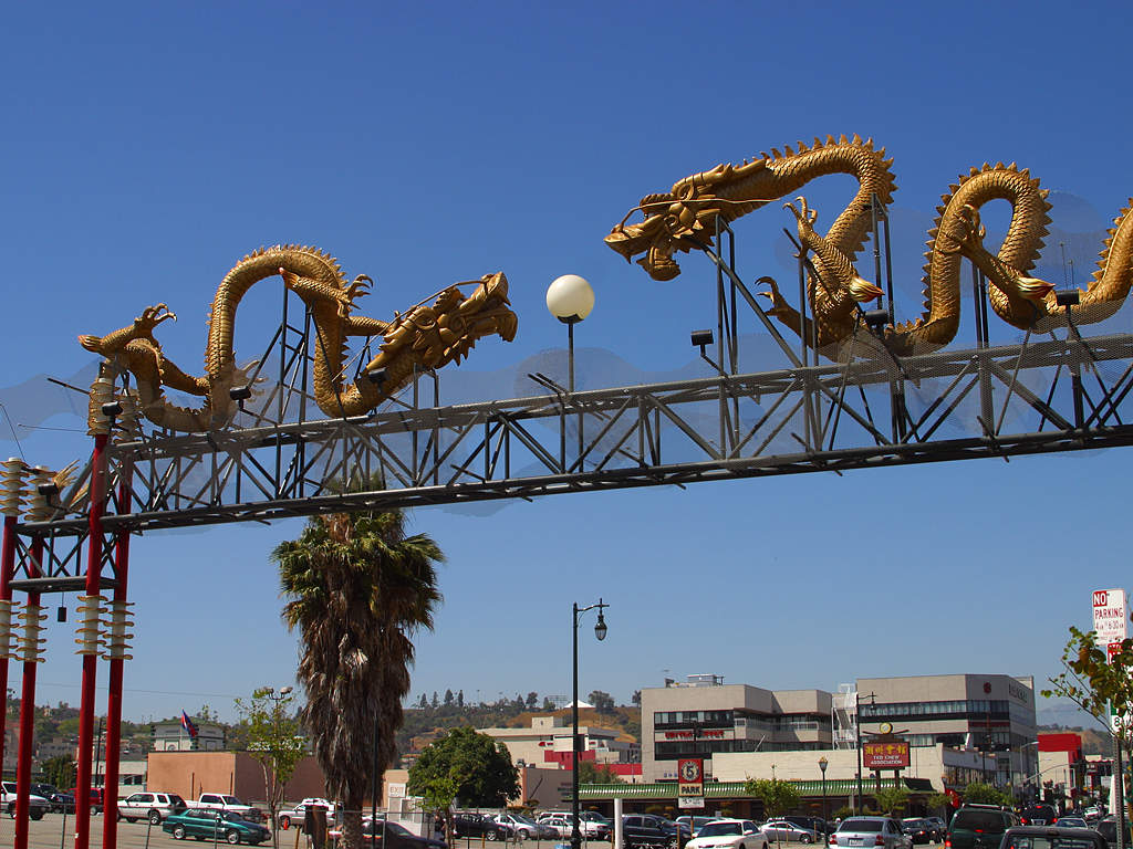
- List of districts and neighborhoods of Los Angeles
-
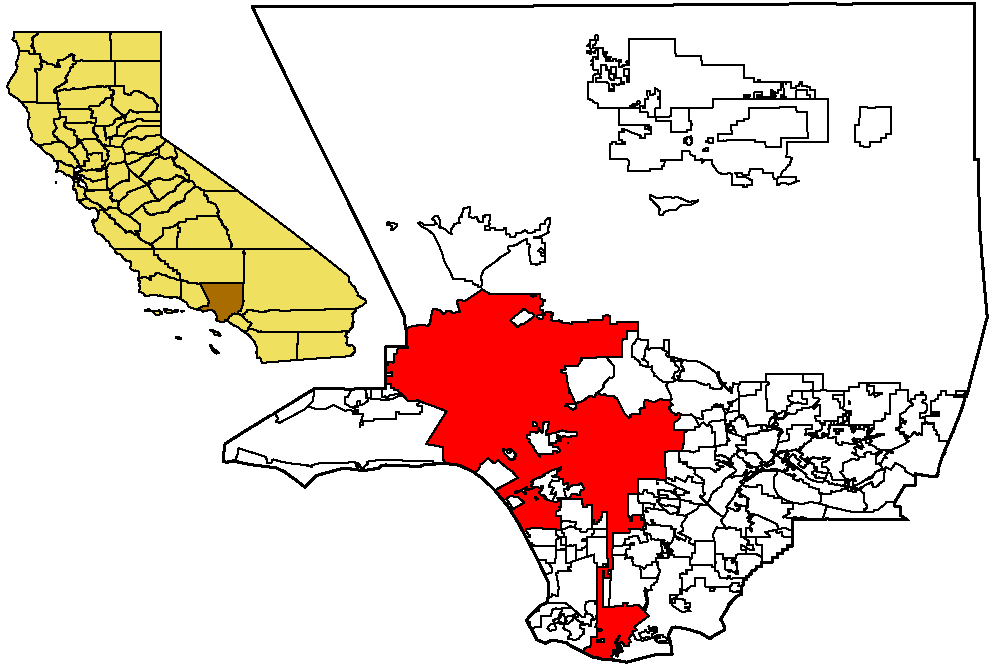
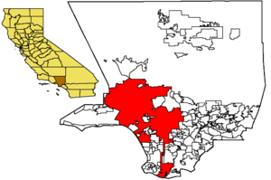 Map depicting boundaries of the city of Los Angeles as a part of Los Angeles County
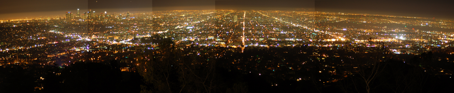
 Los Angeles at night, from the Griffith Observatory. Downtown Los Angeles is visible on the left.
This is a list of the districts and neighborhoods of the city of Los Angeles. The districts are organized by region.
Overview
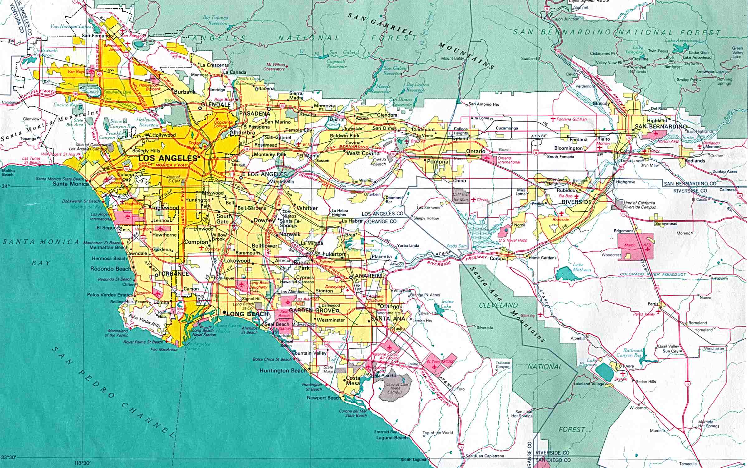
 Map of Los Angeles in 1970
 Downtown Los Angeles skyline
The neighborhoods and districts of Los Angeles possess a degree of diversity that is befitting the second-largest city in the United States. Much of this is an artifact of the city's history of growth by annexation and horizontal development, which allowed distinct environments to arise in many areas; indeed, many districts of Los Angeles, such as Venice, Hancock Park, Silver Lake and Boyle Heights are somewhat culturally-distinctive communities.[citation needed]
Many of the districts of Los Angeles have their own post offices of the U.S. Postal Service, and these post offices are officially designated by the names of their districts. For example, to mail a letter to someone in Canoga Park, California, Tarzana, California, or Van Nuys, California, that is the last line that one needs to write in the address, and it is not necessary to include anything about Los Angeles, Los Angeles County, or United States. Likewise, in telephoning to summon a policeman, an ambulance, or the fire department to some location, it is not necessary to say anything more than its street address and words such as Brentwood, Hollywood, Northridge, Panorama City, or Studio City.
The writer Dorothy Parker once described Los Angeles as "72 suburbs in search of a city." Bob Pool of the Los Angeles Times said "it's not surprising that residents take their neighborhood names so seriously. Those designations are part tradition and history -- but also part economic and political." Pool added that many area residents see a significant difference in property values if a place is considered to be within the wealthy Hancock Park versus if a place was considered to be in the working class Mid-City area. In the San Fernando Valley some communities separated from existing communities to form new ones. For instance two portions of Van Nuys renamed themselves Lake Balboa and Valley Glen, and one portion of Canoga Park renamed itself West Hills. The City of Los Angeles posted signs indicating names of communities within the city, but the city has not officially defined the boundaries of those communities. On February 19, 2009, the Los Angeles Times newspaper published its map of neighborhood boundaries in Los Angeles, and the creation of this map had been a project in progress for three years.[1]
The City of Los Angeles began in what is now downtown, in what had first been a Tongva village named Yang-na located in what is now the Los Angeles State Historic Park near Chinatown. It later became a Spanish pueblo and eventually grew to a metropolis based on manufacturing, aerospace, and entertainment industries. The city, and indeed the county, radiated outward from downtown, and geographic names referencing cardinal points or relative directions tend to be determined by their relationship to downtown rather than directions proper. For example, East L.A. is not all of the city east of West L.A., but rather the portion of the city east of downtown (and the Los Angeles River in its proximity).[citation needed]
The origins of L.A. neighborhoods are varied. Angelino Heights,[2] for example, with its 1880s-era Victorian houses, was within view and walking distance (although a long one) from downtown Los Angeles, while distant Playa Vista is the city's newest manufactured neighborhood, conceived and birthed by developers. Chinatown was originally an ethnic-based community whose population and businesses were forced to move wholesale from a few miles away when L.A.'s newly built Union Station displaced Old Chinatown in the 1930s. San Pedro was once an independent city that voted to be annexed to Los Angeles: San Pedro benefited from L.A.'s access to water and the larger city got access to San Pedro's harbor.[citation needed]
The City of Los Angeles is covered by several different telephone Area Codes. Area code 213 includes Downtown L.A. and its neighborhood. Most remaining areas of central L.A. fall within Area code 323, including Hollywood, Mid-Wilshire, and South Los Angeles. Area code 310 and area code 424 cover western Los Angeles, other towns on the westside, and the Harbor Area. Area code 818 covers the San Fernando Valley and its neighborhood.[citation needed]
Downtown Los Angeles
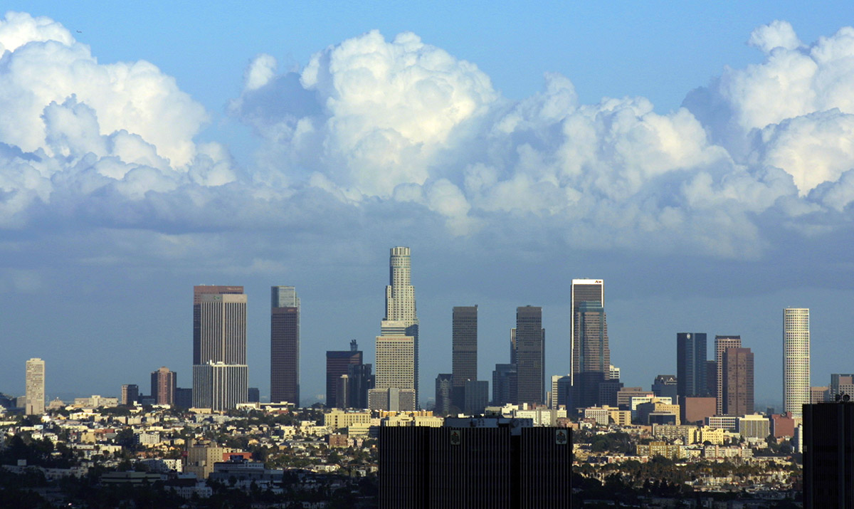
 Downtown as seen from Elysian Park
 Chinatown gateMain article: Downtown Los Angeles
Downtown Los Angeles marks the geographic, governmental, and historic center of Los Angeles. Although it is the smallest region of Los Angeles by area, it includes a great variety of diverse neighborhoods, ranging from several modern skyscrapers of the Financial District to the historic structures of the Historic Core to the ethnic enclaves of Chinatown and Little Tokyo. It also contains many cultural attractions and entertainment venues. Downtown is also a center for local and regional transportation, with several freeways passing through and Union Station connecting regional trains to local buses and the Metro Line.
- Arts District
- Bunker Hill
- Chinatown
- Civic Center
- Fashion District
- Financial District
- Flower District
- Furniture and Decorative Arts District
- Gallery Row
- Historic Core
- Jewelry District
- Little Tokyo
- Skid Row
- South Park
- Old Bank District
- Toy District
- Wholesale District
East and Northeast Los Angeles
 Moon rising over Eagle Rock; the rock itself is visible in the bottom rightMain article: East Los Angeles (region)See also: Northeast Los Angeles
- See also: East Los Angeles, California. (an unincorporated area)
To the east and northeast of Downtown Los Angeles and the Los Angeles River lies East Los Angeles. The region may sometimes be defined to include adjacent areas outside of the city boundaries of Los Angeles, such as Montebello and East Los Angeles. The communities listed here, however, all lie within the City of Los Angeles.
Many of the neighborhoods of Eastern Los Angeles house large Latino populations, although several neighborhoods, especially in northeast L.A., have more mixed populations. Many of the neighborhoods house very diverse residents. In the northern portions of Montecito Heights there are white populations of Italian and French descent. Eagle Rock also houses significant Latino, White, and Asian (in particular those of Filipino descent) populations and is one of the most diverse neighborhoods in Los Angeles County.[3] In Monterrey Hills nearly half of the population is white. The population also ranges from working-class to affluent. The predominantly residential neighborhoods of the region contain many hills, especially in northern regions.
Northeast Los Angeles neighborhoods
- Boyle Heights
- El Sereno
- University Hills
- Atwater Village
- Cypress Park
- Eagle Rock
- Garvanza
- Glassell Park
- Hermon
- Highland Park
- Lincoln Heights
- Montecito Heights
- Monterey Hills
- Mt. Washington
Echo Park and Westlake
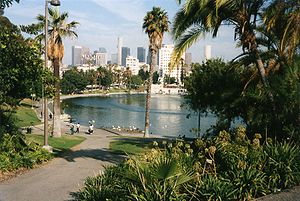 MacArthur Park, with the Westlake Theater and downtown in the backgroundMain article: Northwest Los Angeles
Immediately west of Downtown Los Angeles lie some of the city's earliest suburbs. Angelino Heights and Echo Park were the locations of some of the first film studios west of the Mississippi River. Now mostly populated by Latino immigrants, a great amount of distinctive architecture has been preserved from the early 20th century, including the restored Victorian homes in Angelino Heights. This region is one of the most densely populated areas in Los Angeles and serves as the former site of Chavez Ravine which was historically a Latino neighborhood until it was demolished in the 1950s in order to construct Dodger Stadium.
- Angelino Heights
- Franklin Hills
- Echo Park
- Edendale
- Victor Heights
- Historic Filipinotown
- Temple-Beaudry
- Elysian Heights
- Mission Junction
- Pico-Union
- Westlake
- Elysian Park
- Solano Canyon
- Elysian Valley
Hollywood
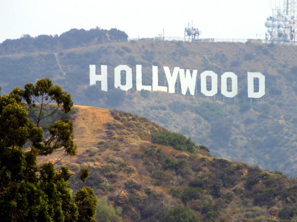
 The world-famous Hollywood signSee also: West Hollywood, California, Universal City, California, and Greater Hollywood, Los Angeles
Formerly a religious colony, then an independent city, Hollywood was annexed by Los Angeles in 1910. Its name is synonymous with the motion picture industry, yet much of movie production has moved out to neighboring cities and towns. Tourists flock to Hollywood Boulevard to gaze up to the Hollywood sign in the Santa Monica Mountains. The last decade has brought new life to the once-struggling parts of the Hollywood district, with various developments taking advantage of new subway stations. The wealth of the neighborhoods here is strongly influenced by elevation; some of the wealthiest tracts in the country are up in the Hollywood Hills, with gradually less affluent population leading to pockets of large working-class and transient populations further southeast.
- Hollywood
- Beachwood Canyon
- Cahuenga Pass
- Hollywood Hills
- Hollywood Dell
- Whitley Heights
- Hollywood Heights
- Laurel Canyon
- Mount Olympus
- Nichols Canyon
- Outpost Estates
- Sunset Hills
- East Hollywood
- Little Armenia
- Thai Town
- Virgil Village
- Melrose District
- Melrose Hill
- Sierra Vista
- Spaulding Square
- Yucca Corridor
Harbor Area
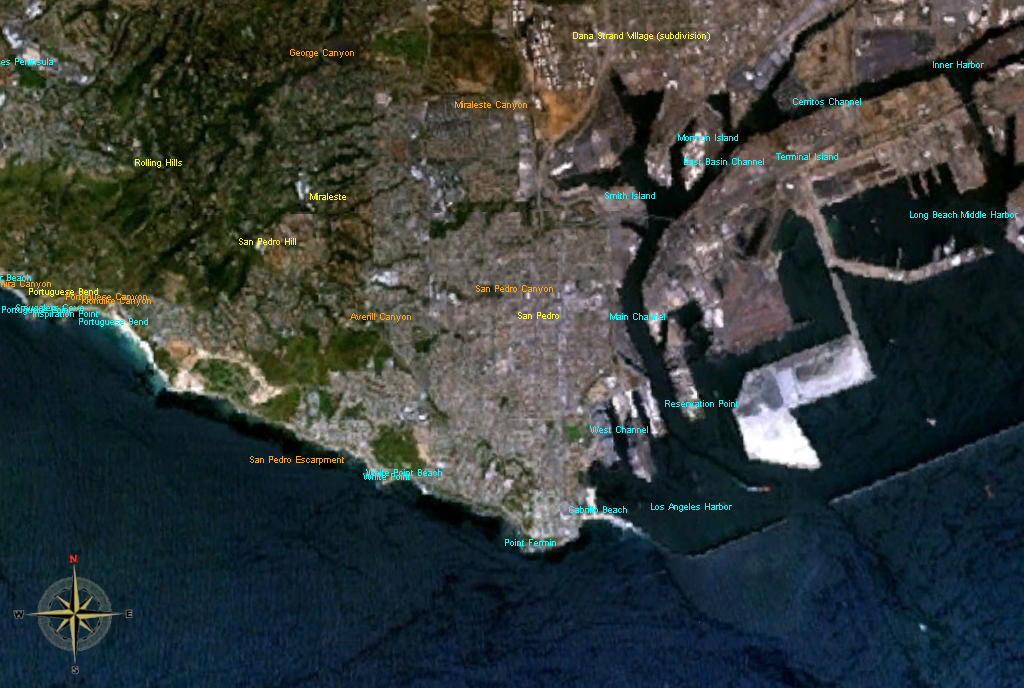
 Satellite image of the Harbor areaMain article: Harbor Area
Following the Harbor Gateway south to the port leads to the Harbor area, an enclave of Los Angeles that is surrounded by various cities and towns. The land of the Harbor Gateway was annexed to the City of Los Angeles so that it would have a contiguious land connection with its seaport. The most prominent neighborhood of the harbor area is called San Pedro.
- Harbor City
- Harbor Pines
- Harbor Gateway
- San Pedro
- Palisades
- Port of Los Angeles
- Point Fermin
- South Shores
- Vista del Oro
- The Gardens
- Rolling Hills Highlands
- Vinegar Hill
- Terminal Island
- Wilmington
Los Feliz and Silver Lake
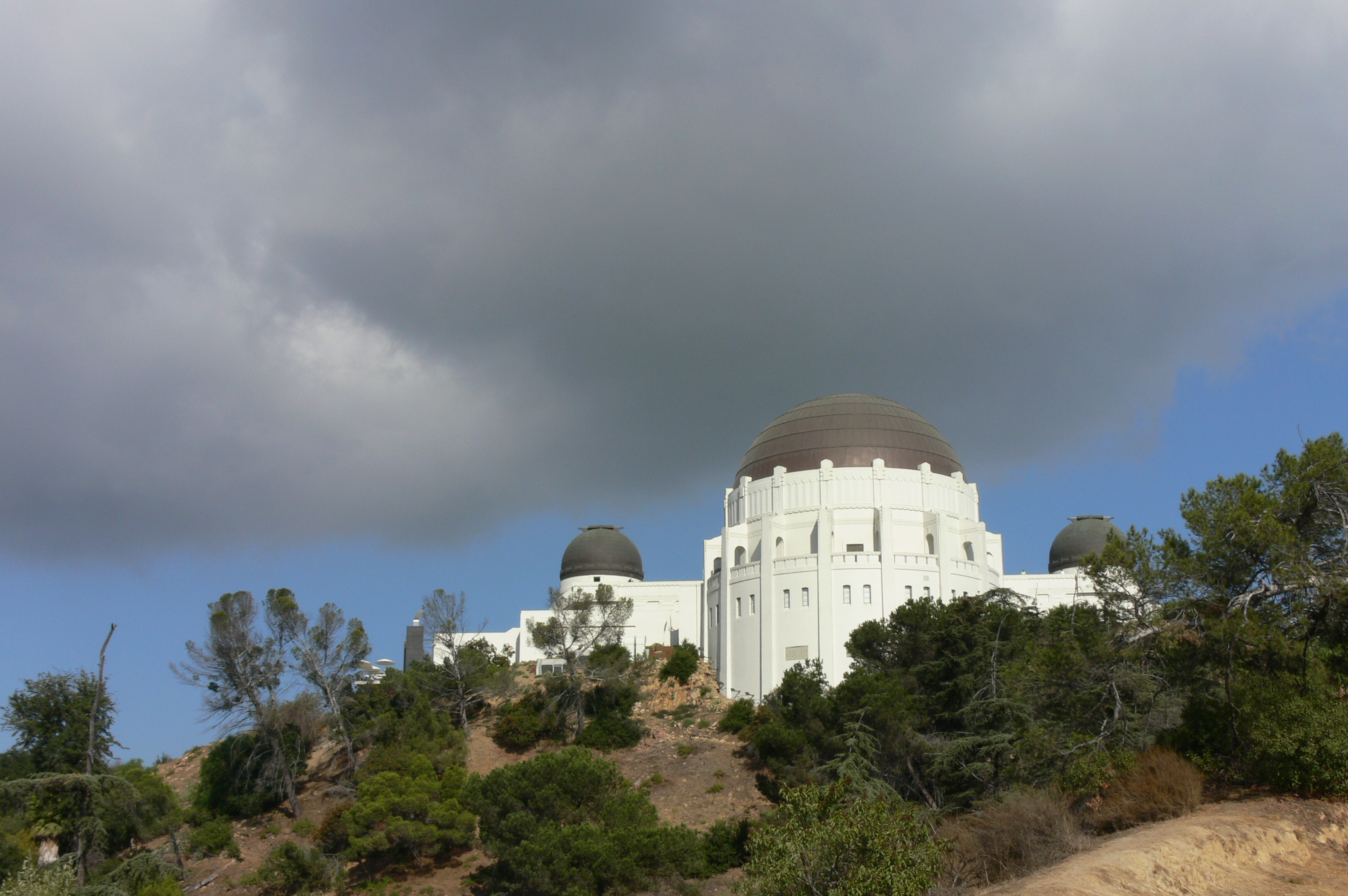
 Griffith Observatory in Los Feliz.
Nestled between Hollywood and the Los Angeles River are a group of the city's older residential neighborhoods that houses Griffith Park, one of the nation's largest public parks.
Main article: Northwest Los AngelesSimilar to most of the city, communities in this area are significantly wealthier closer to the hills. In this fashion, Los Feliz retained its expensive reputation while other districts further south and closer to Westlake were plagued by gang wars or crime. In the last decade, the area particularly around the Silver Lake Reservoir and now Sunset Boulevard has become closely associated with gentrification, a process which has pushed working class families out due to high housing costs.
- Los Feliz
- Franklin Hills
- Silver Lake
- Sunset Junction
South Los Angeles
 Gateway to Jefferson Park
 South CentralMain article: South Los Angeles
South Los Angeles, formerly called "South Central Los Angeles", Many of the neighborhoods of South Los Angeles house African americans, includes most of the city directly south of downtown, Interstate Highway 10 (the Santa Monica Freeway, and Wilshire Boulevard, but not those areas as far southeast as the Harbor Gateway, the Harbor Area, or the Port of Los Angeles.
- Arlington Park
- Athens on the Hill
- Baldwin Hills
- Baldwin Hills Estates
- Baldwin Village
- Baldwin Vista
- Broadway Square
- Cameo Plaza
- Canterbury Knolls
- Century Palms
- Chesterfield Square
- Crenshaw
- Crenshaw Manor
- Exposition Park
- Gramercy Park
- Green Meadows
- Jefferson Park
- King Estates
- Leimert Park
- Magnolia Square
- Manchester Square
- Morningside Circle
- Park Mesa Heights[4]
- Hyde Park
- Angeles Mesa
- View Heights
- Vermont Knolls
- Vermont Park
- Vermont Square
- Village Green
- Watts
- West Adams
- Kinney Heights
- North University Park
- Figueroa Corridor
- University Park
- West Alameda
- West Park Terrace
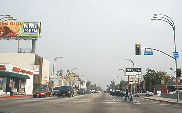
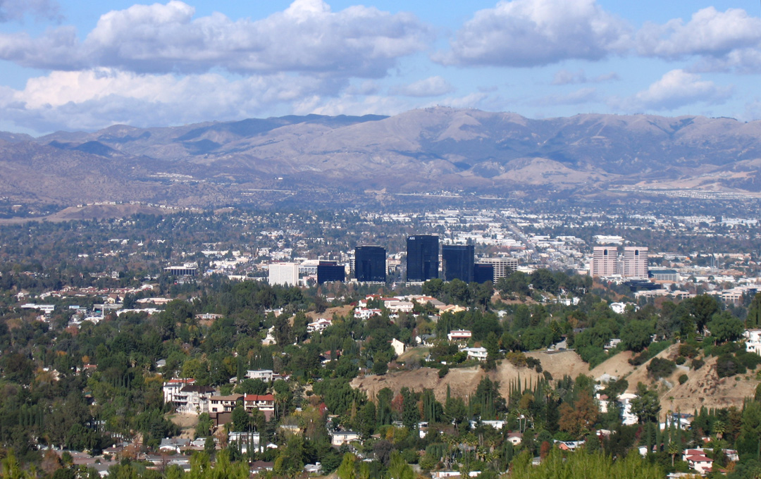
San Fernando Valley
 Mission San Fernando Rey de España is the only California Mission located in Los Angeles. It is in the community of Mission Hills.
 Lake Balboa, namesake of the neighborhood
 Victory Boulevard in Van Nuys
 View of Woodland Hills with Warner Center in the foregroundMain article: San Fernando Valley
The largest region of the city is the San Fernando Valley, often referred to as "the Valley," and which includes portions of the Crescenta Valley. It is mainly suburban, and houses a wide-range of socioeconomic groups. It comprises almost half of the city's land area and about forty percent of the city's population. Mulholland Drive in the Santa Monica Mountains forms its southern boundary. It has gone through periodic clashes with the rest of the city over policy, culminating in a failed effort to incorporate as a city in 2002.
- Arleta
- Balboa Park
- Canoga Park
- Chatsworth
- Encino
- Granada Hills
- Balboa Highlands
- Hansen Hills
- Knollwood
- Lake View Terrace
- Lake Balboa
- La Tuna Canyon
- Rancho La Tuna Canyon
- Mission Hills
- North Hills
- North Hollywood
- Northridge
- Pacoima
- Panorama City
- Porter Ranch
- Reseda
- Reseda Ranch
- Shadow Hills
- Stonehurst
- Sherman Oaks
- Sherman Village
- Studio City
- Sun Valley
- Sunland
- Sylmar
- Olive View
- Kagel Canyon
- Tarzana
- Melody Acres[10]
- Toluca Lake
- Toluca Woods
- West Toluca
- Tujunga
- Valley Village
- Van Nuys
- Ventura Business District
- Warner Center
- West Hills
- Winnetka
- Woodland Hills
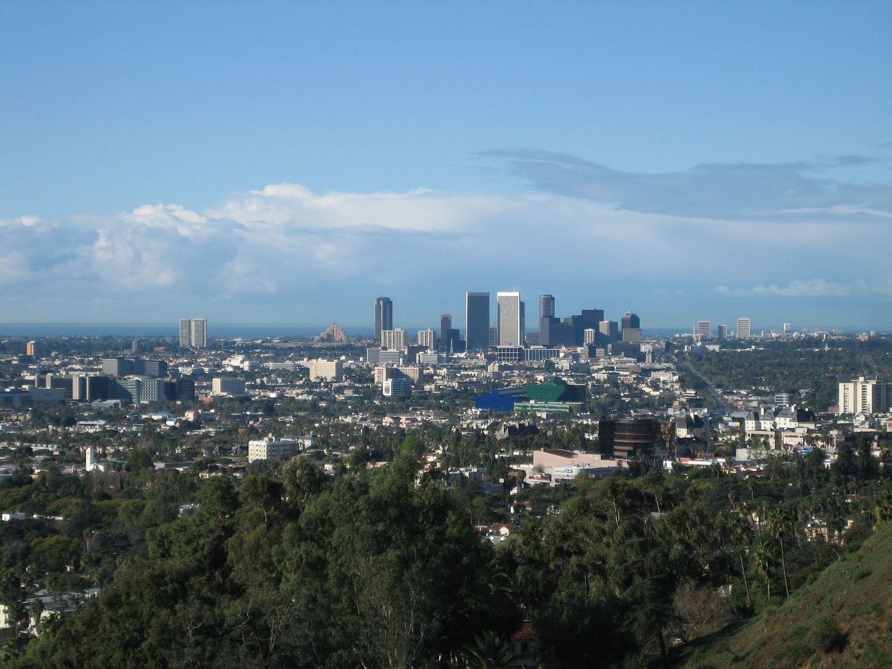
West Los Angeles (The Westside)
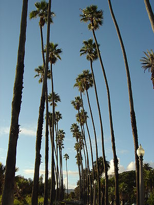 A palm-lined boulevard in West Los Angeles
 Bel-Air entrance gate
 Century City skyline
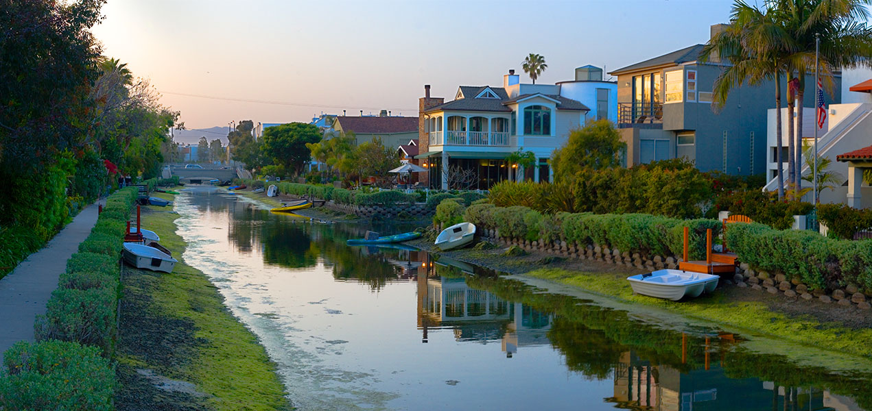
 Venice Canals
 Venice BoardwalkMain article: West Los AngelesSee also: Westside (Los Angeles County)
West Los Angeles is the part of the city encircled by Beverly Hills and Wilshire on the east, and Santa Monica and the Pacific Ocean on the west, the Santa Monica Mountains on the north, and Culver City and El Segundo on the south.
While the area is inhabited by a wide range of socioeconomic groups, it undoubtedly houses the largest concentration of wealth in the city. Attracted by its rolling hills on the north end, and close proximity to the ocean, early developers succeeded in establishing some of the most upscale residential districts in the city and the county. Pre-eminent among these are Bel-Air and Pacific Palisades. Yet further south, pockets of working class areas remain in those areas closest to former industrial areas like those near South LA and Culver City.
The term Westside, though often debated, refers to both the western parts of the city of Los Angeles as well as adjacent cities and towns, such as Santa Monica, Beverly Hills, and West Hollywood. West L.A. or West Los Angeles also refers to a specific neighborhood south of Brentwood and east of Santa Monica.
- Bel-Air
- Roscomare Valley
- Beverly Glen [1]
- East Gate Old Bel Air
- West Gate Bel Air
- Upper Bel Air
- Benedict Canyon
- Beverly Crest
- Beverlywood
- La Cienega Heights
- Brentwood
- Brentwood Circle
- Brentwood Glen
- Brentwood Hills
- Brentwood Park
- Brentwood Village
- Bundy Canyon
- Kenter Canyon
- Mandeville Canyon
- Westridge Heights
- South Brentwood
- Westgate
- Century City
- Cheviot Hills
- Castle Heights
- Crestview
- Del Rey
- Mar Vista
- Westdale
- Marina Peninsula
- Pacific Palisades
- Castellammare
- Marquez Knolls
- Huntington Palisades
- Palisades Highlands
- Santa Monica Canyon
- Rustic Canyon
- Palisades del Rey (defunct neighborhood)
- Palms
- Westside Village
- Playa del Rey
- Playa Vista
- Rancho Park
- Home Junction
- Regent Square
- South Robertson
- Reynier Village
- Venice
- Oakwood
- Venice Canals [2]
- Westchester
- Kentwood
- Los Angeles International Airport
- Loyola Village
- Manchester Square
- Westport Heights
- West Los Angeles
- Sawtelle
- Westwood
- Holmby Hills
- Little Persia
- Westwood Village
- Westwood North Village
Wilshire
 Carthay Circle
 Canter's Deli in the Fairfax District
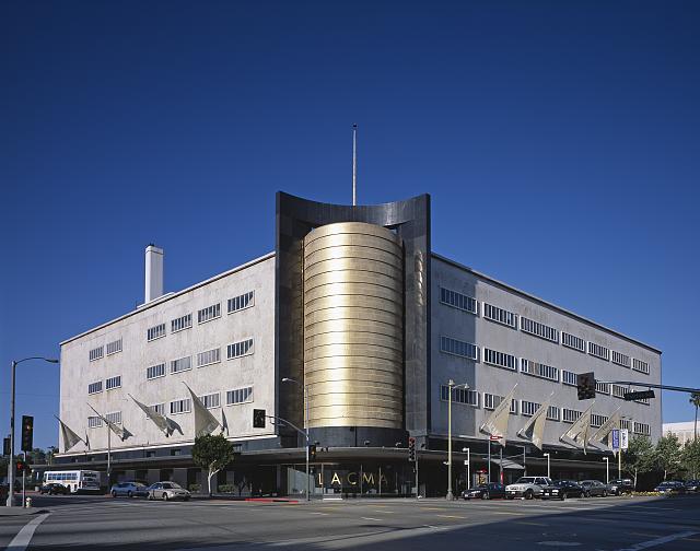
 This Streamline Modern building at the corner of Wilshire Boulevard and Fairfax Avenue houses part of the Los Angeles County Museum of ArtMain article: Wilshire, Los Angeles
The Wilshire area lies north of the Santa Monica Freeway (Interstate 10), east of Beverly Hills, west of Downtown, and south of Hollywood.
The Wilshire area is a collection of wealthy, middle, and working-class neighborhoods that cluster around Wilshire Boulevard. Unlike other parts of Los Angeles the wealthier neighborhoods are set not in the hills, but rather on leveled land north and south of Wilshire Boulevard, east of Beverly Hills such as Larchmont, Hancock Park, and Fremont Place. Koreatown is an example of a neighborhood undergoing a revival, with new condominiums being constructed on Wilshire Boulevard.
- Carthay
- Carthay Circle
- Carthay Square
- South Carthay
- Little Ethiopia
- Sycamore Square
- Fairfax District
- Olympic Park
- West Pico
- Picfair Village
- Pico Del Mar
- Pico Park
- Wilshire Highlands
- Wilshire Vista
- Arlington Heights
- Western Heights
- Country Club Park
- Greater Hancock Park
- Brookside Park
- Fremont Place
- Hancock Park
- Larchmont
- Larchmont Village
- Windsor Square
- La Brea-Hancock
- Ridgewood-Wilton
- Oxford Square
- St. Andrews Square
- Wilshire Park
- Longwood Highlands
- Park Mile
- Windsor Village
- Harvard Heights
- Victoria Park
- Lafayette Square
- Wellington Square
- Miracle Mile
- Miracle Mile North
- Miracle Mile South
- Park La Brea
- Wilshire Center
- Koreatown
- Little Bangladesh
- Catalina Heights
- Koreatown
City maps and data
- Map - Individual Communities within the City of Los Angeles (Detailed View)
- The Los Angeles Times: Data Desk: Mapping L.A.: Neighborhoods
- Southern California Association of Governments analysis of 2006 census data
- Flickr: LA City Neighborhood Signs
Other areas in Los Angeles County
- Other cities and towns in Los Angeles County
- Other areas of Los Angeles County, which are census-recognized but unincorporated
References
- ^ Pool, Bob. "L.A. neighborhoods, you're on the map." The Los Angeles Times. February 19, 2009. "1. Retrieved on March 20, 2010.
- ^ By Jennifer Mena, Preserving L.A.'s past in Angelino Heights, Los Angeles Times, February 13, 2005
- ^ "Mapping Los Angeles". Los Angeles Times. http://projects.latimes.com/mapping-la/neighborhoods/. Retrieved 21 August 2011.
- ^ http://www.pmhcc90043.org/About.html
- ^ Eng, Dinah (17 February 2008). "A place born when the stars were silent". Los Angeles Times. http://articles.latimes.com/2008/feb/17/realestate/re-guide17.
- ^ http://www.dailynews.com/ci_13879377?source=rss_viewed
- ^ Todd Jones. "Silver Triangle | Studio City Real Estate - Homes for Sale". StudioCityHomeFinder.com. http://studiocityhomefinder.com/silver-triangle. Retrieved 19 August 2011.
- ^ David Hitt & Josephine Rossi. "Silver Triangle | Studio City California Homes". Prudential California Realty. http://www.san-fernando-valley-ca-real-estate.com/community/silver-triangle. Retrieved 19 August 2011.
- ^ "About Silver Triangle". BlockShopper LLC. http://losangeles.blockshopper.com/subdivisions/silver_triangle/about. Retrieved 19 August 2011.
- ^ . http://www.latimes.com/classified/realestate/news/communities/2004/la-re-guide24oct24,0,2372029.story?coll=la-realestate-communities-2004.[dead link]
- ^ . http://www.latimes.com/classified/realestate/news/communities/2003/la-re-guide2nov02,0,116268.story?coll=la-realestate-communities-2003.[dead link]
- ^ . http://www.latimes.com/classified/realestate/news/communities/la-re-guide19jun19,0,4225663.story?coll=la-realestate-communities.[dead link]
External links
- Los Angeles Times: L.A. neighborhoods, you're on the map An online map of the boundaries of 87 communities.
- Mapping Los Angeles Downtown Districts
- South Park The municipal park at 50th Street and Avalon Boulevard.
City of Los Angeles Topics History • Transportation • Culture • Landmarks • Historic sites • Skyscrapers • Demographics • Crime • Sports • Media • Music • Notable people • Lists
Government Flag • Mayors • City Council • Other elected officials • Airport • DWP • Fire Department • Police • Public schools • Libraries • Port • TransportationRegions Downtown • Eastside/Northeast • Harbor Area • Greater Hollywood • Westlake & Silver Lake/Los Feliz • San Fernando and Crescenta Valleys • South Los Angeles • Westside • WilshireCategories:- Neighborhoods in Los Angeles, California
- Lists of neighborhoods in U.S. cities
- Lists of places in California
- Geography of Los Angeles, California
- Los Angeles, California-related lists


Wikimedia Foundation. 2010.