- Canoga Park, Los Angeles
-
Canoga Park
Owensmouth— Neighborhood of Los Angeles — Location within Los Angeles/San Fernando Valley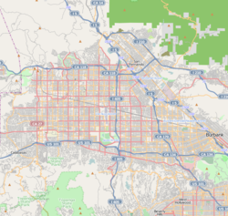
 Canoga Park
Coordinates: 34°12′04″N 118°35′50″W / 34.20111°N 118.59722°W Country United States State California County Los Angeles City Los Angeles Owensmouth 1912 Canoga Park 1930 Area – Land 4.35 sq mi (11.3 km2) Elevation 800 ft (244 m) Population (2008)[1] – Total 60,578 – Density 12,240/sq mi (4,725.9/km2) Time zone PST (UTC-8) – Summer (DST) PDT (UTC-7) zip code 91303, 91304, 91305, 91309 Area code(s) 818 Canoga Park (formerly known as Owensmouth) is a district in the San Fernando Valley region of Los Angeles, California, United States about 25 miles (40 km) northwest of Downtown Los Angeles.
It is bordered by Woodland Hills on the south, West Hills on the west, Chatsworth on the north, and Winnetka on the east.
Contents
History and landmarks
Pre-American history
The area of present day Canoga Park was the homeland of Native Americans in the Tongva-Fernandeño and Chumash-Venturaño tribes, that lived in the Simi Hills and along to the tributaries of the Los Angeles River. They traded with the north Valley Tataviam-Fernandeño people. American Indian civilizations inhabited the Valley for an estimated 8,000 years.[2][3] Their culture left the Burro Flats Painted Cave nearby.[4]
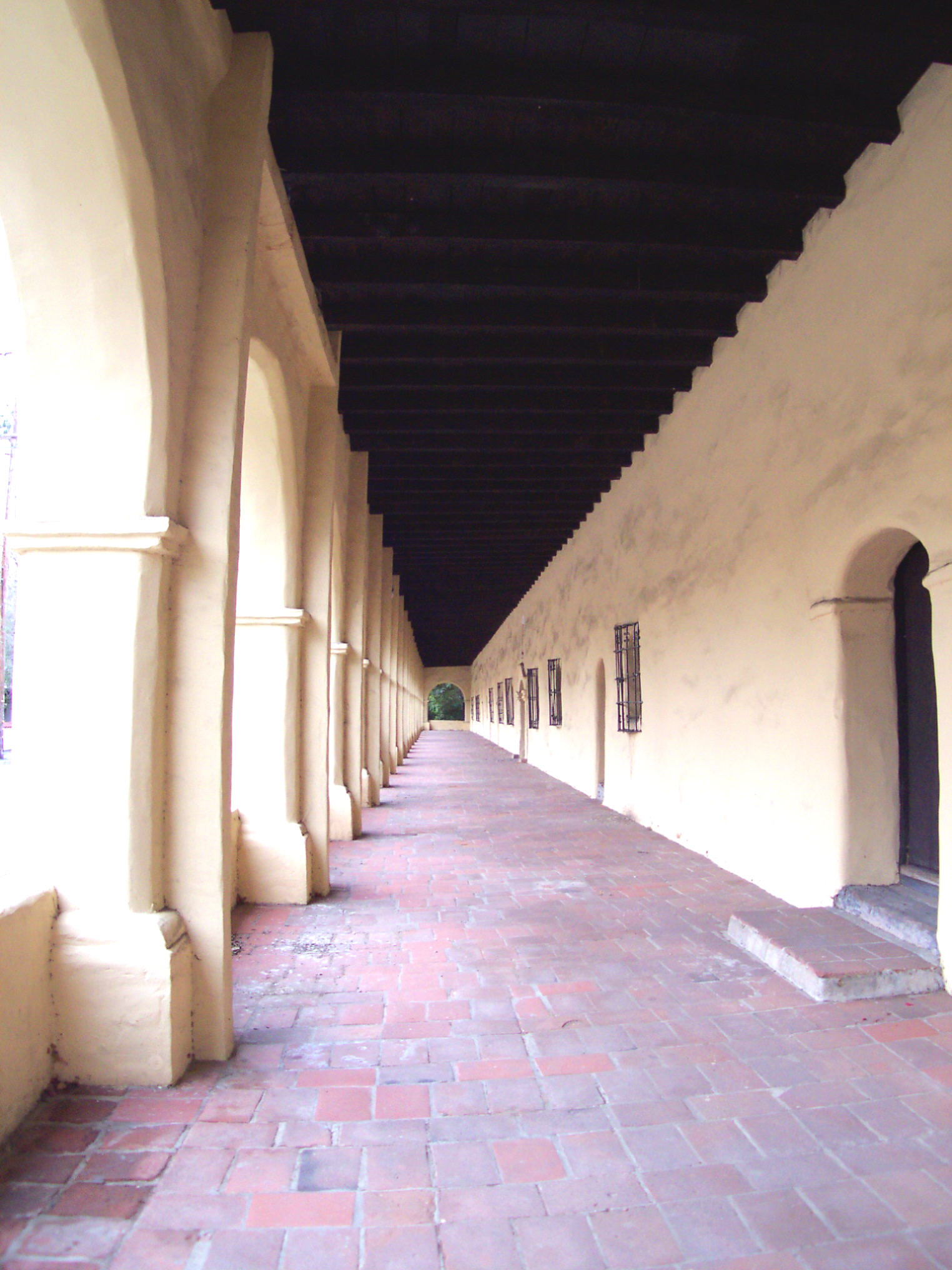
From 1797 to 1846 the area was part of Mission San Fernando Rey de España (Mission San Fernando). After the Mexican War of Independence from Spain the 'future Canoga Park' land became part of Rancho Ex-Mission San Fernando. In 1845 a land grant for the separate and historically rich Rancho El Escorpión was issued by Governor Pío Pico to three Chumash people, Odón Eusebia, his brother-in-law Urbano, and Urbano's son Mañuel.[5][6][7] It was located in the area west of Fallbrook Avenue, and later called Platt Ranch.[8][9]
American history
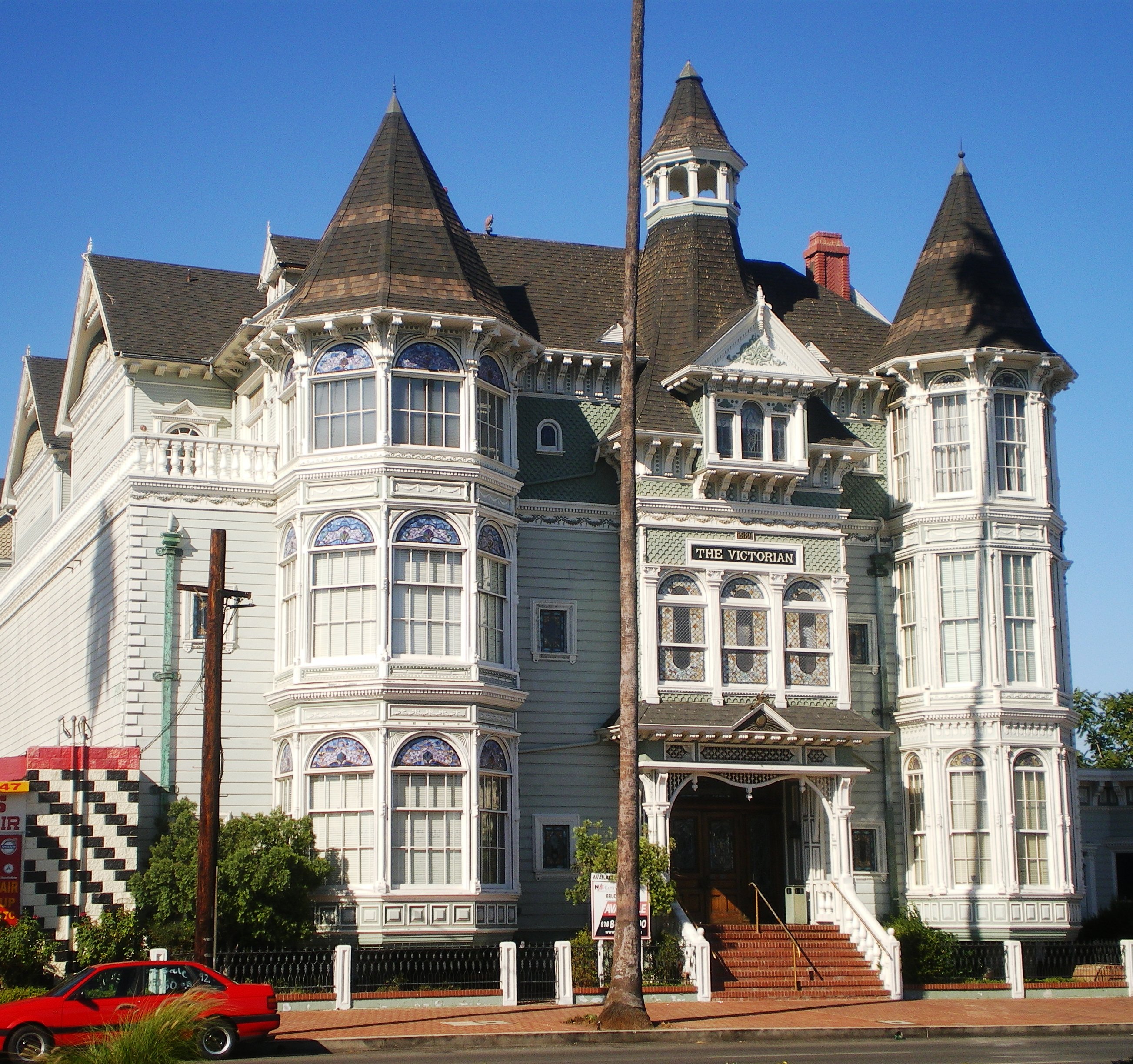
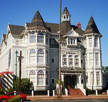 Platt Building, also known as The Victorian, 19725 Sherman Way, Canoga Park, Los Angeles, California
In 1863 the syndicate San Fernando Homestead Association led by Isaac Lankershim and Isaac Van Nuys purchased the southern half of the historic San Fernando Valley. They established seven wheat ranch operations and were the first to ship wheat to Europe from California. In 1869 Alfred Workman acquired the westernmost ranch, a 13,000 acres (50 km2) wheat farm in future Canoga Park (for more: See Landmarks section below).[10] Eucalyptus trees first imported and planted on the ranch, spread to other Canoga Park area ranches and farms.[11][12]
The area was included in the greater part of the southern San Fernando Valley development syndicate, started when the LA Suburban Home Company bought out the Van Nuys Ranch in 1909. The entire south San Fernando valley, from Roscoe Bl south to the hills, with certain exceptions, were to be subdivided on anticipation of the Los Angeles aqueduct's completion in 1913. The purchasers of the land included Harry Chandler and Harrison Gray Otis of the Los Angeles Times, Moses Sherman (a streetcar line builder), and Hobart Johnstone Whitley, an all purpose real estate developer who, from a start in the Land Rush of 1889 in Oklahoma to platting out 140 towns, including Hollywood.
The area was originally named Owensmouth (Pacific Electric) by Los Angeles Suburban Home Company by general manager Hobart Johnstone Whitley with a real estate salesman's exaggeration that it was the new mouth of the Owens River, after the Los Angeles Aqueduct would be completed the next year. The town was founded on March 30, 1912, and the Suburban Home Company contracted with the Janss Investment Company, to sell properties. A well-thought pre-development scheme brought Pacific Electric streetcars and an all purpose highway (Sherman Way) out all the way from Hollywood through Cahuenga Pass, through the previously subdivided Van Nuys (1911). Highlighting the "opening day barbecue" was the display of the "Owensmouth Baby", a racecar that could go up and down the paved Sherman Way at the incredible speed of 35 mph—as you could do—in an age without pavement or speed limits.
Owensmouth, as the junior San Fernando Valley city to Van Nuys, promoted itself with the "baby" motif—using storks in their advertisement—the "baby city" of the Valley. And Owensmouth remained a very small community.
The lack of an independent water supply made annexation to the City of Los Angeles inevitable, and on February 26, 1917 it joined with its larger neighbor. The name was changed to Canoga Park in 1930. It is believed to be named after Canoga, New York, which derived its name from the Native American village "Ganogeh". Eventually, the area's zoning was rural/agricultural and its industry was small farms involved in production of fruits, vegetables, melons, some livestock, horses, movie/television studio and stunt location work.[13]
Recent history
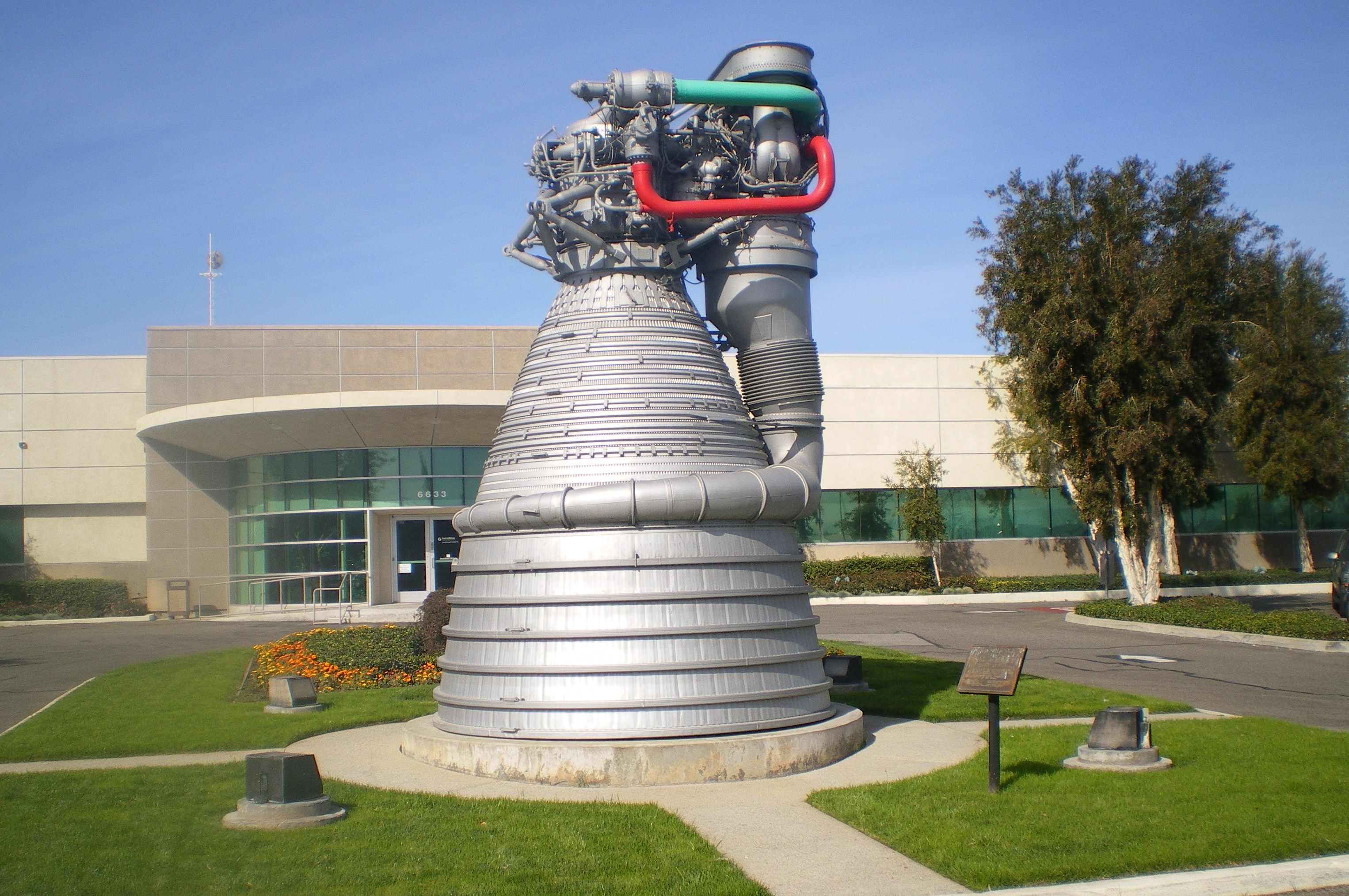
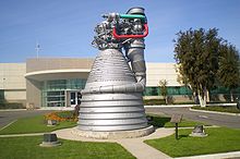 Pratt & Whitney Rocketdyne Division
In 1955, Rocketdyne, then a division of North American Aviation, moved into the area. It became a major employer along with the Atomics International and Santa Susana Field Laboratory (SSFL) divisions.[14] Other aerospace companies followed: including Atomics International, Thompson Ramo Wooldridge-TRW, Hughes Aircraft, Rockwell International, Boeing, and Teledyne. Small machine shops and other ancillary businesses also sprang up to service the aerospace industry. Currently the Pratt & Whitney Rocketdyne facility, operated by Pratt & Whitney division of United Technologies Corporation, is the remaining aerospace industry. The Santa Susana Field Lab property has been closed and will be undergoing an extensive environmental cleanup, and become an open-space park.[15][16]
In 1987 much of the western district of Canoga Park was renamed West Hills and a portion of the eastern district was renamed Winnetka. On June 25, 2005, Canoga Park was named an All-America City. Currently Canoga Park and neighboring Woodland Hills may have the largest shopping mall on the West Coast, with the planned merger of Topanga Plaza-Westfield Topanga with the Woodland Hills Promenade-Westfield Promenade in Warner Center.
Canoga Park was mentioned on the Frank Zappa album Joe's Garage as the hometown of the main character. It is also mentioned in the songs "Can't Let Go" by Bryan Ferry and "Eat Fried Wheat (a Canoga Park jingle)" by Vycrol.
Geography
Bell and Dayton Creeks flowing from the Simi Hills, and Arroyo Calabasas (Calabasas Creek) from the Santa Monica Mountains are several of the headwaters of the Los Angeles River that originate in the western San Fernando Valley that flow through Canoga Park. The Los Angeles River itself begins at the confluence of Calabasas Creek and Bell Creek behind Canoga Park High School. These and other small creeks supply stormwater and suburban runoff water to the Los Angeles River, and several are considered year round creeks. Although the creeks are now channeled and run within concrete walls, they do form a significant urban wildlife landscape and contribute to the population of indigenous wildlife left within the San Fernando Valley.
Demographics
Canoga Park is home to a diverse community. Most of Canoga Park is now suburban neighborhoods, with light industrial and commercial areas, while some film production, stunt-work, equestrian, and feed businesses still exist. In 2009, the Los Angeles Times's "Mapping L.A." project supplied these Canoga Park neighborhood statistics: population: 53,227; median household income: $51,601.[17]
Notable persons
- Francis Lederer (1899–2000), movie star, early resident and honorary mayor of Canoga Park.
- Eugene Selznick (b. 1930), American volleyball player
- Bryan Cranston (b. 1956), actor
- Ilene Woods (1929–2010)
- Randy Wolf (b. 1976), Major League baseball player
Government and infrastructure
Police
Los Angeles Police Department operates two police stations that serve Canoga Park:[18]
- West Valley Community Police Station serves residents south of Roscoe Boulevard:[19]
- Topanga Community Police Station serves residents north of Roscoe Boulevard:[20]
-
- The Topanga Community Police Station opened in January 2009. The police department named the station after a village in the Tongva language of the historically local Tongva-Fernandeño Native Americans tribe. The department originally planned to name it the Northwest Station, but residents preferred a name linking to the area's history.[21] Prior to the opening of the Topanga station, the Devonshire Community Police Station served that section.[22]
Post offices
The United States Postal Service operates the Canoga Park Post Office at 8201 Canoga Avenue and the Challenger Post Office at 21801 Sherman Way. Challenger Station maintains a fine WPA mural by the famous Western artist, Maynard Dixon.[23][24]
Public libraries
The Los Angeles Public Library operates the Canoga Park Branch Library at 20939 Sherman Way.[25]
Parks and recreation
- Lanark Recreation Center, formerly Orcutt Park, is an L.A. City park in Canoga Park (21816 Lanark Street and Topanga Canyon Boulevard, 91304). The center has: a lighted baseball diamond; an unlighted baseball diamond; lighted indoor basketball courts; lighted outdoor basketball courts; a children's play area; a lighted American football field; an indoor gymnasium (without weights); picnic tables, a lighted soccer (football) field, lighted tennis courts, and lighted volleyball courts; and an auditorium. It also serves as a Los Angeles Police Department drop-in site.[26]
Education
Public schools
Canoga Park is zoned to Los Angeles Unified School District schools.
Public schools serving Canoga Park include:
- Elementary schools
- Canoga Park Elementary School[28]
- Enadia Way Elementary School (opened 2008[29] – Attendance boundaries shifted in 2009[30])
- Hart Street Elementary School[31]
- Limerick Elementary School
- Stanley Mosk Elementary School
- Multicultural Learning Center/ Charter School
- Middle schools
- Columbus Middle School[32]
- Multicultural Learning Center/ Charter School
- High schools
- Charter schools
- Ingenium Charter School, K-6 school on campus of Columbus Middle School[33]
Private schools
Private schools located in Canoga Park include:
- The Concordia Schools Concordia Canoga Park (K-12)[34]
- Faith Baptist Schools
- AGBU High School
See also
- Owensmouth (Pacific Electric)
- Rancho El Escorpión
- History of the San Fernando Valley to 1915
References
- ^ LAtimes.com/mapping-L.A. neighborhoods/Canoga Park . accessed 8.18.2011
- ^ USA Today article USA Today
- ^ Mercury News article
- ^ [1] SSPSHP link: pp.41–2
- ^ U.S. Geological Survey Geographic Names Information System: Rancho El Escorpión
- ^ Map of old Spanish and Mexican ranchos in Los Angeles County
- ^ Ogden Hoffman, 1862, Reports of Land Cases Determined in the United States District Court for the Northern District of California, Numa Hubert, San Francisco
- ^ http://www.co-hs.org/ April 2007 Bulletin-Canoga/Owensmouth Historical Society
- ^ [2] SSPSHP link: Ethnohistory
- ^ SFVHS-Workman
- ^ [3]
- ^ http://bigorangelandmarks.blogspot.com/2007/03/no-9-shadow-ranch.html
- ^ Rivers in the Desert By Margaret Leslie Davis http://books.google.com/books?id=7lvRnuwxmUoC&pg=PA92&dq=h+j+whitley&hl=en&ei=4P5-TOT3Koa4sAO7yeX0Cg&sa=X&oi=book_result&ct=result&resnum=1&ved=0CCoQ6AEwADgK#v=onepage&q=h%20j%20whitley&f=false (1993)
- ^ Rocketdyne forum
- ^ State DTSC-SSFL info site
- ^ ACME-SSFL info site
- ^ "Canoga Park" entry on the Los Angeles Times "Mapping L.A." website
- ^ "Canoga Park Police Stations." Los Angeles Police Department. Retrieved on December 6, 2008.
- ^ "West Valley Community Police Station." Los Angeles Police Department. Retrieved on December 6, 2008.
- ^ "Topanga Community Police Station." Los Angeles Police Department. Retrieved on December 6, 2008.
- ^ Vives, Ruben. "LAPD opens new station in Canoga Park." Los Angeles Times. January 4, 2009. Retrieved on April 26, 2009.
- ^ "Canoga Park Police Stations." Los Angeles Police Department. October 11, 2007. Retrieved on April 26, 2009.
- ^ "Post Office Location – CANOGA PARK." United States Postal Service. Retrieved on December 6, 2008.
- ^ "Post Office Location – CHALLENGER." United States Postal Service. Retrieved on December 6, 2008.
- ^ "Canoga Park Branch Library." Los Angeles Public Library. Retrieved on December 6, 2008.
- ^ a b "Lanark Recreation Center." City of Los Angeles. Retrieved on March 22, 2010.
- ^ "Lanark Pool." City of Los Angeles. Retrieved on March 22, 2010.
- ^ http://www.canoga-lausd-ca.schoolloop.com
- ^ http://www.laschools.org/project-status/one-project?project_number=56.40038
- ^ "8. Proposed Changes to Enadia Way Elementary School Area Schools." Los Angeles Unified School District. Retrieved on March 17, 2010.
- ^ http://www.lausd.k12.ca.us/Hart_EL/
- ^ http://www.lausd.k12.ca.us/Columbus_MS/
- ^ http://data1.cde.ca.gov/dataquest/DQReports.asp?CDSType=S&CDSCode=19766790121137/
- ^ "Home." Concordia Canoga Park. Retrieved on September 1, 2011. "7357 Jordan Avenue, Canoga Park, CA 91303"
- ^ Lin, C.J. "Valley private school options dwindling." August 17, 2011. Retrieved on August 31, 2011.
- ^ "Welcome to Trinity Lutheran High School." Trinity Lutheran High School. Retrieved on September 1, 2011. "7357 Jordan Ave Canoga Park, CA. 91303"
External links
- L.A. Shadow Ranch Park
- Shadow Ranch history
- L.A. Orcutt Ranch Park
- Orcutt Ranch history
- Lanark Recreation Center
- Canoga Park local portal
Coordinates: 34°12′04″N 118°35′50″W / 34.20111°N 118.59722°W
Los Angeles city areas within the San Fernando and Crescenta Valleys Districts and
neighborhoodsArleta · Canoga Park · Chatsworth · Encino · Granada Hills · Lake View Terrace · Lake Balboa · Mission Hills · NoHo Arts District · North Hills · North Hollywood · Northridge · Pacoima · Panorama City · Porter Ranch · Reseda · Shadow Hills · Sherman Oaks · Studio City · Sun Valley · Sunland · Sylmar · Tarzana · Toluca Lake · Tujunga · Valley Village · Van Nuys · Ventura Business District · Warner Center · West Hills · Winnetka · Woodland Hills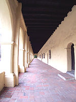
Points of
interestSee also Downtown · Eastside/Northeast · Harbor Area · Greater Hollywood · Westlake & Silver Lake/Los Feliz · San Fernando and Crescenta Valleys · South Los Angeles · Westside · WilshireCity of Los Angeles Topics History • Transportation • Culture • Landmarks • Historic sites • Skyscrapers • Demographics • Crime • Sports • Media • Music • Notable people • Lists
Government Flag • Mayors • City Council • Other elected officials • Airport • DWP • Fire Department • Police • Public schools • Libraries • Port • TransportationRegions Downtown • Eastside/Northeast • Harbor Area • Greater Hollywood • Westlake & Silver Lake/Los Feliz • San Fernando and Crescenta Valleys • South Los Angeles • Westside • WilshireCategories:- Neighborhoods in Los Angeles, California
- Communities in the San Fernando Valley
- San Fernando Valley
- History of Los Angeles, California


Wikimedia Foundation. 2010.