- National Register of Historic Places listings in Los Angeles County, California
-
This list includes properties and districts listed on the National Register of Historic Places in Los Angeles County, California outside the cities of Los Angeles and Pasadena. Click the "Map of all coordinates" link to the right to view a Google map of all properties and districts with latitude and longitude coordinates in the table below.[1]
For sites in the city of Los Angeles, see National Register of Historic Places listings in Los Angeles. For those in Pasadena, see National Register of Historic Places listings in Pasadena, California.
-
- This National Park Service list is complete through NPS recent listings posted November 10, 2011.[2]
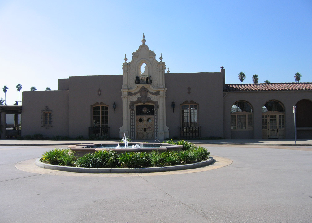
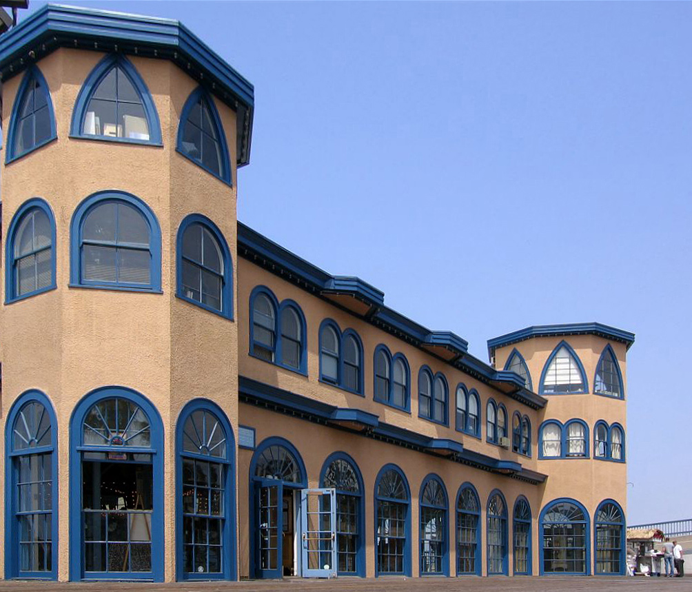
[3] Landmark name [4] Image Date listed Location City or town Summary 1 Adamson House 
October 28, 1977 23200 W. Pacific Coast Highway
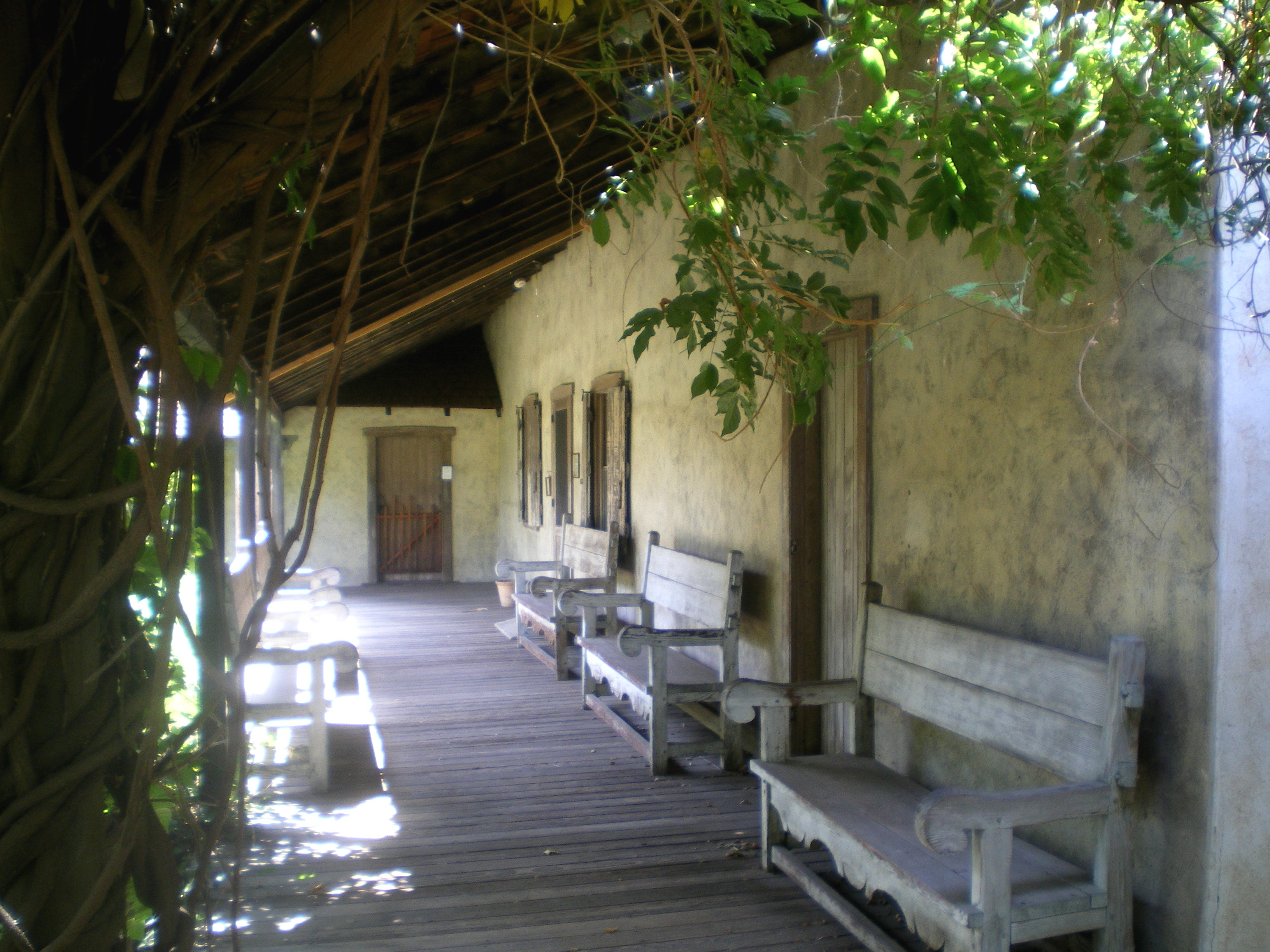
34°02′04″N 118°40′42″W / 34.034444°N 118.678333°WMalibu 2 Adobe Flores 
June 18, 1973 1804 Foothill St.
34°07′11″N 118°08′41″W / 34.119722°N 118.144722°WSouth Pasadena 3 Alexander Theatre 
February 16, 1996 216 N. Brand Blvd.
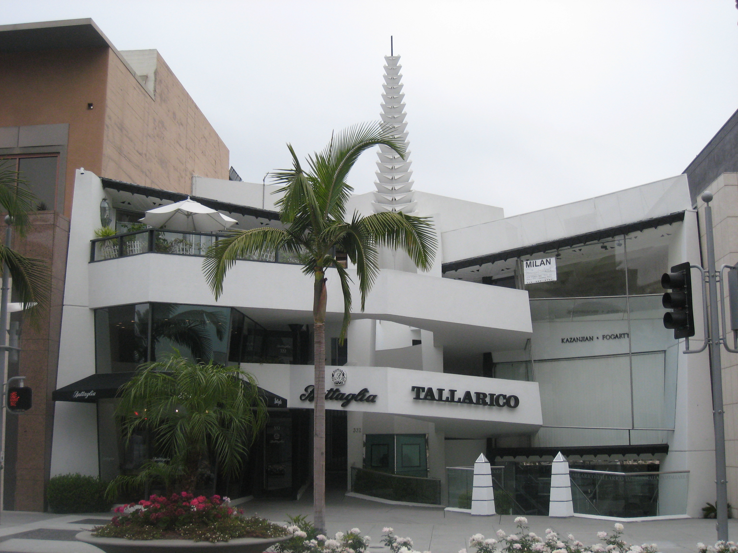
34°08′57″N 118°15′12″W / 34.149167°N 118.253333°WGlendale 4 Anderton Court Shops 
May 14, 2004 332 N.Rodeo Dr.
34°04′06″N 118°24′03″W / 34.068333°N 118.400833°WBeverly Hills Frank Lloyd Wright 5 Antelope Valley Indian Museum State Historic Park February 26, 1987 15701 East Ave.
34°39′01″N 117°50′56″W / 34.650278°N 117.848889°WLancaster 6 Ard Eevin November 21, 2006 851 W. Mountain St.
34°10′37″N 118°16′13″W / 34.176944°N 118.270278°WGlendale 7 Arroyo Seco Parkway Historic District 
February 4, 2011 CA 110 from Four Level Interchange in Los Angeles to East Glenarm St. in Pasadena
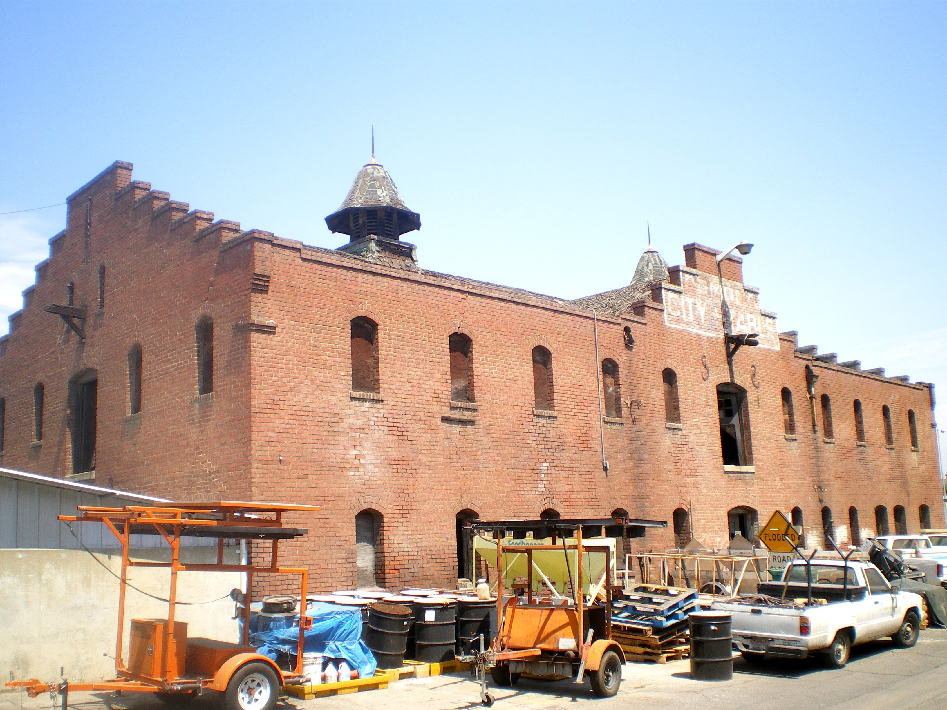
34°07′39″N 118°08′50″W / 34.1275°N 118.147222°WDowntown Los Angeles to Pasadena The Arroyo Seco Parkway Historic District passes through South Pasadena 8 Atchison, Topeka, and Santa Fe Railroad Station 
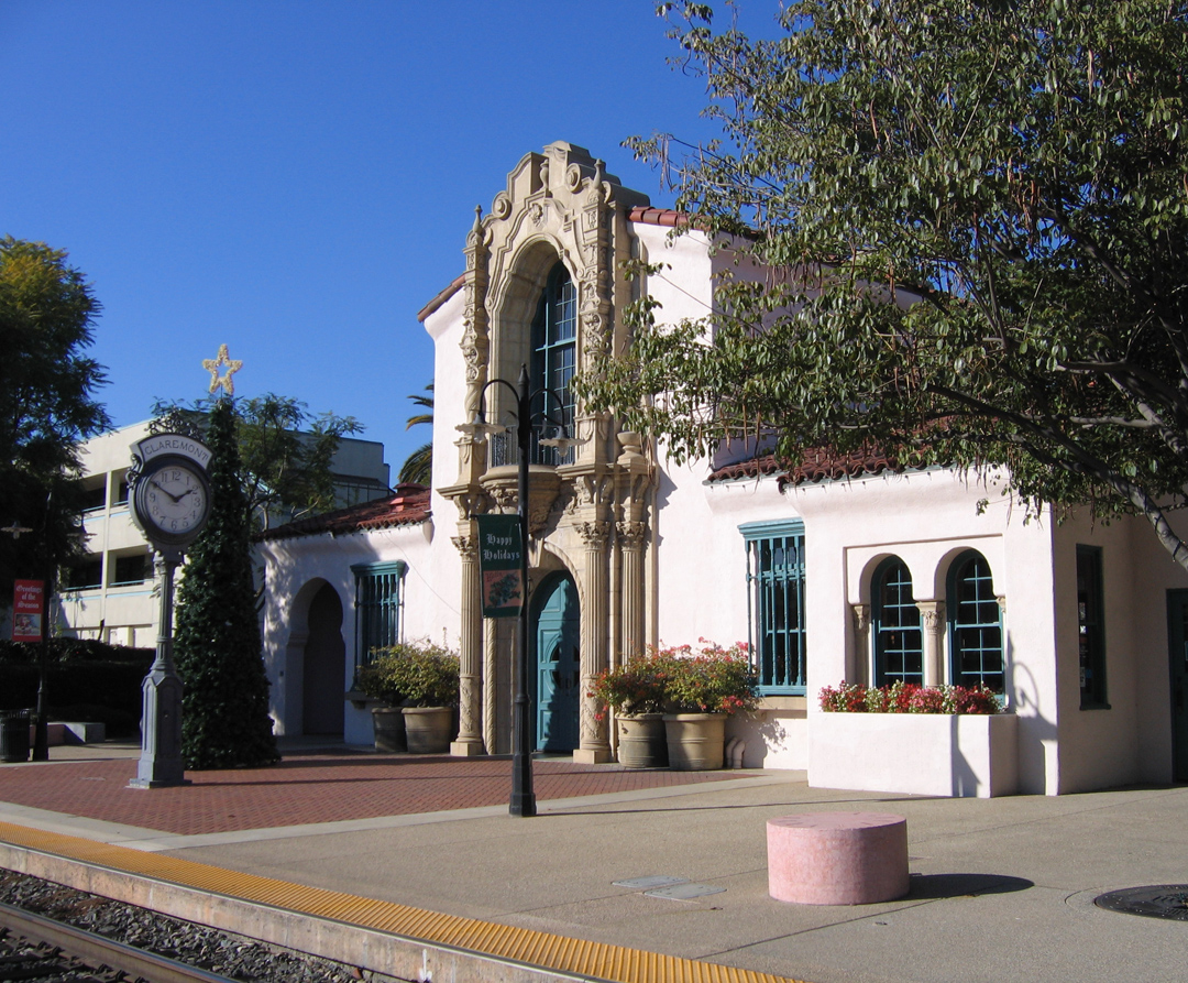
July 15, 1982 110 W. 1st St.
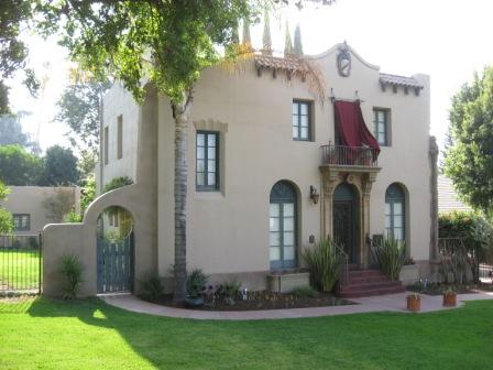
34°05′39″N 117°42′58″W / 34.094167°N 117.716111°WClaremont 9 Auditorium 
October 13, 1983 2200 W. Carson
33°49′48″N 118°19′11″W / 33.83°N 118.319722°WTorrance 10 Aztec Hotel 
May 22, 1978 311 W. Foothill Blvd.
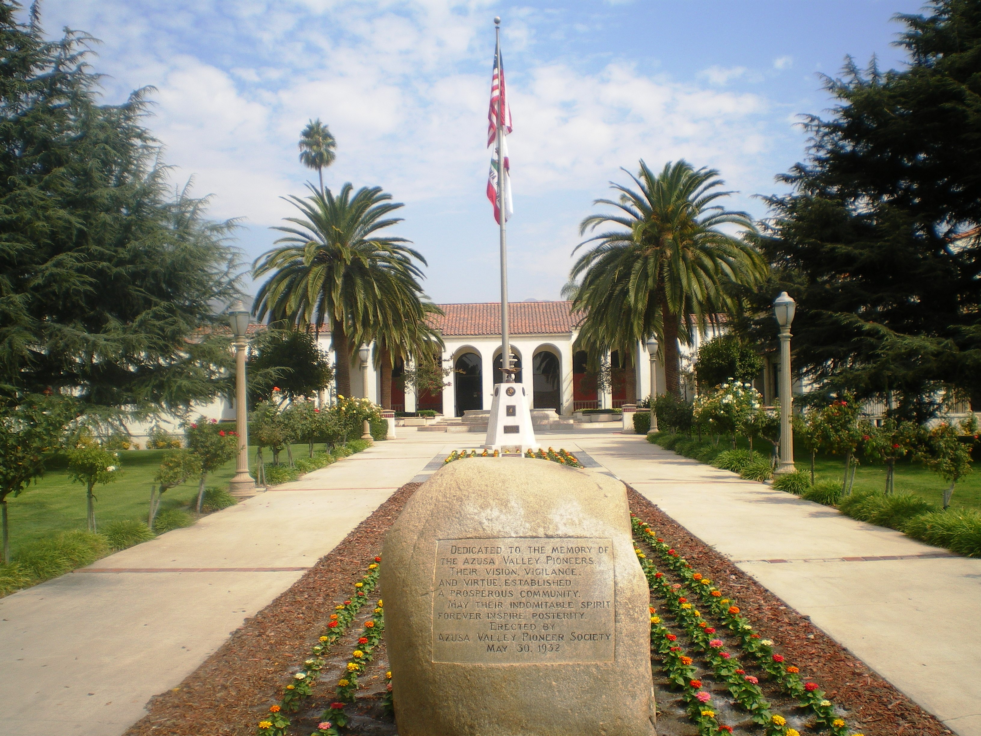
34°09′06″N 118°00′18″W / 34.151667°N 118.005°WMonrovia 11 Azusa Civic Center 
February 21, 2002 213 Foothill Blvd.
34°08′03″N 117°54′18″W / 34.134167°N 117.905°WAzusa 12 Jonathan Bailey House 
August 29, 1977 13421 E. Camilla St.
33°59′05″N 118°01′53″W / 33.984722°N 118.031389°WWhittier 13 Beverly Hills Women's Club 
October 4, 2006 1700 Chevy Chase Dr.
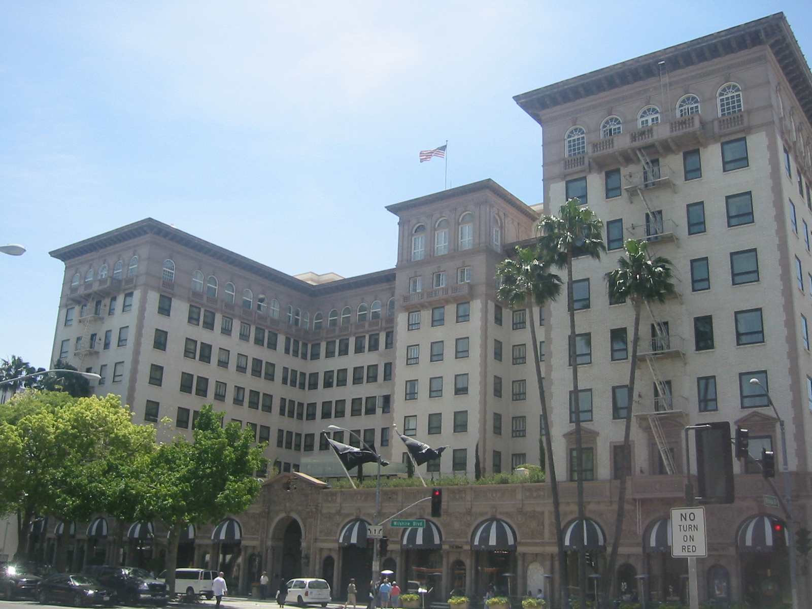
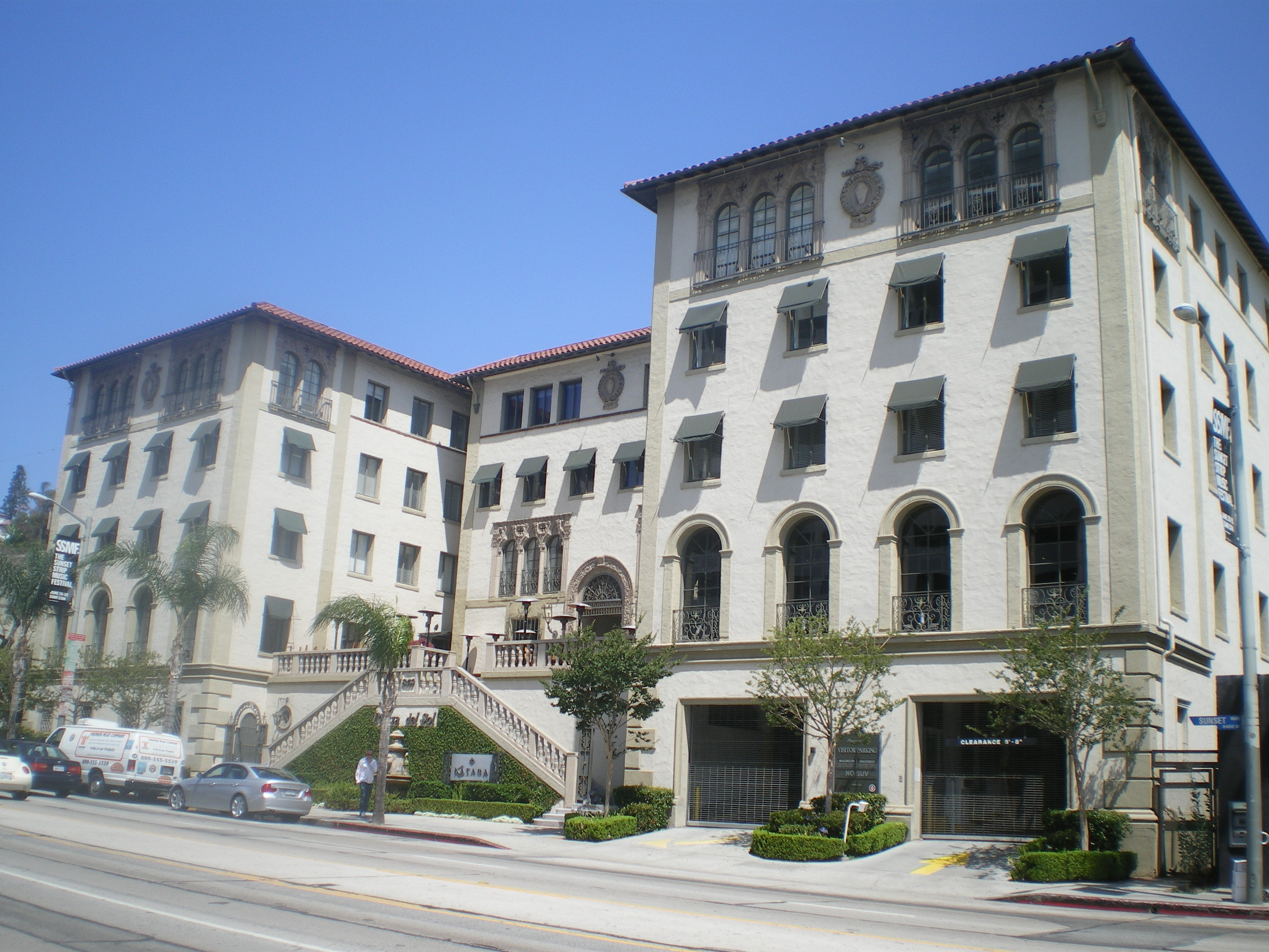
34°05′09″N 118°25′47″W / 34.085833°N 118.429722°WBeverly Hills 14 Beverly Wilshire Hotel 
June 12, 1987 9528 Wilshire Blvd.
34°04′01″N 118°23′20″W / 34.066944°N 118.388889°WBeverly Hills 15 Casa de Parley Johnson March 20, 1986 7749 Florence Ave.
33°57′24″N 118°07′57″W / 33.956667°N 118.1325°WDowney 16 Cedar Avenue Complex September 30, 1993 44843 (44855), 44845 and 44851 Cedar Ave., 606 Lancaster Blvd., and Old Jail (no address)
34°41′58″N 118°08′20″W / 34.699444°N 118.138889°WLancaster 17 Charmont Apartments 
July 25, 1996 330 California Ave.
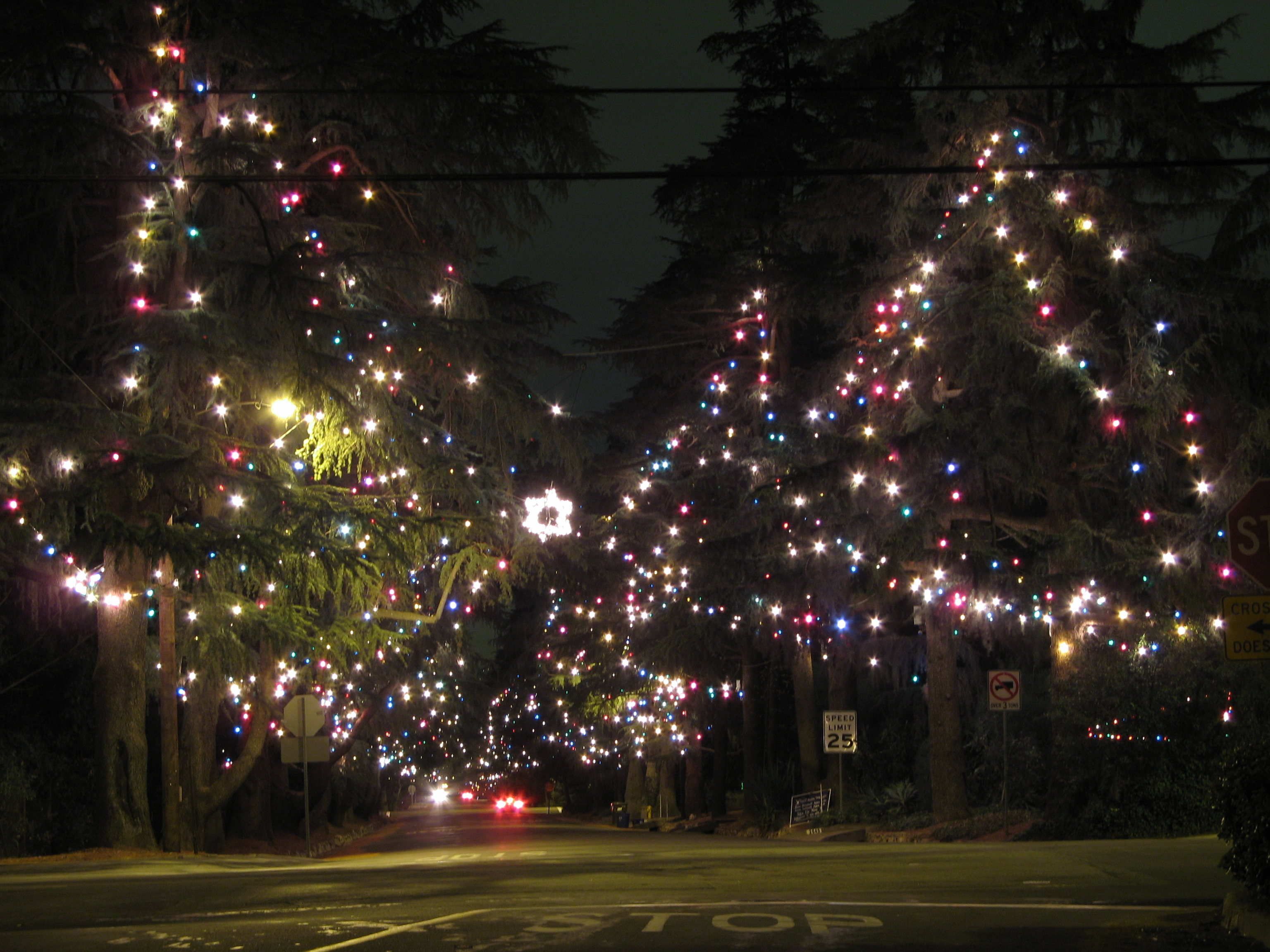
34°01′12″N 118°29′58″W / 34.02°N 118.499444°WSanta Monica 18 Christmas Tree Lane 
September 13, 1990 Santa Rosa Ave. between Woodbury Ave. and Altadena Dr.
34°11′25″N 118°08′09″W / 34.190278°N 118.135833°WAltadena 19 Citizens Publishing Company Building 
February 12, 1987 9355 Culver Blvd.
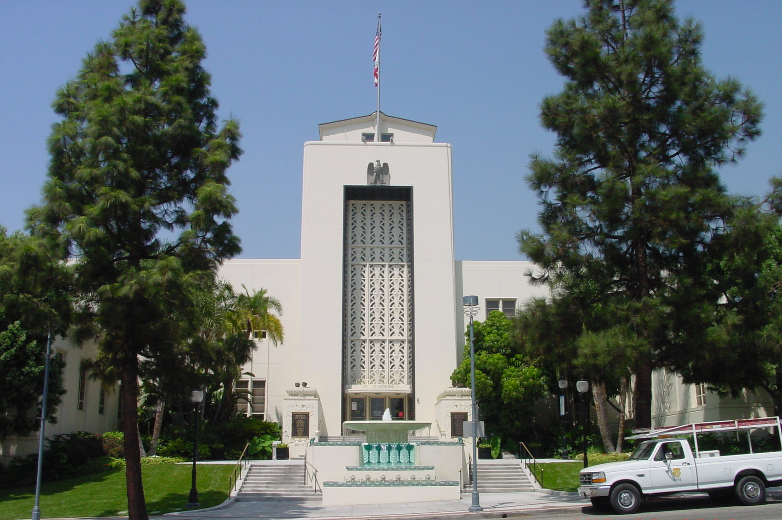
34°01′31″N 118°23′35″W / 34.025278°N 118.393056°WCulver City 20 City Hall-City of Burbank 
April 18, 1996 275 E. Olive Ave.
34°10′55″N 118°18′27″W / 34.181944°N 118.3075°WBurbank 21 Clarke Estate January 4, 1990 10211 Pioneer Blvd.
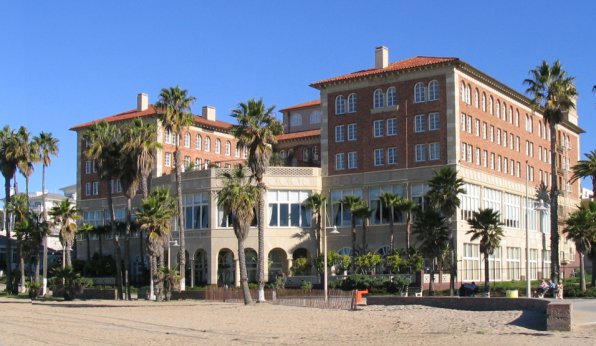
33°56′36″N 118°04′52″W / 33.943333°N 118.081111°WSanta Fe Springs 22 Club Casa Del Mar 
September 29, 2000 1910 Ocean Ave.
34°00′23″N 118°29′25″W / 34.006389°N 118.490278°WSanta Monica 23 Colonial House 
April 15, 1982 1416 N. Havenhurst Dr.
34°05′45″N 118°21′35″W / 34.095833°N 118.359722°WWest Hollywood 24 Cooper Arms 
December 28, 2000 455 E. Ocean Blvd.
33°46′01″N 118°11′13″W / 33.766944°N 118.186944°WLong Beach 25 Crank House July 23, 1997 2186 Crary St.
34°10′21″N 118°06′20″W / 34.1725°N 118.105556°WAltadena 26 Culver Hotel 
April 14, 1997 9400 Culver Blvd.
34°01′24″N 118°23′38″W / 34.023333°N 118.393889°WCulver City 27 James Daniel Derby House December 14, 1978 2535 E. Chevy Chase Dr.
34°09′41″N 118°12′38″W / 34.161389°N 118.210556°WGlendale 28 DeWenter Mansion, Guest House and Grounds November 5, 1992 6100 Brydon Rd.
34°09′07″N 117°45′23″W / 34.151944°N 117.756389°WLa Verne 29 Diamond Apartments 
March 26, 1992 321 Diamond St.
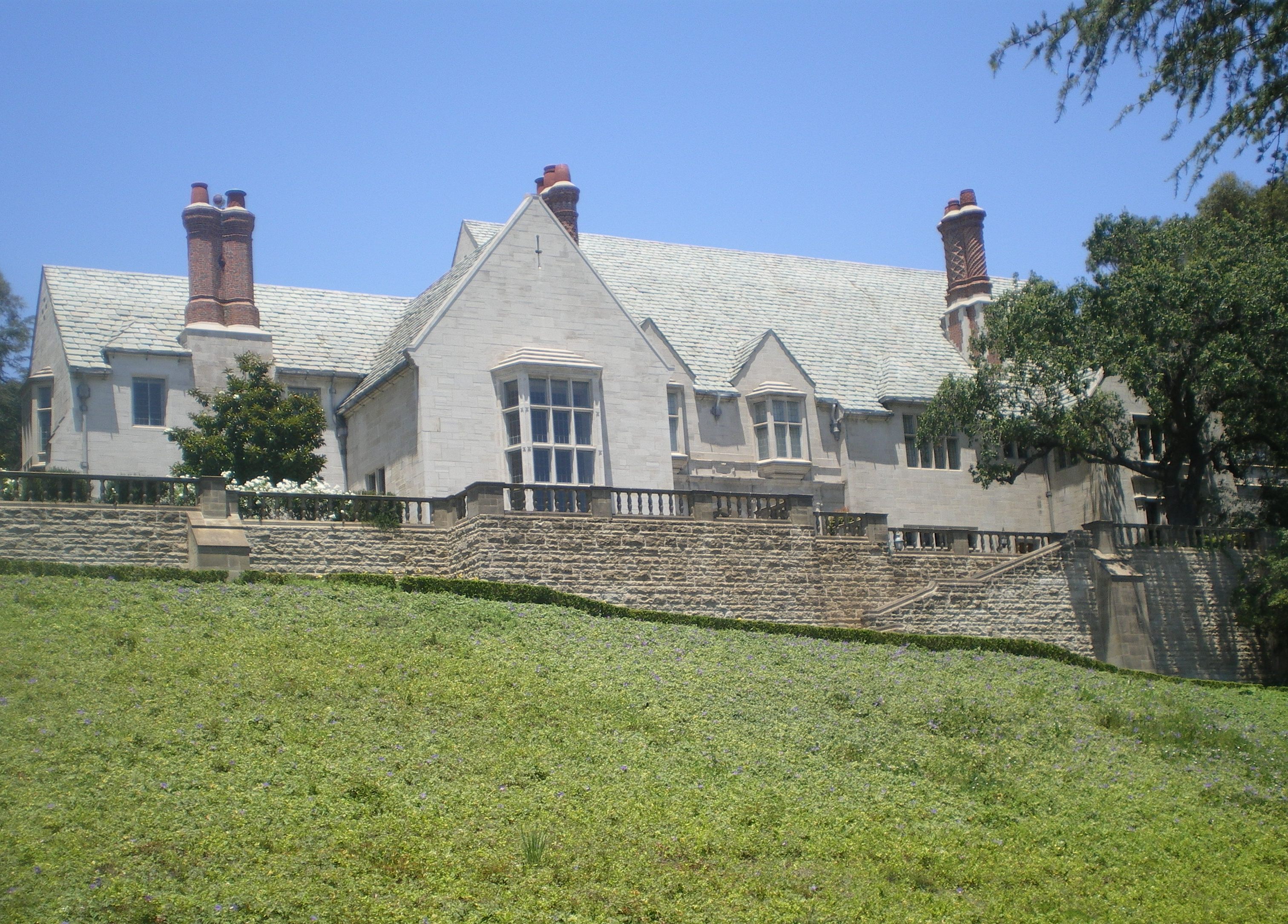
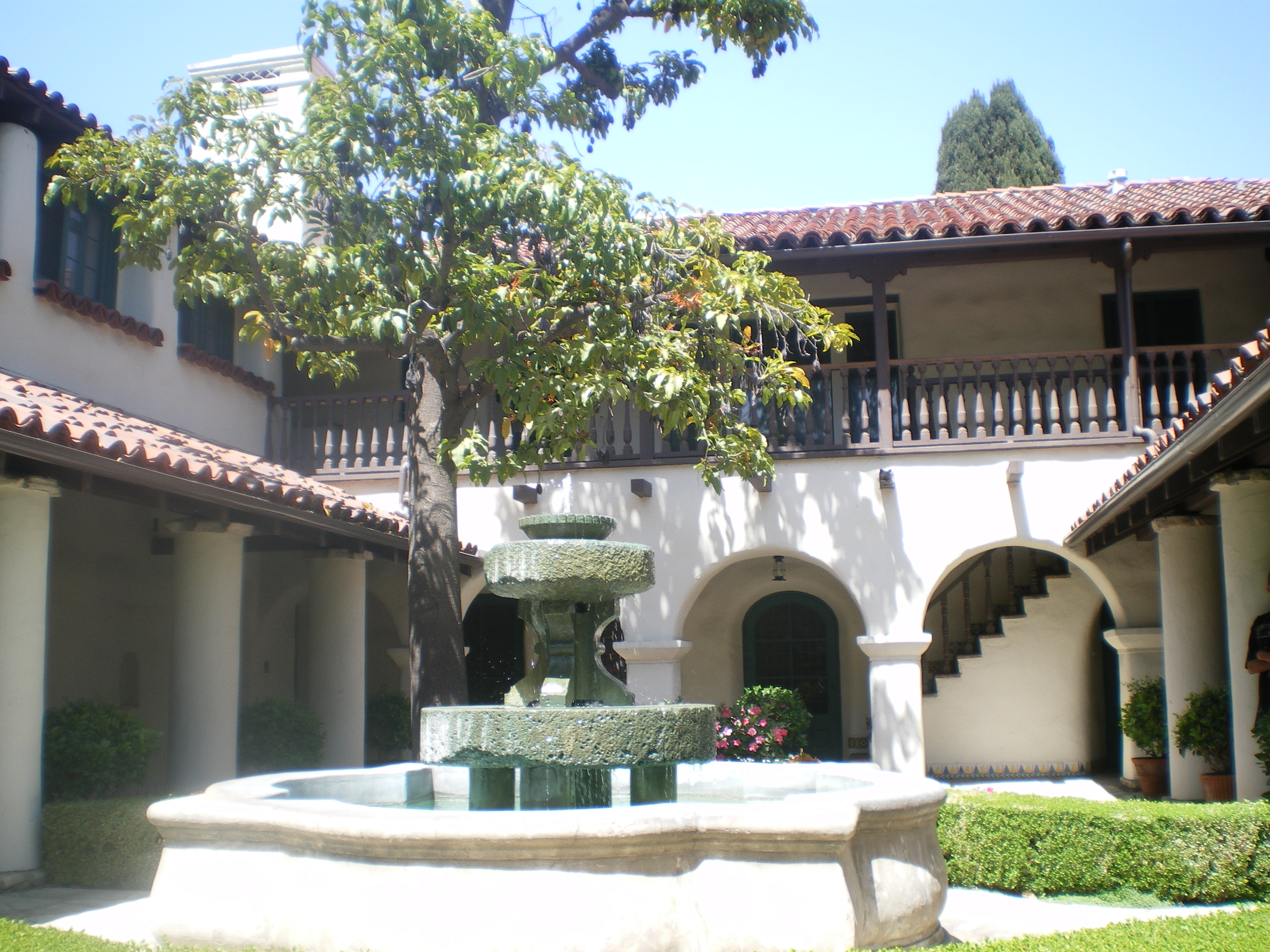
33°50′39″N 118°23′16″W / 33.844167°N 118.387778°WRedondo Beach 30 Doheny Estate/Greystone Mansion 
April 23, 1976 905 Loma Vista Dr.
34°05′31″N 118°24′01″W / 34.091944°N 118.400278°WBeverly Hills 31 Dominguez Rancho Adobe May 28, 1976 18127 S. Alameda St.
33°52′01″N 118°13′03″W / 33.866944°N 118.2175°WCompton 32 Edison Historic District 
August 13, 1986 611, 637, and 500 blk. of W. Second St.
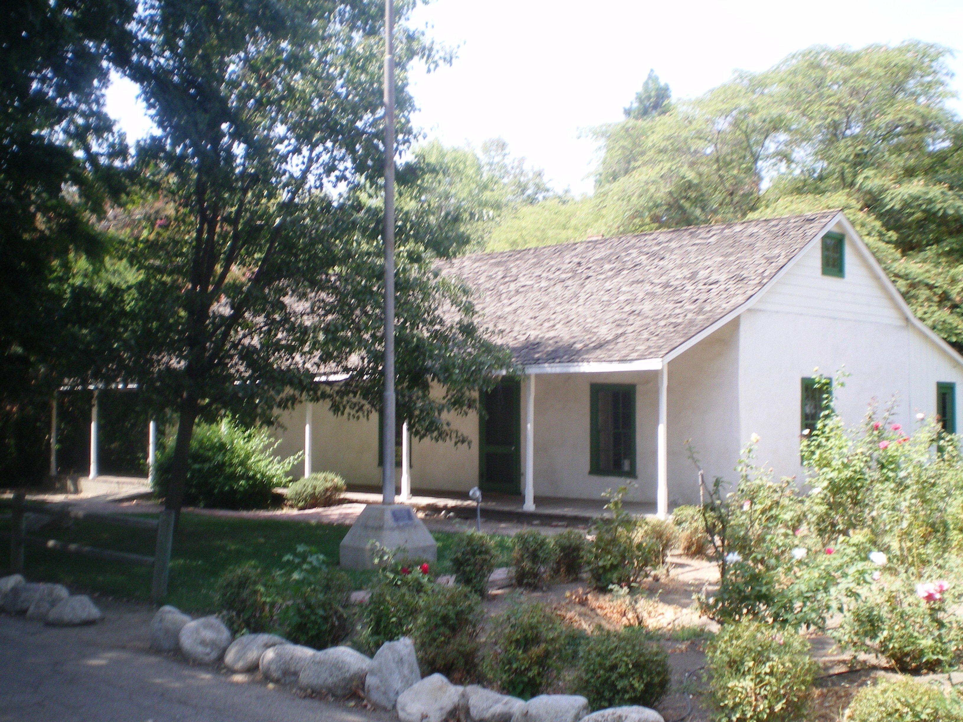
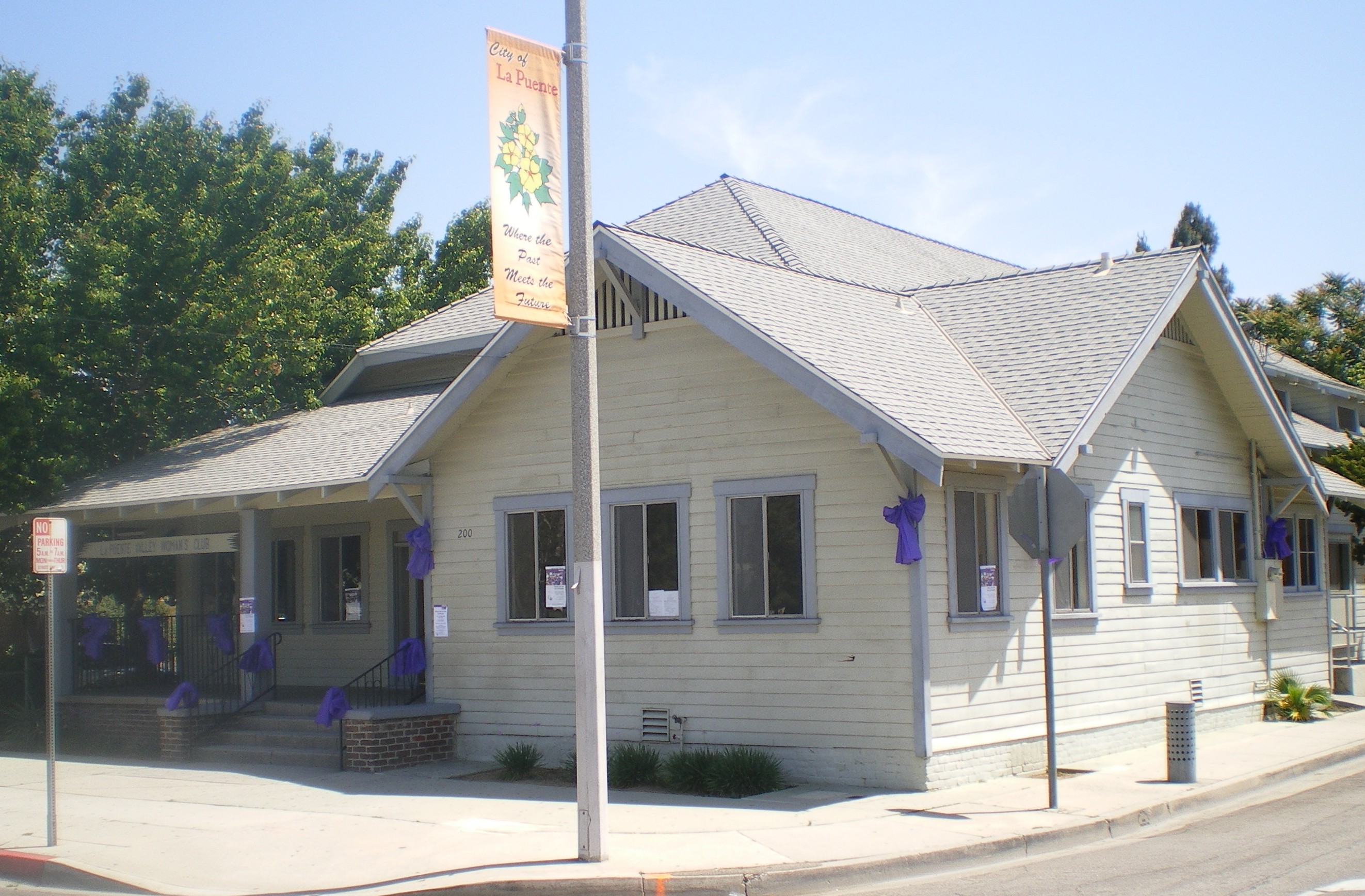
34°03′28″N 117°45′13″W / 34.057778°N 117.753611°WPomona 33 El Molino Viejo 
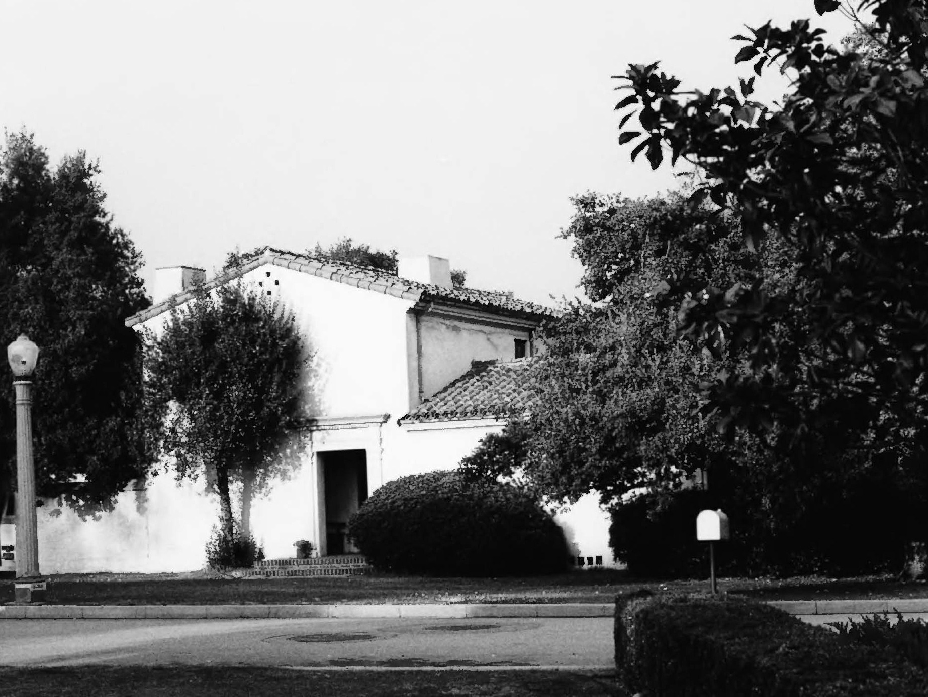
May 6, 1971 1120 Old Mill Rd.
34°07′32″N 118°07′37″W / 34.125556°N 118.126944°WSan Marino Water-driven grist mill built ca. 1816; oldest commercial building in Southern California 34 Katherine Emery Estate January 10, 2011 1155 Oak Grove Ave.
34°07′31″N 118°07′38″W / 34.125278°N 118.127222°WSan Marino 35 Episcopal Church of the Ascension August 19, 1977 25 E. Laurel Ave.
34°09′58″N 118°03′04″W / 34.166111°N 118.051111°WSierra Madre 36 Gen. Charles S. Farnsworth County Park February 7, 1997 568 E. Mt. Curve Ave.
34°11′59″N 118°07′54″W / 34.199722°N 118.131667°WAltadena 37 Fern Avenue School 
February 20, 1992 1314 Fern Ave.
33°50′06″N 118°19′52″W / 33.835°N 118.331111°WTorrance 38 First National Bank of Long Beach 
September 13, 1990 101-125 Pine Ave.
33°46′06″N 118°11′30″W / 33.768333°N 118.191667°WLong Beach 39 Peter Gano House September 15, 1983 718 Crescent Ave.
33°20′34″N 118°19′20″W / 33.342778°N 118.322222°WAvalon 40 Garfield House 
April 24, 1973 1001 Buena Vista St.
34°07′14″N 118°09′21″W / 34.120556°N 118.155833°WSouth Pasadena 41 Glendale Southern Pacific Railroad Depot 
May 2, 1997 Gardena Ave., jct. with W. Cerritos Ave.
34°07′25″N 118°15′29″W / 34.123611°N 118.258056°WGlendale 42 Glendale Young Men's Christian Association 
October 21, 1994 140 N. Louise St.
34°08′52″N 118°15′04″W / 34.147778°N 118.251111°WGlendale 43 Glendora Bougainvillea February 7, 1978 Bennett and Minnesota Aves.
34°08′27″N 117°51′34″W / 34.140833°N 117.859444°WGlendora 44 Green-Rankin-Bembridge House 
February 10, 2005 953 Park Circle Dr.
33°46′45″N 118°12′04″W / 33.779167°N 118.201111°WLong Beach 45 Barbara Greenwood Kindergarten September 18, 1978 Hacienda Pl. and McKinley Ave.
34°04′31″N 117°45′16″W / 34.075278°N 117.754444°WPomona 46 Zane Grey Estate October 24, 2002 396 E. Mariposa St.
34°11′26″N 118°08′30″W / 34.190556°N 118.141667°WAltadena 47 Hacienda Arms Apartments 
December 15, 1983 8439 Sunset Blvd.
34°05′42″N 118°22′24″W / 34.095°N 118.373333°WWest Hollywood 48 Olan G. and Aida T. Hafley House July 12, 2011 5561 E. La Pasada St.
33°46′54″N 118°07′30″W / 33.781667°N 118.125°WLong Beach 1953 house designed by Richard Neutra[5] 49 Hawkins-Nimocks Estate-Patricio Ontiveros Adobe December 31, 1987 12100 Telegraph Rd.
33°56′22″N 118°04′34″W / 33.939444°N 118.076111°WSanta Fe Springs 50 Home Economics Building 
October 13, 1983 2200 W. Carson
33°49′52″N 118°19′16″W / 33.831111°N 118.321111°WTorrance 51 Hoover Hotel 
February 1, 2002 7035 Greenleaf Ave.
33°58′41″N 118°02′10″W / 33.978056°N 118.036111°WWhittier 52 Horatio West Court 
April 11, 1977 140 Hollister Ave.
34°00′12″N 118°29′10″W / 34.003333°N 118.486111°WSanta Monica Irving Gill 53 Hotel Glendale 
October 7, 1994 701 E. Broadway
34°08′48″N 118°14′45″W / 34.146667°N 118.245833°WGlendale 54 Edwin Hubble House 
December 8, 1976 1340 Woodstock Rd.
34°07′23″N 118°07′12″W / 34.123056°N 118.12°WSan Marino 55 Humaliwo September 1, 1976 Address Restricted Malibu 56 Darius David Johnston House November 2, 1978 12426 Mapledale St.
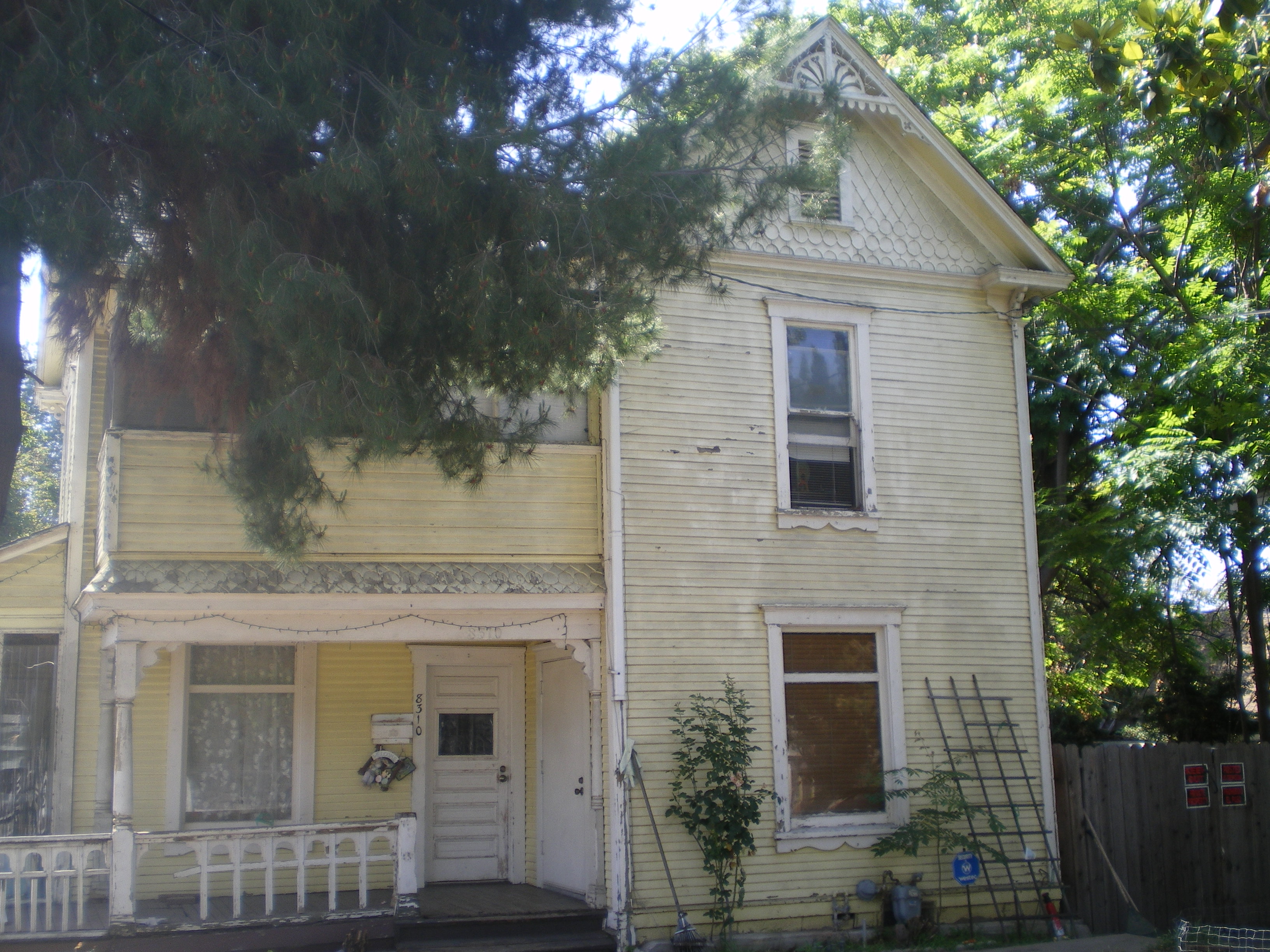
33°53′54″N 118°04′02″W / 33.898333°N 118.067222°WNorwalk 57 Orin Jordan House 
July 28, 1980 8310 S. Comstock Ave.
33°57′40″N 118°01′59″W / 33.961111°N 118.033056°WWhittier 58 Keyes Bungalow November 14, 1978 1337 E. Boston St.
34°10′57″N 118°07′22″W / 34.1825°N 118.122778°WAltadena 59 Killingsworth, Brady, & Smith July 15, 2009 3827-3837 Long Beach Blvd.
33°49′41″N 118°11′23″W / 33.828056°N 118.189656°WLong Beach 60 La Casa Alvarado 
April 19, 1978 1459 Old Settlers Lane
34°04′26″N 117°45′19″W / 34.073889°N 117.755278°WPomona 61 La Casa Primera de Rancho San Jose 
April 3, 1975 1569 N. Park Ave.
34°04′30″N 117°45′15″W / 34.075°N 117.754167°WPomona 62 La Puente Valley Woman's Club 
April 29, 1999 200 N. First St.
34°01′19″N 117°57′05″W / 34.021944°N 117.951389°WLa Puente 63 Lanterman House 
December 29, 1994 4420 Encinas Dr.
34°12′16″N 118°12′20″W / 34.204444°N 118.205556°WLa Canada Flintridge 64 Leonis Adobe 
May 29, 1975 23537 Calabasas Rd.
34°09′26″N 118°38′24″W / 34.157192°N 118.639881°WCalabasas 65 Lincoln Park Historic District April 9, 2004 Roughly bounded by McKinley Ave., Towne Ave., Pasadena St. and Garey Ave.
34°03′59″N 117°44′44″W / 34.066389°N 117.745556°WPomona 66 Abraham Lincoln Elementary School 
August 3, 1989 1200 N. Gordon Ave.
34°04′13″N 117°45′08″W / 34.070278°N 117.752222°WPomona 67 Harold Lloyd Estate 
February 9, 1984 Address Restricted Beverly Hills 68 Long Beach Professional Building 
August 3, 2005 117 E. 8th St.
33°46′36″N 118°11′32″W / 33.776667°N 118.192222°WLong Beach 69 Howard Longley House 
April 16, 1974 1005 Buena Vista St.
34°07′14″N 118°09′19″W / 34.120556°N 118.155278°WSouth Pasadena 70 Lopez Adobe 
May 6, 1971 1100 Pico St.
34°16′55″N 118°26′33″W / 34.281944°N 118.4425°WSan Fernando 71 Los Cerritos Ranch House 
April 15, 1970 4600 Virginia Rd.
33°50′22″N 118°11′42″W / 33.839444°N 118.195°WLong Beach 72 Lynwood Pacific Electric Railway Depot 
September 25, 1974 11453 Long Beach Blvd.
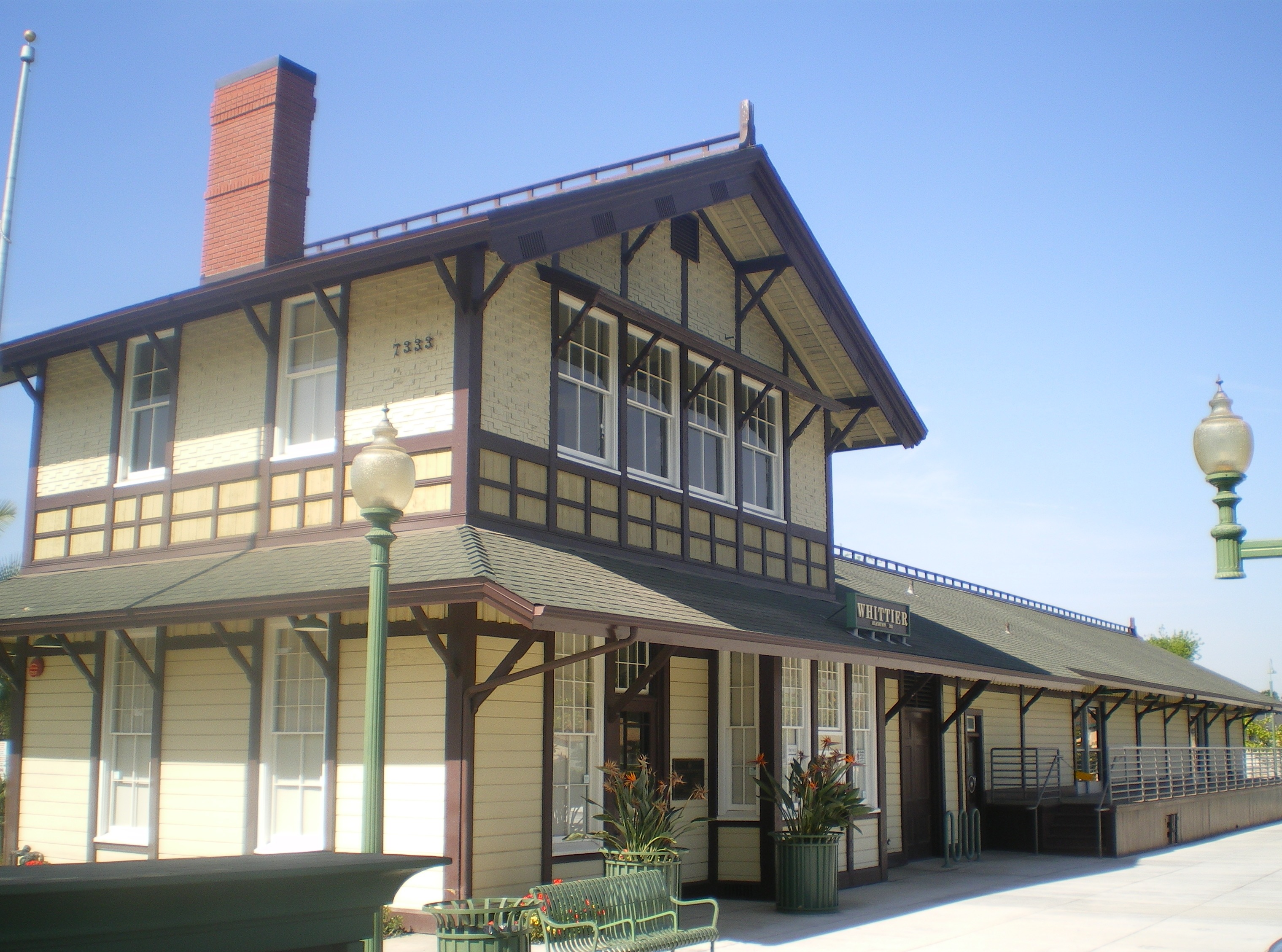
33°55′32″N 118°12′34″W / 33.925556°N 118.209444°WLynwood 73 Main Building 
October 13, 1983 2200 W. Carson
33°49′51″N 118°19′13″W / 33.830833°N 118.320278°WTorrance 74 McNally's Windemere Ranch Headquarters July 20, 1978 San Esteban and San Cristobal Dr.
33°53′53″N 118°01′28″W / 33.898056°N 118.024444°WLa Mirada 75 Andrew McNally House March 27, 2007 654 E. Mariposa St.
34°11′20″N 118°08′10″W / 34.188889°N 118.136111°WAltadena 76 Middough Brothers-Insurance Exchange Building 
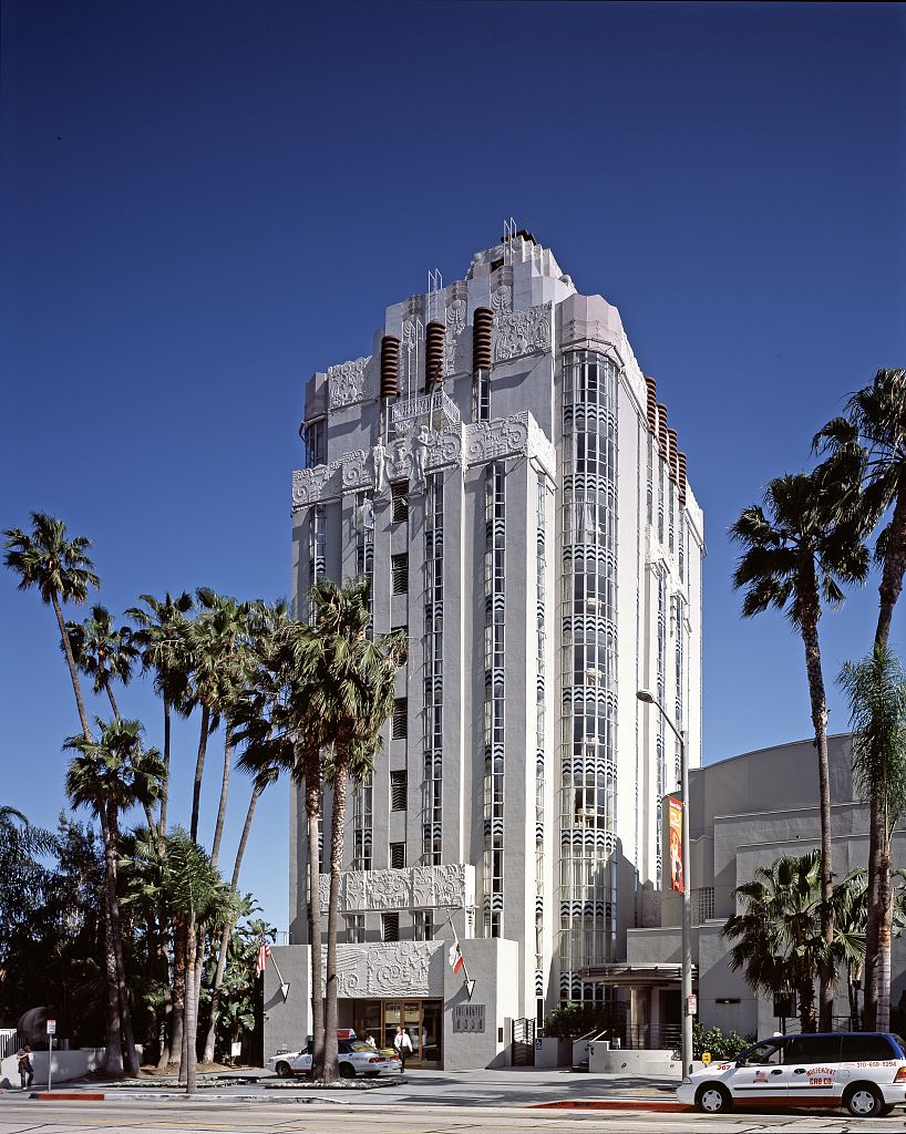
February 5, 2003 205 E. Broadway
33°46′09″N 118°11′24″W / 33.769167°N 118.19°WLong Beach 77 Miltimore House March 24, 1972 1301 S. Chelten Way
34°06′41″N 118°08′30″W / 34.111389°N 118.141667°WSouth Pasadena 78 Montebello Woman's Club March 31, 1995 201 S. Park Ave.
34°00′35″N 118°06′17″W / 34.009722°N 118.104722°WMontebello 79 Mount Lowe Railway 
January 6, 1993 N of Altadena in Angeles NF
34°12′40″N 118°07′14″W / 34.211111°N 118.120556°WAltadena 80 National Bank of Whittier Building 
December 30, 1982 13002 E. Philadelphia St.
33°58′44″N 118°02′10″W / 33.978889°N 118.036111°WWhittier 81 North Harper Avenue Historic District June 28, 1996 Roughly, N. Harper Ave. between Fountain and De Longpre Aves.
34°05′42″N 118°22′04″W / 34.095°N 118.367778°WWest Hollywood 82 Oaklawn Bridge and Waiting Station 
July 16, 1973 Between Oaklawn and Fair Oaks Aves.
34°07′08″N 118°09′08″W / 34.118889°N 118.152222°WSouth Pasadena 83 The Oaks April 6, 1978 250 N. Primrose Ave.
34°09′22″N 118°00′07″W / 34.156111°N 118.001944°WMonrovia 84 Pacific Electric Railroad Bridge 
July 13, 1989 Torrance Blvd. and Bow St.
33°50′15″N 118°18′39″W / 33.8375°N 118.310833°WTorrance 85 Pacific Electric Railway Company Substation No. 8 
November 9, 1977 2245 N. Lake Ave.
34°11′04″N 118°07′55″W / 34.184444°N 118.131944°WAltadena 86 Paddison Ranch Buildings June 23, 1978 11951 Imperial Hwy.
33°55′05″N 118°04′35″W / 33.918056°N 118.076389°WNorwalk 87 Padua Hills Theatre January 23, 1998 4467 Via Padova
34°09′04″N 117°42′03″W / 34.151111°N 117.700833°WClaremont 88 Ygnacio Palomares Adobe 
March 24, 1971 Corner of Arrow Hwy. and Orange Grove Ave.
34°05′30″N 117°44′30″W / 34.091667°N 117.741667°WPomona 89 Palos Verdes Public Library and Art Gallery 
April 7, 1995 2400 Via Campesina
33°47′58″N 118°23′13″W / 33.799444°N 118.386944°WPalos Verdes Estates 90 Parkhurst Building 
November 17, 1978 185 Pier Ave.
33°59′55″N 118°28′45″W / 33.998611°N 118.479167°WSanta Monica 91 Patio del Moro 
September 11, 1986 8225-8237 Fountain Ave.
34°05′41″N 118°22′03″W / 34.094722°N 118.3675°WWest Hollywood 92 John Carlton Pegler House October 20, 1988 419 E. Highland Ave.
34°09′56″N 118°02′44″W / 34.165556°N 118.045556°WSierra Madre 93 Phillips Mansion 
November 6, 1974 2640 W. Pomona Blvd.
34°03′22″N 117°47′44″W / 34.056111°N 117.795556°WPomona 94 Pio Pico Casa 
June 19, 1973 6003 Pioneer Blvd.
33°59′37″N 118°04′51″W / 33.993611°N 118.080833°WWhittier 95 Pitzer House 
September 4, 1986 4353 N. Towne
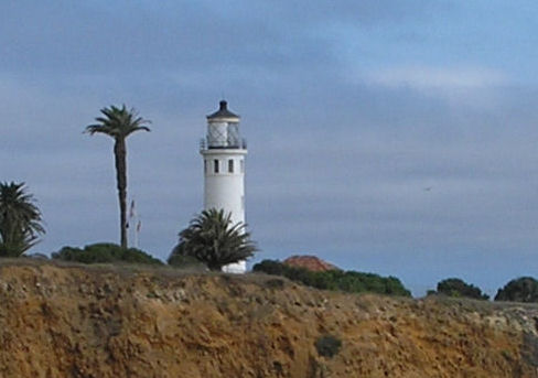
34°07′17″N 117°44′10″W / 34.121389°N 117.736111°WClaremont 96 Point Vicente Light 
October 31, 1980 Rancho Palos Verdes
33°44′31″N 118°24′31″W / 33.741944°N 118.408611°WLong Beach 97 Pomona City Stables 
October 6, 2004 636 W. Monterey Ave.
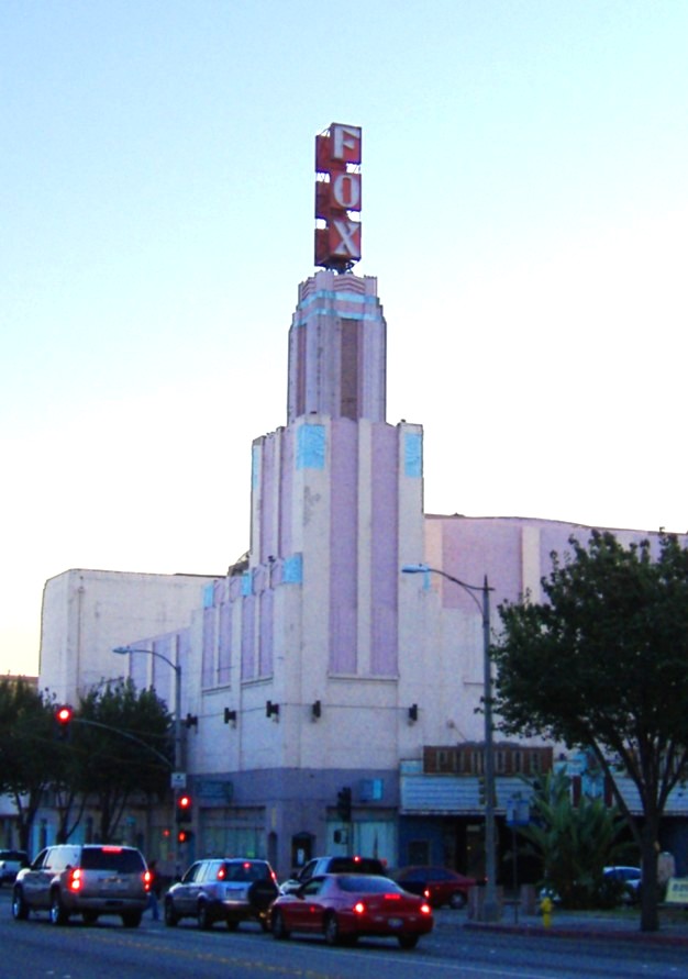
34°03′33″N 117°45′31″W / 34.059167°N 117.758611°WPomona 98 Pomona Fox Theater 
February 19, 1982 102-144 3rd St.
34°03′24″N 117°44′59″W / 34.056667°N 117.749722°WPomona 99 Pomona YMCA Building 
March 6, 1986 350 N. Garey Ave.
34°03′36″N 117°44′56″W / 34.06°N 117.748889°WPomona 100 Puvunga Indian Village Sites 
January 21, 1974 Address Restricted Long Beach 101 Queen Anne Cottage and Coach Barn October 31, 1980 301 N. Baldwin Ave.
34°08′27″N 118°03′09″W / 34.140833°N 118.0525°WArcadia 102 Rancho Los Alamitos 
July 7, 1981 6400 Bixby Hill Rd.
33°46′38″N 118°06′19″W / 33.777222°N 118.105278°WLong Beach 103 Redondo Beach Original Townsite Historic District 
June 30, 1988 N. Gertruda Ave., Carnelian St., N. Guadalupe Ave. and Diamond St.
33°50′48″N 118°23′08″W / 33.846667°N 118.385556°WRedondo Beach 104 Redondo Beach Public Library 
March 12, 1981 309 Esplanade St.
33°50′16″N 118°23′20″W / 33.837778°N 118.388889°WRedondo Beach 105 Jennie A. Reeve House June 21, 1984 4260 Country Club Dr.
33°50′03″N 118°11′41″W / 33.834167°N 118.194722°WLong Beach 106 Rialto Theatre 
May 24, 1978 1019-1023 Fair Oaks Ave.
34°06′50″N 118°08′59″W / 34.113889°N 118.149722°WSouth Pasadena 107 Ridge Route 
September 25, 1997 Along Old Ridge Rte., roughly bounded by Sandberg and Canton Canyon
34°37′56″N 118°41′49″W / 34.632222°N 118.696944°WCastaic 108 James C. Rives House May 22, 1978 10921 S. Paramount Blvd.
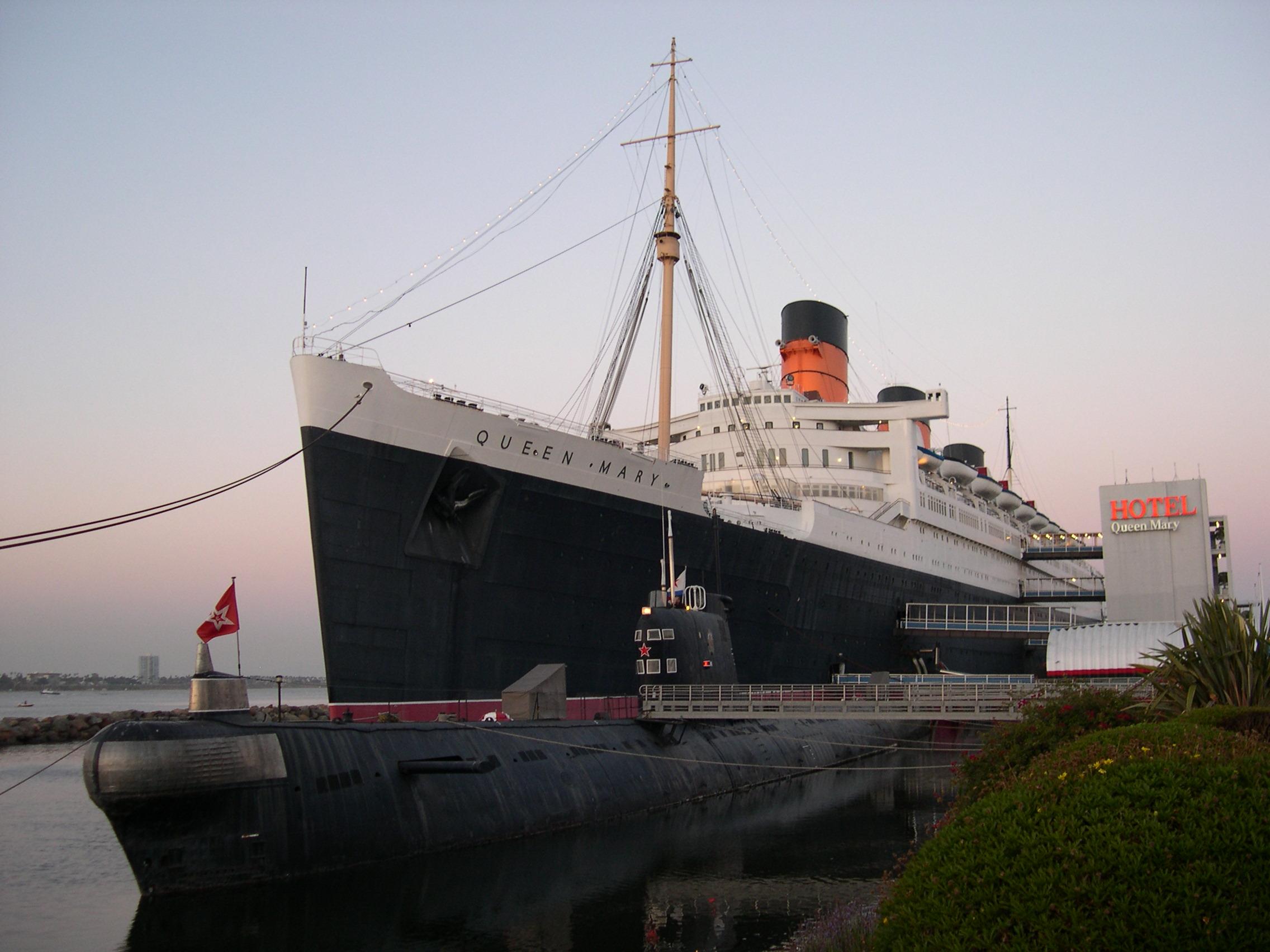
33°56′42″N 118°08′10″W / 33.945°N 118.136111°WDowney 109 RMS Queen Mary 
April 15, 1993 Pier J, 1126 Queensway Hwy.
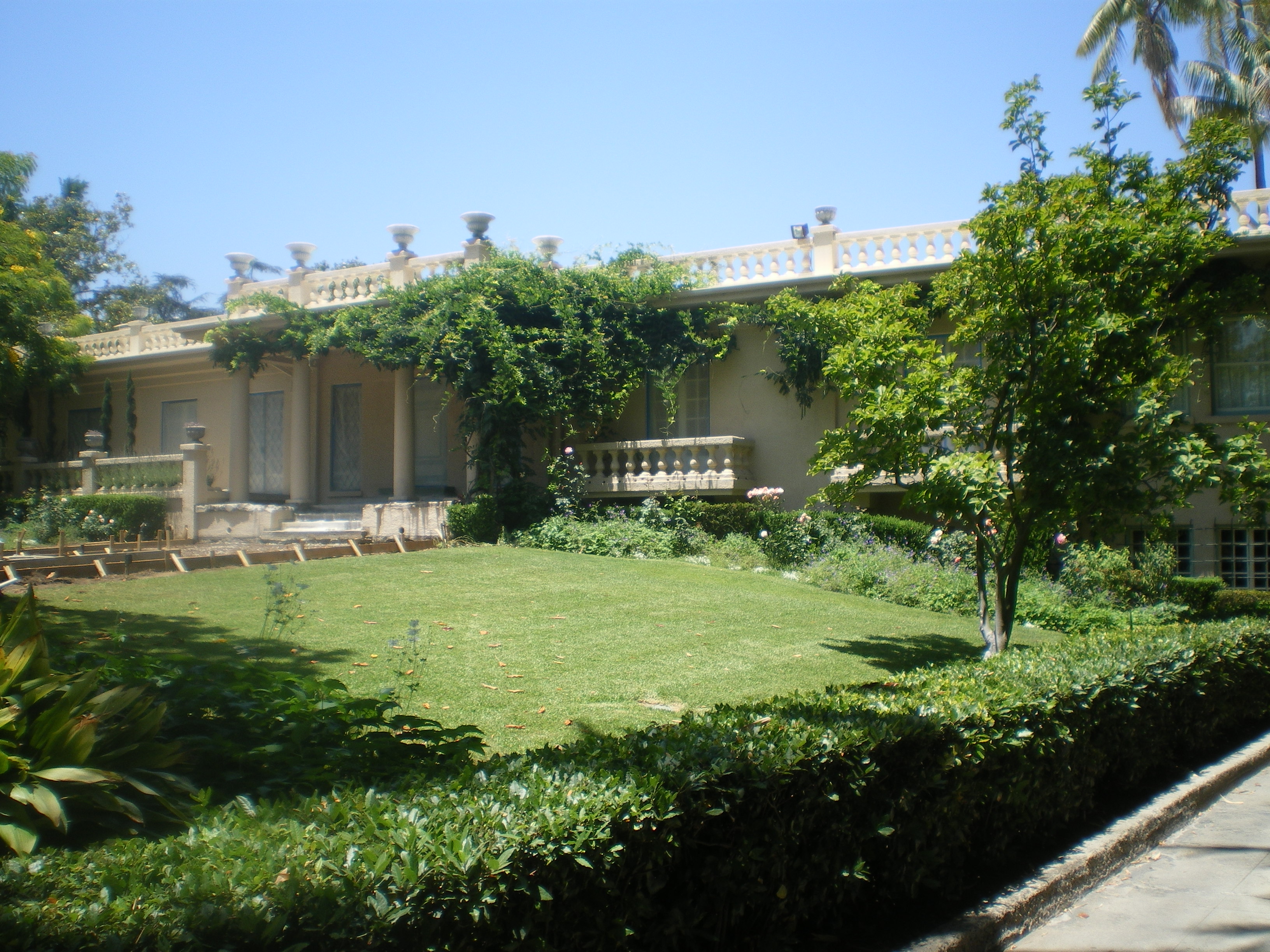
33°45′10″N 118°11′23″W / 33.752778°N 118.189722°WLong Beach 110 Virginia Robinson Estate 
November 15, 1978 1008 Elden Way
34°05′11″N 118°25′00″W / 34.086389°N 118.416667°WBeverly Hills public gardens & house museum 111 Ronda 
February 28, 1985 1400-1414 Havenhurst Dr.
34°05′48″N 118°21′59″W / 34.096667°N 118.366389°WWest Hollywood 112 John A. Rowland House 
July 16, 1973 16021 E. Gale Ave.
34°00′39″N 117°57′24″W / 34.010833°N 117.956667°WIndustry a round little house from 1855 113 Russian Village District 
December 28, 1978 290-370 S. Mills Ave. and 480 Cucamonga Ave.
34°05′30″N 117°42′17″W / 34.091667°N 117.704722°WClaremont 114 Saddle Rock Ranch Pictograph Site February 12, 1982 Address Restricted Malibu 115 San Dimas Hotel 
March 16, 1972 121 San Dimas Ave.
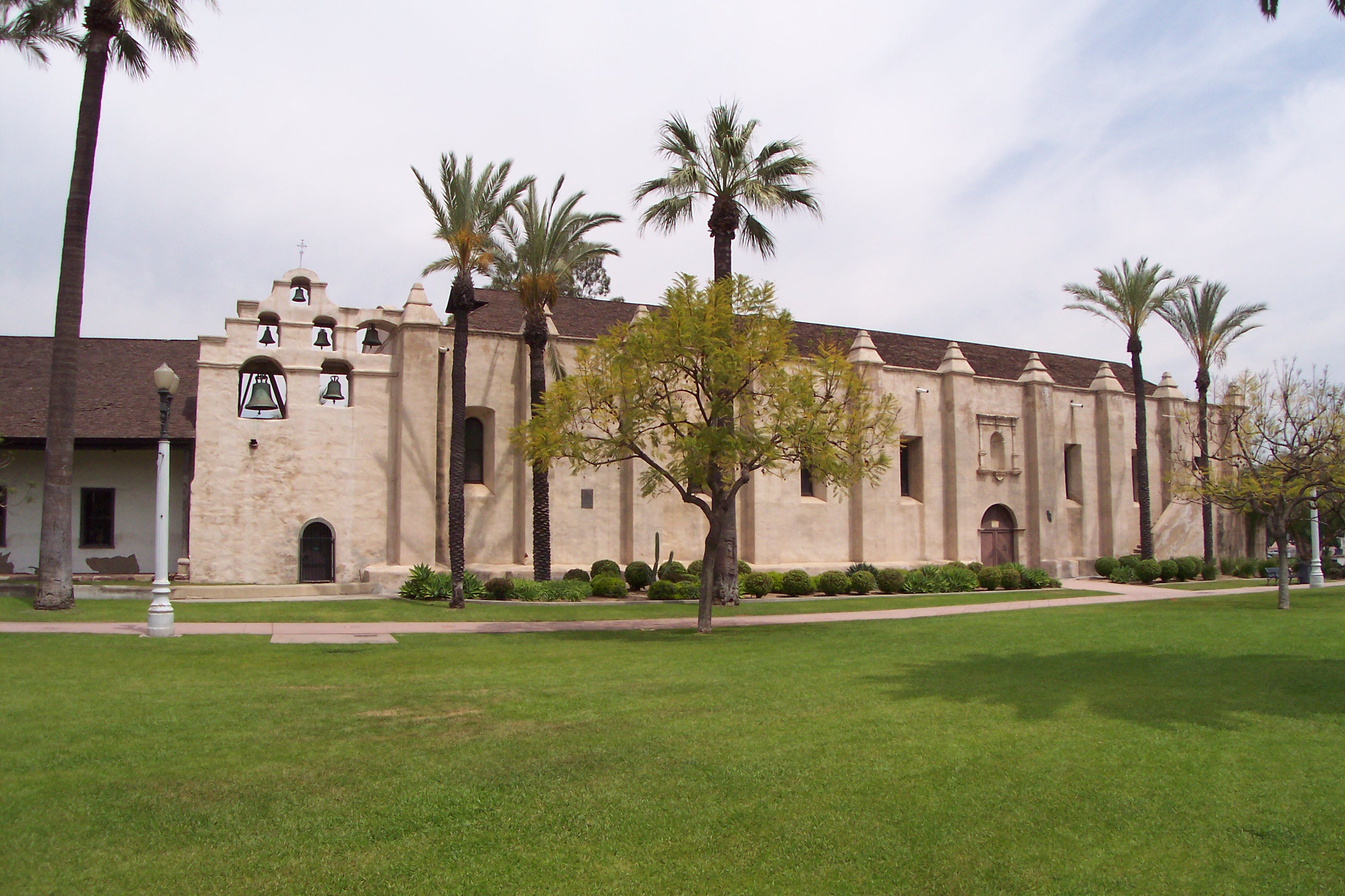
34°06′27″N 117°48′23″W / 34.1075°N 117.806389°WSan Dimas 116 San Gabriel Mission 
May 6, 1971 Junipero St. and W. Mission Dr.
34°05′52″N 118°06′22″W / 34.097778°N 118.106111°WSan Gabriel 117 San Rafael Rancho December 12, 1976 Bonita Dr.
34°10′49″N 118°13′55″W / 34.180278°N 118.231944°WGlendale 118 Santa Monica Looff Hippodrome 
February 27, 1987 276 Santa Monica Pier
34°00′36″N 118°29′43″W / 34.01°N 118.495278°WSanta Monica 119 R. M. Schindler House 
July 14, 1971 833 N. Kings Rd.
34°05′11″N 118°22′16″W / 34.086389°N 118.371111°WWest Hollywood 120 Scripps College for Women 
September 20, 1984 Columbia and 10th St.
34°06′18″N 117°42′30″W / 34.105°N 117.708333°WClaremont 121 Scripps Hall July 28, 1999 209 E. Mariposa St.
34°11′34″N 118°08′38″W / 34.192778°N 118.143889°WAltadena 122 Second Church of Christ Scientist 
April 1, 2005 655 Cedar Ave.
33°44′55″N 118°11′35″W / 33.748611°N 118.193056°WLong Beach 123 Upton Sinclair House 
November 11, 1971 464 N. Myrtle Ave.
34°09′44″N 118°00′00″W / 34.162222°N 118.0°WMonrovia 124 South Pasadena Historic District 
July 21, 1982 Roughly bounded by Mission and El Centro Sts., and Fairview and Meridian Aves.
34°07′01″N 118°09′23″W / 34.116944°N 118.156389°WSouth Pasadena 125 Southern Pacific Railroad Depot, Whittier 
March 29, 2005 7333 Greenleaf Ave.
33°58′28″N 118°02′15″W / 33.974444°N 118.0375°WWhittier 126 Sovereign Hotel 
October 24, 1997 205 Washington Ave.
34°01′13″N 118°30′07″W / 34.020278°N 118.501944°WSanta Monica 127 Standard Oil Building 
June 9, 1980 7257 Bright Ave.
33°58′33″N 118°02′08″W / 33.975833°N 118.035556°WWhittier 128 Stevens House October 9, 2009 23524 Malibu Colony Rd.
34°01′55″N 118°41′14″W / 34.031839°N 118.687214°WMalibu 129 Charles E. Straight House 
July 8, 1992 4333 Emerald Ave.
34°07′03″N 117°46′04″W / 34.1175°N 117.767778°WLa Verne 130 Sunset Tower 
May 30, 1980 8358 Sunset Blvd.
34°05′42″N 118°22′17″W / 34.095°N 118.371389°WWest Hollywood 131 Sweetser Residence 
September 5, 1985 417 E. Beryl St.
33°50′57″N 118°23′16″W / 33.849167°N 118.387778°WRedondo Beach 132 Temple Mansion 
December 2, 1974 15415 E. Don Julian Rd.
34°01′12″N 117°57′53″W / 34.02°N 117.964722°WIndustry 133 Torrance School October 13, 1983 2200 W. Carson
33°49′41″N 118°19′06″W / 33.828056°N 118.318333°WTorrance 134 Tuna Club of Avalon April 2, 1991 100 St. Catherine Way, Catalina Island
33°20′44″N 118°19′35″W / 33.345556°N 118.326389°WAvalon 135 US Post Office-Beverly Hills Main 
January 11, 1985 469 N. Crescent Dr.
34°04′19″N 118°24′08″W / 34.071944°N 118.402222°WBeverly Hills 136 US Post Office-Burbank Downtown Station 
January 11, 1985 125 E. Olive Ave.
34°10′48″N 118°18′34″W / 34.18°N 118.309444°WBurbank 137 US Post Office-Glendale Main 
January 11, 1985 313 E. Broadway St.
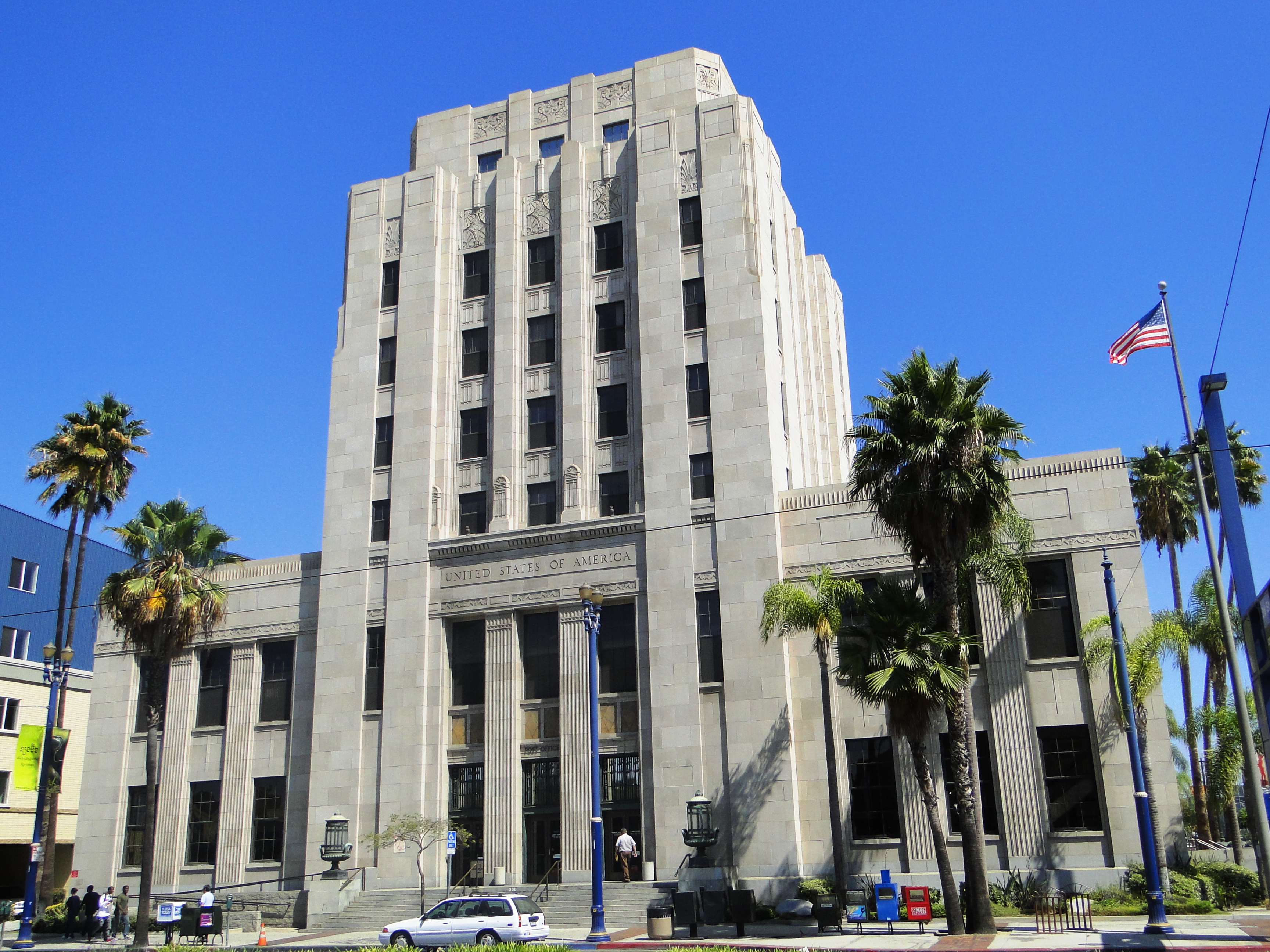
34°08′54″N 118°15′07″W / 34.148333°N 118.251944°WGlendale 138 US Post Office-Long Beach Main 
January 11, 1985 300 Long Beach Blvd.
33°46′22″N 118°11′20″W / 33.772778°N 118.188889°WLong Beach 139 Vasquez Rocks 
June 22, 1972 Agua Dulce Rd.
34°29′07″N 118°19′28″W / 34.485278°N 118.324444°WAgua Dulce 140 Villa Francesca October 2, 1986 1 Peppertree Dr.
33°44′26″N 118°22′09″W / 33.740556°N 118.369167°WRancho Palos Verdes 141 Villa Riviera 
July 25, 1996 800 E. Ocean Blvd.
33°45′59″N 118°10′54″W / 33.766389°N 118.181667°WLong Beach 142 Washington Building 
May 28, 1991 9720-9732 Washington Blvd.
34°01′19″N 118°23′44″W / 34.021944°N 118.395556°WCulver City 143 Wayfarers Chapel 
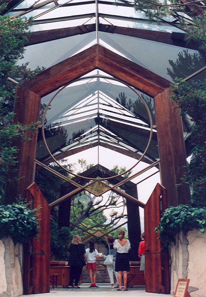
July 11, 2005 5755 Palos Verdes Dr. S
33°44′41″N 118°22′33″W / 33.744722°N 118.375833°WRancho Paolos Verdes Lloyd Wright 144 Henry Weaver House 
December 27, 1989 142 Adelaide Dr.
34°01′40″N 118°30′47″W / 34.027778°N 118.513056°WSanta Monica 145 Well No. 4, Pico Canyon Oil Field 
November 13, 1966 9.5 mi. N of San Fernando, W of U.S. 99
34°22′10″N 118°37′49″W / 34.369444°N 118.630278°WMentryville 146 The Willmore 
May 20, 1999 315 W. Third St.
33°46′15″N 118°11′40″W / 33.770833°N 118.194444°WLong Beach 147 Woman's Club of Redondo Beach 
April 19, 1984 400 S. Broadway
33°50′12″N 118°23′06″W / 33.836667°N 118.385°WRedondo Beach 148 Woodbury-Story House 
December 30, 1993 2606 N. Madison Ave.
34°11′21″N 118°08′00″W / 34.189167°N 118.133333°WAltadena 149 Workman Adobe 
November 20, 1974 15415 Don Julian Rd.
34°01′12″N 117°57′51″W / 34.02°N 117.964167°WIndustry 150 Workman Family Cemetery November 20, 1974 15415 E. Don Julian Rd.
34°01′07″N 117°57′45″W / 34.018611°N 117.9625°WIndustry 151 Lloyd Wright Home and Studio 
April 6, 1987 858 N. Doheny Dr.
34°05′12″N 118°23′37″W / 34.086667°N 118.393611°WWest Hollywood Lloyd Wright 152 William Wrigley, Jr. Summer Cottage August 15, 1985 76 Wrigley Rd.
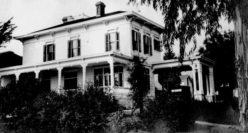
33°20′28″N 118°19′13″W / 33.341111°N 118.320278°WAvalon 153 Wynyate April 24, 1973 851 Lyndon St.
34°06′39″N 118°09′28″W / 34.110833°N 118.157778°WSouth Pasadena See also
- National Register of Historic Places listings in Los Angeles
- National Register of Historic Places listings in Pasadena, California
- National Register of Historic Places listings in California
References
- ^ The latitude and longitude information provided in this table was derived originally from the National Register Information System, which has been found to be fairly accurate for about 99% of listings. For about 1% of NRIS original coordinates, experience has shown that one or both coordinates are typos or otherwise extremely far off; some corrections may have been made. A more subtle problem causes many locations to be off by up to 150 yards, depending on location in the country: most NRIS coordinates were derived from tracing out latitude and longitudes off of USGS topographical quadrant maps created under the North American Datum of 1927, which differs from the current, highly accurate WGS84 GPS system used by Google maps. Chicago is about right, but NRIS longitudes in Washington are higher by about 4.5 seconds, and are lower by about 2.0 seconds in Maine. Latitudes differ by about 1.0 second in Florida. Some locations in this table may have been corrected to current GPS standards.
- ^ "National Register of Historic Places: Weekly List Actions". National Park Service, United States Department of the Interior. Retrieved on November 10, 2011.
- ^ Numbers represent an ordering by significant words. Various colorings, defined here, differentiate National Historic Landmark sites and National Register of Historic Places Districts from other NRHP buildings, structures, sites or objects.
- ^ "National Register Information System". National Register of Historic Places. National Park Service. . http://nrhp.focus.nps.gov/natreg/docs/All_Data.html.
- ^ "NRHP Nomination Form: Hafley House". January 30, 2011. http://www.parks.ca.gov/pages/1067/files/hafley%20house.pdf. Retrieved August 2, 2011.
U.S. National Register of Historic Places Topics Lists by states Alabama • Alaska • Arizona • Arkansas • California • Colorado • Connecticut • Delaware • Florida • Georgia • Hawaii • Idaho • Illinois • Indiana • Iowa • Kansas • Kentucky • Louisiana • Maine • Maryland • Massachusetts • Michigan • Minnesota • Mississippi • Missouri • Montana • Nebraska • Nevada • New Hampshire • New Jersey • New Mexico • New York • North Carolina • North Dakota • Ohio • Oklahoma • Oregon • Pennsylvania • Rhode Island • South Carolina • South Dakota • Tennessee • Texas • Utah • Vermont • Virginia • Washington • West Virginia • Wisconsin • WyomingLists by territories Lists by associated states Other Categories:- National Register of Historic Places listings in Los Angeles County, California
- History of Los Angeles County, California
- Los Angeles County, California
- National Register of Historic Places in California by county
- Landmarks in Los Angeles, California
- National Historic Landmarks in California
-


Wikimedia Foundation. 2010.