- National Register of Historic Places listings in the United States Virgin Islands
-
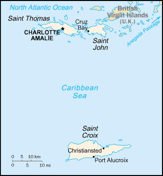
 Map of the United States Virgin Islands
This is a list of the buildings, sites, districts, and objects listed on the National Register of Historic Places in the United States Virgin Islands. There are currently 86 listed sites spread across 16 of the 3 islands/districts of the United States Virgin Islands. Four sites are additionally designated National Historic Landmarks and two others as National Historic Sites.
-
- This National Park Service list is complete through NPS recent listings posted November 10, 2011.[1]
Numbers of listings
The following are approximate tallies of current listings in the United States Virgin Islands on the National Register of Historic Places. These counts are based on entries in the National Register Information Database as of April 24, 2008[2] and new weekly listings posted since then on the National Register of Historic Places web site.[3] There are frequent additions to the listings and occasional delistings and the counts here are not official. Also, the counts in this table exclude boundary increase and decrease listings which modify the area covered by an existing property or district and which carry a separate National Register reference number.
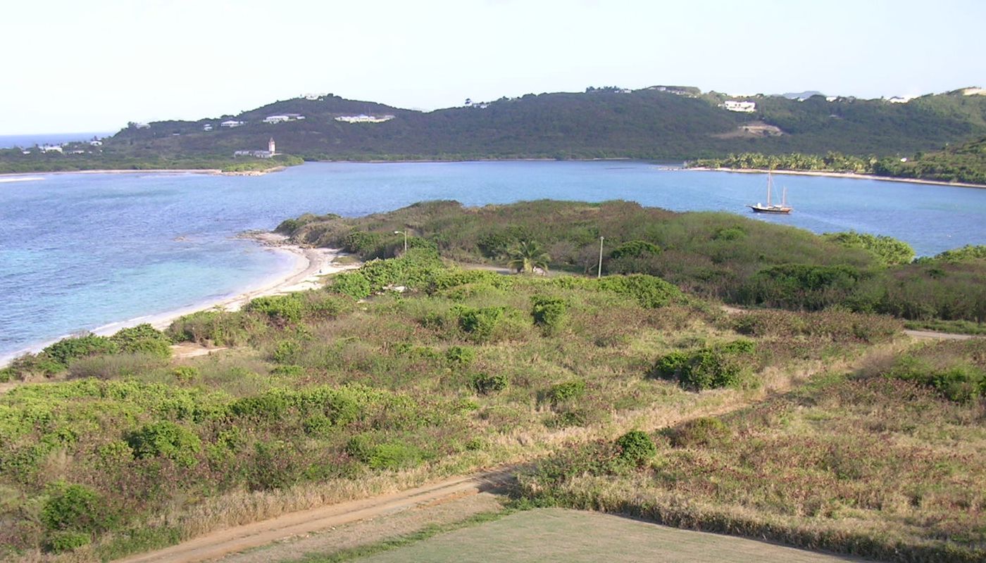
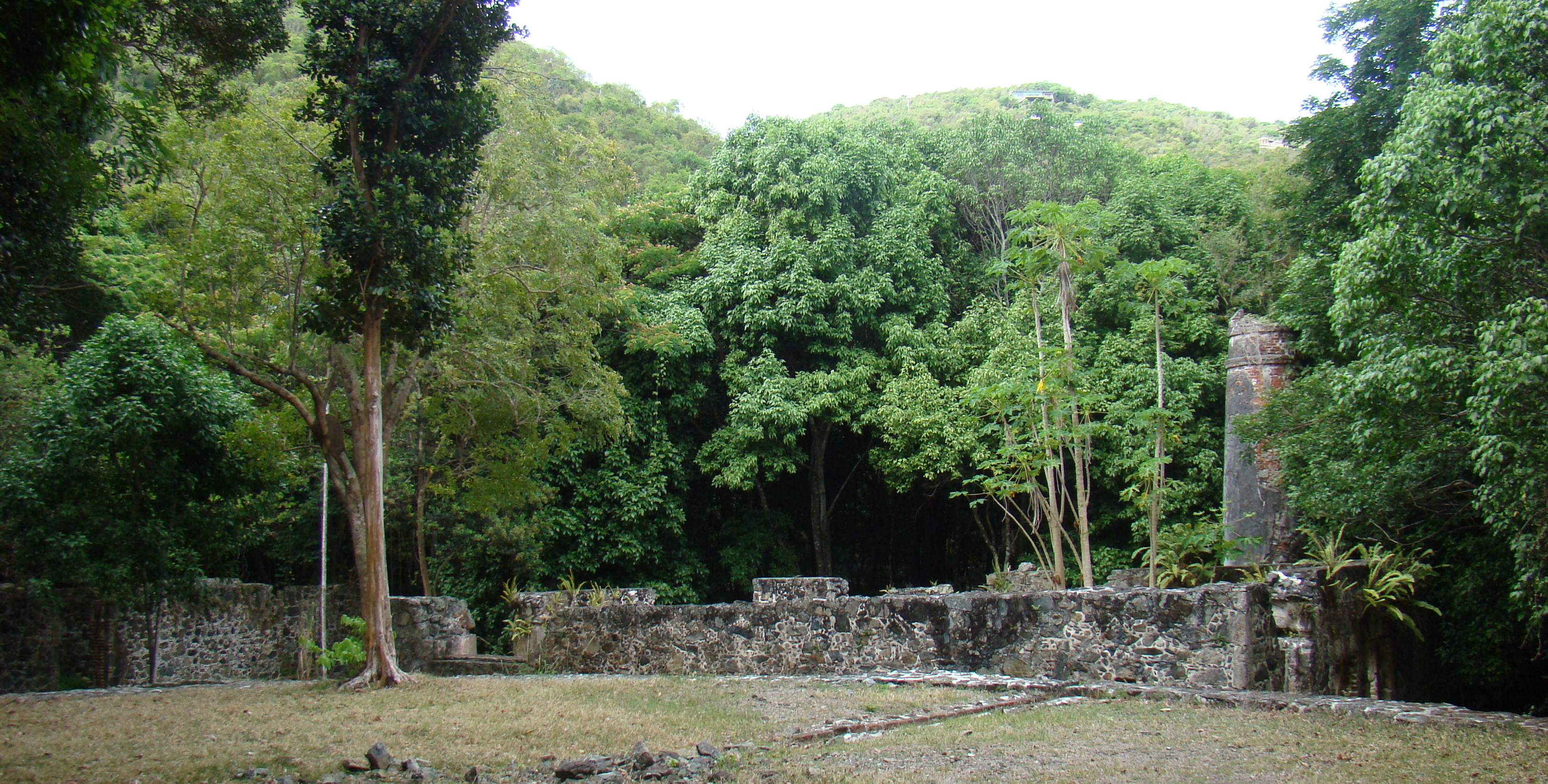
District # of Sites 1 Saint Croix 39 2 Saint John 25 3 Saint Thomas 22 Total: 86 Saint Croix
Landmark name Image Date listed Location Subdistrict Summary 1 Aklis Archeological Site July 1, 1976 Address Restricted Frederiksted 2 Bethlehem Middle Works Historic District July 6, 1988 King's Quarter
17°43′3.5″N 64°47′33″W / 17.717639°N 64.7925°WSouthcentral 3 Christiansted Historic District July 30, 1976 Roughly bounded by Christiansted Harbor, New, Peter's Farm Hospital, and West Streets
17°44′46″N 64°42′16″W / 17.74611°N 64.70444°WChristiansted 4 Christiansted National Historic Site October 15, 1966 Bounded by King, Queen, and Queens Cross Streets and Christiansted Harbor
17°44′56″N 64°42′8″W / 17.74889°N 64.70222°WChristiansted 5 Coakley Bay Estate July 23, 1976 East of Christiansted
17°45′41.5″N 64°38′27″W / 17.761528°N 64.64083°WEast End 6 Columbus Landing Site 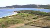
October 15, 1966 East of Greig Hill on Salt River Bay East End 7 Danish West India and Guinea Company Warehouse October 9, 1974 Church and Company Streets
17°44′55.5″N 64°42′9″W / 17.74875°N 64.7025°WChristiansted 8 Diamond School July 1, 1976 West of Christiansted on Centerline Road
17°42′46.5″N 64°49′47″W / 17.712917°N 64.82972°WSouthcentral 9 Estate Butler's Bay August 25, 1978 North of Frederiksted
17°44′56.5″N 64°53′32″W / 17.749028°N 64.89222°WNorthwest 10 Estate Grove Place July 17, 1978 4 miles (6.4 km) east of Frederiksted off Centerline Road
17°40′43.5″N 64°49′23″W / 17.67875°N 64.82306°WNorthwest 11 Estate Hogansborg February 17, 1978 East of Frederiksted off Centerline Road
17°42′39.5″N 64°50′44″W / 17.710972°N 64.84556°WNorthwest 12 Estate Judith's Fancy July 17, 1978 4 miles (6.4 km) northwest of Christiansted
17°46′41.5″N 64°44′44.5″W / 17.778194°N 64.745694°WSion Farm 13 Estate La Reine November 24, 1980 20 Kings Quarter and 19 Queens Quarter
17°44′9.5″N 64°46′19″W / 17.735972°N 64.77194°WNorthcentral 14 Estate Little Princess June 9, 1980 Northwest of Christiansted
17°45′35.5″N 64°43′31″W / 17.759861°N 64.72528°WSion Farm 15 Estate Mount Victory February 17, 1978 Northeast of Frederiksted
17°45′13.5″N 64°52′5″W / 17.75375°N 64.86806°WNorthwest 16 Estate Prosperity February 17, 1978 North of Frederiksted
17°43′42.5″N 64°52′53″W / 17.728472°N 64.88139°WNorthwest 17 Estate Saint George Historic District October 24, 1986 Prince Quarter
17°43′4.5″N 64°49′48.5″W / 17.717917°N 64.830139°WNorthwest 18 Estate St. John June 9, 1978 3 miles (4.8 km) northwest of Christiansted
17°45′57.5″N 64°44′48″W / 17.765972°N 64.74667°WSion Farm 19 Fair Plain Archeological District September 29, 1976 Address Restricted Christiansted 20 Fairplain Historic and Archeological District July 6, 1988 Address Restricted Christiansted 21 Frederiksted Historic District 
August 9, 1976 Roughly bounded by Fisher Street, the cemetery, and Fort Frederik
17°42′44″N 64°52′53″W / 17.71222°N 64.88139°WFrederiksted 22 Friedensfeld Midlands Moravian Church and Manse July 1, 1976 West of Christiansted
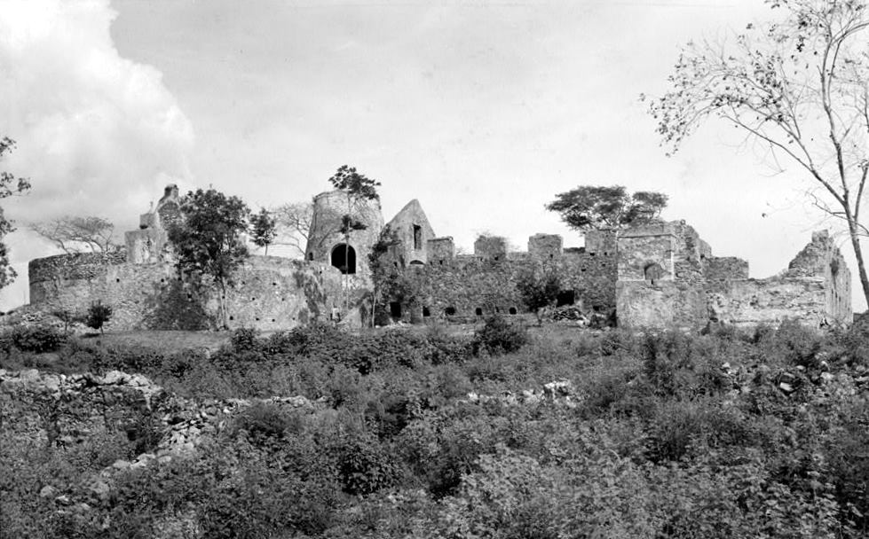
17°44′53.5″N 64°46′48″W / 17.748194°N 64.78°WNorthcentral 23 Friedensthal Mission August 25, 1978 Southwest of Christiansted
17°44′38.5″N 64°42′35″W / 17.744028°N 64.70972°WChristiansted 24 Ft. Frederik of US Virgin Islands 
September 25, 1997 South of junction of Mahogany Road and U.S. Virgin Island Highway 631, north end of Frederiksted
17°42′55″N 64°53′1″W / 17.71528°N 64.88361°WFrederiksted 25 Great Pond Archeological Site July 12, 1976 Address Restricted Christiansted 26 Green Kay July 19, 1976 East of Christiansted
17°45′39.5″N 64°38′13″W / 17.760972°N 64.63694°WEast End 27 La Grande Princesse School July 12, 1976 Northeast of Christiansted
17°45′29.5″N 64°43′51″W / 17.758194°N 64.73083°WSion Farm 28 Little La Grange October 22, 1976 Northeast of Frederiksted
17°43′47.5″N 64°51′54″W / 17.729861°N 64.865°WNorthwest 29 Lower Granard Archeological District July 1, 1976 Address Restricted Christiansted 30 Prosperity Archeological Site July 12, 1976 Address Restricted Frederiksted 31 Richmond Prison Detention and Workhouse February 14, 1978 West of Christiansted
17°44′53.5″N 64°42′45″W / 17.748194°N 64.7125°WChristiansted 32 River Archeological Site July 1, 1976 Address Restricted Frederiksted 33 Salt River Bay National Historic Site and Ecological Preserve February 24, 1992 2100 Church Street
17°46′52″N 64°45′23″W / 17.78111°N 64.75639°WChristiansted 34 Sion Hill 
July 19, 1976 West of Christiansted
17°44′34.5″N 64°44′41″W / 17.742917°N 64.74472°WSion Farm 35 Slob Historic District November 12, 1987 King's Quarter
17°43′54″N 64°46′16″W / 17.73167°N 64.77111°WSion Farm 36 St. Georges Archeological Site September 29, 1976 Address Restricted Frederiksted 37 Strawberry Hill Historic District October 2, 1987 Queen's Quarter Sion Farm 38 Upper Salt River Archeological District September 1, 1976 Address Restricted Christiansted 39 Whim 
July 30, 1976 1.7 miles (2.7 km) southeast of Frederiksted on Centerline Road
17°42′9.5″N 64°51′47″W / 17.702639°N 64.86306°WSouthwest Saint John
Landmark name Image Date listed Location Subdistrict Summary 1 Annaberg Historic District 
July 23, 1981 Northwest of Coral Bay, Leinster Bay
18°21′53″N 64°44′18″W / 18.36472°N 64.73833°WCentral 2 Brown Bay Plantation Historic District July 23, 1981 North of Palestina
18°21′47″N 64°42′25.5″W / 18.36306°N 64.707083°WCentral Virgin Islands National Park MRA 3 Catherineberg-Jockumsdahl-Herman Farm 
March 30, 1978 East of Cruz Bay
18°20′49″N 64°45′39″W / 18.34694°N 64.76083°WCentral Virgin Islands National Park MRA 4 Cinnamon Bay Plantation 
July 11, 1978 Northeast of Cruz Bay on Cinnamon Bay
18°21′15″N 64°45′15″W / 18.35417°N 64.75417°WCentral Virgin Islands National Park MRA 5 Congo Cay Archeological District December 1, 1978 Address Restricted Cruz Bay Virgin Islands National Park MRA 6 Dennis Bay Historic District July 23, 1981 Northeast of Cruz Bay off North Shore Road
18°21′15″N 64°46′33″W / 18.35417°N 64.77583°WCentral Virgin Islands National Park MRA 7 Emmaus Moravian Church and Manse November 7, 1977 West of Palestina
18°21′1″N 64°42′48″W / 18.35028°N 64.71333°WCoral Bay 8 Enighed July 1, 1976 Cruz Bay Quarter
18°19′54″N 64°47′30″W / 18.33167°N 64.79167°WCruz Bay 9 Estate Beverhoudt August 29, 1978 1.5 miles (2.4 km) east of Cruz Bay off Center Line Road
18°20′27″N 64°46′19″W / 18.34083°N 64.77194°WCentral 10 Estate Carolina Sugar Plantation July 19, 1976 West of Coral Bay on King Hill Road
18°20′58″N 64°43′7″W / 18.34944°N 64.71861°WCoral Bay 11 Fortsberg September 1, 1976 Southeast of Coral Bay
18°20′45″N 64°42′20″W / 18.34583°N 64.70556°WCoral Bay 12 Hermitage Plantation Historic District July 23, 1981 East End Road, Hurricane Hole
18°21′32″N 64°41′59″W / 18.35889°N 64.69972°WCentral Virgin Islands National Park MRA 13 HMS Santa Monica February 17, 1978 Address Restricted Coral Bay 14 Jossie Gut Historic District July 23, 1981 West of Coral Bay off Center Line Road, Reef Bay
18°20′32″N 64°44′25″W / 18.34222°N 64.74028°WCeentral Virgin Islands National Park MRA 15 L'Esperance Historic District July 23, 1981 East of Cruz Bay off Center Line Road, Reef Bay
18°20′33″N 64°45′30″W / 18.3425°N 64.75833°WCentral Virgin Islands National Park MRA 16 Lameshur Plantation June 23, 1978 East of Cruz Bay on Little Lameshur Bay
18°20′33″N 64°45′30″W / 18.3425°N 64.75833°WCentral Virgin Islands National Park MRA 17 Liever Marches Bay Historic District July 23, 1981 East of Brown Bay
18°21′16″N 64°42′4″W / 18.35444°N 64.70111°WCentral Virgin Islands National Park MRA 18 Lind Point Fort July 23, 1981 Northwest of Cruz Bay
18°20′13″N 64°47′50″W / 18.33694°N 64.79722°WCentral Virgin Islands National Park MRA 19 Mary Point Estate 
May 22, 1978 Northeast of Cruz Bay
18°22′6″N 64°44′29″W / 18.36833°N 64.74139°WCentral Virgin Islands National Park MRA 20 More Hill Historic District July 23, 1981 Off East End Road
18°21′40″N 64°41′37″W / 18.36111°N 64.69361°WEast End Virgin Islands National Park MRA 21 Petroglyph Site July 7, 1982 Reef Bay Central 22 Reef Bay Great House Historic District July 23, 1981 West of Bordeaux, Reef Bay
18°19′55.5″N 64°44′23″W / 18.332083°N 64.73972°WCentral Virgin Islands National Park MRA 23 Reef Bay Sugar Factory Historic District 
July 23, 1981 East of Cruz Bay, Reef Bay
18°19′31″N 64°44′40″W / 18.32528°N 64.74444°WCentral Virgin Islands National Park MRA 24 Rustenberg Plantation South Historic District July 23, 1981 West of Coral Bay off Center Line Road, Cinnamon Bay
18°20′42″N 64°44′59″W / 18.345°N 64.74972°WCentral Virgin Islands National Park MRA 25 Trunk Bay Sugar Factory July 23, 1981 Northeast of Cruz Bay on North Shore Road, Trunk Bay
18°21′35.5″N 64°46′2″W / 18.359861°N 64.76722°WCentral Virgin Islands National Park MRA Saint Thomas
Landmark name Image Date listed Location Subdistrict Summary 1 Bordeaux November 15, 1978 West of Charlotte Amalie
18°21′47″N 65°0′59″W / 18.36306°N 65.01639°WWest End 2 Botany Bay Archeological District July 1, 1976 Address Restricted Charlotte Amalie 3 Charlotte Amalie Historic District July 19, 1976 Roughly bounded by Nytvaer, Berg and Government Hills, Bjebre Gade and St. Thomas Harbor
18°20′42″N 64°55′55″W / 18.345°N 64.93194°WCharlotte Amalie 4 Estate Botany Bay July 30, 1976 West of Charlotte Amalie
18°21′37″N 65°1′53″W / 18.36028°N 65.03139°WWest End 5 Estate Brewers Bay July 31, 1978 2 miles (3.2 km) west of Charlotte Amalie at Brewers Bay
18°20′51″N 64°58′45″W / 18.3475°N 64.97917°WCharlotte Amalie 6 Estate Hafensight February 17, 1978 South of Charlotte Amalie
18°16′56″N 64°55′18″W / 18.28222°N 64.92167°WCharlotte Amalie 7 Estate Neltjeberg February 17, 1978 Northwest of Charlotte Amalie
18°22′13″N 64°57′58″W / 18.37028°N 64.96611°WWest End 8 Estate Niesky August 29, 1978 1.5 miles (2.4 km) west of Charlotte Amalie off Harwood Highway
18°20′19″N 64°57′6″W / 18.33861°N 64.95167°WCharlotte Amalie 9 Estate Perseverance February 17, 1978 West of Charlotte Amalie, Virgin Islands
18°21′18″N 64°59′51″W / 18.355°N 64.9975°WWest End 10 Fort Christian 
May 5, 1977 At Saint Thomas Harbor
18°20′26″N 64°55′47″W / 18.34056°N 64.92972°WCharlotte Amalie Danish fort, the oldest structure in the U.S. Virgin Islands 11 Hamburg-America Shipping Line Administrative Offices October 10, 1978 48B Tolbod Gade
18°20′30″N 64°55′53″W / 18.34167°N 64.93139°WCharlotte Amalie 12 Hassel Island July 19, 1976 South of Charlotte Amalie in Saint Thomas Harbor
18°19′46″N 64°56′8″W / 18.32944°N 64.93556°WCharlotte Amalie 13 Hull Bay Archeological District September 1, 1976 Address Restricted Charlotte Amalie 14 Krum Bay Archeological District August 28, 1976 Address Restricted Charlotte Amalie 15 Mafolie Great House February 17, 1978 North of Charlotte Amalie
18°21′13″N 64°55′42″W / 18.35361°N 64.92833°WNorthside 16 Magens Bay Archeological District July 30, 1976 Address Restricted Charlotte Amalie 17 New Herrnhut Moravian Church October 8, 1976 East of Charlotte Amalie
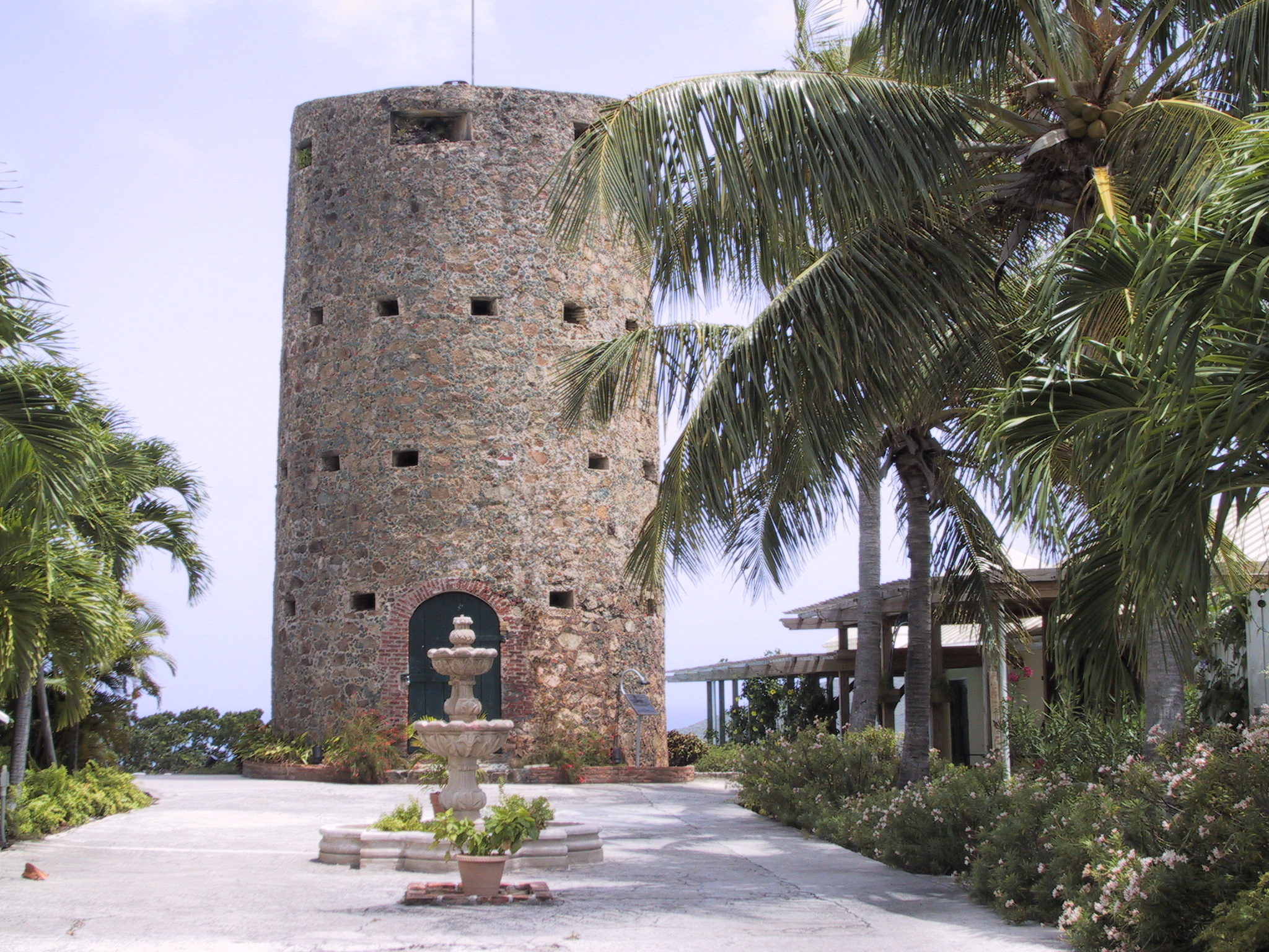
18°20′13″N 64°54′5″W / 18.33694°N 64.90139°WNorthside 18 Skytsborg 
December 20, 1991 39 Donningens Gade
18°20′46″N 64°55′46″W / 18.34611°N 64.92944°WCharlotte Amalie 19 St. Thomas Synagogue 
September 25, 1997 Crystal Gade #16AB, Queens Quarters
18°20′42.5″N 64°19′28″W / 18.345139°N 64.32444°WCharlotte Amalie 20 St. Thomas Synagogue-Beracha Veshalom Vegemiluth Hasadim August 15, 1997 16AB Krystal Gade
18°20′42.5″N 64°19′28″W / 18.345139°N 64.32444°WCharlotte Amalie 21 Tutu Plantation House July 12, 1976 3 miles (4.8 km) northeast of Charlotte Amalie, United States Virgin Islands
18°20′31″N 64°53′8″W / 18.34194°N 64.88556°WTutu 22 Venus Hill February 17, 1978 North of Charlotte Amalie
18°21′12″N 64°55′46″W / 18.35333°N 64.92944°WNorthside See also
References
- ^ "National Register of Historic Places: Weekly List Actions". National Park Service, United States Department of the Interior. Retrieved on November 10, 2011.
- ^ "National Register Information System". National Register of Historic Places. National Park Service. 2008-04-24. http://nrhp.focus.nps.gov/natreg/docs/All_Data.html.
- ^ "National Register of Historic Places: Weekly List Actions". National Park Service. http://www.cr.nps.gov/nr/nrlist.htm. Retrieved January 16, 2009.
U.S. National Register of Historic Places Topics Lists by states Alabama • Alaska • Arizona • Arkansas • California • Colorado • Connecticut • Delaware • Florida • Georgia • Hawaii • Idaho • Illinois • Indiana • Iowa • Kansas • Kentucky • Louisiana • Maine • Maryland • Massachusetts • Michigan • Minnesota • Mississippi • Missouri • Montana • Nebraska • Nevada • New Hampshire • New Jersey • New Mexico • New York • North Carolina • North Dakota • Ohio • Oklahoma • Oregon • Pennsylvania • Rhode Island • South Carolina • South Dakota • Tennessee • Texas • Utah • Vermont • Virginia • Washington • West Virginia • Wisconsin • WyomingLists by territories American Samoa • District of Columbia • Guam • Minor Outlying Islands • Northern Mariana Islands • Puerto Rico • Virgin IslandsLists by associated states Other  Territory of United States Virgin Islands
Topics - Geography
- Economy
- Demographics
- Communications
- Transportation
- History
- Visitor Attractions
Government - Politics
- Governors
- Congressional Delegates
- Senators
- Elections
Cities Islands Parks Categories:- National Register of Historic Places in the United States Virgin Islands
-


Wikimedia Foundation. 2010.