Virgin Islands Coral Reef National Monument
- Virgin Islands Coral Reef National Monument
Infobox_protected_area | name = Virgin Islands Coral Reef National Monument
iucn_category = III
caption =
locator_x = 175
locator_y = 57
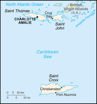
location = Virgin Islands, USA
nearest_city = St John, VI
lat_degrees = 18
lat_minutes = 18
lat_seconds = 22
lat_direction = N
long_degrees = 64
long_minutes = 43
long_seconds = 37
long_direction = W
area = 12,708 (51.42 km²)
established = January 17, 2001
visitation_num =
visitation_year =
governing_body = National Park Service The Virgin Islands Coral Reef National Monument is a U.S. National Monument located off Saint John, Virgin Islands.
The clear waters surrounding Saint John support a diverse and complex system of coral reefs. The health of these reefs is closely tied to its component plants and animals as well as adjacent non-coral marine environments such as sandy bottoms, seagrass beds, and mangrove forests.
Seeking to provide greater protection to the sensitive coral reef resources, President Clinton established the Virgin Islands Coral Reef National Monument on January 17, 2001. The monument includes 12,708 acres (51 km²) of federal submerged lands within the 3 mile (5 km) belt off Saint John, including Hurricane Hole and areas north and south of Saint John.
ee also
*Virgin Islands National Park
External links
* Official NPS website: [http://www.nps.gov/vicr/ Virgin Islands Coral Reef National Monument]
Wikimedia Foundation.
2010.
Look at other dictionaries:
Virgin Islands Coral Reef National Monument — Hurricane Hole … Deutsch Wikipedia
Virgin Islands National Park — Virgin Islands Nationalpark Virgin Islands … Deutsch Wikipedia
National Monument — Der Devils Tower war das erste Nationalmonument National Monument heißen in den Vereinigten Staaten durch die Bundesregierung ausgewiesene Schutzgebiete oder Gedenkstätten, die überwiegend vom National Park Service, einer dem Innenministerium… … Deutsch Wikipedia
National Monument (United States) — Devils Tower National Monument Navajo National … Wikipedia
United States Virgin Islands — Virgin Islands of the United States … Wikipedia
Saint John, U.S. Virgin Islands — Infobox Islands name = Saint John image caption = image size = locator Location map|US Virgin Islands|lat=18.3333|long= 64.7333 map custom = yes native name = native name link = nickname = Love City location = Caribbean Sea coordinates =… … Wikipedia
Geography of the United States Virgin Islands — See also: United States Virgin Islands U.S. Virgin Islands NASA NLT Landsat 7 (Visible Color) Satellite Image Location: Caribbean, islands 1,100 miles (1,770 km) southeast of Florida, 600 … Wikipedia
Buck Island Reef National Monument — Infobox protected area | name = Buck Island Reef National Monument iucn category = III caption = locator x = 210 locator y = 240 location = Virgin Islands, USA nearest city = Christiansted, Saint Croix lat degrees = 17 lat minutes = 47 lat… … Wikipedia
U.S. Virgin Islands — Amerikanische Jungferninseln … Deutsch Wikipedia
United States Virgin Islands — Amerikanische Jungferninseln … Deutsch Wikipedia