- National Register of Historic Places listings in Riverside County, California
-
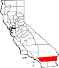
This list includes properties and districts listed on the National Register of Historic Places in Riverside County, California. Click the "Map of all coordinates" link to the right to view a Google map of all properties and districts with latitude and longitude coordinates in the table below.[1]
-
- This National Park Service list is complete through NPS recent listings posted November 10, 2011.[2]
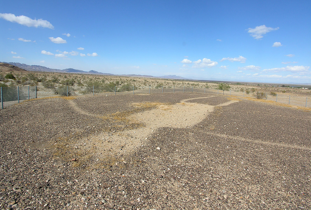
[3] Landmark name [4] Image Date listed Location City or town Summary 1 Administration Building, Sherman Institute January 9, 1980 9010 Magnolia Ave.
33°55′30″N 117°26′13″W / 33.925°N 117.436944°WRiverside 2 All Souls Universalist Church September 18, 1978 3657 Lemon St.
33°58′56″N 117°22′14″W / 33.982222°N 117.370556°WRiverside 3 Andreas Canyon January 8, 1973 Address Restricted Palm Springs 4 Archeological Sites CA-RIV-504 and CA-RIV-773 March 12, 2003 Address Restricted Blythe 5 Arlington Branch Library and Fire Hall July 22, 1993 9556 Magnolia Ave.
33°55′11″N 117°26′48″W / 33.919722°N 117.446667°WRiverside 6 Armory Hall January 29, 1992 252 N. Main St.
33°40′15″N 117°19′32″W / 33.670833°N 117.325556°WLake Elsinore 7 Barker Dam 
October 29, 1975 SE of Twentynine Palms in Joshua Tree National Park
34°01′52″N 116°08′39″W / 34.031111°N 116.144167°WTwentynine Palms 8 Blythe Intaglios 
August 22, 1975 Address Restricted Blythe 9 Buttercup Farms Pictograph May 3, 1976 Address Restricted Perris 10 Andrew Carnegie Library June 29, 1977 8th and Main Sts.
33°52′23″N 117°33′56″W / 33.873056°N 117.565556°WCorona 11 William Childs House July 28, 1999 1151 Monte Vista Dr.
33°57′32″N 117°20′11″W / 33.958889°N 117.336389°WRiverside 12 Chinatown March 1, 1990 Brockton and Tequesquite Aves.
33°58′35″N 117°23′05″W / 33.976389°N 117.384722°WRiverside 13 Coachella Valley Fish Traps June 13, 1972 Restricted Address Valerie 14 Corn Springs October 30, 1998 Address Restricted Desert Center 15 Corona High School August 3, 2005 815 W. 6th St.
33°52′35″N 117°34′32″W / 33.876389°N 117.575617°WCorona 16 Crescent Bathhouse July 30, 1975 201 W. Graham Ave.
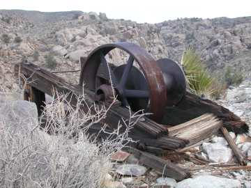
33°40′09″N 117°19′47″W / 33.669167°N 117.329722°WLake Elsinore 17 Desert Queen Mine 
January 17, 1976 S of Twentynine Palms in Joshua Tree National Park
34°01′26″N 116°04′09″W / 34.023889°N 116.069167°WTwentynine Palms 18 Estudillo Mansion October 25, 2001 150 S. Dillon
33°46′51″N 116°58′02″W / 33.780833°N 116.967222°WSan Jacinto 19 Federal Post Office November 20, 1978 3720 Orange St.
33°58′55″N 117°22′18″W / 33.981944°N 117.371667°WRiverside 20 First Church of Christ, Scientist September 22, 1992 3606 Lemon St.
33°58′57″N 117°22′11″W / 33.9825°N 117.369722°WRiverside 21 First Congregational Church of Riverside 
April 3, 1997 3504 Mission Inn Ave.
33°58′54″N 117°22′16″W / 33.981667°N 117.371111°WRiverside 22 Galleano Winery June 22, 2003 4231 Wineville Rd.
34°00′40″N 117°32′29″W / 34.011111°N 117.541389°WMira Loma 23 Rocco Garbani Homestead December 22, 1999 33555 Holland Rd.
33°39′34″N 117°04′24″W / 33.659444°N 117.073333°WWinchester 24 Gilman Ranch November 17, 1977 1937 W. Gilman St.
33°56′15″N 116°53′54″W / 33.9375°N 116.898333°WBanning 25 Grand Boulevard Historic District July 14, 2011 Grand Boulevard
33°52′09″N 117°34′02″W / 33.869167°N 117.567222°WCorona 26 Harada House 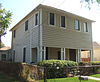
September 15, 1977 3356 Lemon St.
33°59′06″N 117°22′05″W / 33.985°N 117.368056°WRiverside 27 Heritage House February 28, 1973 8193 Magnolia Ave.
33°56′05″N 117°25′20″W / 33.934722°N 117.422222°WRiverside 28 Cornelius Jensen Ranch September 6, 1979 4350 Riverview Dr
33°59′34″N 117°25′01″W / 33.992778°N 117.416944°WRubidoux 29 Lake Norconian Club February 4, 2000 Jct. of Fifth and Western Ave.
33°55′30″N 117°34′06″W / 33.925°N 117.568333°WNorco 30 Gus Lederer Site March 12, 2003 Address Restricted Desert Center 31 March Field Historic District December 6, 1994 Eschscholtzia Ave., March Air Force Base
33°53′59″N 117°15′17″W / 33.899722°N 117.254722°WRiverside 32 Martinez Canyon Rockhouse December 14, 1999 BLM, Palm Springs-South Coast Resource Area
33°30′20″N 116°19′31″W / 33.505556°N 116.325278°WNorth Palm Springs 33 Martinez Historical District May 17, 1973 Off SR 86
33°33′46″N 116°09′12″W / 33.562778°N 116.153333°WTorres-Martinez Indian Reservation 34 Masonic Temple June 6, 1980 3650 11th St.
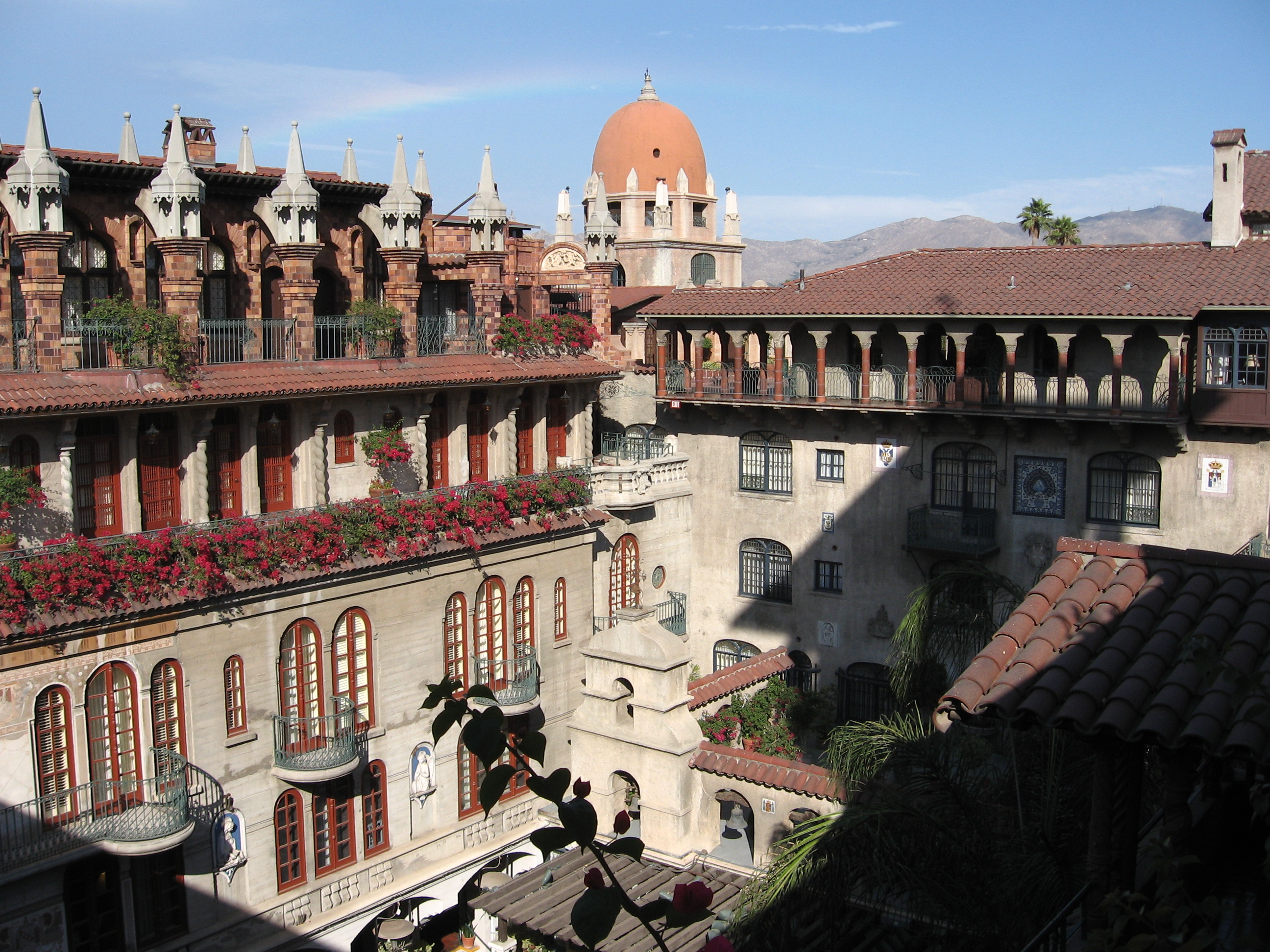
33°58′43″N 117°22′30″W / 33.978611°N 117.375°WRiverside 35 McCoy Spring Archeological Site May 10, 1982 Address Restricted Blythe 36 Mission Court Bungalows July 8, 1993 3355-3373 Second St. and 3354-3362 First St.
33°59′12″N 117°21′55″W / 33.986667°N 117.365278°WRiverside 37 Mission Inn 
May 14, 1971 3649 7th St.
33°59′00″N 117°22′18″W / 33.983333°N 117.371667°WRiverside 38 Murrieta Creek Archeological Area April 24, 1973 Address Restricted Temecula 39 North Chuckwalla Mountain Quarry District August 24, 1981 Address Restricted Desert Center 40 North Chuckwalla Mountains Petroglyph District Ca-Riv 1383 September 3, 1981 Address Restricted Desert Center 41 Thomas O'Donnell House January 7, 2011 447 Alejo Rd.
33°49′49″N 116°33′09″W / 33.830278°N 116.5525°WPalm Springs 42 Old YWCA Building 
January 28, 1982 3425 Mission Inn Avenue
33°58′54″N 117°22′14″W / 33.981722°N 117.370472°WRiverside 43 Perris Depot August 5, 1994 120 W. Fourth St.
33°46′25″N 117°13′44″W / 33.773611°N 117.228889°WPerris 44 Riverside Municipal Auditorium and Soldier's Memorial Building 
March 31, 1978 3485 7th St.
33°58′55″N 117°22′12″W / 33.981944°N 117.37°WRiverside 45 Riverside-Arlington Heights Fruit Exchange June 9, 1980 3391 7th St.
33°58′52″N 117°22′10″W / 33.981111°N 117.369444°WRiverside 46 Ryan House and Lost Horse Well 
June 5, 1975 S of Twentynine Palms in Joshua Tree National Park
33°59′06″N 116°08′52″W / 33.985°N 116.147778°WTwentynine Palms 47 San Pedro, Los Angeles, & Salt Lake RR Depot April 18, 1977 3751 Vine St.
33°58′45″N 117°21′59″W / 33.979167°N 117.366389°WRiverside 48 San Timoteo Canyon Schoolhouse January 19, 2001 31985 San Timoteo Canyon Rd.
33°58′33″N 117°06′10″W / 33.975833°N 117.102778°WRedlands 49 M. H. Simon's Undertaking Chapel June 9, 1980 3610 11th St.
33°58′43″N 117°22′29″W / 33.978611°N 117.374722°WRiverside 50 Southern Hotel October 15, 1992 445 S. D St.
33°46′55″N 117°13′40″W / 33.781944°N 117.227778°WPerris 51 Sutherland Fruit Company April 11, 1986 3191 Seventh St.
33°58′50″N 117°21′59″W / 33.980556°N 117.366389°WRiverside 52 Tahquitz Canyon October 31, 1972 Address Restricted Palm Springs 53 University Heights Junior High School June 24, 1993 2060 University Ave.
33°58′30″N 117°21′20″W / 33.975°N 117.355556°WRiverside 54 Victoria Avenue 
October 26, 2000 Victoria Ave., from Arlington Ave. to Boundary Ln.
33°55′33″N 117°23′57″W / 33.925833°N 117.399167°WRiverside 55 Woman's Improvement Club Clubhouse November 3, 1988 1101 S. Main St.
33°52′12″N 117°33′58″W / 33.87°N 117.566111°WCorona See also
- National Register of Historic Places listings in California
- List of National Historic Landmarks in California
References
- ^ The latitude and longitude information provided in this table was derived originally from the National Register Information System, which has been found to be fairly accurate for about 99% of listings. For about 1% of NRIS original coordinates, experience has shown that one or both coordinates are typos or otherwise extremely far off; some corrections may have been made. A more subtle problem causes many locations to be off by up to 150 yards, depending on location in the country: most NRIS coordinates were derived from tracing out latitude and longitudes off of USGS topographical quadrant maps created under North American Datum of 1927, which differs from the current, highly accurate GPS system used by Google maps. Chicago is about right, but NRIS longitudes in Washington are higher by about 4.5 seconds, and are lower by about 2.0 seconds in Maine. Latitudes differ by about 1.0 second in Florida. Some locations in this table may have been corrected to current GPS standards.
- ^ "National Register of Historic Places: Weekly List Actions". National Park Service, United States Department of the Interior. Retrieved on November 10, 2011.
- ^ Numbers represent an ordering by significant words. Various colorings, defined here, differentiate National Historic Landmark sites and National Register of Historic Places Districts from other NRHP buildings, structures, sites or objects.
- ^ "National Register Information System". National Register of Historic Places. National Park Service. . http://nrhp.focus.nps.gov/natreg/docs/All_Data.html.
U.S. National Register of Historic Places Topics Lists by states Alabama • Alaska • Arizona • Arkansas • California • Colorado • Connecticut • Delaware • Florida • Georgia • Hawaii • Idaho • Illinois • Indiana • Iowa • Kansas • Kentucky • Louisiana • Maine • Maryland • Massachusetts • Michigan • Minnesota • Mississippi • Missouri • Montana • Nebraska • Nevada • New Hampshire • New Jersey • New Mexico • New York • North Carolina • North Dakota • Ohio • Oklahoma • Oregon • Pennsylvania • Rhode Island • South Carolina • South Dakota • Tennessee • Texas • Utah • Vermont • Virginia • Washington • West Virginia • Wisconsin • WyomingLists by territories Lists by associated states Other  Category:National Register of Historic Places •
  Portal:National Register of Historic Places
Municipalities and communities of Riverside County, California County seat: Riverside Cities Banning | Beaumont | Blythe | Calimesa | Canyon Lake | Cathedral City | Coachella | Corona | Desert Hot Springs | Eastvale | Hemet | Indian Wells | Indio | Jurupa Valley | La Quinta | Lake Elsinore | Menifee | Moreno Valley | Murrieta | Norco | Palm Desert | Palm Springs | Perris | Rancho Mirage | Riverside | San Jacinto | Temecula | Wildomar
CDPs Aguanga | Anza | Bermuda Dunes | Cabazon | Cherry Valley | Coronita | Crestmore Heights | Desert Center | Desert Edge | Desert Palms | East Hemet | El Cerrito | El Sobrante | French Valley | Garnet | Glen Avon | Good Hope | Green Acres | Highgrove | Home Gardens | Homeland | Idyllwild-Pine Cove | Indio Hills | Lake Mathews | Lake Riverside | Lakeland Village | Lakeview | March ARB | Mead Valley | Meadowbrook | Mecca | Mesa Verde | Mira Loma | Mountain Center | North Shore | Nuevo | Oasis | Pedley | Ripley | Romoland | Rubidoux | Sky Valley | Sunnyslope | Temescal Valley | Thermal | Thousand Palms | Valle Vista | Vista Santa Rosa | Warm Springs | Whitewater | Winchester | Woodcrest
Unincorporated
communitiesAlberhill | Alessandro | Arcilla | Arnold Heights | Belltown | Biskra Palms | Bly | Bonnie Bell | Box Springs | Cactus City | Cahuilla | Cahuilla Hills | Chiriaco Summit | East Blythe | Edgemont | El Cariso | Gilman Hot Springs | La Cresta | Lost Lake | Mortmar | Murrieta Hot Springs | River Bend Lodge | Sun City Palm Desert
Indian
reservationsAgua Caliente Indian Reservation | Cabazon Indian Reservation | Cahuilla Reservation | Colorado River Indian Reservation | Los Coyotes Reservation | Morongo Reservation | Ramona Indian Reservation | Santa Rosa Indian Reservation | Soboba Reservation | Torres-Martinez Indian Reservation
Ghost towns Alamo Bonito | Auld | Bergman | Caleb | Eagle Mountain | Hell | La Placita | Midland | Pinacate | Saahatpa | Terra Cotta
Categories:- History of Riverside County, California
- Landmarks of Riverside County, California
- Visitor attractions in Riverside County, California
- National Register of Historic Places in California by county
- Lists of National Register of Historic Places in California
-


Wikimedia Foundation. 2010.