- National Register of Historic Places listings in Tulsa County, Oklahoma
-
 Location of Tulsa County in Oklahoma
This is a list of the National Register of Historic Places listings in Tulsa County, Oklahoma.
This is intended to be a complete list of the properties and districts on the National Register of Historic Places in Tulsa County, Oklahoma, United States. The locations of National Register properties and districts for which the latitude and longitude coordinates are included below, may be seen in a Google map.[1]
There are 79 properties and districts listed on the National Register in the county, including 1 National Historic Landmark.
-
- This National Park Service list is complete through NPS recent listings posted November 10, 2011.[2]
Current listings
[3] Landmark name [4] Image Date listed Location City or town Summary 1 66 Motel December 13, 1996 3660 Southwest Boulevard
36°06′37″N 96°00′46″W / 36.110278°N 96.012778°WTulsa 2 Ambassador Hotel 
November 17, 1999 1314 S. Main
36°08′34″N 95°59′14″W / 36.142778°N 95.987222°WTulsa 3 Atlas Life Building 
May 19, 2009 415 S. Boston Ave.
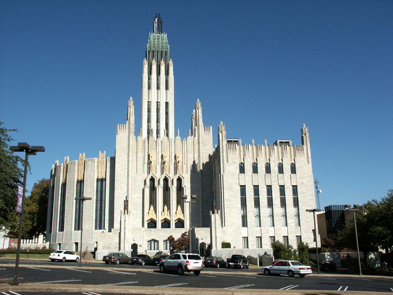
36°09′08″N 95°59′20″W / 36.152222°N 95.988889°WTulsa 4 Boston Avenue Methodist Episcopal Church 
August 31, 1978 1301 South Boston Ave.
36°08′38″N 95°59′04″W / 36.143889°N 95.984444°WTulsa 5 Boulder-on-the-Park September 2, 2003 1850 S. Boulder Ave.
36°08′02″N 95°59′20″W / 36.133889°N 95.988889°WTulsa 6 Brady Heights Historic District 
June 27, 1980 Roughly bounded by Marshall and Easton Sts. and Denver and Cheyenne Aves.
36°09′58″N 95°59′54″W / 36.166111°N 95.998333°WTulsa 7 Brady Historic District September 3, 2010 Roughly along E/W Cameron and E/W Archer, from N. Boulder to N. Detroit
36°09′31″N 95°59′33″W / 36.158611°N 95.9925°WTulsa 8 Broken Arrow Elementary-Junior High School March 7, 2003 210 N. Main
36°03′18″N 95°47′28″W / 36.055°N 95.791111°WBroken Arrow 9 Buena Vista Park Historic District September 6, 2007 Roughly bounded by W. 18th St., S., rear lot lines of the eastern side of S. Cheyenne Ave., W., W. 21st St., S., and Riverside Dr./S. Carson
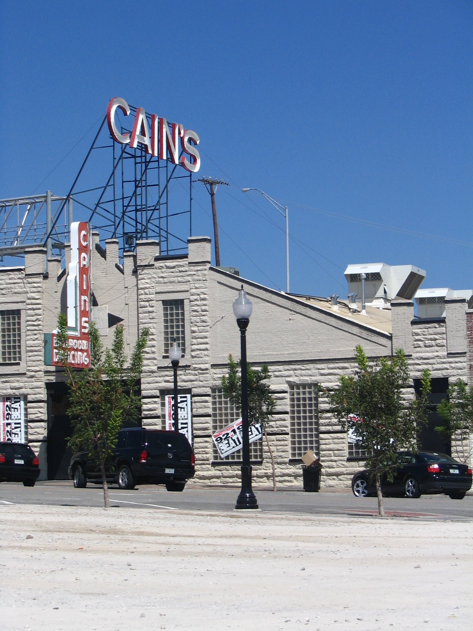
36°08′05″N 95°59′24″W / 36.134722°N 95.99°WTulsa 10 Cain’s Dancing Academy 
September 4, 2003 423 N. Main
36°09′38″N 95°59′35″W / 36.160556°N 95.993056°WTulsa 11 Carlton Place Historic District September 6, 2007 Bounded by W. 14th St., S., S. Carson Ave., W., W. 15th St., S., and S. Cathage Ave., W.
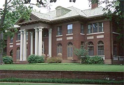
36°08′29″N 95°59′28″W / 36.141389°N 95.991111°WTulsa 12 Casa Loma Hotel September 3, 2010 2626-2648 E. Eleventh St.
36°08′52″N 95°57′10″W / 36.147778°N 95.952778°WTulsa Route 66 and Associated Resources in Oklahoma AD MPS 13 Circle Theater March 7, 2003 10 S. Lewis Ave.
36°09′33″N 95°57′29″W / 36.159167°N 95.958056°WTulsa 14 Cities Service Station #8 March 14, 2011 1648 Southwest Boulevard
36°08′17″N 96°00′26″W / 36.138056°N 96.007222°WTulsa Route 66 and Associated Resources in Oklahoma AD MPS 15 City Veterinary Hospital August 26, 2008 3550 S. Peoria Ave.
36°06′44″N 95°58′33″W / 36.112222°N 95.975833°WTulsa 16 Clinton-Hardy House January 23, 1979 1322 S. Guthrie
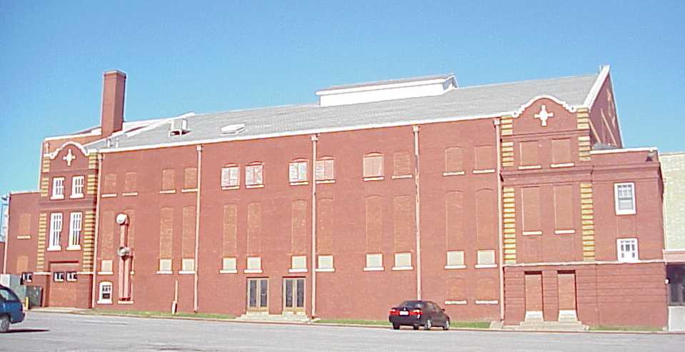
36°08′34″N 95°59′45″W / 36.142778°N 95.995833°WTulsa 17 Convention Hall 
August 29, 1979 105 W. Brady St.
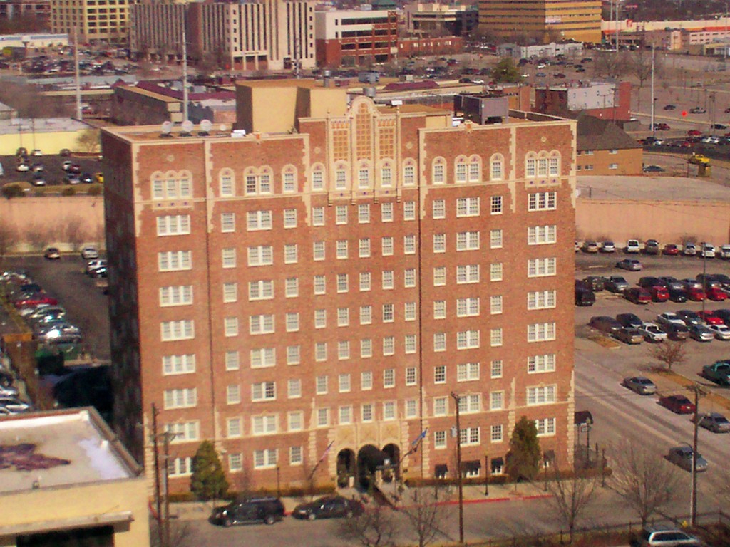
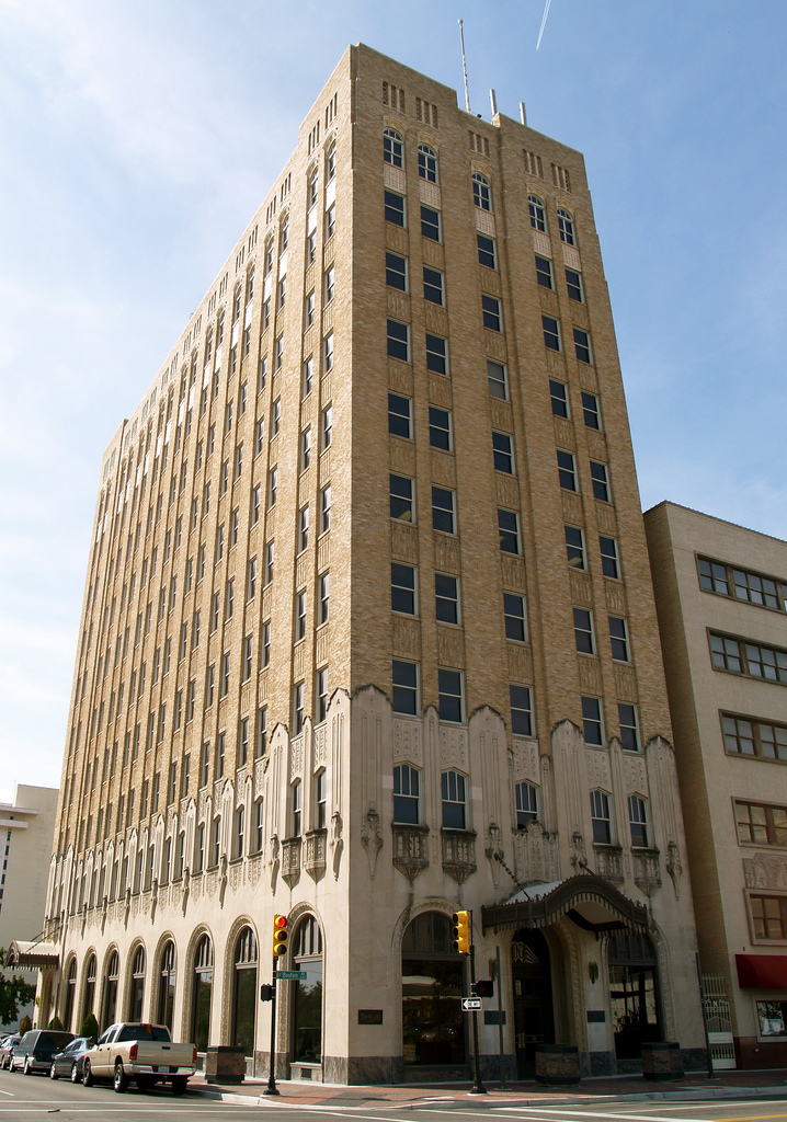
36°09′29″N 95°59′43″W / 36.158056°N 95.995278°WTulsa 18 Cosden Building 
February 1, 1979 409 S. Boston
36°09′09″N 95°59′20″W / 36.1525°N 95.988889°WTulsa 19 Creek Council Tree Site September 29, 1976 18th and Cheyenne Sts.
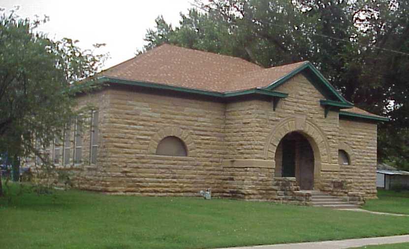
36°08′13″N 95°59′24″W / 36.136944°N 95.99°WTulsa 20 Dawson School 
December 7, 2001 Junction of East Ute Place and N. Kingston Pl.
36°11′02″N 95°54′32″W / 36.183889°N 95.908889°WTulsa 21 Carl K. Dresser House June 2, 2000 235 W. 18th St.
36°08′11″N 95°59′29″W / 36.136389°N 95.991389°WTulsa 22 Eleventh Street Arkansas River Bridge December 13, 1996 Former U.S. Route 66 over the Arkansas River from Tulsa to West Tulsa
36°08′38″N 96°00′10″W / 36.143889°N 96.002778°WTulsa 23 Fort Arbuckle Site December 22, 1978 West of Sand Springs
36°09′15″N 96°13′29″W / 36.154167°N 96.224722°WSand Springs 24 Gillette Historic District 
September 20, 1982 Bounded by S. Yorktown and S. Lewis Aves, E. 15th and E. 17th Sts.
36°08′21″N 95°57′35″W / 36.139167°N 95.959722°WTulsa 25 Gillette-Tyrell Building January 21, 1982 423 S. Boulder Ave.
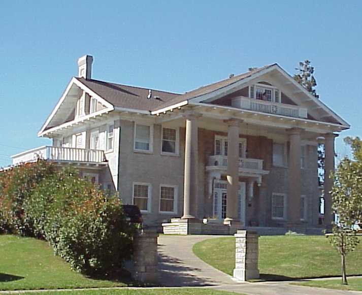
36°09′04″N 95°59′27″W / 36.151111°N 95.990833°WTulsa 26 Harwelden February 8, 1978 2210 S. Main St.
36°07′54″N 95°59′15″W / 36.131667°N 95.9875°WTulsa 27 Haskell State School of Agriculture December 19, 1978 808 E. College St.
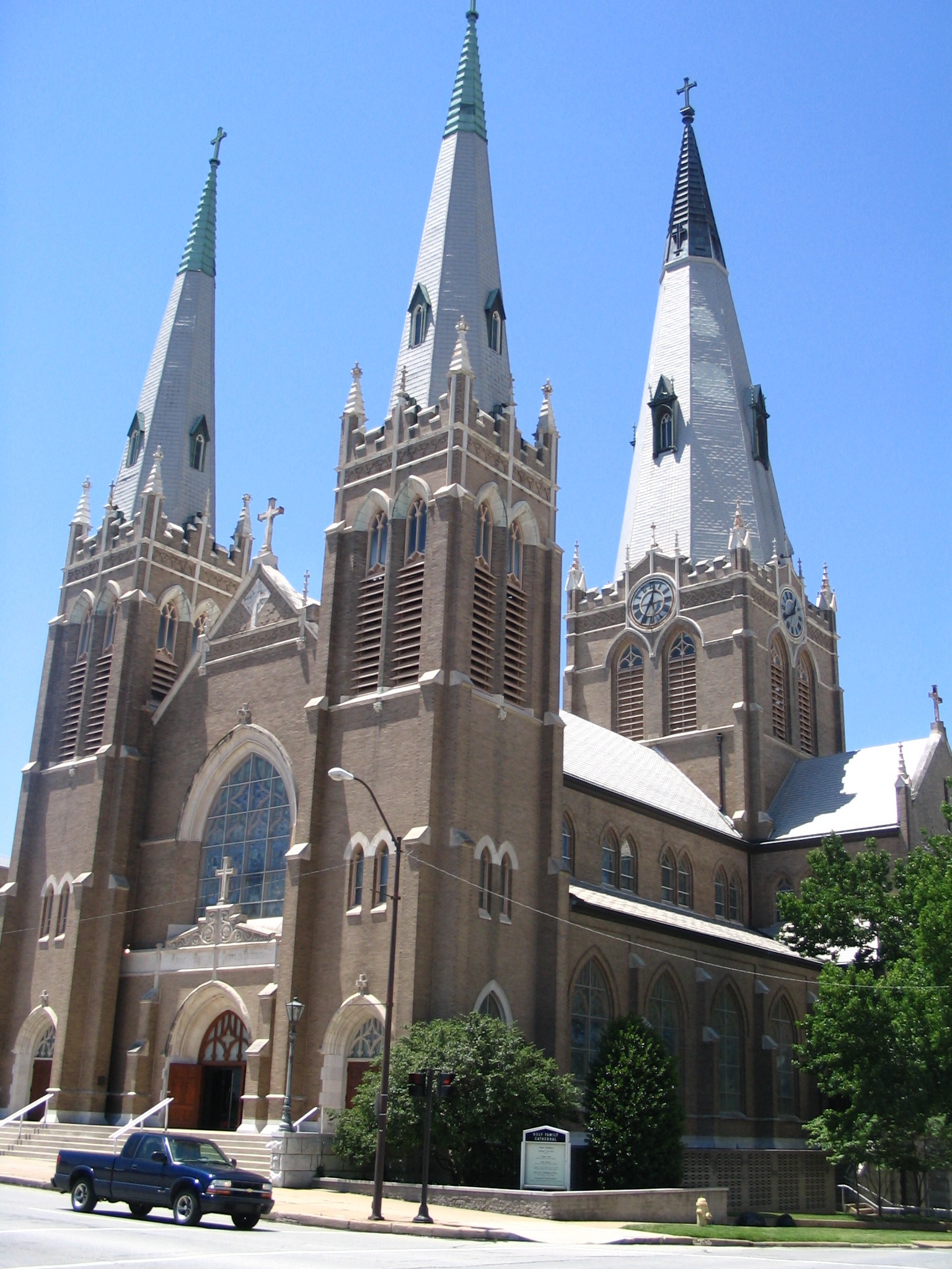
36°03′12″N 95°46′49″W / 36.053333°N 95.780278°WBroken Arrow 28 Holy Family Cathedral, Rectory, and School 
February 11, 1982 W. 8th St. and S. Boulder Ave.
36°08′51″N 95°59′23″W / 36.1475°N 95.989722°WTulsa 29 Hooper Brothers Coffee Company Building December 19, 1978 731-733 E. Admiral Boulevard
36°09′33″N 95°58′55″W / 36.159167°N 95.981944°WTulsa 30 Robert Lawton Jones House December 13, 2001 1916 E. 47th St.
36°05′40″N 95°57′47″W / 36.094444°N 95.963056°WTulsa 31 KATY Railroad Historic District December 13, 2010 Roughly along W. Easton and the old KATY Railroad Right-of-Way between N. Cheyenne and N. Boston Aves.
36°09′37″N 95°59′51″W / 36.160278°N 95.9975°WTulsa 32 Maple Ridge Historic Residential District 
April 6, 1983 Roughly bounded by Hazel Boulevard, S. Peoria Ave., 14th St., and Railroad
36°07′58″N 95°58′48″W / 36.132778°N 95.98°WTulsa 33 Mayo Building December 4, 2008 420 S. Main St.
36°09′08″N 95°59′26″W / 36.152222°N 95.990556°WTulsa 34 Mayo Hotel 
June 27, 1980 115 W. 5th St.
36°09′03″N 95°59′31″W / 36.150833°N 95.991944°WTulsa 35 Mayo Motor Inn August 26, 2008 416 S. Cheyenne Ave.
36°09′05″N 95°59′34″W / 36.151389°N 95.992778°WTulsa 36 James H. McBirney House November 13, 1976 1414 S. Galveston
36°08′30″N 95°59′52″W / 36.141667°N 95.997778°WTulsa 37 McFarlin Building December 6, 1979 11 E. 5th St.
36°09′06″N 95°59′22″W / 36.151667°N 95.989444°WTulsa 38 Robert M. McFarlin House January 25, 1979 1610 Carson
36°08′20″N 95°59′26″W / 36.138889°N 95.990556°WTulsa 39 B.W. McLean House and Office March 22, 1991 123 E. A St.
36°01′25″N 95°58′05″W / 36.023611°N 95.968056°WJenks 40 Mincks-Adams Hotel 
November 7, 1978 403 S. Cheyenne St.
36°09′10″N 95°59′15″W / 36.152778°N 95.9875°WTulsa 41 Moore Manor February 19, 1982 228 W. 17th Pl.
36°08′12″N 95°59′26″W / 36.136667°N 95.990556°WTulsa 42 Morrow Home Place September 3, 2010 13200 E. 126th St. N.
36°20′12″N 95°49′36″W / 36.336667°N 95.826667°WCollinsville 43 Mount Zion Baptist Church September 5, 2008 419 N. Elgin E. Ave.
36°09′45″N 95°59′25″W / 36.1625°N 95.990278°WTulsa 44 North Cheyenne Avenue Historic District December 13, 2010 Roughly along East/West Frisco Tracks and alley between W. Archer and W. Brady Sts., N. Denver and alley between N. Boulder
36°09′27″N 95°59′46″W / 36.1575°N 95.996111°WTulsa 45 Oil Capital Historic District December 13, 2010 Roughly between 3rd and 7th Sts. and Cincinnati and Cheyenne Aves.
36°09′05″N 95°59′24″W / 36.151389°N 95.99°WTulsa 46 Oklahoma Natural Gas Company Building 
April 10, 1984 624 S. Boston Ave.
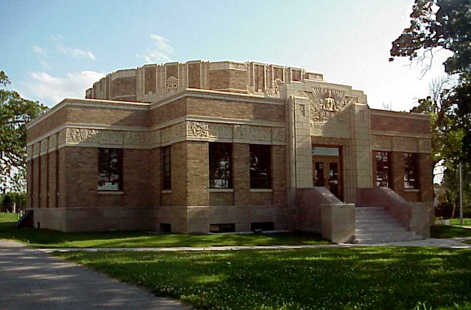
36°09′00″N 95°59′18″W / 36.15°N 95.988333°WTulsa 47 Page Memorial Library March 18, 1999 6 E. Broadway
36°08′23″N 96°06′35″W / 36.139722°N 96.109722°WSand Springs 48 Foster B. Parriott House September 14, 2002 2216 E. 30th St.
36°07′13″N 95°57′35″W / 36.120278°N 95.959722°WTulsa 49 Petroleum Building 
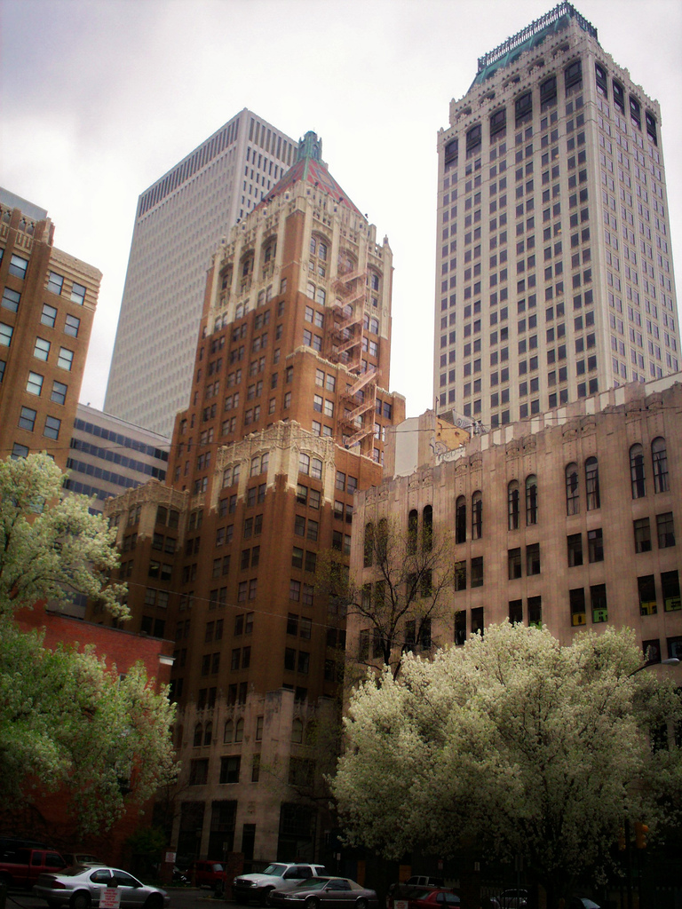
April 15, 1982 420 S. Boulder St.
36°09′04″N 95°59′29″W / 36.151111°N 95.991389°WTulsa 50 Philcade Building 
September 18, 1986 511 S. Boston Ave.
36°09′03″N 95°59′26″W / 36.150833°N 95.990556°WTulsa 51 Phillips 66 Station No. 473 December 6, 2004 2224 E. Admiral Boulevard
36°09′34″N 95°57′34″W / 36.159444°N 95.959444°WTulsa 52 Waite Phillips Mansion December 1, 1978 2727 S. Rockford Rd.
36°07′22″N 95°58′10″W / 36.122778°N 95.969444°WTulsa 53 Philtower 
August 29, 1979 427 S. Boston Ave.
36°09′07″N 95°59′19″W / 36.151944°N 95.988611°WTulsa 54 Pierce Block December 11, 1979 301 E. 3rd St.
36°09′18″N 95°59′13″W / 36.155°N 95.986944°WTulsa 55 Public Service of Oklahoma Building April 10, 1984 600 S. Main St.
36°09′00″N 95°59′22″W / 36.15°N 95.989444°WTulsa 56 Ranch Acres Historic District December 12, 2007 Roughly bounded by E. 31 St., S. Harvard Ave, E. 41st St., and S. Delaware and S. Florence Aves.
36°06′41″N 95°56′32″W / 36.111389°N 95.942222°WTulsa 57 Riverside Historic Residential District March 31, 2005 Roughly bounded by the Midland Railway Bike Trail, Riverside Dr., S. Boston Ave., E. 24th St., and E. 21st St.
36°07′37″N 95°59′05″W / 36.126944°N 95.984722°WTulsa 58 Riverside Studio June 14, 2001 1381 Riverside Dr.
36°06′44″N 95°59′47″W / 36.112222°N 95.996389°WTulsa 59 Riverview Historic District September 6, 2007 Roughly bounded by W. 12th and 13th Sts., S., east of S. Elwood Ave., W., W. 14th Place, S., S. Riverside Dr., and S. Jackson Ave.
36°08′30″N 95°59′43″W / 36.141667°N 95.995278°WTulsa 60 St. John Vianney Training School for Girls June 7, 1983 4001 E. 101st St.
36°01′04″N 95°56′13″W / 36.017778°N 95.936944°WTulsa 61 Sand Springs Power Plant September 3, 1998 221 S. Main St.
36°08′02″N 96°06′32″W / 36.133889°N 96.108889°WSand Springs 62 Sinclair Service Station December 13, 1996 3501 E. 11th St.
36°08′53″N 95°56′15″W / 36.148056°N 95.9375°WTulsa 63 Sixth Street Commercial/Residential Historic District September 3, 2009 Roughly along E. 6th St. from S. Peoria Ave. to the north/south alley between Quaker and Quincy Aves.
36°09′07″N 95°58′31″W / 36.152028°N 95.975139°WTulsa 64 William G. Skelly House 
November 28, 1978 2101 S. Madison
36°07′59″N 95°58′48″W / 36.133056°N 95.98°WTulsa 65 Southwestern Bell Main Dial Building June 22, 1984 424 Detroit Ave.
36°09′10″N 95°59′14″W / 36.152778°N 95.987222°WTulsa 66 Stonebraker Heights Historic District September 6, 2007 Roughly bounded by W. 15th St., S., an alley east of South Cheyenne Ave., W., W. 17th St., S., and S. Elwood Ave., W.
36°08′21″N 95°59′28″W / 36.139167°N 95.991111°WTulsa 67 Swan Lake Historic District 
February 20, 1998 Roughly bounded by E. 15th St., S. Utica Ave., E. 21st St., and S. Peoria Ave.
36°08′17″N 95°58′11″W / 36.138056°N 95.969722°WTulsa 68 Tracy Park Historic District September 20, 1982 Roughly bounded by Norfolk, Peoria, 11th, and 13th Sts.
36°08′45″N 95°58′37″W / 36.145833°N 95.976944°WTulsa 69 Tribune Building 
July 16, 1979 20 E. Archer St.
36°09′26″N 95°59′30″W / 36.157222°N 95.991667°WTulsa 70 Tulsa Fire Alarm Building 
September 2, 2003 1010 E. 8th St.
36°09′00″N 95°58′43″W / 36.15°N 95.978611°WTulsa 71 Tulsa Monument Company September 4, 2008 1735 E. 11th St., S.
36°08′53″N 95°57′57″W / 36.148056°N 95.965833°WTulsa 72 Tulsa Municipal Building 
July 18, 1975 124 E. 4th St.
36°09′10″N 95°59′18″W / 36.152778°N 95.988333°WTulsa 73 United States Post Office and Courthouse 
March 24, 2000 224 S. Boulder Ave.
36°09′12″N 95°59′33″W / 36.153333°N 95.9925°WTulsa 74 James Alexander Veasey House July 27, 1989 1802 S. Cheyenne Ave.
36°08′12″N 95°59′23″W / 36.136667°N 95.989722°WTulsa 75 Vickery Phillips 66 Station March 3, 2004 602 S. Elgin
36°09′06″N 95°59′04″W / 36.151667°N 95.984444°WTulsa 76 Westhope 
April 10, 1975 3704 S. Birmingham St.
36°06′35″N 95°57′14″W / 36.109722°N 95.953889°WTulsa 77 White City Historic District June 14, 2001 Roughly bounded by E. 2nd St., S. Fulton Ave., the former St. Louis – San Francisco railroad tracks, E. 11th St., and S. Yale Ave.
36°09′04″N 95°55′03″W / 36.151111°N 95.9175°WTulsa 78 Will Rogers High School September 6, 2007 3909 E. 5th Place
36°09′13″N 95°55′58″W / 36.153611°N 95.932778°WTulsa 79 Yorktown Historic District June 20, 2002 Roughly bounded by 16th and 17th Sts., Victor and Wheeling Aves., 20th St., and Lewis Ave.
36°08′12″N 95°57′44″W / 36.136667°N 95.962222°WTulsa See also
- List of National Historic Landmarks in Oklahoma
- National Register of Historic Places listings in Oklahoma
References
- ^ The latitude and longitude information provided in this table was derived originally from the National Register Information System, which has been found to be fairly accurate for about 99% of listings. For about 1% of NRIS original coordinates, experience has shown that one or both coordinates are typos or otherwise extremely far off; some corrections may have been made. A more subtle problem causes many locations to be off by up to 150 yards, depending on location in the country: most NRIS coordinates were derived from tracing out latitude and longitudes off of USGS topographical quadrant maps created under the North American Datum of 1927, which differs from the current, highly accurate WGS84 GPS system used by Google maps. Chicago is about right, but NRIS longitudes in Washington are higher by about 4.5 seconds, and are lower by about 2.0 seconds in Maine. Latitudes differ by about 1.0 second in Florida. Some locations in this table may have been corrected to current GPS standards.
- ^ "National Register of Historic Places: Weekly List Actions". National Park Service, United States Department of the Interior. Retrieved on November 10, 2011.
- ^ Numbers represent an ordering by significant words. Various colorings, defined here, differentiate National Historic Landmark sites and National Register of Historic Places Districts from other NRHP buildings, structures, sites or objects.
- ^ "National Register Information System". National Register of Historic Places. National Park Service. . http://nrhp.focus.nps.gov/natreg/docs/All_Data.html.
U.S. National Register of Historic Places Topics Lists by states Alabama • Alaska • Arizona • Arkansas • California • Colorado • Connecticut • Delaware • Florida • Georgia • Hawaii • Idaho • Illinois • Indiana • Iowa • Kansas • Kentucky • Louisiana • Maine • Maryland • Massachusetts • Michigan • Minnesota • Mississippi • Missouri • Montana • Nebraska • Nevada • New Hampshire • New Jersey • New Mexico • New York • North Carolina • North Dakota • Ohio • Oklahoma • Oregon • Pennsylvania • Rhode Island • South Carolina • South Dakota • Tennessee • Texas • Utah • Vermont • Virginia • Washington • West Virginia • Wisconsin • WyomingLists by territories Lists by associated states Other National Register of Historic Places in Tulsa County, Oklahoma Broken Arrow Broken Arrow Elementary-Junior High School · Haskell State School of Agriculture

Jenks B. W. McLean House and Office
Sand Springs Page Memorial Library · Sand Springs Power Plant · Fort Arbuckle Site
Tulsa Ambassador Hotel · Boston Avenue Methodist Church · Boulder-on-the-Park · Brady Heights Historic District · Buena Vista Park Historic District · Cain's Ballroom · Carlton Place Historic District · Circle Theater · City Veterinary Hospital · Clinton-Hardy House · Cosden Building Creek Council Tree Site · Dawson School · Carl K. Dresser House · Eleventh Street Arkansas River Bridge · Gillette Historic District · Gillette-Tyrell Building · Harwelden · Holy Family Cathedral · Hooper Brothers Coffee Company Building · Robert Lawton Jones House · Maple Ridge Historic Residential District · Mayo Hotel · Mayo Motor Inn · James H. McBirney House · McFarlin Building · Robert M. McFarlin House · Mount Zion Baptist Church · Ranch Acres Historic District · Riverview Historic District · Stonebraker Heights Historic District · Mincks-Adams Hotel · Moore Manor · Oklahoma Natural Gas Company Building · Owen Park Historic District · Foster B. Parriott House · Petroleum Building · Philcade Building · Phillips 66 Station No. 473 · Philbrook Museum · Philtower · Pierce Block · Public Service of Oklahoma Building · Riverside Historic Residential District · Riverside Studio · Sinclair Service Station · 66 Motel · William G. Skelly House · Southwestern Bell Main Dial Building · St. John Vianney Training School for Girls · Swan Lake Historic District · Tracy Park Historic District · Tribune Building · Tulsa Convention Hall · Tulsa Fire Alarm Building · Tulsa Monument Company · Tulsa Municipal Building · United States Post Office and Courthouse · James Alexander Veasey House · Vickery Phillips 66 Station · Westhope · White City Historic District · Will Rogers High School · Yorktown Historic District
See also: National Register of Historic Places listings in Tulsa County, Oklahoma and List of National Historic Landmarks in OklahomaCategories:- Tulsa County, Oklahoma
- National Register of Historic Places in Oklahoma by county
- Buildings and structures in Tulsa County, Oklahoma
-


Wikimedia Foundation. 2010.