- National Register of Historic Places listings in Tuolumne County, California
-
This list includes properties and districts listed on the National Register of Historic Places in Tuolumne County, California. Click the "Map of all coordinates" link to the right to view a Google map of all properties and districts with latitude and longitude coordinates in the table below.[1]
-
- This National Park Service list is complete through NPS recent listings posted November 10, 2011.[2]
[3] Landmark name [4] Image Date listed Location City or town Summary 1 Baker Highway Maintenance Station September 2, 2004 33950 CA 108
38°19′49″N 119°45′20″W / 38.330278°N 119.755556°WStrawberry 2 Cady House February 25, 1982 72 N. Norlin St.
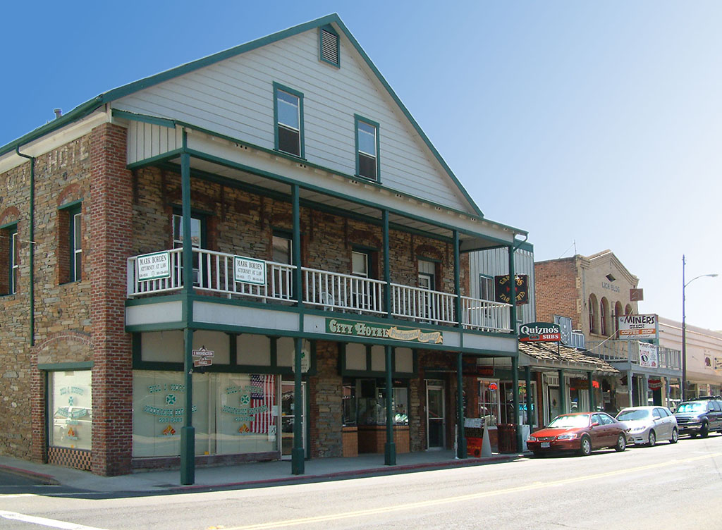
37°59′09″N 120°23′05″W / 37.985833°N 120.384722°WSonora 3 Chinaman Mortar Site June 20, 1975 Address Restricted Strawberry 4 City Hotel 
June 30, 1983 145 S. Washington St.
37°59′01″N 120°22′51″W / 37.983611°N 120.380833°WSonora 5 Columbia Historic District 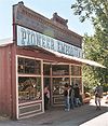
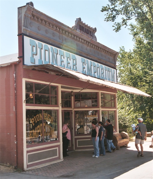
October 15, 1966 4 mi (6.4 km). NW of Sonora on CA 49 Sonora 6 Cooper Cabin January 9, 2009 Address Restricted, Emigrant Wilderness, Stanislaus National Forest Strawberry 7 Emporium 
February 17, 1978 735 Main St.
37°57′10″N 120°25′22″W / 37.952778°N 120.422778°WJamestown 8 Gamble Building and Miner's Bean Kettle March 22, 1991 17544 CA 120
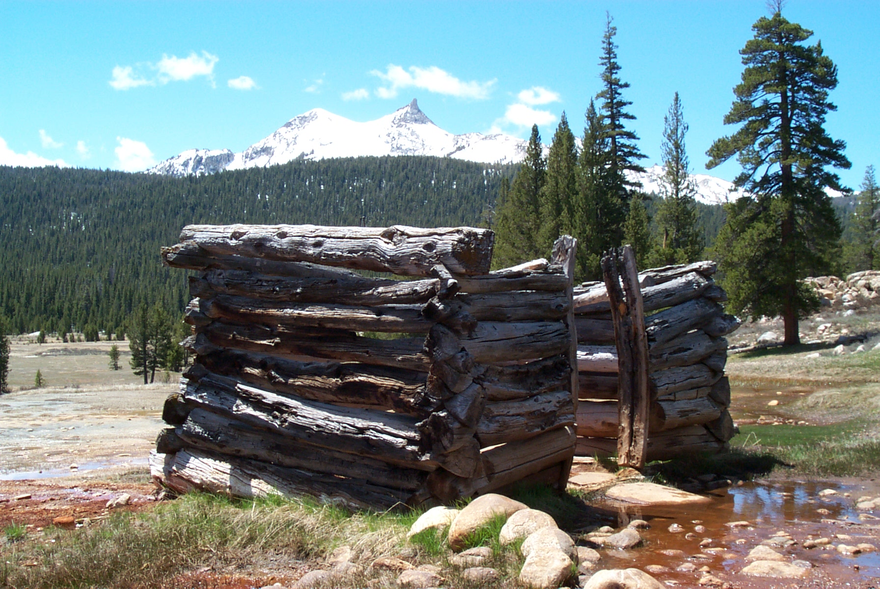
37°49′25″N 120°15′25″W / 37.823611°N 120.256944°WBig Oak Flat 9 Great Sierra Mine Historic Site 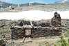
May 24, 1978 W of Lee Vining in Yosemite National Park
37°55′39″N 119°16′05″W / 37.9275°N 119.268056°WLee Vining 10 Great Sierra Wagon Road August 25, 1978 N of Yosemite Village
37°50′32″N 119°43′20″W / 37.842222°N 119.722222°WYosemite Valley 11 Groveland Hotel May 6, 1994 18767 Main St. (CA 120)
37°50′22″N 120°13′42″W / 37.839444°N 120.228333°WGroveland 12 Hotel Charlotte September 26, 1994 18736 Main St. (CA 120)
37°50′21″N 120°13′45″W / 37.839167°N 120.229167°WGroveland 13 McCauley Cabin 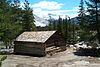
March 8, 1977 W of Lee Vining at Tuolumne Meadows
37°52′40″N 119°22′01″W / 37.877778°N 119.366944°WLee Vining 14 Niagara Camp June 6, 1975 NE of Tuolumne in Stanislaus National Forest
38°00′19″N 120°00′09″W / 38.005278°N 120.0025°WTuolumne 15 Parsons Memorial Lodge 
April 30, 1979 Tuolumne Meadows
37°52′42″N 119°22′00″W / 37.878333°N 119.366667°WYosemite National Park 16 Quail Site March 10, 1975 Address Restricted Long Barn 17 Soda Springs Cabin 
April 19, 1979 SW of Lee Vining
37°52′44″N 119°21′56″W / 37.878889°N 119.365556°WLee Vining 18 Sonora Youth Center October 8, 2009 732 S. Barretta St.
37°58′31″N 120°22′37″W / 37.975394°N 120.377003°WSonora 19 Sugg House September 13, 1984 37 Theall St.
37°59′02″N 120°22′49″W / 37.983889°N 120.380278°WSonora 20 Stanislaus Branch, California Forest and Range Experiment Station January 15, 2009 Forest Rd. 4N13B Strawberry 21 Tioga Pass Entrance Station 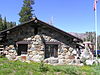
December 14, 1978 SW of Lee Vining in Yosemite National Park
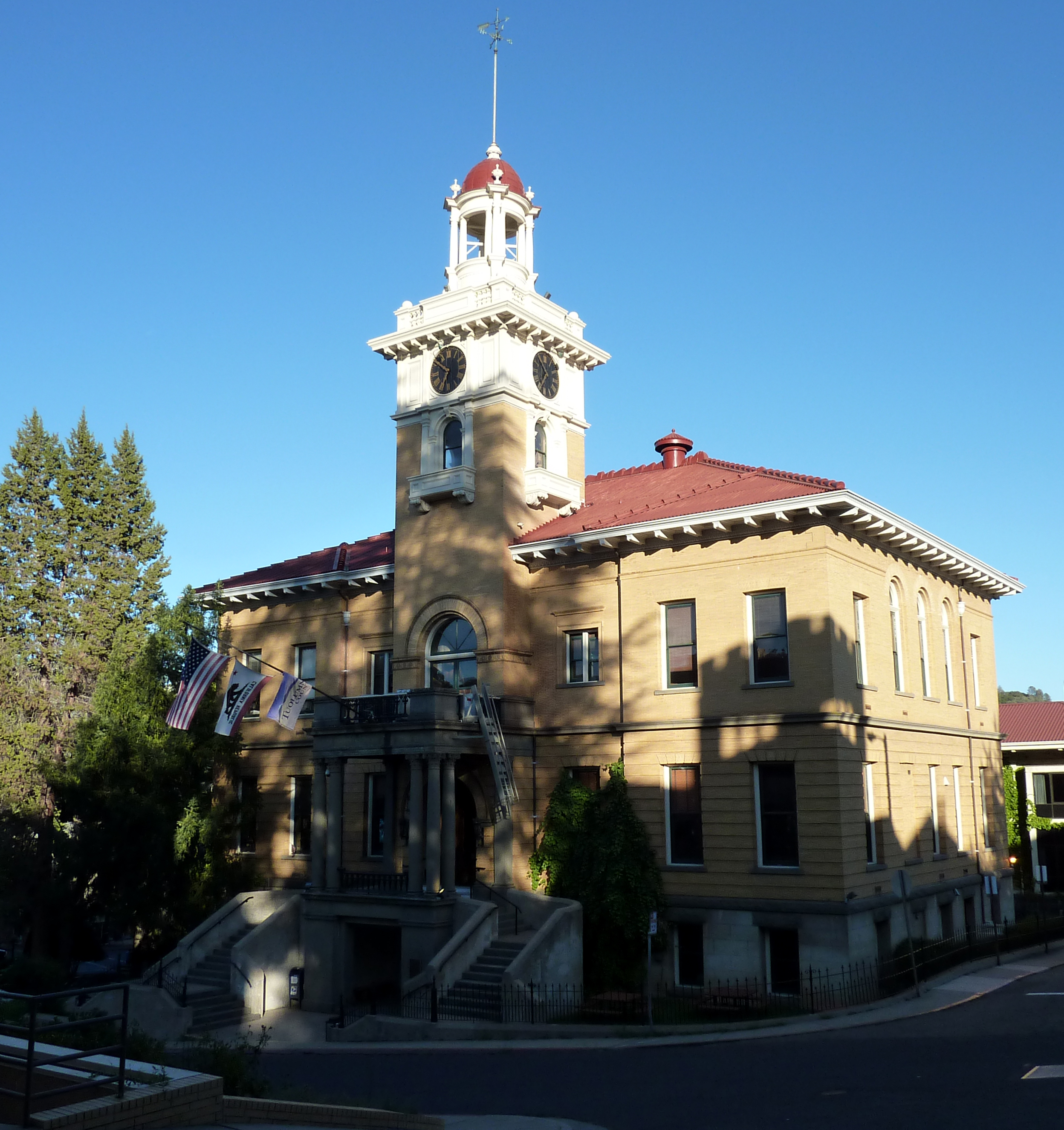
37°54′39″N 119°15′27″W / 37.910833°N 119.2575°WLee Vining 22 Tuolumne County Courthouse 
September 17, 1981 41 W. Yaney Ave.
37°59′08″N 120°22′59″W / 37.985556°N 120.383056°WSonora 23 Tuolumne County Jail 
November 7, 1978 156 W. Bradford St.
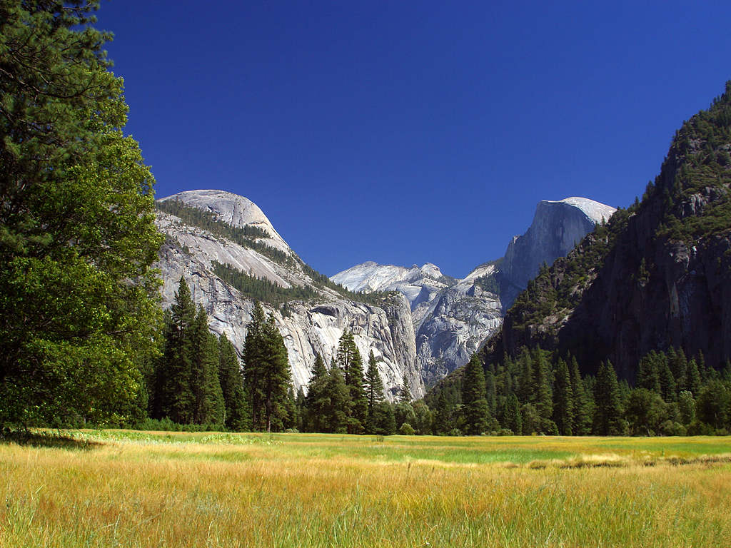
37°59′02″N 120°23′04″W / 37.983889°N 120.384444°WSonora 24 Tuolumne Meadows 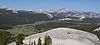
November 30, 1978 SW of Lee Vining in Yosemite National Park
37°52′17″N 119°22′20″W / 37.871389°N 119.372222°WLee Vining 25 Tuolumne Meadows Ranger Stations and Comfort Stations 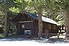
December 18, 1978 SW of Lee Vining in Yosemite National Park
37°52′24″N 119°21′16″W / 37.873333°N 119.354444°WLee Vining 26 Watts & Tannahill Company Store March 31, 1995 18761 Main St. (CA 120)
37°50′21″N 120°13′43″W / 37.839167°N 120.228611°WGroveland 27 Yosemite Valley 
December 14, 2006 Yosemite National Park
37°43′43″N 119°36′07″W / 37.728611°N 119.601944°WYosemite See also
- National Register of Historic Places listings in California
- List of National Historic Landmarks in California
References
- ^ The latitude and longitude information provided in this table was derived originally from the National Register Information System, which has been found to be fairly accurate for about 99% of listings. For about 1% of NRIS original coordinates, experience has shown that one or both coordinates are typos or otherwise extremely far off; some corrections may have been made. A more subtle problem causes many locations to be off by up to 150 yards, depending on location in the country: most NRIS coordinates were derived from tracing out latitude and longitudes off of USGS topographical quadrant maps created under the North American Datum of 1927, which differs from the current, highly accurate WGS84 GPS system used by Google maps. Chicago is about right, but NRIS longitudes in Washington are higher by about 4.5 seconds, and are lower by about 2.0 seconds in Maine. Latitudes differ by about 1.0 second in Florida. Some locations in this table may have been corrected to current GPS standards.
- ^ "National Register of Historic Places: Weekly List Actions". National Park Service, United States Department of the Interior. Retrieved on November 10, 2011.
- ^ Numbers represent an ordering by significant words. Various colorings, defined here, differentiate National Historic Landmark sites and National Register of Historic Places Districts from other NRHP buildings, structures, sites or objects.
- ^ "National Register Information System". National Register of Historic Places. National Park Service. . http://nrhp.focus.nps.gov/natreg/docs/All_Data.html.
U.S. National Register of Historic Places Topics Lists by states Alabama • Alaska • Arizona • Arkansas • California • Colorado • Connecticut • Delaware • Florida • Georgia • Hawaii • Idaho • Illinois • Indiana • Iowa • Kansas • Kentucky • Louisiana • Maine • Maryland • Massachusetts • Michigan • Minnesota • Mississippi • Missouri • Montana • Nebraska • Nevada • New Hampshire • New Jersey • New Mexico • New York • North Carolina • North Dakota • Ohio • Oklahoma • Oregon • Pennsylvania • Rhode Island • South Carolina • South Dakota • Tennessee • Texas • Utah • Vermont • Virginia • Washington • West Virginia • Wisconsin • WyomingLists by territories Lists by associated states Other Municipalities and communities of Tuolumne County, California City 
CDPs Cedar Ridge | Chinese Camp | Cold Springs | Columbia | East Sonora | Groveland | Jamestown | Long Barn | Mi-Wuk Village | Mono Vista | Phoenix Lake | Pine Mountain Lake | Sierra Village | Soulsbyville | Strawberry | Tuolumne City | Tuttletown | Twain Harte
Unincorporated
communitiesBlanchard | Buchanan | Bumblebee | Confidence | Dardanelle | Deadwood | Groveland-Big Oak Flat | Mather | Moccasin | Phoenix Lake-Cedar Ridge | Pinecrest | Standard
Categories:- Tuolumne County, California
- National Register of Historic Places in California by county
- Lists of National Register of Historic Places in California
-


Wikimedia Foundation. 2010.