- National Register of Historic Places listings in Osage County, Oklahoma
-
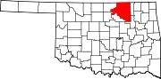
 Location of Osage County in Oklahoma
This is a list of the National Register of Historic Places listings in Osage County, Oklahoma.
This is intended to be a complete list of the properties and districts on the National Register of Historic Places in Osage County, Oklahoma, United States. The locations of National Register properties and districts for which the latitude and longitude coordinates are included below, may be seen in a Google map.[1]
There are 23 properties and districts listed on the National Register in the county.
-
- This National Park Service list is complete through NPS recent listings posted November 10, 2011.[2]
Current listings
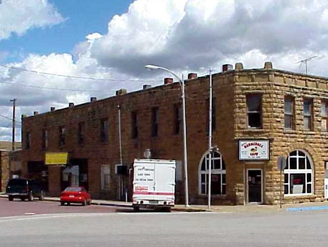
[3] Landmark name [4] Image Date listed Location City or town Summary 1 Bank of Bigheart 
November 23, 1984 308 W. Main St.
36°33′43″N 96°09′41″W / 36.561944°N 96.161389°WBarnsdall 2 Bank of Burbank November 23, 1984 McCorkle and 1st Sts.
36°41′53″N 96°43′35″W / 36.698056°N 96.726389°WBurbank 3 Bank of Hominy 
November 23, 1984 102 W. Main St.
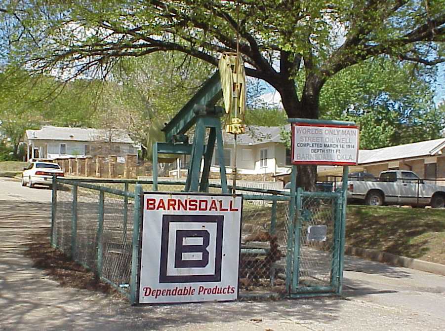
36°24′55″N 96°23′38″W / 36.415278°N 96.393889°WHominy 4 Barnsdall Main Street Well Site 
October 1, 1997 West of the junction of State Highway 11 and Main St.
36°33′42″N 96°09′57″W / 36.561667°N 96.165833°WBarnsdall 5 Blacksmith's House May 7, 1979 210 W. Main St.
36°39′48″N 96°20′32″W / 36.663333°N 96.342222°WPawhuska 6 Chapman-Barnard Ranch Headquarters March 2, 2001 1511 County Route 4201
36°50′47″N 96°25′22″W / 36.846389°N 96.422778°WPawhuska 7 Chief Ne-Kah-Wah-She-Tun-Kah Grave and Statue May 22, 1979 Off State Highway 18
36°33′52″N 96°42′37″W / 36.564444°N 96.710278°WFairfax 8 City Hall January 1, 1976 Main and Grandview Ave.
36°39′47″N 96°20′27″W / 36.663056°N 96.340833°WPawhuska 9 Fred Drummond House April 16, 1981 305 N. Price Ave.
36°25′04″N 96°23′39″W / 36.417778°N 96.394167°WHominy 10 First National Bank and Masonic Lodge June 22, 1984 301 N. Main St.
36°34′15″N 96°42′16″W / 36.570833°N 96.704444°WFairfax 11 Hominy Armory May 20, 1994 201 N. Regan St.
36°25′01″N 96°23′43″W / 36.416944°N 96.395278°WHominy 12 Hominy Osage Round House May 16, 1979 Round House Sq. in Indian Village
36°24′41″N 96°23′07″W / 36.411389°N 96.385278°WHominy 13 Hominy School August 12, 1988 200 block of S. Pettit St.
36°24′50″N 96°23′26″W / 36.413889°N 96.390556°WHominy 14 Immaculate Conception Church May 21, 1979 1314 Lynn Ave.
36°10′09″N 96°00′06″W / 36.169167°N 96.001667°WPawhuska 15 Lincoln Colored School December 5, 2003 171 NE. Walnut
36°34′33″N 96°42′07″W / 36.575833°N 96.701944°WFairfax 16 Marland Filling Station September 14, 2002 102 S. Wood
36°24′55″N 96°23′31″W / 36.415278°N 96.391944°WHominy 17 Osage Agency May 17, 1974 Agency Hill
36°39′57″N 96°20′24″W / 36.665833°N 96.34°WPawhuska 18 Osage Bank of Fairfax November 23, 1984 250 N. Main St.
36°34′13″N 96°42′13″W / 36.570278°N 96.703611°WFairfax 19 Osage County Courthouse August 23, 1984 6th and Grandview Sts.
36°39′52″N 96°20′28″W / 36.664444°N 96.341111°WPawhuska 20 Pawhuska Armory May 20, 1994 823 E. 8th St.
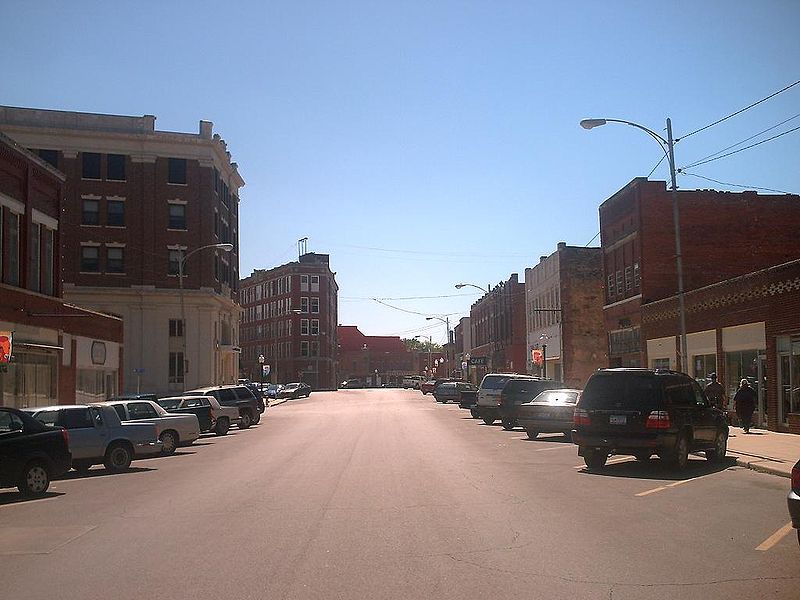
36°39′56″N 96°19′40″W / 36.665556°N 96.327778°WPawhuska 21 Pawhuska Downtown Historic District 
November 26, 1986 Roughly bounded by Grand View Ave., E. 8th St., Leahy Ave., and E. 5th St.
36°39′51″N 96°20′25″W / 36.664167°N 96.340278°WPawhuska 22 Wolverine Oil Company Drayage Barn March 4, 1998 State Highway 11, 3.5 miles north of Avant
36°32′36″N 96°04′18″W / 36.543333°N 96.071667°WAvant 23 Woolaroc Ranch Historic District 
December 5, 2008 8 miles east of the junction of State Highways 11 and 123 Barnsdall See also
- List of National Historic Landmarks in Oklahoma
- National Register of Historic Places listings in Oklahoma
References
- ^ The latitude and longitude information provided in this table was derived originally from the National Register Information System, which has been found to be fairly accurate for about 99% of listings. For about 1% of NRIS original coordinates, experience has shown that one or both coordinates are typos or otherwise extremely far off; some corrections may have been made. A more subtle problem causes many locations to be off by up to 150 yards, depending on location in the country: most NRIS coordinates were derived from tracing out latitude and longitudes off of USGS topographical quadrant maps created under North American Datum of 1927, which differs from the current, highly accurate GPS system used by Google maps. Chicago is about right, but NRIS longitudes in Washington are higher by about 4.5 seconds, and are lower by about 2.0 seconds in Maine. Latitudes differ by about 1.0 second in Florida. Some locations in this table may have been corrected to current GPS standards.
- ^ "National Register of Historic Places: Weekly List Actions". National Park Service, United States Department of the Interior. Retrieved on November 10, 2011.
- ^ Numbers represent an ordering by significant words. Various colorings, defined here, differentiate National Historic Landmark sites and National Register of Historic Places Districts from other NRHP buildings, structures, sites or objects.
- ^ "National Register Information System". National Register of Historic Places. National Park Service. . http://nrhp.focus.nps.gov/natreg/docs/All_Data.html.
U.S. National Register of Historic Places Topics Lists by states Alabama • Alaska • Arizona • Arkansas • California • Colorado • Connecticut • Delaware • Florida • Georgia • Hawaii • Idaho • Illinois • Indiana • Iowa • Kansas • Kentucky • Louisiana • Maine • Maryland • Massachusetts • Michigan • Minnesota • Mississippi • Missouri • Montana • Nebraska • Nevada • New Hampshire • New Jersey • New Mexico • New York • North Carolina • North Dakota • Ohio • Oklahoma • Oregon • Pennsylvania • Rhode Island • South Carolina • South Dakota • Tennessee • Texas • Utah • Vermont • Virginia • Washington • West Virginia • Wisconsin • WyomingLists by territories Lists by associated states Other  Category:National Register of Historic Places •
  Portal:National Register of Historic Places
Municipalities and communities of Osage County, Oklahoma County seat: Pawhuska Cities Barnsdall | Bartlesville‡ | Hominy | Pawhuska | Ponca City‡ | Sand Springs‡ | Shidler | Tulsa‡
Towns CDP Unincorporated
communitiesApperson | Bowring | Carter Nine | Gray Horse | Little Chief | Lynn Addition | McCord | Nelagony | Okesa | Pearsonia | Pershing | Tallant | Whippoorwill | Wild Horse | Wolco
Footnotes ‡This populated place also has portions in an adjacent county or counties
Categories:- Osage County, Oklahoma
- National Register of Historic Places in Oklahoma by county
- Buildings and structures in Osage County, Oklahoma
-


Wikimedia Foundation. 2010.