- National Register of Historic Places listings in Cole County, Missouri
-
This is a list of properties and historic districts in Cole County, Missouri, that are listed on the National Register of Historic Places. .
Contents: Counties in Missouri A–B · C · D–I · J–K · L–N · O–St. · St. Louis · Ste.–Z -
- This National Park Service list is complete through NPS recent listings posted November 10, 2011.[1]
Current listings
Landmark name Image Date listed Location City or Town Summary 1 Lewis and Elizabeth Bolton House August 20, 1999 9514 MO W
38°26′43″N 92°9′58″W / 38.44528°N 92.16611°WJefferson City 2 Broadway-Dunklin Historic District November 14, 2002 Most of 600 Blk of Broadway, and the 200 and 300 Blks of West Dunklin St.
38°34′30″N 92°10′44″W / 38.575°N 92.17889°WJefferson City 3 Nelson C. and Gertrude A. Burch House January 8, 2003 115 W. Atchison St.
38°34′15″N 92°10′49″W / 38.57083°N 92.18028°WJefferson City 4 Oscar G. and Mary H. Burch House November 15, 2002 924 Jefferson St.
38°34′14″N 92°10′49″W / 38.57056°N 92.18028°WJefferson City 5 Capitol Avenue Historic District December 28, 2005 Roughly Capitol Ave., from Adams to Cherry Sts.
38°34′23″N 92°9′51″W / 38.57306°N 92.16417°WJefferson City 6 Cole County Courthouse and Jail-Sheriff's House April 3, 1973 Monroe and E. High Sts.
38°34′30″N 92°10′9″W / 38.575°N 92.16917°WJefferson City 7 Cole County Historical Society Building May 21, 1969 109 Madison St.
38°34′38″N 92°10′9″W / 38.57722°N 92.16917°WJefferson City 8 Dulle Farmstead Historic District December 30, 1993 1101 Hwy. 54 W.
38°31′25″N 92°13′7″W / 38.52361°N 92.21861°WJefferson City 9 East End Drugs August 21, 2003 630 E. High St.
38°34′18″N 92°9′52″W / 38.57167°N 92.16444°WJefferson City 10 Gay Archeological Site 
January 25, 1971 Address Restricted Osage City 11 H.E. Gensky Grocery Store Building June 6, 2001 423 Cherry St.
38°34′7″N 92°9′54″W / 38.56861°N 92.165°WJefferson City 12 Claud D. Grove and Berenice Sinclair Grove House November 15, 2002 505 E. State St.
38°34′31″N 92°9′51″W / 38.57528°N 92.16417°WJefferson City 13 Herman Haar House May 2, 1997 110 Bolivar St.
38°35′2″N 92°10′43″W / 38.58389°N 92.17861°WJefferson City 14 Philip Hess House November 15, 2002 714 Washington St.
38°34′23″N 92°10′45″W / 38.57306°N 92.17917°WJefferson City 15 Ivy Terrace March 16, 1990 500 E. Capitol Ave.
38°34′26″N 92°9′57″W / 38.57389°N 92.16583°WJefferson City 16 Jefferson City Community Center May 14, 1992 608 E. Dunklin St.
38°34′4″N 92°10′12″W / 38.56778°N 92.17°WJefferson City 17 Jefferson City National Cemetery October 1, 1998 1024 E. McCarty St.
38°34′6″N 92°9′42″W / 38.56833°N 92.16167°WJefferson City 18 Jefferson Female Seminary February 24, 2000 416 and 420 E. State St.
38°34′32″N 92°9′56″W / 38.57556°N 92.16556°WJefferson City 19 Kaullen Mercantile Company November 21, 2002 900 and 902 E. High St.
38°34′9″N 92°9′43″W / 38.56917°N 92.16194°WJefferson City 20 Lansdown-Higgins House November 12, 1999 5240 Tanner Bridge Rd.
38°30′23″N 92°12′19″W / 38.50639°N 92.20528°WJefferson City 21 Lincoln Univ. Hilltop Campus Historic District April 28, 1983 820 Chestnut St.; also another part of 820 Chestnut St.
38°33′51″N 92°10′9″W / 38.56417°N 92.16917°WJefferson City "Another part" represents a boundary increase of August 21, 2002 22 Lohman's Landing Building 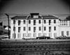
February 25, 1969 W corner of Jefferson and Water Sts.
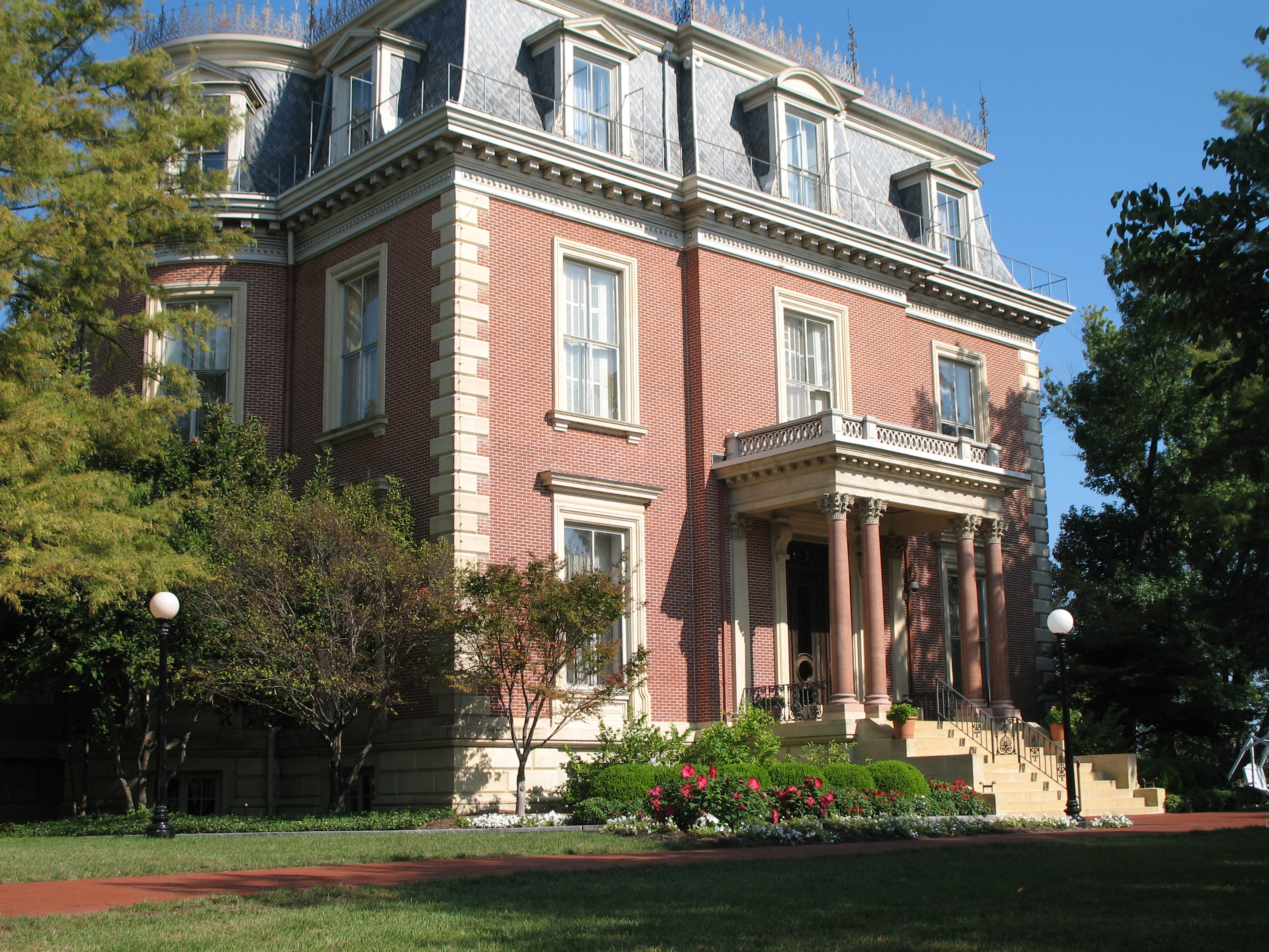
38°34′39″N 92°10′14″W / 38.5775°N 92.17056°WJefferson City Part of the Jefferson Landing State Historic Site 23 Missouri Governor's Mansion 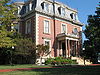
May 21, 1969 100 Madison St.
38°34′41″N 92°10′12″W / 38.57806°N 92.17°WJefferson City 24 Missouri State Capitol Building and Grounds 
June 23, 1969 High St. between Broadway and Jefferson Sts.
38°34′44″N 92°10′23″W / 38.57889°N 92.17306°WJefferson City 25 Missouri State Capitol Historic District June 18, 1976 Bounded roughly by Adams, McCarthy, Mulberry Sts. and the Missouri River; also the 200 block of W. McCarty St. and 406-408 Washington St.
38°34′39″N 92°10′16″W / 38.5775°N 92.17111°WJefferson City Second set of addresses represents a boundary increase of July 17, 2002 26 Missouri State Penitentiary Warden's House October 24, 1991 700 E. Capitol Ave.
38°34′20″N 92°9′47″W / 38.57222°N 92.16306°WJefferson City 27 Moreau Park Historic District September 30, 2009 3714 Old Wardsville Rd. Jefferson City 28 Munichburg Commercial Historic District July 1, 2009 114-130 (even only) E. Dunklin St., 610, 620 Madison St., 704 Madison St.
38°34′19.17″N 92°10′33.31″W / 38.5719917°N 92.1759194°WJefferson City Southside Munichburg, Missouri MPS 29 Lester S. and Missouri "Zue" Gordon Parker House June 15, 2000 624 E. Capitol Ave.
38°34′21″N 92°9′49″W / 38.5725°N 92.16361°WJefferson City 30 Dr. Joseph P. and Effie Porth House January 26, 2001 631 W. Main St.
38°35′0″N 92°10′43″W / 38.583333°N 92.17861°WJefferson City 31 John B. and Elizabeth Ruthven House May 26, 2000 406 Cherry St.
38°34′9″N 92°9′55″W / 38.56917°N 92.16528°WJefferson City 32 Charles J. and Clara B. Schmidt House January 7, 2003 215 W. Atchison St.
38°34′19″N 92°10′53″W / 38.57194°N 92.18139°WJefferson City 33 John M. and Lillian Sommerer House June 12, 2007 2023 W. Main St.
38°35′26.82″N 92°12′12.68″W / 38.5907833°N 92.2035222°WJefferson City 34 Hugh and Bessie Stephens House May 12, 2009 601 Jackson St.
38°34′13.36″N 92°10′14.29″W / 38.5703778°N 92.1706361°WJefferson City 35 Tergin Apartment Building April 22, 1999 201 W. McCarty St.
38°34′37″N 92°10′31″W / 38.57694°N 92.17528°WJefferson City 36 Albert and Wilhelmina Thomas House November 14, 2002 224 W. Elm St.
38°34′33″N 92°10′40″W / 38.57583°N 92.17778°WJefferson City 37 Villa Panorama January 3, 1985 1310 Swifts Hwy.
38°34′9″N 92°11′32″W / 38.56917°N 92.19222°WJefferson City 38 Joseph and Elizabeth Wallendorf House April 4, 2008 701 S. Country Club Dr.
38°34′41.08″N 92°15′50.56″W / 38.5780778°N 92.2640444°WJefferson City 39 Zion Lutheran Church November 15, 2000 2346 Zion Rd.
38°32′10″N 92°15′11″W / 38.53611°N 92.25306°WJefferson City 40 William E. and Frederica M. Zuendt House November 15, 2002 920 Jefferson St.
38°34′15″N 92°10′48″W / 38.57083°N 92.18°WJefferson City References
- ^ "National Register of Historic Places: Weekly List Actions". National Park Service, United States Department of the Interior. Retrieved on November 10, 2011.
Municipalities and communities of Cole County, Missouri Cities Jefferson City‡ | Lohman | Russellville | St. Martins | Taos

Villages Townships Clark | Jefferson | Liberty | Marion | Moreau | Osage
Unincorporated
communitiesFootnotes ‡This populated place also has portions in an adjacent county or counties
U.S. National Register of Historic Places Topics Lists by states Alabama • Alaska • Arizona • Arkansas • California • Colorado • Connecticut • Delaware • Florida • Georgia • Hawaii • Idaho • Illinois • Indiana • Iowa • Kansas • Kentucky • Louisiana • Maine • Maryland • Massachusetts • Michigan • Minnesota • Mississippi • Missouri • Montana • Nebraska • Nevada • New Hampshire • New Jersey • New Mexico • New York • North Carolina • North Dakota • Ohio • Oklahoma • Oregon • Pennsylvania • Rhode Island • South Carolina • South Dakota • Tennessee • Texas • Utah • Vermont • Virginia • Washington • West Virginia • Wisconsin • WyomingLists by territories Lists by associated states Other Categories:- Cole County, Missouri
- National Register of Historic Places in Missouri
-


Wikimedia Foundation. 2010.