- National Register of Historic Places listings in Missouri, Counties O–St.
-
List of Registered Historic Places in Missouri, Counties O–St.:
Contents: Counties in Missouri A–B · C · D–I · Jackson · J–K · L–N · O–St. · St. Louis · Ste.–Z Oregon – Osage – Ozark – Pemiscot – Perry – Pettis – Phelps – Pike – Platte – Polk – Pulaski – Putnam – Ralls – Randolph – Ray – Reynolds – Ripley – St. Charles – St. Clair – St. Francois -
- This National Park Service list is complete through NPS recent listings posted November 10, 2011.[1]
Oregon County
Landmark name Image Date listed Location City or Town Summary 1 Greer Mill January 26, 2006 W. Side, MO 19, 10 miles N of Alton
36°47′11″N 91°20′33″W / 36.78639°N 91.3425°WAlton 2 Pigman Mound Archeological Site 
March 4, 1971 Address Restricted Riverton Osage County
Landmark name Image Date listed Location City or Town Summary 1 Bonnots Mill Historic District January 21, 1993 Roughly Old Mill Rd., Riverside Dr., Highwater Rd., Iris Ave., Wildwood Ln., Hwy. A and Main, Short and Church Hill Sts.
38°34′38″N 91°57′47″W / 38.57722°N 91.96306°WBonnots Mill 2 Chamois Public School June 26, 2003 402 S. Main St.
38°40′23″N 91°46′6″W / 38.67306°N 91.76833°WChamois 3 Dauphine Hotel November 14, 1980 Off MO A
38°34′44″N 91°57′51″W / 38.57889°N 91.96417°WBonnots Mill 4 Huber's Ferry Farmstead Historic District January 15, 1999 Junction US 50 and US 63
38°29′27″N 92°0′23″W / 38.49083°N 92.00639°WJefferson City 5 Osage County Poorhouse February 13, 1998 MO 621, 0.5 miles S of Linn
38°28′45″N 91°51′18″W / 38.47917°N 91.855°WLinn 6 Sacred Heart Catholic Church and Parsonage September 9, 1982 SR U
38°23′49″N 91°52′53″W / 38.39694°N 91.88139°WRich Fountain 7 St. Joseph Church April 11, 1972 Main St.
38°26′28″N 91°59′45″W / 38.44111°N 91.99583°WWestphalia 8 Alvah WAshington Townley Farmstead Historic District August 5, 1999 304 S. Market St.
38°40′25″N 91°46′10″W / 38.67361°N 91.76944°WChamois 9 Dr. Enoch T. and Amy Zewicki House February 27, 2002 402 E. Main St.
38°29′6″N 91°51′2″W / 38.485°N 91.85056°WLinn Ozark County
Landmark name Image Date listed Location City or Town Summary 1 John Conkin and Clara Layton Harlin House October 22, 2003 403 Harlin Dr.
36°36′20″N 92°25′48″W / 36.60556°N 92.43°WGainesville 2 Hodgson-Aid Mill February 12, 2002 MO 181 Sycamore Pemiscot County
Landmark name Image Date listed Location City or Town Summary 1 Campbell Archeological Site July 24, 1974 Address Restricted Cooter 2 Caruthersville Water Tower September 9, 1982 W. 3rd St.
36°11′40″N 89°39′30″W / 36.19444°N 89.65833°WCaruthersville 3 Delmo Community Center January 15, 2009 1 Delmo St. Homestown 4 Delta Center Mound July 24, 1974 Address Restricted Portageville 5 Denton Mound and Village Archeological Site July 29, 1969 Address Restricted Denton 6 Murphy Mound Archeological Site May 21, 1969 Address Restricted Caruthersville 7 J. M. Wallace Archeological Site December 2, 1970 Address Restricted Wardell Perry County
Landmark name Image Date listed Location City or Town Summary 1 Bergt, Christian A., Farm January 10, 1980 E of Frohna
37°38′43″N 89°36′52″W / 37.64528°N 89.61444°WFrohna 2 Concordia Log Cabin College November 21, 1978 Main St.
37°37′50″N 89°35′10″W / 37.63056°N 89.58611°WAltenburg 3 Doerr-Brown House November 14, 1980 17 E. St. Joseph St.
37°43′26″N 89°51′40″W / 37.72389°N 89.86111°WPerryville 4 Eggers and Company General Store June 21, 2007 19 PCR 32B
37°42′9″N 89°41′18″W / 37.7025°N 89.68833°WFarrar 5 St. Mary's of the Barrens Historic District August 25, 1995 SW of the junction of W. Saint Joseph St. and MO 51
37°43′34″N 89°53′14″W / 37.72611°N 89.88722°WPerryville 6 Shelby-Nicholson-Schindler House July 24, 1974 701 W. St. Joseph St.
37°43′30″N 89°52′15″W / 37.725°N 89.87083°WPerryville 7 Tower Rock 
February 26, 1970 1 mile S of Wittenberg in Mississippi River
37°37′54″N 89°30′53″W / 37.63167°N 89.51472°WWittenberg Pettis County
Phelps County
Landmark name Image Date listed Location City or Town Summary 1 Community Theater December 20, 2006 117 First St.
37°54′52″N 91°54′5″W / 37.91444°N 91.90139°WNewburg 2 Gourd Creek Cave Archeological Site July 29, 1969 Address Restricted Newburg 3 Maramec Iron Works District 
April 16, 1969 7 miles S of St. James on MO 8
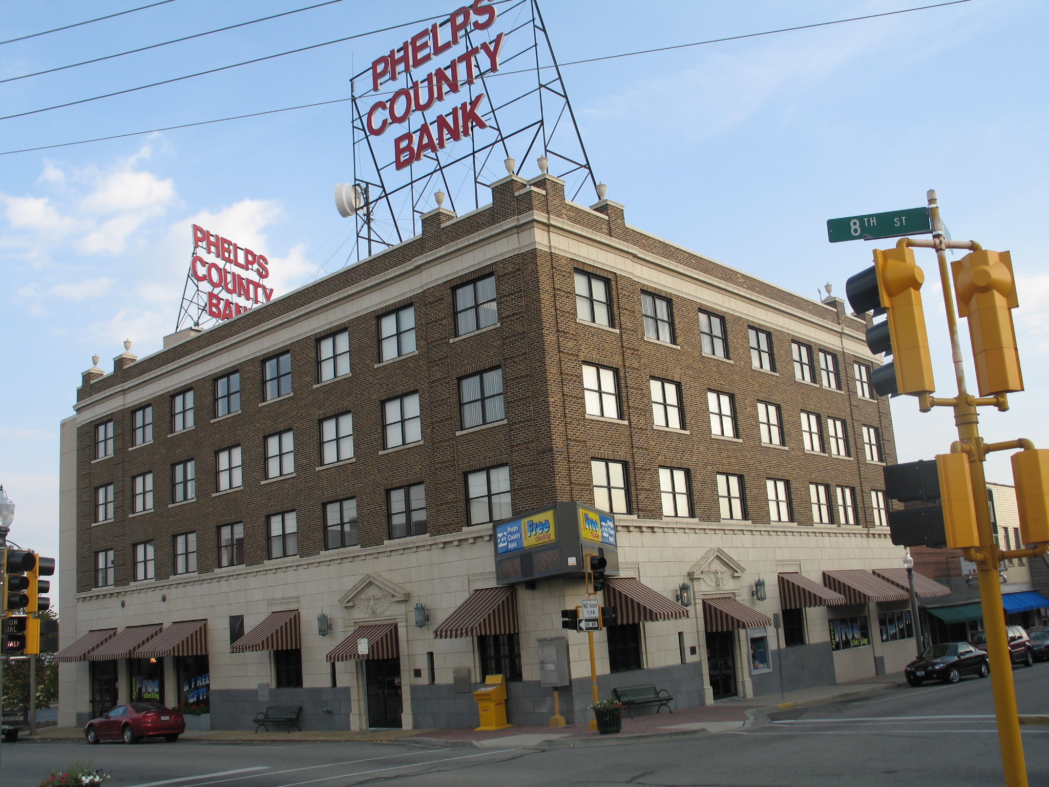
37°57′21″N 91°32′19″W / 37.95583°N 91.53861°WSt. James 4 National Bank of Rolla Building 
December 28, 2001 718 Pine St.
37°56′59″N 91°46′16″W / 37.94972°N 91.77111°WRolla 5 Ozark Iron Furnace Stack June 15, 1970 2 miles W of Newburg
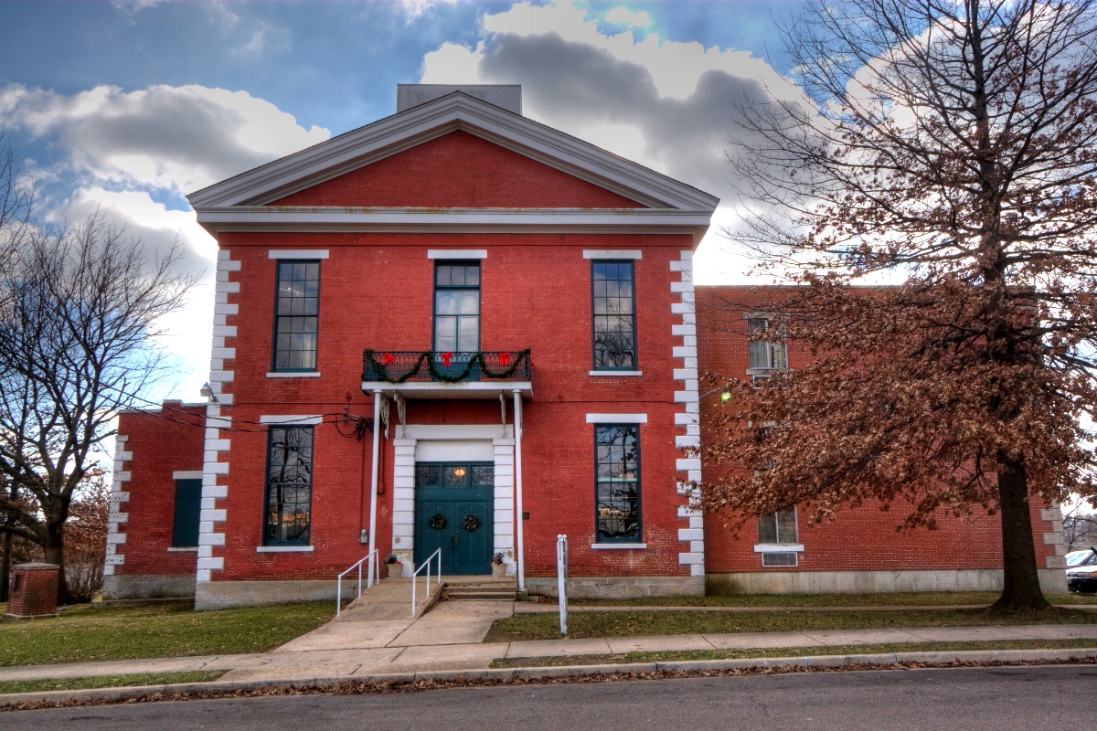
37°54′56″N 91°55′52″W / 37.91556°N 91.93111°WNewburg 6 Phelps County Courthouse 
January 7, 1993 Junction of Third and Main Sts.
37°56′45″N 91°46′22″W / 37.94583°N 91.77278°WRolla 7 Phelps County Jail 
May 10, 1990 Park St. between Second and Third Sts.
37°56′45″N 91°46′27″W / 37.94583°N 91.77417°WRolla 8 Rolla Ranger Station Historic District August 4, 2003 Bridge School Road and Kingshighway
37°56′37″N 91°47′23″W / 37.94361°N 91.78972°WRolla 9 St. James Chapel July 28, 1983 Church and Meramec Sts.
37°59′38″N 91°36′49″W / 37.99389°N 91.61361°WSt. James 10 Verkamp Shelter July 30, 1974 Address Restricted St. James Pike County
Platte County
Polk County
Landmark name Image Date listed Location City or Town Summary 1 Bolivar Public Library July 17, 2003 120 E. Jackson St.
37°36′48″N 93°24′37″W / 37.61333°N 93.41028°WBolivar 2 North Ward School July 14, 2011 201 W. Locust St.
37°36′57″N 93°24′49″W / 37.61583°N 93.41361°WBolivar Pulaski County
Landmark name Image Date listed Location City or Town Summary 1 Decker Cave Archeological Site February 12, 1971 Address Restricted Buckhorn 2 Calloway Manes Homestead June 6, 1980 NW of Richland
37°52′54″N 92°23′49″W / 37.88167°N 92.39694°WRichland 3 Old Stagecoach Stop November 24, 1980 Linn St., Courthouse Sq.
37°49′46″N 92°12′0″W / 37.82944°N 92.2°WWaynesville 4 Onyx Cave May 21, 1999 14705 Private Drive 8541
37°53′8″N 92°1′47″W / 37.88556°N 92.02972°WNewburg 5 Pulaski County Courthouse July 17, 1979 Courthouse Sq.
37°49′45″N 92°12′4″W / 37.82917°N 92.20111°WWaynesville Putnam County
Landmark name Image Date listed Location City or Town Summary 1 Unionville Square Historic District July 19, 2002 Roughly along portions of Main, Grant., 16th and 17th Sts.
40°28′36″N 93°0′8″W / 40.47667°N 93.00222°WUnionville Ralls County
Landmark name Image Date listed Location City or Town Summary 1 James B. Brown House January 26, 1984 2400 Carrs Lane
39°40′10″N 91°22′50″W / 39.66944°N 91.38056°WHannibal 2 John Garth House 
July 11, 1977 South of Hannibal off U.S. 61
39°40′10″N 91°24′33″W / 39.66944°N 91.40917°WHannibal Garth Woodside Mansion Bed and Breakfast Inn, built 1871 3 Greenlawn Methodist Church and Cemetery June 21, 2007 Junction of MO J and Cty Rd. D
39°28′47″N 91°41′10″W / 39.47972°N 91.68611°WPerry 4 Lock and Dam No. 22 Historic District March 10, 2004 Secondary Rd. E New London 5 Ralls County Courthouse and Jail-Sheriff's House September 14, 1972 Courthouse Sq.
39°35′9″N 91°24′1″W / 39.58583°N 91.40028°WNew London 6 St. Paul Catholic Church May 31, 1979 W of Center off SR EE
39°30′12″N 91°36′21″W / 39.50333°N 91.60583°WCenter 7 St. Peter's Catholic Church November 14, 1980 SW of Rensselaer on SR 2
39°37′11″N 91°36′14″W / 39.61972°N 91.60389°WRensselaer 1862 church on the site where Augustus Tolton, the first ordained African American Catholic priest, was baptized.[2] 8 Saverton School December 10, 1998 Junction of Cty. Rtes. N and E
39°38′33″N 91°15′58″W / 39.6425°N 91.26611°WSaverton Randolph County
Landmark name Image Date listed Location City or Town Summary 1 Burkholder-O'Keefe House September 25, 1989 605 S. Fifth St.
39°24′52″N 92°26′30″W / 39.41444°N 92.44167°WMoberly 2 Mitchell Petroglyph Archeological Site June 23, 1969 Address Restricted Cairo 3 Moberly Junior High School January 4, 2008 101 N Johnson St.
39°25′9″N 92°26′37″W / 39.41917°N 92.44361°WMoberly Ray County
Landmark name Image Date listed Location City or Town Summary 1 Dougherty Auditorium September 16, 1982 203 W. Main St.
39°16′42″N 93°58′45″W / 39.27833°N 93.97917°WRichmond 2 Isiah Mansur Farmstead Historic District August 14, 1998 17740 Hwy E.
39°24′46″N 93°53′11″W / 39.41278°N 93.88639°WRichmond 3 New Hope Primitive Baptist Church November 14, 1980 SW of Richmond on Old Orrick Rd.
39°14′59″N 94°2′37″W / 39.24972°N 94.04361°WRichmond 4 Ray County Courthouse October 11, 1979 Off MO 10 and MO 13
39°16′44″N 93°58′37″W / 39.27889°N 93.97694°WRichmond 5 Ray County Poor Farm July 10, 1979 W. Royale St.
39°16′22″N 93°59′20″W / 39.27278°N 93.98889°WRichmond 6 Watkins House February 10, 1983 302 S. Camden St.
39°16′36″N 93°58′45″W / 39.27667°N 93.97917°WRichmond Designed by architect George Franklin Barber Reynolds County
Landmark name Image Date listed Location City or Town Summary 1 Buford-Carty Farmstead June 16, 2004 0.75 miles S of Hwy J on Cty Rd. 814
37°31′11″N 90°56′11″W / 37.51972°N 90.93639°WBlack 2 Civil War Fortification at Barnesville July 1, 1998 Deer Run State Forest
37°13′10″N 90°59′14″W / 37.21944°N 90.98722°WEllington Ripley County
Landmark name Image Date listed Location City or Town Summary 1 B-9 Structure Archeological Site October 7, 1975 Address Restricted Grandin 2 Randolph Columbus Barrett House November 7, 1976 209 Plum St.
36°37′17″N 90°49′25″W / 36.62139°N 90.82361°WDoniphan 3 Indian Ford June 21, 2007 Address Restricted Doniphan 4 Little Black River Archeological District April 21, 1975 Address Restricted Naylor 5 Mule Camp Site November 11, 1975 Address Restricted Fairdealing 6 Price Site April 3, 1978 Address Restricted Currentview 7 Ripley County Courthouse November 7, 1976 Courthouse Circle
36°37′4″N 90°49′37″W / 36.61778°N 90.82694°WDoniphan 8 Ripley County Jail, Sheriff's Office and Sheriff's Residence April 5, 1991 Courthouse Cir.
36°37′1″N 90°49′39″W / 36.61694°N 90.8275°WDoniphan 9 Sylvan School October 10, 2002 Cty Rd H4, approx. 2 miles SW of junction MO 142 and W
36°32′14″N 90°38′21″W / 36.53722°N 90.63917°WNaylor St. Charles County
St. Clair County
Landmark name Image Date listed Location City or Town Summary 1 Harper School July 24, 2007 Junction of MO 82 and MO U
38°3′47″N 93°31′4″W / 38.06306°N 93.51778°WHarper 2 Osceola Public School Building January 21, 1999 Junction of Fifth and Pine Sts.
38°2′41″N 93°42′3″W / 38.04472°N 93.70083°WOsceola St. Francois County
Landmark name Image Date listed Location City or Town Summary 1 Bonne Terre Depot April 5, 1984 Oak St.
37°55′7″N 90°32′56″W / 37.91861°N 90.54889°WBonne Terre 2 Bonne Terre Mine September 9, 1974 MO 47
37°55′22″N 90°33′8″W / 37.92278°N 90.55222°WBonne Terre 3 Courthouse Square Historic District June 9, 2004 Roughly bounded by W. Spring St., N. Washington St., W. Harrison St., and A St.
37°46′51″N 90°25′20″W / 37.78083°N 90.42222°WFarmington 4 East Columbia Historic District July 14, 2004 Southern side of East Columbia: 14-122 E. Columbia, northern side; 101-103 and 117-119 E. Columbia; also 202 E. Columbia St.
37°46′49″N 90°25′11″W / 37.78028°N 90.41972°WFarmington 202 E. Columbia represents a boundary increase of May 30, 2007 5 Eugene Field School September 6, 2005 403 Glendale St.
37°51′18″N 90°31′9″W / 37.855°N 90.51917°WPark Hills 6 Farmington State Hospital No. 4 Cemetery October 25, 2010 ¼ mile south of Doubet Rd. on east side of Pullan Rd.
37°45′40″N 90°26′28″W / 37.76111°N 90.44111°WFarmington vicinity 7 James Robinson McCormick House July 31, 1998 324 W. Columbia St.
37°46′50″N 90°25′33″W / 37.78056°N 90.42583°WFarmington 8 Presbyterian Orphanage of Missouri April 26, 2006 412 W. Liberty St.
37°47′0″N 90°25′39″W / 37.783333°N 90.4275°WFarmington 9 St. Francois County Jail and Sheriff's Residence July 19, 1996 11 N. Franklin St.
37°46′52″N 90°25′23″W / 37.78111°N 90.42306°WFarmington 10 St. Joe Lead Company Administration Building April 5, 1984 Elm St.
37°55′16″N 90°32′59″W / 37.92111°N 90.54972°WBonne Terre See also
References
- ^ "National Register of Historic Places: Weekly List Actions". National Park Service, United States Department of the Interior. Retrieved on November 10, 2011.
- ^ Poletti, Mary (January 24, 2011). "Grant, sainthood cause drive preservation of historic Ralls County church". Quincy Herald-Whig. Quincy, Illinois. http://www.whig.com/story/news/Brush-Creek-Church-012411. Retrieved January 26, 2011.
U.S. National Register of Historic Places Topics Lists by states Alabama • Alaska • Arizona • Arkansas • California • Colorado • Connecticut • Delaware • Florida • Georgia • Hawaii • Idaho • Illinois • Indiana • Iowa • Kansas • Kentucky • Louisiana • Maine • Maryland • Massachusetts • Michigan • Minnesota • Mississippi • Missouri • Montana • Nebraska • Nevada • New Hampshire • New Jersey • New Mexico • New York • North Carolina • North Dakota • Ohio • Oklahoma • Oregon • Pennsylvania • Rhode Island • South Carolina • South Dakota • Tennessee • Texas • Utah • Vermont • Virginia • Washington • West Virginia • Wisconsin • WyomingLists by territories Lists by associated states Other  Category:National Register of Historic Places •
  Portal:National Register of Historic PlacesCategories:
- National Register of Historic Places in Missouri
-


Wikimedia Foundation. 2010.