- Audrain County, Missouri
-
Audrain County, Missouri 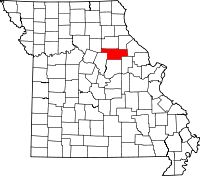
Location in the state of Missouri
Missouri's location in the U.S.Founded December 17, 1836 Named for James H. Audrain, a member of the Missouri State Legislature Seat Mexico Largest city Mexico Area
- Total
- Land
- Water
696.79 sq mi (1,805 km²)
693.10 sq mi (1,795 km²)
3.69 sq mi (10 km²), 0.53Population
- (2010)
- Density
25,529
37/sq mi (14/km²)Time zone Central: UTC-6/-5 Website www.audraincounty.org Audrain County is a county located in the U.S. state of Missouri. As of 2010, the population was 25,529. Its county seat is Mexico[1]. The county was organized in 1836. Audrain County was named for Col. James Hunter Audrain. Col. Audrain was Colonel of militia in the War of 1812. In 1830 Col. Audrain was elected to the state legislature.
Contents
History
 The Audrain County Courthouse in Mexico.
Audrain County was one of several along the Missouri River settled by migrants from the Upper South, especially Kentucky and Tennessee. They brought slaves and slaveholding traditions with them, and quickly started cultivating crops similar to those in Middle Tennessee and Kentucky: hemp and tobacco. They also brought characteristic antebellum architecture and culture. The county was considered at the heart of what was called Little Dixie.[2]
Geography
According to the 2000 census, the county has a total area of 696.79 square miles (1,804.7 km2), of which 693.10 square miles (1,795.1 km2) (or 99.47%) is land and 3.69 square miles (9.6 km2) (or 0.53%) is water.[3]
Adjacent counties
- Monroe County (north)
- Ralls County (northeast)
- Pike County (east)
- Montgomery County (southeast)
- Callaway County (south)
- Boone County (southwest)
- Randolph County (northwest)
Major highways
Demographics
Historical populations Census Pop. %± 1900 21,160 — 1910 21,687 2.5% 1920 20,589 −5.1% 1930 22,077 7.2% 1940 22,673 2.7% 1950 23,829 5.1% 1960 26,079 9.4% 1970 25,362 −2.7% 1980 26,458 4.3% 1990 23,599 −10.8% 2000 25,853 9.6% 2010 25,529 −1.3% As of the census[4] of 2010, there were 25,529 people, 9,844 households, and 6,762 families residing in the county. The population density was 37 people per square mile (14/km²). There were 10,881 housing units at an average density of 16 per square mile (6/km²). The racial makeup of the county was 91.08% White, 7.19% Black or African American, 0.26% Native American, 0.34% Asian, 0.03% Pacific Islander, 0.21% from other races, and 0.88% from two or more races. 0.73% of the population were Hispanic or Latino of any race. 27.1% were of German, 24.5% American, 10.7% English and 8.5% Irish ancestry according to Census 2000.
There were 9,844 households out of which 31.40% had children under the age of 18 living with them, 55.20% were married couples living together, 9.90% had a female householder with no husband present, and 31.30% were non-families. 27.80% of all households were made up of individuals and 13.40% had someone living alone who was 65 years of age or older. The average household size was 2.43 and the average family size was 2.96.
In the county the population was spread out with 24.60% under the age of 18, 7.90% from 18 to 24, 28.20% from 25 to 44, 22.50% from 45 to 64, and 16.90% who were 65 years of age or older. The median age was 38 years. For every 100 females there were 84.20 males. For every 100 females age 18 and over, there were 78.70 males.
The median income for a household in the county was $32,057, and the median income for a family was $40,448. Males had a median income of $28,550 versus $20,712 for females. The per capita income for the county was $16,441. About 11.10% of families and 14.80% of the population were below the poverty line, including 23.30% of those under age 18 and 9.80% of those age 65 or over.
Emergency services
Audrain County E-911 Joint Communications
Audrain County Joint Communications is the primary public safety answering point (PSAP) for Audrain County, and is responsible for handling incoming and outgoing communication from the public for assistance from law enforcement, fire, and medical personnel throughout Audrain County. Joint Communications is specifically responsible for receiving incoming 9-1-1 emergency telephone calls, and dispatching the appropriate personnel; receiving other non-emergency telephone calls and dispatching, routing, or messaging those calls to the correct personnel; entering information into, and inquiring information from the Missouri Uniform Law Enforcement System (MULES) and the National Crime Information Center (NCIC) crime databases; maintaining a detailed computerized log of requests received and dispatched; and keeping current on city and county geography, so that members may assist responding personnel in locating addresses.
Joint Communications is located at 1854 East Liberty Street in Vandiver Village, and serves a coverage area of 697 square miles (1,800 km2) with a population of nearly 26,000 people.[5] Staff includes 7 full-time Dispatchers, 2 part-time Dispatchers, 3 full-time Shift Supervisors, the Assistant 911 Director, and the 911 Director. There is a minimum of two Dispatchers on duty at all times to answer incoming and outgoing communications.
Upgrades to the communications equipment and computer software were made when Mexico Public Safety Dispatch and Audrain County Sheriff's Dispatch consolidated to form the Joint Communications Center in October 1999. These upgrades allowed for even better service to the county. At that time the Vandalia Police Department elected to continue to operate their communications center for the Vandalia Police Department, Vandalia Fire District, and Van-Far Ambulance District. Audrain County Joint Communications and Vandalia Communications acted as backup sites for each other, so if anything happened to one center there would be no disruption of service to the residents and visitors of Audrain County.
In February 2007, Joint Communications implemented an Emergency Medical Dispatch (EMD) program utilizing the protocol-based Medical Priority Dispatch System created by the National Academies of Emergency Dispatch. This program allows dispatchers to quickly and accurately determine the nature of an emergency medical call and prioritize it to allow for the most appropriate response. Joint Communications's dispatchers are trained to provide real-time instruction of CPR and other life-saving first aid while simultaneously dispatching Emergency Medical Service (EMS) professionals to the emergency. This reduces the time between the onset of symptoms and when basic aid is provided to the patient, thus increasing the patient's chances of survival in life-threatening emergencies.
Another equipment upgrade was completed in March 2007. This upgrade included new 9-1-1 equipment and a new telephone and radio voice recorder. These upgrades were necessary to keep current with the latest technology available. With the new 9-1-1 system dispatchers have quicker access to a caller's telephone and address data and it introduced a mapping system to automatically plot emergency calls on a map, allowing for a faster response by emergency personnel as dispatchers previously had to look up addresses on the map manually. The new 9-1-1 system also allows for upgrades to accommodate future telephone and communications technologies. The previous 9-1-1 system was unable to process telephone number and location information from cellular telephone calls, which created a problem in determining the location of an emergency if the caller is unable to speak. The new 9-1-1 system is compatible with cellular telephone and Voice over Internet Protocol (VoIP) technologies, and these services will be added to the Audrain County E-911 system as they become available.
On February 15, 2008, Audrain County Joint Communications assumed the communications responsibilities for the Vandalia Police Department, Vandalia Fire District and Van-Far Ambulance District. Ralls County E-911 was designated as the backup PSAP for Audrain County Joint Communications so if anything were to happen to the Joint Communications Center there would be no disruption of service to the residents and visitors of Audrain County.[6]
In August 2008, Joint Communications Director Chris Hardin began the process of implementing Phase II wireless service to the Audrain County E-911 system. This process was expected to take several months, but after Phase II wireless service was implemented Joint Communications would be able to locate a caller when they called 911 from a cellular telephone.
Joint Communications became Wireless Phase II with AT&T Mobility (formerly Cingular Wireless) on March 3, 2009 and with US Cellular on March 16, 2009. The other cellular phone providers were expected to follow shortly.
Joint Communications became Wireless Phase II with Sprint Nextel on July 15, 2009 meaning that Joint Communications is now Wireless Phase II with all of the cellular phone providers officially serving Audrain County.
Emergency Medical Services
- Audrain Ambulance District
- Van-Far Ambulance District
Fire Services
- Farber Fire Department
- Laddonia Fire Department
- Little Dixie Fire Protection District
- Martinsburg Fire Department
- Mexico Public Safety Department
- Vandalia Fire Department
Law Enforcement
- Audrain County Sheriff's Office
- Farber Police Department
- Martinsburg Police Department
- Mexico Public Safety Department
- Vandalia Police Department
Government and infrastructure
The Women's Eastern Reception, Diagnostic and Correctional Center, a women's prison of the Missouri Department of Corrections, is located in Vandalia and in Audrain County.[7]
Cities and towns
Cities
Villages
Unincorporated towns
Townships
Audrain County is divided into eight townships:
See also
References
- ^ "Find a County". National Association of Counties. http://www.naco.org/Counties/Pages/FindACounty.aspx. Retrieved 2011-06-07.
- ^ The Story of Little Dixie, Missouri, Missouri Division, Sons of Confederate Veterans, accessed 3 June 2008
- ^ "Census 2000 U.S. Gazetteer Files: Counties". United States Census. http://www.census.gov/tiger/tms/gazetteer/county2k.txt. Retrieved 2011-02-13.
- ^ "American FactFinder". United States Census Bureau. http://factfinder.census.gov. Retrieved 2008-01-31.
- ^ About Audrain County, 28 February 2009.
- ^ About Audrain County Joint Communications, 28 February 2009.
- ^ "Facility Addresses." Missouri Department of Corrections. Retrieved on November 24, 2010.
External links
- Audrain County's website
- Audrain County E-911 Joint Communications website
- Audrain County Sheriff's Office website
- Digitized 1930 Plat Book of Audrain County from University of Missouri Division of Special Collections, Archives, and Rare Books

Randolph County Monroe County Ralls County 
Pike County  Audrain County, Missouri

Boone County Callaway County Montgomery County Municipalities and communities of Audrain County, Missouri Cities 
Villages Townships Cuivre | Linn | Loutre | Prairie | Saling | Salt River | South Fork | Wilson
Footnotes ‡This populated place also has portions in an adjacent county or counties
Categories:- Missouri counties
- 1836 establishments in the United States
- Populated places established in 1836
- Little Dixie (Missouri)
- Audrain County, Missouri


Wikimedia Foundation. 2010.