- Mercer County, Missouri
-
Mercer County, Missouri 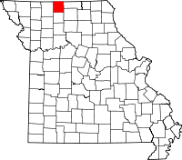
Location in the state of Missouri
Missouri's location in the U.S.Founded information needed Seat Princeton Area
- Total
- Land
- Water
455.18 sq mi (1,179 km²)
454.18 sq mi (1,176 km²)
1.00 sq mi (3 km²), 0.22%Population
- (2000)
- Density
3,757
8/sq mi (3/km²) Mercer County Courthouse and downtown Princeton
Mercer County is a county located in the U.S. state of Missouri. As of 2000, the population was 3,757. Its county seat is Princeton[1].
Contents
History
Early years
Mercer County was organized on February 14, 1845, from part of Grundy County, Missouri.[2] It is named in honor of General Hugh Mercer who fought and died in the American Revolutionary War. The first permanent settlements in what is now Mercer County happened in 1837 when a few families from other parts of Missouri moved to the area. James Parsons, a Tennessee native, is generally considered to be the first permanent settler in the spring of 1837.[3] At that time the land was still included as part of Livingston County and would remain so until 1841 when it became part of newly-created Grundy County. Prior to 1837 the land was used by Native American tribes, primarily the Sac/Fox and Potawatomi, as prime hunting grounds. The occasional temporary hunting village would be established by the tribes but otherwise the land was empty of humans. In 1847 the town of Princeton, named for the battle where General Mercer was killed, was established as the county seat.[4] The northern boundary of the county was in dispute for the first six years of its existence due to the Honey War, a bloodless territorial dispute between Missouri and Iowa. Prior to an 1851 decision by the U.S. Supreme Court, the boundary was 9.5 miles farther north than present day.
Civil War
Mercer County, like its neighbor to the east Putnam County, was a staunch supporter of the Union. Most county residents had roots in northern U.S. states "back east" like Pennsylvania, Ohio, and Indiana and didn't have the strong slave-holding tradition of other northern Missouri counties like Macon, Audrain, and Monroe (commonly referred to as Little Dixie) whose population largely emigated from southern states. In the 1860 U.S. Census, only twelve Mercer County families were listed as slave owners, with a combined total of twenty-four slaves. [5] Fewer that twenty Mercer County men fought for the Confederacy, while well over a thousand volunteered for Union service. Among the units containing Mercer men were the Twenty-Third, Twenty-Seventh and Thirty-Fifth Regiments, the Second and Twelfth Cavalry, the Fifth Kansas Cavalry, and various smaller units of the Missouri State Militia.[6]
Geography
According to the 2000 census, the county has a total area of 455.18 square miles (1,178.9 km2), of which 454.18 square miles (1,176.3 km2) (or 99.78%) is land and 1.00 square mile (2.6 km2) (or 0.22%) is water.[7]
Adjacent counties
- Decatur County, Iowa (northwest)
- Wayne County, Iowa (north)
- Putnam County (east)
- Sullivan County (southeast)
- Grundy County (south)
- Harrison County (west)
Major highways
Demographics
Historical populations Census Pop. %± 1900 14,706 — 1910 12,335 −16.1% 1920 11,281 −8.5% 1930 9,350 −17.1% 1940 8,766 −6.2% 1950 7,235 −17.5% 1960 5,750 −20.5% 1970 4,910 −14.6% 1980 4,685 −4.6% 1990 3,723 −20.5% 2000 3,757 0.9% As of the census[8] of 2000, there were 3,757 people, 1,600 households, and 1,089 families residing in the county. The population density was 8 people per square mile (3/km²). There were 2,125 housing units at an average density of 5 per square mile (2/km²). The racial makeup of the county was 98.72% White, 0.19% Black or African American, 0.56% Native American, 0.05% Pacific Islander, 0.03% from other races, and 0.45% from two or more races. 0.29% of the population were Hispanic or Latino of any race.
There were 1,600 households out of which 28.30% had children under the age of 18 living with them, 57.60% were married couples living together, 6.70% had a female householder with no husband present, and 31.90% were non-families. 29.30% of all households were made up of individuals and 17.60% had someone living alone who was 65 years of age or older. The average household size was 2.31 and the average family size was 2.83.
In the county the population was spread out with 23.00% under the age of 18, 6.70% from 18 to 24, 24.20% from 25 to 44, 24.00% from 45 to 64, and 22.00% who were 65 years of age or older. The median age was 42 years. For every 100 females there were 95.70 males. For every 100 females age 18 and over, there were 92.60 males.
The median income for a household in the county was $29,640, and the median income for a family was $35,313. Males had a median income of $26,690 versus $19,814 for females. The per capita income for the county was $15,140. About 10.20% of families and 13.30% of the population were below the poverty line, including 13.30% of those under age 18 and 14.50% of those age 65 or over.
Communities
Cities
Village
Other communities
Historical communities
Source[9]
- Adel 40°31′53″N 93°40′08″W / 40.53139°N 93.66889°W
- Alvord 40°27′20″N 93°35′43″W / 40.45556°N 93.59528°W
- Burrows 40°30′58″N 93°45′20″W / 40.51611°N 93.75556°W
- Cleopatra 40°32′55″N 93°24′15″W / 40.54861°N 93.40417°W
- Dinsmore 40°20′28″N 93°44′41″W / 40.34111°N 93.74472°W
- Goshen 40°22′58″N 93°40′46″W / 40.38278°N 93.67944°W
- Half Rock 40°16′23″N 93°26′08″W / 40.27306°N 93.43556°W
- Ilia 40°31′50″N 93°27′01″W / 40.53056°N 93.45028°W
- Saline 40°31′37″N 93°43′40″W / 40.52694°N 93.72778°W
- Topsy (Newtown) 40°21′11″N 93°28′47″W / 40.35306°N 93.47972°W
- Wataga 40°33′38″N 93°37′59″W / 40.56056°N 93.63306°W
See also
- National Register of Historic Places listings in Mercer County, Missouri
References
- ^ "Find a County". National Association of Counties. http://www.naco.org/Counties/Pages/FindACounty.aspx. Retrieved 2011-06-07.
- ^ Missouri Secretary of State, Missouri History: What are the Origins of Missouri Counties?
- ^ A Directory of Towns, Villages and Hamlets of Mercer County, Missouri by Arthur Paul Mosler.
- ^ Encyclopedia of the History of Missouri, Edited by Howard L. Conard Vol. IV, Pages 327-328. Published 1901
- ^ The Post-Telegraph newspaper, Mercer, Missouri. April 1960.
- ^ Rogers' Souvenir History of Mercer County, by W.B. Rogers. 714 pages. Published 1911.
- ^ "Census 2000 U.S. Gazetteer Files: Counties". United States Census. http://www.census.gov/tiger/tms/gazetteer/county2k.txt. Retrieved 2011-02-13.
- ^ "American FactFinder". United States Census Bureau. http://factfinder.census.gov. Retrieved 2008-01-31.
- ^ USGenWeb: GNIS Query Results, Mercer County, Missouri
External links
- Digitized 1930 Plat Book of Mercer County from University of Missouri Division of Special Collections, Archives, and Rare Books

Decatur County, Iowa Wayne County, Iowa Harrison County 
Putnam County  Mercer County, Missouri

Grundy County Sullivan County Municipalities and communities of Mercer County, Missouri Cities 
Village Unincorporated
communitiesMill Grove | Modena | Ravanna
Categories:- Missouri counties
- Mercer County, Missouri


Wikimedia Foundation. 2010.