- Mississippi County, Missouri
-
Mississippi County, Missouri 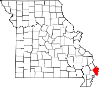
Location in the state of Missouri
Missouri's location in the U.S.Founded February 14, 1845 Named for The Mississippi River Seat Charleston Largest city Charleston Area
- Total
- Land
- Water
428.91 sq mi (1,111 km²)
413.16 sq mi (1,070 km²)
15.75 sq mi (41 km²), 3.67%PopulationEst.
- (2008)
- Density
13,504
14/sq mi (5/km²)Time zone Central: UTC-6/-5 Website 01f3e4a.netsolhost.com/ Mississippi County is a county located in the Bootheel of Southeast Missouri in the United States. As of the 2000 U.S. Census, the county's population was 13,427. A 2008 estimate, however, showed the population to be 13,504. The largest city and county seat is Charleston[1]. The county was officially organized on February 14, 1845, and was named after the Mississippi River.
Contents
History
Mississippi County is located in what was formerly known as "Tywappity Bottom," a vast area bordered by the Scott County Hills on the north, St. James Bayou on the south, the Mississippi River on the east and Little River on the west.
In 1540, Hernando De Soto penetrated to the Arkansas River and perhaps well into Southeast Missouri, populated only by various Native American tribes. Under the pressure of a constantly advancing white immigration, the Native Americans were forced to retreat further westward to survive. The entire area of Southeast Missouri was noted for its level swampy lowlands, subject to the overflow of the Mississippi River during periods of excessively heavy rainfall. Virgin forests attracted the timber barons who demanded the forests. Following the clearing of the land, levees were built and drainage districts were formed. As hundreds of miles of levees and dikes were constructed within the drainage districts, thousands of acres of land were reclaimed for agriculture use. The reclaimed land, was made especially rich by centuries of floods from the Mississippi River, was excellent farm land for corn, wheat, cotton, and later soybeans and rice.
By 1820 settlements had been made in most of the present counties of Southeast Missouri. The settlers, largely farmers, came from Illinois, Kentucky, Tennessee, and Virginia, in search for fertile and cheap land which they found around Charleston.
The site of the present City of Charleston was originally entered in 1830. In 1837, a person by the name of Thankful Randol sold Joseph Moore 22½ acres of land and the City of Charleston was immediately laid out. Its original boundary was 12 blocks - four north and south and three east and west. The Original Plat was filed on May 20, 1837. An act to incorporate the City of Charleston, Missouri, in the County of Mississippi, was enacted by the General Assembly of the State of Missouri on March 25, 1872.
Religion
According to the Association of Religion Data Archives County Membership Report (2000), Mississippi County is a part of the Bible Belt with evangelical Protestantism being the majority religion. The most predominant denominations among residents in Mississippi County who adhere to a religion are Southern Baptists (53.88%), Methodists (13.70%), and Christian Churches and Churches of Christ (7.55%).
Geography
According to the 2000 census, the county has a total area of 428.91 square miles (1,110.9 km2), of which 413.16 square miles (1,070.1 km2) (or 96.33%) is land and 15.75 square miles (40.8 km2) (or 3.67%) is water.[2]
Adjacent counties
- Alexander County, Illinois (north)
- Ballard County, Kentucky (northeast)
- Carlisle County, Kentucky (east)
- Hickman County, Kentucky (southeast)
- Fulton County, Kentucky (south)
- New Madrid County (southwest)
- Scott County (northwest)
Despite the fact that four of the seven counties that Mississippi County borders are in Kentucky, there is no direct highway connection between Mississippi County and its four neighboring Kentucky counties. In fact, none of the four Kentucky counties that border Missouri have any direct highway connection with Missouri, making Kentucky and Missouri the only two U.S. states to border each other without a direct highway connection between them.
Major highways
Demographics
As of the census[3] of 2000, there were 13,427 people, 5,383 households, and 3,671 families residing in the county. The population density was 32 people per square mile (13/km²). There were 5,840 housing units at an average density of 14 per square mile (5/km²). The racial makeup of the county was 77.93% White, 20.53% Black or African American, 0.25% Native American, 0.11% Asian, 0.01% Pacific Islander, 0.29% from other races, and 0.89% from two or more races. Approximately 0.96% of the population were Hispanic or Latino of any race.
There were 5,383 households out of which 31.20% had children under the age of 18 living with them, 47.70% were married couples living together, 17.30% had a female householder with no husband present, and 31.80% were non-families. 28.50% of all households were made up of individuals and 14.40% had someone living alone who was 65 years of age or older. The average household size was 2.44 and the average family size was 2.98.
In the county the population was spread out with 26.30% under the age of 18, 8.80% from 18 to 24, 25.40% from 25 to 44, 23.60% from 45 to 64, and 15.90% who were 65 years of age or older. The median age was 37 years. For every 100 females there were 87.60 males. For every 100 females age 18 and over, there were 82.70 males.
The median income for a household in the county was $28,837, and the median income for a family was $35,554. Males had a median income of $26,110 versus $17,204 for females. The per capita income for the county was $16,847. About 19.00% of families and 23.70% of the population were below the poverty line, including 31.70% of those under age 18 and 21.70% of those age 65 or over.
Education
Of adults 25 years of age and older in Mississippi County, 61.1% possesses a high school diploma or higher while 9.6% holds a bachelor's degree or higher as their highest educational attainment.
Public Schools
- Charleston R-I School District - Charleston
- Charleston Kindergarten Center (K)
- Warren E. Hearnes Elementary School (K-05)
- A.D. Simpson 6th Grade Center (06)
- Charleston Middle School (07-08)
- Charleston High School (09-12)
- East Prairie R-II School District - East Prairie
- R.A. Doyle Elementary School (PK-02)
- A.J. Martin Elementary School (03-06)
- East Prairie Jr. High School (07-08)
- East Prairie High School (09-12)
Private Schools
- St. Henry's School - Charleston - (01-08) - Roman Catholic
Cities and towns
Politics
Local
Politics at the local level in Mississippi County is completely controlled by the Democratic Party. All of Mississippi County's elected officeholders are Democrats.
Mississippi County, Missouri Elected countywide officials Assessor Shirley Coffer Democratic Circuit Clerk Leigh Ann Colson Democratic County Clerk Hubert DeLay, Jr. Democratic Collector Faye P. Elliott Democratic Commissioner
(Presiding)Jim Blumenberg Democratic Commissioner
(District 1)Robert Jackson Democratic Commissioner
(District 2)Steve Jones Democratic Coroner Terry A. Parker Democratic Prosecuting Attorney Darren Cann Democratic Public Administrator Rick Reed Democratic Recorder Judy Rolwing Democratic Sheriff Keith Moore Democratic Surveyor Martin Lucas Democratic Treasurer Sandra B. Morrow Democratic State
Past Gubernatorial Elections Results Year Republican Democratic Third Parties 2008 50.27% 2,659 47.70% 2,523 2.03% 107 2004 48.65% 2,558 50.30% 2,645 1.05% 55 2000 41.97% 2,170 56.79% 2,936 1.24% 64 1996 25.52% 1,325 73.11% 3,796 1.37% 71 In the Missouri House of Representatives, all of Mississippi County is a part of Missouri’s 161st District and is currently represented by Steve Hodges (D-East Prairie).
Missouri House of Representatives - District 161 - Mississippi County (2010) Party Candidate Votes % ±% Democratic Steve Hodges* 2,407 69.77 -30.23 Republican Ron McCormick 1,043 30.23 +30.23 In the Missouri Senate, all of Mississippi County is a part of Missouri's 27th District and is currently represented by State Senator Jason Crowell (R-Cape Girardeau). Crowell defeated Linda Sanders (D-Jackson) by almost a two-to-one margin, 64.24-35.76 percent in the district. The 27th Senatorial District consists of Bollinger, Cape Girardeau, Madison, Mississippi, Perry, and Scott counties.
Missouri Senate - District 27 - Mississippi County (2008) Party Candidate Votes % ±% Republican Jason Crowell 2,497 50.60 Democratic Linda Sanders 2,438 49.40 Federal
In the U.S. House of Representatives, Mississippi County is represented by Jo Ann Emerson (R-Cape Girardeau) who represents all of Southeast Missouri as part of Missouri's 8th Congressional District.
U.S. House of Representatives - District 8 - Mississippi County (2010) Party Candidate Votes % ±% Republican Jo Ann Emerson 2,218 64.03 -2.08 Democratic Tommy Sowers 1,122 32.39 +0.66 Independent Larry Bill 91 2.63 +2.63 Libertarian Rick Vandeven 33 0.95 -0.46 Political Culture
Past Presidential Elections Results Year Republican Democratic Third Parties 2008 56.65% 3,034 41.95% 2,247 1.40% 75 2004 54.79% 2,903 44.81% 2,374 0.40% 21 2000 45.93% 2,395 52.85% 2,756 2.33% 439 1996 30.39% 1,595 61.63% 3,235 7.98% 419 At the presidential level, Mississippi County is a fairly independent-leaning or battleground county although, like many counties in the impoverished Bootheel with a significant African American population, it does has a slight tendency to lean Democratic. While George W. Bush carried Mississippi County in 2004, Al Gore won the county in 2000, although both times the margins of victory were significantly closer than in many of the other rural areas. Bill Clinton also carried Mississippi both times in 1992 and 1996 by convincing double-digit margins. And like many of the other rural counties in Missouri, Mississippi County favored John McCain over Barack Obama in 2008, although the margin of victory was smaller than in most rural areas.
Like most rural areas throughout Missouri, voters in Mississippi County generally adhere to socially and culturally conservative principles but are more moderate or populist on economic issues, typical of the Dixiecrat philosophy. In 2004, Missourians voted on a constitutional amendment to define marriage as the union between a man and a woman—it overwhelmingly passed Mississippi County with 86.87 percent of the vote. The initiative passed the state with 71 percent of support from voters as Missouri became the first state to ban same-sex marriage. In 2006, Missourians voted on a constitutional amendment to fund and legalize embryonic stem cell research in the state—it failed in Mississippi County with 57.35 percent voting against the measure. The initiative narrowly passed the state with 51 percent of support from voters as Missouri became one of the first states in the nation to approve embryonic stem cell research. Despite Mississippi County’s longstanding tradition of supporting socially conservative platforms, voters in the county have a penchant for advancing populist causes like increasing the minimum wage. In 2006, Missourians voted on a proposition (Proposition B) to increase the minimum wage in the state to $6.50 an hour—it passed Mississippi County with 75.66 percent of the vote. The proposition strongly passed every single county in Missouri with 75.94 percent voting in favor as the minimum wage was increased to $6.50 an hour in the state. During the same election, voters in five other states also strongly approved increases in the minimum wage.
Missouri Presidential Preference Primary (2008)
In the 2008 Missouri Presidential Preference Primary, voters in Mississippi County from both political parties supported candidates who finished in second place in the state at large and nationally.
- Former U.S. Senator Hillary Rodham Clinton (D-New York) received more votes, a total of 1,094, than any candidate from either party in Mississippi County during the 2008 Missouri Presidential Presidential Preference Primary.
Mississippi County, Missouri 2008 Republican primary in Missouri John McCain 373 (33.73%) Mike Huckabee 471 (42.59%) Mitt Romney 226 (20.43%) Ron Paul 15 (1.36%) Mississippi County, Missouri 2008 Democratic primary in Missouri Hillary Rodham Clinton 1,094 (65.43%) Barack Obama 502 (30.02%) John Edwards (withdrawn) 57 (3.41%) See also
- National Register of Historic Places listings in Mississippi County, Missouri
- Bertie's Joey; a recount of an event that shows the Mississippi County needs aid.
References
- ^ "Find a County". National Association of Counties. http://www.naco.org/Counties/Pages/FindACounty.aspx. Retrieved 2011-06-07.
- ^ "Census 2000 U.S. Gazetteer Files: Counties". United States Census. http://www.census.gov/tiger/tms/gazetteer/county2k.txt. Retrieved 2011-02-13.
- ^ "American FactFinder". United States Census Bureau. http://factfinder.census.gov. Retrieved 2008-01-31.
External links
- Digitized 1930 Plat Book of Mississippi County from University of Missouri Division of Special Collections, Archives, and Rare Books

Scott County Alexander County, Illinois Ballard County, Kentucky 
Carlisle County, Kentucky  Mississippi County, Missouri

New Madrid County Fulton County, Kentucky Hickman County, Kentucky Municipalities and communities of Mississippi County, Missouri Cities Anniston | Bertrand | Charleston | East Prairie | Miner‡ | Wyatt

Villages Unincorporated
communitiesFootnotes ‡This populated place also has portions in an adjacent county or counties
Categories:- Missouri counties
- Mississippi County, Missouri
- Missouri counties on the Mississippi River


Wikimedia Foundation. 2010.